
Four Stones Hill
Walk Date – 8th May 2016
Distance – 4.8 miles
Weather – dry, very warm and sunny, brisk southerly wind
Route


Its a warm and sunny afternoon so we decide to take a short walk not too far from home which begins in the little village of Burnbanks. This view shows, more or less, half of the village …..

….. and this is, more or less, the other half. It was originally built in the 1930’s by Manchester Corporation to house the workers who were constructing the Haweswater Dam and reservoir, although at that time it was a much larger village. There’s more about it on the web if you’d like more information.

We took the right hand lane at the telephone box which leads to a gate, beyond which is the path showing in the photo. We left that path, which will be our return route, to bear off up to the right over the open fellside.

That’s the path we have just walked and down below are the houses of the village.

As you can see there is nothing excessively steep to deal with and its a pleasant stroll up to the rocky tops of Burn Banks.

One of the rocky tops of Burn Banks, this whole area is one of those places where you can just wander in and out of the craggy bits, walk to the top of them, have a bit of a gentle scramble over them, or simply find somewhere with a view you like and spend an hour or so simply doing nothing.

There are paths here, there and everywhere so you can choose whichever one takes your fancy, they’re all interconnected so you’d probably end up back where you started if you didn’t have a particular destination in mind.

Our destination is Four Stones Hill which is over yonder, the dark hump to the left, so we follow the grassy green path. The only fly in the ointment today was the strength of the wind and that’s been a feature of the weather for over a week now. Thankfully it was a warm one.

Looking along Haweswater towards Measand End from one of the little hill tops along the way.

Turning a little to the right of the previous shot for a look ahead to Four Stones Hill, on the near left, and High Kop, the high point on the centre skyline.

A view down to Haweswater Dam with the water levels now back to normal. During the winter floods the water was pouring over the highest parts of the wall.

From the same viewpoint a look along Haweswater towards Mardale Head.

An ancient round cairn sited just below Four Stones Hill, the purpose of which seems to be unknown.

Four Stones Hill beyond the ancient cairn circle.

Just a very short distance from the cairn circle is Four Stones Tarn, minus the water as we’ve had a bit of a dry and windy spell just lately. This also sits just below the summit of Four Stones Hill.

I’m standing where water should be, although if there was any water it would hardly reach my ankles as the ground is so flat.

Presumably at one time there were four standing stones, given the name of the hill, but only two are still standing here now.

From left to right the fells on the skyline are Selside Pike, Branstree and Harter Fell. We met the only other walkers we saw today at this point. Just two older blokes making their way steadily up towards us and then downing packs in the cairn circle and having a bit of a tea break.

It would be interesting to know where the other two stones were placed, and the significance of siting four stones just here.

Gateway to The Lakes.

From the top of Four Stones Hill a look down at the dried up tarn, that’s the bright green bit with the line of stones beside it.

Looking the other way the view of Haweswater and the dam wall. Below and just right of centre you might be able to pick out a cairn perched on the rock outcrop …..

…. but just in case you can’t there it is in close up. Its an unusual shape being more pyramidal than circular.

Looking back to Four Stones Hill from the two standing stones

Branstree and Harter Fell at the Mardale Head end of Haweswater.

Looking over to Measand End as we walk down Four Stones Hill.

Over on our right is Fordingdale Bottom with Measand Beck running through it.

This is our halfway point where we cross Measand Beck to start the return leg back to Burnbanks.

The beck has some attractive waterfalls but it is rather difficult to get close to them as they drop down through a deep and rocky ravine.

We’re on the path which runs along the top of the ravine and at this point the beck is quite some way below us, so the only water we can see at the moment is Haweswater.

A look back at Four Stones Hill from the path above the ravine. The rocky area in the foreground is the other side of the ravine.

There are a few places along the path where it is possible to scramble down to the beckside for a better view of the falls. The sides of the ravine have lots of bushes and trees so the best views are to be had when the trees aren’t in leaf. In a couple of weeks this view will be obscured by all the foliage.

Another lovely set of falls, a view achieved by taking a bit of a scramble over wet, slippery rocks.

The spring leaves are already obscuring the view of the upper set of falls at this point.

This is almost the last set of falls before …..

….. the beck flows under this bridge and then into Haweswater just a few yards further downstream.
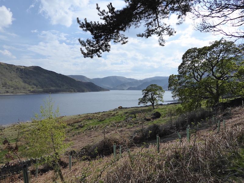
From the bridge the path runs alongside, but slightly above, the Haweswater shoreline.

High fences and gates to prevent deer and other grazing animals from eating newly planted woodland. Once the trees are established the fencing and gates will be removed.

Haweswater Information Board courtesy of United Utilities.

Gorse bushes in full bloom all along the path.

A view of Haweswater, with the wind still ruffling the surface, from the path. We’re almost back in Burnbanks village so our walk is almost at an end …..

….. but I thought you might like to see a photo of the busy road junction at the entrance to the village. The road I’m standing on goes into the village behind me and no further. The road to the right goes along the opposite shore of Haweswater and comes to a dead end at Mardale Head. The one on the left takes you back through some pretty hamlets and villages and then onwards towards Penrith. We’re parked just out of shot on the right so that’s the end of today’s outing. We haven’t walked any great distance, there were no strenuous climbs, the weather was lovely and there were no crowds, just the thing for a pleasant Sunday afternoon ramble.