Barrow and Outerside

Walk Date – 2nd November 2015

Distance – 5 miles

Weather – dry, warm and sunny


There were some quirky weather events this morning. The conditions along the A66 to Braithwaite alternated between dense and gloomy fog patches, where you could barely see the road in front of you, and blazing sunshine, which had you reaching for the sunglasses.


Route

Braithwaite village itself was clear of fog but from our parking spot I noticed this low lying inversion covering the vale of Keswick. This is looking over at Skiddaw, on the centre skyline, and Skiddaw Little Man to the right of it, from Braithwaite village, with the inversion looking like the filling in a sandwich. As you can see there’s not a cloud in the sky, a beautiful morning for a walk.

The autumn colours are fabulous just now, and much better than last year when a series of strong winds blew the leaves off before they had a chance to really put on a good show.

Passing through Braithwaite village. The main holiday season is over so there was hardly anyone around.

We’ve gained a little height as we walk up to Braithwaite Lodge, so I take a look back over the village, and the inversion, to the Skiddaw fells.

Colourful fell sides below Barf which is over there on the right skyline.

A close up of distant Binsey sticking up above the inversion.

The inversion covering the vale of Keswick.

Looking ahead to Barrow summit, on the left, with the Coledale fells over on the right.

Looking over Swinside Knott towards the Eastern fells, Keswick and Derwentwater are somewhere there under the inverson.

We carry on along the path and reach the point where, having gained height, it now has to be lost and then regained. Oh well, its only a small drop down.

Looking back at our route up Barrow, the inversion is thinning out over there.

As we climb I keep glancing across to see how things are progressing, going …..

….. going …..

….. and finally gone.

The knobbly top of Causey Pike from Barrow summit. Views to the south were difficult to get today as the sunlight was so strong.

On the skyline over to the right is Grisedale Pike, the conical shaped fell just to the left of it is Outerside, and that’s where we are off to next.

Looking over to Binsey again and it looks like the inversion is beginning to build once more.

On Barrow summit and all is now clear over Keswick and Derwentwater.

The vale below the Skiddaw fells is clear at the moment, but keep an eye on that inversion over to the left …..

….. because its definitely starting to creep in again.

Enjoying the sunshine on Barrow summit.

No sign of this dissipating any time soon.

We’ve walked down from Barrow to this path junction where there’s a choice of routes, left for Stoneycroft Gill, up to the right for Stile End, and straight ahead for Outerside, that’s the fell which is smack in the middle.

A close up of Outerside.

On the path to Outerside and looking back at Barrow, on the left, and the layers of fells to the east on the skyline.

The old sheepfold alongside Stoneycroft Gill. Around this point we turned off to the right of the path to walk on to Outerside. The fell in the shade on the right is Causey Pike.

From Outerside a view across Coledale to Grisedale Pike, with Hopegill Head over on the far left.

On Outerside summit with a view of the northern fells again. The inversion, coming in from Bass Lake which is under the cloud to the left, has covered the vale of Keswick once more.

Looking westwards across Kinn, the inversion is beginning to creep up the side of Ullock Pike, and Binsey has all but disappeared.

Outerside summit.

Nature putting on a grand show and we had a grandstand view from Outerside summit. It was very warm up here today, you wouldn’t think it was 2nd November, would you?

The fell in shade on the left is Crag Hill, and just peeping out behind it is Grasmoor. There are just too many strong shadows today to show much in the way of details or features.

Meanwhile, the inversion behind us continues to spread itself around Keswick.

Now its beginning to creep up Stoneycroft Gill.

You can just make out the very top of Binsey, over to the left, in all that cloud.

A look down over Scope End and Barrow to check the progress of the inversion.

A long zoom over to Binsey, which now looks as if its floating. Binsey was the only thing visible in this direction.

Now a long zoom onto Ullock Pike, the inversion now a good distance up the fell side.

Another long zoom over to Catstycam, on the left skyline, and Helvellyn, over on the right. No inversion across there just the general haze.

Time to make our way down so that’s the end of inversion gazing for today.

From the Stoneycroft Gill path a view up Causey Pike. This side of the fell stayed in shade all day now that the sun doesn’t get very high.

Looking down Stoneycroft Gill across to the eastern fells.

A view of Catbells over Stoneycroft as we reach the valley bottom.

Looking over to Swinside Knott. We left the road walking section at this point to take the path back to Braithwaite.

One more hillside to climb and then it’ll be downhill all the way to Braithwaite.

Not far to go now. That’s Braithwaite village, where we started from, so that’s the end of our walk. Only a short trip today now that the daylight hours are dwindling, but a very enjoyable one nevertheless especially as we weren’t expecting to see an inversion.


Around Mardale Head

Walk Date – 26th October 2015

Distance – not recorded

Weather – dry, sunny and very windy


Although the day was fine, dry and sunny there was a very strong wind blowing so it wasn’t a day for an outing on the high fells. What with one thing and another we were not able to go anywhere during the morning anyway, so after an early lunch at home we decided to drive over to Mardale Head. It wasn’t really a walk as such, more of a recce to look at paths for a future walk in this area, so I haven’t included a route map. I did take a few photos though so here they are:

From the roadside a view across Haweswater over to Kidsty Pike.

A close up of Kidsty Pike.

The little island of Wood Howe, more of it showing than usual due to the low water level.

The Rigg.

Wood Howe standing out clearly in the bright sunshine.

Swine Crag across the head of Mardale.

The low water level reveals the old walls of Mardale.

Looking northwards along Haweswater.

Smallwater Beck below Piot Crag.

Falls in Smallwater Beck.

Looking back down Mardale from the beck.

A glimpse of Haweswater down in the valley, and un-named tarn over on the right.

Zooming in on Haweswater far below us. This was as high as we went, any further and we would have been up on the ridge and face on into the strong wind.

Small Water again.

Looking across to Caspel Gate with the rocky top of Kidsty Pike just behind it.

Rough Crag with Kidsty Pike just peeping out behind it on the left.

A close up of Kidsty Pike.


Robinson and Dale Head

Walk Date – 15th October 2015

Distance – 8 miles

Weather – dry, warm and sunny after a frosty start


The good weather continues thanks to the high pressure system which is still sitting over the country, so we drove over to Little Town in the Newlands Valley for a walk up to Robinson and Dale Head. Another clear bright morning, plenty of blue sky and sunshine but there was frost on the fields and the temperature down at freezing level in the shade as we started out.


Route

Fleeces, jackets, hats and gloves were on to begin with as we would be walking up alongside Scope Beck which would be in the shadow of Hindscarth for most of the way up to the reservoir. The sun was already high enough for Robinson, on the right hand side, to be getting the benefit so we knew once we had passed by the reservoir we would also be in the sunshine.

Robinson in close up.

Holiday cottage alongside the footpath below High Snab.

Shouldn’t Eric Morecambe be standing here?

Walking along the path above Scope Beck towards Robinson.

A look back down the valley. Catbells is in shadow on the right with Blencathra just behind it.

We’re still walking above Scope Beck which you can see down on the left. This is a lovely route, the path rises gently through a quiet valley, and it doesn’t feel like you’re having to put in much effort for the height you are gaining.

Another look back as we gain more height. Hindscarth is still casting its shadow so its a bit nippy down here.

The path takes us alongside Scope Beck reservoir where a couple of sheep are having breakfast on the dam wall.

Another view of the reservoir as we continue along the path.

Looking ahead to Blea Crag which forms part of Robinson. No, we’re not climbing up that. The path passes below it and then branches off to the right a little way beyond it.

We climbed higher and so did the sun, and at last we are out of Hindscarth’s shadow.

Ahead of us is Littledale. The long sweep on the skyline is Littledale Edge which we’ll be walking across later on.

We’re now climbing out of Littledale and making for the main ridge path which comes up from High Snab Bank. From here we’re looking straight across at Hindscarth, behind it is the Maiden Moor – High Spy ridge, and on the horizon are the Dodds and the Helvellyn range.

We’ve now joined the main path which comes over High Snab Bank, that’s the long ridge below us, and Blea Crag, where the path looks as though it just drops off over the edge.

Continuing up Robinson we get a view of Crummock Water. The bend in the road down there is Newlands Hause which has a number of cars parked down there today. That’s the start of another route up Robinson.

Plenty of fells on view from here. The nearest one is Whiteless Pike. The little rocky one in the middle is Rannerdale Knotts, and behind that is Mellbreak.

Whiteless Pike is now on the left and leads up to Wandope on the right. Behind both of them is Grasmoor.

Moving a little to the right and now Crag Hill is on the left with its ridge leading down to Sail, while over on the far right is Grisedale Pike.

Moving even further to the right now and we have Scar Crags to the left, which leads on to Causey Pike on the right.

From the same spot but now looking northwards over the vale of Keswick. You certainly get a lot of view for your money up here.

On the broad plateau of Robinson now and the man from the water company is checking the water level. Only joking, he doesn’t really work for a water company. Notice that fleeces, jackets, hats and gloves are no longer required. Its warmer than it was in summer.

I’m about to have a rant here so those of you of a nervous disposition may wish to skip this bit. This is Robinson summit, atop which is a wind shelter, not needed today because there wasn’t much. However it had been utterly taken over by a person with a huge amount of radio equipment and an aerial longer than a fishing rod, not visible as they’ve been edited out. Also present, his female companion, frosty in appearance and manner. They weren’t so much summit hogging as summit squatting and looked as though they were there for the day. The fact that several people were present trying to take photos made no difference to him, ‘Major Tom’ kept wittering on to ‘Ground Control’ about absolutely nothing at all, selfish b****r! People make the effort to walk up and then can’t get a decent photo because of people like him. Where’s your manners mate? Set your stuff up clear of the summit and let other folks get a look in. Its a National Park, that means it belongs to all of us, its not your personal fiefdom. I get really angry about this sort of thoughtlessness. End of rant.

I moved away from the source of my irritation and concentrated on photos instead. Directly opposite is High Stile on the left and Red Pike on the right.

No view of the coast today but on the left skyline is Great Borne, and the long fell to the right of it is Hen Comb.

Rannerdale Knotts jutting out towards Mellbreak and looking as though its sliced Crummock Water in two. The other body of water is Loweswater.

Leaving Robinson and heading down to Littledale Edge. The long flat topped fell on the left is Hindscarth but we are heading for the one beyond it which is Dale Head.

Continuing along Littledale Edge towards Hindscarth and Dale Head.

From Littledale Edge a look across to the High Crag – High Stile – Red Pike ridge. Over on the left skyline is Pillar.

There’s still a bit more ‘up’ to go before we reach Dale Head summit. That’s it on the left in the shade. If you zoom in you’ll see the large summit cairn.

Almost at the summit of Dale Head and looking over the Newlands Valley. On the left is Hindscarth, on the right the crags of High Spy, and sitting under the little cloud in the centre is the Skiddaw range.

The splendid cairn on Dale Head. As we haven’t eaten since breakfast at 7.30 am and its now 1.40 pm I think we are due a spot of lunch.

We decide to have something to eat at the sheepfold beside Dale Head Tarn, so off we go down Dale Head, with the crags of High Spy across from us.

Down there is Dale Head tarn with the sheepfold beside it, that’s booked for lunch if the table is still available when we get there.

Dale Head Tarn.

“Table for two?”

“Certainly Madam, please follow me to the sheepfold suite.”

Its now 2.15 pm so lunch is a little late. From our pool side table we tuck in and watch other walkers coming and going on the Dale Head path, their voices carrying clearly across the still air.

After lunch we take the path which will take us down to the Newlands Valley. Its not that one over there, that would take us up to High Spy and we’re not going there today. We’ll be going through the gap in the middle.

The path keeps company with Newlands Beck as we begin to descend into Newlands Valley …..

….. passing below the scree, crags and boulders of High Spy.

Across the valley is the flat topped Hindscarth. Between us and Hindscarth is Newlands Beck which is about to descend into the valley via a series of falls. Below are some photos of them …..

One of several sheepfolds, most in ruins, we passed as we walked down the valley, this one is in good repair so it is probably still in use.

A look back at our descent route, one of the waterfalls is just visible in the centre.

Lovely autumnal colours as we walk along the valley bottom.

The distinctive peak of Causey Pike over on the left, we haven’t much further to go now.

We’re only a short distance from the car now so I take a look back at the big fells at the head of the valley. On the extreme left is Dale Head, then Hindscarth and over on the extreme right is Robinson.The cone shaped fell in the middle foreground is Scope End which forms one end of Hindscarth. Its only about 4.00 pm but already the light is beginning to go, and in a couple of weeks time the clocks go back which will reduce the daylight hours even further. All of which means that future walks will have to be tailored to the amount of daylight available and that long summer walks are over for this year.


Great Mell Fell and Little Mell Fell

Walk Date – 12th October 2015

Distance – 3 miles

Weather – heavy rain until 1.00 pm, then sunny and windy


Route – out and back for both

Red – Walk route. Blue – Car journey.

Autumn colours in the bracken as we climb up Great Mell Fell.

Looking back down the path towards Little Mell Fell.

Gowbarrow Fell across the sunlit fields below us.

On the skyline opposite us are Great Dodd on the left and Clough Head on the right.

No, it hasn’t fallen over, its just going with the flow of the prevailing westerly winds. There are quite a few like this up here.

Further up the steepish path and yet another leaning tree growing happily on the exposed fell side.

Little Mell Fell below some spectacular skies.

Still climbing. I liked the way the curve of the woodland was mirrored by the clouds above.

Looking eastwards, the thin blue line on the horizon is the Pennines. What a fantastic sky today.

A close up of an un-named tarn below Little Mell Fell.

More impressive cloud formations over to our right as we continue up Great Mell Fell.

In the middle foreground in Gowbarrow Fell and beyond are some of the far eastern fells. The dip in the skyline to the right of centre is Threshthwaite Mouth.

The wooded area just below the summit of Great Mell Fell.

Well it might be dead, but the way the light was illuminating the bleached trunk and branches seemed to give it a new lease of life, it absolutely sparkled in the sunshine.

We’re not sparkling in any sunshine though. Typically, the minute we reached the top large clouds passed across the sun. We weren’t expecting the very strong and cold north wind we got either, it was forecast to be a mild southerly one.

At least Blencathra was nicely lit, its not often we see it in such detail, and that cloud above it was just wonderful.

A longer view of Blencathra with its neighbouring northern fells.

At the summit cairn on Great Mell Fell and well wrapped up against the wind. We waited quite a while for the cloud to blow over but it stubbornly refused to do so until we were on our way back down.

Blencathra, beautifully detailed today with all the edges and ridges clearly defined.

Looking eastwards towards Rampsgill Head and High Raise.

In the middle foreground is Place Fell with just a smidge of Ullswater showing below it.

The light went out for a while as that big grey cloud moved across. The eastern fells still have a bit of sunshine.

We have sunshine once again as we go back down. We want to go up Little Mell Fell before the light begins to fade.

Sunlight bouncing off trunks and branches as we move back into the woodland.

Plenty of detail on Gowbarrow Fell now. Its a lovely afternoon and we’ve dropped down out of the wind so its nice and warm too.

The foreground fell is Gowbarrow, behind it is Beda Fell, just peeping out behind Beda is The Nab, then Rampsgill Head, and on the right skyline is High Street.

Back in the lane where we started from looking across the fields on the lower slopes of Great Mell Fell. Lakeland looking lovely in the late afternoon.

Our parking spot, the lane which leads to the path up Great Mell Fell. Now for short drive over to The Hause.

A five minute drive takes us to The Hause where we park up again. Now we’re going up there – Little Mell Fell.

Beyond the gate the path leads up to the summit. It doesn’t look much but it certainly has you puffing and panting. Its steep but mercifully short and 10-15 minutes later you are at the top.

13 minutes later and we’re at the trig point on Little Mell Fell, with a little of Ullswater showing behind.

Once again we reach the top and the sun goes in.

The wooded slopes of Great Mell Fell where we have just come from, with Blencathra and the northern fells behind.

Arthur’s Pike, on the left side of that deep gully. No-one sailing on Ullswater today.

On the other side of the gully is Bonscale Pike. The gully is Swarthbeck Ghyll.

A little further to the right and a view of all the fells to the east of Ullswater, far too many to name here.

Arthur’s Pike and Bonscale Pike across Ullswater.

Making our way down to The Hause where the car is parked.

One last shot looking over Ullswater before we’re back down …..

….. and another looking across at the eastern fells.

Almost back down at The Hause.

The path we’ve just come down, and as we’re not going to Lowthwaite we turn in the opposite direction and head back to the car.

Not many walkers venture here, these aren’t the big exciting fells that draw the crowds. We saw only one man and he seemed to be using Little Mell Fell as a training ground judging by the speed he was going. He was going up as we were coming down, and he came back down while we were still going down. He then crossed the road, continued up a hill on that side and then disappeared over the top, all in the space of the 15 minutes we took to walk down. Not a walker as such, more likely a fell runner doing a spot of speed walking. The Mell Fells are two small fells, and isolated from the all the rest, but even so they have something to offer, even if it is just peace and quiet for a while, and on such a good weather day a grand opportunity for some marvellous cloudscape photos.

An enjoyable 3 hours of wandering.


Seat Sandal

Walk Date – 3rd October 2015

Distance – 5.4 miles

Weather – sunny and warm, not a breath of wind


Route

7.04 am. Sunrise over the fields at the back of the house.

Helm Crag lurking behind the morning fog as we park up in a lay-by on the A591.

Over to the right Steel Fell begins to appear.

Walking up the path from Mill Bridge and a look back shows the fog thinning out, maybe we’ll get a lovely blue sky day after all.

A little further up the path and the fog is still rising from Dunmail Raise down below us.

Looking ahead to Seat Sandal, everything looking nice and clear up there.

A look back down into the Vale of Grasmere where there is still plenty of fog drifting around.

The path diverges here, left for Little Tongue Gill, and right, over the far bridge, for Tongue Gill.

Looking back at the Tongue Gill crossing point.

The path we are using is the one running through the bracken to the right of the wall. It looks quite gentle from here but once on it you soon realise that it isn’t.

Phew! It was hot work getting to this point. See what I mean about it not being quite as gentle it looked.

As you can see it was a steep pull up to this point so we stopped for a breather and a quick mop of the brow. We’re down to t-shirt level now as it so hot up here, and there isn’t any air movement at all to help cool us down a little. Looks like most of the fog has gone down there although it is still rather hazy.

A good high level path across Hause Riggs which gives the legs a chance to recover from the steep climb.

From Hause Riggs a look over the waterfalls in Tongue Gill.

Across from us is Fairfield rising from Grisedale Hause.

Another view of Fairfield from the Hause. Just behind me alongside the wall is a shelter so we decided to have a short drinks stop before continuing on up to Seat Sandal summit.

Suitably refreshed we leave the shelter and start up the very rough path, ‘one step forward and two steps back’ came to mind as we made our way up it. There is another and better path elsewhere but for some reason, which now escapes me, we decided on this one.

From the climb there’s a view over Grisedale Tarn. Notice the fog rising out of Grisedale at the far end of the tarn.

From left to right, Dollywaggon Pike, Saint Sunday Crag and Fairfield.

Geese flying south for their winter holidays. Lots of calling out going on between them: “Did you lock the back door?” “Who’s got the tickets and passports?”

Blimey! I was so absorbed watching the geese I hadn’t been looking down here. That fog is racing up from Grisedale and extends as far as I can see. This must be a big cloud inversion taking place.

Now its spreading rapidly along the tarn and up the sides of Saint Sunday Crag.

Not only is it rushing up from Grisedale at the other end of the tarn, its also racing in up Raise Beck from Dunmail Raise at this end of it too.

We’re on the summit plateau now so we can’t see the tarn any more. This is one of the un-named tarns up here and all except this one were dry as we’ve not had much rain lately.

Approaching the summit and we still have blue sky and sunshine.

I walked across to the edge to see what was happening down at the tarn. The cloud is still advancing and over on the right its also spreading up from Deepdale.

It looks as though Dollywaggon Pike is about to disappear in the cloud coming up Raise Beck, all of it moving amazingly quickly.

The cloud is now rising up from everywhere, Raise Beck to the left, Grisedale in the centre, Deepdale the next dip along, and the first few wisps coming up from Tongue Gill on the right.

Dollwaggon Pike is about to disappear and the fells to the left of it are blanketed by the cloud. Look closely and you’ll see a fell top just visible in the distance which I think is probably Skiddaw. That stands at 3054′ and the top is only just visible. Where the layer of white cloud is you would normally be seeing lots of fells so this is a massive cloud event we are experiencing.

It looks as though it won’t be too long before Saint Sunday Crag is surrounded by cloud. Everything eastwards is covered with it too.

Seat Sandal summit cairn. No views of Grasmere since the cloud is now coming up from there too on the left of the shot.

Seat Sandal summit again and we’re still in clear air but its getting closer, look behind you.

Within seconds it enveloped us and everything else so we hunkered down in the shelter, had some lunch and just watched nature at work. Its amazing how quickly you can get a jacket and hat on when you need to.

Things hadn’t improved by the time we’d had our lunch so there was no point in hanging around. Here we are approaching the second cairn to the south west of the summit and we still couldn’t see anything at all until we were practically on top of it.

A brief hint of brightness while we were at the second cairn, everything was eerily quiet and still, not a sound from anywhere and not a soul around.

As you can see there wasn’t much in the way of views on the way down although the worst of the cloud had moved away by now. The earlier quiet stillness at the summit has been replaced by the roar of traffic on the A591 down below us.

At the bottom end of Steel Fell there’s a little more definition, and you can just make out part of the Helm Crag – Gibson Knott ridge behind Steel Fell’s lower slopes.

You’ll have to look hard but up on the left you can just make out the water of Grasmere.

As we made our way down I took a look over towards the summit of Seat Sandal which is once again covered by cloud.

Running through the bracken across the centre of the photo is the path we took this morning.

On a better day this would be a lovely view down to Grasmere, still you can see Helm Crag and the water, so that’s better than nothing at all I suppose.

Looking to the north west and behind Steel Fell another huge bank of cloud rolls across.

Across the valley we have a clearer view of Helm Crag and the ridge to Gibson Knott and Calf Crag.

I don’t know what made me turn round but I did, I saw this and had to sit down I was laughing so much. Can you see a face over on the left of the rock? Did you ever watch Deputy Dawg?

The lower slopes of Steel Fell from our descent. The cloud has retreated northwards away from us but activity is still ongoing over there.

The summit of Seat Sandal is now clear while Fairfield, to the right, is cloud covered again.

Almost back on the path we started out on this morning, that’s it to the left of the farm building.

Helm Crag across the valley.

One last shot of Steel Fell.  A massive cloud inversion today, completely unexpected but just fabulous to watch and to experience. They don’t happen often but when they do its a wonderful sight.


Birkhouse Moor and Catstycam

Walk Date – 1st October 2015

Distance – 8.3 miles

Weather – sunny, warm and not a breath of wind


Route

Early morning mist in the Eden Valley as we drive to Glenridding.

Mist drifting gently between the trees and the landscape gradually turning autumnal.

The car park at Glenridding. No mist here and not many people either, although it’ll be busy later on no doubt.

Walking through Keldas woods we have a view of Heron Pike, part of Sheffield Pike, the summit of which is way over on the left.

I tried several times to get a good shot of Lanty’s Tarn but it still looks a bit gloomy. The sun wasn’t quite high enough while we were here to provide plenty of light.

Now that we’re clear of the woods the view has opened up quite a lot more. Ullswater is flanked by Glenridding Dodd on the left, Gowbarrow Fell in the centre, and Place Fell on the right. The village of Glenridding down there in the middle.

Following the wall path up to Birkhouse Moor and we get our first view of the Helvellyn range.

Fleeces and jackets no longer required, its becoming very warm work as we make our way up to Birkhouse Moor up there on the skyline.

I noticed this sheepfold on the fell side below us so I took a close up of it. Any excuse to stop for a minute and mop the brow.

A look back at the route we have been following. More of the eastern fells are coming into view now.

Almost on Birkhouse Moor ridge now and a great view of Glenridding, Place Fell and Ullswater.

On the ridge of Birkhouse Moor with a view of Helvellyn in the centre, Catstycam on the right, and Striding Edge in shadow over on the left.

We walked over to the north top of Birkhouse Moor for this fabulous view down Ullswater. This isn’t the summit, that’s further back behind us, but this has the better view.

Helvellyn and Catstycam from the cairn at the north top of Birkhouse Moor.

The cairn marking the summit of Birkhouse Moor. The limited view of Ullswater through the dip in the wall shows why the short diversion to the north top is worthwhile.

Shorts and t-shirt? Hard to believe that its the first day of October.

The dam in Keppel Cove, In 1927 the previous dam was washed away in a storm. This concrete dam replaced the old one, but it was also breached in a storm in 1931 and never repaired.

Catstycam, and the path from Glenridding which leads up to it and also to Swirral Edge, which is over to the left.

The headwall of Helvellyn, with Striding Edge on the left and Swirral Edge on the right.

The long sweep from Catstycam to Swirral Edge.

A well known landmark, ‘The Hole in the Wall’, which leads to …..

….. the start of the path across Striding Edge, leading eventually to the summit of Helvellyn.

Looking back at our route across Birkhouse Moor.

A close up of the ‘climb out’ area at the end of Striding Edge. In the red circle are two walkers who have already made the crossing and are on their way to the summit. That’s not the summit just above their heads, that’s the Gough Memorial, the summit is a little way over to the right and isn’t in the photo.

Looking down at Red Tarn as we sweated our way up the path making for Catstycam. It was now very warm indeed and that water looked so inviting. A group of youngsters had just walked to the tarn and were having a very pleasant time paddling and swimming, judging by the whoops and yells coming from down there.

From here we have a good view of the path we’ve been following up to this point. Where the upper path meets the wall towards the top of the shot is where ‘The Hole in the Wall’ starts.

Yep, up there. The last little bit of the climb up to Catstycam summit. Its a bit warm for a steep climb but no complaints, we came up here a couple of years ago in June and got pelted by a hailstorm. The annoying thing was that on that occasion the day had started out just like this one but by the time we got to this point huge black clouds appeared over Helvellyn and that was that. We got a soaking despite the waterproofs and no views either. I’ve had a quick look and there’s nothing like that over Helvellyn today.

I don’t know how many miles you can see from Catstycam summit, but it must be a heck of a lot on a day like today.

Its also a heck of a long way down. We’ll be returning to Glenridding by that path on the right hand side of the beck down there.

Looking east at the fells on view over there, from Catstycam summit.

A dizzying close up peep over the edge at the sheepfold way below us, with the breached dam down at the bottom right.

The Swirral Edge route up to Helvellyn, with Hellvellyn Lower Man over on the right.

Looking west over the Lower Man – White Side col.

Now looking at Skiddaw behind the White Side – Raise col.

From Catstycam looking down to Red Tarn, Striding Edge was now very crowded with a constant stream of walkers passing along it.

It doesn’t look in this shot, it but Helvellyn summit and the routes up to it were constantly busy with walkers today.

Catstycam summit.

Another group of walkers setting off up the Swirral Edge route.

We left the summiteers and dropped down into this little sun trap just above Red Tarn and had our lunch. Very warm and peaceful, well apart from the yells of the youngsters who were still splashing about down below us.

After our lunch break we set off down this path for the return journey to Glenridding. All the way down we met people who were on their way up, all of them sweating profusely in the afternoon heat.

Making our way back down the long path. Ahead of us is the old Greenside Mine and above it is Sheffield Pike.

Still making our way down this very long path.

Further down still and there’s a lot more path left to walk down. Just follow the yellow brick road, Glenridding is down there, I promise you.

Bridges, becks and boulders all the way down.

This is one beck we didn’t cross when we reached the its bridge, the reason being that we wanted to stay this side of the beck to take this photo of …..

….. the former Greenside Lead Mine which closed in 1962, after almost 300 years of operation. If you cross the beck you walk through the area and can get a closer look at the buildings but not the whole of the site.

Almost down with a view of Place Fell and Angle Tarn Pikes over on the right skyline.

Across the valley is Glenridding Dodd.

Rattlebeck Bridge. We last came across here in 2011 when the railings were made of wood, I don’t think this is an improvement.

Now a garden ornament, but I can remember when they were still on the streets and lit by gas.

An old muck spreader put to good use in a Glenridding garden. Bill and Ben look to be taking a tea break, and as we aren’t that far from home, a short drive will take us home for our tea break too.


Glaramara

Walk Date – 28th September 2015

Distance – 7.5 miles

Weather – sunny and dry but with a strong cold wind


Route – mostly out and back


Early morning in a very quiet Stonethwaite village.

Base Brown ahead of us as we walk along to Mountain View Cottages.

The walk starts here just opposite Mountain View Cottages.

Looking back along Borrowdale as we follow the path through the shoulder high bracken.

Reaching the waterfalls in Combe Gill with a view of Combe Head over on the right.

Higher up the path you get a good view of the becks and moraines at the head of the valley.

A close up of Combe Head.

Looking back down our route from Borrowdale. Our starting point, Mountain View Cottages, is the long white building more or less in the centre of the photo.

Looking across Combe Gill to Bessyboot, the summit of Rosthwaite Fell.

After climbing continuously since the start of the walk we reach a very small patch of flatter ground where the legs can recover for a minute or two before starting the next uphill section, Here I’m looking to the west with a view of where we were two days ago. On the centre of the skyline is Grey Knotts and to the left of it the summit of Brandreth. Just peeping out over on the right is Fleetwith Pike.

A view of the Skiddaw range behind Derwentwater and Keswick. The little rocky topped fell in the centre is Castle Crag.

The Dodds and the Helvellyn range far over to the east of us.

Cloud atmospherics rolling over Greenup Edge in exactly the same place as we saw them on 26th September.

In the centre is Base Brown, to its left rises Green Gable and rising left again is Great Gable. Brandreth and Grey Knotts are over on the right skyline. Well, the legs have had a good rest while I’ve been capturing the views so we’d better get going again before they seize up completely.

From left to right – Great End, Lingmell and Great Gable. Good to see them without the usual swirls of cloud around them.

From left to right – Harrison Stickle, Loft Crag and Pike O’Stickle, collectively known as The Langdale Pikes.

Up ahead is Combe Head, which we’ll be going across to after we’ve been up to Glaramara.

The path we took up Great Gable two days ago can be seen quite clearly just above Gable Crags on the right of the fell.

The summit cairn and wind shelter on Glaramara. Don’t be fooled by that sunshine, the wind was strong and cold up here.

Looking over to the east from the summit and on the left is Dollywaggon Pike, which is the beginning, or the end depending on which way you’re walking, of the Helvellyn range. Opposite it on the right are Saint Sunday Crag and Fairfield, and below them is Seat Sandal.

Moving the camera a little to the left and now Dollywaggon Pike is over on the right and to its left is Nethermost Pike.

A little further to the left and the long plateau of Helvellyn is the next one along, with the peak of Catstycam just peeping up behind it.

Further left again and now we have Great Dodd on the extreme left, in the centre is Stybarrow Dodd, and over on the extreme right is White Side.

This is the end, or the beginning, of the Helvellyn range, over on the left is Clough Head and to its right is Great Dodd. Its a long ridge walk from Clough Head to Dollywaggon Pike at the other end.

Demonstrating the latest wind-swept look on a very chilly Glaramara summit.

I have to take my gloves off to use the camera, so with fingers now numbed by the cold and having difficulty standing upright I take this shot looking over to Pillar above the slopes of Green Gable.

Over on the far left of the skyline is Pillar and over on the right is Grasmoor, two of the big ‘uns.

From Glaramara summit a view of two more big ‘uns, Skiddaw over on the left skyline, while over on the right is Blencathra.

Looking across to the west and on the skyline from the left are Grasmoor, Crag Hill, Grisedale Pike and Causey Pike.

Looking south west now at the huge bulk of Great End. The little party of walkers just below me are intently studying their maps, the Glaramara ridge can be a very confusing place but fortunately there is no low cloud today to add to their confusion. That’s exactly why we’re up here today, you can see for miles.

Bowfell is still recognisable even though most of its features are hidden in the shade. Its one feature which is still visible is the Great Slab, the lighter grey patch on it to the left of centre.

A lone walker striding out in front of Esk Pike.

Looking westwards from Glaramara summit. I think its time we got ourselves off this cold and windy summit and drop down to somewhere a bit warmer.

We’re down off the summit now and walking below the ‘rock step’ which leads up to it. Its not difficult, but you don’t have to climb it to get to the summit, you can simply go round and walk up the back of it. Being a walker and not a climber you can guess which route I took.

Making our way over to Combe Head, its full of lumps, bumps and squelch and a pair of wellies would have come in handy walking across here.

The tarns at Combe Head.

The view down Combe Gill and Borrowdale from Combe Head.

Looking over Bessyboot to the eastern fells.

Wind-swept and squinting against the strong sunlight. I could have done with my thicker jacket and winter trousers up here, brrr. This strong wind wasn’t mentioned in the forecast or I’d have put them on.

Combe Head summit.

A look back across the squelchy col to the summit rocks of Glaramara.

Making our way back down I take this close up of Fleetwith Pike. The summit is over on the left with the rocky spur of Black Star over on the right.

I also took a closer look at the summit area of Grey Knotts, over there above the top of Raven Crag.

A look back at Combe Head and Glaramara, the two walkers giving a sense of scale.

Dale Head and High Spy on either side of High Scawdel. Its much warmer down here now that we’re out of the wind.

A man in blue and a man in red, both repairing the walls. We noticed them this morning as we were walking up.

Bessyboot summit on the middle skyline below some odd little clouds.

The sheepfold alongside Combe Gill.

Almost back where we started at Mountain View Cottages and so that’s the end of today’s walk. The car is just a short distance away in Seathwaite and then its back home for a cuppa.


Grey Knotts, Brandreth, Green Gable and Great Gable

Walk Date – 26th September 2015

Distance – 6.5 miles

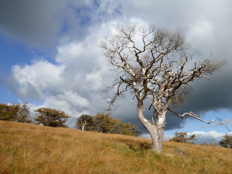
Weather – dry, warm, high cloud, no wind


The weather forecast predicted fine, dry weather with little wind thanks to a high pressure system that is sitting over the country at the moment, and by all accounts the good weather is set to last until Friday next week, maybe even beyond that.

Today began with a lovely morning. High cloud, warm without being too sunny, and no wind, all in all just right for a day’s fell walking.
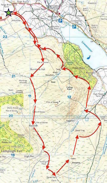

Route

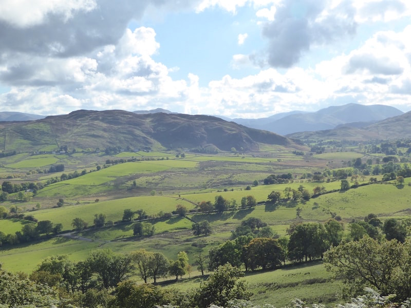
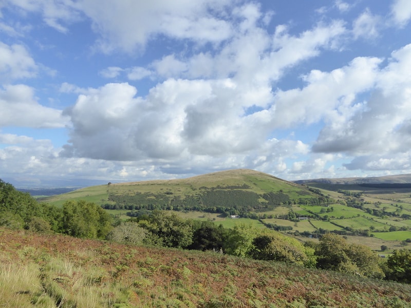
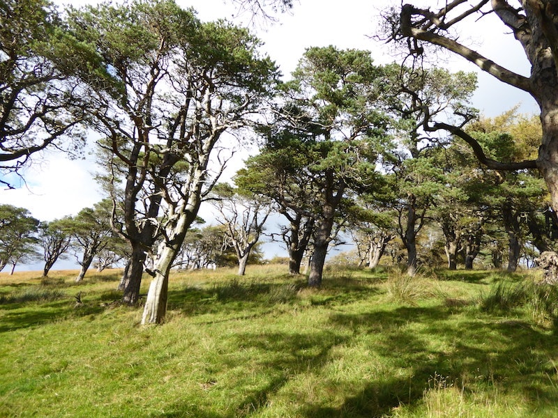
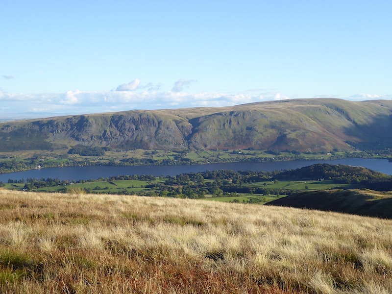
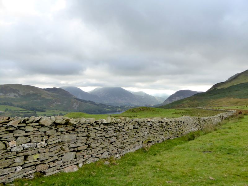
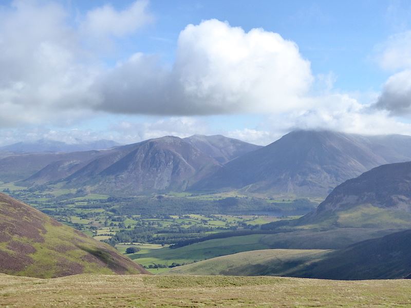
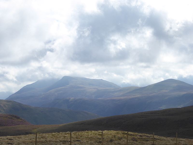
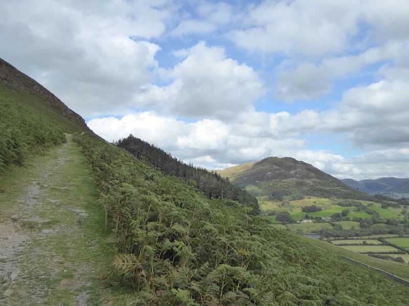
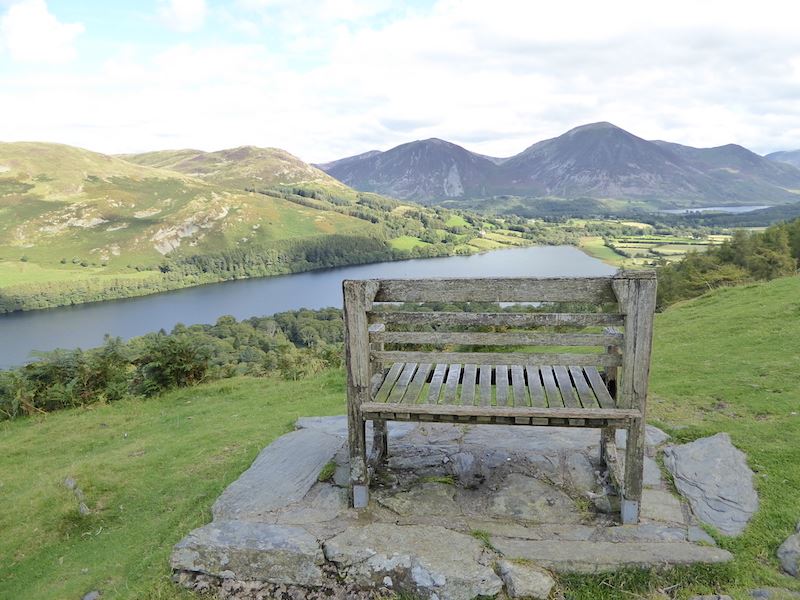
From the Honister Slate Mine car park a view of the crags of Black Star. Not many people about at the car park, we saw about half a dozen walkers setting off before us as we got ready to start off and then one chap followed us up all the way and that was it.

On the path from the mine and approaching the rock cutting.

This is all that remains of the old winding house, marked as ‘Drum House’ on the map at the top of the old, and long since dismantled, tramway.

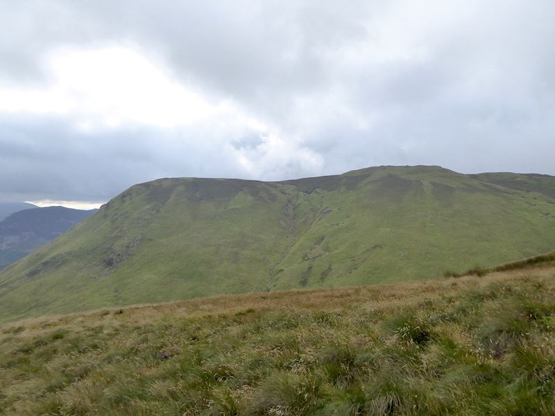
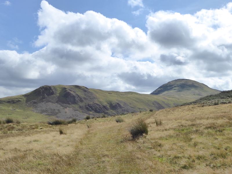
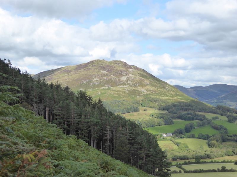
From the winding house a view of Grey Knotts which will be our first fell of the day.

The junction of paths at the old winding house where we will take the left hand one over to Grey Knotts. Going straight on would lead to Haystacks which is just visible behind what looks like the end of the path. The fell with all the cloud is Pillar.

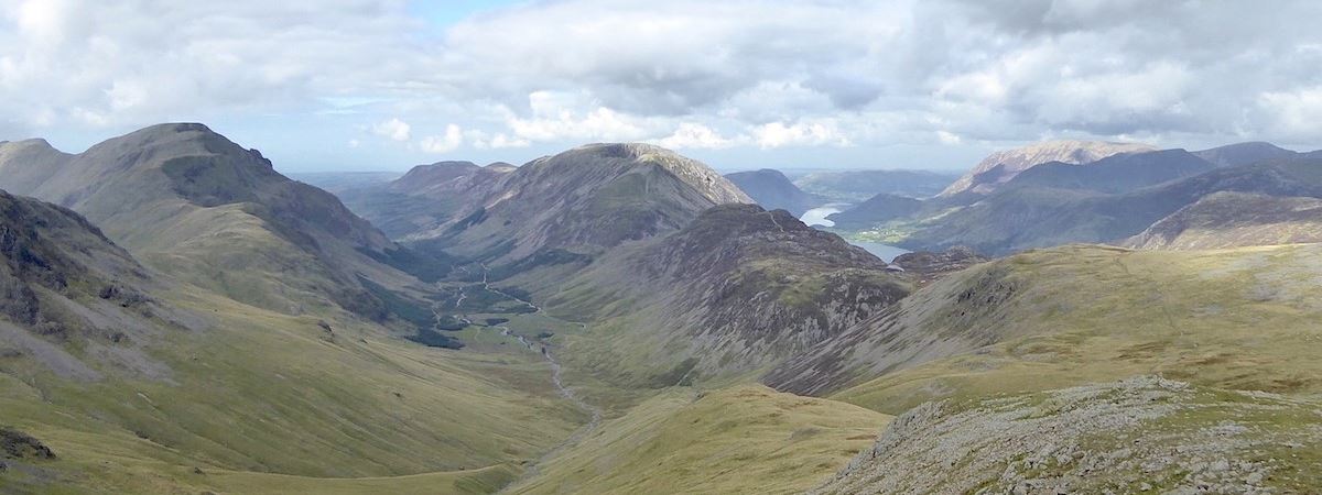
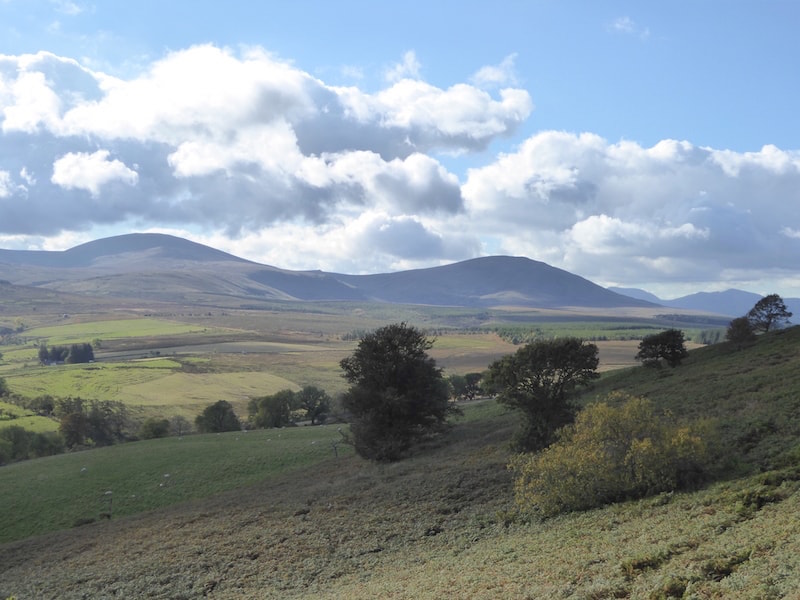
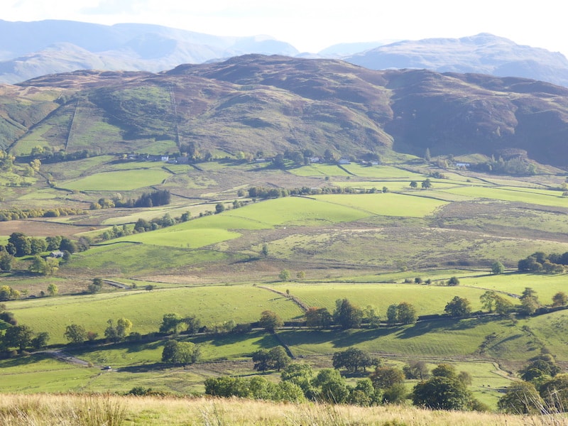
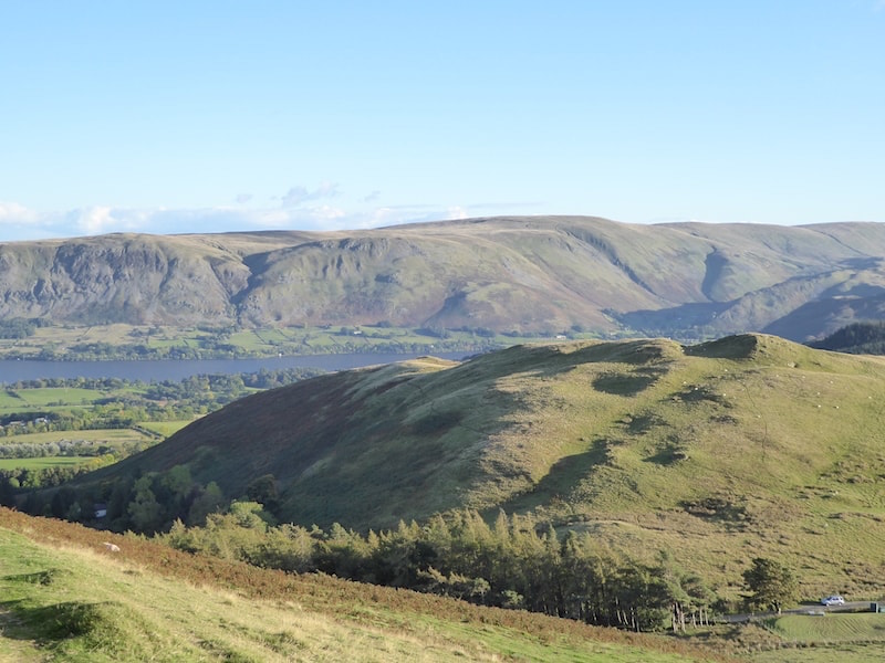
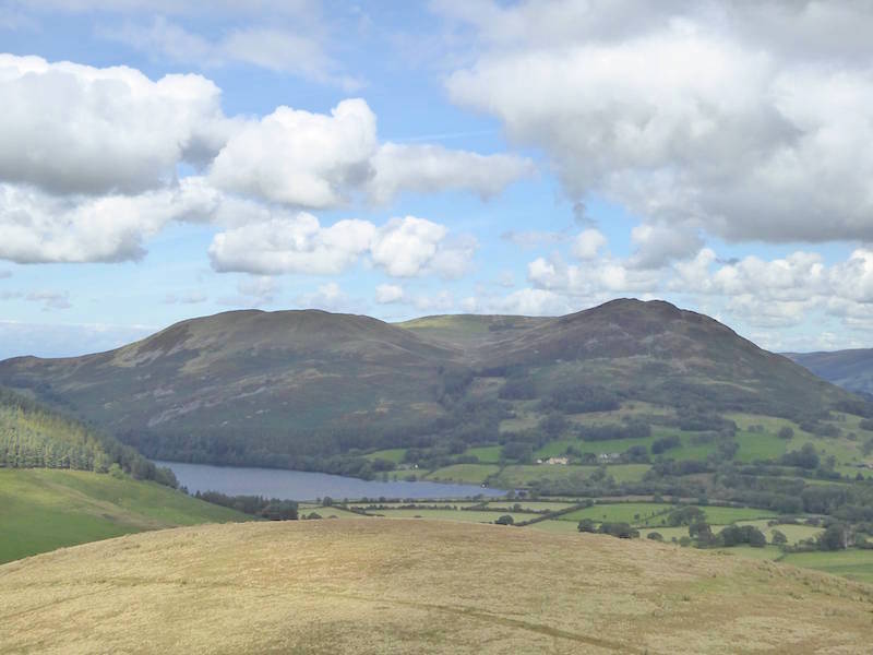
Looking across Dubs Bottom with Haystacks in the centre, to the left is Pillar, and to the right is High Crag and High Stile.

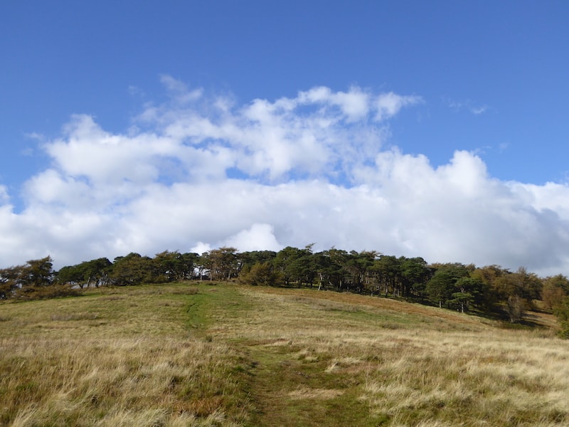
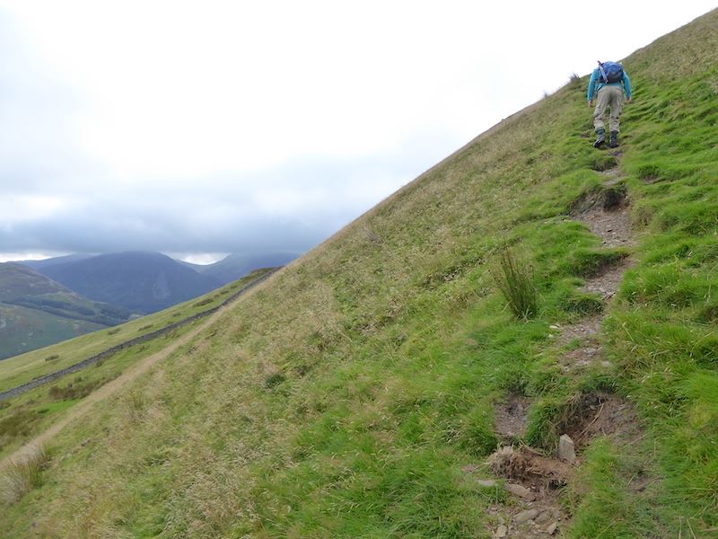
We turned off the main path after about a quarter of a mile to walk off path up the grassy slopes of Grey Knotts. No problems getting up, both the grass and the outcrops were surprisingly dry, and it didn’t take long to get up to the top.

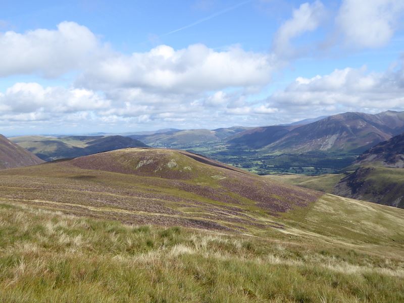
Looking across Dubs Bottom to Haystacks as we climb the slopes of Grey Knotts.

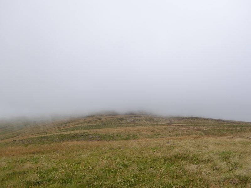
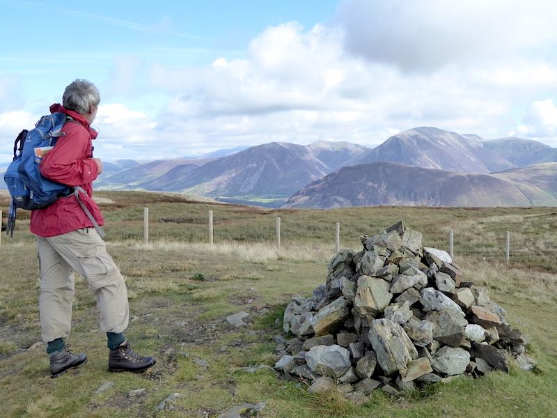
Up on the top of Grey Knotts, where we now need to locate the two rocky outcrops which mark the highest points. It might look as though this would be a ‘needle in a haystack’ exercise since Grey Knotts isn’t exactly short of rocky bits, but it isn’t as confusing as it might seem to begin with as many of the outcrops are quite obviously a lot lower than others.

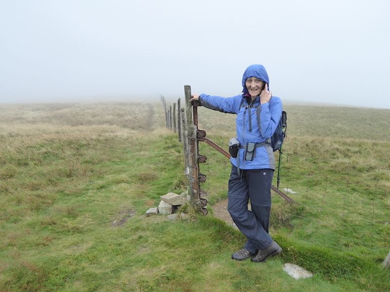
We’ll need to cross the fence to reach the first summit which is on the rocky section to the left.

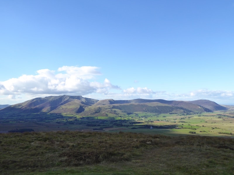
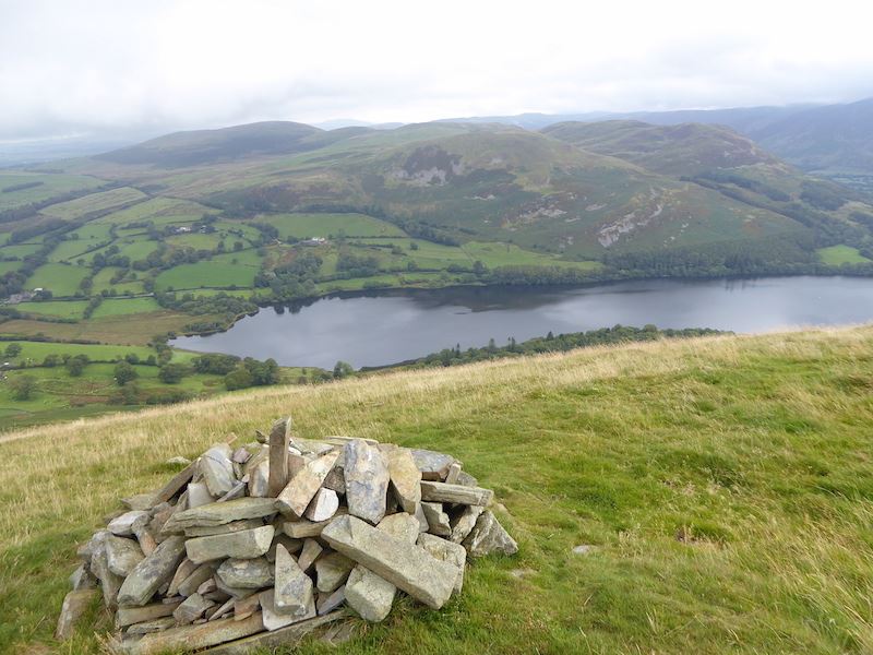
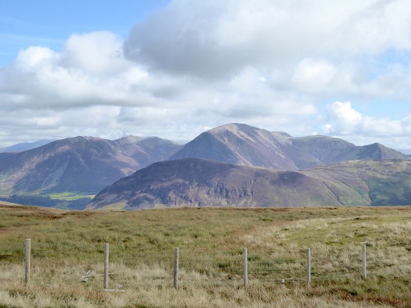
A good view of Glaramara with Combe Head just to the left of it, from the first summit on Grey Knotts.

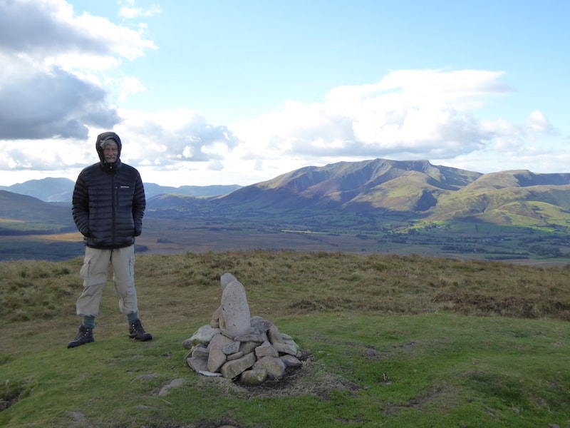
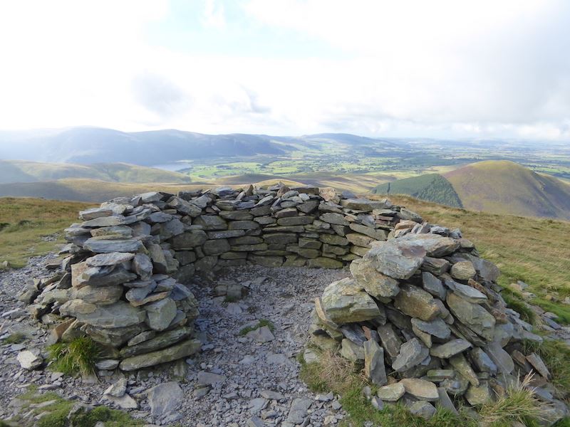
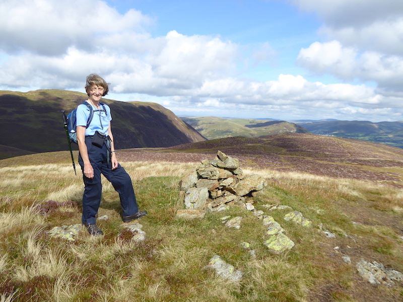
Grey Knotts, summit one.

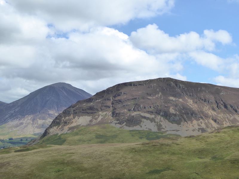
Looking south and the dominant crescent shaped fell is Great Gable, which will be the final fell on our walk today.

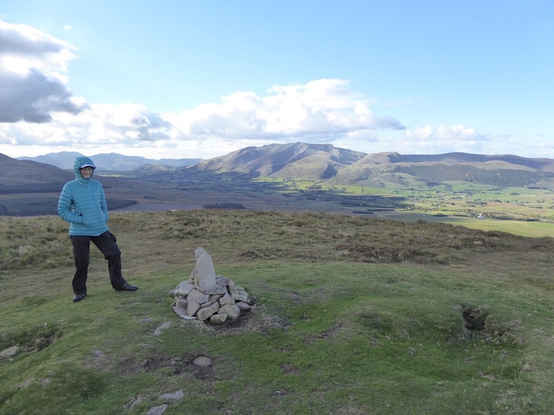
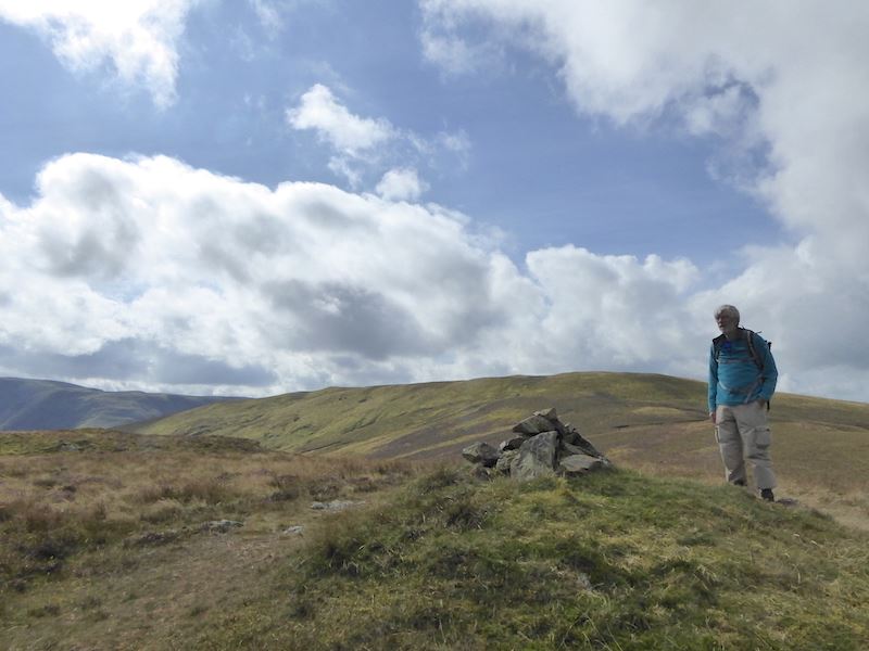
Grey Knotts summit two, two metres higher than the other one says the GPS. Who cares, just enjoy the view. We were just getting ready to leave when a group of three or four blokes arrived, one of whom was one of those ‘jolly joker’ types, who tried to create some confusion by stating that this was Great Gable. I ignored him, J told him that it was Grey Knotts so, having realised that we knew exactly where we were, he wound his neck in by saying that it only worked when the cloud was down. I don’t see anything funny in that either, what sort of person are you if you meet someone on a cloud covered fell and then try to mislead them about the name of it. An egotistical dickweed, and a know-all who really knew b****r all I suspect.

Since we were ready to leave Grey Knotts we left them to their own devices and headed for a straightforward walk over to Brandreth. A look back at the summit of Grey Knotts, now occupied by the same group of rather noisy, and silly, male walkers. Why do some grown men behave no better than ten year old boys in a school playground when they go out in a group?

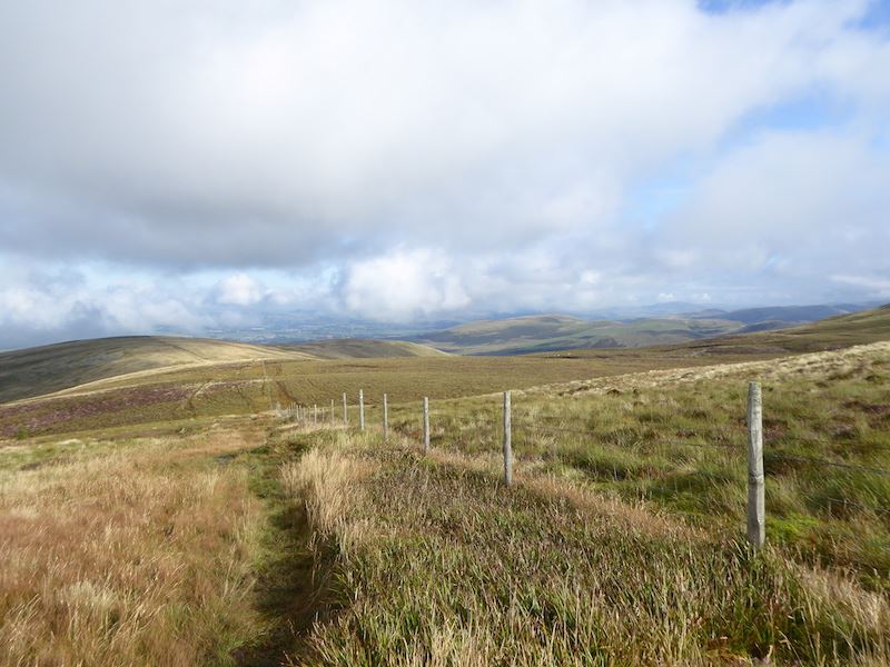
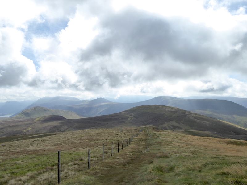
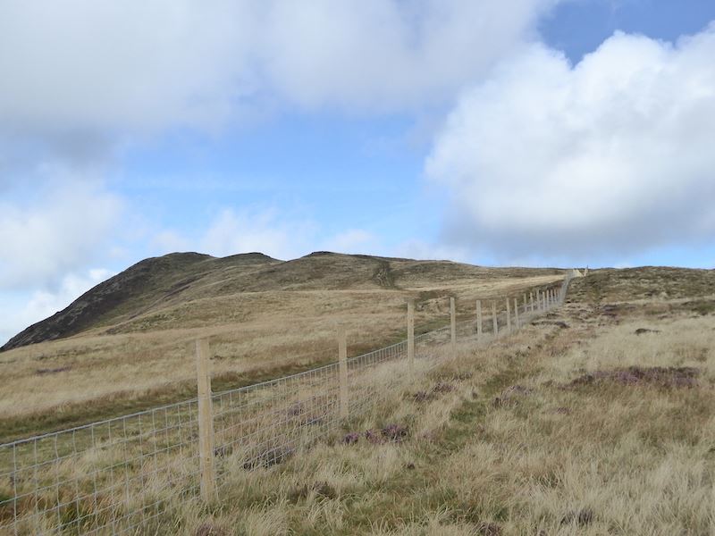
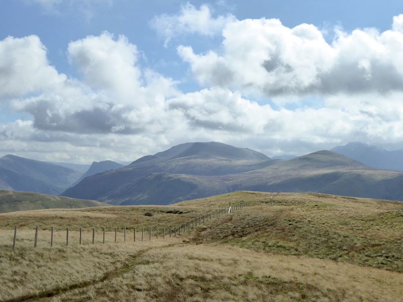
Onwards to Brandreth, just follow the fence and you can’t go wrong.

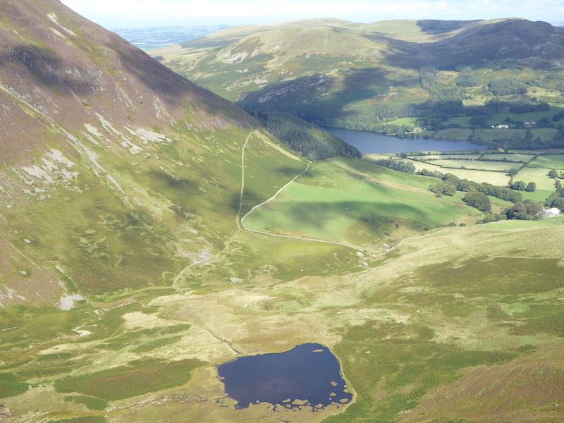
Passing the larger tarn on Grey Knotts. Its a flat area which retains a lot of water so there are a number of pools along here.

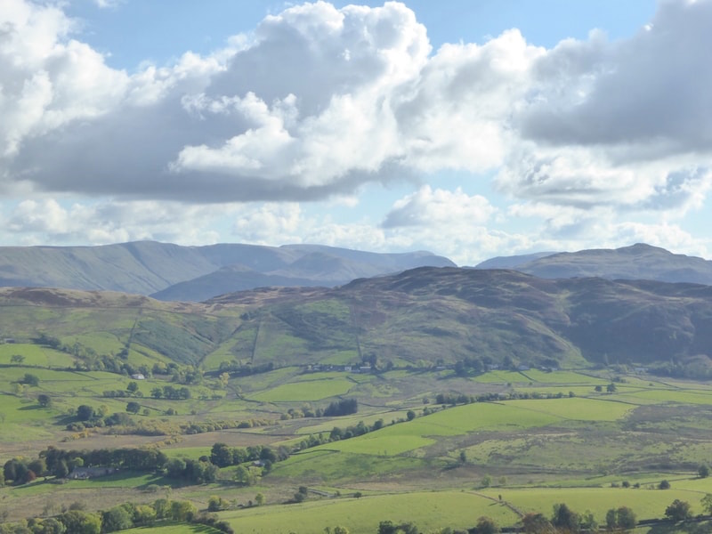
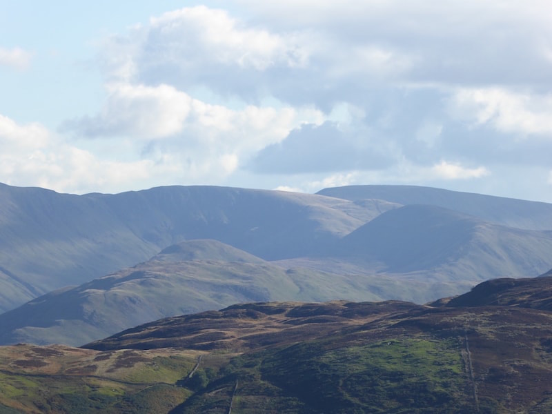
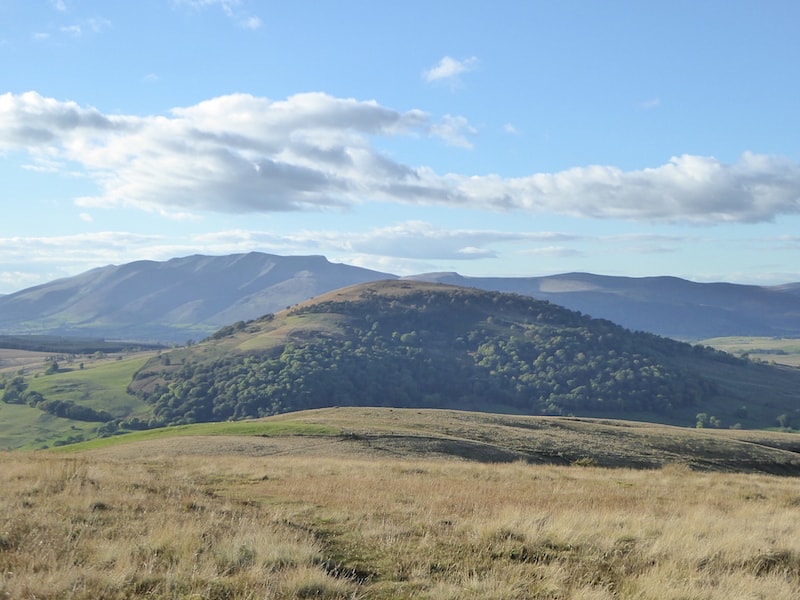
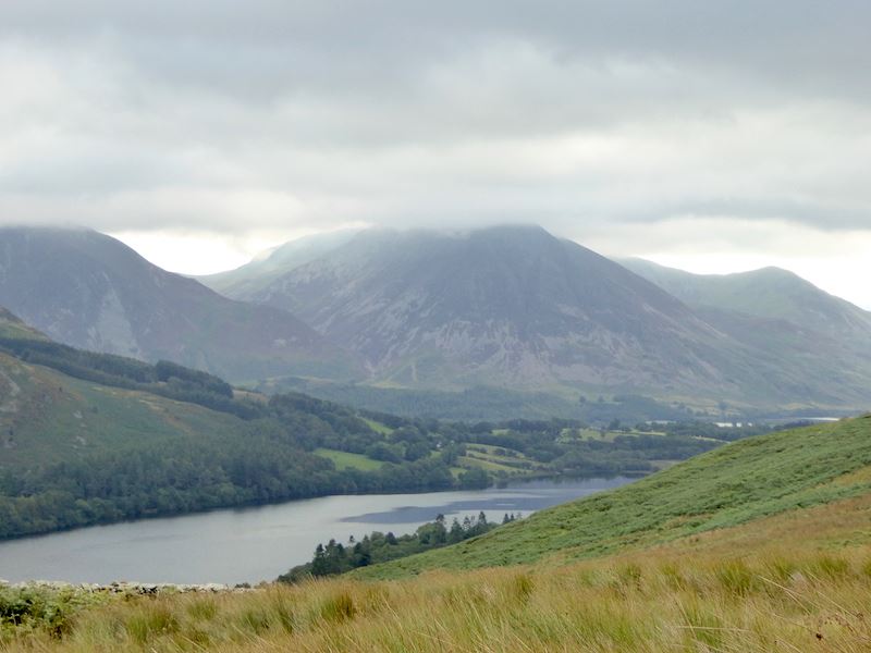
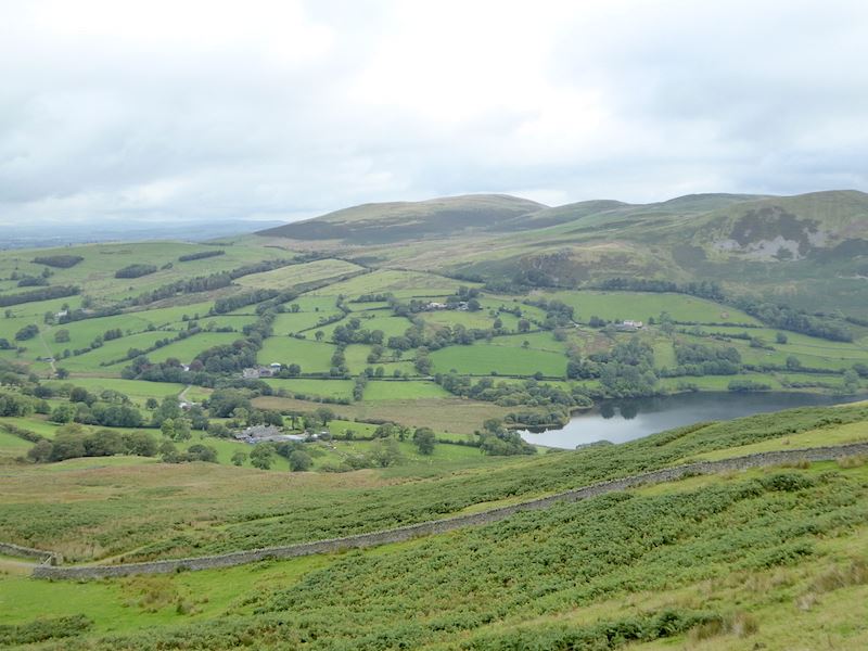
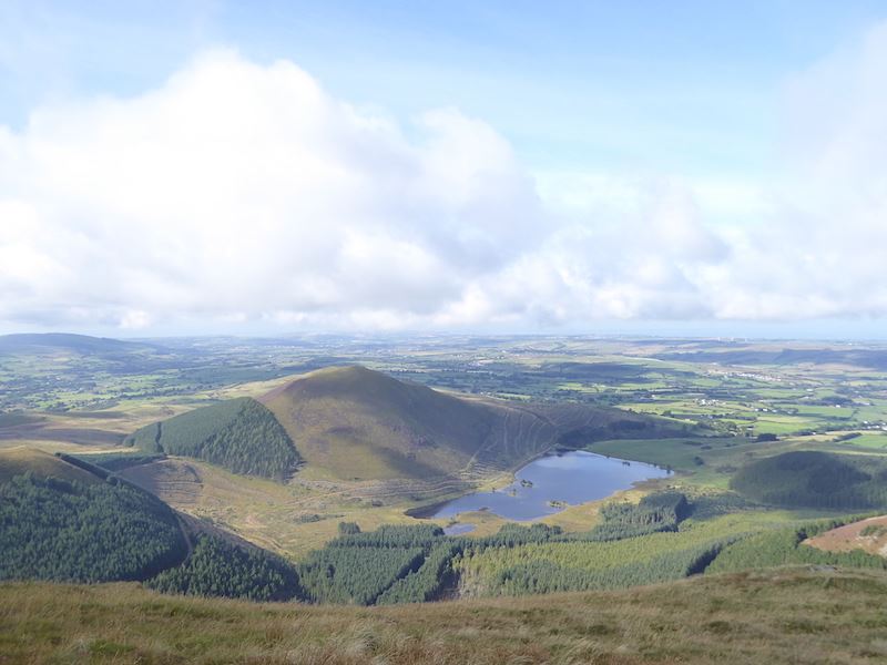
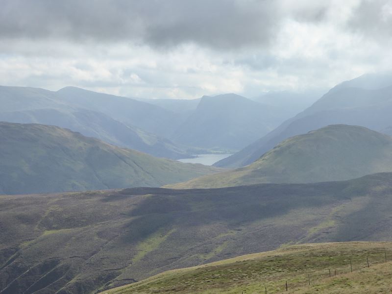
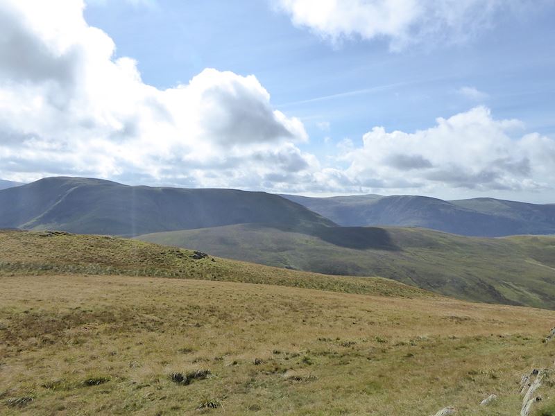
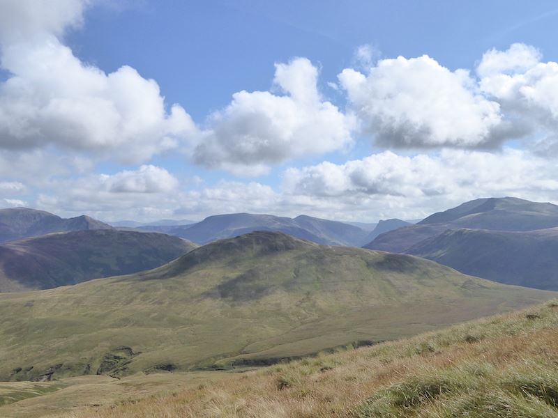
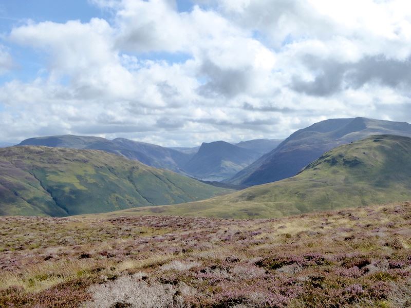
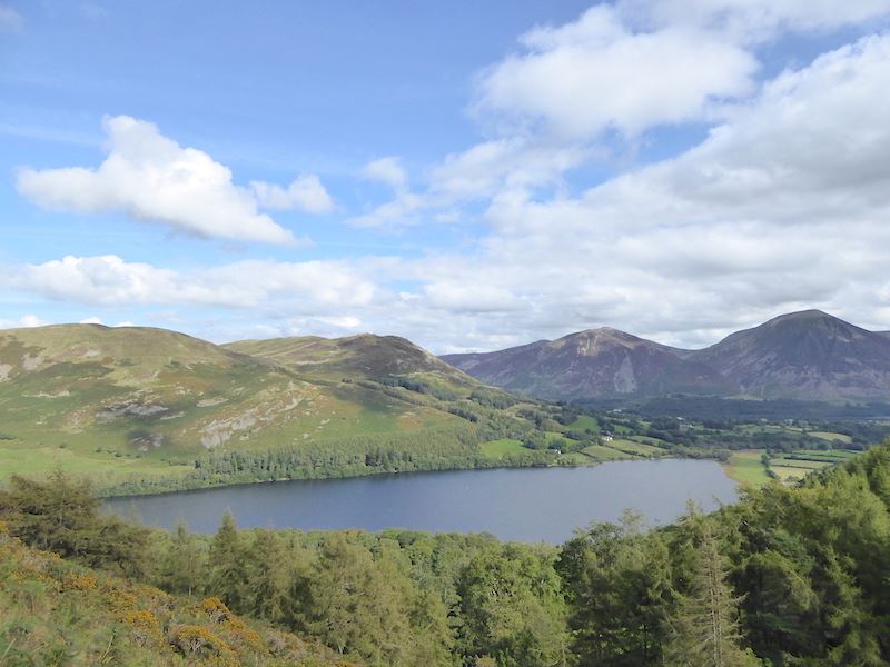
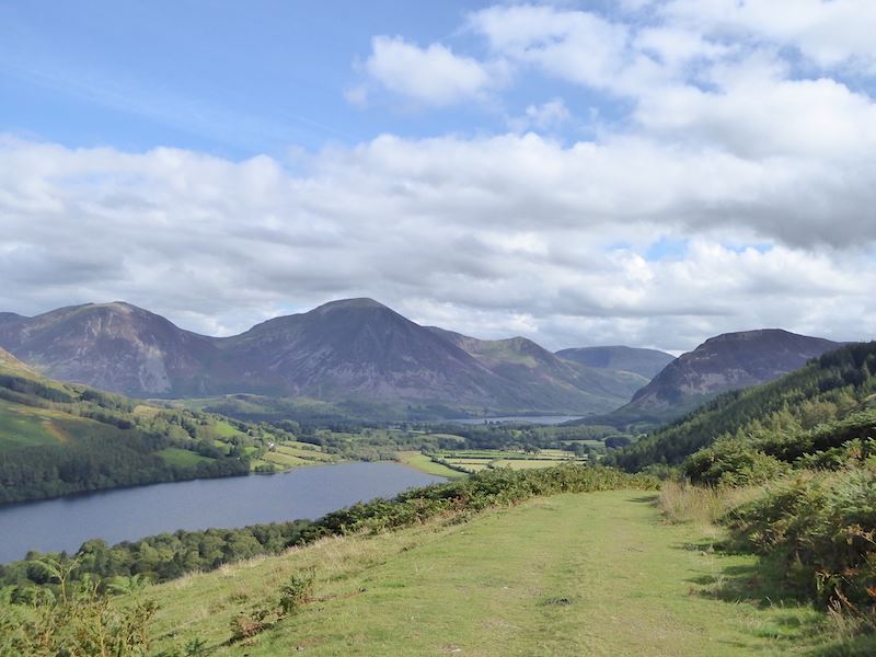
Making our way across Brandreth with Ennerdale Water over to the left of the shot, Buttermere and Crummock Water on the right and fells everywhere you look.

Pillar, standing out clearly now that the cloud has shifted, with Ennerdale Water to the right of it.

On our left we have a view of Glaramara on the skyline.

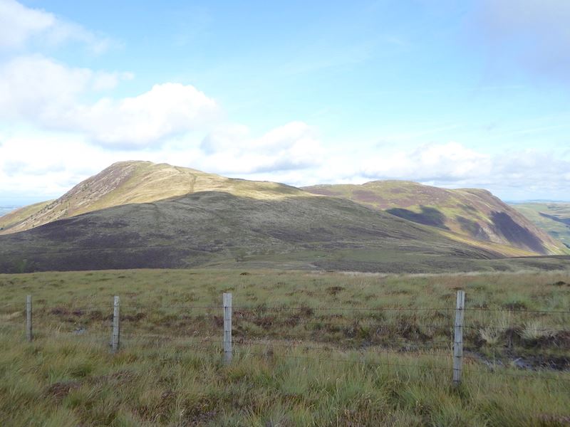
There’s nothing very remarkable about Brandreth itself and if you weren’t taking notice you could walk past the summit without noticing as the whole area is relatively flat.

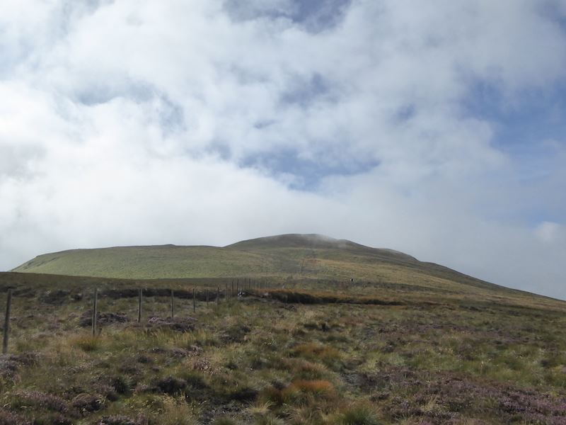
The next stop on from Brandreth will be Green Gable, which, as its name suggests, is the one with the green covered slopes directly ahead of us. Between here and there’s a dip between the two fells, an area known as Gillercomb Head, so we have to lose some height only to have to regain it on the other side.

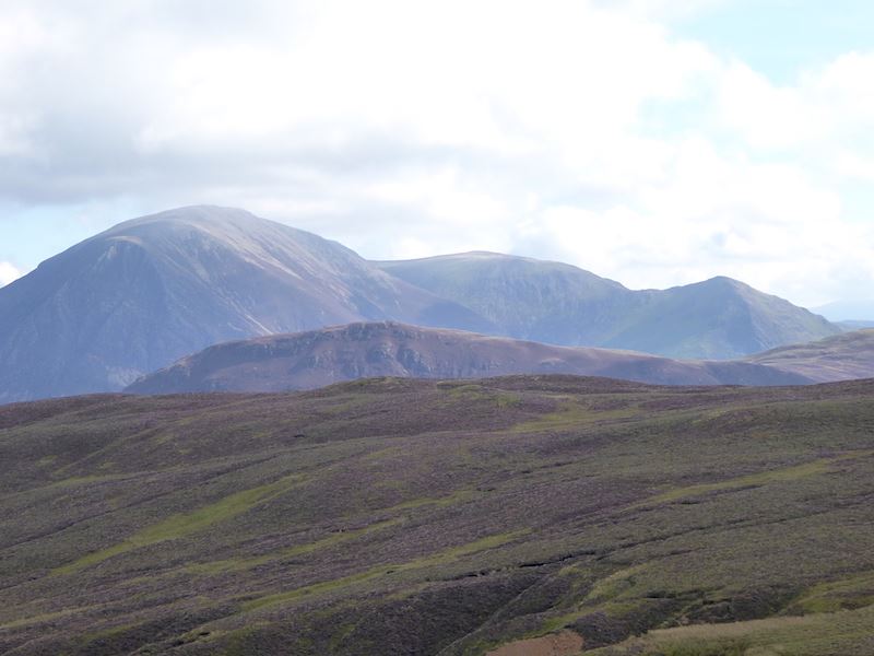
Dropping down from Brandreth now and over to our right we have a view of Kirk Fell with Pillar on its right.

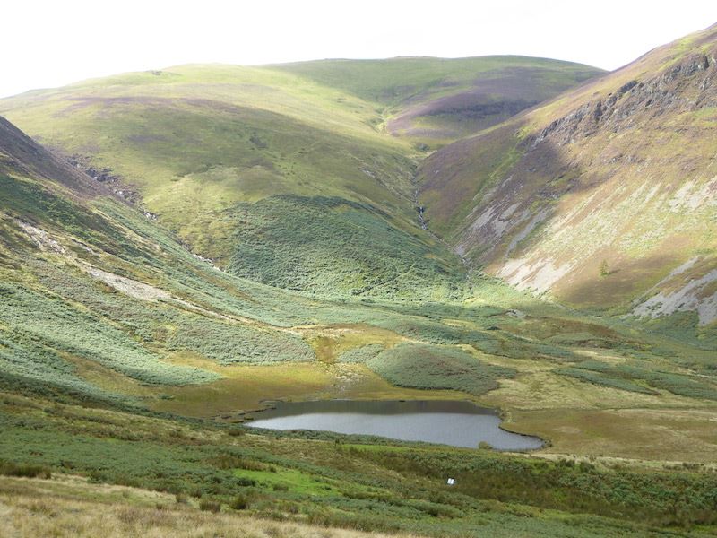
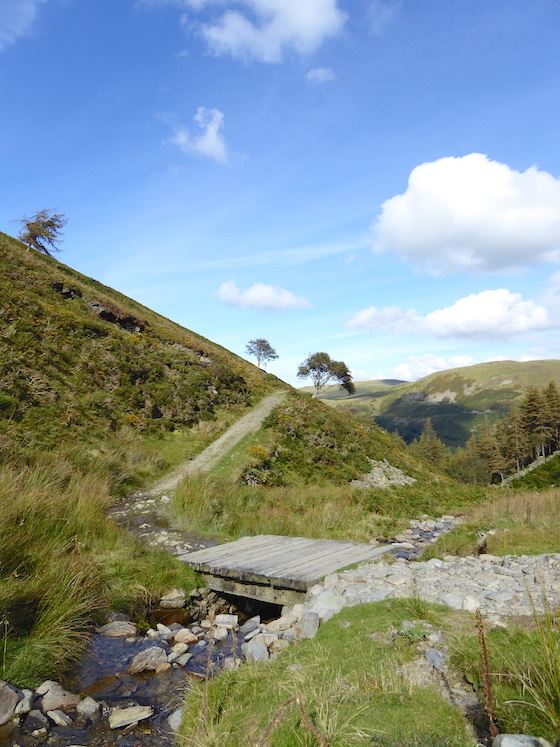
Passing by the tarns as we reach the lowest point on Gillercomb Head.

A look back at the descent route from Brandreth from just beyond the tarns.

Starting the climb up Green Gable and a look down into the hanging valley of Gillercomb. Raven Crag on the left is known to climbers as Gillercomb Buttress. The surrounding scenery provides plenty of interest which relieves the tedium of the somewhat dull trudge up Green Gable. Here’s a few shots taken on the way up …..

….. Base Brown in front of Glaramara, both getting a splash of sunshine …..

….. looking straight down Ennerdale …..

….. on the skyline and sandwiched between Kirk Fell and Pillar is the western section of the Mosedale Horseshoe …..

….. with a closer look at Pillar …..

….. a view along Ennerdale with the slopes of High Crag and High Stile rising on the right …..

….. a close up of Bowfell and Esk Pike …..

….. and Great End.

No chance of missing the path up Green Gable, cairns marking the route all the way. I think the shot might explain why I think this a dull trudge, there’s nothing of much interest ahead and the path  seems never-ending.

But end it does, and then the very impressive crags of Great Gable rear up before you.

From Green Gable this is the the view to the west, there are some big fells around these parts.

There’s even a view of the Langdale Pikes so I took a close up of them as the cloud drifted below them for a moment or two.

The cloud was also rising up between Bowfell and Esk Pike.

Amazingly, there were cloud free tops from Great End, on the left, right across to Scafell Pike over on the right.

Taking advantage of the moment for a close up of Broad Crag with Scafell Pike towering above it.

Time for a five minute sit down on Green Gable before we tackle Great Gable.

Why am I smiling, I’ve got to get up that big lump of rock behind me next?

Great Gable and its imposing crags. A wall of deeply gouged, vertical brooding rock staring straight back at you. The southern face, on the far side of the summit, is even more intimidating.

Making our way down the slippery slope to Windy Gap. The walker down at the bottom was wearing only his boots and a pair of shorts, no doubt due to having just sweated his way up the very steep path on the left. I thought we had encountered the famous ‘naked walker’ but when he got a bit closer I could see it wasn’t him. He had a rucksack on his back and I did wonder if not wearing a t shirt was wise since rucksack straps can start to chafe the skin after a while, especially if you are sweating. From Windy Gap he started up the path to Great Gable just as we were going to do. We were still only halfway down Windy Gap when we noticed him leave the path he was on and move left over to a grassy area, stood a few minutes looking up and then moved back to the original path again and continued looking up at it. I realised he was assessing the scramble section and wondering whether to tackle it but I don’t know what conclusion he came to as I was having to concentrate on the loose path I was coming down and watching where I was putting my feet. The next time I looked over at where he had been standing he had gone.

A view of Styhead Tarn on our left as we descend Windy Gap. The descent needs care as the path down is loose and will slide away under your feet very easily, so you’d be on your backside and slithering down to the junction at the end of it before you could stop yourself.

Safely down to Windy Gap which didn’t live up to its name today, no wind at all.

Climbing out from Windy Gap up to Great Gable. In about 500 feet we’ll be at the summit, best not to think about that and just keep putting one foot in front of the other until you get there.

Higher up the path now and we begin to see Sprinkling Tarn above Styhead Tarn.

We still have a path to follow, but that’s about to change in a couple of minutes.

As we climb I take a look back down to Windy Gap and the path off Green Gable.

The path disappears amongst the jumble of boulders so its every man for himself for a while. Its a good little scramble, perfectly safe and only lasts a few minutes, after which you are above it and able to stand on just two feet again. Great fun, especially as the rocks were bone dry and we could see where we were aiming for, it would be a different matter in rain and cloud though.

Safely over the scramble section and we’re now able to stand upright again and have a look down at the view.

Turning around from the previous view for a rather less picturesque one. From here its steeply up over the rock strewn ground where progress can be slow since you need to make sure of your footing on the rocky rubble.

A pause for breath so a chance to look back at the steepness of the route.

We could see the summit about 100 yards before us when I noticed something I really didn’t want to see – cloud and mist heading our way, seemingly out of nowhere dammit, and only five minutes from the top. There won’t be those grand views down into Wasdale, what a bummer!

As the summit area looked crowded we stopped here and had a bite to eat while waiting for the cloud to clear.

The cloud was still down by the time we’d eaten so we decided to continue on up to the summit anyway, view or no view.

A brief gap in the cloud gave us a distant view of Blencathra over there on the centre of the skyline.

The Memorial Tablet on Great Gable, still with the crosses of remembrance from last November’s gathering, no vandalism here.

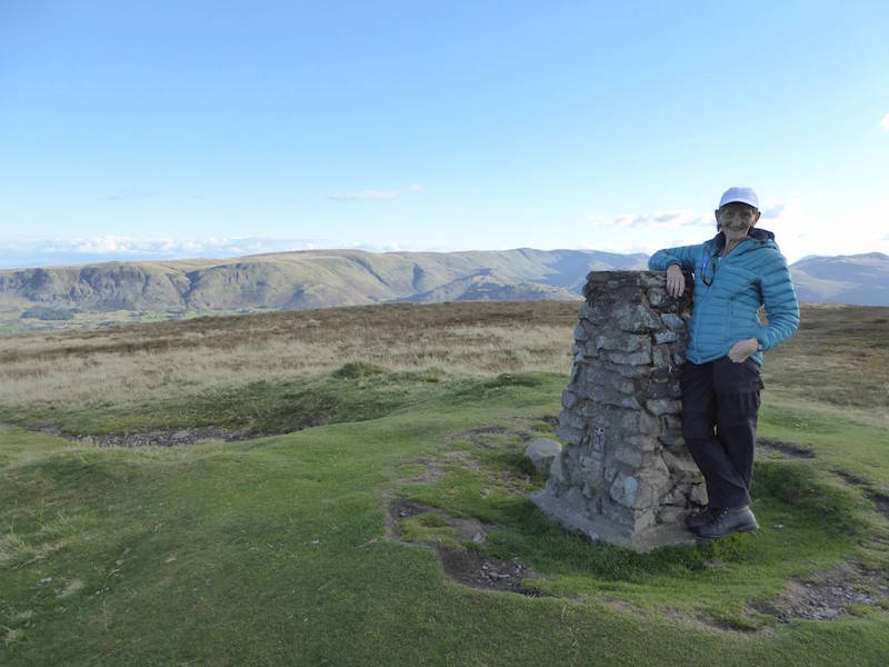
The two of us on Great Gable summit, another walker very kindly offered to take it.

The cloud clears a little to give us a view of Scafell Pike up there on the right.

With fingers crossed we make our way down to the Westmorland Cairn and hope the cloud clears.

Yes, its clearing, we can see Lingmell Beck down there.

A view down the almost vertical southern face of Great Gable overlooking Wasdale. Peering down at the Great Napes and its a very long way down to the bottom. I was being urged to come away from the edge at this point.

Cloud is still swirling around but the view is there just as I’d hoped. Its reputed to be the finest view in the Lake District.

A better view down to the Great Napes and the steep scree slopes alongside them.

Back to that stupendous view from the cairn.

Finally persuaded to stand by the cairn. Understandably scary as its  perched on the edge and its a long way down.

I was hoping for a view of Scafell Pike in this shot but the cloud came back.

A longer view down to Wasdale Head and the surrounding fells.

Things got a little clearer so I took another shot before we left the cairn.

We left the summit of Great Gable and wandered over to have a view of Kirk Fell.

Before we left I zoomed in on the summit area, still full of walkers eating their lunches.

Another zoom to look at Pike O’Stickle and Loft Crag on the right and Harrison Stickle on the left.

Here we go again, returning by the same route. Its no easier descending so its bottom gear going down as well up.

Now going back down over the scramble section. In addition to hands and feet there is one other part of the anatomy which comes in very handy in situations like this, especially if you don’t have long legs.

At Windy Gap we turned down the very loose stony path, it became more like ski-ing than walking at times.

Slow but steady progress down Windy Gap.

Suddenly, and quite dramatically, cloud begins to roll through between Great Gable and Kirk Fell.

Four walkers giving some scale to Gable Crags. They are about to go up Windy Gap, I think they might find that to be rather like trying to walk up the ‘DOWN’ escalator.

Cloud now streaming through from Beck Head and we were expecting to be enveloped at any minute.

Green Gable still visible but Great Gable is rapidly disappearing. Fortunately it didn’t come drifting our way.

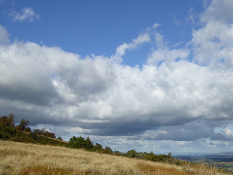
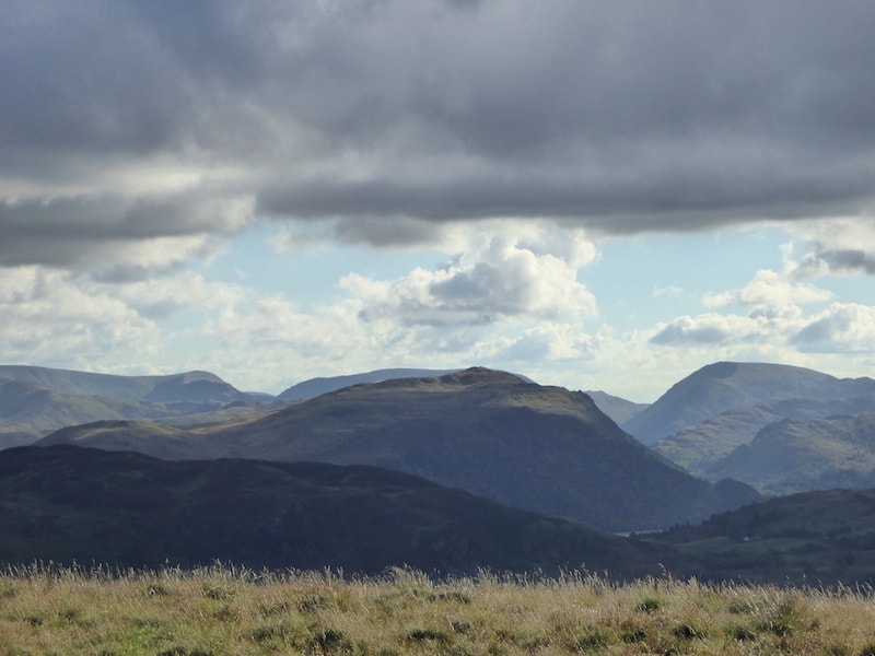
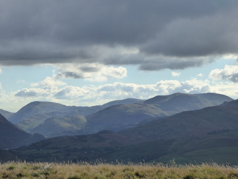
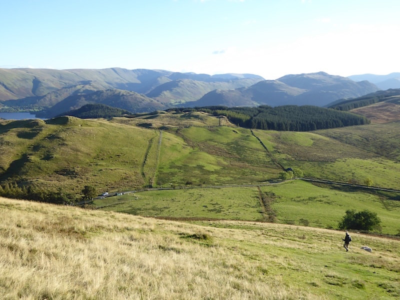
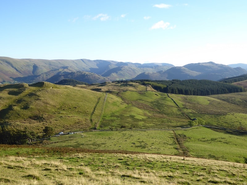
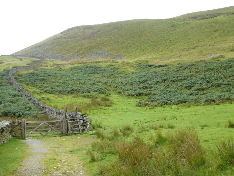
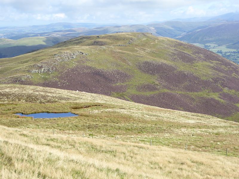
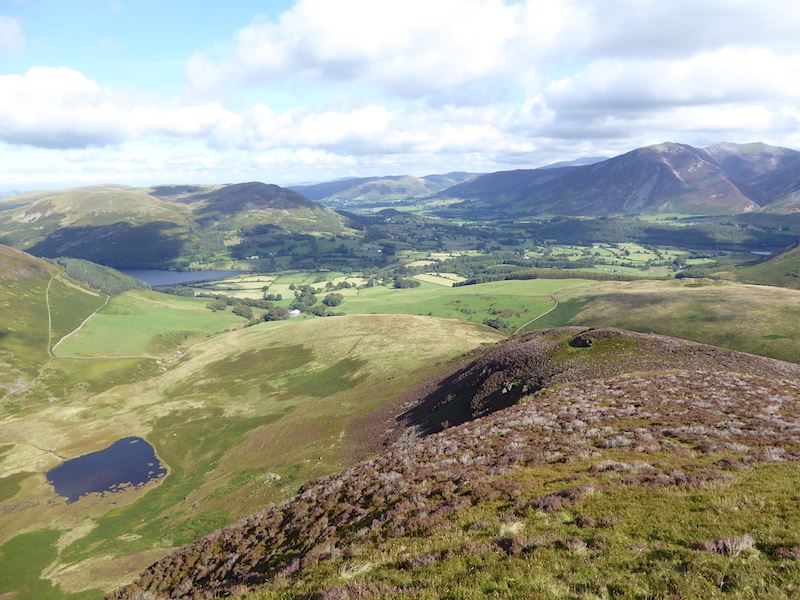
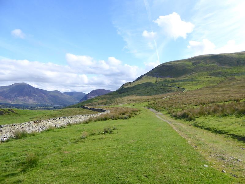
We’re on our way back to Honister and passing below the aptly named Grey Knotts.

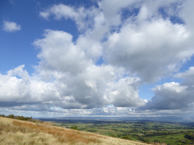
The grey cloud built up and moved steadily across during the afternoon. It was very mild despite the chilly looking greyness of everything.

Looking back at Grey Knotts as we near the old winding house …..

….. and from there we return to the Honister slate mine.

They’re fixing the fells again.

Should be fixed by the end of October then.

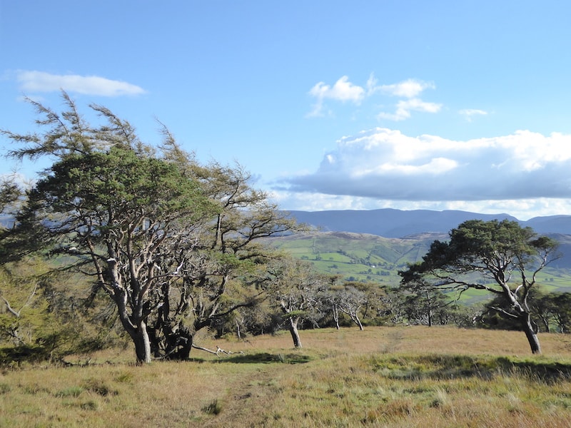
We continued on down back to Honister, changed out of our boots, and made our way back home. I really enjoyed this walk, the weather was just right, the views were wonderful, and I made it to the Westmorland Cairn and saw the view I didn’t see last time we were here. Only a small success in the grand scheme of things but no less satisfactory, its always good to fulfil an ambition no matter how small it is..


Gowbarrow Fell

Walk Date – 24th September 2015

Distance – 4.6 miles

Weather – sunny spells, showery, windy


Route

The lay-by on Park Brow has been blocked off can no longer be used for free parking, thanks very much National Trust. The gate marks the start of the path to Aira force. I’m on my own for this walk.

Place Fell from the path across the field.

At the end of the field path a new gate and bridge give access to the Aira Force pathways.

Its a left turn then for me then as I’m going up to Gowbarrow.

The newish bridge over the beck, installed in 2014 I think.

Looking downstream from the bridge area.

Looking upstream from the bridge.

The left turn from the bridge brings me out at this gate and onto the open fell side.

Looking over in the direction of Dockray on a nice sunny morning, but will it last?

A look back along the path to Place Fell. The clouds are gathering.

One more gate and then I’m out onto the fellside for the climb up Gowbarrow.

Clouds moving rapidly over the Ullswater fells, the wind was quite brisk as I climbed higher.

Looking in the direction of Dockray and the fells beyond from the path alongside the wall.

In what seems like no time at all the summit of Gowbarrow comes into view.

From the same spot I turn round for a look back along the path, nice and sunny at the moment, but the wind was a bit of a nuisance, although it did keep the clouds moving

Here’s a close up of Great Dodd on the left and Clough Head over on the right.

Not far now to the top of Gowbarrow.

A bit misty on Blencathra, but the peak of Lonscale Fell to the left of it is clear enough.

On Gowbarrow summit looking over at the north eastern end of Ullswater.

Little Mell Fell from Gowbarrow summit.

Great Mell Fell from Gowbarrow summit.

Looking westwards from the summit shows the path I came along and a view of the Dodds on the skyline.

Looking north over towards Blencathra and the northern fells from Gowbarrow top.

Looking westwards over at The Dodds.

The Mell Fells, Great on the left and Little on the right.

Below me, in the centre of the photo, is the path I’ll be taking off Gowbarrow.

Down below the summit where it was such a relief to not have the wind buffeting me all the time.

The path leading off the summit.

A look back at the summit as I continue on the path. Not a soul around today.

An old shooting lodge once stood here, this was the only part of the ruins that were visible above the nettles and the bracken.

Looking across Ullswater, the sunlit fell in the centre is Beda Fell.

Its becoming very gloomy overhead, is that the last of the sunshine?

I’m walking back on the terrace path, through the bracken on the left you can see the route I’ve just walked down.

Place Fell is greyed out, Yew Crag viewpoint cairn is below it, on this side of Ullswater.

Yew Crag viewpoint.

Looking towards Glenridding from the viewpoint …..

….. and now looking northeastwards.

There’s a definite look of a rain shower along there.

I zoomed in on the launch far below me. Everyone is huddled into coats but no doubt enjoying the ferry trip along Ullswater. It looks a bit draughty down there though, the wind is whipping up the water quite a bit.

The memorial seat and the Yew Crag viewpoint, with the ferry passing below it on its way to Pooley Bridge.

On maximum zoom here for a shot of the summit of Place Fell.

Oh dear, here it comes. I didn’t think I was going to get away with it. Time to put the camera away and get the waterproofs on.

Lyulph’s Tower, and here’s where I stopped to take the waterproofs off. The time elapsed between this photo and the previous one tells me that the shower lasted ten minutes.

Its still raining over there though, I’m glad I’m not on the Helvellyn range right now.

This is a popular tourist spot and is usually quite busy. What a surprise when I rounded the corner and here was no-one around. When you cross over the bridge this is what you see …..

…..Aira Force. I wish I had a pound for every photo that’s been taken of this.

Making my way back up the path beside the upper falls. These are just below the new bridge I photographed at the beginning of the walk.

The end of the walk and the weather improves enough to illuminate Place Fell and High Dodd over to the left of it.

This morning’s route followed the wall which you can see rising up the fellside above the plantation of pine trees. As so often happens the sun comes back out just as you finish your walk.

The old, and free, parking area opposite the now blocked off lay-by is also under the auspices of The National Trust …..

….. which usually means you have to pay to park. However, where the ticket machine should have been was this board which was thanking me for paying and displaying. I thought it was very courteous of them seeing as I hadn’t. I would have if they had remembered to put the machine in.


Burnbank Fell, Blake Fell and Gavel Fell

Walk Date – 19th September 2015

Distance – 7.4 miles

Weather – low cloud at first, then sunny with high cloud, dry, very little wind


We left home at 8.00 am and arrived at Fangs Brow at 9.00 am as we wanted to be sure to be able to get a parking spot. Not only did we get a spot but we had the choice of where and how to park since we were the only ones there. The weather forecast for today was good, no rain, hardly any wind and plenty of sunny spells and we left home in lovely weather. As we drove further west the cloud increased and although we were still in sunshine at Fangs Brow it was obvious that we weren’t going to have it for very much longer as the cloud continued to build up.


Route

The gate at Fangs Brow which gives access to the path to Burnbank Fell, the one on the skyline. Its a lovely morning.

Just as we set off the sunshine disappeared and we were under a cloud blanket. Its just clipping the top of Grasmoor in the centre of the shot. Despite the cloud it was quite a still day as we walked along the farm track alongside the wall in the direction of Burnbank Fell. Crossing the lower fields at one point was a bit of a concern since a rather large bull was standing alongside the path and watching us approach. He was on the left side of the path by the wall, the others in the herd were over on the right of the track and as we continued towards them another bull came wandering across the path too. The rest of them then began to move slowly across our path so I quickened my pace to get by them before they blocked the way completely. I had said to J not to make any noise and just to ignore them, so what did he do? Started saying ‘hello’ to them and then whistling. Despite that we managed to walk by them without any trouble.

A little further on from the cows mother and foal were busy and paid absolutely no attention to us as we walked by.

Over the wall we have a view of Fellbarrow.

Loweswater comes into view and the cloud increases on Grasmoor. The weather was definitely getting gloomier by the minute and by now it was quite grey overhead, what happened to the lovely day the forecast had promised?

There’s a choice of routes at the gate: left for Loweswater, ahead for a steep ascent of the slope on the left skyline, or right for a slightly more manageable zig-zag path up to the marker cairn.

There’s the gate in the bottom left, we chose the zig-zag option for our route up Burnbank Fell.

The path climbs in a zig-zag so its supposed to make it a bit gentler, but steep is still steep whichever path you take. It looks much worse than it really was though and the ‘steps’ came in handy. Plenty of stops for photos and a rest for the legs helped too.

The view across Loweswater as we reach a flatter section. Its not the summit of Burnbank Fell, just a marker cairn or ‘pile of stones’ as its described on the OS map.

A view of Carling Knott as we continue the climb up to Burnbank Fell summit.

The route ahead, but here comes the cloud and within seconds we had lost all views. Time for the jackets to go on.

Burnbank summit. The cairn is about 2 yards over to the right but two walkers were sitting on it or we might have clambered over. The fence is a useful guide in such conditions. It was a while before the camera came out again since views were non-existent. We carried on through the murk and a couple of minutes later the two blokes who had been sitting on the cairn came charging past us as if they had a train to catch.

The cloud eventually thinned and drifted away, and now we can see where we’re going, along a very soggy path up there to Blake Fell. The two blokes were up ahead with one of them now struggling in the boggy conditions and beginning to fall behind the other one. They were following the track to Blake Fell too so it crossed my mind that the lead bloke was anxious to bag the summit shelter. There seemed to be no other reason for all the rush, unless he was ultra competitive and wanted the dubious satisfaction of getting in front of us. If that was the case he needn’t have bothered, we don’t approach our walks as if they are fell races and we certainly don’t compete with other walkers to get somewhere first. Can’t see the point myself, there will always be somebody behind or in front of you so why rush about unnecessarily.

Looking back along our route from Burnbank Fell. The cloud is breaking up nicely so we may be in for a nice day after all. As the ground started to rise higher we left the sogginess behind, the cloud was thinning out rapidly and moving away from us and the sun was beginning to break through, all of which lifted the spirits no end. The warmth came back, the views came back and we could now see where we were going so things were much better all round.

From Blake Fell summit there’s a view of Cogra Moss, the watery bit, and Knock Murton is the hill to the left of it.

As I suspected the two blokes who had charged ahead of us were in the summit shelter as we got nearer to it, not that it would have done them a lot of good as it is perfectly useless as a shelter unless you are a very short person. The top of the shelter is only just above knee high and is very small inside so not a lot of room for two big blokes. They were only about ten minutes in front of us so they didn’t stay in it very long and as we approached I noticed them preparing to leave. Off they went so we sat against the shelter wall and had a short break while J tucked into his Mars Bar.

Carling Knott across a little tarn just below Blake Fell summit.

Looking across Lorton Vale to Whiteside and Grasmoor. Its turning out nice again.

Its still looking a bit murky over there though. Buttermere is in the centre with Fleetwith Pike rising right behind it.

On the descent from Blake Fell and heading towards Gavel Pike. That’s the one in shade in the middle foreground, you just follow the fence. As we left the shelter another walker came towards us, another bloke, a thirty something, with lots of studs all over his ears. He couldn’t wait to tell us that he’d been on Mellbreak at 7.00 am that morning. Were we supposed to be impressed, give him a medal, pat him on the back or what. Why did he think we would be interested in what he was doing at 7.00 am? We couldn’t have cared less. I noticed another walker approaching from the same direction so I asked ‘ear studs’ if it was his walking companion. Turned out that it wasn’t and that he ‘walks alone’ due apparently to the fact that his mates say he walks too far. Well that may be, but he was the sort of bloke who would get on your nerves if you were out for the day with him so perhaps that might be the reason they wouldn’t walk with him. I wouldn’t want to walk to the garden gate with him. Off we went, leaving him and the other guy to sort out who was going to bag the shelter, and started descending to make our way to the crossing point for the path to Gavel Fell. Several people were on their way up as we went down but only hellos were exchanged and nobody trying to tell us their exploits thus far, thank goodness.

Further down the path was this arrangement of stones and I have no idea what it is. There’s nothing at all marked on the OS map. It was a fair size whatever it once was.

Red Pike on the centre skyline with Starling Dodd on the extreme right.

A look back at Blake Fell as we make our way over to Gavel Pike. As we reached the corner fence back there and crossed over it we met a couple who were just about to cross it on their way up to Blake Fell. They had strong Irish accents and the woman of the two stopped and asked us if the fell in front was in fact Blake Fell so we assured them it was. Then she looked back at where she and her husband had come from and asked us what the fell behind them was. Gavel Fell we told her, that’s where we’re heading. No, she said, that’s Gavel Fell over there, pointing to an area of raised ground about halfway along the plateau of Gavel Fell, that’s where we’ve just come from. Thinking she might be referring to the rising ground just in front of Gavel Fell summit I told her it was Fothergill Head and started to get my map out. No, don’t bother, she said, we have a map so we’ll have a look at it later on. With that we went our respective ways while we mulled over what she had been on about. Gavel Fell was directly in front of us, but that wasn’t what she had pointed at so what I think they had done was get confused. If you take the path from Loweswater, which they had, and climb up Gavel Fell’s north ridge and up on to its plateau the path will lead you to a marker cairn on High Nook Top. From there the path continues to the fence line just below the summit of Gavel Fell. Here there is a stile in the fence and once across the stile you would need to turn up to the left to reach the summit of Gavel Fell. Taking a right turn over the stile takes you over to the Blake Fell path which is where we had met them. My guess is that having reached the marker cairn they thought they had reached the summit of Gavel Fell when they really hadn’t, and then by turning right at the stile they missed the summit cairn on Gavel Fell altogether. That explains why they didn’t know what the big hill behind them was, its Gavel Fell and I’m sure they’ve missed  the summit of it. A quick look at the map they were carrying would have told them where they were, I wonder if they did eventually look at it and realise what had happened. You have some interesting experiences out on the fells.

We were still mulling over the conversation with the Irish walkers as we continued on up to Gavel Fell top, noting the new fence which we had seen a chap erecting in June last year and which was now finished. From the climb to Gavel Fell a look back at Blake Fell on the left and Carling Knott on the right.

Across acres of purple heather, now in full bloom and scenting the air, are Grasmoor, Wandope and Whiteless Pike. The ridge along the middle of the photo is the top of Mellbreak.

Gavel Fell summit. The visibility to the middle distance was OK, but anything further away was too indistinct to see. I didn’t mind, clarity means a cold north wind is present and as we had a very gentle westerly I was happy to do without the long distance views for today.

We can see more of Mellbreak now, in the middle, and a whole lot more of the fells behind it too. When we came up here last summer one man, working by himself, was replacing the old fence.

Its looking a lot better over there now all the cloud has lifted from the tops. He made a good job of the fence didn’t he?

From Gavel Fell summit looking across to Great Borne on the left, and its ridge running over to Herdus. Over on the right of the skyline are Crag Fell and Grike.

From the summit we headed across the plateau to the marker cairn on High Nook Top, the place which I think the Irish woman thought was Gavel Fell summit. The cairn is situated beyond that rise in the centre, with a square sheepfold just to the right of the rise.

Visibility is really good now, here we can see Hen Comb nearest to us, behind is Mellbreak with Grasmoor and its surrounding fells beyond that.

Its just past midday, the sun is out, the sky is blue, there’s plenty of cloud but its not spoiling the view.

I’m now down to t-shirt level as it was very warm walking across here with the sun on our backs. As you can see there’s a slight breeze which was very welcome at times.

From the little cairn on the small rise a look back at Gavel Fell on the skyline.

A glimpse of Buttermere over to our right as we continue our descent through the sweet smelling heather.

The plateau ends above Black Crag from where we can look down at High Nook Tarn. The path beyond, which is rising up the hillside, is what we are aiming for.

High Nook Tarn on our left as we head down the ridge to find a place to have some lunch. Its now 1.00 pm and a long time since breakfast so we were getting ready for a stop and something to eat.

From our sunny lunch spot we have a view of Mellbreak with Grasmoor just behind it. We watched a pack of trail hounds chasing about the lower slopes just below us, running at full pelt and barking their heads off as they picked up the scent of the aniseed trail which had been laid down for them. We kept hearing them for the rest of the afternoon so they were having a good run out, how they can keep that running up without ever stopping always amazes me.

Directly in front of us are Darling Fell on the left and Low Fell on the right. What a great place to eat your sandwiches. We had a good thirty minutes stop for lunch just enjoying the  break and the views but we had to get up and continue eventually.

As we descended I took a look back for this shot of Hen Comb.

Down there is High Nook Tarn. Beyond it can be seen a path through the bracken which is another route up to Gavel Fell.

Crossing High Nook Beck to take the path along the fell side.

From the path a look over to Low Fell which has been in the shade for as long as it has been in view. Patience is needed, the sun will eventually hit on it.

Patience rewarded, at last the sun shines on Low Fell.

A sturdy bridge across Holme Beck.

We’re now on the path above Holme Wood which gives a lovely view across Loweswater. On the left are Darling Fell and Low Fell, with Whiteside and Grasmoor over on the right. The walk along the terrace path is lovely and by now the day was completely different to the cloudy conditions we had when we started out. Blue skies, high white cloud and plenty of sunshine and we met quite a number of people who were taking advantage of the fine weather to walk along it.

Now that’s a seat with a view. We spent a few minutes here, its a lovely viewpoint along the terrace with a bench for the leg weary to take advantage of for a while and enjoy the view along Loweswater and the Grasmoor fells at the end of it.

You might remember that a few years ago there was a vote for ‘Britain’s Favourite View’ and the winner was a view of Wastwater and its surrounding fells. I think that if this view had been included in the voting it might just have given Wastwater a run for its money. It was just beautiful here today in the warm autumn sunshine.

However, all good things come to an end so we continued along the path and in no time we were back on the farm track again. The cattle had been moved over to another field so no more apprehension concerning them, the horses too had gone elsewhere, and as we looked towards the gate at the parking area we counted 14 vehicles now parked there, just as well we turned up early then.

We’re back at Fangs Brow and a look back at where we began our walk this morning. We were the only people parked here when we set off, now the roadside is full of parked cars,. Where are they all?