
A circuit of Buttermere
Walk Date – 10th January 2016
Distance – 4.2 miles
Weather – rain to start with, very windy and overcast
Route
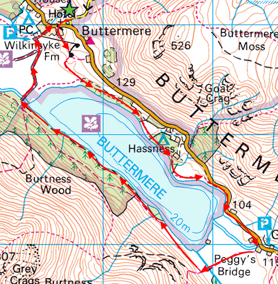

Its blowing like billy-o and raining as we set off from Syke Farm for a clockwise circuit of Buttermere. The weather is no better but desperation has set in and we need to get out for a couple of hours, rain or no rain, or we’ll go ‘stir crazy’.

A look back towards Dodd and Red Pike from the lakeshore path and raindrops on the camera lens.

A little caution was required along some sections of the path, everything underfoot was wet and slippery and we didn’t relish the thought of an impromptu slither down into Buttermere.

Haystacks and High Crag across Buttermere.

A dusting of snow on High Crag but hardly any on Haystacks.

A view of Mellbreak at the far end of Buttermere.

A closer view of High Crag.
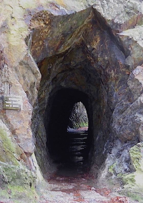
Approaching the entrance to the tunnel.

Haystacks, looking a bit dour under some very gloomy skies.

A look back at the tunnel exit, or the entrance if you’re going anti-clockwise.

Fleetwith Pike and Haystacks at this end of Buttermere.

I intended to take a shot of the Buttermere Pines further back along the path but forgot, so I’ll have to make do with this for the time being.

Fleetwith Pike above the car park at Gatesgarth. 9 cars @ £4 each = £36 so far, and there’s still plenty of time for more visitors this afternoon. I wish I had a bit of spare land somewhere in the Lake District.

Haystacks as we cross the field from Gatesgarth Farm.

I know it doesn’t look it but the wind was ferocious along here. Being small and lighweight I held on to the fence just in case.

Fleetwith Pike, doesn’t look too bad from here …..
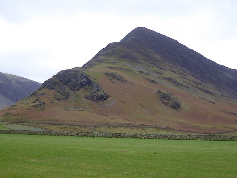
….. a view of the side of it reveals its true nature, its a steep one alright.

Looking towards Warnscale Bottom and seeing plenty of water flowing down Warnscale Beck and Black Beck.

Plenty of water flowing under Peggy’s Bridge too, although the wind was doing its best to blow it back up on to the hills.

“You’re fed up with the rain? How do you think I feel, stuck out in it all day and night? What with the rain and that Belted Galloway behind you with its incessant bellowing, I’m just about at the end of my tether,”

I’m standing in a howling wind, slowly sinking into saturated, muddy ground and looking back at Fleetwith Pike.

Looking across Buttermere to a snowy Grasmoor behind Whiteless Pike.

A longer view down Buttermere.

There was a terrific amount of damage all the way along here, trees recently uprooted and fallen over, so I’m assuming its storm damage rather than regular thinning out.

A look to my right from the lakeshore path …..

….. and a look to my left from the same spot.

Rannerdale Knotts over to the left and Buttermere village nestling amongst the trees.

Almost at the end of Buttermere and looking towards High Snockrigg and Robinson. Lots of storm debris lying around everywhere.

Sourmilk Gill in spate and making a terrific noise about it too.

Approaching the footbridge on the path back into Buttermere village.

Looking over at High Stile and Sourmilk Gill. The sound of the water rushing down the gill could be heard at the parking area just above the church in the village.

From left to right – High Crag, High Stile and a bit of Dodd. Its a long time since we went up there, perhaps we’ll get round to it this summer.

The Fish Inn in Buttermere, there weren’t many people around the village today.

Syke Farm and the path through it which we used when we started our walk.

The ornamental gate at St. James’s Church in Buttermere …..

….. and to end with, a quick peek inside the church.