
Angletarn Pikes and Brock Crags
Walk date – 6th January 2024
Distance – 7.25 miles
Weather – a high pressure day with bright sun and no wind, mild but very chilly in shade
We had intended doing this walk yesterday but the weather didn’t live up to its billing so we put it off until today in the hope that the high pressure forecast bringing with it clear skies, sunshine and little or no wind would actually materialise today. To begin with, here in the Eden Valley, things were a little disappointing as we looked out of the window this morning. There was fog everywhere and it was showing no signs of lifting by the time we were ready to start out for Patterdale. By the time we were on the A6 visibility had improved a little but we decided that the A66 might be a better and quicker route rather than taking the potentially foggy lakeshore road along Ullswater. We turned off the A66 heading down the A5091 Matterdale road and emerged, into bright sunshine and no fog, onto the lakeshore road just below the Aira Force car park. From there it was straight on to Patterdale and the cricket ground parking area where we parked up in an almost empty car park and duly put our £1 coins into the honesty box. As we were gathering our gear together and getting the gps fired up the clock of St Patrick’s Church chimed letting us know that it was now nine of the clock and a few minutes later were kitted up and ready to make our way over to Side Farm and begin today’s walk.
Route
Patterdale cricket ground – Side Farm – Rooking – Boredale Hause – Angletarn Pikes north and south tops – Brock Crags – Cat Crag – Boredale Hause – Rooking – Side Farm – Patterdale cricket ground
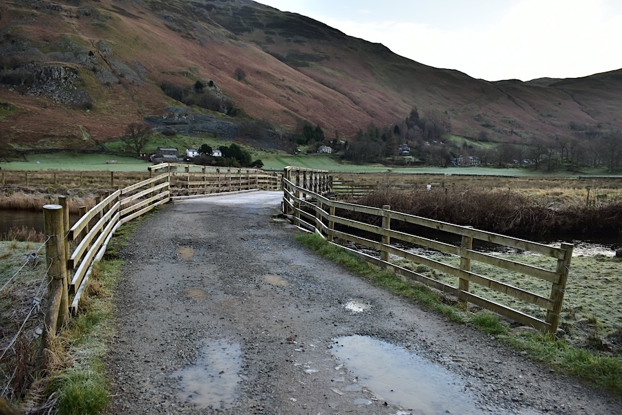
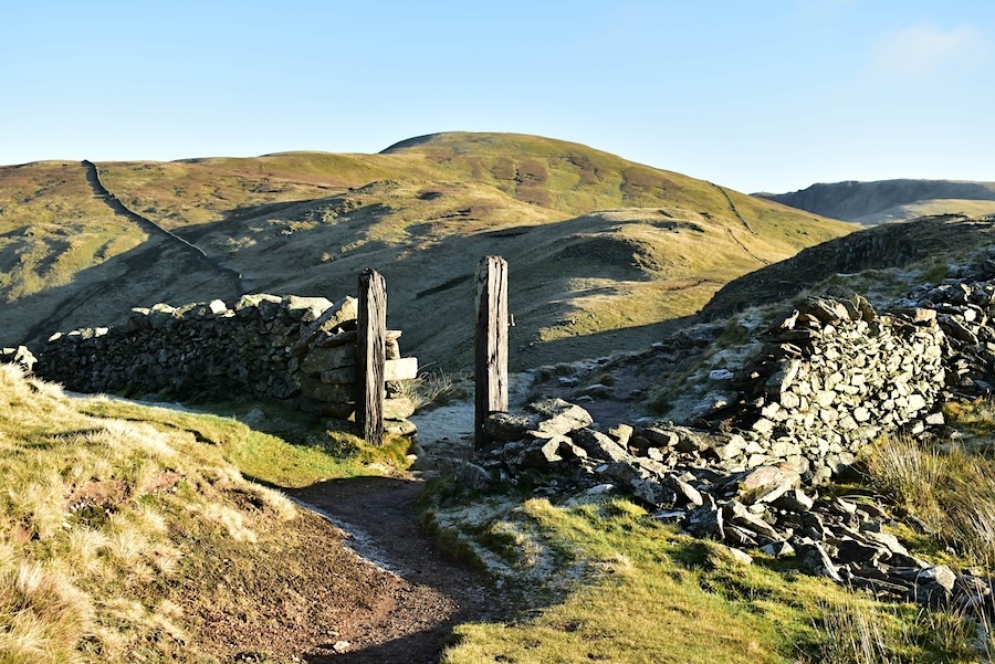
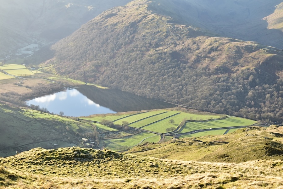
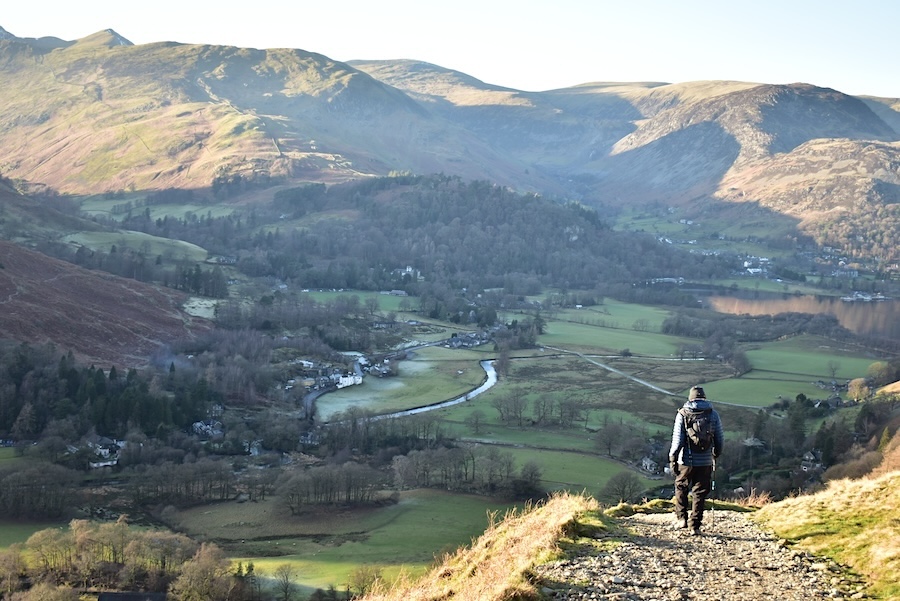
Approaching Side Farm where the access road was full of the usual puddles and crossed over the frost covered bridge above a very full Goldrill Beck. Things are a bit chilly at the moment as the sun hasn’t risen high enough above the fells to the south to provide the valley with a burst of sunshine.
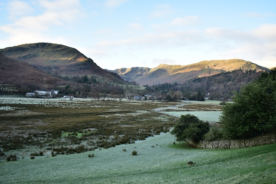
Beyond Side Farm now and following the access road over to Rooking. Looking back across Patterdale we can see a hint of sun on Thornhow End and more than a hint of sun over Birkhouse Moor and the Helvellyn group. The morning chill is still in the air down here in Patterdale and my jacket hood is on to stop the chill attacking my ears. I do have woolly hats but I always end up taking the things off and stuffing them into my pack. J seems to get on with them much better than I do.
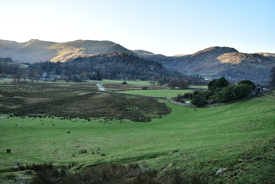
Some of the houses in the hamlet of Rooking can be seen below us as we start the climb up to Boredale Hause. Glenridding Dodd, and Sheffield Pike just behind it, are the sunlit fells in the centre of the shot. We’ll get some sunlight eventually but right now the climbing is keeping us warm and its a bonus not to have the sunlight in our eyes, at least we can see where we’re going.
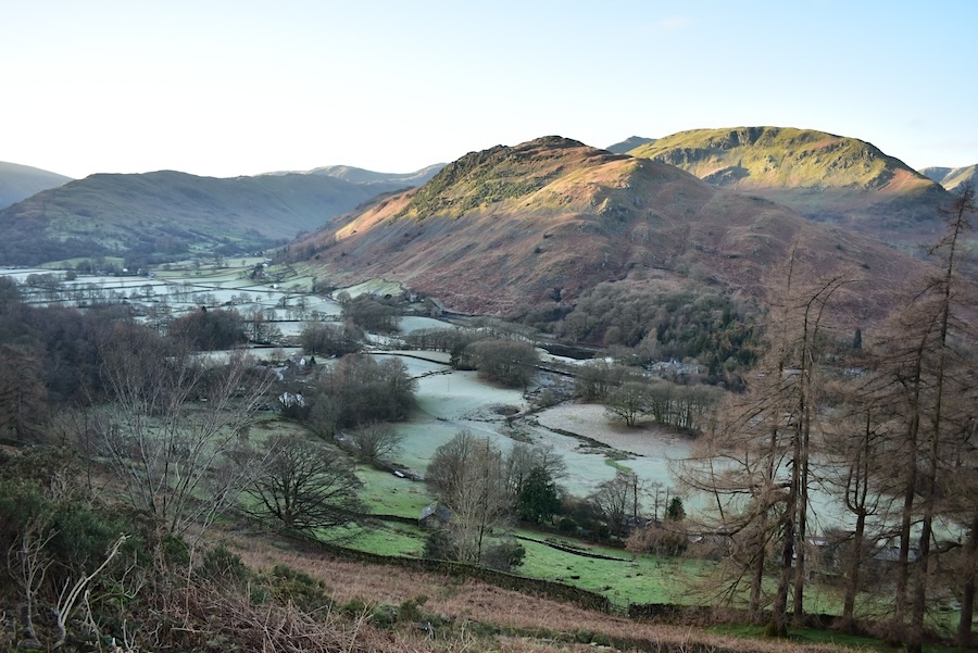
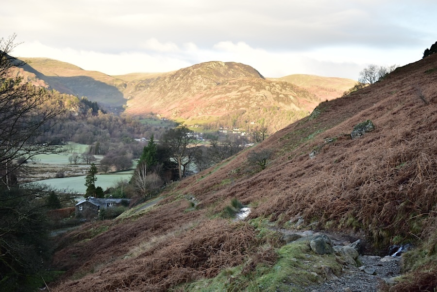
The frosty fields of Patterdale appear below us as we climb higher, the tops of Arnison Crag and Birks are catching the sunlight though.
A look back towards Glenridding where, little by little, the frosty fields turn from white to green and the surrounding fells become bathed in snshine.
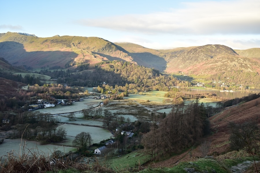
Much higher up the path now from where we can see that Arnison Crag, Birks and the top of Saint Sunday Crag are now in full sun in sharp contrast to the fields of Patterdale below them which remain as frosty as ever.
A close up of the three afore-mentioned fells as we reach Boredale Hause. Its lovely to be able to see sunlit fells again.
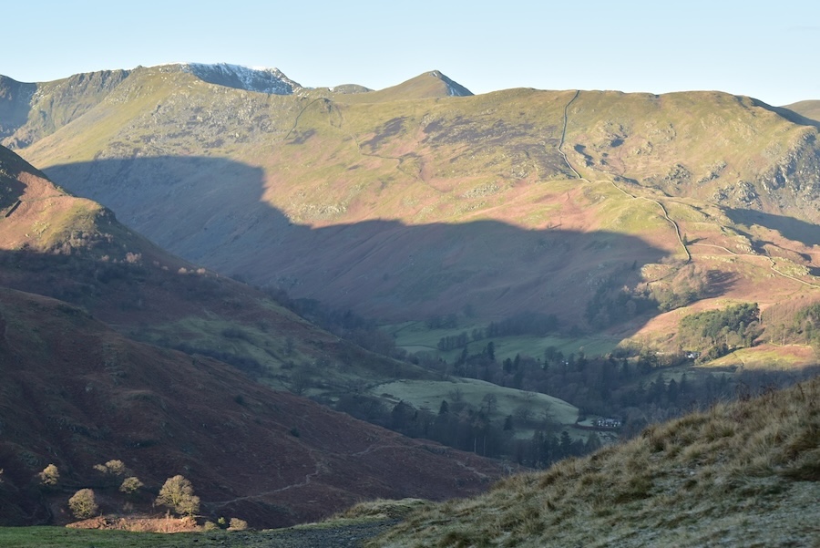
Another shot from the Hause, this time looking across at Birkhouse Moor (R) merging into Striding Edge and a snow sprinkled Helvellyn summit (L) with Catstycam’s pointed peak appearing between the two. Two pairs of walkers came by us as we stopped for photos and a breather on the way up, and they stopped for a chat with us. We met up with both pairs at the Hause as they were having a short break and contemplating Place Fell, their next objective.
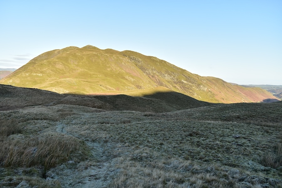
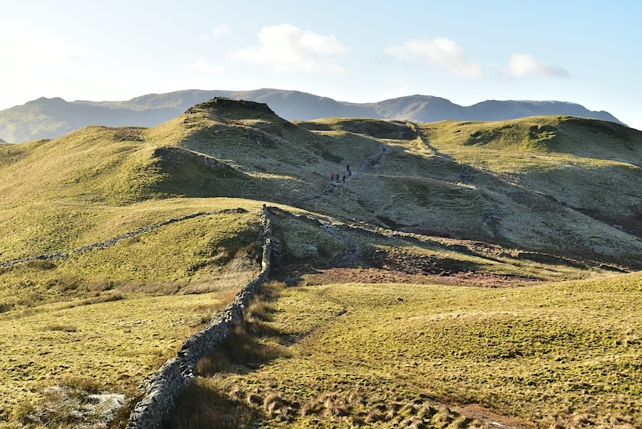
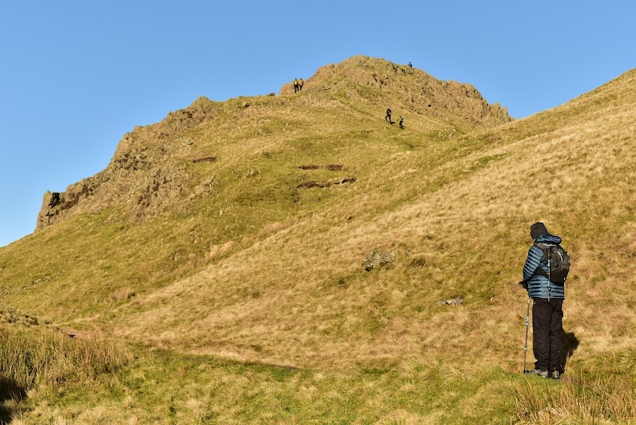
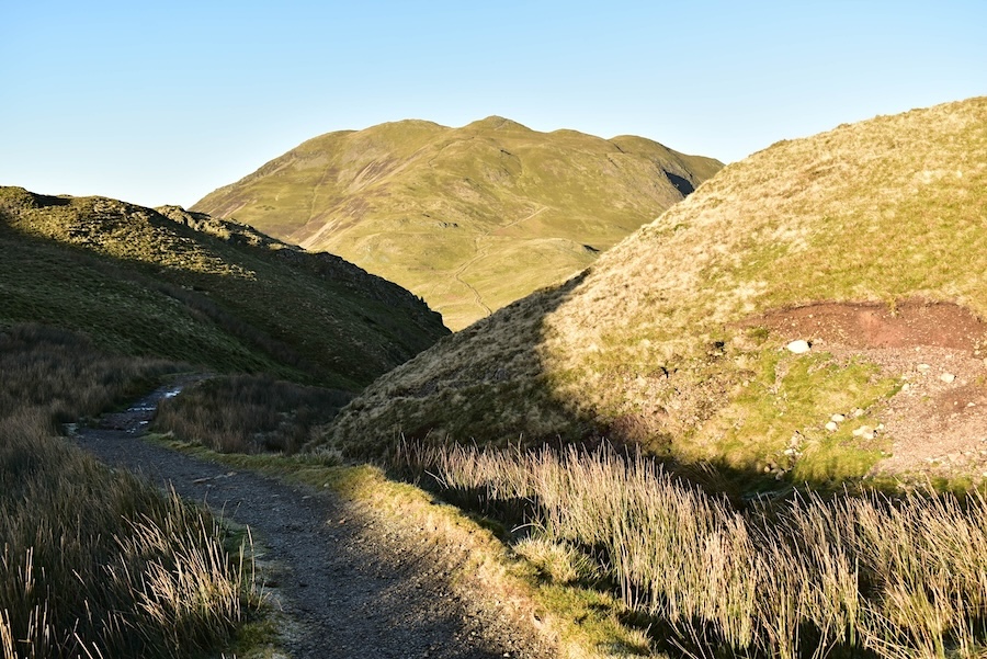
They eventually started out on their upward climb via the popular route over the southern shoulder while we took the Beda Fell path from the Hause. This path eventually brings us to a junction where we branched off to make our way over to the north top of Angletarn Pikes. This is what we call the ‘back route’ up to the Pikes and is always much less busy than the usual route up from Boredale Hause. On the minus side though it can be very boggy in places so ‘you pays yer money and takes yer pick’. One of the pluses today was that the sun still hadn’t risen high enough for it to be shining straight into our eyes and preventing us seeing the boggy bits.
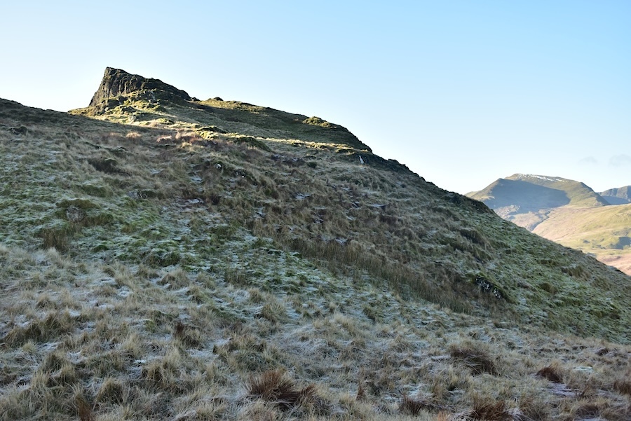
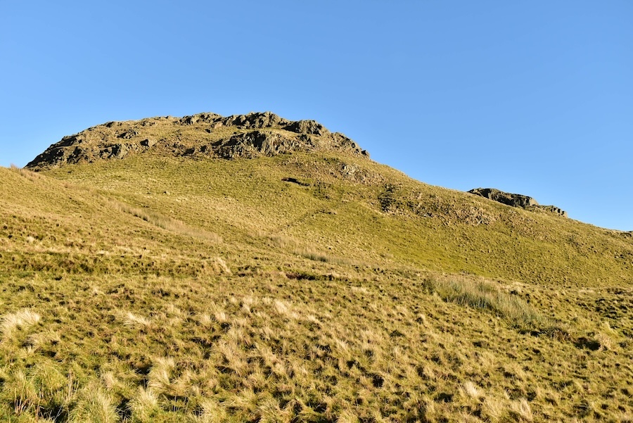
Eventually the craggy peak of the north top of Angletarn Pikes comes into view and there’s just a straightforward climb over the frosty grass left for us to do before we reach the top. Saint Sunday Crag has also sneaked into the shot over on the right.
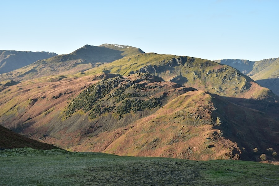
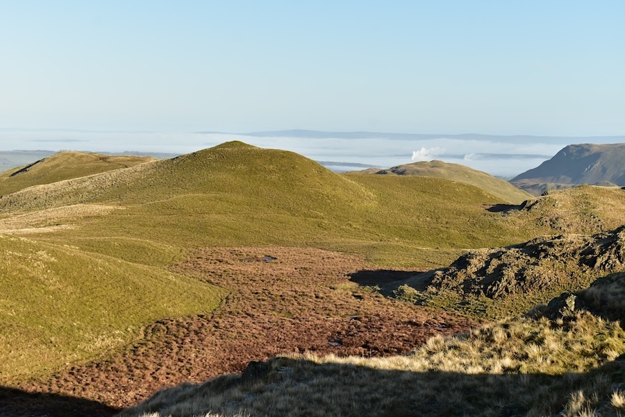
Looking east from the north top towards Beda Fell and the long ridge over to High Raise. Over on the left we can see that the inversion persists along the Eden Valley. While we were up here we were joined by a couple of chaps from Sedbergh who had parked their car at St Peter’s Church, at the hause above the Howtown zig-zags, before dropping down into Martindale and climbing Beda Fell and then making their way over to Angletarn Pikes. From here they were going over to Place Fell, returning via Boredale and Winter Crag and then walking back up to the hause and church where they had parked. That’s a route with a substantial number of ups and downs so perhaps the sight of their car at the end of it would be very welcome. They eventually began the next part of their route and I took a few more shots from the north top …..
….. the sun’s position made taking shots to the south a little awkward but here’s a view of Brothers Water and the fells surrounding it …..
….. the view into Deepdale with Hartsop above How to the left and Saint Sunday Crag over on the right with Fairfield, Hart Crag and Dove Crag, from right to left, on the skyline …..
….. the view along the north top noticing that the inversion over the Eden Valley has not dissipated which is very unusual as it is now mid morning and on such a sunny day most inversions are usually breaking up by now. More of that later though.
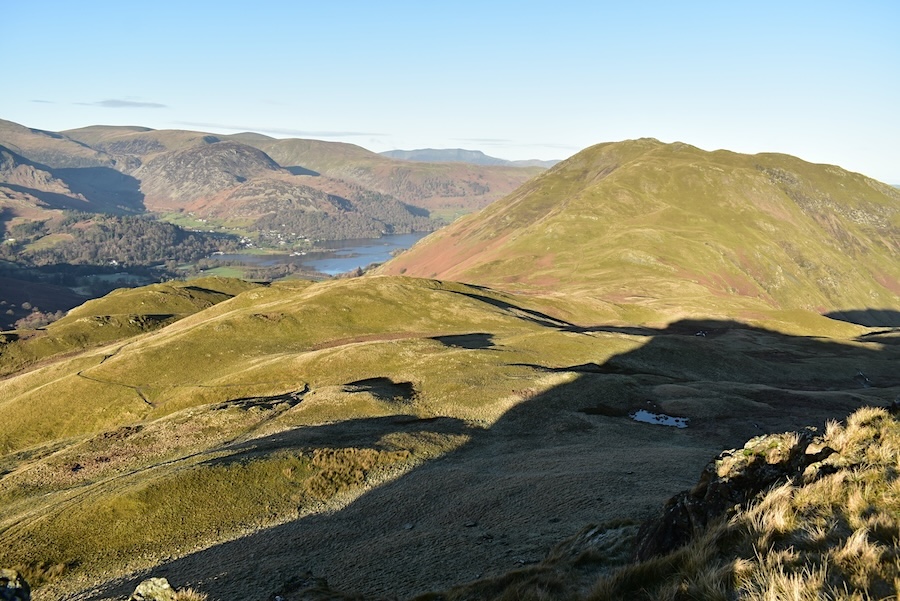
Still on the north top with a look to the west where the fells are too numerous to name …..
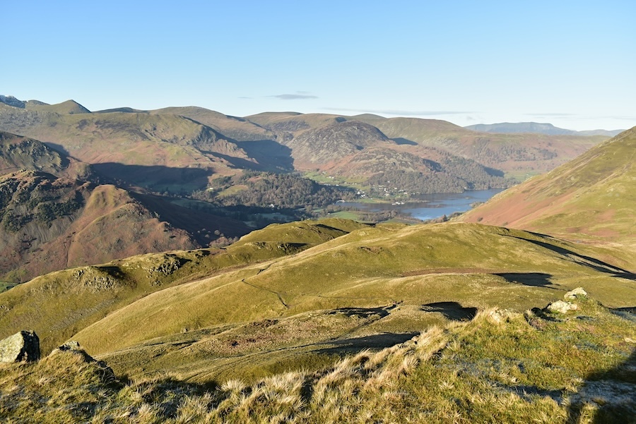
….. a look towards Glenridding and part of Ullswater …..
….. and finally looking across the lower slopes of Angletarn Pikes towards Place Fell. Blencathra is the darker smudge on the centre skyline.
Crossing over from the north top to the south one and passing a frozen tarn on the way.
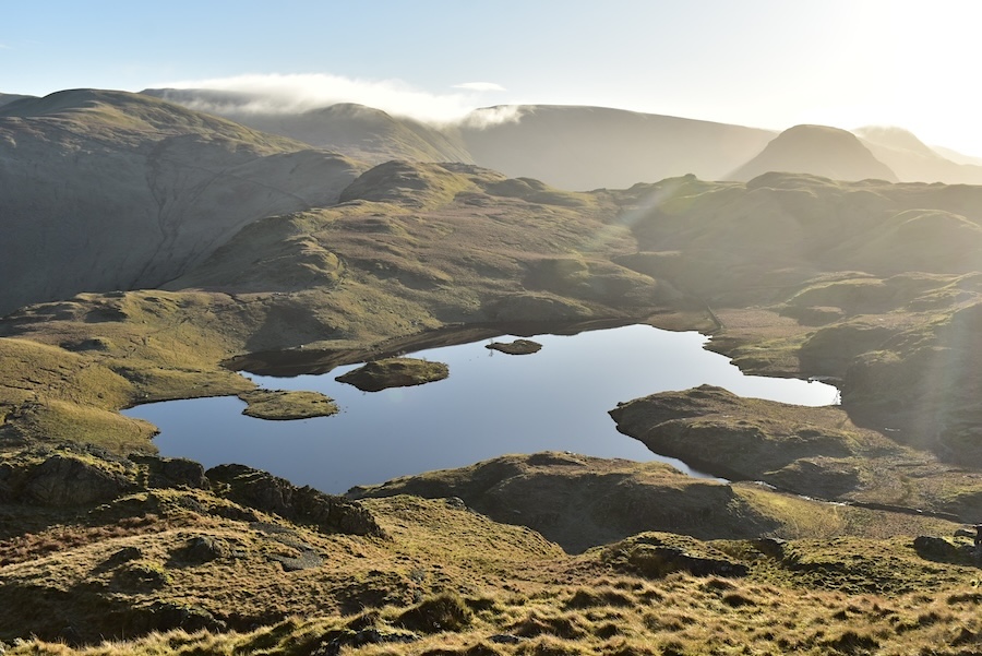
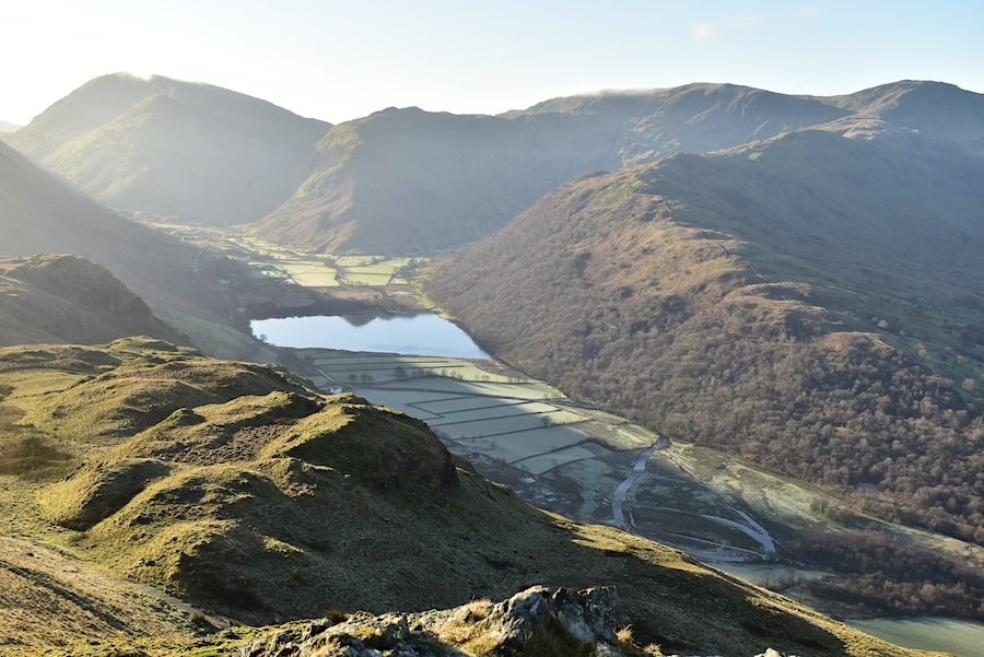
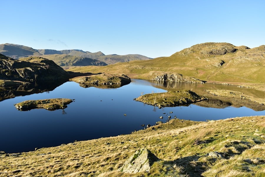
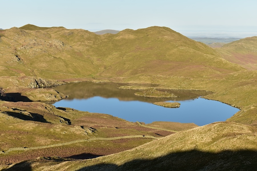
Now on the south top and one of my favourite views, Angle Tarn, whose surface today was as smooth as glass. The sun’s position creating strong shadows and lack of detail once again. Notice the cloud creeping over High Raise, Kidsty Pike and High Street indicating that an inversion over Haweswater was possibly beginning to break up, the views from over there would have been fabulous if an inversion had taken place.
Again looking east where the North Pennines form the distant skyline and the Eden Valley between us and them is still covered by the inversion. The white blob rising just behind one of the small humps in the landscape is the steam rising from a rendering factory near Penrith and gives rise to a local phenomenon known as the ‘Penrith Pong’. The phenomenon has made it into the press so you can look it up if its of interest.
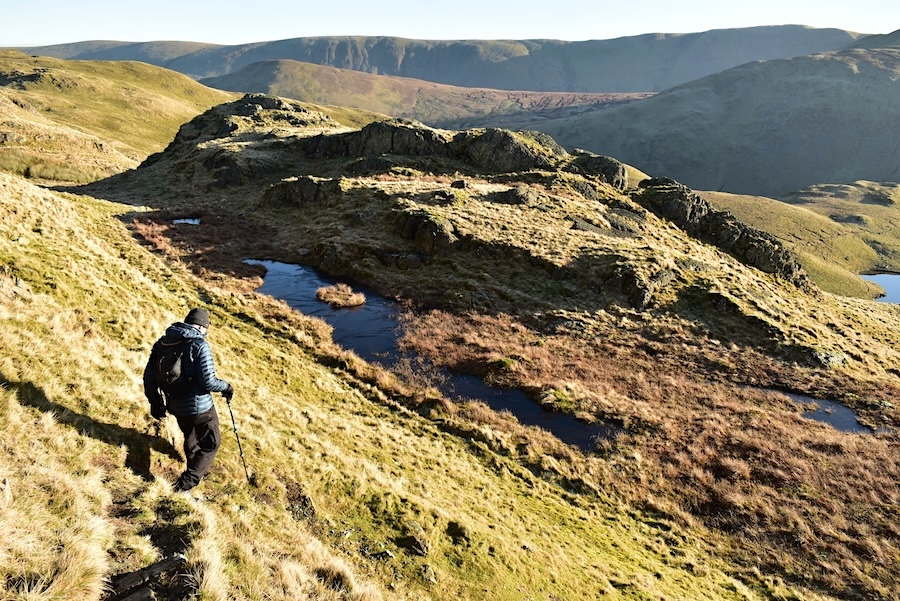
Descending from the south top now and making our way to …..
….. the path around Angle Tarn where we decided to take a break, have something to eat and do nothing but enjoy the views and the good weather. We didn’t take a walk up here in 2023 so its nice to have such a lovely day to enjoy it once again.
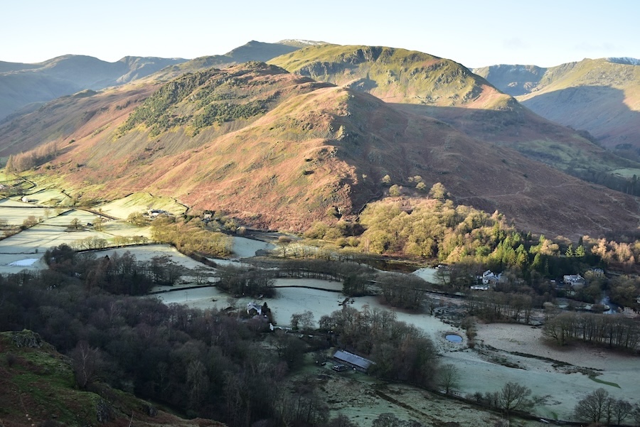
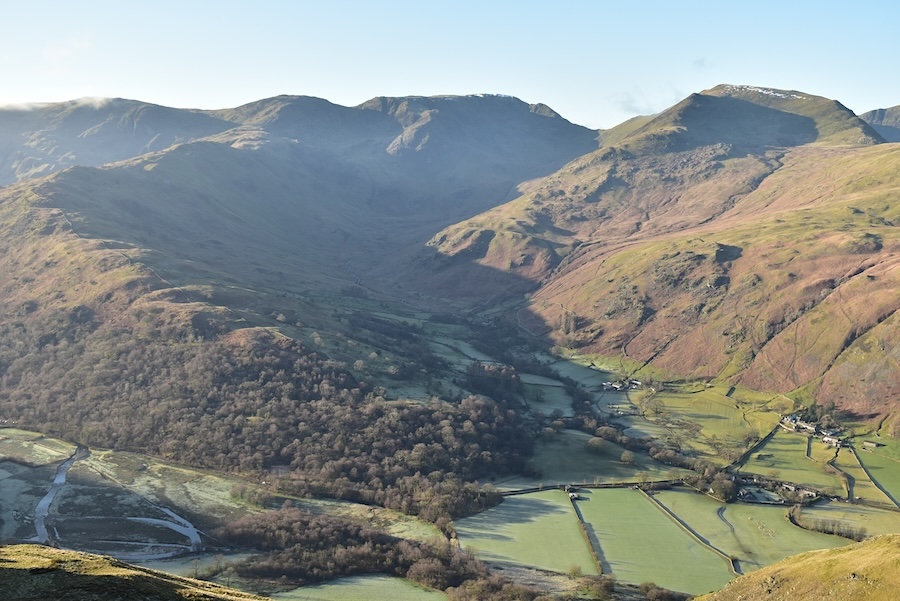
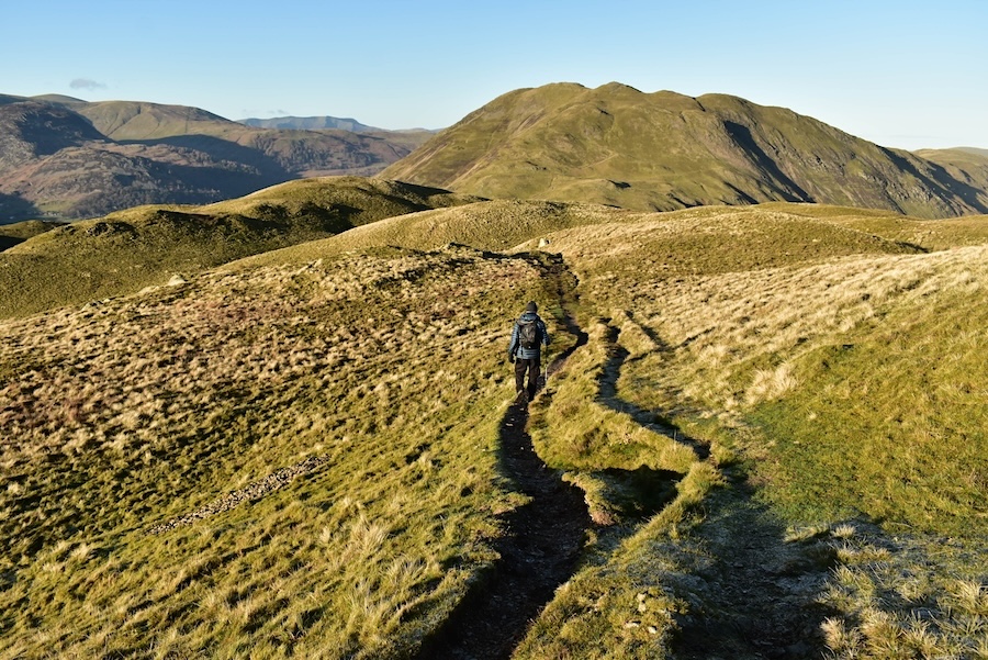
After our break we carried on over towards Brock Crags and on the way across we climbed a short distance from the path up to Buck Crag for a peep down into Bannerdale, a sunny Beda Fell on the left and a partly shaded The Nab on the right.
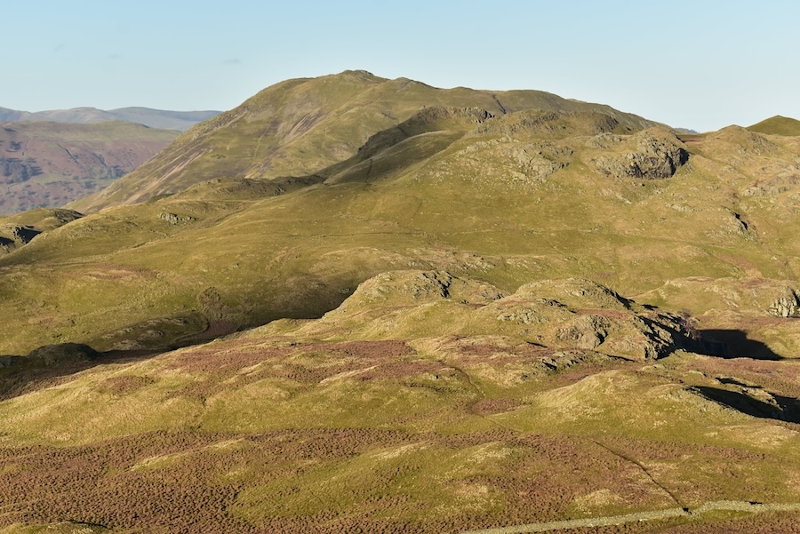
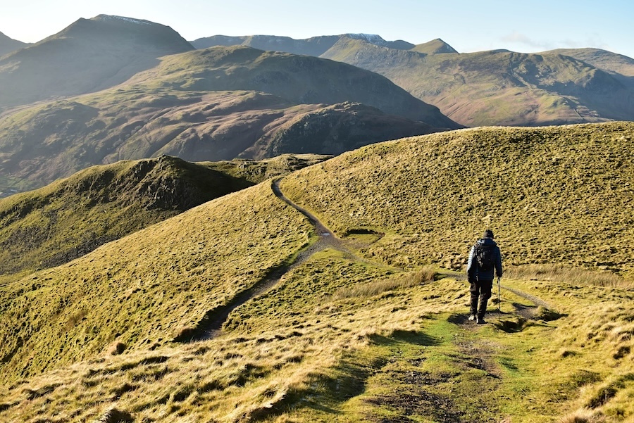
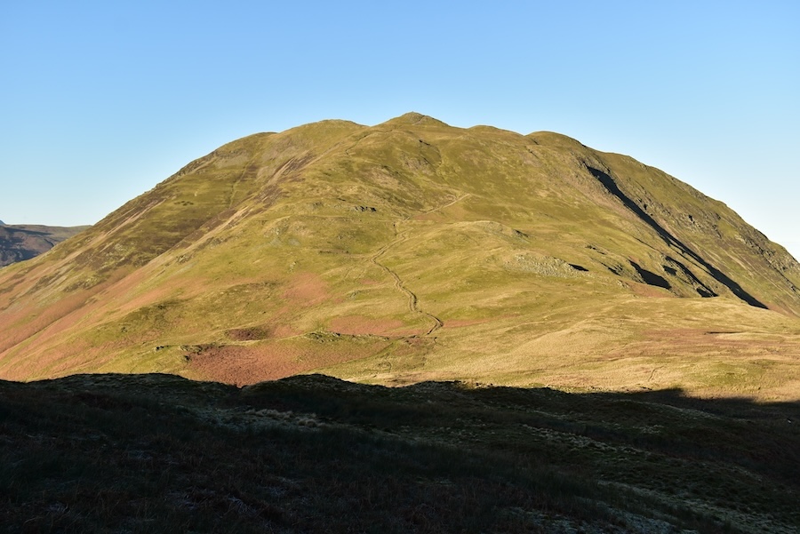
Rest Dodd standing our clearly in the bright sunshine as we reached the old gateposts at the start of Satura Crag. That’s not our planned route today though so we turn right at this point and begin to make our way over to Brock Crags and …..
….. here’s the view ahead of us as we begin to cross over. The group of three walkers we could hear talking and laughing from here, the two walkers behind weren’t part of the group. When the group of three reached this point we looked back and saw that they passed through the Satura Crag gateposts so we thought they must have been heading for High Street or one of the fells along the way. At our next look back we were surprised to see them once again now retracing their steps back from the gateposts and were now going towards Angle Tarn on the path we had left a few minutes earlier. Wonder if they took a wrong turn or just didn’t like the look of what was ahead of them, must have been one or t’other I suppose.
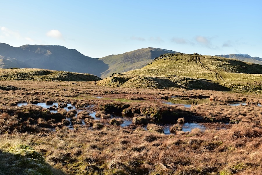
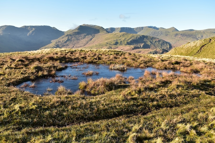
Meanwhile we were still tramping around the boggy bits of Brock Crags whose various pools and small tarns had about an inch, or 2.5 cm if you prefer, of ice covering their surfaces.
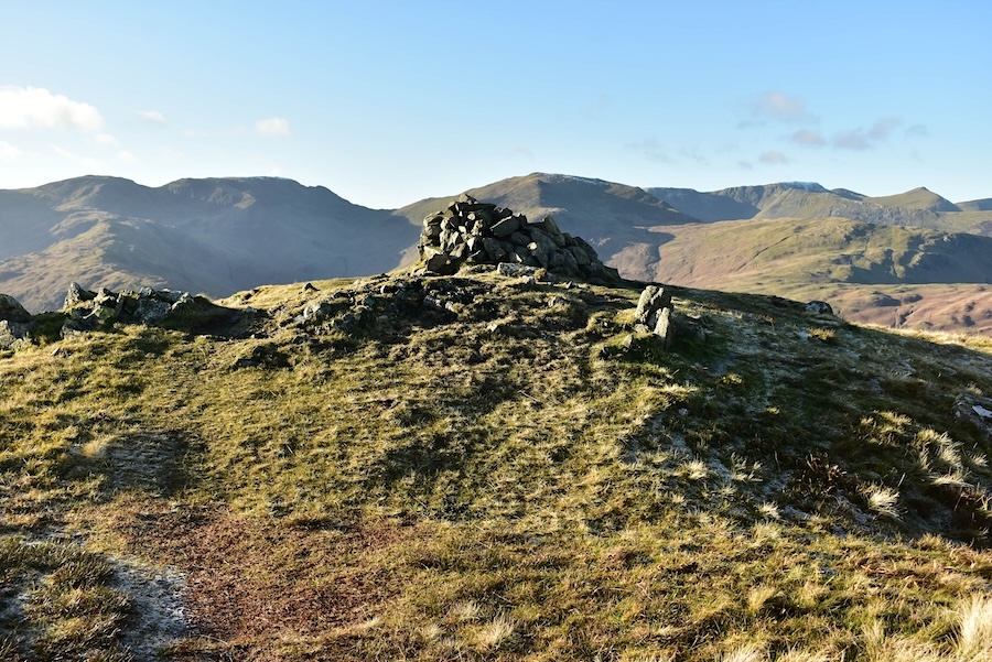
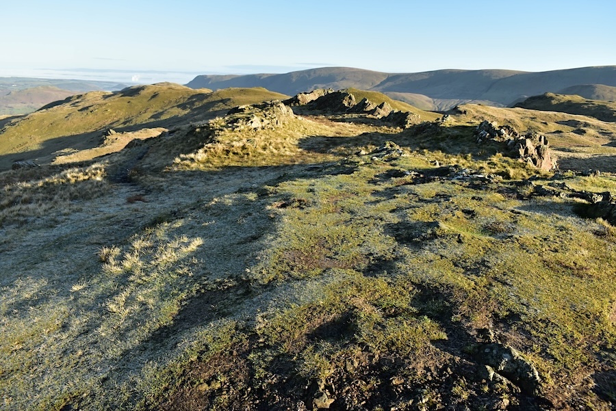
The summit cairn on Brock Crags …..
….. and the view down to Brothers Water from it and also …..
….. a view of Angle Tarn and its surroundings.
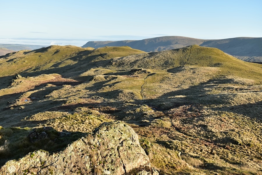
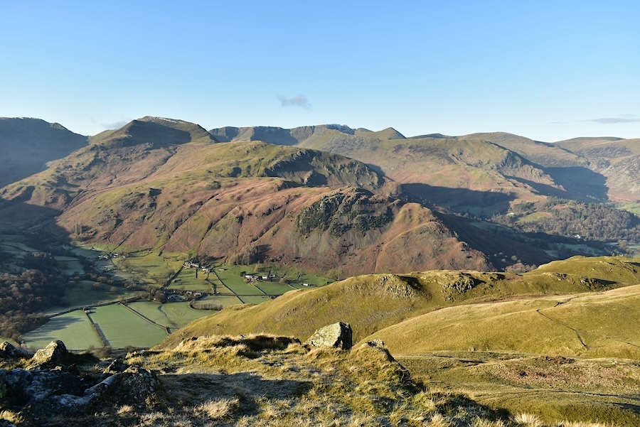
It looks like a bit of a jumble but with a zoom in you can identify, in descending order of height, Place Fell, the north and south tops of Angletarn Pikes and immediately below the various humps of Cat Crag, which is where we’re off to next.
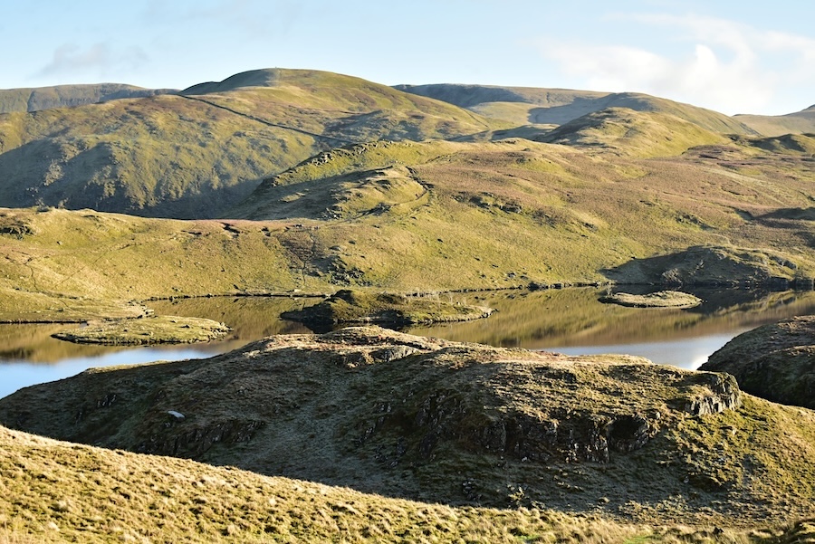
A view of Angle Tarn and its surroundings from Cat Crag. Not as many people out walking as we expected on such a sunny Saturday but there were a few dotted around here and there.
From Cat Crag we made our way across the boggy bits and took the path passing below the two tops back to Boredale Hause. This is a shot looking up at the south top …..
….. and a view of the north top as we passed below them. The north top was fairly busy at the time we passed below it. One or two were brave enough to be down to their t-shirts but we didn’t see anyone wearing shorts, its not that warm just yet!
On the path leading back to Boredale Hause now with …..
….. magnificent scenery all around us.
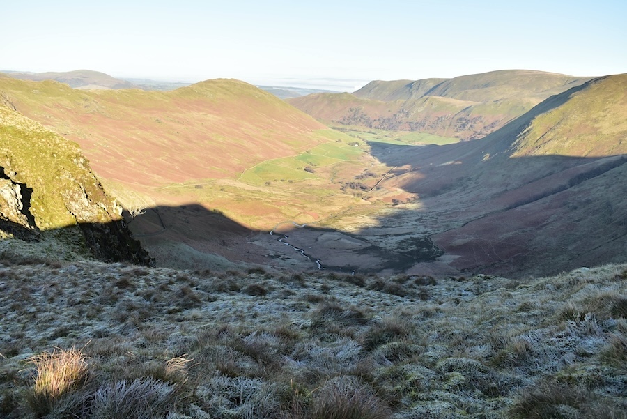
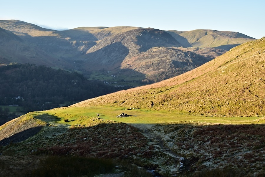
We’re about to enter the chiller cabinet for the next few minutes as we make our way down alongside the beck.
Further down now and still in the chiller cabinet but with a super view of Place Fell.
A zoom in on sunny Boredale Hause …..
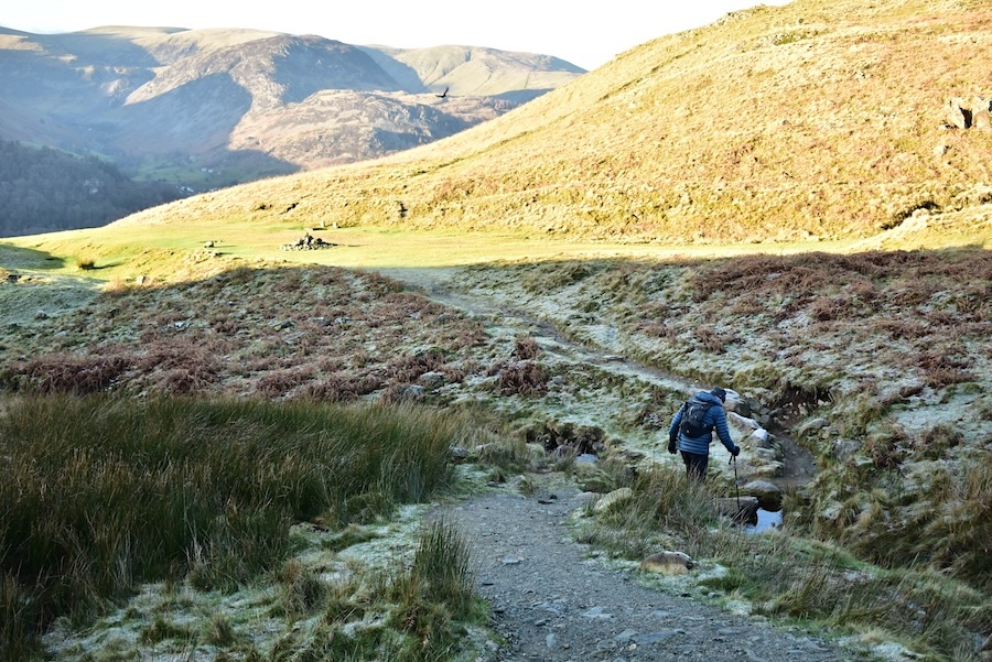
…… which can’t come soon enough as its been a bit nippy through this section of the path.
Back in the sunshine now and making our way back down to Rooking. Its only early afternoon but the Patterdale fields and Glenridding are already back in the shade of the higher fells to the south. J looks as though he’s about to step off the edge of the path in this shot.
Back down in Rooking now and making our way along to Side Farm and its access path over to Glenridding and the cricket ground parking area. A local chap was emptying the day’s takings from the honesty box when we got back to the car park and there seemed to be a good amount of rattling as he scooped it out so its good to know that some of the occupants of the full car park had popped some £1 coins in, it all adds to the cricket club’s coffers and helps them pay the bills. On the drive back we decided to take the lakeshore road home and experienced something most unusual as we did so. The Glenridding end of Ullswater was in bright sunshine and you could see clearly across the water but, as we reached Aira Force, the fog re-appeared. Thin patches to begin with but becoming increasingly denser the further along we went. We could not see across to the Howtown landing stage area which is normally very obvious and by the time we reached Pooley Bridge it was even denser. When we were on the A6 heading for the turn off down into the Eden Valley it was obvious that the inversion which we had seen from Angletarn Pikes had persisted all day despite the sunny weather. It is now Sunday afternoon and we are still beneath this extensive blanket of fog. I began thinking about the Ullswater ferry boats so I did a quick check on their website, here’s what it said –
Sunday 7th January, 2024
There is thick fog at the north end of Ullswater this morning. If this doesn’t lift we may have to cancel sailings, therefore please check with us before setting out to travel with us.
Sorry for any inconvenience, and please do not hesitate to contact us on 017684 82229 should you require any additional information.
As I’ve already mentioned an inversion staying put for two days is a most unusual occurrence so we can only hope that it won’t last much longer. If it does then we only have to drive up out of the valley to get back into some sunshine, always assuming that there is any sunshine to be had of course.