
Armboth Fell and High Tove
Walk Date – 22nd May 2016
Distance – 4.2 miles
Weather – dry, warm and sunny
Walks have had to be curtailed over the past two weeks as its planting time and the garden needed bringing up to scratch after the winter. So we took advantage of the good weather to get it done, of course once the gardening was dealt with the weather changed and we were confined to barracks again under grey overcast skies and cold winds. Today however, after an unsettled morning there seemed to the chance of a warm and sunny afternoon so off we went to Thirlmere for a short walk up Armboth Fell and then over to HIgh Tove.
Route


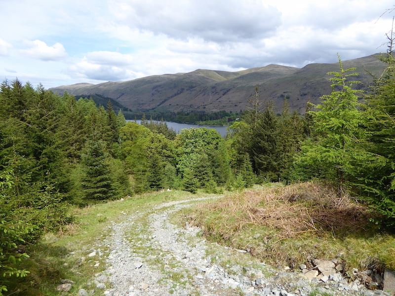
The route starts on the road on the west side of Thirlmere, close to the United Utilities car park at Armboth, and starts off as this very rough track alongside Fisher Gill.

Just a short distance up the rough track this forest trail comes into view across Fisher Gill, which is over to the left on the photo. There was no problem in crossing the gill as there were plenty of stones to step on as is obvious in the previous photo, and once on the forest trail I took this shot looking back down it. Now its time to turn round and start walking uphill again.

Over on our left, almost hidden by the trees, we glimpse the old Armboth Hall summerhouse, and you’ve got to go and take a look around, haven’t you?

Armboth Hall was demolished in the 1880’s when the water level of Thirlmere was raised to create the reservoir, and the old summerhouse is the only building belonging to the Hall which still remains.

I don’t know if the bothy is used very much but the basics seem to be available …..

….. and although it is rather spartan in appearance …..

….. it would no doubt be a welcome refuge in very bad weather.
From the bothy the forest track continues to climb steeply but eventually the gradient eases and levels out for a short distance.
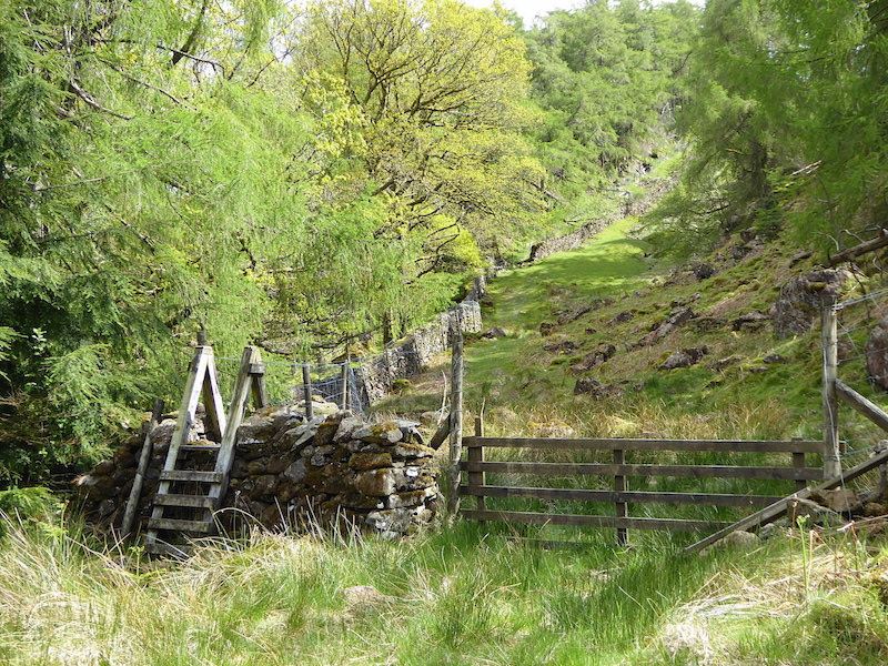
The forest track ends at this stile which we climb over and continue on across the grassy area alongside the wall.

We’re still walking alongside the wall, but the trees have been left behind and now we are out on the open fellside with this view of High Seat over to the right of us.

We leave the path we were on through a gate in the fence on our left and make a short detour up to Fisher Crag. This is the view from the summit looking southwards along Thirlmere with the Helvellyn range on the opposite shore.

Also from the summit is this lovely view northwards along Thirlmere with Blencathra at the far end.

Looking towards Armboth Fell from Fisher Crag. That’s where we are heading next but we can’t go directly across as the large flattish area in the centre is very boggy. So we keep to the higher ground to the right of the tall tree and do battle with the heather and rocks instead.

The bright sunshine highlighting the ridges and valleys on Blencathra.

Looking north along Thirlmere once again, to the right of Blencathra is Clough Head and below that the tree covered slopes of Great How.

Grappling with the heather as we make our way over to Armboth Fell summit, making sure we keep well away from the flatter, and wetter, areas. The Helvellyn range on the skyline behind.

From the same spot and now looking across to the Dodds on the skyline.

The rocky outcrop which forms the summit of Armboth Fell and over on the right skyline is High Tove where we are heading for next. If you look closely you might be able to pick out the path we will take to get across there.

On the centre skyline is Ullscarf with the two rocky tops of High Saddle and Low Saddle running down along its northern shoulder.

Looking across to High Seat from the summit of Armboth Fell.

Blencathra and the Dodds from Armboth Fell.

There were some superb cloud formations over the Dodds …..

….. and the Helvellyn range today.

On the way across to High Tove so I take a look back at the rocky summit of Armboth Fell …..

….. and another look back from further along.

I couldn’t resist taking a shot of these fabulous clouds hovering above the Dodds.

Another view of Ullscarf to our left as we approach High Tove.

Looking back from the crossing to High Tove and on the skyline from left to right are Helvellyn, Nethermost Pike, Dollywaggon Pike, Fairfield, Seat Sandal and Heron Pike. On the extreme right of the photo, just above the heather covered pointed bit, is Steel Fell.

On High Tove summit now and looking north towards High Seat with Blencathra behind it. The area between where I’m standing and High Seat, known as The Pewits, is one of the wettest in the Lake District. Its an extensive morass and walking across it is very unpleasant unless the ground is frozen solid or there has been a prolonged period of dry weather

Even here the ground is still holding the water and we haven’t had any serious rainfall for a while. Going through the gate would lead you down into Watendlath, and on the right of the skyline is Dale Head , just to the left of it is the arching curve of Pillar, and over on the extreme left is Great Gable.

At least this bit is dry so we had a short break to enjoy the views and the sunshine. The fell dominating the skyline is Ullscarf.

Views of High Seat and Blencathra from High Tove summit.

High Seat and Blencathra again, but now including Clough Head over on the right.

A close up view of the fells on the skyline which are, from left to right, Crinkle Crags, Bowfell and Esk Pike.

Another close up, this time of the fells to the east of us. From left to right is Helvellyn, with its summit in the shade, then comes Nethermost Pike, which is enjoying some sunshine, and lastly, the shaded top of Dollywaggon Pike.

Making our way down from High Tove with Fisher Gill burbling away to the right of us.

Below us is the wall which we followed earlier on the way to Fisher Crag, and on the skyline are White Side and Brown Cove Crags.

Thirlmere comes into view again as we descend alongside Fisher Gill.

Huge boulders are strewn all around this section of the path, I’m no geologist so I can’t say if they are glacial erratics or not.

AW deemed this one worthy of a mention in his guide book to the central fells, describing it as a ‘perched boulder’. It is balanced somewhat precariously but its been like this for donkey’s years.

Adding a sense of scale to the perched boulder.

Not far to go now, there’s the road just showing through the trees at the bottom.

We just have to cross the footbridge, turn right onto the road and the car park is just out of shot on the right. A great little walk on a warm and sunny Sunday afternoon and the only people we saw were the two who returned to their car just as we were about to drive back home.