Bleaberry Fell and High Seat
Walk date – 1st December 2019
Distance – about 5 or 6 miles
Weather – cold, dry and sunny, slight northerly breeze on tops
Over the past few nights there have been some hard frosts but last night’s must have been the deepest and most intense so far. This morning everything was covered in a thick layer of frost so deep that it looked as though we’d had a fall of snow, the temperature was a good few degrees below zero and the minute you went outdoors any bits of skin not wrapped in something warm and cosy rapidly turned blue and numb. We had decided yesterday that we would take a walk up Bleaberry Fell and across to High Seat knowing that the normally boggy and unpleasant ridge between the two would, by now, be almost certain to be frozen solid. Before we could get on our way though there was the job of defrosting the car, after managing to get into it since all the doors had managed to freeze themselves tightly shut too. Anyway, after much spraying and scraping we managed to persuade the car to come out of its deep freeze state and let us get on our way. The distance given for today’s walk is approximate since someone, who shall remain anonymous, decided to re-set the gps when we reached High Seat which meant that we didn’t have a full walk mileage recorded. The route map once again is the home made variety and not the usual gps one thanks to a computer update which resulted in the gps program no longer being supported. I’m making no further comment on that little episode!
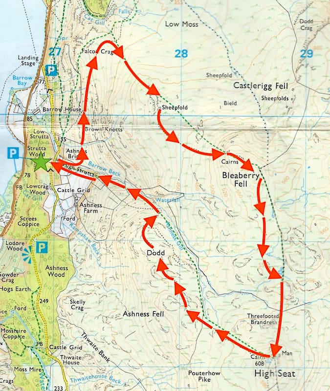
Route
Ashness Bridge car park- High Strutta – Barrow Beck – Brown Knotts – Falcon Crag – Bleaberry Fell – High Seat – Dodd – High Strutta – Ashness Bridge car park
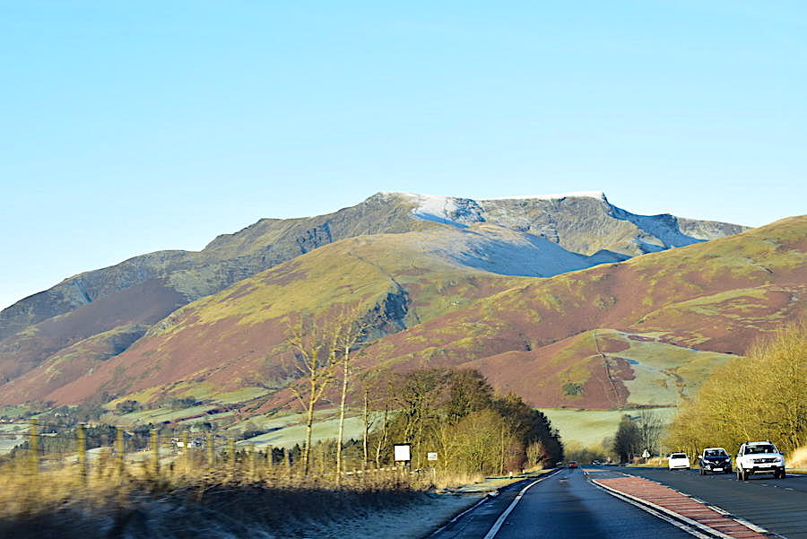
On the way to Keswick and a shot, from the car, of Blencathra which looked lovely in the bright morning sunlight. As I gazed at a very frosty Sharp Edge I thought about how very icy and slippery its rocky ridge would be today and wondered if anyone would be attempting a crossing of it today.
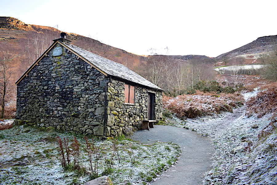
On with the walk proper now and having parked up in the National Trust car park (across the road behind me) we walk over to the Bark House Mountain Hut, a one room bothy situated close to Ashness Bridge. Its a National Trust property staffed by volunteers who open the bothy, from time to time, as a walkers shelter. Apparently a board is put outside to indicate when it is open so walkers can pop in and have a cup of tea, a sit down and a chat, but in all the many times we’ve been here I have never known it to be open. Perhaps they can’t get the staff. Aside from all of that we follow the path going off to the right from the bothy and begin our walk up High Strutta.
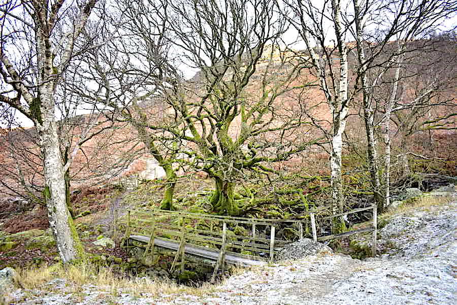
Before long we leave the High Strutta path and veer over to the left to cross this footbridge across Barrow Beck. The ground and the footbridge are thick with frost and are showing no signs of melting despite the sunshine.
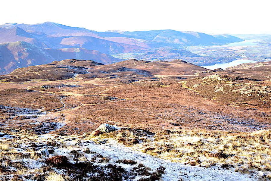
After crossing the footbridge we followed one of the many tracks across the slopes of Brown Knotts. The sun wasn’t yet quite high enough to clear the top of Brown Knotts so we lost the sunshine for a while. However the lovely views along Derwentwater from this route took our minds off the chilliness and the steady climb and lack of any breeze kept us warm enough for the time being.
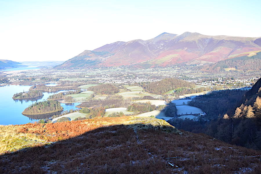
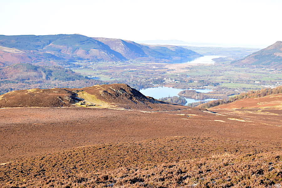
Out in the sunshine again as we gain more height so time for a sunny look back towards the head of Derwentwater with its deeply frosted fields and the backdrop of the Maiden Moor – High Spy ridge.
Across Derwentwater is the northern end of Catbells behind which Causey Pike is taking centre stage, and over on the right is the Grisedale Pike – Hopegill Head. Their summer greenery long gone and replaced by the burnt umber winter tones of the heather and bracken covering their fell sides.
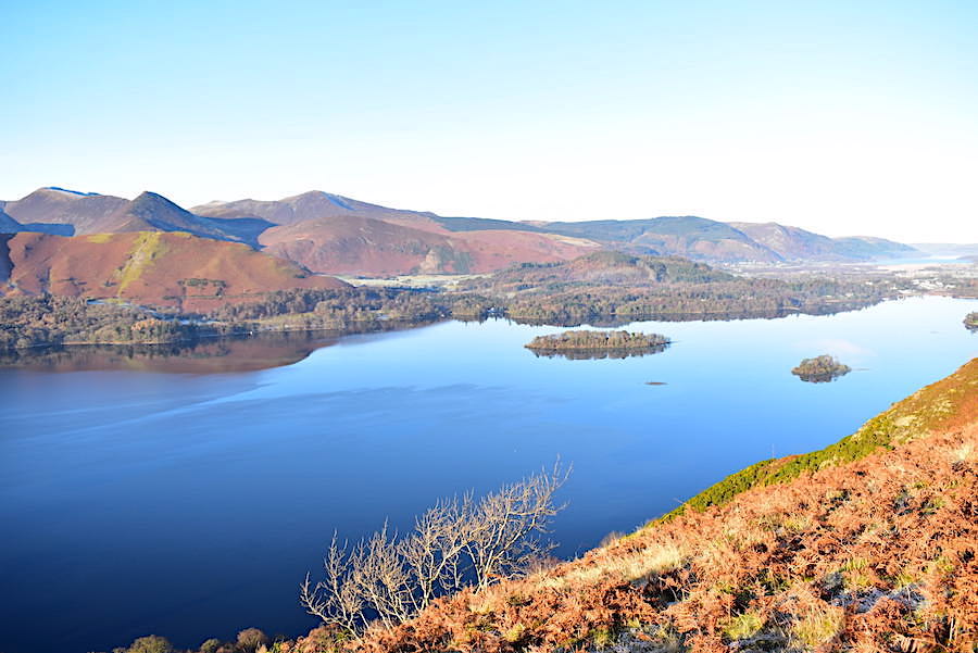
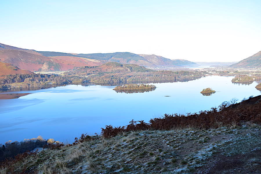
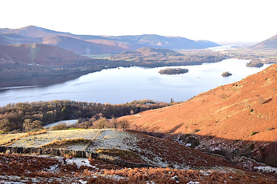
A longer look across a tranquil Derwentwater towards St Herbert’s Island and the Hawes End landing stage …..
….. and from the same spot another look back at Great Bay, at the head of Derwentwater, and below us the frosty fields of Barrow Bay are just beginning to feel the first rays of today’s sunshine. We’re still climbing steadily so we’re pleasantly warm, warm enough now for my gloves to be consigned to my jacket pockets for a while.
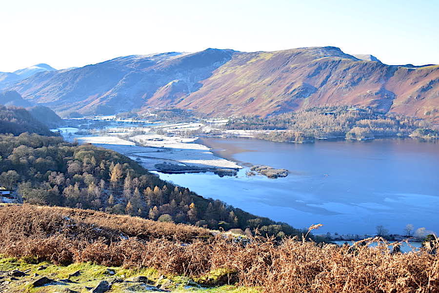
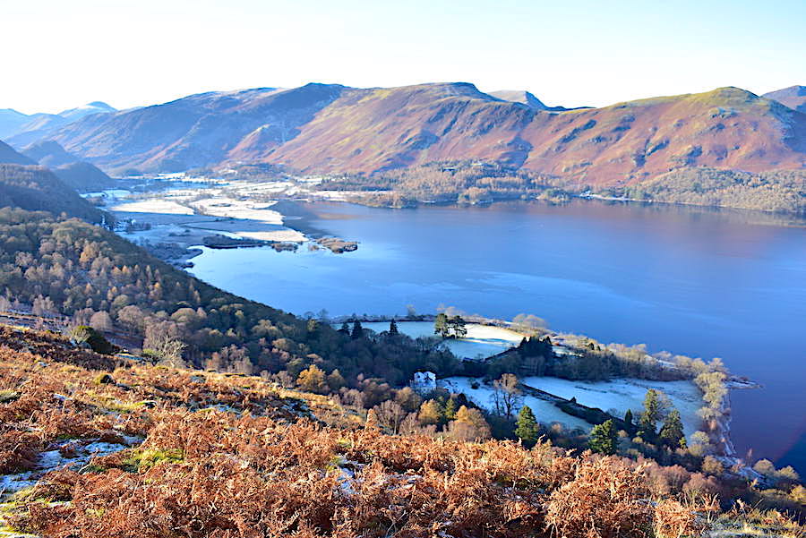
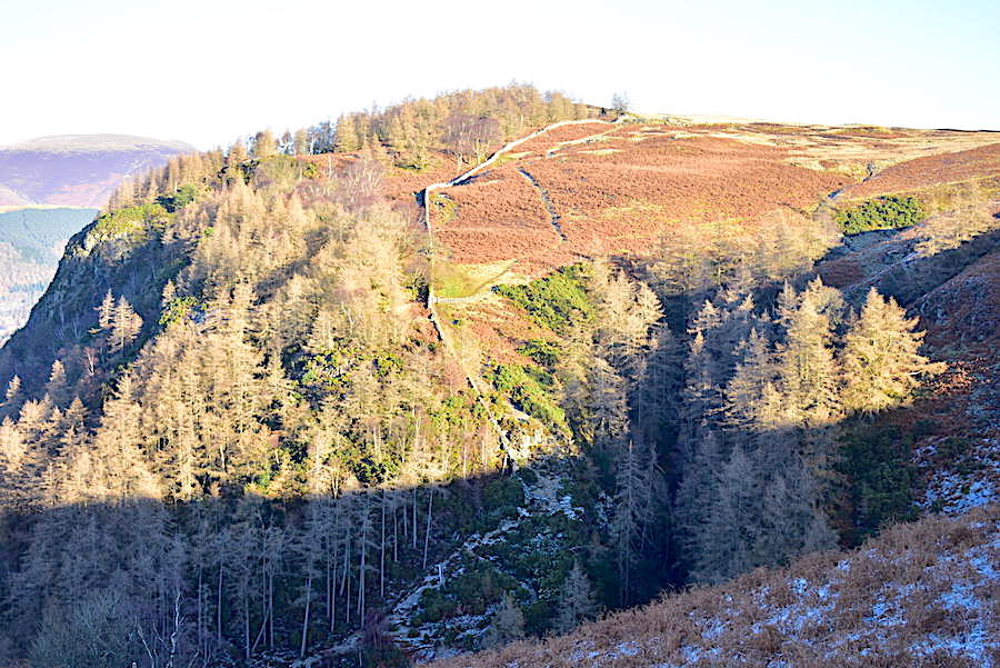
A little higher now and time for a look back across Ashness Woods towards Borrowdale before the sun moves around and blots everything out. King’s How is in the centre of the middle foreground with Castle Crag below it to its right, and we have a skyline view of Glaramara, Great End, the Scafells, Lingmell and Great Gable. Although the longer views were quite clear today there was a slight mistiness around, although perhaps it was nothing more than the coldness of the atmosphere just giving everything a chilly blue tinge. The mountain hut located at the beginning of our walk is now a good distance below us, in the centre towards the bottom edge of the shot.
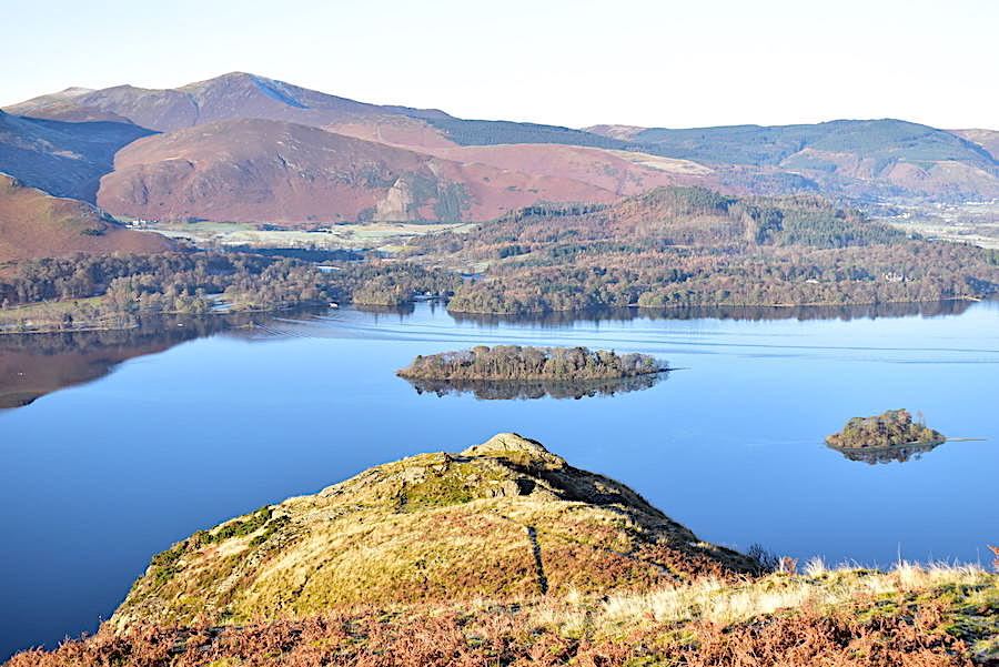
We’re on Falcon Crag now, looking across St Herbert’s Island to where one of the Derwentwater launches left a few ripples behind as it made its way towards the jetty at Hawes End. I expect a few of its passengers will disembark there and take a walk up Catbells, and a very enjoyable little walk they’ll have on a day like today.
Looking north from Falcon Crag we get a view of the steep Cat Gill route up Walla Crag. It looks very frosty and chilly down there in Great Wood and anyone walking through there today would probably have been mighty glad to finally reach the sunlight.
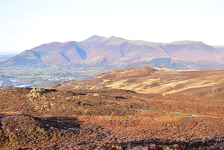
Using the shade to hide my very long shadow I took a look to the north for this view of the Skiddaw group, still looking somewhat hazy despite the bright light.
Back to Falcon Crag for another look back along Derwentwater and then …..
….. we leave Falcon Crag to round Brown Knotts and pick up the path to Bleaberry Fell which is coming across from Walla Crag. We begin to see more walkers from now on, some going to Walla Crag, on the left, and others making their way from there up to Bleaberry Fell. On rounding Brown Knotts we now had the sun directly in our eyes which made looking where we were going just a bit tricky, especially as neither of us had remembered our sunglasses. It did briefly cross my mind as I was getting ready but not long enough for me to remember to go and pick them up! Ah well, sometimes they aren’t a lot of help when the sun is so bright that all you can see in front of you is black anyway.
A grand view of Blencathra from the sheepfold. We made a stop here, de-layered and had a mop down as we were both just becoming way too warm thanks to the steady climb, sun directly in our faces and absolutely no air movement anywhere. Hats, gloves and fleeces get stowed in the pack, jackets put back on but left unzipped and then, feeling comfortable again, we were good to go once more.
A short scramble up the steep slope for a view of the sheepfold before we set off again …..
….. along the very icy path from where I took this look back to Brown Knotts and noticing another pair of walkers coming along behind us. Quite a number of walkers were heading across here today but there’s lots of space so there’s no feeling of being in a queue.
Further along the path now and just before it begins to steepen I took a look back towards Brown Knotts with a glimpse of Bass Lake just behind them.
A zoom in, across acres of heather, to the sheepfold in the little grassy patch on Brown Knotts. The path we’re on is gradually becoming steeper and the walkers ahead of us keep stopping for a breather from time to time.
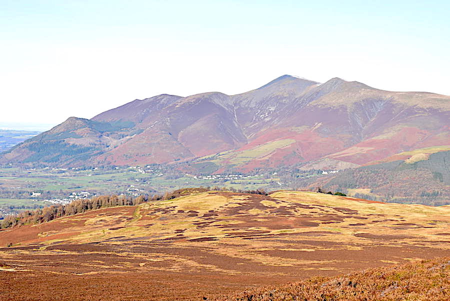
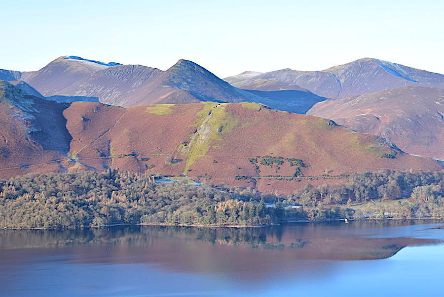
A rather better view of the colourful Skiddaw group as I zoomed in on them across Walla Crag from the same vantage point as the previous shot …..
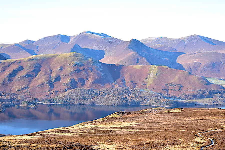
….. and then across the water to Catbells behind which the north western fells are developing deeper shadows as the sun crosses the sky …..
….. finally a slight turn to my left for this view of the hause between Maiden Moor and Catbells with the hamlet of Manesty, at Abbot’s Bay, below them.
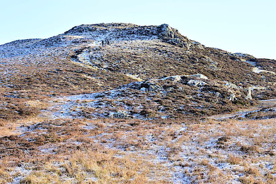
On, or rather, up we go for the final heave up to the shoulder of Bleaberry Fell where every one of the steps up the last steep section of the laid path were thickly encrusted with ice and frost which everyone was taking very carefully. Back along the path we continue to see walkers heading this way.
On the shoulder at last where legs and breathing can get back to normal and where I took this look along the sunny vale of Keswick towards Blencathra and Clough Head. We’re still in shade as there’s still a little more up to go but its not as steep and we have grass and heather to walk over rather than ice encrusted stones.
A close up of Blencathra beyond Low Moss on the lower slopes of Bleaberry Fell and then …..
….. we emerge into the blinding sunlight once again on the top of Bleaberry Fell and this sunny view across to Clough Head, Calfhow Pike and Great Dodd …..
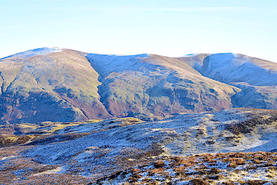
….. and then this one of Great Dodd, Watson’s Dodd and Stybarrow Dodd …..
….. followed by Stybarrow Dodd, Raise and White Side …..
….. and a little further to my right to include Helvellyn Lower Man, Brown Cove and Brown Cove Crags on the extreme right of the skyline.
Below us are the yellow hues of the lower slopes of Bleaberry Fell at the end of which is the subsidiary top of Pike, alongside are the brown and craggy humps and bumps of High Rigg, with the A591 running between the pair of them. Not that you can see the A591 in the shot but I thought I’d just chuck it in as an added extra.
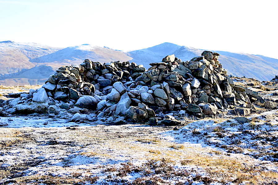
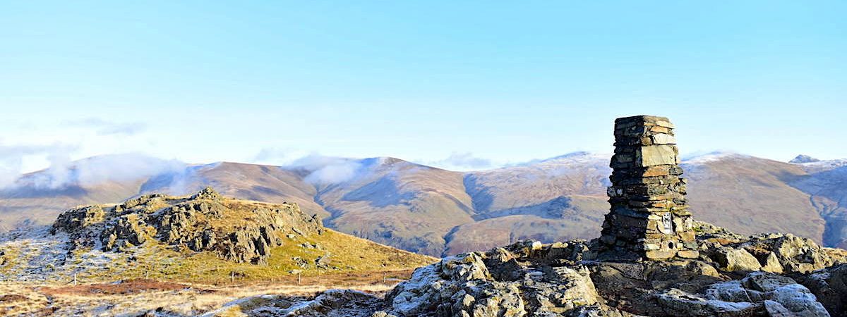
Back to the matter in hand and here we are at the summit shelter on Bleaberry Fell where we are now the recipients of a very nippy little northerly breeze so the hoods go up and the gloves got back on. A couple of walkers were sitting on the sunny south side of the shelter, out of the breeze, and partaking of some light refreshments. The stones of the steeply pitched path we’ve just climbed were as deeply frosted as the stones on this side of the shelter which made hard work of the last bit of the climb. Still it does face north so we knew that frosty conditions would be waiting for us.
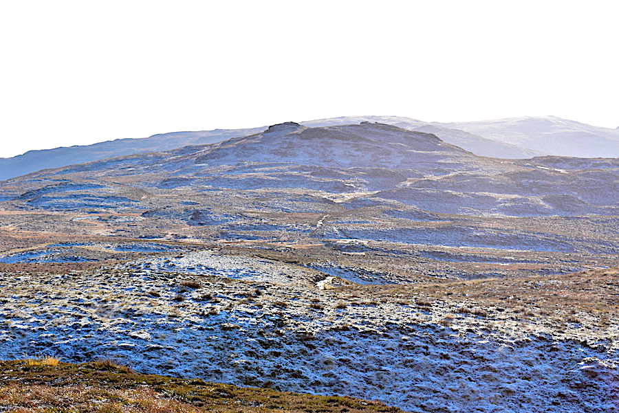
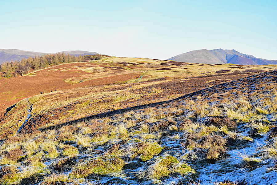
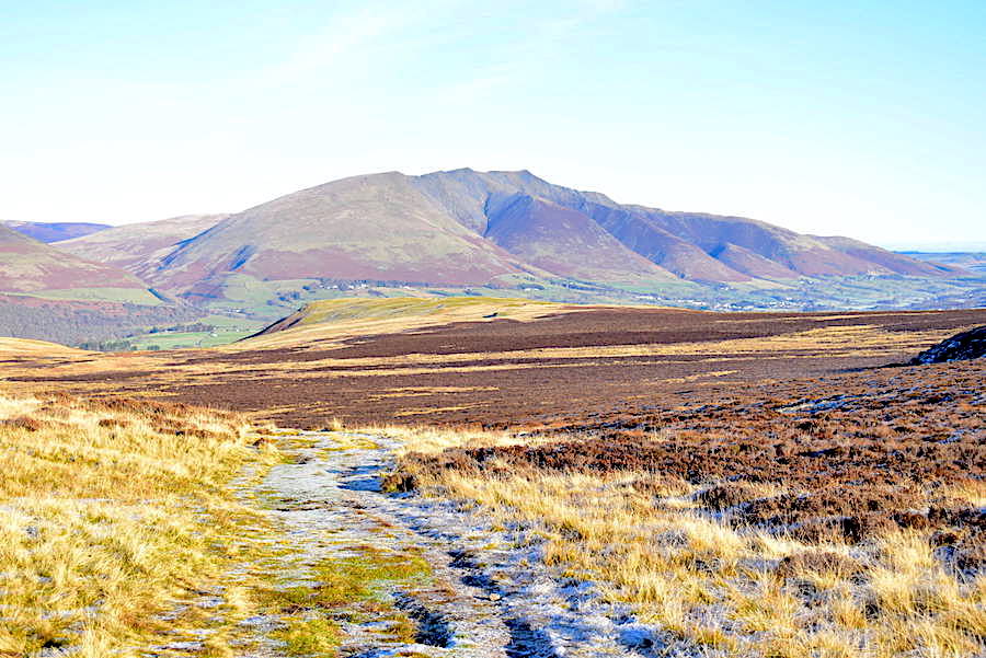
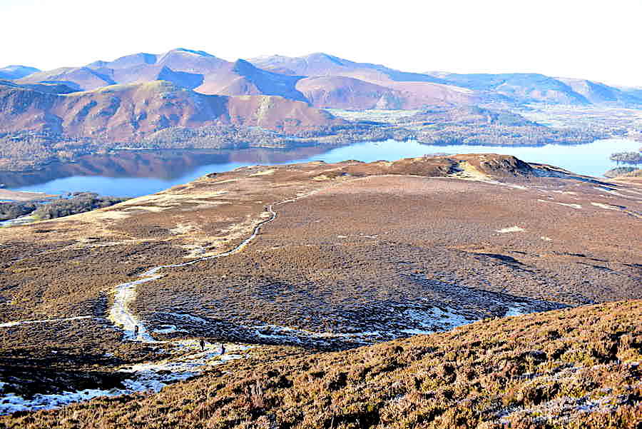
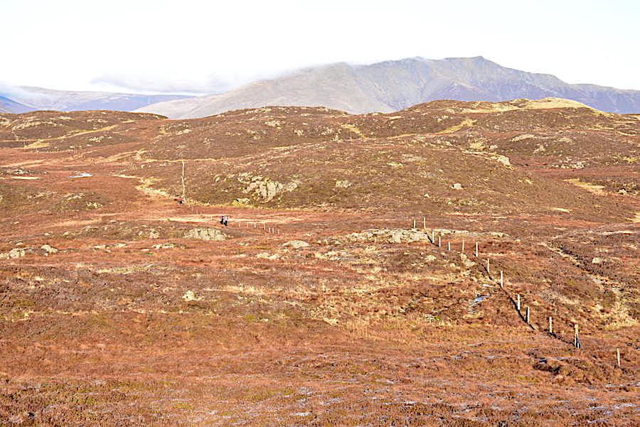
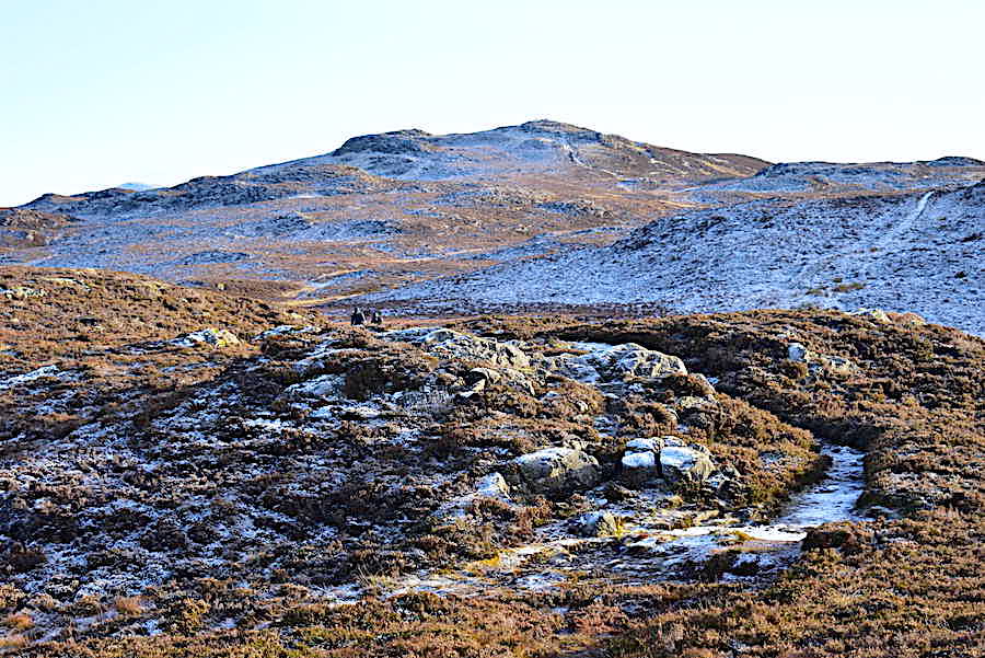
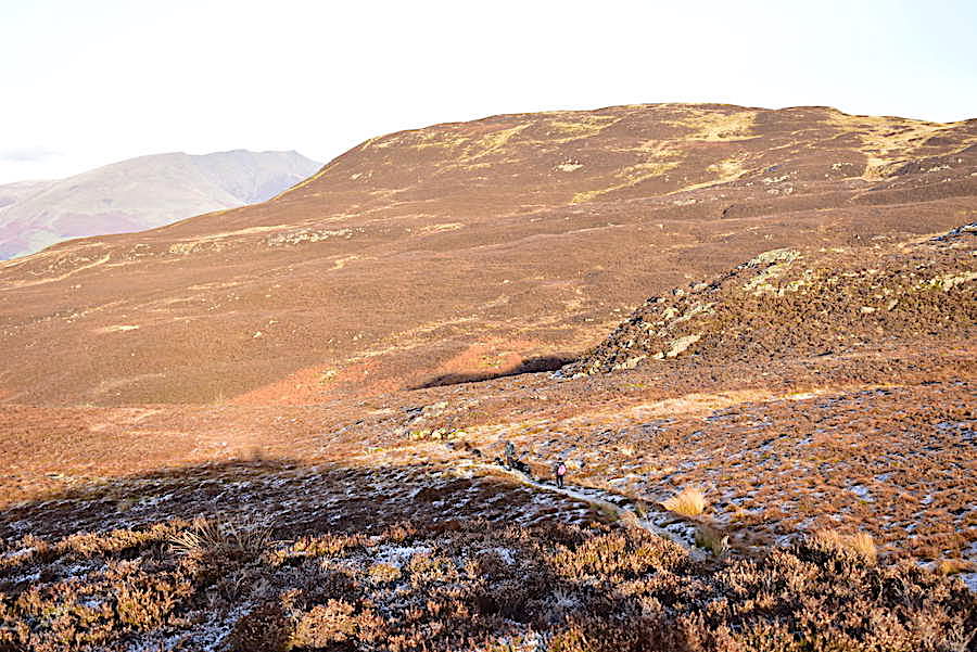
A slew of walkers all managed to arrive at the summit at the same time which made things a little crowded so we found a sheltered spot a few yards away and treated ourselves to a short coffee break while everyone else was taking their photos. A bit of improvised shade held over the camera lens allowed me to take this shot of the ridge walk between Bleaberry Fell and High Seat and which came out much better than I expected. It looks as though it should be a very straightforward and pleasant walk across but most of the time its a pain in the you know what because it is such a very, very wet and boggy place. We hoped the freezing weather had done the trick as we set off and headed for High Seat …..
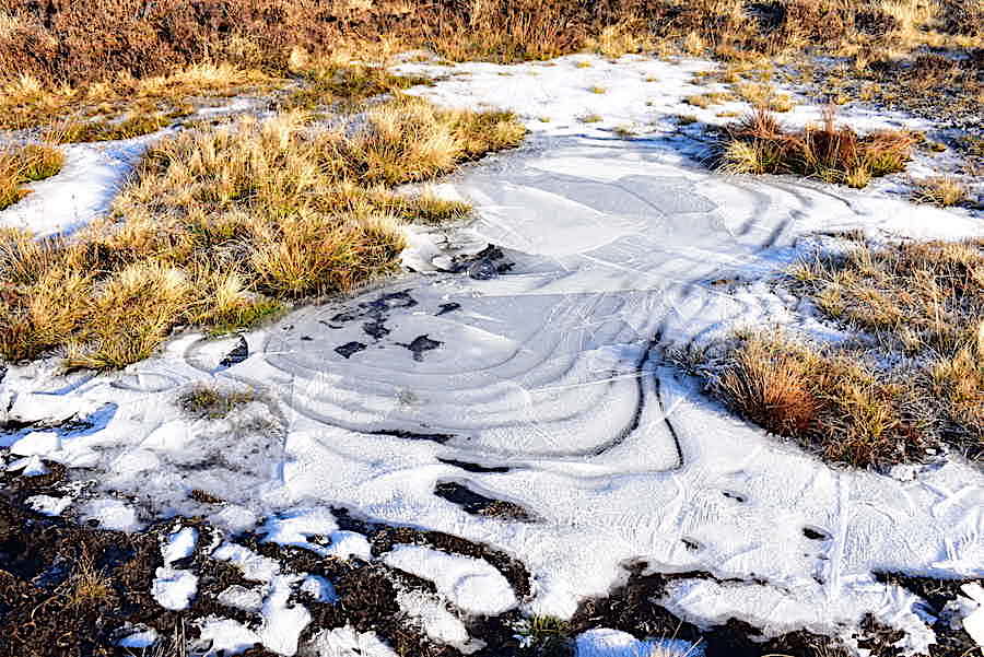
….. and, joy of joys, it had, all the way across and in every direction, as these ice patterns on the frozen puddles show. No wide detours to avoid the bogs and marsh, no stepping lightly or warily on anything which looked remotely like splashing over one’s boot tops, no inconveniences whatsoever. A perfectly straightforward walk across with the ever satisfying sound of ice and crisp vegetation crunching beneath our boots.
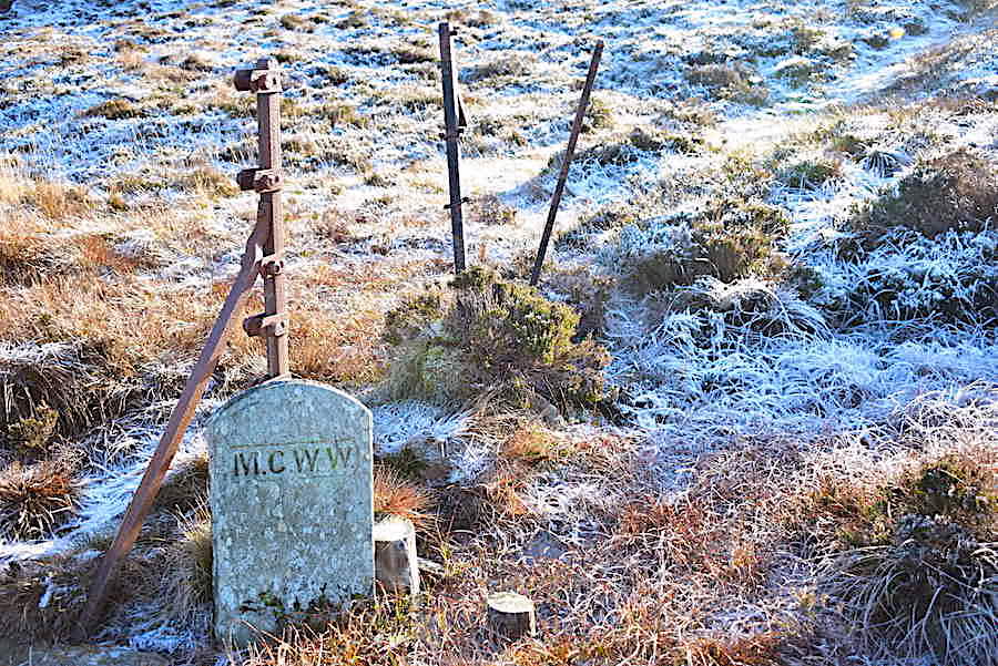
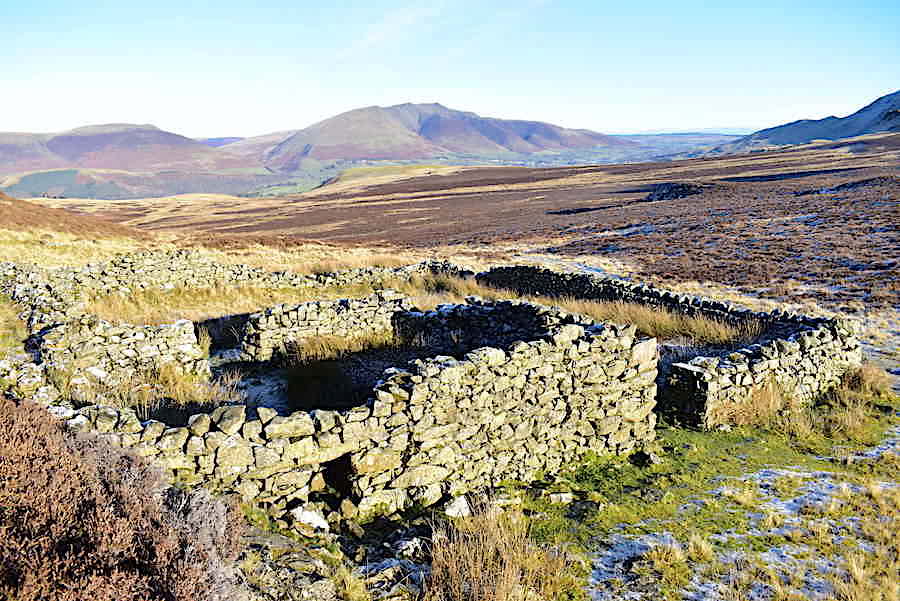
On the route map, just below High Seat summit, you may have noticed the words Threefooted Brandreth. A brandreth turns out to be the word for a three legged stand in an oven on which a griddle would be placed and on which you could then place your cakes and bread in order to bake them. Clearly this is not a Threefooted Brandreth but in the absence of anything which remotely resembled one I can only offer these three fence posts and an old Manchester Corporation Water Works marker stone by way of compensation and which we found along the way in the general area marked on the map. Despite a concentrated attempt I failed to identify anything amongst the humps and bumps of the designated area which looked as if it had three of anything, never mind resembling a brandreth, so I gave up and we moved on.
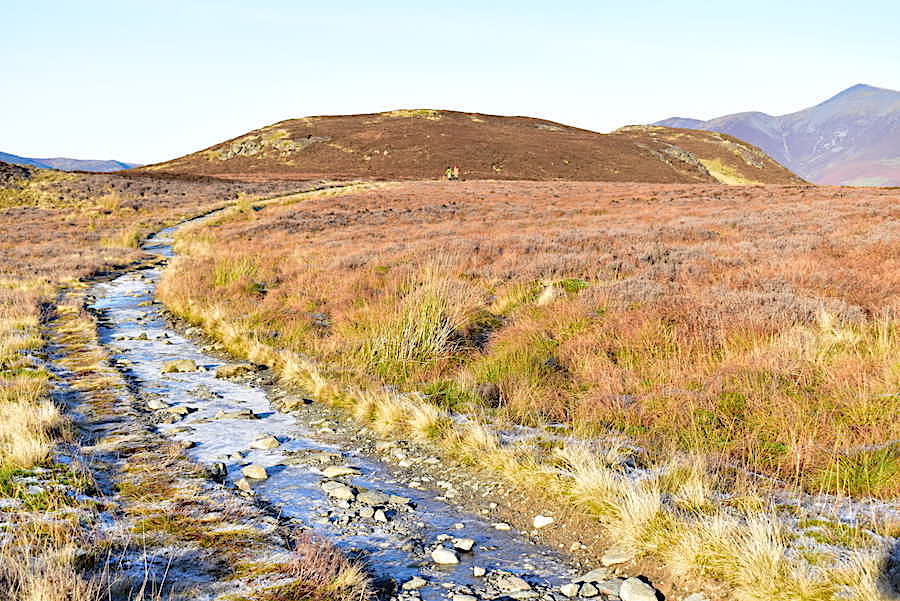
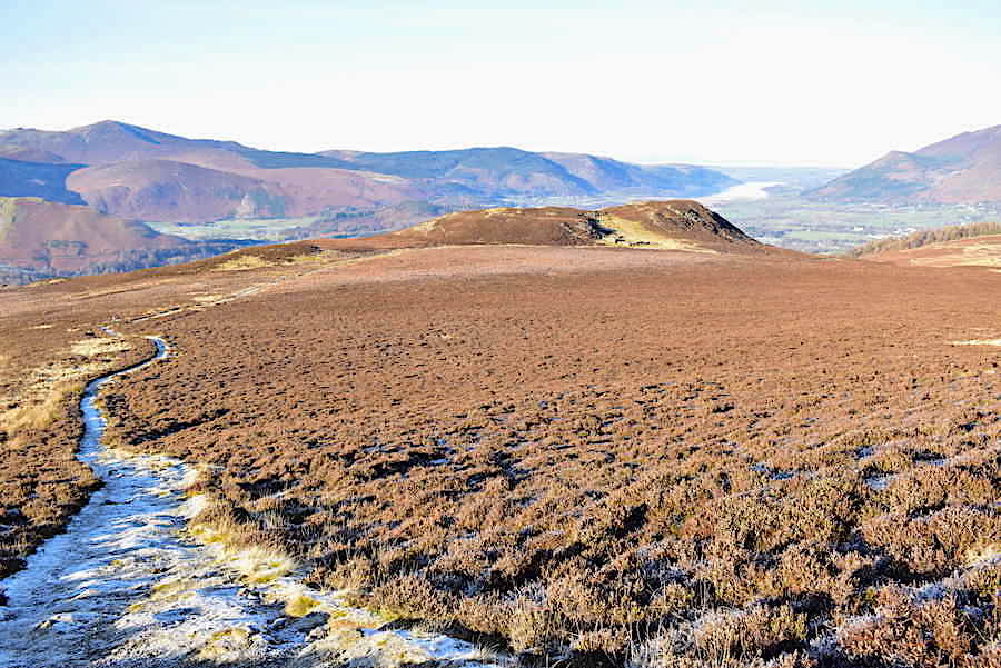
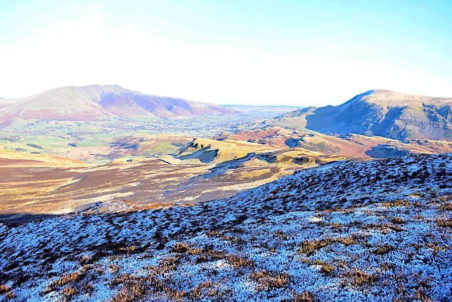
The walk across was uneventful and quite pleasant thanks to the frozen ground with walkers crossing quite regularly between the two high points. We were just about to enter deep shade for the last part of the climb to High Seat so I took a look back and noticed a bank of cloud, which had somehow managed to appear our of a clear blue sky, beginning to stream over Blencathra and …..
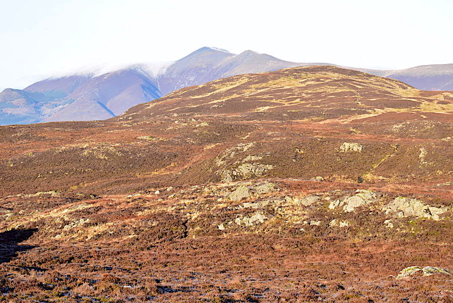
….. similarly over the Skiddaw group where it shows up much better here than in the previous shot. We enter the shadow of High Seat at this point and begin to climb the last climb of the day, a steepish bit of up but quite short and soon over and done with.
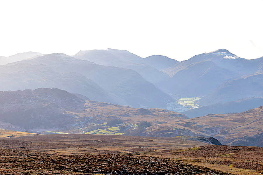
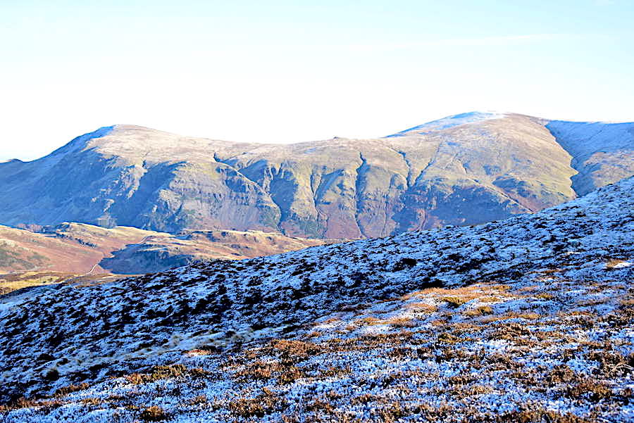
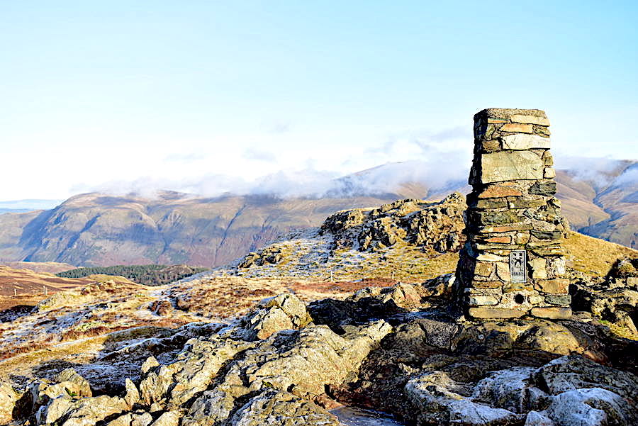
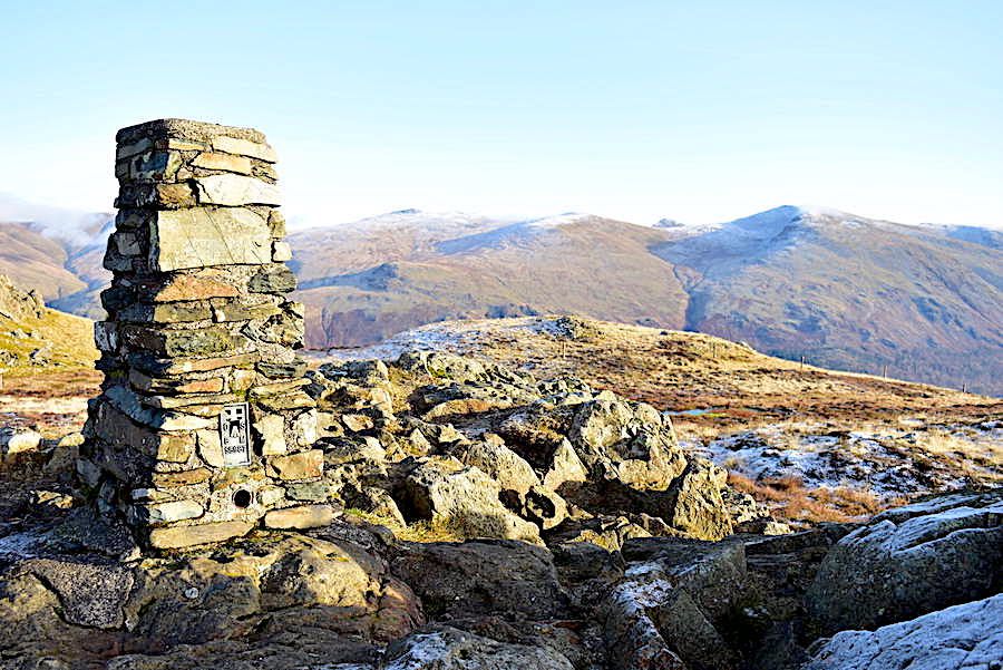
Once again a clutch of walkers arrived at the summit from various directions all at the same time, so once again we retreated to the sunny and sheltered side of the summit, put our mid layers back on and then tucked into the sausage rolls and coffee while we waited for the crowds to disperse. I had a go with the improvised lens shading again for this shot but it didn’t work out quite so well this time. Nevertheless its still possible to identify a few of the fells, on the far left of the skyline is Esk Pike, next is Ill Crag and Scafell Pike, followed by Lingmell and Great Gable. Sticking up between Esk Pike and Ill Crag is the top of Glaramara, and below that the knobbly summit ridge of Great Crag.
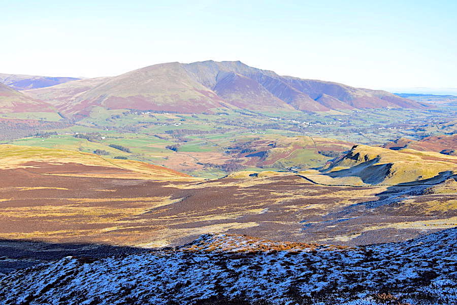
The clutch of walkers went their separate ways and with a deserted summit now available back we went to take a few shots of the surrounding views. The cloud which had been streaming over Blencathra looked to have made its way across the A66 and was now drifting across Clough Head and Great Dodd. It arrived from nowhere and didn’t last very long but it was good to have the extra bit of interest in the sky which clouds always manage to provide.
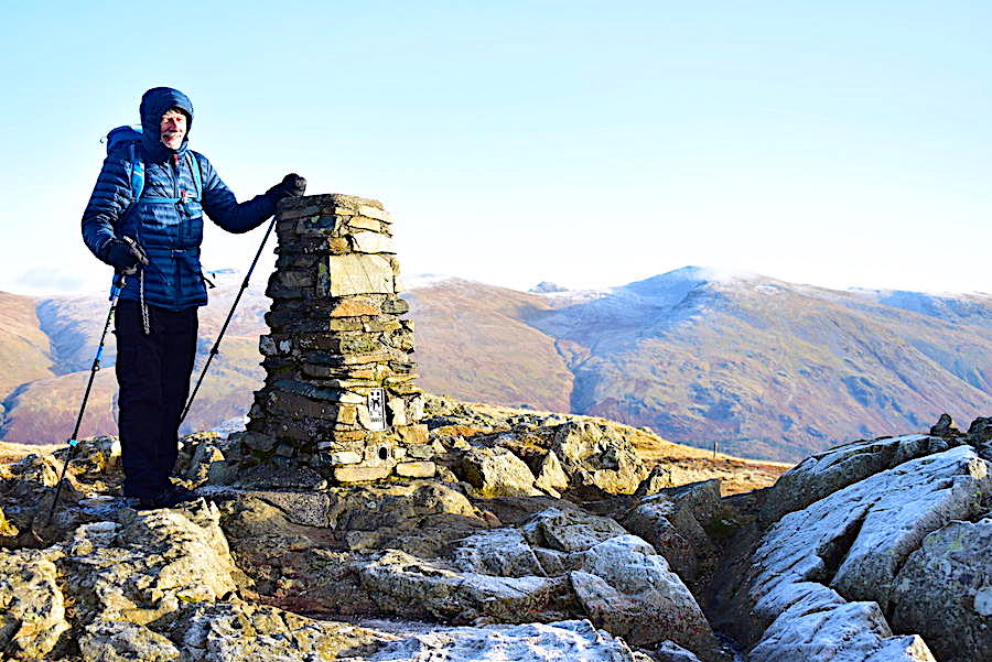
J in full Arctic mode at the High Seat trig column. The breeze was only of hair ruffling strength on the Beaufort Scale but, since it arrived at High Seat by direct delivery from the Arctic, by ‘eck it wasn’t half chilly.
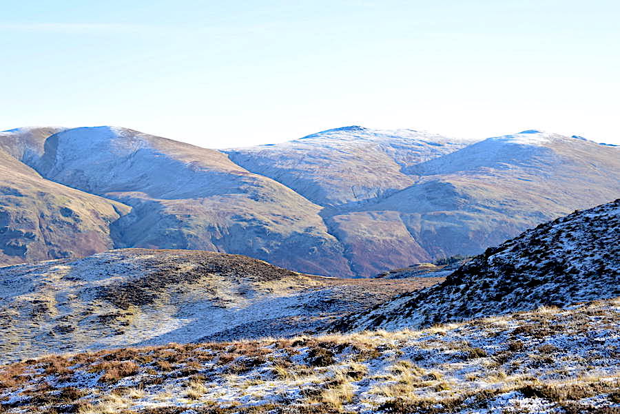
Looking over towards Clough Head and Great Dodd …..
….. followed by a quick swivel to look across at the rest of the Dodds.
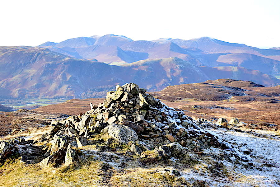
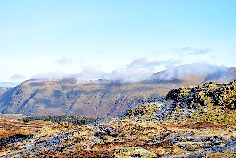
The northwestern fells beyond the summit cairn on High Seat…..
….. and the view across Ashness Fell from the summit cairn. My hands are now completely numb so the gloves go back on and we begin to make our way down again.
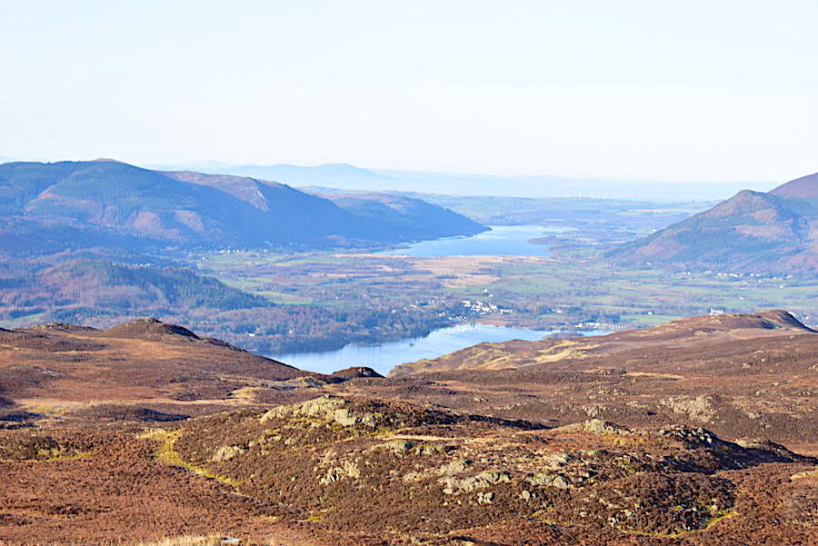
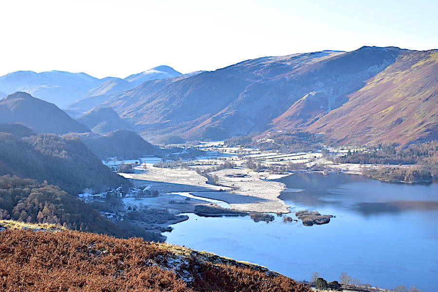
Making our way across to Dodd and enjoying the views of Derwentwater and Bass Lake all the way.
A look back at High Seat where a couple more walkers are also making their way down just a short distance behind us. There’s a good laid path for the majority of the way down and of course any remaining soggy areas were well and truly frozen over …..
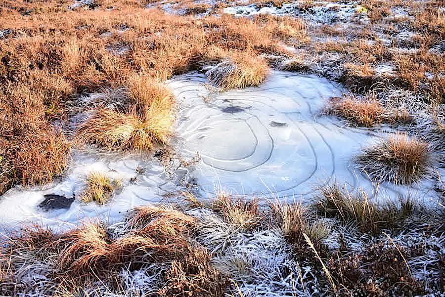
….. as illustrated by another frozen pool along the way decorated with intricate ice patterns, just like all the others we saw today.
We’re on Dodd now and a look back at our route off High Seat shows the pair of walkers still a short distance behind us, as they are not heading up here though they will pass below us as they make their way down to Ashness Gill.
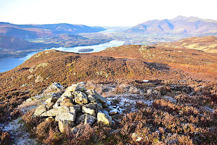
The view along Derwentwater from the cairn on Dodd …..
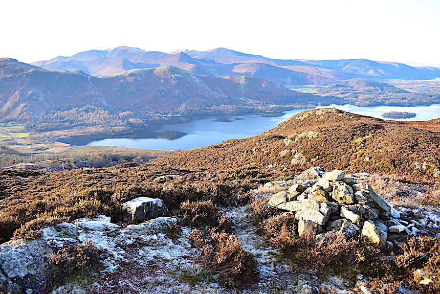
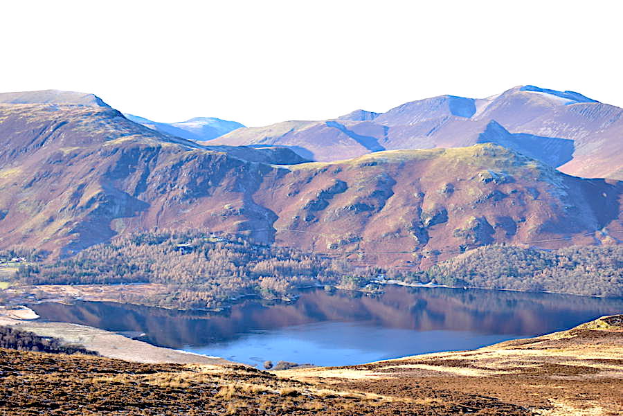
….. and a look across Derwentwater to Catbells and some of the northwestern fells.
A closer look at Derwentwater and Bass Lake. Despite the sunshine its still a bit too nippy to stand around for long as the chilly breeze is still with us and coming directly at us. The tissue usage rate has been on the increase since we left High Seat summit.
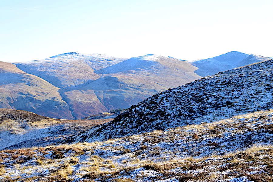
Turning towards Bleaberry Fell as we begin to drop down off Dodd and pick up the path again. You might be able to pick out the pair of walkers, who had always been just a short way behind us, now on the path just just ahead of us. The path tracks over to the left of the shot and then drops steeply down towards Ashness Gill. The stone pitched path down was just as thickly iced as the one leading up Bleaberry Fell so they and us made our respective ways down very carefully.
The Skiddaw group looking rather grand in the early afternoon sun.
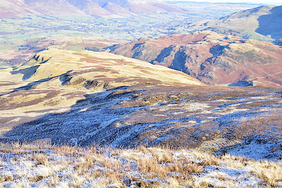
Not far to go now before we reach the gate in the wall where we’ll leave the steep, stony and icy path behind and reach the grassy slope of High Strutta, where the ground beneath our boots will be a whole lot easier on the feet. The lady walker of the pair ahead of us was taking things very carefully on that last little icy patch just in front of the gate.
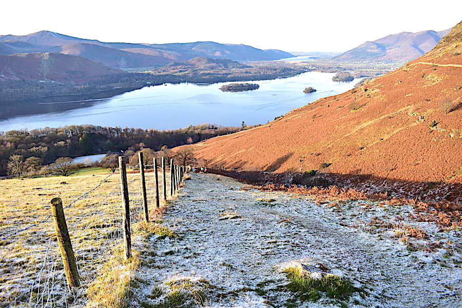
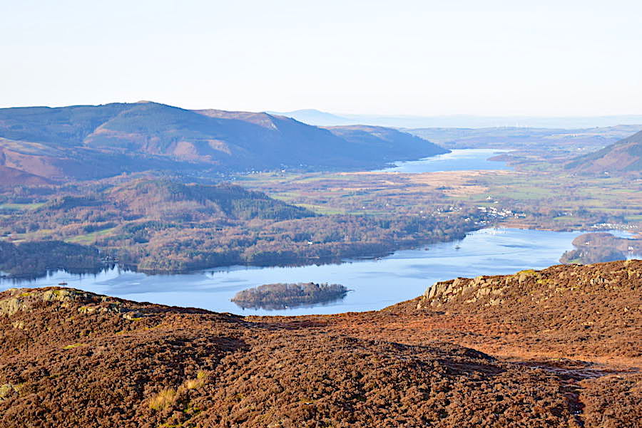
A lovely view of Derwentwater all the way down High Strutta and before too much longer …..
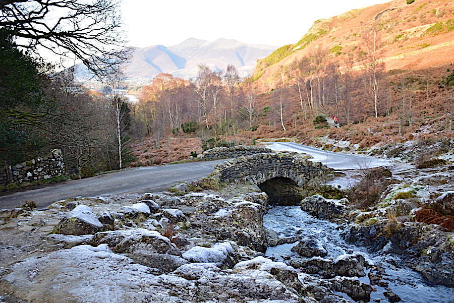
….. we’re back at Ashness Bridge and the end of our walk. When we drove up here this morning we remarked on the lack of frost and ice on the road. There was none at all anywhere along the road from the start of it up to the car park, so we were surprised to see how much had accumulated on the road just beyond the bridge since we set out. Oddly enough there was none on the bridge itself or the road going up to Watendlath either which had us wondering why. So, that’s about it for today, there’s just a short walk across the road up to the car park and then its back in the car ready for the drive back home. A very enjoyable wintry walk in glorious weather, days like this have been far too few and far between over the last few weeks and its been good to get back outdoors again. Let’s hope the next good weather day isn’t too long in turning up.