
Crosby Ravensworth Circular
Walk date – 14th April 2026
Distance – 6 miles
Weather – a grey day with overcast skies with a cool breeze
The forecast said there would be sunny spells until about lunchtime today with cloud cover gradually arriving during the afternoon. Yesterday (Monday) had pretty much the same forecast although with a stronger breeze so based on those forecasts we decided to wait and take a walk today. At 7.30 am things were very sunny and bright but by 8.00 am the sheets of cloud had arrived and the sunshine disappeared, never to be seen again for the rest of the day. We should have gone yesterday!
Route
Crosby Ravensworth – Slack Randy – Crosby Ravensworth Fell – Oddendale – High Dalebanks – Low Dalebanks – Crosby Ravensworth


Behind our parked car in Crosby Ravensworth was this newly painted bench seating celebrating the coronation of Queen Elizabeth ll in 1953. Took me straight back to the day in 1952 when her father, King George Vl, died and an incident which took place in my junior school classroom. Our class teacher had just finished taking the register when the door was flung open, in stepped Florence, (who was always late), and loudly announced that the king had died, or to put it in her Yorkshire words “King’s dee’d”. Following this momentous announcement our class teacher calmly said “Come in Florence, close the door and go and sit at your desk.” Which she did and the incident was not referred to again, at least in the classroom, for the rest of the day. During playtime there was lots of chatter about it, naturally enough. Its a childhood memory I’ll never forget.
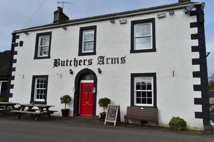
Walking up Gilts Lane from the parking area, opposite the village hall, we pass the local pub …..

….. and continued along passing Jenny Well House and barn.

Jenny Well House frontage complete with lych gate. The house and barn are Grade ll listed buildings. The house dates from 1784, possibly even earlier, although it was remodelled and added to in the Gothic style in the 19th century. One other residence that we passed had the unusual name of ‘Nurse’s House’ whereas the rest of the residences had names which might be seen in any English village.

At the top of the village is a lane junction, the one on the right, which we turned onto, is known as Slack Randy. The road on the left leads eventually to Orton and is currently being used as a diversion route for anyone living in Crosby Ravensworth wanting to get to Maulds Meaburn. The road from Crosby Ravensworth to Maulds Meaburn, a distance of no more than a mile, is closed at present, which means that both sets of villagers have to travel about seven miles via the diversionary route!

The tarmac surface of Slack Randy comes to an end just above the village and becomes a wide dirt and/or stony track which gently climbs up to open moorland.

Looking back along the track winding its way up the incline, Woodfoot farm is over on the right and the North Pennines can just be seen on the distant skyline.

Cross Fell, the highest point of the North Pennines, is left of centre on the skyline. Its two close neighbours, Little Dun Fell and Great Dun Fell, are to the right of it. For the time being they are still enjoying the morning sunshine but the cloud is rapidly approaching them. In the foreground is one of the many tree plantings which have sprung up along the track and most of them look to be doing well, which is only to be expected at such low elevations. Its when planting takes place at higher elevations where the trouble starts and all that can be seen are rows and rows of plastic tubes!

At the junction we decided to take the path on the right as we’ve followed the path on the left to various destinations on previous walks. We haven’t used the right hand path before but we know it will lead eventually to the path going over to Oddendale.

A copse of splendid trees with a ‘Berlin’ wall around it …..

….. and the same copse of trees now with an old lime kiln below it. On our route map it can be located near the words ‘Quarry (dis)’ just after the junction shown in a previous shot. Its the very small square in the middle of a very small and irregularly shaped field.

Another plantation of young saplings which are flourishing. The open moorland beyond had none of these little plantations so somebody seems to have realised that the higher, and therefore more open to the wind, you plant them the less chance of success you have. It doesn’t matter which track is taken as each one leads to a gate in the same fence beyond which is open moorland.

Cross Fell and the rest of the Northern Pennines still bathed in sunlight. Our appearance and progress was observed by this group of sheep we had disturbed.

Out onto the open moorland at this point and crossing Crosby Ravensworth Fell. The two lone trees on the left mark the limestone pavement area, (see our walk of 19th June 2017 for photos of that area) and the hill over on the right, which is probably the summit of Crosby Ravensworth Fell, is what we call Hill 401 simply because that’s the height given on the OS map.

A glimpse of the structures on Seal Howe as we passed by. Apparently these are the remains of a Bronze Age Round Cairn where ancient human remains have been discovered. We didn’t go over there today so refer to our walk of 13th July 2023 for photos of the cairn and other structures.

In the near distance is Hardendale Nab, (ref – same 2023 walk as given above), to the left of which in the far distance is Carrock Fell.

To our left and behind the traffic on the M6 we had a view, in ascending order, of some of the Shap fells, Selside Pike, High Street, Kidsty Pike and High Raise.

A puddle filled path leading towards ….

….. Oddendale and the wall and trees enclosing the little hamlet. When we reached the wall we had a short break before …..

….. following the path around to the tarmac lane leading into Oddendale hamlet. J with woolly hat but no gloves, me with hood firmly on in addition to gloves to provide a bit of warmth against the cool breeze.

Entering Oddendale where the white painted house appeared to be undergoing some building work as can be seen from the pile of building materials in front of it. Three workmen were chatting just inside a doorway and gave us a cheery greeting.

These next buildings seemed to have undergone very extensive alterations and have been turned into a very des.res. I saw a photo on the Geograph site, only taken five years ago, and the building on the right had lots of scaffolding around it, which suggested that the roof was being dealt with first. The initial purchase and the subsequent alterations must have cost someone a pretty penny or two.

Just beyond the building in the previous photo was a gate so here’s the view of what lay beyond it. The path in the photo was not the one we needed as it doesn’t lead to anywhere so we walked back down the slight slope to another gate leading to the path we did want to follow. This gate had a very weather worn arrow sign on it which was so faded it was almost useless. It did however have an arrow shape on it even though the arrow colouring had disappeared but we had to be really close to it to before we noticed it.

Awww, cute little things snuggled in the grass while Mum kept a careful eye on us as we walked by them.

Further along the High Dalebanks path we came across a disturbing situation. On the edge of the path was the very pitiful sight of a lamb all alone and with no mother nearby. Its bleats were very weak and every time it tried to stand its legs wouldn’t hold and it sank down into the grass again. J eventually picked it up, walked into the field with it and put it down in the hope that its mother would be nearby. She wasn’t. The lamb tried to stand up again and huddled itself into J’s trouser legs, probably hoping to find a feed there. J tried a couple more times to get it to stand but it couldn’t because it was so weak and we came to the conclusion that its mother had simply abandoned it. We could see no physical reason for the lamb’s plight, its legs weren’t broken or malformed, its breathing seemed to be OK and it looked just like all the other lambs. They all had mothers nearby who could provide them with milk, but this one didn’t and was suffering the consequences. There was nothing we could do which would help and it was heartbreaking to have to leave it when it couldn’t fend for itself.

Further on was this little group, two lambs and their mother keeping an eye on things, happy and contented. The two lambs were unaware of how fortunate they were in having someone to look after them.

After passing through a gate and were approaching High Dalebanks the open nature of the grassland changed and became enclosed fields again …..

….. and from High Dalebanks it was only a short walk down to Low Dalebanks where I took the above shot as we passed through.

From Low Dalebanks we walked along the daffodil bordered lane towards Crosby Ravensworth …..

….. passing the entrance to Haber Farm where the farm’s entrance sign caught my eye.

The sturdy bridge across Dalebanks beck …..

….. and a little further down below it is the ford across the same beck.

From the ford across the beck there was just a short walk back into Crosby Ravensworth village where I walked a few paces down to the ford crossing over the same beck in front of St Lawrence Church. I had just taken the shot when it began to rain so I dashed back to the car and I had only just climbed in when the heavens opened and down came the rain in big, splurgy drops which covered the windscreen within seconds. We sat out the rain shower in the car while fortifying ourselves with hot coffee and whatever we had in our food boxes, after which we made our way back home under cloudy skies but no more rain. As I write this report (Wednesday) its pouring with rain and very windy and I keep wondering whether that little lamb is coping with it or not.