Silver How, Blea Rigg and Tarn Crag
Walk Date – 17th July 2012
Distance – 7 miles
Weather – overcast and showery
Route


Another grey day dawned but at least its not raining, yet. We’re walking up to Allan Bank heading for Silver How and then on to Blea Rigg. On the way we have this view of Seat Sandal, on the left, with the U-shaped gap of Grisedale Hause between it and Fairfield opposite.

We also have a view of Helm Crag, its been quite a while since we walked up there.

A longer view of Helm Crag and Seat Sandal.

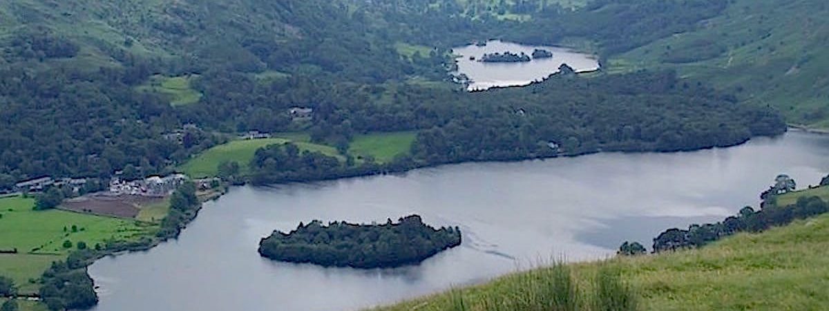
We reach the summit of Silver How and get this view of Grasmere and Rydal Water.

The large, haphazard pile of stones marking the summit of Silver How.

From Silver How we head off towards the rocky outcrop of Lang How, with an inquisitive Herdwick monitoring our progress.
Walking the ridge consists of lots of ups and downs and large areas of wetness, but eventually we reach the shelters which mark the point where we turn up to the summit of Blea Rigg.

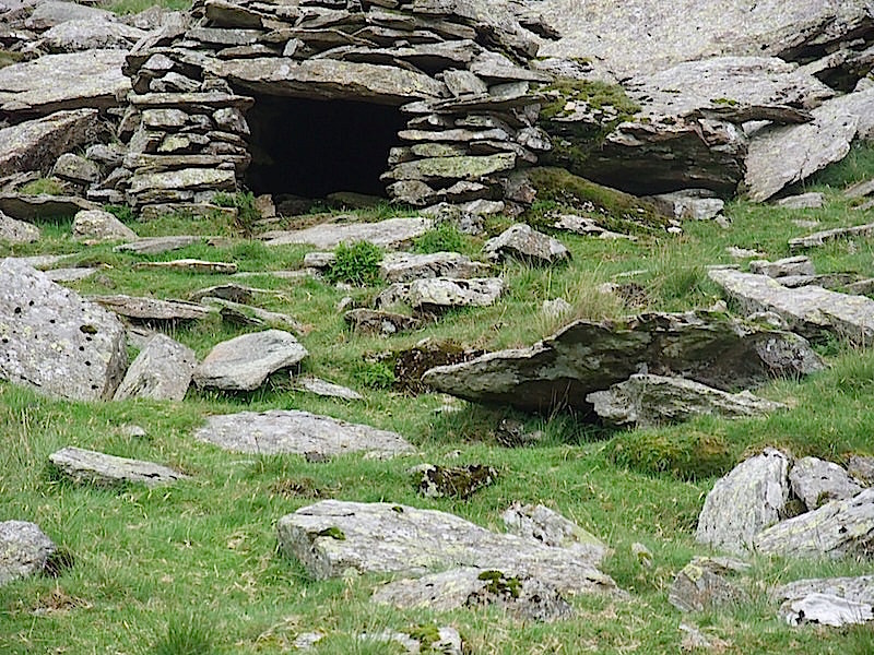
Just a short way from the first shelter is this one, which has been created by using a split boulder, blocking one side of the split with rocks, and leaving this end open to allow entry into the shelter.

Another view showing the construction of the shelter.
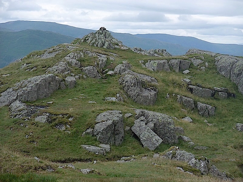
The rocky summit of Blea Rigg.

A view of Harrison Stickle, over on the right skyline, from Blea Rigg summit. I’m down to just a t-shirt layer so its not at all cold, but its still very overcast and gloomy.

Further along the ridge and we get a great view of Harrison Stickle, left, and Pavey Ark, right, towering above Stickle Tarn.

Looking down on Codale Tarn from the ridge. That’s where we are heading next and when we get there it will be time to have something to eat.

Belles Knott from the Blea Rigg ridge.

Below Belles Knott is Easedale Tarn, with Helm Crag just beyond it, in the middle foreground.

Down at Codale Tarn we find a flattish spot and have some lunch. There was no-one else here and it was lovely just to enjoy the solitude and contemplate the next part of the walk.

As we climb up to Tarn Crag I take a look back at Codale Tarn, and the Blea Rigg ridge we came down earlier.

The summit of Tarn Crag, and another layer of clothing has been added, must be getting chilly then.

A look back at Tarn Crag summit as we begin to descend.

A shower of rain comes across while we are making our way down to Easedale Tarn. The Blea Rigg ridge opposite is about to be obliterated by cloud.

A look back up to Tarn Crag as we approach Easedale Tarn.

Down by the tarn, down came the cloud, down came the rain, not a time to hang about.

Waterfall in Sour Milk Gill alongside the path we are using back down into Easedale.
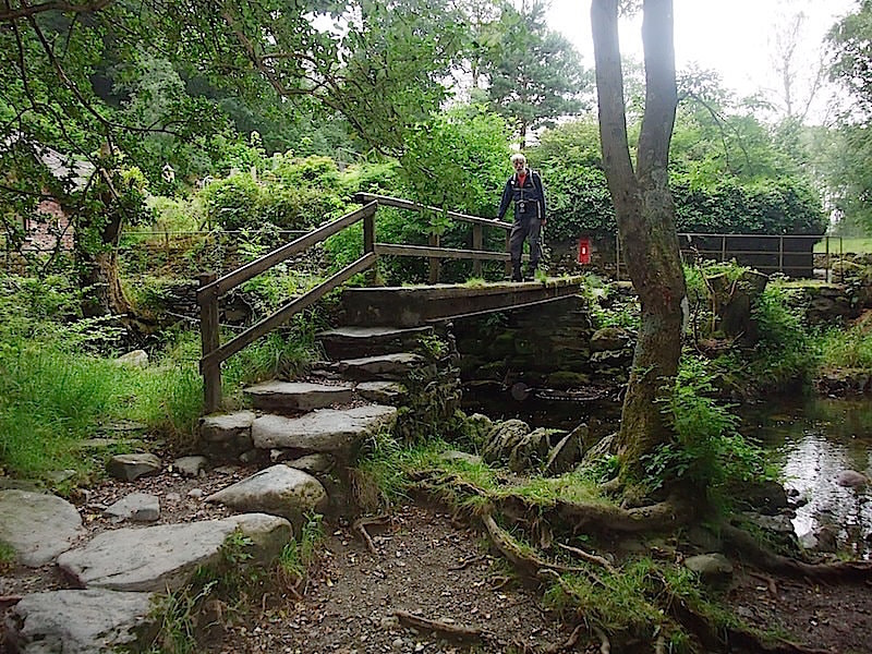
The bridge marks the end of the path through Easedale, so its over the bridge, a walk along the road and back into Grasmere.