
Souther Fell
Walk Date – 17th April 2016
Distance – 6 miles
Weather – dry and sunny, strong north westerly on summit
Given a weather forecast of a cold, but dry and sunny morning, with the sunshine giving way to thick cloud about 11.00 am we opted for a short morning walk to get the best out of the day’s weather. Our chosen fell was Souther (pronounced so it rhymes with hooter) since we wouldn’t have a great distance to travel to get to it, and there’s free parking nearby.
Route


A little back lane starts at The White Horse Inn at Scales and this shot of Great Dodd was taken just a short distance along that lane. Overnight snow has covered the Dodds and the Helvellyn range once again, although there wasn’t the same amount of coverage on the fells in other areas. Is this winter/spring ever going to loosen its grip?

Clough Head looking similarly wintry. Even at this low level it was decidedly chilly, and jackets and gloves were well and truly on.

A gap in the trees offered the chance of a shot of both Great Dodd and Clough Head looking pristine in their snowy coats.
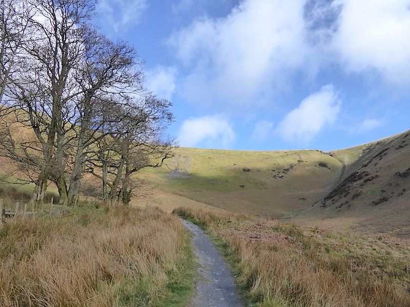
The lane we were walking on continues on to Mungrisdale but here we turn off to walk up Mousethwaite Comb and up to the col below Souther Fell.

Further up the path in Mousethwaite Comb. You can just make out the diagonal path running up from that patch of scree in the centre to the col over on the right.

Off came the jackets at this point, with the sun on our backs and the fell sides blocking the wind it was becoming rather warm.

The path swings around just before the patch of scree and traverses the fell up to the col. The gradient is much easier along here than it was getting up to this point, although I should point out that no part of the path is excessively steep. The fell in the shade is Souther Fell.

We’re about halfway along the traverse path here so I took a look back at the route up the Comb, and also at a group of three walkers, just out of shot, making their way along the path which passes above the top of the rocky outcrop over to the right. It seemed to take them quite a long time to get past it, although to be fair it does come at the end of a fairly steep climb from another starting point at Scales.

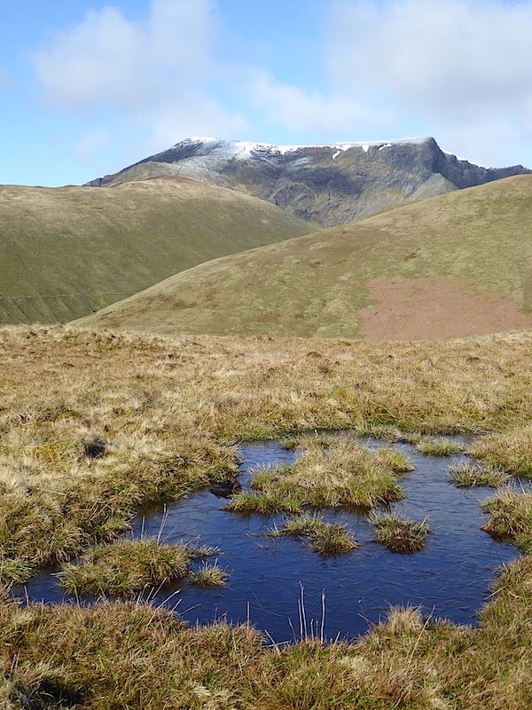
We’re up on the col now so I walked over a little way for this shot of the Dodds, Clough Head and some of the north western fells.

From the col we begin climbing up Souther Fell and I took a slight detour from the path to take a look down into the valley to our left with the River Glenderamackin running through it. The path to the lower left leads down to Mungrisdale.

Blencathra in close up from the climb up Souther Fell. That’s had some overnight snow too.

The longer view from the same position. Lower left is the col where we turned up to the right to reach this point. Turning left at the col would take you up that s-shaped path over Scales Fell and on to Blencathra. To the left of that path on the edge of the shot is the rocky outcrop which the three walkers I mentioned earlier were walking over and, once over it, they continued straight ahead on the path running along the flanks of Scales Fell and which offers an alternative route up to Blencathra. Finally, from the col a path drops down to the bridge over the Glenderamackin, from where you can join the path running along the bottom of White Horse Bent, and that leads up to a col between Blencathra and Bannerdale Crags. So what looks like an insignificant patch of wet grass provides the walker with a variety of walking options.

The grey rocks of Sharp Edge ridge rising up to the flat northern end of Blencathra. No, I haven’t walked up Blencathra via Sharp Edge and, as I am not interested in living dangerously, I have no plans to do so either. It has claimed lives, I’m not going to give it the chance to claim mine.

Souther Fell has nothing so exciting or dangerous which is fine by me, here’s a look back at its large, grassy and undulating top. The snow is already thinning out on Clough Head there in the centre of the shot. Jackets, hoods and gloves are now back on since there is a very strong north westerly blowing across here
In ascending order – a frozen pool, White Horse Bent, Scales Fell and Blencathra.

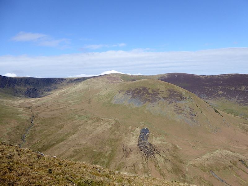
Bannerdale Crags, directly across the valley, from Souther Fell.

Looking across to the long stretch of moorland which connects Bannerdale Crags, on the left, with Bowscale Fell over on the right.

You could be forgiven for thinking that this is the summit of Souther Fell, given that it has a decent sized cairn, but it isn’t. Its a pity that the actual summit, some distance away to the right of the shot, is nothing more than a scrape of bare rock sticking out of the grass. There’s nothing to indicate that it is the summit, and if you weren’t looking out for it you could walk straight past it and not give it a second glance. This has a bit more about it so I didn’t bother taking any photos of the bit of bare rock on the actual summit.

The long strip of land in the middle foreground is The Tongue which juts out between Bannerdale Crags and Bowscale Fell. Behind it is the Bowscale Fell ridge with the summit of Bowscale, just peeping above The Tongue, over to the left.

Looking west from the cairn.

It was very windy up here and I think the wind re-styled my hair two or three times as I was sitting here. The shots I deleted were even more Worzel Gummidge than this one.

The view to the south west from the cairn.

A final view from the cairn.

One of the many frozen pools up here today. Its not especially squelchy up here and, although the grass was still wet from the overnight rain and snow, the paths were firm and the going was good. That sounds like a description for the ground conditions for a big race at Ascot.

Looking ahead along the undulating grassy ridge of Souther Fell. That weather front over there seems to suggest that the forecast for thick cloud about 11.00 am might just be accurate.

Continuing along the top of Souther Fell and the views of Bannerdale Crags are opening up more now.

The view into Bannerdale and the weather front is closing in. Localised white cloud bubbling up above the skyline too.

A look back to the highest point of Souther Fell. There’s a distinct lack of excitement about this summit.

Two ridges, Sharp Edge on Blencathra behind the narrow east ridge of Bannerdale Crags.

The long ridge up to Bowscale Fell, which begins in Mungrisdale, behind the rounded hump of The Tongue. The weather front behind it is creeping closer by the minute.
A head on view of The Tongue with what looks like a large landslip on its lower slopes, possibly winter storm damage. The wind seemed to get stronger and colder from this point and we were constantly buffeted around, with numb fingers the minute the gloves came off to use the camera.

We’re beginning the descent now and about to lose the view so a final look back into Bannerdale and its crags.

The little hamlet of Mungrisdale below, the large white building in the centre is The Mill Inn. We met quite a number of people coming up, a lot of them wearing light summer clothing since they started out down there in the warm sunshine. We did mention to them how cold the wind was so I hope they had some warmer clothing in their packs.

A peep round the corner at The Tongue from the steepish descent. Its 10.46 am and the cloud is almost upon us so a pat on the back for the Met. Office.

The notice is a bit faded but it reads, ‘ There is not a public footpath through this field. Please keep out.’ It didn’t matter much to us anyway as we had to walk back to Scales which is in the opposite direction to the village, but I did wonder if the pub owner wishes that walkers could just nip down across the field and straight into the pub. I was just pleased to be down in the warmth and out of the buffeting wind.

We’re walking ahead of the cloud so we can still enjoy the sunshine as we walk the lane back to Scales. It wasn’t as messy as this all the way back.

A redundant hay feeder now that all the sheep are on the fell sides eating the fresh grass.

Further along the lane was this large landslip, more storm damage.

A new fence replaces the one which the landslip destroyed …..

….. and down in the field, behind another new fence, is where quite a lot of the landslip still remains.

I was getting a very hard stare from this ewe as if to say, ” I’ve just got them off for their morning nap so don’t you start making any of your camera noises or there’ll be trouble.”

A splendid oak tree beside the lane.

Far Souther Fell cottage.

Southerfell Farm, built 1625 according to the lintel above the door, or was it 1675? Anyway its been here a long time, although I’m not so sure that the chequered section on the end of it is quite that old.

The leading edge of the cloud has caught up with us and the light is becoming more subdued as I look across the A66 to Great Mell Fell.

Not quite so much snow on Great Dodd and Clough Head now, and the blue sky is disappearing too.

The view from the lane of some of the north western group of fells.

Back at Mousethwaite Comb ….

….. and the path up the Comb where we started out three hours ago.
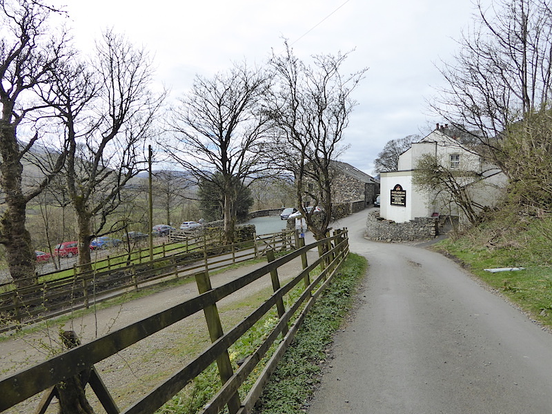
The White Horse Inn at Scales and journey’s end. The entrance to the parking area is alongside this fence on the left. That line of cars over there are parked in one of the lay-bys on the A66. There was only one other car in the car park when we arrived and none in any of the lay-bys, now they are all full. Well, we’ve had the best of the weather and the cloud has taken over so we might as well go home. It may not be the most exciting or dramatic one, but Souther Fell proved to be just the ticket for today’s sunny morning.