
Talkin Fell, Simmerson Hill and Geltsdale
Walk Date – 17th May 2018
Distance – 5 miles
Weather – dry, warm and sunny, cloudy spells occasionally, a very slight breeze now and again
The catalyst for today’s walk was a visit we paid to Talkin Tarn Country Park last Sunday afternoon. It was a beautiful sunny day, if a little on the breezy side, and we enjoyed a gentle 1.3 mile stroll around the tarn finishing at the cafe and gift shop. Naturally we called in at the cafe and as we were sitting in the sunshine enjoying our coffee and cake we noticed a fell on the distant skyline which appeared to have structures on the top of it. We hadn’t brought the binoculars so couldn’t readily identify if the structures were just outcrops, or perhaps small trees or shrubs, none of which turned out to be accurate as I found out when we were back at home and I did a spot of Googling. So since another dry and sunny day turned up we decided to drive up to Castle Carrock, about 10 miles to the east of Carlisle, and follow the Geltsdale road out of the village up to a good sized parking area by the curiously named Jockey Shield from where we began today’s walk.
Route
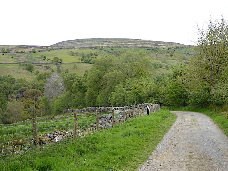
From the parking area behind me at the top of this lane we walked down the stony track to …..

….. Hynam Bridge spanning the River Gelt.

The bridge is quite tall and so there was rather a dizzying view below us to watch the river pushing its way through the narrow rocky gorge below us.

The view downstream as the gorge widens a little and the river passes by the Environment Agency’s river level monitoring station, not much water flowing through today though so the risk of flooding is negligible.

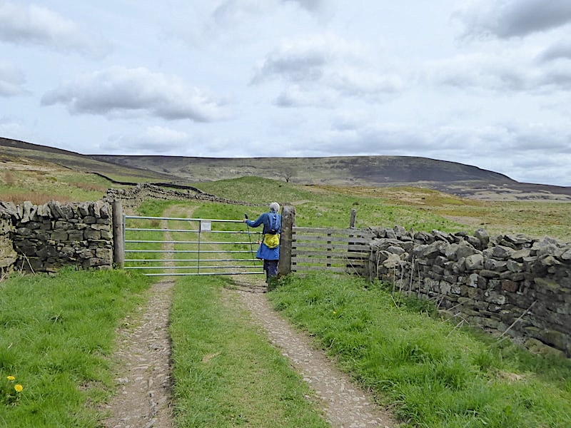
The track carries on from the monitoring station and at this junction we take the right hand path up to the gate and enter Hynam Wood.

It was a lovely stroll through the woods, the trees still aren’t in full leaf so plenty of light was filtering through, with patches of bluebells appearing now and again and bracken making its annual appearance. We were surprised to see it so tall already, the new growth on the left of the shot was approaching the 2′ mark, so maybe the warmth and shelter of the woods is very much to its liking.

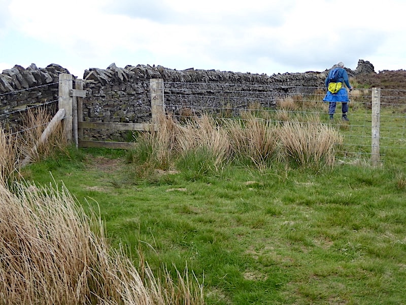
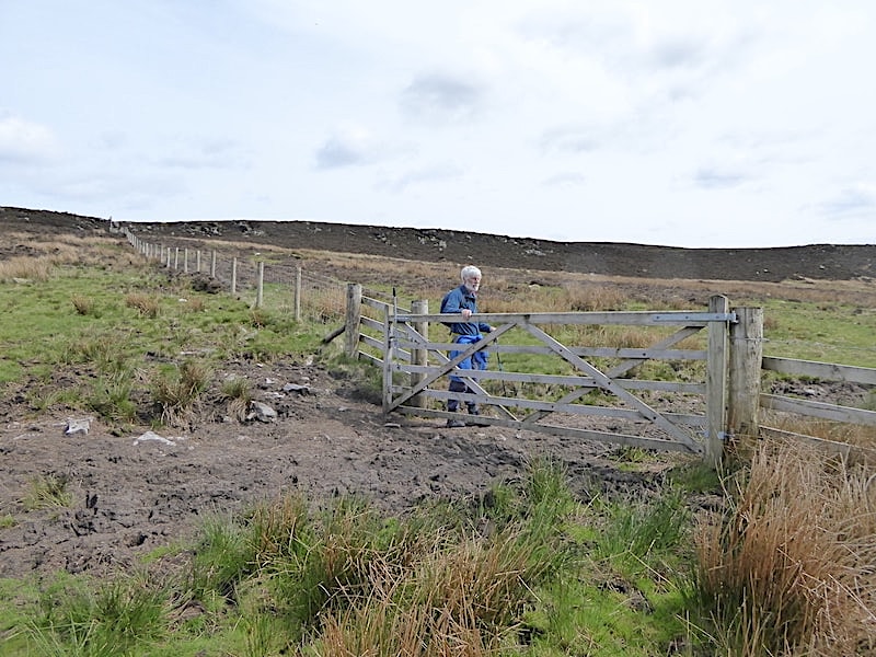
We emerge from the woodland and pass through the gate at the top onto a walled lane coming in on the left from Talkin village, we turn right beyond the gate and continue up the hill.

Just before we leave the woodland area at the top of the hill we take a peep over the wall at the carpet of bluebells beneath the trees which takes me right back to my childhood days. There was a bluebell wood above our little Yorkshire village and every year I would pick masses of them and carry them back home where my mother would have to find enough vases to put them in. You’re not supposed to pick them now but in those days nobody thought anything about it, bluebell woods and hay meadows were everywhere then.

Rounding a bend in the track above the woods and the sight of some of the Lake District’s northern fells comes into view. On the smoky grey skyline they stretch from Blencathra, on the left, to Skiddaw on the right. The sky was an odd mix of cloud today, some very high but very thin milky layers, almost like sheets of gauze, through which the blue sky could be seen, and below them the thicker and numerous clusters of small cumulus cloud which drifted across the sun every now and again. It looks very grey and cool but it was quite the opposite, warm and muggy with only the very occasional hint of any air movement.

On the skyline is Castle Carrock fell, below it trees are lining the road where the parking area is, below the parking road are the trees of Hynam Wood and in the foreground the fellside is completely covered with fresh bracken, an invasive pest for which I would shed no tears of regret if it disappeared completely because I cannot abide the stuff.

I’ll stop wittering on about bracken and concentrate on enjoying the walk along the walled lane instead. Now that we are a little higher Talkin Fell is just beginning to appear above the left hand wall and a zoom in will give a glimpse of those summit structures I mentioned earlier.

Over the right hand wall we have a view along Geltsdale with the trees of Knotts Wood lining the slopes along the course of the River Gelt, and Cold Fell and Tarnmonath Fell on the skyline.

Exmoor ponies on the lower slopes of Talkin Fell.

We were here at the gate for about ten minutes hoping to encourage them to take the bunches of long grass we had pulled from the lane verges but they weren’t having any of it. They did eventually venture quite close to us but would only eat the grass once it was on the ground.
Only a few paces along from the ponies the bi-walled track ends as we pass through this gate leaving only the left hand wall running alongside the route. One of the clouds drifts away and we are back in the sunshine once more.

On we go over the lovely grassy track to the next gate beside which was this quite substantial sheepfold which probably won’t be used any more as re-stocking the land took place a few years ago. Sheep have been removed and the area is now home to a traditional herd of suckler cattle.

The main track heads over to the low saddle up ahead and we veer off left and follow the wall up the hill towards the lower slopes of Talkin Fell.
At the top of the steepish bank we cross this broken stile and continue to follow the wall around …..

….. to this ladder stile with a sheep creep set into the wall beside it. The sheep creep would have allowed the sheep to pass easily from field to field but is superfluous to requirements now that the sheep have been removed. It will still come in handy for walkers accompanied by dogs though, maybe foxes will make good use of it too.

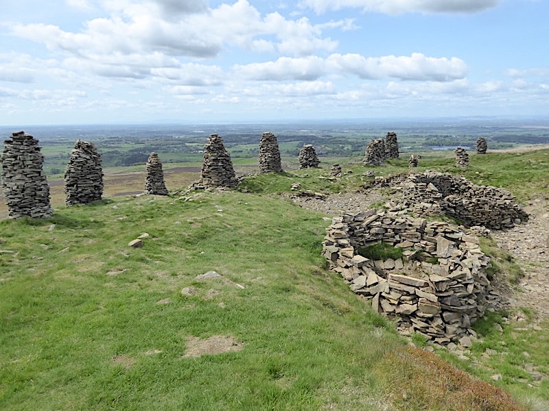
Approaching the trig point on the summit and the intriguing array of curricks, or vertical stone pillars, along its rim. The name of the fell apparently originates from ‘tal’, meaning end, brow or top in the ancient Celtic dialect, and ‘can’ which is thought to mean white or bright. So Talkin suggests a hill name meaning ‘white brow’ or ‘white top’.

I don’t think the curricks are of any great age, and apparently someone local to the area adds another one from time to time, but they are an interesting and unusual feature nevertheless.

We didn’t think these circular structures were shelters either, there was no easy access to any of them and all were constructed around what appeared to be sunken hollows, possibly shake holes, so they may have been placed there to prevent unwary walkers stumbling into them.
Another long sunny spell with not a breath of breeze and it was lovely to be able to wander around and take our time looking at the curricks and taking in the views. Between the curricks towards the right of the shot you may be able to pick out the sliver of blue which is …..

….. Talkin Tarn. This close up shows the cafe, at the water’s edge, over on the right, where we enjoyed our coffee and cake and from where we viewed Talkin Fell and its summit structures.

Talkin Fell, at 381m/1250′ isn’t a mountain by any stretch of the imagination but the views from the summit are very extensive. Situated at the northernmost end of the North Pennines the views range from this one of the Lake District fells to the south west of us …..

….. while to the west we can see Criffel and the distant Galloway hills, in Scotland, across the Solway Firth, although a zoom in, towards the left of the shot, will be required to identify it. Its to the left of the distant sheet of water over there which is the Solway Firth. There was too much haze for any worthwhile shots northwards but the wide ranging views included the forests towards Kielder and The Cheviots. All in all a pretty good reward for hardly any effort.

Enjoying the views from the trig point with Cold Fell and its escarpment behind it.

From the top we backtrack to the ladder stile and once across it we follow the wall to the corner and then branch away from it over onto a left forking path and follow it down through the heather into the hollow below it.
We cross the hollow and track up the rising ground until we reach this second gate in the fence …..

….. from where its simply a case of following the path close by the fence line up through the low outcrops and then bearing right onto a path following the limestone rim of Simmerson Hill. This look back shows the route we took through the heather and across the hollow from Talkin Fell.
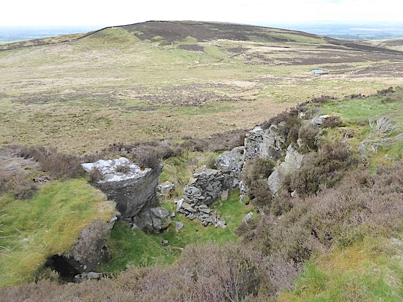
Here and there along the rim we came across little hollowed out sections such as this one below us. Whether man made or natural breaks I don’t know but certainly someone has built what seems to be a shelter wall across the opening down there, perhaps someone’s wild camping spot at one time.

Easy walking along the Simmerson Hill escarpment with Castle Carrock fell beyond it.
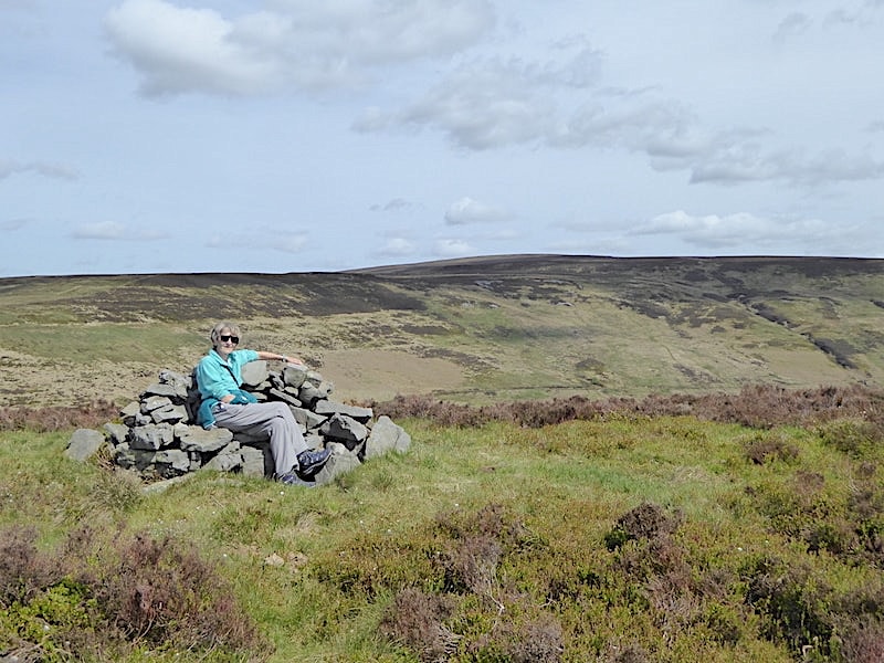
When we rounded the rim we made a short diversion through the heather up to the top of Simmerson Hill where the cairn, shaped like an armchair and very similar to although not as lofty as The Chair on Wasdale’s Red Pike, awaited us. Its warm and sunny and someone has gone to the trouble of creating some pleasant seating from which to view the surrounding scenery so you can’t ignore it, can you? Cold Fell is stretching away into the distance behind me.

Back from the armchair cairn we carry on walking the western scarp just below the summit with the wooded valley of Geltsdale over to the right.

A close up view of this isolated cottage, marked on our route map near the area named as The Greens, but it was difficult to tell from up here whether it is inhabited or not.

The rim gradually peters out and we begin dropping down towards the tree lined banks of How Gill.
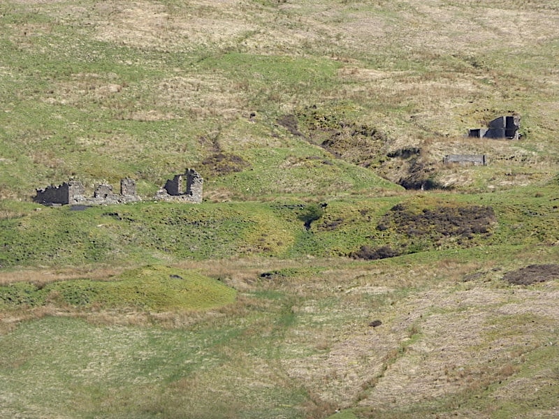
Across to the east on the lower slopes of Tarnmonath Fell we noticed these derelict buildings which once formed part of the abandoned Gairs Colliery which operated from 1912 to 1936.

At the end of the descent from Simmerson Hill we join a level green path where we turn right and begin making our way back to our start point. From the green path the house at The Greens came into view again. Cows wandered freely here and there, although on this warm afternoon most of them had taken to just lazing around, busy doing nothing.

A very large patch of cloud didn’t spoil our walk back along the lovely green path along Geltsdale …..

….. which a little further along turned into this engineered incline track along which horse drawn colliery wagons would be transported.

Further down still and the track turns a little rougher as it drops down to High Hynam …..

….. where it eventually joins with the riverside lane leading to the recently built house at the end of it. A lovely house in a beautiful setting but just a little too isolated for my liking.

The walk back along the river was just gorgeous and didn’t last nearly long enough …..

….. and when we were almost back at the bridge it was possible to get right down to the river’s edge where it flows smoothly over the bedrock. More childhood memories as we had a very similar beck flowing through our village. I spent many hours beside it, and in it, cupping my hands in the pools and catching the tiddlers and minnows as they swam around. Home they went in the jam jar but they were swiftly returned to the beck when I wasn’t around to notice. I was sometimes swiftly returned to the beck too because I often walked the hundred yards or so back home barefoot. Concentrating on getting back over the beck wall without dropping the jam jar would sometimes mean that I forgot to put my socks and shoes back on.

Back at Hynam Bridge …..

….. where the river has to squeeze itself through this narrow rocky gorge …..

….. as it makes its way under the bridge and continues on to join the Irthing and Eden rivers around Carlisle and then out into the Solway Firth.

We cross the bridge and walk back up the lane to the parking area from where I take a look back at Talkin Fell. A really enjoyable five miles through a gentle and very appealing landscape and all because we stopped at a cafe for coffee and cake. Sometimes good things happen quite by accident.