Thirlmere and the Zip Wire
Walk Date – 20th December 2017
Distance – not measured but about 2 miles
Weather – cloudy and mild
A planning application, for what is described as a ‘Thirlmere Activity Hub’ has been submitted by Treetop Trek Ltd to the Lake District National Park. This application includes the development of a zipwire attraction, which will result in 8 zip wires crossing from one side of Thirlmere to the other, a proposal which has naturally created a great deal of concern, dismay and anger from residents and non-residents alike. Having studied the numerous plans and documents concerning this application we decided to go and see for ourselves what the effects of this proposal might be, in the event of the application being approved. For a good numbers of days now there has been a great deal of heavy cloud with most of the fell tops obscured, and together with low lying mist drifting through the valleys it hasn’t really been a great time for getting out on the fells. Today was no different so we decided to use the day to undertake our own bit of research around Thirlmere and use the photos to try to explain just what the planned development involves.
Route – all routes out and back
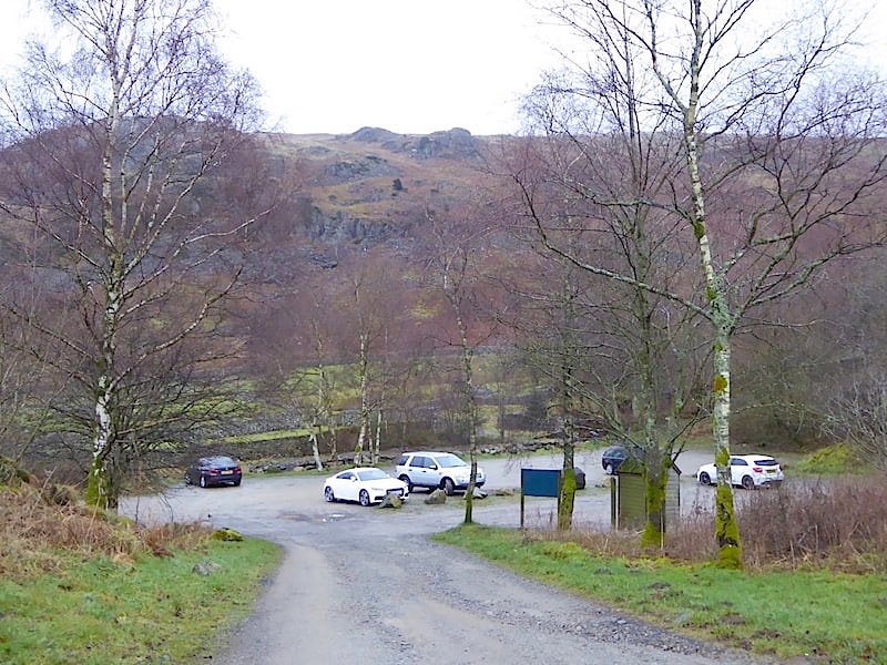
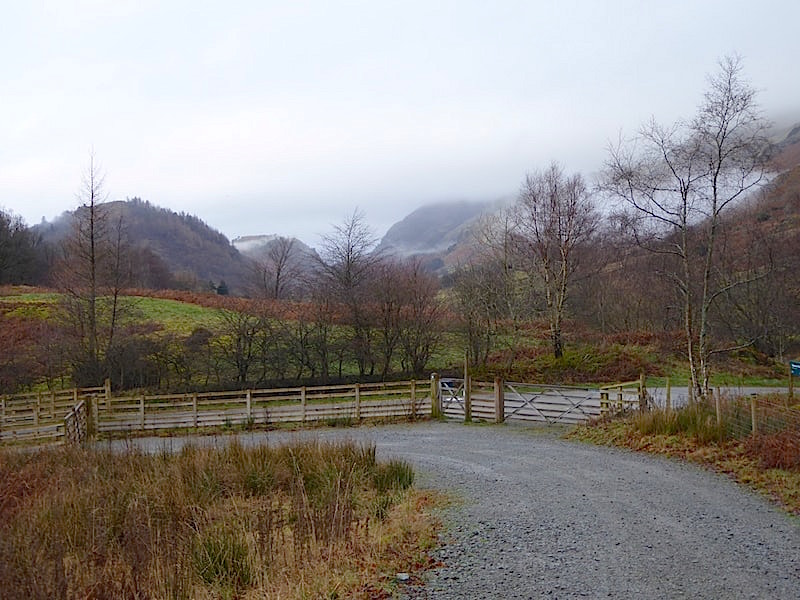
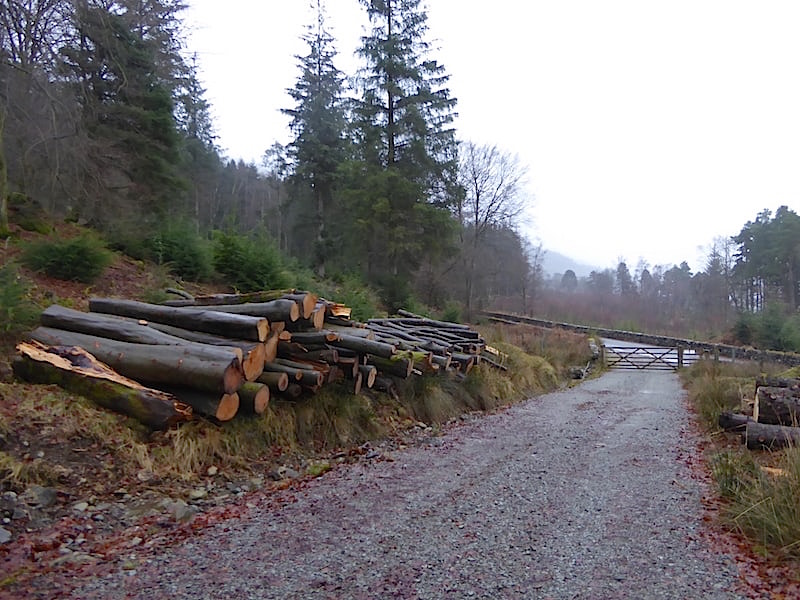
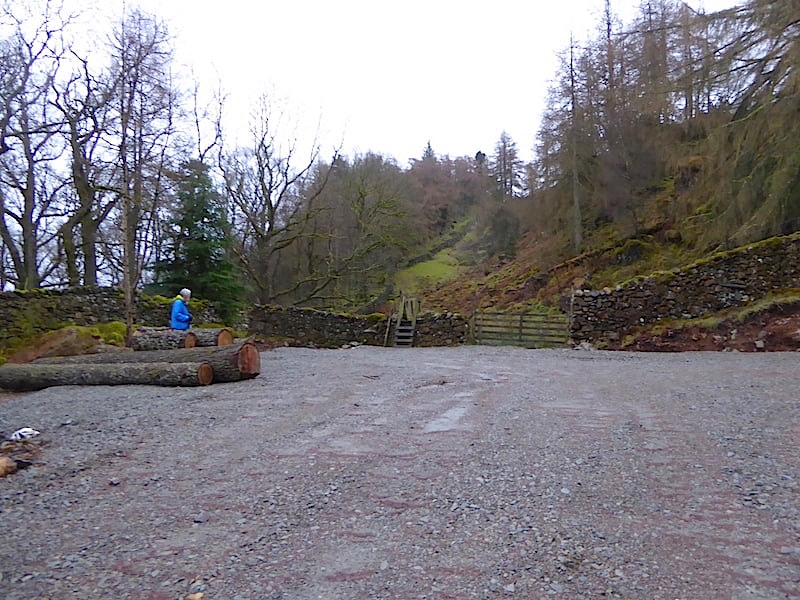
We began by driving into Swirls car park which at present, it is estimated, has a capacity of 36 parking spaces on a pay and display basis.
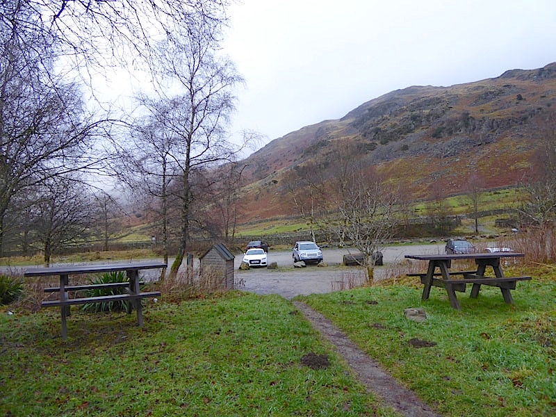
Swirls car park from the picnic area. The plan is to increase the number of parking spaces to 64 with parking bays formally marked out. Presumably this would be the start point for anyone coming to use the zip wire. The picnic area will be moved elsewhere apparently.
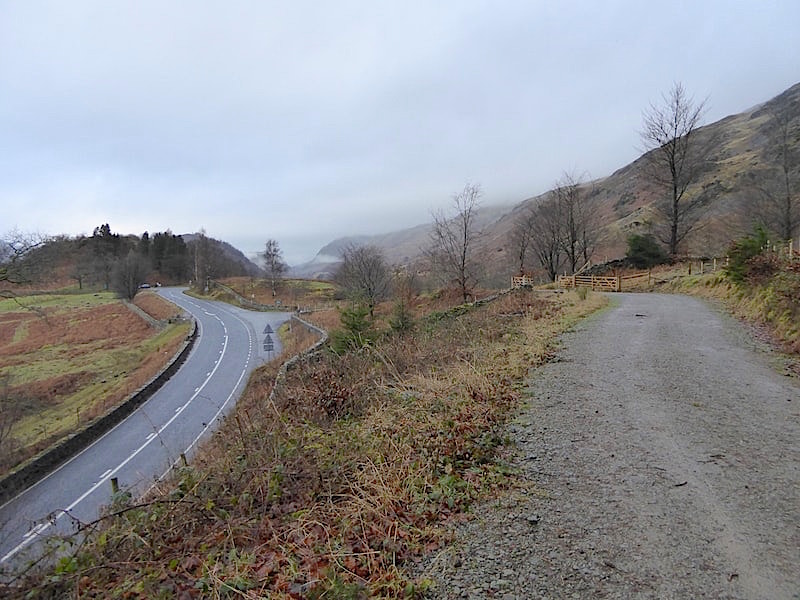
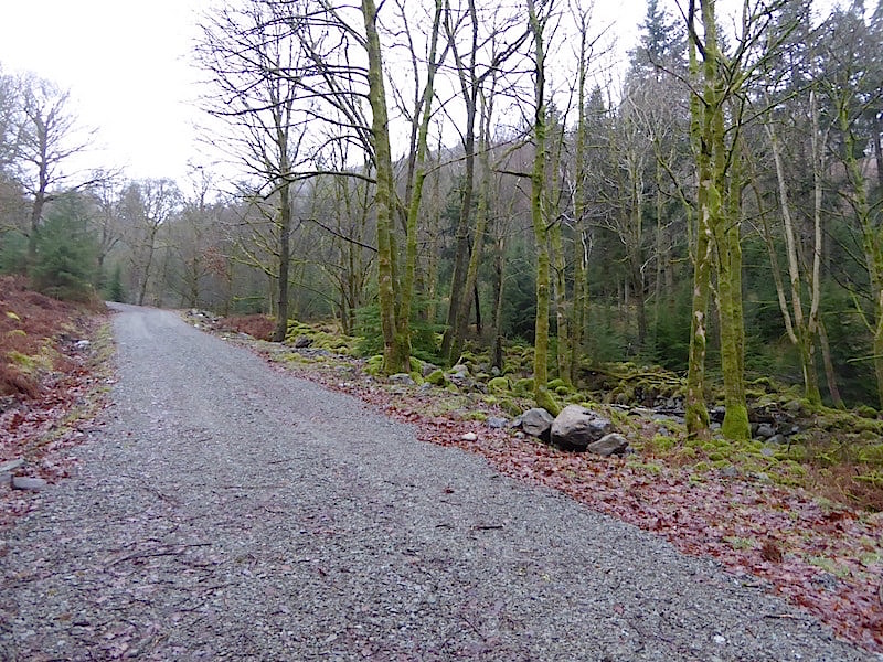
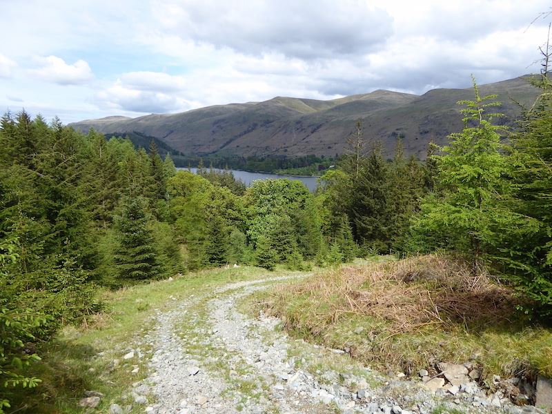
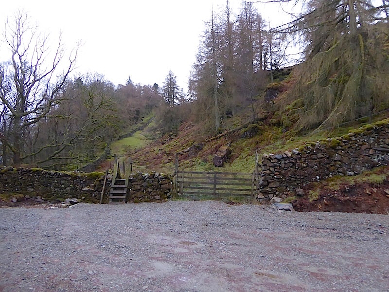
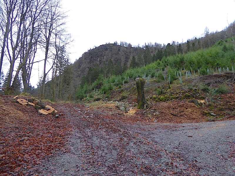
We left the car park, which is over to the right beyond the gate, to walk up this forest track from where I took a look back to the road leading to the car park from the A591 out of shot to the left …..
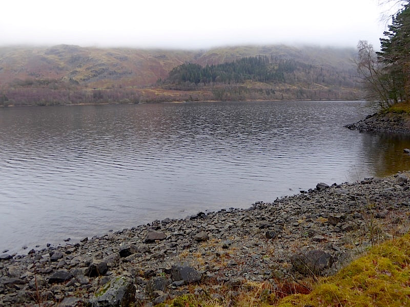
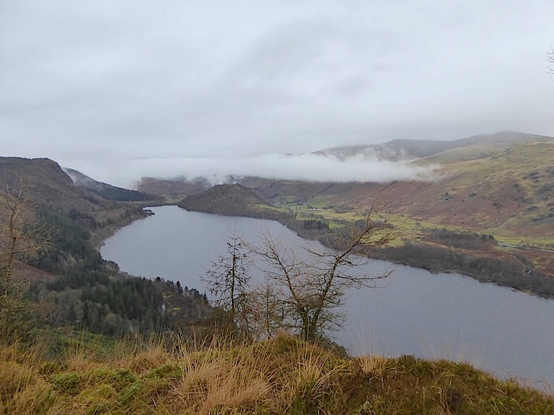
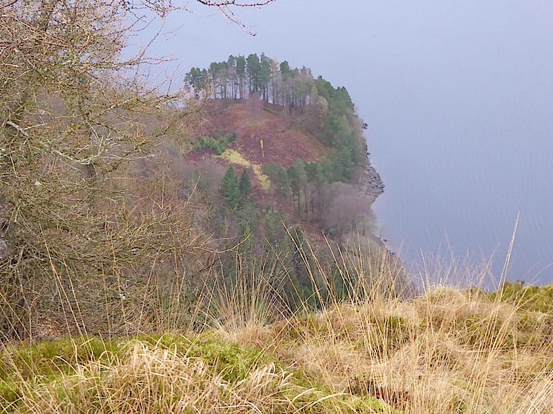
….. and take a look back northwards along the A591 towards Great How on the left of the shot. One of the proposed sets of four zip wires will have its take off point located high up in Highpark Wood, which is out of shot on the right of the photos, and will cross over the A591 and Thirlmere to a landing point near to the Armboth car park on the western side of the water.
So the zip wire from east to west will have participants taking off from the high point of Highpark Wood, suddenly appearing, crossing directly over the line of vision of drivers on the A591 and then continuing across the water to the western shore.
Looking behind us at the view of Fisher Crag, from where another set of four zip wires will carry participants back across the water and the A591 to the landing area on this side of the water.
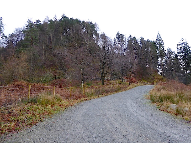
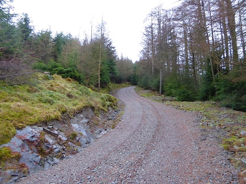
From the plans submitted it is difficult to establish exactly where in Highpark Wood the take off gantries would be sited but presumably, to get the necessary height, it would be somewhere up there. The plans seem to indicate that from the car park, which is in the hollow below and to the left of this forest track, participants would be transported along this track and then turn to the left along a gravel surfaced access track to a turning circle at the end of it. They would then disembark, from whatever motor vehicles had brought them to that point, apparently ‘an army 4×4 vehicle’, and make their way along a boardwalk to the take off area. All of which involves, in addition to the installation of gantries, the creation of a gravel surfaced access track, and a turning circle, going off somewhere to the left of this track, with some some boardwalk provision at the end of it. Apparently this vehicular transport is for all participants not just those with disabilities. We wondered why, when its not a huge distance to walk and get some exercise, it was deemed necessary to provide vehicle transport which will presumably be using diesel fuel and adding unnecessarily to the air and noise pollution.
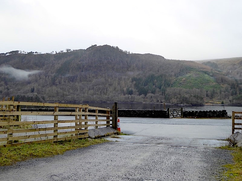
Fisher Crag from the Swirls car park entrance on the A591. As far as we can make out the landing area on that side will be somewhere in the open area just above the short wall across the road. Had the drawings been overlaid onto an OS map it would have been easier to locate the various take off and landing points but they aren’t so we couldn’t.
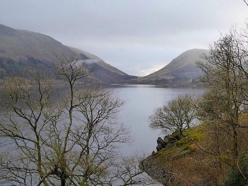
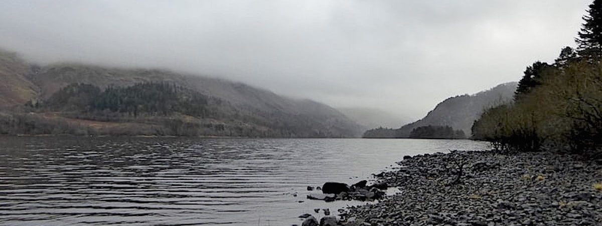
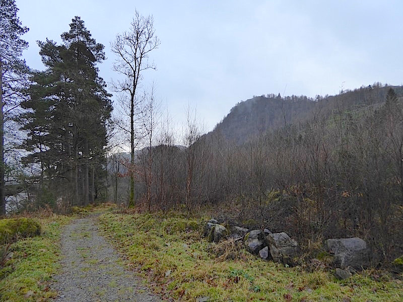
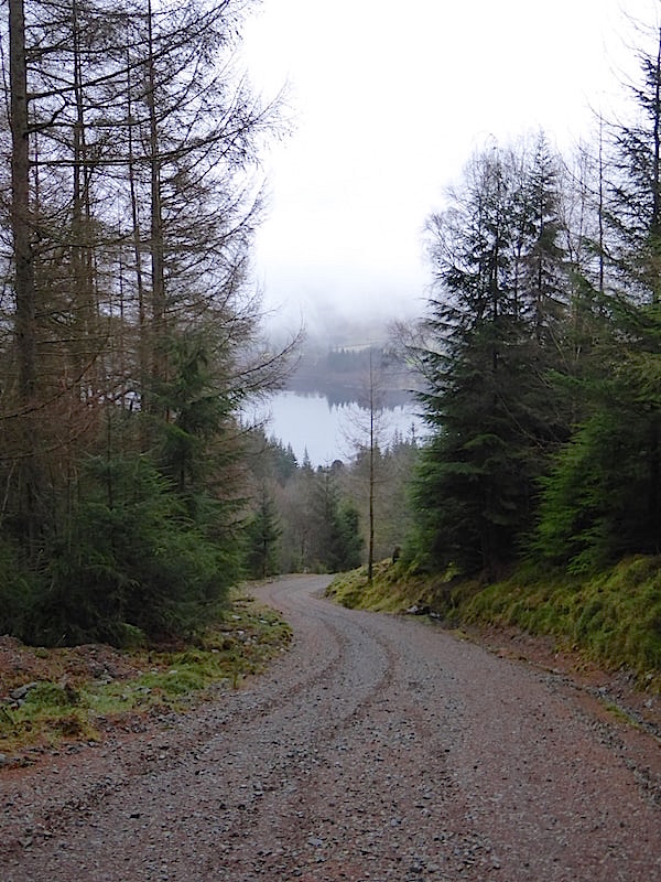
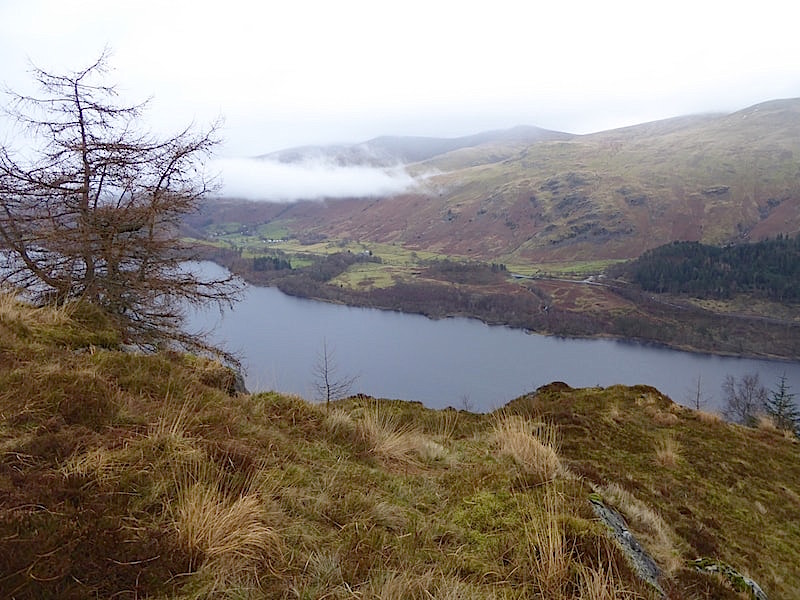
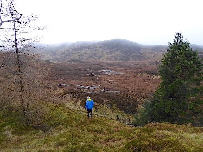
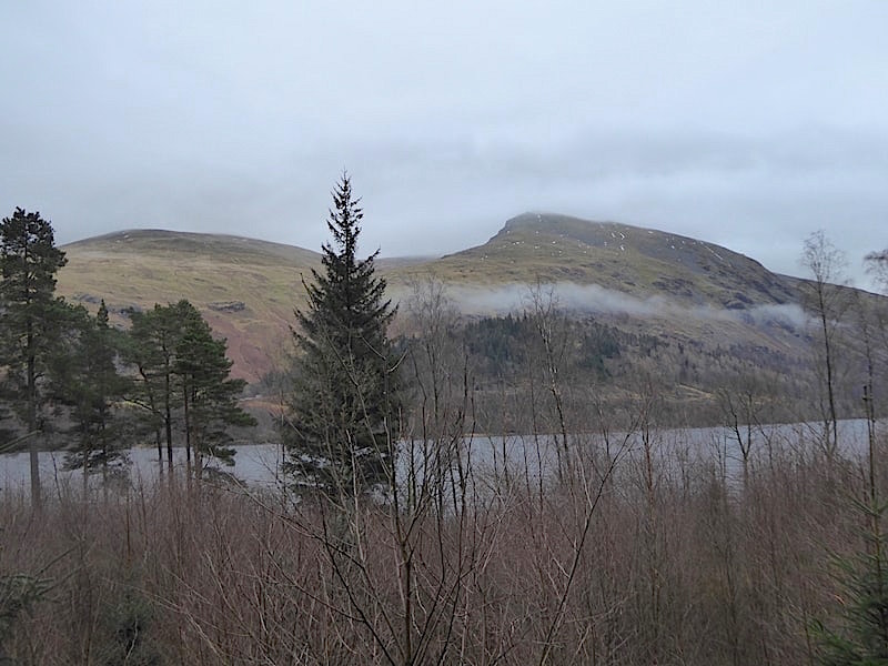
From Swirls we drove over to the western side of the water and as the mist had drifted away temporarily I took this shot looking back towards Dunmail Raise and Steel Fell. Still lovely to look at even on a grey December day.
We parked in the Armboth car park. This has been estimated to have a current capacity of 32 vehicles. The planning application proposes increasing this to 56, again using formally marked out bays and again on a pay and display basis. Accessed from the car park and through a gate, to the right of this shot, is …..
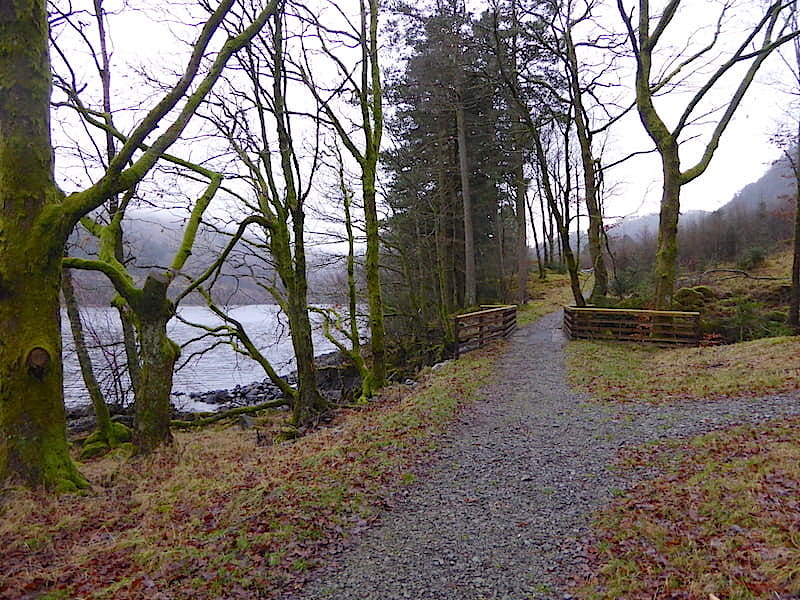
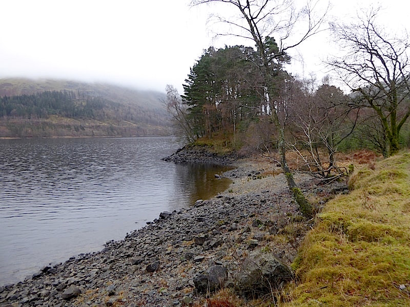
….. this footpath which provides for a peaceful walk along the shore line, and which we follow southwards towards the proposed zip wire landing area.
Further along the footpath Fisher Crag comes into view.
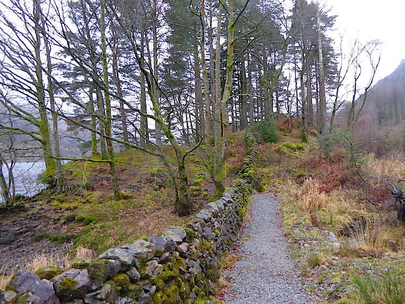
As far as we can make out this footpath will also be used by the zip wire participants as they make their way from the landing area over to the Armboth car park, so it seems that quiet and peaceful walks along here would become a thing of the past. We have been unable to determine whether the footpath will be altered in any way, or whether the ancient dry stone wall alongside it will receive any protection from potential damage.
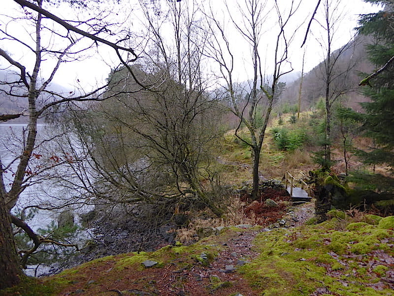
We drop down to the bridge from the path and carry on towards what we think might possibly be the proposed zip wire’s western landing area.
From the little bay we can look directly across Thirlmere to the proposed eastern zip wire take off and landing areas. Highpark Wood, the tree covered hill directly opposite, is where the take off and landing gantries would be located. This would mean that one set of four zip wires and their participants will be heading this way across the water, with the returning set of four zip wires starting from the Fisher Crag area crossing the water back to another set of receiving gantries on the eastern landing area.
Somewhere around here is where the western landing area and its gantries will be sited.
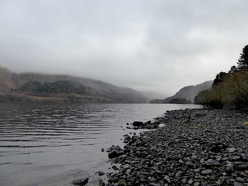
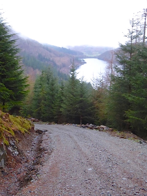
We made our way back along the footpath to the Armboth car park and walked down to the shoreline for this view southwards along Thirlmere. If the planning application for the zip wires is approved then this view in future will have two sets of four zip wires, plus their participants dangling from them, crossing Thirlmere from Highpark Wood on the left over to the Fisher Crag area out of shot to the right. The A591, with its undulations and narrow bends, runs the length of the eastern side of Thirlmere with the obvious, and potentially hazardous, distraction of those using the zip wire in full view all the way along.
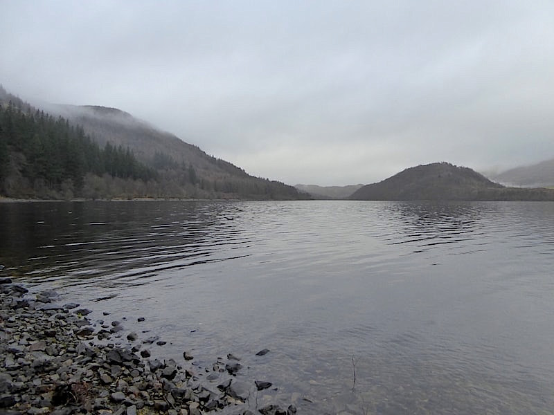
Looking northwards from the same spot and wondering, if this particular planning application is successful, whether the next one would involve stringing more zip wires between Raven Crag and Great Howe.
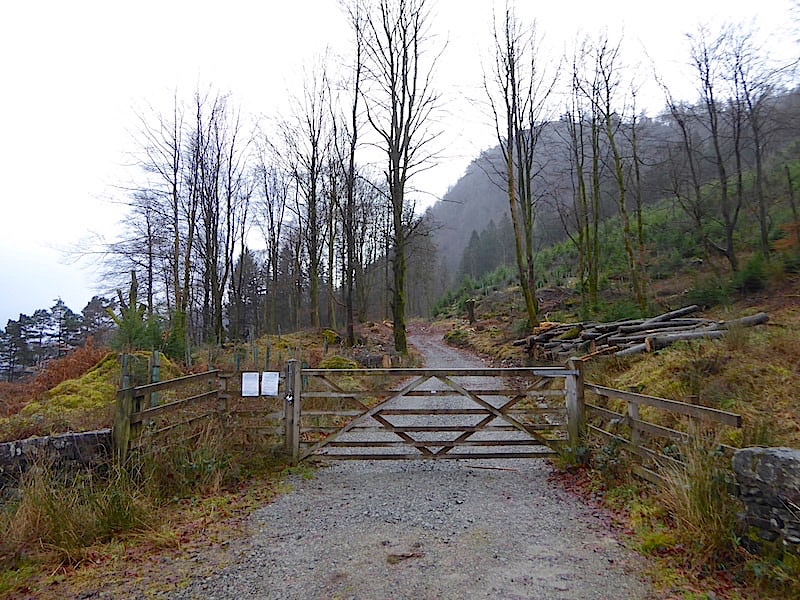
From the Armboth car park we walk the short distance southwards back along the western road to this gated track. The planning application states that, having made their way from the western landing area back along the footpath to the car park, 36 zip wire participants would then be transported in ‘army 4×4 vehicles’ from the car park, along the road and then up to Fisher Crag via this track.
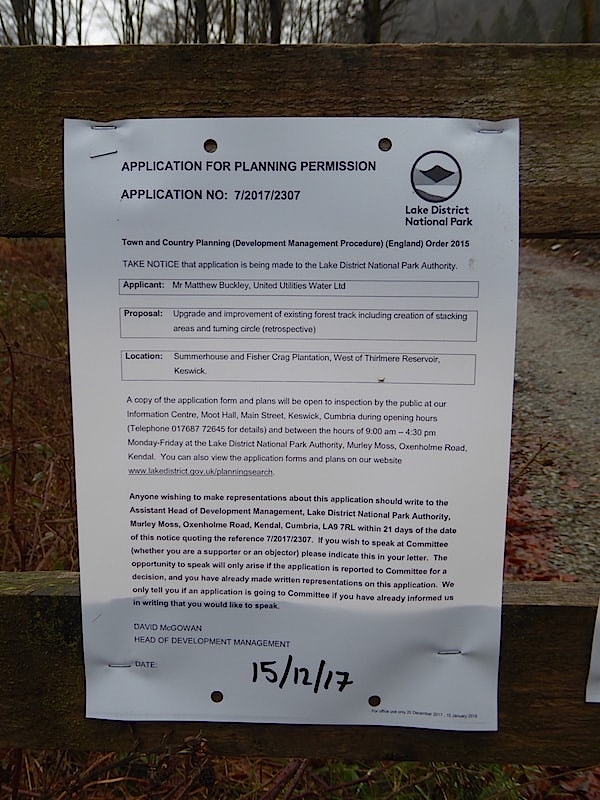
At the gate are these notices. This one, dated 15th December 2017, submitted by United Utilities Water Ltd, seeking retrospective planning permission ‘to upgrade and improve the existing forest track including creation of stacking areas and turning circle’. No mention has been made of widening the track which it certainly has been. As you will see from the following photos this track has been ‘upgraded and improved’ for some time now. Work was already taking place in October and now looks to be complete and you can’t help but begin to question the real reason for the upgrade, especially as the previous track didn’t appear to have had forestry vehicles using it for years. More on that later. For now, it seems as though United Utilities overlooked the small print with regard to track alterations and just carried on regardless. They must have eventually realised, or had been informed, that for certain aspects of the work they did need planning permission, particularly with regard to the direction of some of the water courses being changed, hence the retrospective application for permission. If permission is refused it will be one heck of a job to put things back as they were. If it were you or me we would be told to return things to the way they were and no argument, but United Utilities isn’t just you or me so we’ll have to see what happens.
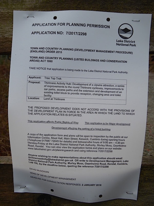
The second notice concerns the Thirlmere Activity Hub application and states quite clearly that it does not accord with the development plan for the area, and that it is a major development which affects public rights of way and affects the setting of a listed building. In which case why is it even being considered?
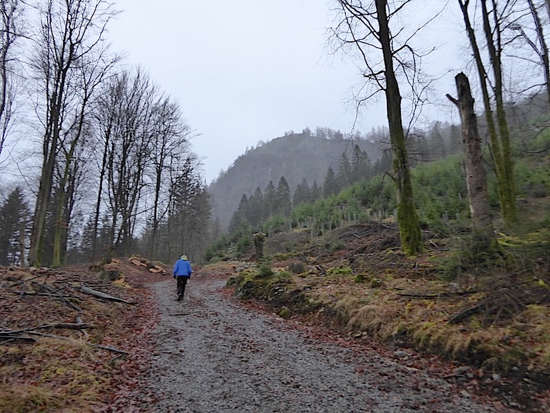
The gate being locked we climbed the fence and continued on up the track with Fisher Crag up ahead of us and considerable evidence of tree felling all around. The track bears round to the right at the bend ahead.
A look back to the locked gate with stacks of felled tree trunks on either side of the tracks, all of which looked as though they had been perfectly healthy prior to felling.
We follow the track round to the right with the copper coloured leaves all around telling us that some perfectly good beech trees have been felled recently, we wondered why that had been necessary. So much for conservation we thought.
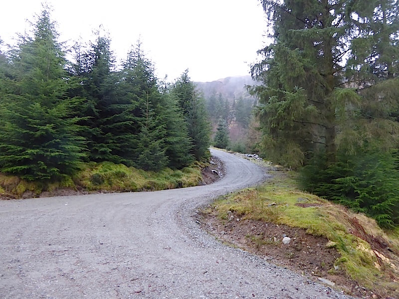
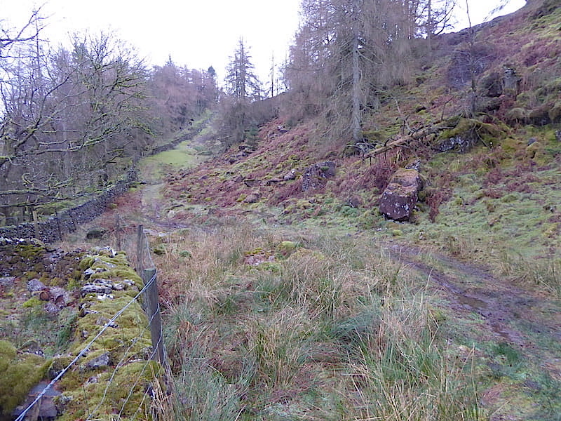
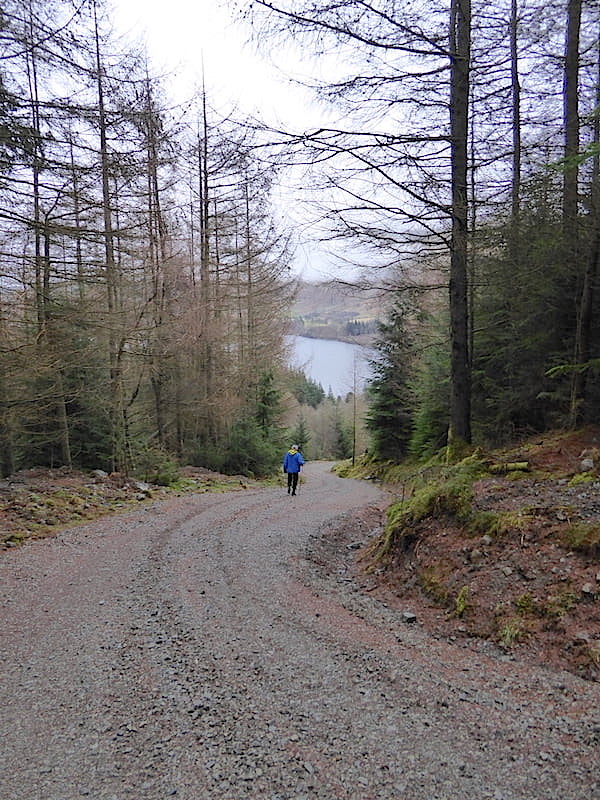
So, here we go up the steadily rising and now, much wider, track …..
….. which at this point runs parallel to and slightly above the road on the western side of Thirlmere …..
….. and a little further along Fisher Gill, on the right, runs down beside it on its way into Thirlmere.
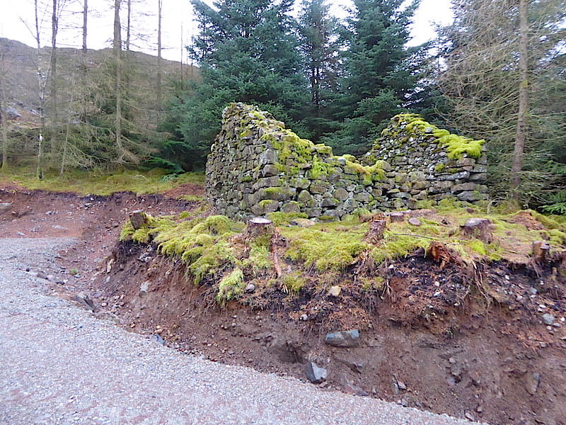
As the track begins to rise more steeply it passes close by the old summerhouse, now a bothy but which once belonged to the long demolished Armboth Hall.
A look back down the track as we continue to climb …..
….. and another look back as we pause for a breather on the steep incline. We walked up here on 22nd May 2016 and below is the same view, more or less, from the pretty much the same spot which I took on the day. It is clear that the old track has been widened considerably so it would seem that those proposed ‘army 4×4 vehicles’ must need quite a bit of space …..
Onwards and upwards …..
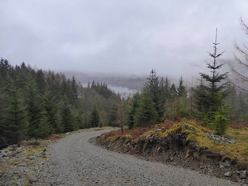
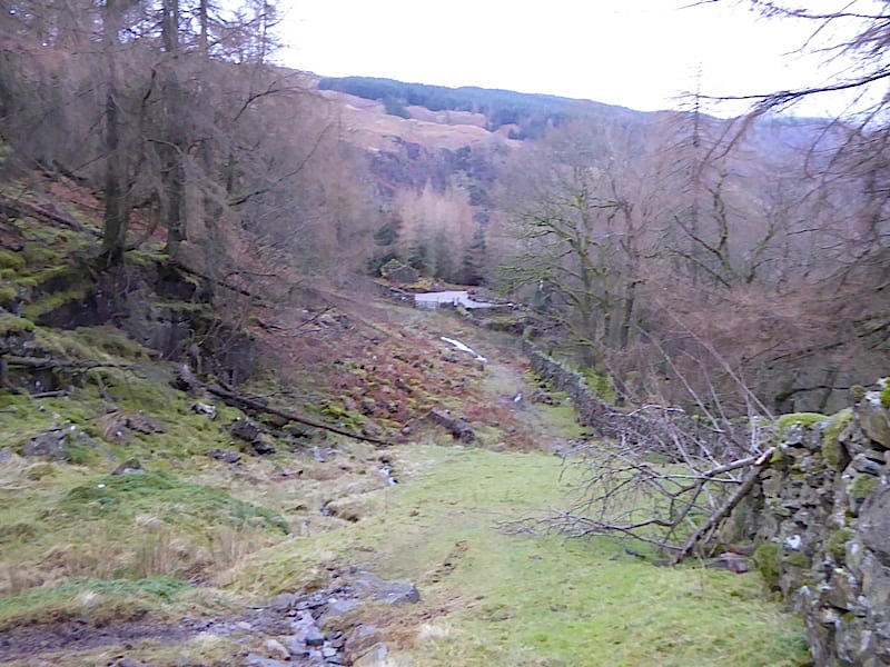
….. with another look back down the steeply rising track with a glimpse of Thirlmere below us.

Another view of Thirlmere from a rough area of bulldozed stone and rubble haphazardly shoved over to the side of the track.
Another look back just before we reach the turning circle at the top of the track. The roughly gouged out ditches at the track sides we assumed to be what constitutes drainage, you’d think a water company could come up with something a bit better wouldn’t you? When you have seen the results of a few days of rain running down the fell sides into the becks and gills and then over and under tracks and footpaths you begin to wonder what sort of a mess this will turn into. You also begin to wonder about the weight of those ‘army 4×4 vehicles’ with their 36 passengers and the effect they will have as they constantly move back and forth along the track. They will also need to be very large vehicles to accommodate that number of people, and very rugged to be able to negotiate this steep a track, are we talking troop carrier type transport here?
Beyond the last steep rise the area flattens out into this turning circle …..
….. which has been completely transformed from how it was back in May 2016. Below is a photo from that walk which shows the previous grassy area which began where the old track petered out and then continued over to the wall and the stile …..
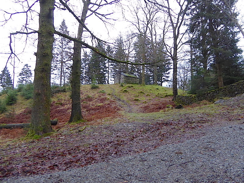
This old building stands to the right of the turning circle as you approach it and the ground beneath it has been excavated to such an extent that it is likely to crumble away and eventually reduce the building to nothing more than a pile of rubble.
The view of the old building as you approach the turning circle. The vehicles transporting zip wire participants will turn around here, passengers will disembark and cross over to a proposed boardwalk and make their way to the take off area located somewhere around Fisher Crag. Once again we found it difficult to establish from the submitted plans exactly where the take off area will be. How many of the 36 passengers from every trip up here will decide to go and look inside this building and further trample the fragile foundation it has been left with?
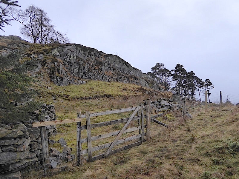
We cross over the stile and make our way upwards towards Fisher Crag. The submitted plans seem to suggest that the proposed boardwalk will be situated on the other side of the wall to where I’m standing although the exact route has yet to be agreed apparently. There will be ‘golf buggy’ transport available for anyone with mobility difficulties. From here it looks as though quite a bit of tree felling will be needed if a boardwalk wide enough and tough enough to take a ‘golf buggy’ is to be provided.
A look back to the turning circle as we continue on up to Fisher Crag.
Just below the summit of Fisher Crag.
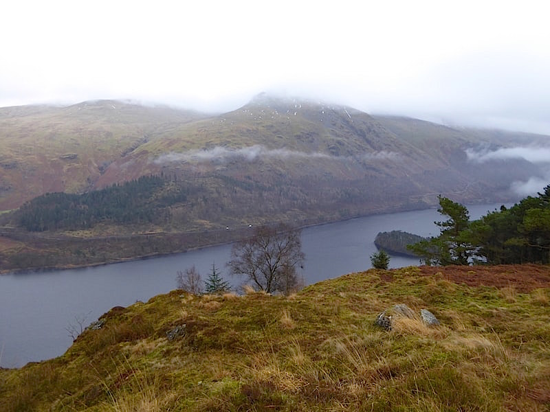
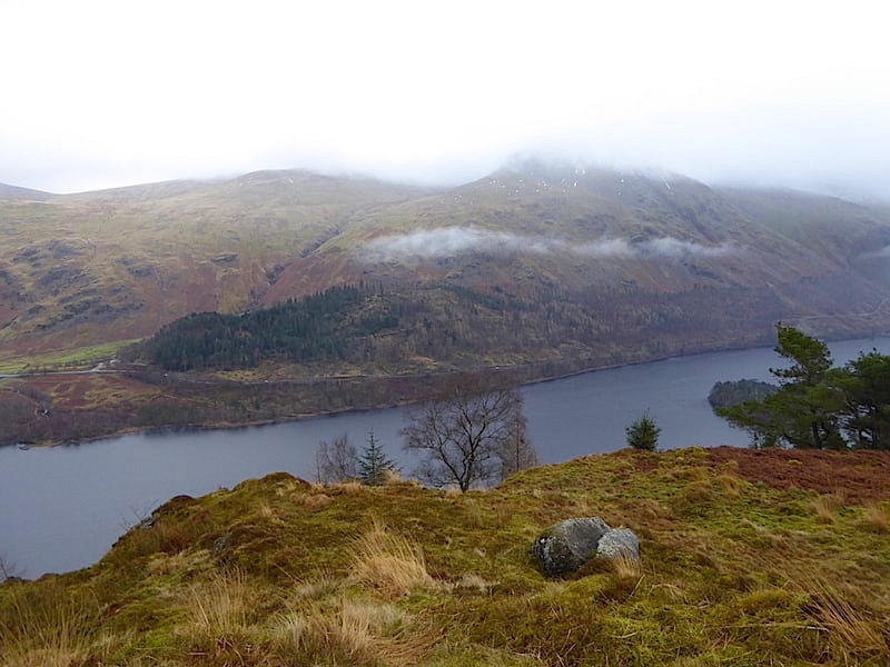
From the summit of Fisher Crag a view across Thirlmere with Highpark Wood to the left of the shot, just above Thirlmere, and Deergarth How Island in Thirlmere below us to the right. Again we couldn’t pinpoint the exact location of the zip wire take off area but from the plans the return wires appear to pass to this side of the island and reach the eastern landing stage at a point somewhere above the road, where the two white vehicles are, but below the forest track which you can see above them. This would indicate that the take off area would be somewhere over to the right of this shot. Once again the zip wire participants will conclude their journeys fairly low down and in the full view and direct line of sight of the drivers on the A591.
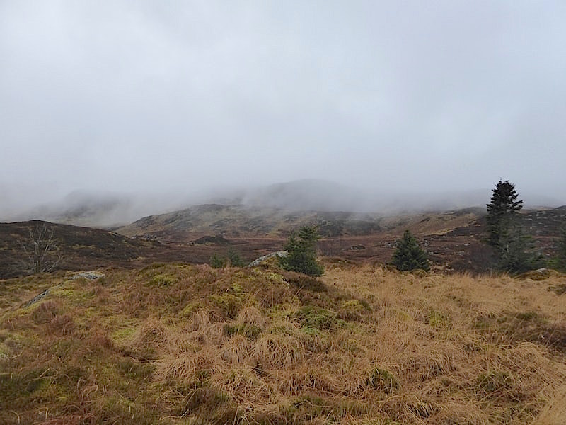
Behind us the low cloud and mist swirls around obscuring all but the nearest high points of our surroundings.
To our right we can just see Deergarth How Island jutting out to the left of the stand of trees below us. The plans appear to indicate that the take off gantries will be located in existing woodland so maybe that is the woodland which is being referred to. The mist is creeping back down towards us once again and adding its own unique contribution to our tranquil surroundings.
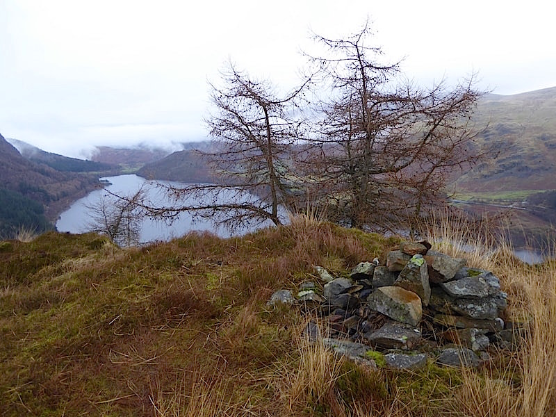
The view northwards from the summit cairn on Fisher Crag …..
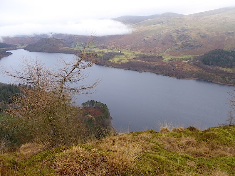
….. and a longer view of Thirlmere from a few paces north of the cairn, the ribbons of cloud and mist adding an extra dimension to the ‘other worldliness’ of this wild and beautiful landscape. The shoreline to the left would house the proposed western landing area for the set of four zip wires if the proposals are given the go ahead.
Highpark Wood, over on the extreme right, will be the site of the proposed take off and landing areas on the eastern side of Thirlmere, and should planning permission be granted then future views from this point would include one set of four zip wires, with their participants dangling beneath them, crossing the water from those trees across to the landing area on the western side, as shown in the previous photo.
Over to my right the second set of four zip wires would return participants to the eastern landing stage which is proposed to be located somewhere on the fell side just below the beginning of the ribbon of cloud hovering above Highpark Wood, so future views from this point would also be compromised.
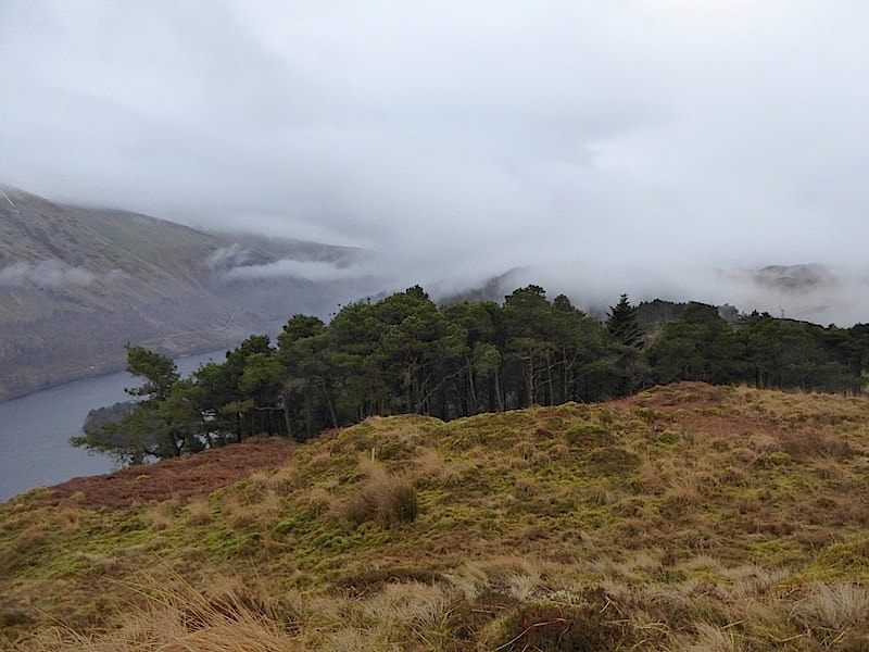
Immediately below is the little promontory area above which we think is the proposed western landing area for one set of zip wires.
A closer look at the little bay and its promontory.
After much discussion about the various site locations and their potential consequences we leave Fisher Crag and return to the fence and the footpath just beyond it …..
….. and make our way back to the turning circle.
Back down the quite steep track with its roughly hewn ditches on either side of it.
A look back at Fisher Crag as we reach the bend in the track and walk the short distance back to the road on the western side of Thirlmere. Was it absolutely necessary to fell that tree towards the centre of the shot?
Walking back along the road to the Armboth car park with the view of Highpark Wood and Brown Crag across Thirlmere constantly reminding us of this planning application and its zip wires proposals, and we return to the car deep in thought. I hope that the photos and accompanying text go some way to explaining what is proposed and some of the possible consequences. As more information has been submitted to the Lake District National Park Planning Department the date for submissions regarding this application has been extended to 12th January 2018. Having studied the planning application and visited the proposed sites we will be submitting our responses in due course. If you would like to know more then these links may be helpful –
To view the planning application in full on the Lake District National Park web site click on –
To view the responses from St John’s, Castlerigg and Wythburn Parish Council click on –
stjohnscastleriggwythburnparishcouncil.org.uk
and here are a few other sites you may wish to view –
https://www.friendsofthelakedistrict.org.uk/Pages/Site/thirlmere/Category/thirlmere-zip-wires
https://www.thebmc.co.uk/bmc-objects-to-proposed-zipwire-development-at-thirlmere
Thank you for taking the time to view our walk report.