
Winder, Arant Haw and Crook
Walk date – 6th May 2026
Distance – 5.5 miles
Weather – sunny with fair weather cloud, but the chilly easterly breeze kept the temperature down
We went to Sedbergh today to take a short but steepish walk up Winder and Arant Haw. When we arrived at the car park several market stalls had been set out which in turn reduced the amount of parking spaces available. Big sigh from our driver but we found a space eventually. J went over to the machine and paid for the car park ticket after which we set off through a quiet market scene and a very quiet Sedbergh.
Route
Sedbergh car park (pay & display)- Howgill Lane – Lockbank Farm – path to col between Winder and Arant Haw – Winder – Arant Haw – Crook – Settlebeck Gill – Dales High Way – Joss Lane – Sedbergh car park


Walking along Sedbergh’s main street towards Howgill Lane. Even though the market was on there were very few people around and there wasn’t a sound anywhere, we weren’t even that early either. We named it Silent Sedbergh today. The shop with the green awning sells fruit and veg so their business might have suffered a bit today as there was a stall in the car park market selling just the same sort of thing and which had a lengthy queue of shoppers. Bet the shopkeeper is not very thrilled about Sedbergh’s Wednesday morning market!

We turned off the main street and walked up Howgill Lane until we came to this junction leading to Lockbank Farm where we turned off and began walking up the lane towards the farm. We always seem to forget that the lane gets steeper as it gets closer to the farm! As we paused for breath in the farmyard the farmer, who was swilling the mud off his boots, told us that it catches everyone out and ended up saying “and you’re buggered before you’ve even got started!”

Having got our breath back we made our farewells to the farmer, who wished us a good day in return, and made our way through the gate and up the stony track to the next gate. Having passed through the gate we were on the track leading along up to Winder. It doesn’t get any less steep.

We turned left onto the track above Lockbank farm and kept to it until we reached the point where we needed to double back on ourselves and begin the walk up Winder.

After more steep climbing we eventually reached this flatter section where we paused for a look back. A cyclist was coming towards us fairly quickly down the incline and when he reached this point he hit the brakes and descended very slowly. We’d only been walking a few minutes up to this point and already the houses down in the valley look quite tiny so its a steep initial climb.

Looking down across the valley and Sedbergh as the path we were following levelled out a little.

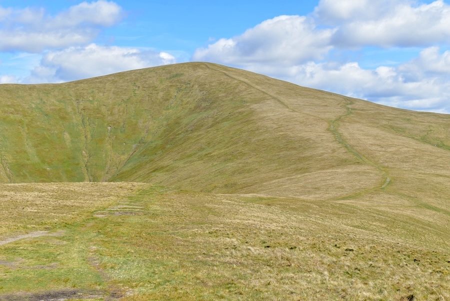
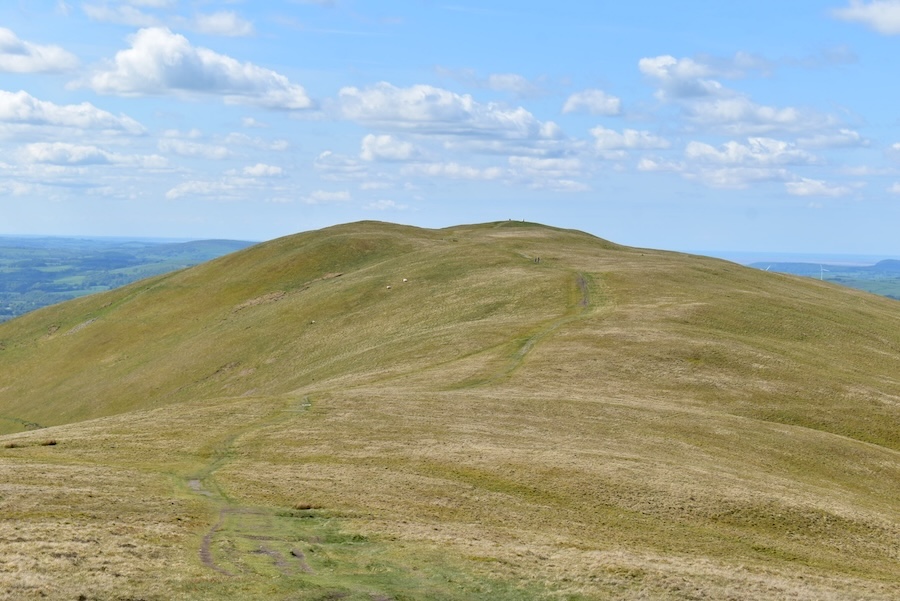
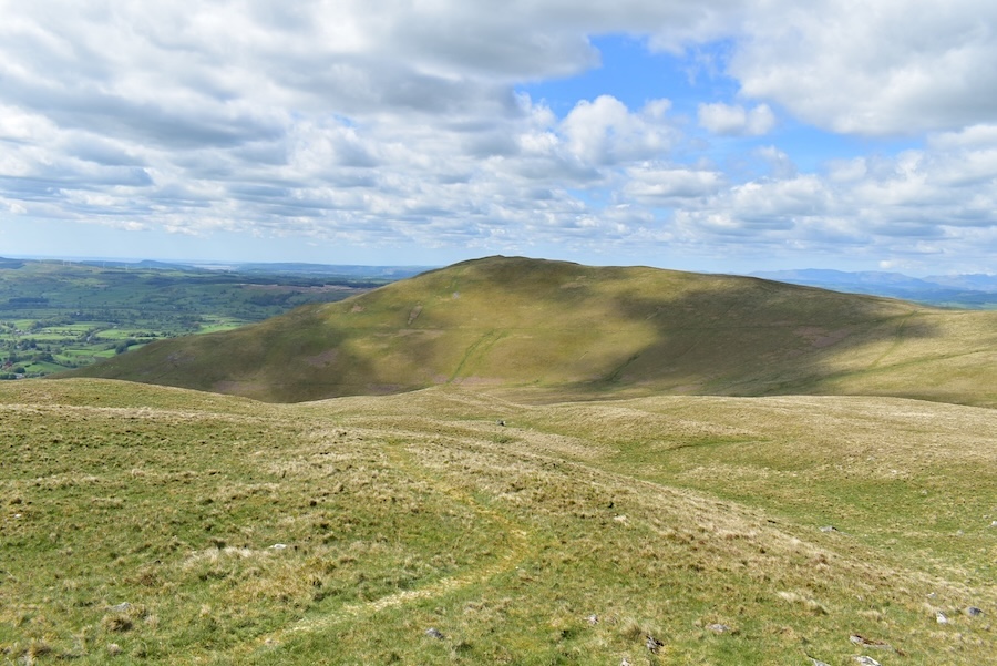
The view ahead as we walked along. There are several paths going off to the left all of which lead up to the top of Winder so anyone in a hurry could use one of those. We weren’t in a hurry so we ambled along this path …..

….. and as we ambled along we noticed these three fell ponies on the fellside above us who did seem to be in something of a hurry and by the time I’d got the camera focussed on them the legs of two of them had already disappeared as they scampered across the slope.

At this point the path divides and becomes two separate ones although it doesn’t matter which one is chosen as they both become one path again a little further on …..

….. and were almost at the point at which the two separate paths become united again.

Winder’s skyline view …..

….. and the view ahead of us as we make our way over to the col between Winder and Arant Haw over on the right. Lots of ‘plane trails above us, again!

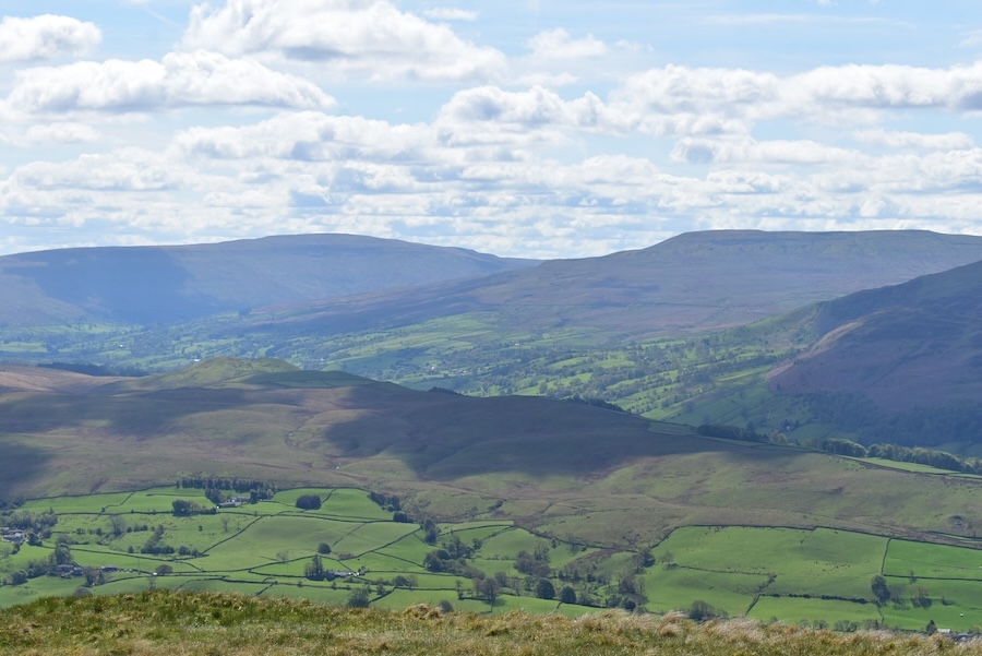
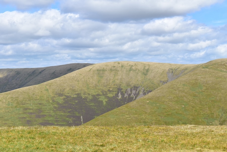
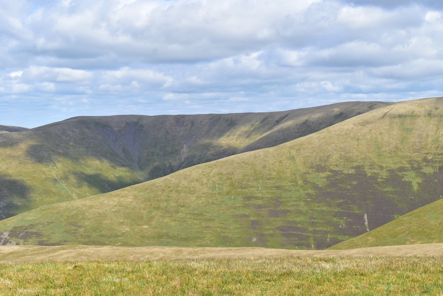
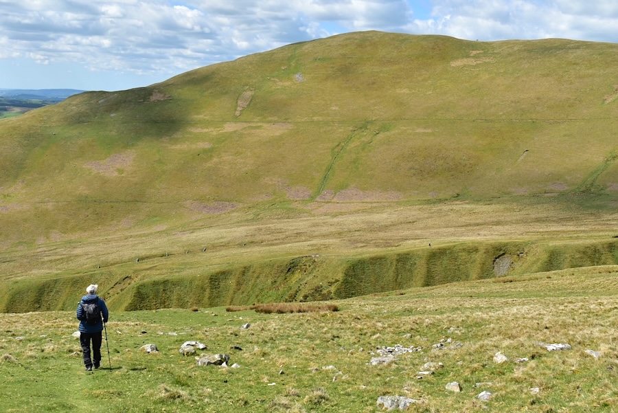
Looking across Settlebeck Gill, which will be our return route, towards Wild Boar Fell (R) and Nine Standards Rigg (C) on the skyline. I think the fell on the far left of the shot might be Aye Gill Pike, although I’m not absolutely certain about that.

We reached the col via the little path at the bottom of the shot and from where I took this view of Crook across Settlebeck Gill.

We made our way up to the col and then turned left and made our way over to the summit of Winder. It looks a long way off but the walk across the gently undulating ground doesn’t take very long,

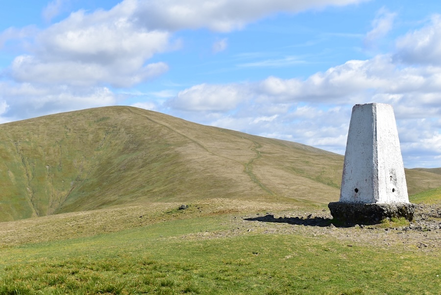
The topograph and white trig column on Winder summit.

The topograph indicates what can be seen from Winder’s summit and because they were in our view I took this shot of the information on it. The Langdale Pikes are 25 miles away, Coniston Old Man is 24 miles away and below that, although I didn’t manage to include it, was Black Combe 22 miles away …..

….. and, although its a very hazy view, here they are, Black Combe just above the trig column, right of centre are the Coniston Fells and towards the right of the shot are the Langdale Pikes plus their neighbours.
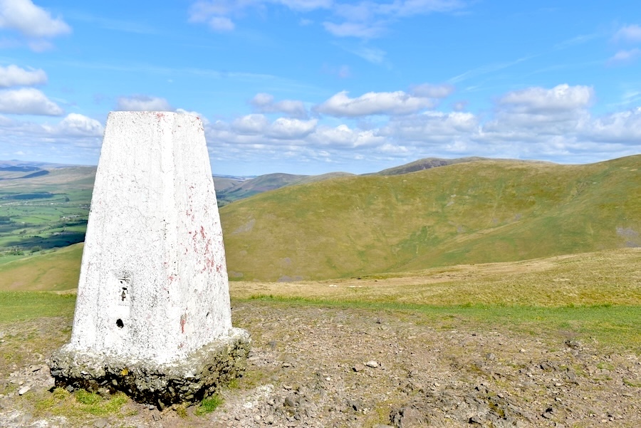
Arant Haw from the trig column …..
….. Bush Howe peeping up behind the lower slopes of Arant Haw …..
….. and Nine Standards Rigg and Wild Boar Fell on the skyline. While we were up on Winder top we dropped down a little way from the summit, and out of the nippy east breeze, for a chocolate bar break in readiness for …..
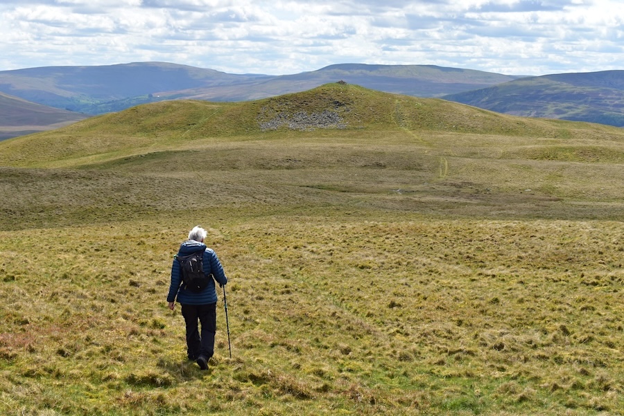
….. our next target of Arant Haw. The topograph indicated that it was one mile away from Winder summit. It felt more like ten by the time we’d got up there though. After we’d crossed the col and began to climb we kept to the path on the left going straight up to the summit.
A look back to Winder from the climb up Arant Haw. There are two people descending Winder but it will need a zoom in to see them. Apart from them there was no-one else around at the time. When we reached the last, and steepest, part of the climb I looked back and noticed something below us. I asked J if he thought it was another walker but he thought it was only the sign which indicated the spot at which the path split into two parts. I kept looking back just to make certain and the ‘something’ eventually turned into another walker who was absolutely steaming up the path behind us. He eventually caught up with us when we stopped to give my, by now, painful calf muscles a rest just a short distance below the summit. He stopped too and had a chat with us, mostly about the dry weather and where we were heading. When he asked if we were going on to The Calf, the highest point of the Howgills, we replied that Arant Haw was the highest point we were reaching today. He mentioned that this was his favourite walk and after a bit more chat he went on his way. We watched him cross over towards Rowantree Grains, where walkers get a bit of a break before the stiff climb up Calders, which is only 2 metres lower than the high point of The Calf. I’d need another couple of hours than J had paid for back at the car park, minus today’s easterly breeze, in order to do that walk, I thought.

From the summit of Arant Haw (605 metres) a close up look straight across to Calders …..
….. a shot to the left of the previous one showing Bram Rigg top on the centre skyline …..
….. followed by another slight turn to the left for this view of The Calf and its long ridge walk to the summit. Naturally, the highest point was covered by cloud shadow by the time I got to it!
From Arant Haw’s summit cairn I pointed the camera towards the northwest for a view of Fell Head …..
….. followed by another view of The Howgills’ big three, from left to right on the skyline are The Calf (676m), Bram Rigg Top (672m) and Calders (674m).
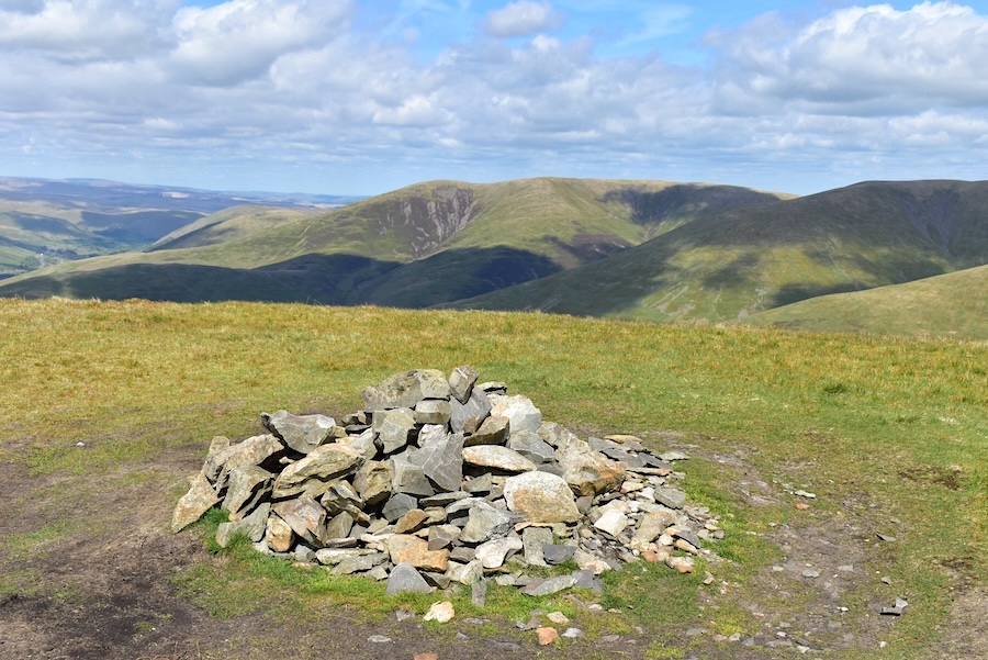
The chilly breeze on Arant Haw didn’t invite lingering so we headed back down and eventually crossed over the dry as a bone ground to Crook, which we reached in 30 minutes …..
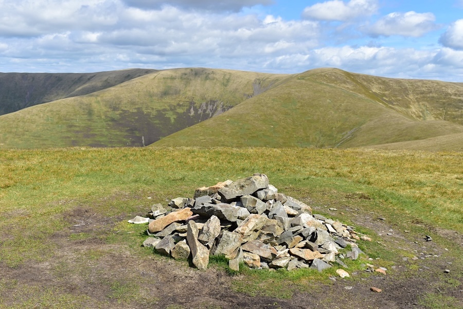
….. and a look back to Arant Haw from the huge cairn on Crook …..
….. with another look back at it once the cloud had cleared from the top.
Once again the nippy breeze didn’t invite any lingering so we followed a path heading west towards Winder and Settlebeck Gill.

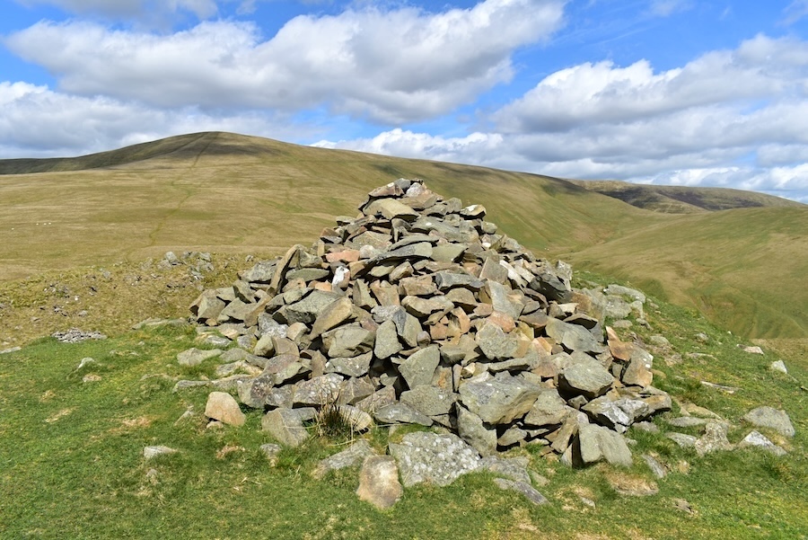
A look back at the two peaks of Crook which are only separated by a very short strip of ground. The lower one probably explains the size of the big cairn on the highest point as it was covered in stones from one end to the other.
Approaching Settlebeck Gill with Winder in the background. The sides of the gill looked fearfully steep as we approached …..
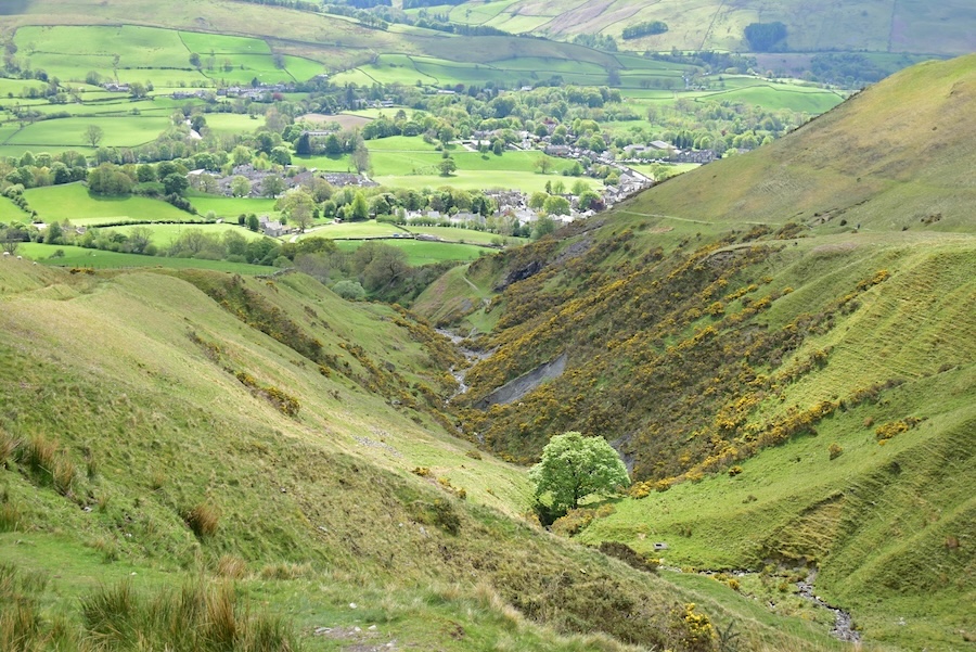
….. and when we were closer to the gill they were even steeper than they had looked. As we looked along the length of the gill I decided to take a shot of it, just as a cloud covered the sun which, of course, dulled the bright yellow gorse which had been one of the gill’s stand out features. Sedbergh, on the other hand, remained in the sunshine.
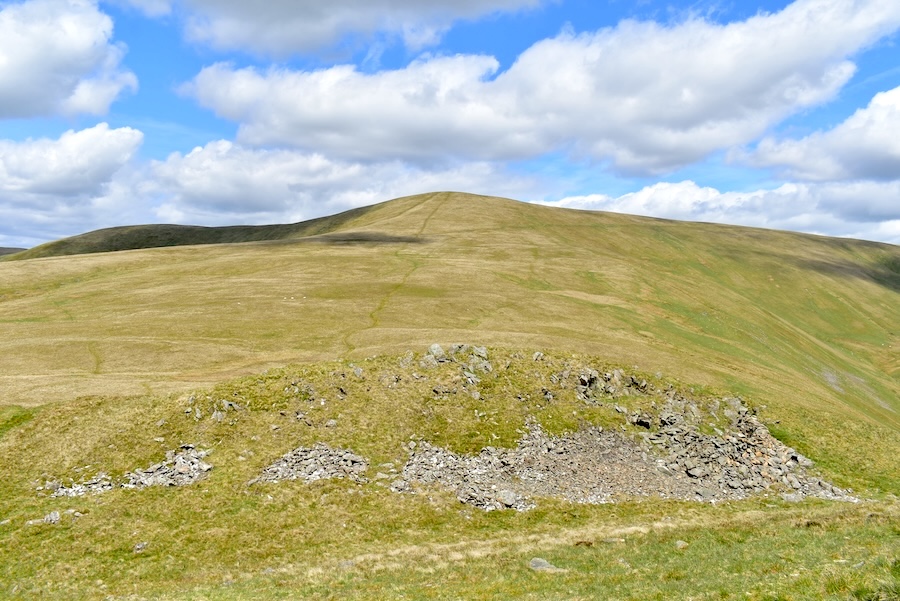
The path we were on continued along but we turned off it and descended very steeply down towards the gill crossing.
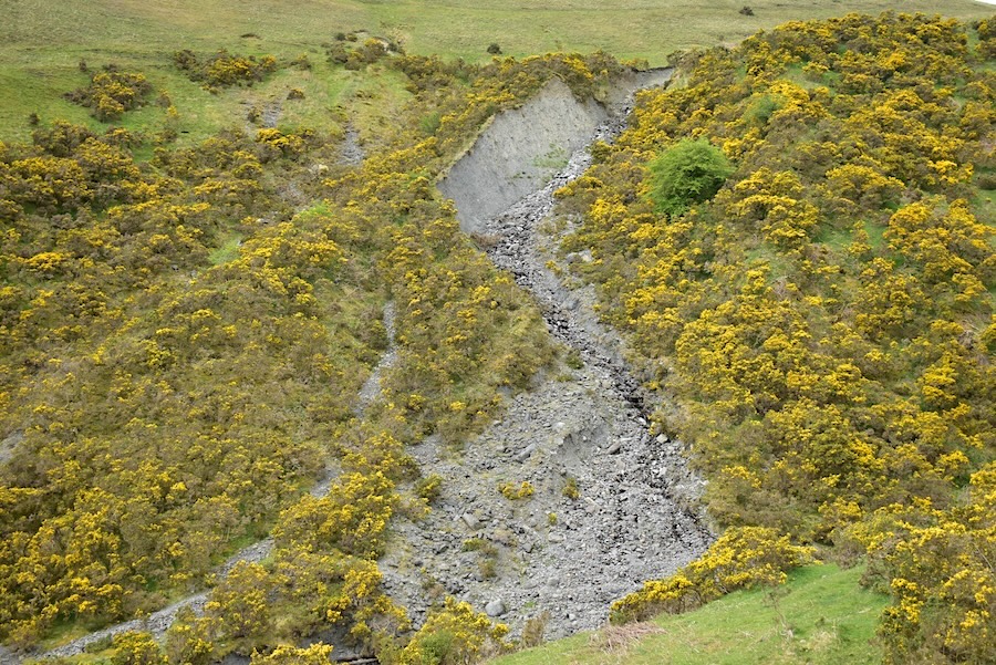
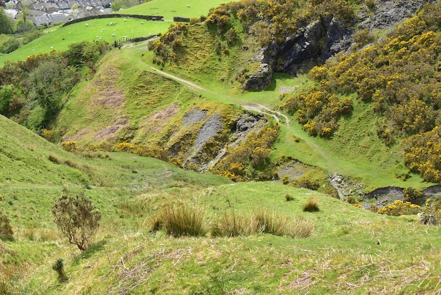
This landslip caught my attention as we descended but the yellow gorse flowers were still muted as we were still under a big cloud.
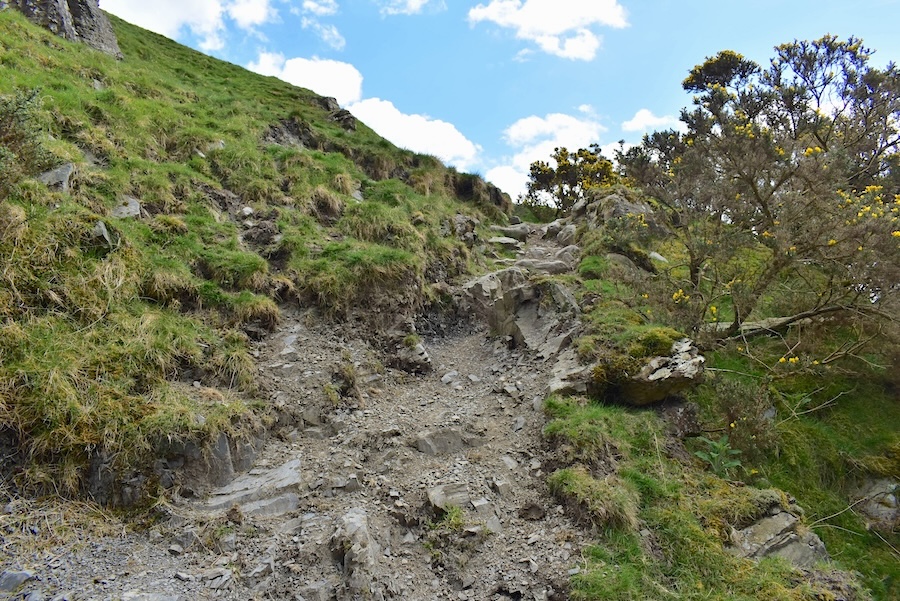
The very last part of the path as we made it down to the gill crossing, it was very steep, very loose and slithery and full of hazards just waiting to trip you over. Watch where you’re putting your feet, AW’s motto, was never more appropriate than when coming down here.

Crossing Settlebeck Gill and from a distance the descent path doesn’t look too bad …..
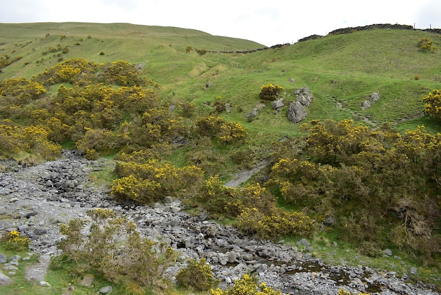
….. and, before we continued, I took a look back at the beck, the crossing and Sool Bank, on the left, which forms the lower part of Crook.

From the crossing we took to the Dales High Way path on the other side of the gill which eventually crossed the fields above Sedbergh and finally led us out onto Joss Lane and right back to the car park in Sedbergh. The morning market, which is only there until lunch time, had packed up and gone with just one stall holder still packing stuff away in the car boot, and we still had 30 minutes left on the car park ticket. Shall we have our sandwiches and coffee in the car? Might as well as its a longish drive back home. So that’s what we did. Sedburgh was still silent too.