Stony Cove Pike, Caudale Head (John Bell’s Banner) and the Atkinson Memorial

Walk date – 30th April 2025

Distance – 6 miles

Weather – sunny, very warm, occasional light breeze, extremely hazy


The sunshine was already giving rise to a very warm morning despite the thin haze of ‘artificial’ cloud that was already in the sky, and being added to by the chemtrail ‘planes which were out in abundance today. We have noticed an increase in that particular activity since the recent government announcement that it had decided to begin geo-engineering experiments, as if we hadn’t noticed that it has been happening for years now. Maybe that decision has been made because too many people know that it is happening so they’ve decided to ‘come clean’ about it all, although the government website still refers to them as ‘contrails’ which are quite different to what is actually being sprayed on the earth. There’s no point in my ranting about it because they’ll carry on doing it anyway and none of the earth’s inhabitants have any choice about breathing in whatever is in the air. I have only one word for them and although I won’t repeat it here, it begins with B, ends with S and has six other letters between them. The answer will no doubt come easily to readers.

Having got that off my chest let’s turn to today’s walk instead. In addition to being a very warm day there was little by way of any breeze although we did get the occasional movement of air from time to time which was more than welcome. It was a perfect spring day for being out on the fells but not such a good day for views and long distance photography as there was too much haze to see anything clearly. Nevertheless we had an enjoyable walk across dry ground over a fell that we haven’t visited for quite a few years.


Route

Kirkstone Pass – St Raven’s Edge – Pike How – Stony Cove Pike – Caudale Head – Atkinson Memorial – Pike How – St Ravem’s Edge – Kirkstone Pass

We started out up the path from the Kirkstone Pass Inn but we hadn’t walked very far when J decided to go back to the car park and check whether he had locked the car or not. He had locked it as things turned out but while I was waiting for him to return I took the above shot of our first objective, St Raven’s Edge.  Too many shadows to see it very clearly but the best that could be obtained at the time as the bright sun was just behind it and thus casting many shadows.

I also took this one looking down the Kirkstone Pass towards Place Fell, as can be seen the long distance views were very indistinct today.

Once J rejoined me we set off up the path, negotiated the couple of short scrambles and made our way over to the huge pile of stones which forms the summit cairn. Looks as though someone with artistic tendencies has had a go at creating a more interesting stone sculpture on the top of it.

Once we reached the cairn I decided that a change of clothing was necessary as I was too warm to continue any further in the 3/4 cropped trousers I was wearing. I had packed my shorts just in case that might turn out to be the case so those went on instead. Instant bliss! J did not have his shorts with him so had to settle for rolled up trouser bottoms instead. The above shot was taken after my change of clothing and looks south towards Wansfell Pike.

Setting off along the path leading up to Stony Cove Pike and as we got closer to the rocky hump ahead of us we could hear a voice. It turned out to be a chap who, by the time we reached it, was standing on the very top of the hump and talking to someone on his phone. Perhaps that was the only place he could get a good enough phone signal.

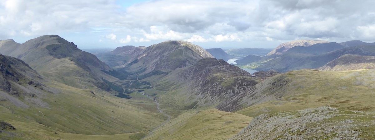
The murky silhouette of Froswick, Ill Bell and Yoke behind the craggy hills above Woundale which are occupying the middle foreground.

We start to drop down from St Raven’s Edge while wondering if all the usual soggy, squelchy spots have benefitted from the dry spell we are still having. But …..

….. we needn’t have even considered it. Even this bit was drying out very nicely and we only used the stepping stones because they were there. We could just as easily hopped over from one side to the other as the surrounding mud was mostly quite firm.

J striding out along the path and heading towards the two rocky bumps on the skyline. I think the one on the left is Pike How which would mean that the one over on the right is High Bull Crag. Don’t quote me on that though because this place is full of both named and nameless humps and bumps so I may be completely wrong.

A look over to Red Screes as we follow the path alongside the wall. A little further along we met a solo walker, a young woman from New Zealand, who was going to go up Red Screes when she reached the Kirkstone Pass. She mentioned that with the weather being so warm she wasn’t looking forward to it.

We continued along the rising path which eventually begins to curve around towards Stony Cove Pike. J looks round to see what I’m up to. The wall across the top has collapsed in many places so there is no problem crossing it if walkers want to go in a different direction.

Another view of Froswick, Ill Bell and Yoke, with Sallows and Sour Howes behind them in the distance over to the right. Also to the right of the shot and just above the expanse of rough grass, I think that the indistinct rounded hump might well be the top of Troutbeck Tongue.

The summit cairn on Stony Cove Pike together with a view of the beacon on Thornthwaite Crag. A solo male walker also arrived at the summit shortly after I took the photo. He used the same path as we had to reach this point but I think he must have come from the Atkinson Memorial direction as we had seen no-one behind us on the path from St Raven’s Edge. He eventually took to the descent path going down Thresthwaite Mouth so maybe he was heading for Thornthwaite Crag and the beacon.

Across the  col between Thornthwaite Crag and Gray Crag was this view of High Street and …..

….. moving the camera a little to my left there is a view of Gray Crag across the middle foreground. Behind that the slope of High Street begins to meet up with the Straits of Riggindale which in turn rises up towards High Raise and Kidsty Pike.

A little further to the left shows the Hartsop end of Gray Crag above which Rest Dodd can be seen, and to the right of Rest Dodd is Loadpot Hill.

Froswick, Ill Bell and Yoke appear once again as I turned towards the south west. Any views beyond these three were not worth photographing.

In the hope that things might look a little less murky we started off down the path towards Hartsop Dodd which is the hump which can be seen just beyond the tarns. Coming towards us was a group of four young women who eventually stopped and waited for the fifth member of their group who was some distance behind them. It wouldn’t be too wild a guess to assume that the climb up Hartsop Dodd, via its very steep northern path, would have slowed her down considerably. At least her four companions had the sense to wait for her to catch up with them as its never a good idea to allow any member of a group to get too far behind. Anything might happen to the last one and the front ones wouldn’t know about it at all so it makes sense to keep together.

 As the surrounding views from about halfway down the path were just as dismal as those we had already seen we decided not to bother going on any further so we turned around at this point and returned to the cross wall between Caudale Head and Stony Cove Pike. If you’d like to see what the surrounding views are from the top of Hartsop Dodd take a look at our walk of 16th May 2018 when we did more or less the same walk.

I took a few shots of the views from the spot on the path where we turned around. This one looks across Hartsop above How towards Saint Sunday Crag, the Helvellyn group and The Dodds …..

….. this is looking beyond the mine area on Caudale Moor towards Dove Crag, Hart Crag and Fairfield, with a small section of the end of the Helvellyn range over on the right …..

….. and this is looking across to Place Fell and Rest Dodd. None of them were very distinct which was very disappointing. Never mind, there’s a sunny and windless day to enjoy, which we have been looking forward to since autumn last year, so we’d best get on with it.

Back at the cross wall where I took a look over the wall to see what Wansfell and Windermere had to offer, which was not very much in the long distance views department.

We began to make our way along the path by the cross wall over to the big stone cairn at Caudale Head passing this nameless tarn along the way.

As I was taking the above shot of the tarn from this angle the group of girls we had met coming up the path from Hartsop Dodd earlier were just passing by us, busy chattering to one another and barely noticing us at all. I began to wonder why they would leave that path and go over to the stone cairn on Caudale Head as we were doing. I came up with various possibilities none of which seemed sensible to me, but then I’m not a nineteen year old lass out for the day with a group of mates. We carried on over to the summit cairn on Caudale Head where, just as in 2018, I omitted to take a photo of the large cairn. One of these days I will remember!

From the cairn on Caudale Head we made our way over to the Atkinson Memorial with its wooden cross and its two inscriptions carved on slates …..

….. this one, to the memory of Mark Atkinson …..

….. and this one dedicated to his son William. Our walk of 30th June 2016 has a transcript of both memorial plates and some more information so I won’t repeat it here.

The Atkinson memorial with a backdrop of the fells at the northern end of the Fairield Horseshoe plus the Helvellyn group.

The memorial again, this time with a view of the Kirkstone Pass Inn which the Atkinson family used to run.

We returned to the wall junction and had a coffee break before making our way back down again. The views were nothing to write home about but here’s what we were looking at while we had our break. Above is the path beside the wall leading back down to St Raven’s Edge, behind which is Wansfell and Lake Windermere …..

….. straight across is Red Screes …..

….. and in the very hazy distance we had a skyline view of Crinkle Crags, Bowfell, the Scafells and Great End. In front of them is the long ridge running down from Dove Crag to High Pike (the easiest mile in Lakeland according to AW), and in front of that is the northern slope of Red Screes dropping down to Middle Dodd.

After our break we crossed back over the wall and began our trek back to St Raven’s Edge. The name John Bell’s Banner is intriguing and a bit of internet research revealed a little further information. John Bell was once a clergyman in Ambleside and the word ‘banner’ has an old usage meaning ‘boundary’. On our route map the words ‘John Bell’s Banner’ appear below the words ‘Stony Cove Pike’ suggesting that the two are one and the same. But when consulting the larger OL5 1:25 map the wording of ‘John Bell’s Banner’ appears on the western side of this wall. In other words on the right as you look at the above photo. Perhaps the wall in the above shot marks the boundary or “banner” of John Bell’s parish, hence the name ‘John Bell’s Banner’. The Atkinson Memorial is also placed on the west side of the wall which suggests that at the time of the memorial’s construction the Atkinson family considered themselves to be part of the Ambleside parish.

On the way down I took a look over the rough terrain to our left to show the nature of the smaller fells above Woundale and the Troutbeck valley. It mostly consists of rough, soggy grassland with patches of peat hags here and there.

One of the traditionally soggier sections on this path but there were no problems today mostly due to the dry weather but also thanks to the many repairs which seem to have taken place since we were last up here. The dryness has contributed to an abundance of ‘unofficial’ grassy paths appearing. Created by walkers who see no need to use a pitched, and occasionally awkwardly placed stones, when the ground beside them is bone dry.

Climbing up the hill towards the crags of rocks where we saw the man on the phone when we started out earlier.

The summit cairn on St Raven’s Edge appears as we round the rocky crags and after a short walk …..

….. we are back on the summit area with a somewhat better view of Froswick, Ill Bell and Yoke than we had earlier. ….

….. although Sallows and Sour Howes being a little further away are still somewhat indistinct.

A look down at the Kirkstone Pass Inn and the twists and turns of the road (known as The Struggle) leading down to Ambleside as we cross the summit area and head towards the path leading us back down.

The final shot of today’s walk is of the Kirkstone Pass Inn where a great deal of renovation is taking place. The inn was put up for sale in 2021 and sold in 2022 but I have not been able to find out anything more than that. The pub signage remains on the external wall and over the porch, just beside the van in the above shot, but that may only be a recognition of its former life rather than a sign that it will continue as a pub. The location of the building, at the top of the pass, right beside a main road and bus route, and in a very windy position, would suggest that it probably isn’t going to be a private residence since who in their right mind would plan to live in such an inhospitable spot. No planning application for a change of use has been submitted which rules out conversion into holiday lets or similar so perhaps it will continue operating as an inn once the renovations are complete. We’ll just have to wait and see. A great weather day for a change although we could have done without the thick haze. The weather forecasters had predicted that visibility today would be excellent!


Birks Fell and Arnison Crag

Walk date – 24th April 2025

Distance – 5.75 miles

Weather – dry and sunny with fair weather cloud and a light, and cool, easterly breeze

The forecast for today had been looking good for several days but after seeing the grey cloud cover above us this morning we began to have second thoughts. However the forecast had mentioned that the sunnier weather would be over in the west so we decided to drive over to Patterdale and see what conditions were like there. As we drove towards Pooley Bridge our hopes were raised by the sight of blue skies and fair weather cloud and by the time we reached Patterdale the weather had changed considerably. The grey cloud cover we had seen at home was now behind us, even though we had travelled a little less than twenty miles to the west, with fair weather cloud and blue sky above us. Whatever the forecasters meant by ‘west’ today turned out to only involve driving a few miles in that direction to take advantage of a good weather day. Today’s route map looks rather like a squashed pair of specs or a length of rope with a noose at both ends and how that came about will eventually become apparent.


Route

Patterdale cricket ground car park – Patterdale village – path behind the Patterdale Hotel – path beside Arnison Crag – Trough Head – col between Birks and Saint Sunday Crag – Birks – Trough Head – Arnison Crag – path around cricket ground back to car park

From the cricket ground parking area we walked via the path around St Patrick’s church and into Patterdale village. When we reached the Patterdale Hotel we walked around the back of the hotel to pick up the path through Glenamara Park which eventually leads to the gateway in the photo above. We didn’t go through either of the gates shown but turned left on reaching them and began our climb up beside Arnison Crag. Birks Fell is in view beyond the gate and that’s where we’re heading for first. On reaching the gate we divested ourselves of unnecessary layers as its a steep climb and a warm morning with not much breeze. We also got out the walking poles, every little helps as the saying goes! As we stood by the double gate in the above shot doing all of the above we noticed that passing through it led, via a gently inclining path, directly back to the cricket ground and its parking area thus avoiding a walk through the village. We decided to use that direct path back to the car on our return.

Meanwhile we set off up the steep path alongside the wall and began making our way up to the col below Arnison Crag. The section between the gates and the col is very steep but the view of Ullswater and its surroundings behind walkers, should they happen to turn around as they pause to give leg muscles a rest and to get their breath back, is magnificent, and especially so on a good weather day such as today.

Another look back as we reach Oxford Crag where on the way up we had noticed a solo walker standing on the top. As we walked up, although staggered would be a more appropriate word, we noticed that he eventually donned a hard hat/helmet and began uncoiling a length of rope so he was obviously preparing to do a spot of rock climbing or rock descending given that he was already on top of the rocks. By the time we wandered across to the viewpoint, out of shot on the right, he had disappeared into the rocks below us. Meanwhile a section of rope attached to a winch would have been handy for us as we continued on up the path.

The viewpoint on Oxford Crag and …..

….. a view over Glenamara Park while there was something more or less level to stand on. The cloud between Sheffield Pike (R) and Birkhouse Moor (L) was obscuring any view of what lay beyond the pair of them.

We reached the col below Arnison Crag but decided that we would go up to the summit on our way back as its only a very short climb which looks far worse than it really is from down here.

No view of the High Street range at the moment as I looked over towards Hartsop and its surrounding fells. Its possible that the bank of cloud is what greeted us this morning as we live to the east of the High Street range. All we can see at present are Brock Crags (L), Gray Crag and Thornthwaite Crag (C) and Hartsop Dodd (R) and they are also looking somewhat murky.

As we made our way from the col below the accepted summit of Arnison Crag I took this shot of the actual summit, which is only higher by a few feet/ metres, than the accepted one but which doesn’t have as good a view as it is some distance away …..

….. and this is the view back towards the accepted summit and Place Fell as we followed the path around it.

A view of Birks above Black Crag as we made our way over to Trough Head …..

….. followed by a view of Gavel Pike and the summit of Saint Sunday Crag.

As we followed the path above Trough Head we noticed that the cloud bank to the east had drifted away which resulted in revealing of part of the long ridge between Loadpot Hill and High Raise. The two obvious tops in the centre of the shot are the north and south tops of Angletarn Pikes.

The path we had been followed gradually disappeared so we had to continue up to the col between Birks and Saint Sunday Crag over some very rough and uneven ground above Cold Cove. J thought that he had missed a turn off from the path we had been using somewhere along the way and I had been too busy taking photos to notice so the usual ankle and back muscle problems soon made their presence felt. By way of compensation we did have some fabulous views of Gavel Pike and Saint Sunday Crag, the shot above being one of them.

Another interesting view was this of Lord’s Seat on the left of Gavel Pike. This was a close up shot as we weren’t as close to Coldcove Gill as it appears.

At last a skyline view of High Raise (L), Rampsgill Head (C) and High Street (R) now that the cloud bank has rolled back even further. It also seems to be breaking up a little. Also clearer to see now are Rest Dodd, just below High Raise, and The Knott which is just below Rampsgill Head.

Still crossing the rough ground with a look over to my right for a skyline view of Birks.

We eventually joined up with the missing path when I spotted a wide green path over to the right of where we were walking so for the last 200 yards or so we had a well trodden path underfoot. Ankles and back muscles began to stop complaining. On reaching the always soggy col we scouted around for somewhere suitable to have a coffee break. While we were looking we saw a group of three walkers crossing the marshy ground heading for the path through the series of outcrops on Saint Sunday Crag. Visitors to the area we supposed, judging by the large transparent map case one of them had dangling from across the shoulders, and the white spot visible on the first set of outcrops is the t-shirt of one of them. They had two dogs with them and their respective leads seemed to have become entangled resulting in a few minutes spent untangling them. After that we concentrated on our coffee break and subsequently lost sight of them.

After our break I crossed the pathways over the col to this small grassy mound for this shot looking back to Ullswater. Beyond the water is Gowbarrow Fell with Little Mell Fell right behind it, over on the right is Place Fell, and over to the left is Glenridding Dodd. The lone fell on the left skyline is Great Mell Fell.

Turning to my left for this fabulous view of the Helvellyn group across Grisedale. Below them, and immediately below the huge basin of Nethermost Cove, is Eagle Crag the site of a former mining area. A walk through Grisedale is one we’ve taken many times and can often be more interesting than the walk across the tops of Dollywaggon, Nethermost and Helvellyn.

The top of Catstycam was just visible above the beginning of the Striding Edge route up to Helvellyn with a little of the latter showing over on the left.

After our coffee break we  climbed up the path from the col and started out on the crossing of Birks. In the distance are two walkers standing on one of the humps and bumps making up Birks, we were to meet up with them later as we crossed over.

There was a fine view of Saint Sunday Crag as I took a look back as we started out …..

….. and a lovely view of the Helvellyn group and the grassy mound I stood on to take the previous shot of them. The clouds looked wonderful today as they slowly drifted across the fells and cast ever changing shadows over the landscape below. We eventually met up with the two walkers previously mentioned who were Tiffany and Gillian accompanied by Gillian’s dog Cosmo, all from Carlisle. They had recognised us from this website and we spent quite a while chatting to them about fell walking and routes, in particular Saint Sunday Crag which they were about to walk up, and this and that in general. At one point Cosmo looked up at Gillian as if requesting something so she put a hand in her pocket, tossed something to him which he caught immediately without any difficulty, his feet never even left the ground. They took a photo with us included before we parted company with them but I forgot to ask to take one of them so I kept looking back and took the following one when they re-appeared …..

….. and there they are, making their way over to begin their ascent of Saint Sunday Crag. It might need a zoom in to see them clearly although even with that it will be difficult to make out any detail. After checking the original photo the one on the right is Tiffany, who was identifiable from her long blonde hair. Nice meeting you ladies and we hope you had a pleasant walk up Saint Sunday Crag and arrived back in Carlisle safely.

After our meeting with Gillian and Tiffany, and I hope that I’ve spelled their names correctly because I didn’t remember to ask how they were spelled, we carried on over to to the summit cairn on Birks with Place Fell in the background. From the summit I took my usual look around at what we could see around us …..

….. prominent on the skyline is Red Screes with Middle Dodd just below it and St Raven’s Edge over on its left. The fell stretching across the middle foreground is Hartsop above How …..

….. a little further to the left for this shot of Caudale Moor with Thornthwaite Crag on the extreme left …..

….. a little further to the left shows the extensive plateau of High Street below which is Gray Crag …..

….. and even further to the left is High Raise (L) and Rampsgill Head (R).

We descended Birks via the collapsed wall for part of the way before leaving it and taking to the green path over on the left. Before we left the wall path we stopped and had a longish chat with a husband and wife team who were out enjoying the sunshine. I didn’t ask their names so my apologies for referring to you anonymously and hope you had a very pleasant walk. Nice to meet you both.

Once down off Birks we followed the path up from Trough Head leading us back to Arnison Crag. On the way I noticed that this morning’s cloud bank had gone from between Birkhouse Moor and Sheffield Pike and we were now able to see the fells which lay beyond those two fells, those being Green Side, White Stones and Stybarrow Dodd.

We arrived back at the col below Arnison Crag and climbed the short path up to the top from where we had a view of Hartsop above How and some of the fells behind it which have already been identified.

We had a very sunny view of Hartsop Dodd, Stony Cove Pike, Caudale Moor and St Raven’s Edge beyond Hartsop above How …..

….. a view down to Hartsop Village and its surrounding fells …..

….. and an equally sunny view of Angletarn Pikes and Brock Crags across Patterdale …..

….. and finally the cracking view from the summit crags along Ullswater and its surroundings.

We descended along the path by the wall with a view of the the waters of Ullswater reflecting the blue of the sky all the way down. J takes a look behind him to see what I’m doing.

Almost back down to Oxford Crag and its viewpoint …..

….. and when we reached it there was a group below it being instructed about rock climbing, safety and everything else that goes along with climbing activities. The cricket ground and its pavilions are clear to see as is the parking area beneath the shade of the trees. The gate and the path leading to it which I mentioned earlier is not very far away now.

Once we had dropped below Oxford Crag there was just a short length of path left to walk along before we were by the gates I mentioned at the beginning of today’s walk. We passed through the double gate onto a path which took us down a very gentle incline and to the path around the cricket field. One wicket had its covers on and this coming Saturday 26th April the Patterdale first XI will be playing Nunwick Cricket Club first XI starting at 2.00 pm. The Nunwick team are also a local side and are based in the Eden Valley. Who do you support when you live close by both areas?

This last shot shows what must surely be the shortest and lowest footbridge ever built. It made me smile because it was so cute and whimsical. It was at the junction of the path we were on with a different one going in another direction and only a couple of minutes walk from the car parking area. Its obviously spanning a constantly damp patch of ground so someone has thoughtfully provided a solution to the problem of muddy shoes/boot/paws for anyone local who is out walking the dog or for any walkers using the path to make their way over to the higher fells. After all, you don’t want to start a walk with muddy boots, do you?


Swindale on a sunny afternoon

Walk date – 17th April 2025

Distance – 6.1 miles

Weather – dry and sunny with fair weather cloud, cool southwesterly breeze,

This morning we did all the grocery shopping to get it over and done with before the Easter weekend is upon us which starts tomorrow with Good Friday, and continues through Bank Holiday Monday. Neither of us enjoys grocery shopping and we especially don’t enjoy trundling our way around crowded supermarkets and shops so we wanted to get it over and done with before the rush started. By the time we were back home, unpacked everything and filled the cupboards, ‘fridge and freezer and had a cup of coffee to regain some of our equilibrium the morning was almost over. The weather had slowly improved during the morning breaking up from grey and overcast into white clouds and ever larger patches of blue sky. We decided to take a local walk and while away the afternoon by taking a saunter over the lower fells on Swindale Common. Its a walk we’ve done many times in the past, recorded and unrecorded, and is one we have often used when the cloud base is low. This can be quite a wet walk underfoot but as we have just had a couple of dry weather weeks we thought the ground would be firm enough despite the heavy rain which fell during the night. By and large the ground was firm underfoot although some puddles remained here and there after last night’s rain. The only time we really noticed the cool breeze was on the top of Hare Shaw where it was chilly enough to raise goose bumps on bare arms. During the majority of the walk we were in the lee of the many undulations covering the Common and on the return leg we had our backs to it anyway.


Route

Rosgill Moor – Scalebarrow Knott – Harper Hills – Hare Shaw – Powley’s Hill – Harper Hills – Rosgill Moor

We parked without difficulty on the hard standing at the top of the road leading down into Swindale Foot. A couple of cars were already parked there but one of them had left by the time we looked back after just starting out on the path in the above photo. We could see the owner putting things into the car boot and after that we didn’t see another soul during the rest of our walk. The above shot shows the path snaking across Rosgill Moor towards Scalebarrow Knott on the left side of the wall. There was quite a chilly breeze blowing along here so our jacket hoods went on. The lead photo, above the title of today’s walk, was taken from the parking area.

From the path the view down to Swindale Foot where three vehicles were parked, the sunlight glinting off their windows every now and again as the clouds rolled by.

Looking back at the path we’ve just walked from the parking area, from the cairn just below the summit of Scalebarrow Knott. A few puddles here and there along the way but it was dry underfoot for most of the way along.

From the top of Scalebarrow Knott a view along the route we will take across the path over on the left of the shot. The high fells around Haweswater are beginning to appear while closest to us, over to the right is the brown scrubby area known as Naddle Forest. The high point of Naddle Forest is Hugh’s Laithes Pike.

Below us is a brown reedy area that used to be Scalebarrow Tarn. It did once contain water but over the years we have watched it gradually turn from a water filled tarn into a marshy hollow overgrown with reeds.

From Scalebarrow Knott down we go and head for the hills, Harper Hills to be precise about it which is the area immediately ahead on this side of the wall.

Looking back down the quad bike trail as we made our way up Harper Hills with the North Pennines in the distance. They were covered in cloud this morning when we drove over to Penrith to do the shopping so the weather has changed considerably since then.

From the top of one undulation a look ahead at the next, the summit of Harper Hills. The quad bike track leads over to the left but we kept to the old stony path which keeps company with the wall.

Moving the camera a little to my right brings Kidsty Pike, with Rampsgill Head just behind it, and Whelter Crags into view. Halfway up the old stony path we stopped and had to remove both our jackets and jumpers as we were both becoming very hot in the warm sunshine. Not only was the sunshine very warm but the hillside was sheltered from the breeze.

Looking across Naddle Forest towards Hugh’s Laithes Pike as we continue up to the top of Harper Hills …..

….. and another look over to Hugh’s Laithes Pike when we reached the top.

Also from the top is this view of the Mardale skyline – from L to R are Mardale Ill Bell, High Street and its Rough Crag/Long Crag ridge, Kidsty Pike with Rampsgill Head just peeping up behind it, and High Raise above Whelter Crags.

The summit cairn on Harper Hills looking towards the fells on the eastern side of Swindale.

From the top we dropped back down to the wall/fence line for a view of the small reservoir which is part of the Swindale aqueduct. The water level in the reservoir is quite low at present as can be seen if it is compared with the shot I took on our walk of 15th April 2020. There is also a little more information about the reservoir on that walk. Its just five years, almost to the day, since we took that walk during the non-existent and entirely man made ‘crisis’.

Moving on from Harper Hills we had a skyline view of Powley’s Hill and Hare Shaw.

J taking to the grass to avoid the wet bits as we pick up the old path again.

Lovely skies above us and the North Pennines as I looked back along our route so far.

The path went around this area of rock slabs and it was so waterlogged I think we would have been better off just clambering over the slabs, at least they were dry and not full of puddles.

Beyond the rock slabs and out of the wet now so I took a look back towards Harper Hills and Scalebarrow Knott. The wall is still with us but a little further on it began to change direction and veer across to Naddle Forest. That was our signal that it was time to …..

….. turn upwards and begin the climb over Woodhowe Moss and on to Hare Shaw. Rough ground is hard going so ankles and backs began complaining about the rough treatment they were being subjected to.

These fenced off squares are supposed to be protecting rare plants but the area on the inside didn’t look any different to what was growing outside them. The same applied to all the others which were dotted around.

On a chilly and quite breezy Hare Shaw now with a view of Selside Pike and Branstree to begin with …..

….. followed by Harter Fell, the col at the head of the Nan Bield Pass, and Mardale Ill Bell …..

….. Mardale Ill Bell again, High Street and Kidsty Pike …..

….. Kidsty Pike, with Rampsgill Head just behind, High Raise and Low Raise.

.We dropped down just a few paces to get out of the breeze and have a coffee break from where we could see the cliffs of Measand End behind which is the Low Kop to High Kop ridge and beyond that are Loadpot Hill and Wether Hill.

Looking eastward we had a view of Gouther Crags and Outlaw Crags on the opposite side of Swindale. Beyond them is the High Point of Seat Robert on the fells around Wet Sleddale. To the left of Seat Robert is Wild Boar Fell and to its right are The Howgills the most prominent of which is Yarlside.

After our coffee break I went back up to the top for this shot of the summit cairn which I had forgotten to take earlier.

After that we made our way across Hare Shaw to begin our descent. The shot shows some of the rock pinnacles on Hare Shaw. A large cloud drifted over the sun and plunged us into a prolonged and rather chilly spell.

The cloud eventually drifted away and as we were back in the sun I took a look back towards Hare Shaw. A zoom in will be needed but over on the left is what looks like a line of fence posts. They are not fence posts but what remains of a long forgotten bout of optimistic tree planting. You know the kind of thing, a sapling is planted, then attached to a wooden pole with the sapling and pole being protected by a cylindrical mesh of metal. The few poles which remained upright held no sign of a sapling attached to them and only the metal rusted cylinder remained. The rest of the poles had fallen over together with their protective rusted cylinders with not a sapling to be seen anywhere. Only one plant had managed to survive, a small holly sapling with bright green shiny leaves about two feet tall, and even that had only survived having been lucky enough to have been planted in a hollow and out of the prevailing wind. As we descended we kept seeing similar plantings showing much the same result. Most trees will not grow in windswept situations and acidic soil. Nothing gained but a waste of time, money and effort.

With me still fuming about ineffective tree planting we continued our descent and eventually the area of rock slabs below which we had passed earlier came back into view.

J making his way over to Powley’s Hill where we saw more failed tree planting.

A view of Gouther Crags and Outlaw Crags across Swindale with Seat Robert on the skyline behind them. No cairn or even a single stone marks the top of Powley’s Hill.

We began the descent of Powley’s Hill towards an area known as Mere Syke. This is another marshy section so once we reach it we will move across to the rock slabs down there on the right where there is a path leading around the edge of the marsh.

The marshy area having been successfully negotiated we continue down Powley’s Hill to the fence line where there is a gate leading to the path. We simply climbed over the lowish fence without bothering to go down to the gate and the very wet area around it.

We took to the quad bike track again and made our way back over to Harper Hills.

There are quad bike tracks all over Swindale Common, usually made by farmers as they scour the hills checking their sheep. We didn’t see any sheep today though, they will have been brought down to the lower fields now that we are in peak lambing season. We have had ewes and their new lambs in our local fields for about two weeks now.

As we followed the track around a low hill I took a look back towards Harper Hills and the trail up to it that we had followed at the beginning of our walk.

A lovely view of blue skies, white clouds and grass steadily growing greener as we walk towards Scalebarrow Knott. We didn’t climb it again but followed the track around it which eventually led us back to …..

….. the track over Rosgill Moor and back to the car which is over on the left of the shot. The sun occasionally glints on the windscreens of the traffic on the distant M6 (over on the right behind the white painted house) but there is no traffic noise, the yellow flowers on the gorse bushes are glowing brightly in the sunlight and the grass is greening up very nicely. There is no-one around and the only sound we hear is the crunch of our boots on the gravelly path as we walk along. As we drove home we passed fields full of lambs, some having a nap in the warm sunshine, some chasing each other around the fields and others simply jumping up and down for the sheer fun of it. It was a very nice way to end our walk today and even nicer will be the cup of Rosie Lee that we’ll have when we get home. Well folks, that’s it until next week as we won’t be going out on the fells again until the Easter Bank Holiday weekend is over. Neither of us enjoy busy places and crowded fells so we plan to spend the holiday weekend quietly at home. If the weather co-operates we might even get some gardening done.


Bleaberry Fell, High Seat and High Tove

Walk date – 9th April 2025

Distance – 8 miles

Weather – dry and sunny with a constant cold wind

Another dry and sunny day although there was a constant cold wind which seemed unable to decide from which direction it was coming. It made no difference whichever direction we walked, it was always present and kept the temperature well down despite the strong sunshine. I can’t say what the speed of it was as we wore lighter weight jackets today and the Kestrel meter which measures wind speed and wind chill didn’t get transferred from J’s winter jacket to the one worn today.  However the fell top assessor’s readings from Helvellyn summit today reported an average speed of around 19 mph so it was probably somewhere close to that during our walk today. Jackets and gloves stayed on today and the only time we had some respite from it was when we found a sunny and sheltered spot for the coffee break we took on the northern side of High Seat. We had hoped that walking back down the Watendlath valley to the car park at Low Strutta would provide a warmer and wind free walk back to the car but that didn’t work out in our favour either.


Route

Low Strutta car park – Brown Knotts – Bleaberry Fell – High Seat – The Pewits – High Tove – Watendlath – Low Strutta car park

Looking back at the footbridge over Barrow Beck after walking up the High Strutta footpath from the car park. The footpath is not visible in the shot but is between the green grassy area and the brown bracken on the far side. The High Strutta path is very steep in places but it does lead directly over to High Seat. We aren’t going direct to High Seat hence our turn off to the bridge.

As we approach the high point on Brown Knotts we get a good view of Derwentwater and its little islands. The wind was whipping every which way across the surface of the water as the shot shows, although it was coming predominately from the north as we walked across here. Eyes and noses were soon streaming non-stop.

The southern end of Derwentwater from Brown Knotts where the surface of the water indicates the windy conditions.

Cat Gill and Walla Crag as we reach the path where we double back on ourselves and cross over to the path up to Bleaberry Fell.

Cloud building behind Blencathra but it came to nothing in the end.

At the old sheepfold now and a look back at the Skiddaw group and Lonscale Fell. About a dozen walkers, but in ones and twos rather than one large group, came by in quick succession while we were here so we hung back and waited until they were a good distance ahead before starting out again. We’re not keen on walking in a queue of folk.

A look to the south west as we followed the curved path around to …..

….. the pitched path leading up to the summit of Bleaberry Fell. This is the steepest part of the climb, and the whole walk because High Seat, although its higher than Bleaberry Fell, doesn’t climb quite so steeply or over as long a distance as this one does.

A look back over Low Moss, Derwentwater, Keswick and Bass Lake up just before we got started on the ptiched path.

Not the best photo I’ve ever taken but this shot of the summit shelter on Bleaberry was the best I could do at the time. A shot from the other side, where the entrance to the shelter is, showed nothing more than a dark mound of stones backlit by the sun which was even worse. The line of cloud in the distance looked ominous but that too came to nothing.

The view over to High Seat as we leave the summit of Bleaberry and make our way across. We reckoned that three weeks or so without any serious rainfall might well have dried this otherwise notoriously boggy stretch. It mostly had but there were the occasional patches which still hadn’t completely dried out but even those could be easily crossed. Reaching High Seat with dry boots is a rare occurrence across here.

Looking back at Bleaberry Fell as we walked across. A couple of F16s flew very low over us as we did so, deliberately so I think. They made a terrific noise and we both ended up yelling  at them.

By way of a change from the usual route and  to take my thoughts away from those noisy F16s I suggested we climb up to High Seat summit using the path beside the fence. It disappeared occasionally and parts of it were a little moist but on the whole it was ok. The fence came in handy from time to time too.

Almost at the top so a look back towards Bleaberry Fell and showing the ‘regular’ path and the one alongside the fence that we used. In the distance the cloud which had been capping Skiddaw every now and then seems to be drifting away.

Approaching the trig column on High Seat where I spent a few minutes taking my usual views from the summit …..

…..  the nearby rocky plinth is called Man and is a subsidiary summit of High Seat, beyond it are Clough Head and some of the Dodds …..

….. the path below is the one leading from High Strutta via Dodd (the heathery high point on the right) to High Seat. On the left skyline are Grasmoor, Wandope, Crag Hill and Sail and over on the right are Grisedale Pike, Hobcarton Crags, Hopegill Head and Whiteside …..

….. the Skiddaw group with some of its northern fells neighbours …..

….. just to the left of centre the skyline shows Dale Head and the tops of its neighbours Hindscarth and Robinson …..

….. below us are Great Crag (L) and Grange Fell (R) and behind them a mass of hazy fells. In the centre of the skyline is Lingmell flanked by the Scafells on the left, and Great Gable and Kirk Fell on the right.

….. more or less due south of High Seat are Coldbarrow Fell and Ullscarf, High Raise, Pike O’Stickle, a very distant Grey Friar, Crinkle Crags and Bowfell …..

….. while back at the trig column and looking due east brings into view Catsty Cam, with just its very top appearing between White Side (L) and the Helvellyn group (R).

Seeking respite from the chilly wind we found a sunny and sheltered spot and had a coffee break for a few minutes. It was more than pleasant to be out of the wind and the coffee went down a treat! Below us we could view the ridge of Great Crag but no clear view of Dock Tarn. I’ve convinced myself that just a sliver of it is on view on the extreme left below Great Crag’s rocky top but I could be imagining it …..

….. moving the camera slightly to the right and looking across the humps and bumps of Grange Fell where Great Gable and Kirk Fell form the left skyline and Red Pike (Wasdale) and Pillar create the one on the right …..

After our coffee break it was back to being windblown and the walk down to High Tove. We approach the fence line and its backdrop of the Helvellyn ridge, where both gates were securely fastened so the stile had to be crossed.

Below us is the peat hag area known as The Pewits. We had thought that this might have also dried out but when we looked down we noticed that it still looked very watery plus a few pools that we didn’t remember being there on previous visits. The path looks different too, its now a pale shade of grey whereas we remembered it as a grassy one like the one we’re standing on.

To our surprise when we approached the peat hags we found that it was no longer necessary to walk through boggy ground as stone slabs had been laid all the way, almost reaching High Tove. It certainly speeded up the walk across and great for J’s ankle which doesn’t appreciate rough ground, it was bliss to walk over.

 A couple of the new pools, which have formed since the stone slabs were installed, with a backdrop of fells from Stybarrow Dodd (L) over to Helvellyn (R).

Thanks to the stone slab path we soon arrived at High Tove with its summit marked by this pile of stones. The view is looking towards the top of Armboth Fell, the brown, heathery mound just behind the cairn.

Looking in the opposite direction gives a view of the northern end of the Helvellyn range from Clough Head to White Side.

The view south shows Coldbarrow Fell on the skyline with Middle Crag (I think) below it across the middle foreground. Somewhere behind Middle Crag is Shivery Knott which I’ve mentioned as the name crops up a few photos later on.

The large, and mostly indistinct, hump behind the fence line and Great Crag consists of Rosthwaite Fell and Thornythwaite Fell, better known to all walkers as Bessyboot and Glaramara respectively.

Great Gable, Kirk Fell, Pillar, Dale Head and High Spy form the south western skyline beyond the fence line …..

….. and a little round to the north west are the tops of the fells encircling Coledale where some of them form the well known Coledale Horseshoe. A couple of walkers are taking a lunch break beyond the fence and we briefly exchanged greetings with them as we passed by.

After going through the gate we found this notice attached to it. We had been wondering when the stone slab path had been installed and now we knew. Its also why I pointed out where Shivery Knott is located as it is mentioned in the notice title.

Having absorbed the info on the notice and with a look back over to High Seat we begin to make our way down to the little hamlet of Watendlath.

During the descent we began to come across various installations which looked as though they were part of the peat bog restoration plan as per the notice on the gate. This was a small pool which had formed behind a log held in place by the two shorter logs in front of it.

More water holding installations further down the path with a stepping stone route across a soggy bit.

A tiered arrangement of several pools plus another set of stepping stones which we passed only a little further down. We weren’t quite sure how these installations are meant to work because …..

….. some way further down the path was still quite wet and wasn’t completely dried out until we were much further down and could see …..

….. Watendlath Tarn and the buildings of the little hamlet close by it. The journey down was accompanied by the constant chatter coming from a group of three walkers not too far behind us. The end of the path leading to the hamlet couldn’t come quick enough for us both.

When we reached the hamlet the group dispersed and the incessant chatter ceased immediately. We decided that a cup of coffee in the cafe’s sunny garden would be just the thing to get frayed nerves back on an even keel so that’s what we did.

After the coffee break we began making our way back down the valley where I noticed this juxtaposition of old and new. The old being the cobbled footbridge further back along Watendlath Beck, and the relatively new hydro-electric installation just below us. This has subsequently blended in with its surroundings and is not as noticeable as it was when it was first installed. See our walk of 21st November 2021 when the installation work was in progress.

We had expected the walk back down the Watendlath valley to be sunny and wind free and while the sun continued to blaze down the windy conditions remained. Jackets continued to be worn.

Reecastle Crags towering above us as we walked along.

This shot might be a bit of a headscratcher at first sight but with a zoom in the words ‘ROAD SUMMIT’ painted in white on the stone might be just about readable. The stone marks the highest point of the Watendlath road so for us its down hill for the remainder of the walk back to the Low Strutta car park. Perhaps we should go up and repaint the wording so walkers will notice it more.

We called in at the viewpoint known as Surprise View for this quick shot of Derwentwater. The surface of the water indicating that the wind hasn’t gone away.

Almost down to Thwaite House now which we remember being renovated from a run down bungalow to this more modern two storey residence. It now has a greenhouse, raised garden beds with plants already growing in them and a wild life pond alongside the garden fence, so it seems as though it is now someone’s permanent residence. Passing the house and garden reminded me that we still have plenty of work to do in our own garden. We have been taking advantage of the good weather during the past couple of weeks but there are still some odds and ends of things to do before we can start planting the vegetable and flower seeds. The weather outlook suggests that the sunny weather is unlikely to last beyond this coming weekend so maybe we can get it all finished before then. For now all that remains for us to do is walk back to the car park and drive home. The wind has been a nuisance and so too was the constant chatter, but we’ve had a lovely sunny day with a bit of a surprise along the way, i.e. the stone slab path, so all things considered its been a good day out.


Hatteringill Head, Fellbarrow and Low Fell

Walk date – 2nd April 2025

Distance – 6.8 miles

Weather – dry and very sunny,  fresh and blustery east wind

We drove over to Lorton Vale today to take a walk we’ve done several times already but which still remains one of our favourites. Its another one of those ‘stand alone’ fells which by their distance from other fells means that there are many and varied views on offer. We started out from home early(ish) and were parked up in the small pull-in at approx 8.30 am. We had brought breakfast with us so on arrival and with the pull-in empty we parked up easily and began tucking in. We had just about finished eating when a car came down the road from the village and pulled in behind us. When we saw it coming down the lane we were pleased that we had started out early as there is only a small amount of space, and the driver of the other car probably muttered under his breath when he spotted our car already parked there. We packed the breakfast gear away, tucked it into the boot. got our walking gear together, switched on the gps, waited until it located us and then set off up the road towards the village for our sunny (and windy) day on the fells.


Route

Thackthwaite (road side parking) – field path from village – Hatteringill Head – Fellbarrow – Smithy Fell – Low Fell (north top) – Low Fell (south top) – Crabtree Beck – off path route around southern point of Low Fell – established path below Low Fell – Thackthwaite

From our road side parking spot, just a small pull in for about three or four tidily parked cars, we walked up the quiet lane and into the tiny hamlet of Thackthwaite. A few paces further on from the Welcome sign we turned up a concrete driveway between two former farm houses to begin today’s walk. Daffodils a-plenty along the way and the scent of a variety of many other garden blooms drifted our way from time to time. Despite the sunny morning the air was still quite chilly so we kept our jackets on for the time being.

The track from the village leads along a shaded, wet and stony path before it opens out onto this open field with its backdrop of the sprawling length of Low Fell. Our return path will be along those lower slopes, although we can’t see it at present. Its located somewhere between the brown bracken covered fellsides and the green fields below.

We’ve arrived at the field gate which brings us out onto the path curving around the northern end of Low Fell. The sun beating down on our necks and backs as we climbed the slope soon got rid of the morning chill which resulted in the pair of us removing jackets and jumpers in order to cool us down a little.

We followed the uphill path to this point where the path splits, the left hand one continues up and around the northern end of Low Fell while the right hand one carries on towards the little col between Fellbarrow and Hatteringill Head. We followed the right hand path …..

….. and carried on up a slight slope before having to drop down again to the beck crossing at Meregill Beck. After the gill crossing the path rises up the short banking and then very gradually turns up towards the wall over on the extreme left of the shot.

From the gill there is a steady ascent up to the col and from where I took a look back at the path which rises along the slopes of the northern end of Low Fell. We have used that path occasionally but we find it quite tedious and it seems to take ages before getting anywhere interesting. Additionally, should walkers following that path to the top of it and then want to visit Fellbarrow it will be necessary to double back and go over to it via Sourfoot and Smithy Fells with a steep climb up to Fellbarrow at the end of the trek. We find it a more sensible idea to walk up Fellbarrow to begin with.

The path eventually tracks alongside the wall, plus the remains of an old fence, up to the col. As can be seen from the shot the ground is firm and dry which makes walking much more enjoyable. Its a right old pain in the neck when paths are soggy or ankle deep in mud and you have to divert around them. We haven’t had any serious rain, with just a few showers here and there, for a couple of weeks now but we have had the constant wind which has helped to dry out the land. All the becks, rivers, tarns and lakes still have plenty of water in them so we are not at drought level either.

Having reach the col we decided to make the very short trip across to Hatteringill Head so here’s J marching across to begin the short climb up to its summit cairn …..

….. which quickly comes into view. The path to the summit takes a zig-zag route, which we followed just for the novelty value, although walkers could just as easily make a bee-line straight for it but it is quite steep in places.

On the summit of Hatteringill Head and the view north westward from the summit cairn …..

….. with a view of Fellbarrow over to the south.

From the top of Hatteringill Head we wandered over to another but lower top before making our way over to the hilltop with the crags propping up the end of it. Here is the view a little to the south east across Lorton Vale where the Skiddaw group of fells appears on the skyline just to the left of centre. There was a very blustery wind up here and J took a wind speed reading which indicated something in the +20 mph region. It was cold too so as we descended back to the col we put our jumpers back on just in case it would be more or less the same wind speed up on Fellbarrow.

On the left is the craggy hilltop where J took the wind speed reading. There is a large hole in the ground to the side of them and plenty of spoil on the slope below so perhaps a bit of quarrying had taken place in the past. No wind down here so having climbed the stile we set off up the slopes of Fellbarrow.

A quick look back at Hattergill Head as we started to climb the path.

The summit of Fellbarrow which has acquired a mound of stones since our last visit but we didn’t pay enough close attention to it to see if there was a marker giving some indication so we don’t know why or how it came to be there. Having put our jumpers back on in case it was just as windy up here as it was back on Hatteringill Head we found out that we didn’t need them at all as there was not a smidge of a breeze up here. We sat up here for a few minutes and had a chocolate bar stop.

Across from us is a view of, from L to R, Carling Knott, Blake Fell, with just the top of Sharp Knott peeping up behind it, and then comes Burnbank Fell.

We set off down the steep path beside the fence on Fellbarrow. There is a path on both sides of the fence and it doesn’t matter which one is taken as both lead on to the same place …..

….. the steepish climb up Smithy Fell, where I not only paused to take a look back at our route from Fellbarrow but also to give my calf muscles a short break as they were grumbling about the steep gradient.

A view of the zig-zag route across the northern end of Low Fell which still hasn’t reached the flatter area over on the right. Behind are the shadowy shapes of Whiteside and Grasmoor and some of the fells beyond them.

Meanwhile we carried on down to the very soggy area beneath Sourfoot Fell although today it was much drier than we’ve experienced on previous walks over here. We didn’t bother going up Sourfoot Fell today but continued on the path going over to the left.

Sourfoot Fell and the path below it we used to get to this point. If walkers do go up to the summit there is a path leading from there which joins with the path we used. Whether walkers choose the summit path, the go round it path, or the zig-zag path they all join to form a single one at …..

….. the gate in the fence line. Close to the fence is something which looks like an old sheepfold although there is no indication of it on any of the maps I’ve seen. As can be seen Fellbarrow is some distance away at this point.

Walking along the single track now with an indistinct view of Whiteside and Grasmoor. We’ll get a better view of them later on when the position of the sun changes.

Looking ahead to Watching Crag and Low Fell as we travel along the undulating route.

Several people came down towards the stile via the grass and scrub route over on the right obviously preferring that route to the existing path which is quite loose and scrabbly. Perhaps the stile should be moved over to the end of that route if people prefer to use that one. The existing stile is a bit rickety so it will need replacing some time.

The summit cairn on Low Fell can be seen quite clearly against the blue sky but I didn’t take a shot of it when we passed it. A solo lady runner has just gone by us and is making her way over to it.

A silver sheen on Crummock Water but the most of the fells surrounding it are a monotone shade of smoky blue. The largest fell on the distant skyline is Great Gable and directly below it is Haystacks which we visited on our last walk. We have a little and large sort of view, little Rannerdale Knotts over on the left of the water and the large High Stile ridge over on the right. None of them are clear to see through the haze.

We begin descending Low Fell to make our way over to its southern top which is only 36 feet or 11 metres lower than its northern one.

Looking back to the northern top of Low Fell from the climb to the southern one.

The cairn on the southern top with a view of the northern top behind it.

We made our way over to the viewpoint at the end of Low Fell with a look across to Loweswater along the way.

Looking across to Hen Comb flanked by Great Borne on the right and Starling Dodd on the left. The two tops just appearing behind Starling Dodd are Haycock and Little Gowder Crag respectively.

We decided to take a coffee and sandwiches break while we were up here and this was the view we had. Most of the silver sheen on Crummock Water had been disturbed by the wind roughing up its surface at the time I took the shot. The wind was doing a good job of roughing up our hair too, even though we were hunkered down with our backs to it. Jumpers were back on at this point.

The blustery wind can’t spoil the view though and its just as good as the view we had from Fleetwith Pike at the other end when we were up there a week ago. The views are absolutely fabulous.

To our right and beyond the green fields surrounding Loweswater we can see Great Borne on the skyline and below it are Hen Comb (L), Floutern Cop  (C) and Gavel Fell (R).

To our left, and more distinctive now that the sun is on them, are Whiteside and Grasmoor. We eventually decided that we’d had quite enough of being roughed up by the wind so we packed everything away and made our way over to our descent path …..

….. the very steep path leading down to Crabtree Beck. Not only is it very steep its also very loose underfoot and deeply rutted in places. Opposite us is Darling Fell which is just as steep and our thanks to the fence installers as the fence came in handy from time to time. Two people were just beginning their climb up Low Fell as we neared the end of the path and with no wind on this side of the fell they were facing a very warm climb. I had de-layered again by the time we reached the beck.

No mishaps on the way down to Crabtree Beck so once we were down we searched for the best route over the pathless terrain on this side of the beck. We followed a variety of sheep trods and slowly but surely made our way around the southern end of Low Fell towards the path which we knew would turn up eventually.

Starling Dodd, Hen Comb and Great Borne on the skyline as we made our way around …..

….. and eventually picked up the established path with Whiteside and Grasmoor coming back into view again.

Rounding the bend in the path with a great view of Whiteside and Grasmoor directly ahead of us.

Now we’re walking the path below Low Fell and above Lorton Vale. The well known lone Pine tree comes into view …..

….. and the view of Crummock Water gradually fades away behind us.

Along the way we came across a couple of stiles one of which had notices attached about the amount of tree planting which had been taking place and asking people to keep to the established paths to avoid trampling on the newly planted young trees although I can’t remember if they were attached to this stile or another one.

The path is as undulating as Low Fell above it is, as it gradually and imperceptibly drops down to almost valley level. A new wall has been constructed along one section of the path as a tree, or several trees, had fallen onto the existing fence and broken it beyond repair. We had to move to a higher temporary path on a number of occasions too when nearby springs had dribbled onto the existing path turning it into muddy mire. A little further along from here we met a couple who asked us if this was the path where the solitary Pine tree was. When we told them that it was they told us that they had walked over Low Fell from one end to the other previously but had never walked this path along its sides so that’s what they were doing today. By now we were about ten minutes away from the path which curves around the northern end of Low Fell so they had a good distance still to go. After we said our goodbyes I began to wonder how they were planning to get back to their start point particularly as the male half of the pair told us that he had trouble with his legs and wasn’t able to climb fells any more. Maybe someone would be at the other end to give them a lift back because its a long walk from one end to the other whichever direction someone is travelling.

As we neared the gate where we started out on earlier we noticed this large and disused quarry above us. We didn’t notice the start of the path up to it as we walked along or we would have gone up and taken a look round. It isn’t showing on our route map but it is marked on the OS maps. We couldn’t see the remains of any buildings that we usually see around former quarries. I did manage to find some information about it which mentioned that it was marked as ‘Old” on the 1st edition of OS maps which means that it was out of use by 1857, hardly surprising then that traces of its former buildings have disappeared completely.

At the bottom of the path we arrive back at the gate we passed through to walk up the path opposite a few hours earlier. Shall we go round again we said jokingly to each other or shall we go home and have a cup of coffee instead. The cup of coffee won by a unanimous vote so we passed through the gate and walked down the track back to Thackthwaite where …..

….. we had this glorious view of Whiteside and Grasmoor for the best part of the way down.

We emerge into the bright sunlight again at Thackthwaite where for the very first time we actually exchanged greetings with one of the residents who happened to be walking past his garage at the time. We’ve always thought of it as a ‘ghost’ village where no-one actually lives, only summer visitors who rent the cottages for their holidays, because it has always been so quiet when we’ve walked through it in the past. Now we know that at least one person actually lives there we can’t refer to it as a ‘ghost’ village any more. We’re about five minutes walk away from where the car is parked at this point so we haven’t much further to go. We walked to the car watching tiny birds hopping in and out of the hedgerows and listening to their calls and with all manner of floral perfumes drifting past our noses. What a lovely way to end today’s walk and the fabulous views we’ve enjoyed. Long may this spring weather continue.


Fleetwith Pike and Haystacks

Walk date – 26th March 2025

Distance – 6.6 miles

Weather – a mixed bag today, sometimes sunny, sometimes cloudy, but always with a blustery and chilly breeze, very hazy, no rain


We had a walk over a couple of old favourites today, Fleetwith Pike and Haystacks, which we haven’t visited since 15th February 2019, a gap of six years. We could have done with a little more sunshine and a lot less wind but on the whole we had a good walk with lots of superb views of the surrounding fells. There are other fells we haven’t visited for even longer than that but as many of them are over in the west we are looking forward to longer daylight hours when the clocks go forward an hour this weekend, not to mention some warmer weather in which to walk them. We are more than ready to discard gloves, hats, mid-layers, winter trousers and jackets and all the rest of the gear that winter walking requires, get the t-shirts and shorts out of their winter storage and walk the fells in warm sunshine once again.


Route

Honister slate mine – mine road – Black Star – Fleetwith Pike – Dubs Quarry – Warnscale Beck – Little Round How – Blackbeck Tarn – Innominate Tarn – Haystacks – Innominate Tarn – Blackbeck Tarn – Little Round How – Warnscale Beck – Dubs Quarry – Dismantled tramline – Honister Slate Mine

A couple of views from the car park at the Honister mine – over on the right are Honister Crags the summit of which is Black Star and below the crags is the mine road which we will be using today. On the left is the path climbing up to the dismantled tramway route which we will be using on our return leg. That large grey cloud looked rather ominous but nothing wet fell out of it.

I also took a look down the Honister Pass road where the mine’s slate men figures stand watch over it where nothing was happening other than the clouds casting gloomy shadows over Hindscarth.

We set off along the steep mine road and where we had a ‘get your breath back’ pause at this flatter area  before tackling the next and even steeper section of the road.

A couple of vans belonging to the mine had just come down the road causing us to step to the side until they passed by. No complaints from us though, we were pleased to have an excuse for stopping for a minute or two.

The mine road eventually leads us out onto what we call the Honister Henge track. It has the look and feel of a henge as it has a series of large and upright stones at intervals along its route.

Before we turned off the track I took a look back across the lower slopes of Grey Knotts at the various misty humps and bumps beyond. To the left of the middle foreground is Rosthwaite Fell, otherwise known as Bessyboot. That in turn rises up Thornythwaite Fell to Combe Head, and beyond that is the mist shrouded summit of Glaramara. The distant skyline has High Raise (C) dropping down to Greenup Edge. I looked along the track before we turned off and saw that the corrugated mine building, a photo of which can be seen on our 7th Jan 2018 walk, still hadn’t been completely swallowed up by the spoil heaps although it was now leaning at a very crazy angle.

The walk over to Black Star was very pleasant as we had our backs to the wind and a sunny spell came along. The automatic weather station is still standing in its usual postition though how it has escaped being blown over in several years worth of gales is baffling. Here’s J peering down into Honister Pass from the summit area. There are hundreds of feet of near vertical drop from this point so he didn’t stay longer than was necessary for me to take this shot.

I also took some shots of some of the views from Black Star – this one looks over to Robinson with High Snockrigg to its left …..

….. this is Hindscarth (C) with Littledale Edge to its left and Hindscarth Edge to its right …..

….. and straight across Honister Pass are the crags of Dale Head.

Three peaks in one shot, nearest the camera is Black Star, then Fleetwith Pike followed by High Crag above Buttermere.

The next section of our walk will be via the path from Black Star over to Fleetwith Pike. We exchanged greetings with a couple who arrived at Black Star as we were leaving but we didn’t see them again so no idea where they went after leaving the top. They definitely didn’t follow us along the path over to Fleetwith Pike.

Robinson (L) and Hindscarth (R) joined together by Littledale Edge above which just the top of Causey Pike can be seen. Taken as we were approaching Fleetwith Pike.

On the summit of Fleetwith Pike now with its great view of High Crag, High Stile, Red Pike (almost) and Dodd. Even with all the haze around it still takes your breath away.

Opposite them on the other side of Buttermere is Robinson dropping down to the flattish area of High Snockrigg and below that are Rannerdale Knotts. Beyond High Snockrigg is a sunny Whiteless Pike rising up to Thirdgill Head Man followed by Wandope. The skyline view is of Grasmoor and Crag Hill.

Robinson, Littledale Edge and Hindscarth again.

Alas the neat and tidy columnar cairn on Fleetwith Pike’s summit is no more and we presumed what remains of it has been just been heaped into this disorderly jumble. Fleetwith Pike’s summit and the fabulous view from it deserves something much better than this lowly and dishevelled pile of stones.

The afore-mentioned fabulous view from the summit of Fleetwith Pike where walkers can look along Buttermere and Crummock Water, gaze at the fells which stand alongside them and marvel at what nature has provided for us to look at. Its a shame that there’s so much haze and cloud around today but nature has decided that’s what the conditions will be today. Even so its still a cracking view.

To our left Haystacks with its countless heathery hillocks sprawls along below us before coming to an end at Scarth Gap. Hazy and lacking definition it may be but at least we can see it which is more than can be said for Kirk Fell just behind it which has been covered with cloud all the time it has been in our view.

Having viewed all that was on offer today we set off back down Fleetwith and made our way down to the Warnscale Beck crossing.

Much further down we reach the spoil heaps around Dubs Quarry and in the bottom left corner of the shot just a small section of the Dubs Hut bothy rooftop is in view. Across from us Warnscale Beck meanders its way down into Buttermere and the footpath we will be following up to Haystacks is snaking its way across the fellside just beyond the beck crossing.

Dubs Hut bothy is owned by the Honister Slate Mine Company but, with the permission of the mine company, was re-furbished by the Mountain Bothies Association and then re-opened in 2017. J had a look inside and reported back. ‘Spotlessly clean’ was his verdict.

We made our way from the bothy down to the crossing of Warnscale Beck and took up the path leading over to Innominate Tarn and Haystacks. Along the way we spotted this fabulous view of the High Stile ridge above Buttermere.

Grey Knotts from the path over to …..

….. the crossing at Blackbeck Tarn. The cloud looks like its beginning to lift from Kirk Fell at last.

A shot of the path leading up from the crossing of Black Beck taken from Green Crag. The path becomes very rough from the beck crossing point onwards although it is pitched above the flattish green area just to the right of centre.

The view from the rough path after we had crossed Black Beck where Grasmoor (R) towered above all its neighbours.

A look across at Green Crag now that we’ve reached the sunny flattish green area I mentioned previously. Behind me is the pitched path referred to and as I was climbing them my right hand back muscles began to trouble me again. Lots of ‘ouch’ followed, a walker coming down them said he’d uttered plenty of them when he’d climbed Red Pike earlier and J’s plated ankle is also beginning to grumble. Both of us have these problems whenever we’re walking over rough paths or ground.

Very windy and blowing straight at us at Innominate Tarn when we reached it, as can be seen from the waves on its surface. We had planned to take a coffee break at the tarn but thought better of it and found a more sheltered spot further up the path away from the tarn area. Pillar, on the right behind the tarn, is also now clear of cloud

Looking back to Innominate Tarn, Grey Knotts and Brandreth as we continue on up the path to Haystacks. We took a wind speed reading just before we climbed onto the summit which showed 19 point something mph so we knew that once we put our heads above the parapet the speed would be a bit more than that. The fell-top assessors had a maximum reading of 6.4 mph and they were on Fairfield which is much higher than Haystacks!

Not only was it windier on Haystacks summit but we also found a group of school age youngsters clustered around the iron post. When they left they were immediately replaced by two chaps who stood beside it and talked to each other for a long time. I had to take these summit shots from just below the iron post. Above is a fine view of Robinson and High Snockrigg with Grasmoor, Wandope, Crag Hill and Sail on the left skyline …..

….. Robinson, Littledale Edge and Hindscarth with the Skiddaw group just showing above Littledale Edge …..

….. Hindscarth, Hindscarth Edge and Dale Head on the skyline with Fleetwith Pike just below Dale Head.

We dropped down from the summit area to the un-named tarn just below it and walked along the path to the other end …..

….. and along the way was the fabulous sight of High Crag in full sun. Wonder what the wind speed was up there today?

Great Gable never lost its cloud cap today while Green Gable on the other side of Windy Gap hasn’t had one at all …..

….. below Great Gable, Kirk Fell has finally rid itself of its cloud covering and, haze notwithstanding, is standing out clearly now.

A unexpected view of Crummock Water as we reach the end of the tarn and begin to make our way back down.

Grey Knotts and Brandreth above Innominate Tarn as we descend from Haystacks.

Back at the tarn and where we’ve decided to return to Blackbeck Tarn via the alternative route round the back of the tarn …..

….. with a view towards Robinson, Grasmoor and their neighbouring fells along the way.

Back down to Blackbeck Tarn now where we followed the grassy path, rather than the usual pitched path, to pick up the path back to …..

….. Little Round How where we will descend to the crossing of Warnscale Beck. After crossing the beck we will keep to the dismantled tramway which is crossing the grassland at the top right of the shot. The mine road path can be seen heading up towards the pointed tops of the spoil heaps but we walked part of that on our outward leg and didn’t want to repeat it.

After crossing Warnscale Beck we headed up the grassy slope towards the spoil heaps and …..

….. onto the dismantled tramway where I took a look back towards Haystacks. We have a lot of cloud above us now and the sunshine has been gone for some time …..

….. and as we approached the former drum house we could see where it had gone to, eastward over to the Dodds and the Helvellyn range. We, meanwhile, are still under some heavy cloud which, together with the chilly wind, is keeping the temperature down. As we live beyond the Helvellyn range we should be back in the sunshine once we get back home, and once we get past the drum house and start dropping down we’ll  get some shelter from the wind too. Happy thoughts.

Honister mine and car park from the cutting …..

….. and just a short time later we were approaching the car park and more than ready for a sit down on a comfortable seat. Best of all the sun is still shining over in the east so we won’t have too long to wait until we are back in the sunshine again. Well folks, that’s us done for the day, we’ve both got aching bits but nothing that won’t benefit from relaxing with a hot drink as we chat about the events of the day. Its not been too bad a day and although there was plenty of haze, cloud and wind we’ve had a very enjoyable walk and some superb views. The weather outlook is looking likely to be chilly and windy, more autumnal than springlike, so in the meantime we’ll just have to wait and see what turns up.


Knipe Scar

Walk date – 21st March 2025

Distance – 5.6 miles

Weather – dry, some sunny spells to begin with, much cloudier later, light southerly breeze, mild

The last few days have brought more settled weather so we have been busy dealing with the garden damage which has resulted from all the dreadful storms we have experienced over the winter period. Some of the wooden planters have given up the ghost as have some of the plants so there were lots of jobs needing to be done. Having worked our way through a good number of them we decided that we would take a break today to take advantage of the settled conditions as the weather is forecast to turn showery over the weekend. Today’s forecast was for gale force winds at height, a forecast which was completely wrong as it turned out, but which deterred us from going too high today. We also knew that long distance views would not be worth the effort today because we haven’t seen the north Pennines clearly all week and they’re only across the valley. We settled on going over Knipe Scar which isn’t very high and not too far from home with the subsidiary objective of trying once again to locate the stone circle which is to be found up there. We came across a couple of ‘Road Closed’ notices while we were out, the first one being at Askham on the very road that we needed to be on! However, a chap on duty by the roadside waved us through and said something about taking it steady. There were a couple of vans around the Helton turn off but the road wasn’t really closed to traffic at all and plenty of vehicles were using it. We came across the second notice while we were on the walk which again proved to be quite unnecessary. There seems to be an abundance of these signs just lately, the centre of Penrith has been off limits for about two weeks now, all of which becomes very tedious after a while.


Route

Bampton – Bampton Grange – Fieldgate – Scarside – Knipe Scar – Stone Circle – High Knipe – Howgate Foot – Knipe Hall – Suspension Bridge – River Lowther – Bampton

We set off from the Memorial Hall via a handgate, immediately to the left of the car park entrance, onto a footpath behind the hedgerow alongside the road. These back roads don’t get a lot of traffic but it was still useful to have a footpath rather than having to step onto the grass verge every time a vehicle came along. In the shot above we have just emerged from that footpath onto the bridge over Haweswater beck. Once across the bridge we were able to join the footpath again and continue on our way to Bampton Grange just a short distance away.

This shot looks back along the road to Bampton village. Behind the seat on the right of the shot is the hedge and that’s where the footpath we’ve been using is located. Obviously the footpath can’t continue where it meets the beck hence the short length of road walking across the bridge.

At the road junction just a short distance further on we turned left and walked up the hill to the bridge crossing the river Lowther which brings us into Brampton Grange village. St Patrick’s church clock tower, over on the right, was pretty much the first thing we saw as we walked up the hill from the road junction. Lots of cloud around at the moment so everything is looking a tad dull at present.

The Crown and Mitre at Brampton Grange. It can’t be called the ‘village pub’ though since it no longer operates on that basis. Last I heard was that it was nothing more than a B&B and not a very satisfactory one at that. It looked a bit run down and forlorn as we passed by. Villagers (and tourists) who want a pint and a meal should go to the Mardale Inn, just over the bridge (i.e. the Burnbanks road) in Bampton. This is now community owned and opened for business in 2022 after the village raised enough money to buy the property and pay for its refurbishment. Here’s the link –  https://www.themardaleinn.com/

Everything still looking grey and gloomy as we walk through Brampton Grange. Up ahead we can see one of those ominous ‘Road Closed’ notices. We’ll see about that when we get there!

A view of Knipe Scar as we reach the end of the village and walk up the hill to the ‘Road Closed’ notice. The road going off to the left of the shot goes around the base of the Scar back to Askham.

When we reached the ‘Road Closed’ notice we ignored it and began walking up the lane towards our next landmark. Just as we did so a Highways Agency van pulled up, the driver got out and removed the red and white plastic barrier, drove his van through, got out again, replaced the barrier and then continued on his way up the lane. As the above shot shows, so far we have met nothing by way of road works or machinery and began to wonder why the road had been closed.

A look back towards Bampton Grange with its backdrop of some of the far eastern fells as we suddenly realised that we were experiencing a sunny spell. The lane rises up the hillside quite gradually for the most part so the fact that we were climbing steadily didn’t really register. There are some steeper sections but they are quite short and are soon over with.

Fieldgate, with a battered Christmas wreath hanging from the gate. It was quite deserted but the presence of the decoration on the gate made us think that the property was probably a holiday let. Turns out we were right – https://www.fieldgatefarmstead.co.uk/

I couldn’t manage a front elevation shot as the walls were too high to get a good enough view of it so I had to be content with what you see above.

‘This place ain’t big enough for both of us so its either me or the wall’ said the tree. Looks like the wall won the battle! Similar battles had taken place at intervals as we walked further up the hill with the trees always winning.

The view back down to Fieldgate farmstead and its backdrop of fells. A short distance further up we finally came across three parked vehicles, a flat bed truck, a van and a digger whose human occupants were doing not very much. When we reached the van the driver was sitting in the vehicle so I asked him why the road had been closed. Apparently it was because a fibre optics cable was being installed although nobody seemed to be doing anything about installing the thing. I wondered too about the need for that given the scarcity of people because as the above shot shows this area is not densely populated. The van driver said he didn’t know anything about that side of things as he was just there as part of the Highways Agency’s responsibility for the road closure. Turned out he was from Blackpool, had been working in Cumbria over the past week and freely admitted that he hadn’t a clue where he was. Apparently he’d driven over so many back roads around the county during the week he’d lost all track of his whereabouts and seemed resigned to just going wherever orders from above and his satnav took him. I had a few more minutes of entertaining chat with him before getting going again.

The view over to Knipe Scar from the road junction leading up to Scarside, our next landmark, with the road itself continuing on to Shap. We’ve just experienced  what might be called a generation gap. After my conversation with the van driver just a few paces further up the road there was a young man standing beside the open driver’s door of the flat bed truck with three other young men seated inside the cab. As we passed them the lad standing beside the open door apologised for the inconvenience caused, presumably by them and the presence of their vehicles. I replied that I hadn’t been inconvenienced and they were easy enough to avoid as I was using ‘Shank’s pony’. My reply seemed to bring about some uncertainty in all of them about what I meant so I explained that the expression ‘Shank’s pony’ means to travel on foot, i.e. walking, or in other words the use of the feet and legs in order to get from one place to another. I’m still not sure that they fully understood the terminology.

Approaching Scarside farm where there was no sign of life whatsoever. Just a little further back, at the path junction leading over to Low Scarside farm, we had noticed a ‘For Sale’ sign and as we approached we realised that the sign referred to this property and not the Low Scarside one. It seemed to us as though the current owners had started out enthusiastically enough but eventually their enthusiasm, or their money, ran out hence the sale. Some renovation work had taken place but the whole place is quite run down and needs a lot of work and money to make it a viable concern again. There is nothing quite as dispiriting as a desolate and lifeless farm.

The situation didn’t improve as we walked on past the farmhouse in which every room appeared to have been gutted in readiness for modernisation, until the money ran out or some other life event occurred and brought it all to a halt. Passing by this deserted place was not an agreeable experience.

The presence of a sunny spell gave us cause to stop at this point and remove a layer so I took a look back down the rough track towards the deserted farm. The tarmac ends at the farmhouse and the path becomes a bridleway leading up to the open access land behind me.

Out onto the open access land at this point and as we walked up the hill I took a look across to this group of limestone pavements which feature prominently all the way across Knipe Scar.

At the top of the path we turned left but before we did I decided  to go through the gate in the hope that I might catch a glimpse of Shapbeck Quarry as we could hear sounds of work taking place. Opening the gate proved a little tricky as the latch was open as far as possible but the gate had dropped. J came to the rescue by heaving it up a little thus lifting the latch and allowing me to get through. I didn’t get a glimpse of the quarry after all that as the field track beyond seemed to go on for quite a distance and I wasn’t so keen to see a quarry that I was prepared to walk half a mile just to catch a glimpse of one. Despite the dire warnings issued by the Lowther estate there were no animals of either description in the field either.

Having turned left from the gate we followed the path between the wall and the gorse bushes and made our way over to the summit of Knipe Scar. We could just about see Loadpot Hill through the haze.

J leads the way as we cross over to walk the rim of Knipe Scar’s escarpment.

Limestone pavements in abundance across here.

The top of Knipe Scar comes into view as does the very top of Heughscar Hill in the far distance.

Just in case the sunny spell disappeared before we reached the topmost point I took a look across to some of the far eastern fells which formed today’s skyline.

The sunny spell was still with us when we reached the high point so, as usual, I took a few individual shots of what we could see. They are all a little indistinct thanks to the hazy conditions but at least we could see something, so to start things off, here’s a shot of Heughscar Hill and the long sweep over to …..

….. Loadpot Hill with Arthur’s Pike being somewhat lost in the haze …..

….. next comes the Wether Hill ridge …..

….. which in turn leads over to High Raise, Kidsty Pike, High Street, Mardale Ill Bell and, just peeping up on the extreme left, Froswick …..

….. following on from Froswick, over on the left skyline is Harter Fell, Branstree and Selside Pike. There was little point in going any further round as everything else on view just became a blue-grey mush.

We decided that this time we would have another look around to see if we could locate the stone circle on Knipe Scar. We tried once before some years ago but the bracken was up and was too tall and dense for us to be successful. We could barely get through it never mind find a stone circle but I think we managed it today. Everything is very overgrown but the wooden post  marks the spot and it was possible to make out the circular shape of the limestone rocks used in its formation.

A definite circular shape was visible and …..

….. some of the larger stones have not been completely covered over. The location of the circle is some distance from the escarpment rim path and is closer to the woodland wall. From the circle we made our way back towards the rim path, found a suitable sheltered spot and treated ourselves to a coffee break. The wind up here was livelier than that which the fell top assessors experienced on Helvellyn today. They reported an average speed of 8.4 mph whereas the average on Knipe Scar was 13.3 mph and we were only at 1122′ height. In both cases the forecast for gale force winds at height was way off the mark, as usual.

Looking back to the high point of Knipe Scar as we made our way back to the path across the rim.

Another view of the high point from lower down …..

….. and the last look back as we reached the path again.

We continued on the path passing a couple of small quarrying areas along the way.

Eventually we arrived at a wall and just in front of it we followed the path veering left down the slope and bringing us out at High Knipe Farm. J holds the gate open for me accompanied by some moo-ing from the cows .

Today is the first day of spring and as I spotted clusters of primroses beneath the hedgerows I thought I would include this little group of them to mark the occasion. The Met Office can spout on for all it likes about the 1st of March being the first day of spring but I will continue to maintain that the first day of spring is the day after the Spring Equinox which was yesterday, 20th March, which makes today, 21st March, the first day of spring. Nothing and nobody can ever change that fact no matter how convenient they try to make it. So there!

The hedgerow where I took the above photo is on the left of the lane leading from High Knipe down to Highgate Foot. There were more little clusters of primroses all the way down plus these two fine oak trees.

Help for any new postie – just follow the lane up to High Knipe farm if you have mail for them.

Down at Highgate Foot and …..

….. then immediately up the hill, with another view of Knipe Scar in the distance, turn right at the top and follow the lane down to …..

….. the telephone box at Knipe Hall. We turned off to the left here, there is a signpost indicating the way, and made our way down to …..

….. the river Lowther and …..

….. the suspension bridge across it.

J prepares to cross the bridge while I stay on this side to take some shots of him crossing over …..

….. halfway across so he turns and gives me a wave before carrying on to the other side of the river.

This shot looks back along the bridge after I had reached solid ground again. I’m not good with high bridges whether they cross rivers, roads or railways at the best of times, and I’m especially not good with bouncy ones such as this one. J was banned from setting foot on it while I crossed just in case he made it even more wobbly. That may sound contradictory from someone who walks up and down fells but its all down to the way any high bridge affects me.

The river Lowther meandering along through the valley on its way to join the river Eamont at Brougham Castle. The sunny spells are long gone now and the sky has morphed into unwelcome grey. We begin the walk back to Bampton with a lovely riverside walk, well it would have been if we still had some sunshine.

The course of the river changes slightly at this point where stones washed down by the river have formed themselves into a weir over which some of the river water was flowing and thus creating a subsidiary channel of water.

Lovely river views all the way along the path back to Bampton.

Not quite so lovely was the view which greeted us a little further along. The heavy winter storms together with all the snow melt have flooded and battered this section of the bank, ripped out the fencing and dumped a considerable quantity of stones along the former pathway and field leaving devastation in its wake. New fencing has been erected and a step stile has been provided to allow walkers to drop down to the lower pathway which has been provided.

We used the step stile to get down to this pathway so I could take a shot of the devastation.

The path eventually regains its original route and as we pass the Memorial Hall J spots a horse in the field which he promptly goes across to say Hello to the horse.

J can’t see a horse without stopping to talk to it and giving it a pat. We’re almost back at the Memorial Hall although several high walls prevent us getting to it from the field side so we carry on along the path, eventually reaching the gate at the end of it which we pass through, turn right and walk the hedgerow path back to …..

….. Bampton Memorial Hall where the car is parked. We’ve had a very enjoyable short walk, which was made even more enjoyable as we finally managed to locate the site of Knipe Scar’s stone circle. The only time we met anyone was during our walk back along the riverside path so its obviously a popular walk with local villagers. All in all its been a very  pleasant short walk and we’ve both thoroughly enjoyed it. Its a great little walk.


Bannerdale Crags and Bowscale Fell

Walk date – 14th March 2025

Distance – 6.5 miles

Weather – dry with occasional sunny spells, a large amount of heavy cloud, gusty northerly wind, very cold

We have had a mostly dry and reasonably sunny week although it has been accompanied by plenty of cloud and strong winds. The wind speed has gradually lessened over the week so with a forecast for a dry and sunny(ish) day we decided on a walk over a couple of higher fells today: Bannerdale Crags which rises to 2240′ (683m) and Bowscale Fell which stands at 2303′ (702m), the highest fells we’ve climbed this year so far. We enjoyed a few sunny spells now and again but overall it was most cloudy and the wind, although much less strong than it has been this week, was a gusty and very cold northerly one. That probably was the reason there weren’t many people out and about today and we counted only eight other walkers while we were out.


Route

Mungrisedale – The Tongue via lower path – Bannerdale Crags – Bowscale Fell – The Tongue via lower path – Mungrisedale

We started out from Mungrisedale where the only person around was an elderly gent who was busy putting out the rubbish bags ready for collection. We exchanged greetings, commented on the fine weather and then carried on through the little hamlet towards the path around The Tongue which at this point was directly ahead of us. We were in the shadow of Souther Fell when the photo was taken so it was a bit nippy to say the least and we were looking forward to walking in the sunshine up ahead.

The view down to the former path which can no longer be used, unless the water level in the Glenderamackin river is very low, as part of it was swept away during a storm several years ago. A new path was eventually installed which leads walkers around to the bridge which is shown in the centre of the shot.

The former bridge across the river was also damaged so it too has been replaced with this current one. The track rises quite steeply over a short rise before levelling out a little further on.

We have not noticed the path branching off to the right before. It rises steeply up The Tongue so when we have used this route on previous occasions it must have been hidden by tall green bracken. We pass on taking that route and opt for the lower path along the side of The Tongue, the one curving around over on the left of the shot. The sunny spell continued and with no wind, at the moment, walking along the path was very pleasant.

We turn around the bend and proceed along the good path with this view of Bannerdale Crags ahead of us. The sunny spell has gone for the time being as one of the big heavy clouds has come along, blotted out the sun and cast a gloomy pall over the landscape.

The path turns grassy and up ahead we can see a lone walker making his way up to the col between Bannerdale Crags and Bowscale Fell. He seemed to be making a good pace at the time but the much steeper section just ahead of him slowed him down. It slowed us down too. Its steeper than it looks and just before it joins up with the path across the edge of the col the path has been worn down into deep ridges so there’s a bit of path hopping to contend with too. We’re taking it steady as J had a bad cramp a day or so ago and the affected muscle is still sore.

A close up view of Bannerdale Crags from further along the path. We eventually lost sight of the lone walker in the previous shot but we did see him again when he reached the path around the rim of the crags although we didn’t see him again after that.

Almost at the top of the path now and back in the sunshine again and a view of Blencathra, with a new sprinkling of snow here and there, rising up behind the col.

J making his way over to Bannerdale Crags (L) across the col path and no sign of anyone else ahead of us either.

There was a very gusty wind across here although we weren’t in danger of being blown down into Bannerdale because the gusts were coming straight at us from a north easterly direction. The view, which looks along Bannerdale towards Souther Fell, turned out better than I expected as I was seeing it through very watery eyes and consequently it was a hit and hope shot.

J has his hood up which tells you all you need to know about our windy walk across.

The view across Bannerdale from the path up to the summit of Bannerdale Crags. Across the middle foreground is The Tongue and behind it are the subsidiary tops of Bowscale Fell. It might need a zoom in but the path we used to reach the col is clearly visible along the southern slopes of The Tongue.

Looking along the crags above Bannerdale towards Bowscale Fell and …..

….. a look across The Tongue to Bowscale Fell plus one of its subsidiary tops.

This is more or less the same view as the previous shot but this includes the prominent stone arrangement marking the viewpoint overlooking Bannerdale and its crags. A mass of heavy cloud is coming towards us from the north.

We walked the short distance from the viewpoint marker up to the very insignificant pile of stones marking the summit of Bannerdale Crags. To the west of us is the slightly snowy Skiddaw massif (L) with Great Calva to its right

Directly in front of us is the Hall’s Fell ridge, on the extreme left of the shot, leading up to its exit point and which marks the highest point on Blencathra. I think we managed to spot just one person on the summit. Over on the right is Atkinson Pike below which is the Sharp Edge route up Blencathra. That didn’t appear to have anyone on it today. Just as well perhaps since the gusty wind would have been blowing straight at anyone attempting that route today.

The sunny spell continued so I took another shot, close up this time. When the north wind blows we get clearer air, visibility is better and you often see something that has not been noticed before. We had not noticed the path rising up towards the cove below Atkinson Pike before. In the above shot the path appears towards the bottom left just beyond the grassy top of Bannerdale Crags.

A view of a partially sunny Knott as we retraced our steps from the summit and made our way over the mushy plateau to Bowscale Fell.

A few more splashes of sun land on Knott as we made our way down and meeting four chaps who we had seen some distance behind us when we were walking the path up The Tongue. There appears to be two more walkers further back along the path but we didn’t meet them along the way …..

….. and there seems to be no sign of them in this shot which was taken as we reached the path along the crags just a short time later. Spots of sunlight were landing here and there but overall we were under a blanket of heavy cloud across here. The gusty wind continued to play havoc with eyes and noses.

A look across towards the Skiddaw massif as we cross the boggy ground …..

….. looking back to Atkinson Pike, Hall’s Fell top, Gategill Fell top and Blease Fell top which together with Doddick Fell and Scales Fell (not visible in the shot), create the whole mass of Blencathra.

I took some shots from the summit of Bowscale Fell when we reached it while J gave his sore leg a rest. On the left skyline in the above shot are Pillar, High Stile and Red Pike. On the right skyline and above the crags of Lonscale Fell are (from L to R) Scar Crags, Sail, Crag Hill, Grasmoor, Hobcarton Crag (just) Grisedale Pike and Hopegill Head ……

….. below all of them are Lonscale Fell, Jenkin Hill, Skiddaw Lesser Man, Skiddaw Lower Man and the rising ground up to …..

….. the various high points of Skiddaw itself, which eventually drop away to Broad End …..

….. then Bakestall. Great Calva is opposite them all on the other side of the valley.

In the distance is Knott, no sunshine on it at the moment …..

….. but there’s plenty of it over on High Pike.

Bannerdale Crags backed by some of the Dodds and the other fells in that direction. Its too murky a shot to identify them individually.

As I walked around the summit shelter to take this shot of The Tongue and Souther Fell just below us I noticed a solo walker sitting on one of the nearby stones tucking into what looked like an individual meat pie in a deep tinfoil casing. He was obviously enjoying it and no wonder as it looked quite appetizing. Another couple came along with their dog as I was taking photos but they kept straight on walking so I assumed they would be taking the Raven Crags path as their descent route.

I wandered over to the cairn at the northern end of the summit for this sunless shot of Carrock Fell …..

….. while its close neighbour, High Pike, was bathed in sunshine. ….

….. and even Knott, which has looked very gloomy at times today, is getting in on the act. The clouds are not looking as heavy at present in this direction and more blue sky has appeared, perhaps things are going to improve.

Another view of the Skiddaw massif. I enjoy seeing clouds like this, moving across the landscape, casting their shadows and creating ever changing pictures. They are much more interesting than the dull grey blanket that often hangs over us for days on end and which doesn’t do anything interesting at all. It simply covers everything with its grey gloominess.

We begin to descend Bowscale Fell and meet the same four chaps who were coming up Bannerdale Crags as we were descending, their heads can just be seen in the dip below the path. We didn’t see them again so perhaps they also descended via the Raven Crags route.

We turned off the main path, followed the well trodden path to the upright stone marker where we turned off to the left …..

….. and made our way back down towards The Tongue. Despite the sunshine the wind is still gusting around and being a bit of a nuisance. J puts his hood up.

We found a little sheltered spot, just a sheep scrape so nothing fancy, put out the sit mats and settled down to enjoy the current sunny spell and brighter skies and the flask of hot coffee. The Tongue and Souther Fell was the view to our left …..

….. and a view of the Loadpot Hill/Rampsgill Head ridge, together with High Street and Thornthwaite Crag straight across from us.

Coffee break over we made tracks once again and continued on back to Mungrisedale.

Back again at the bridge crossing the Glenderamackin river. We had a look to see if it was at all possible to use the old riverside path but the access to it was full of marshy land and the river level wasn’t low enough so reluctantly we had to use …..

….. the replacement path which hasn’t aged at all well, just as we knew it wouldn’t. We first set eyes on this path during our walk of 13th May 2019 and we wrote then that these slabs would end up sinking and now many of them have. Those that haven’t fully sunk are heading for the same fate with their corner points and/or edges beneath the water. Only about 5% of the concrete slabs were totally dry and above the water line. What an absolute disgrace it has turned out to be and what a waste of time, money and effort.

Back in Mungrisedale and still mulling over the useless path we’ve just had to walk across. Billions of pounds are being spent on a country that has no visible UK interests, although you can bet on it that there are plenty of hidden interests and plenty of greedy hands just waiting for the handouts, while the interests of Britain’s citizens are totally ignored. Perhaps its time for another one of my ‘blue sky and white clouds’ info reports which I’ve been presenting on and off since 2020, but there’s so much to report on that its hard to know where to begin. I’ll think about it.


Harrop Tarn and Blea Tarn

Walk date – 6th March 2025

Distance – 4 miles

Weather – dry, very sunny, clear skies, mild, breezy

We only had a limited time to spare so we opted for a short walk today. We woke up to a clear blue sky and glorious sunshine which was in keeping with the weather forecast, although the wind was much less than had been predicted. We decided to drive over to Thirlmere and take a walk up to Harrop Tarn and Blea Tarn. We haven’t been up there for several years mostly because United Utilities, who own the land, closed the road running along the western side of Thirlmere in November 2021 following Storm Arwen. The  storm blew down many trees, some of which had damaged Rough Crag. United Utilities therefore deemed the road to be unsafe and promptly closed it. They dragged their corporate heels until a mass demonstration and the start of legal action by the local council prompted them to get their collective finger out and do something about it. The road was finally opened in May 2024, although it is still only accessible from the Wythburn end as the access road at the dam end is still closed off. The ground just about everywhere is still very wet and knowing that our destination has a reputation for being on the damp side anyway we had our gaiters on from the start.


Route

Out and back to Harrop Tarn and Blea Tarn from Dobgill car park

This was the scene at Dobgill Car Park when we arrived. No idea what’s being undertaken or why but we could see that a new trackway through the forest had appeared. The machine part way up the slope was busy scraping up rocks and stones and heaping them to one side at the time. The trackway it was on appeared to turn upwards towards to the left and when we returned one of the orange machines had been moved onto it and was busy thumping away with a hydraulic hammer. The white machine on the right had also been brought into service by then and was busy doing something or other higher up the slope. Will it be a permanent track or one that has been put in temporarily while the work is under way? We’ll keep checking and report back!

Just a few paces back from the entrance to the car park is Dobgill Bridge beneath which flows Dob Gill and …..

….. two or three paces further on is the gate leading to the path going alongside Dob Gill. There is a path going directly from the car park but it takes walkers through the forest and on such a lovely day it seemed a shame not to take advantage of the sunshine. The route up is laborious, and that’s putting it mildly, consisting as it does of rocks, stones, water, fallen branches and very soggy ground and most of our time was spent in deciding which bit of rock, stone or soggy bit to avoid or which could be safely stepped on. On the plus side there is a tall fence, installed to keep out deer, which became very useful from time to time.

Eventually we reached the top of the path and although the old ricketty stile has been removed there is now a tall gate allowing access. Harrop Tarn and Tarn Crags are shown in the shot above and, although its difficult to get a really good shot of the tarn, the sunlight illuminated Tarn Crags wonderfully.

The path from the tall gate leads over to the footbridge across Dob Gill. Anyone who is prone to even the slightest bout of vertigo is advised not to look down when crossing over it as the bridge spans quite a deep chasm between the two sides.

The outflow of Harrop Tarn as it drops down sharply to become Dob Gill. The footbridge we’ve just crossed is over on the left between the trees but I was concentrating more on the skyline view of Dollywaggon Pike and Fairfield over on the right of the skyline. Behind us is the forest track leading us around Harrop Tarn and …..

….. we hadn’t gone very far along it when we came across this new forest track coming over to join the main one. We don’t know whether it leads to another track or whether it will be a permanent feature but it doesn’t seem to be one of the established forest tracks.

A look back as we take to the Watendlath path and continue climbing alongside Mosshause Gill. Lots of storm damage visible all the way along.

We’re almost at the end of the forest section of the track now and the open fellsides begin to appear ahead of us.

More storm damage and a very hazy view towards the northern end of the Helvellyn range as I take a look back along our route from the same spot.

Standing Crag beyond the deer gate and fellsides bathed in sunlight. It will be great to be in the sunshine again after our walk through the forest.

The remains of an old building on the forest side of the deer gate but there is no indication of what it was once used for.

A look back along the path now that we’ve gained a bit more height. Long distance views were very hazy today so our views of Dollywaggon Pike, Fairfield and Seat Sandal lacked detail today.

Blea Tarn looked fantastic today so we dropped down a little way, found a sunny, sheltered spot out of the lively breeze and enjoyed the views while we had a coffee break. The skyline view from L to R is of High Crag and High Stile over in Buttermere, followed by Dale Head, Hindscarth, High Spy and Maiden Moor. On the extreme right behind Maiden Moor are Grasmoor and Crag Hill. The long views were very hazy today and it was difficult to distinguish one fell from another so I hope I have correctly identified the fells that we could see in our coffee stop view.

No problem with this though as Bell Crag is close enough to see clearly. There would be more of an all round view from the top of that but we didn’t have the time to go over there today. Maybe next time.

Bell Crag again this time with Brown Rigg, Helvellyn Lower Man and Helvellyn appearing on the right skyline with not a sign of even one ‘plane trail anywhere in the sky today!

Low Saddle on Coldbarrow Fell. This was on the left of the tarn from our viewpoint …..

….. and looking to our right we could just see the tops of Skiddaw and Skiddaw Little Man beyond High Tove and High Seat. We are on what we call the Central Ridge which stretches along from Bleaberry Fell all the way across to Ullscarf and Greenup Edge.

A silhouette shot of Standing Crag which drops down towards Tarn Crags over on the left.

After our coffee break we walked back to the gate in the fence line to begin our return journey with the Helvellyn range continually in sight until we entered the forest once again.

Another shot of Bell Crag as we walk back along the path. There isn’t another soul up here, just us, a few birds and the ever present squidgy ground where we were constantly hopping from one dry(ish) part of the path to another.

Another silhouette shot, this time of Standing Crag, Ullscarf, and High and Low Saddle on Coldbarrow Fell.

On the skyline are all the fells making up the Helvellyn group. From L to R are Brown Rigg, Helvellyn Lower Man, Helvellyn, Nethermost Pike and Dollywaggon Pike. Nethermost Pike was still clinging on to a very small patch of snow in one of its north facing hollows.

J criss-crossing from path to path to find the driest possible route down.

We came across another heap of stones which may possibly have been some kind of building in the past. It might once have been a shepherd’s bothy or just somewhere to shelter in bad weather.

Not far to go now until we are back at …..

….. the deer gate where the ruins of the former building can be seen just behind it.

We begin our walk back through the forest noticing an abundance of uprooted trees …..

….. all the way down. I wonder if United Utilities will ever get around to sawing them up and removing them. If they hum and hah about it as they did with the west road then I think its unlikely to happen any time soon.

We’ve just descended the path on the right and are back on a much wider one now. Both of the signs indicate the Watendlath path and the path we are now on eventually peters out and disappears deep into the forest.

The main forest track is now in sight just below us in the sunlight. We then turned right and made our way back to Harrop Tarn.

A signpost at the path junction tells us where we’ve been and where we’re going to!

The footbridge crosses the ford running over the forest track. I use the bridge and J just splashes straight through.

Back at Harrop Tarn where I took a shot looking southward along Tarn Crags towards the Wythburn fells.

I think I’ve already mentioned that the deer fence came in handy from time to time. During the summer you have to fight the shoulder high bracken as well!

The final photo for today’s walk is of the Binka Stone which is situated off to one side of the initial grassy path. We’ve never investigated its many nooks and crannies so perhaps that’s another one for the short walks list on low cloud days. Well that’s it for today’s walk and although its been on the short side it has been a walk in wonderfully sunny weather. Best of all there were no ‘plane trails anywhere at all today which made me wonder if the whole geo-engineering thing (man made weather control to me and you) has run its course or have they just run out of money now that USAID has been curtailed. We’ll have to see what happens when the next sunny day comes along although that’s not today (Friday) as its very cloudy and raining again!


Outerside and Barrow

Walk date – 28th February 2025

Distance – 6.9 miles

Weather – dry and sunny, gradual build up of cloud, light but chilly breeze


Yesterday the sun shone out of a cloudless blue sky all day. We had a lazy day as it was my birthday and rounded it off with an evening meal in a local pub. We were hoping that the weather would hold into today as we had decided to take a walk through Coledale and then up to Outerside by a route that we hadn’t tried before. Today’s weather was just as good as yesterday’s so off we went.  We had a slower start to our journey than we had anticipated as we were held up by roadworks on the A6. There was a convoy system in operation plus chaps with Stop/Go poles. An unnecessary performance when traffic lights would do just the same job, on the other hand it provides employment for a few chaps so its swings and roundabouts really. Knowing that there were also roadworks further along the A6 with a diversion in place directing traffic over to the A66 to the east side of Penrith, once we were allowed through we used the back roads to get to Pooley Bridge and from there drove up the A592 to the A66 west of Penrith. We eventually arrived in Braithwaite hoping there would still be somewhere to park. At the lay-by at the bottom of the Whinlatter Pass road was a notice informing us that the road was closed, although this didn’t affect us as we weren’t intending using it anyway, and managed to park up in the lay-by just above the notice. Having collected our gear together we walked up the hill to the parking area. full as usual, and began our walk along the good track leading to the Force Crag mine. Quite a few people were out walking or running and enjoying the good weather today


Route

Braithwaite – Coledale – Birkthwaite Beck – High Moss – Outerside – Barrow – Barrow Door – Braithwaite

From the walk up from the car park the track eventually levels out and we get our first view of some of the fells which form part of the Coledale Horseshoe. The familiar knuckle like top of Causey Pike leading over to Scar Crags on the skyline are part of that horseshoe, but the two fells just in front of them, Barrow and Outerside, are not.

A closer look at the fells named in the first shot as we walk along the track.

Looking back along the track at some of the northern fells group with the Skiddaw group on the left and the Blencathra group over on the right.

Its a lovely morning although there is a light, but cool, breeze blowing directly in our faces so eyes and noses were already watering. Even so we had to stop to remove our mid layer jumpers as we were overheating. Our jackets went back on though as the breeze was a little too chilly to walk in just a t-shirt. The big hump over on the left is Outerside and on the skyline ahead of us are Sail and Crag Hill.

Sail and Crag Hill dwarf the old buildings at Force Crag mine which are just coming into view. We met several individual runners doing their morning run as we walked along.

The view down to the Coledale Beck crossing where we can see the route we are intending to take. Once over the beck we will cross over the grassy path and climb up to the path leading to Coledale Hause, indicated by the dark line going over to the right. Once on that path we will be looking out for a cairn at a path junction where we will turn off and continue on up to Outerside.

The stepping stones across Coledale Beck which were a little wet today but not overflowing with water. Definitely rock solid and no wobbly ones!

Once across we begin the climb over the grassy path up to the Coledale Hause path. A look back down to the buildings of the former mine indicated that one of their tour days had been taking place as we had seen a large group of people wearing bright orange hi-vis jackets returning to the mine. It looked as though the last of them were getting ready to leave now that the tour has ended.

Force Crag is just above the mine and from which the mine gets its name.

Now high above the mine and walking along the Coledale Hause path. The mine is owned by the National Trust and it is they who operate the tour days. I haven’t checked but I would assume that their web site would indicate the dates when tours take place. The mine closed in 1991 having been worked for lead from 1839 until 1865 and for barytes from 1867 until it closed. The mine still retains its processing equipment which would have been used to separate out all the different minerals when the mine was in operation.

When we reached the cairn marking the path junction we left the Coledale Hause path and turned up to follow the Outerside one. It was grassy all the way which was kind on the feet and ankles but it was quite steep as can be seen. I was standing just a few feet below J yet he was already a lot higher than me. It got steeper.

A look back towards Kinn, nearest the camera, and the Skiddaw group when the gradient eased off a little. The cloud has been building for a while but it isn’t spoiling the views and its fascinating to watch their shadows as they move over the landscape.

We’ve just crossed Birkthwaite Beck so I took a look back at our route so far. The mine buildings are now very small and a long way below us. The path is now following a zig-zag route as the climb becomes steeper. Behind me is a steep wall of grass into which previous walkers have gouged footholes. Over time these have deepened and have become like a set of stairs. These are very helpful but when you see them you know what you are in for. The shot before this one was taken somewhere along the path line below the obvious bend.

The last of the very steep part of the path is now behind us and the gradient has eased as the path traverses High Moss. As its name implies, its wet at the best of times and given the amount of rain we’ve had lately it was holding on to even more. At last Outerside is in sight and within reach.

Now we’re on the summit of Outerside our legs can relax for a while and I can take a look round. Here’s a closer look at Sail without snow, as far as I can see, and Crag Hill which has a dusting of snow on it after another round of rain/snow during Wednesday night …..

….. across the Coledale valley, from right to left, are Grisedale Pike, Hobcarton Crags and Hopegill Head …..

….. Sail, Crag Hill, behind which Grasmoor has just appeared, and Coledale Hause …..

….. the flattish area over on the left is Scar Crags and to its right is Sail. The path traversing the slopes of Scar Crags leads up to the hause between the two. The path in the lower left hand corner of the shot leads over to …..

….. Causey Pike, but its knuckly top is not visible from this angle …..

….. the view north eastward is of the Skiddaw range and Blencathra …..

….. and a look north westward  at Kinn, in front of the Lord’s Seat group with just a smidge of Bass Lake visible …..

….. below us are Stile End and Barrow with Keswick and Derwentwater below them and the Vale of Keswick stretching on into the distance …..

….. above Derwentwater is Walla Crag and behind that are Clough Head and Great Dodd. After all the sightseeing we dropped down just a little way so we had some shelter from the nippy little breeze and this shot was the view we had from our coffee and sandwich stop.

After our coffee break we took the rough and rocky descent path across Low Moss leading to Stile End. We didn’t intend going over Stile End so we cut off to the right a little further along to pick up the path for Barrow Door. The initial descent from Outerside has many awkward rock steps and the path across Low Moor is now so deeply grooved that I think our progress would have been quicker and easier had we descended from Outerside to the Stoneycroft Gill path and joined the Barrow Door path via that route.

A look back along Stoneycroft Gill to Outerside, Sail and Crag Hill as we make our way along the Barrow Door path …..

….. and a look down to the path alongside Stoneycroft Gill from the high level path to Barrow Door as we made our way along it.

We’re climbing the gentle approach paths up to Barrow summit now so a look back towards Stile End above which is the Grisedale Pike ridge line. Below Stile End is the path we will use on our return leg back to Braithwaite.

A few shots from Barrow summit…..  here’s Binsey and Bass Lake with Braithwaite directly below us …..

….. the Ullock Pike/Long Side/Carl Side ridge directly in front of Skiddaw and Skiddaw Little Man …..

….. Skiddaw Little Man dropping down to Lonscale Fell with Blencathra, beyond the Glenderaterra valley, at the far end …..

….. Catbells catching some sunlight …..

….. Bleaberry Fell and High Seat across the middle foreground and behind them from L to R are Stybarrow Dodd, Raise, White Side and Catstye Cam. The Helvellyn group is draped with cloud although Browncove Crags has escaped the cloud for the time being …..

….. the view across Derwentwater to Walla Crag, with Clough Head, Great Dodd, Watson’s Dodd and the snowy Stybarrow Dodd on the skyline …..

….. looking back towards Barrow Door and the fells around it …..

….. and lastly the scrape of rock which forms the summit of Barrow.

As there was a fair amount of cloud around I risked a couple of shots in the direction of the sun which didn’t turn out too badly. Here’s the knuckly silhouette of Causey Pike with Scar Crags at the end of it …..

….. Maiden Moor and High Spy beyond Rowling End …..

….. Dale Head, Hindscarth and Robinson, also beyond Rowling End. The views became progressively murkier as I turned more towards the sunlight, but on the whole they didn’t turn out too badly and at least we could see them as the cloud was high above them all.

We’re back at Barrow Door now and about to begin the walk back to Braithwaite. We’ve just had a longish chat with a young man carrying a large pack who was just finishing his week’s camping trip with his final walk up Barrow. He had spent the week walking all the fells in the Coledale area and had camped out whenever and wherever the fancy took him. A very pleasant young lad he was too.

Wending our way down the Barrow Door path now which comes to an end when it meets the tarmac lane which curves around in front of the Coledale Hotel. Thanks to the scudding cloud we had ever changing views of the Skiddaw group all the way down.

A final look at Skiddaw and Skiddaw Little Man above the Braithwaite rooftops and then in no time at all we are back in the village and …..

….. about to cross the little bridge over Coledale beck followed by a left turn which plonks us back on the Whinlatter Pass road. We walked back up the hill to the unofficial lay-by where we had parked the car noticing that the ‘Road Closed’ sign was still in situ. How come we had to dodge so much traffic going up and coming down if the road is closed, or is it open and someone forgot to take the sign away? Anyway its been a lovely day, the sun shone and the clouds were high enough not to spoil the views. Even the light but nippy breeze was tolerable despite all the eye watering and nose blowing. A grand day out, eh Gromit?