Beacon Hill

Walk date – 21st July 2019

Distance – 5.5 miles

Weather – another gloomy and overcast day, no sun, windy

The forecast for yet more cloud, showers and generally gloomy weather was definitely uninspiring so we just had a short local walk today. We drove the twelve miles or so down to Orton having decided that we would take a walk up Beacon Fell. We had considered going over to it when we walked over Great Asby Scar in April 2017 but in the end we didn’t so, as the Lakeland fell tops were likely to be cloud covered today, we decided that this was just the sort of day for the short walk up to the commemorative monument on Beacon Fell, although the flat light and cloud cover meant it certainly wasn’t the best of days for photographs.


Route

Orton – All Saints Church – Broadfell Farm – Orton Scar – Beacon Hill – The Thunder Stone – Bridleway below Knott – Knott Lane – B6261 – Orton

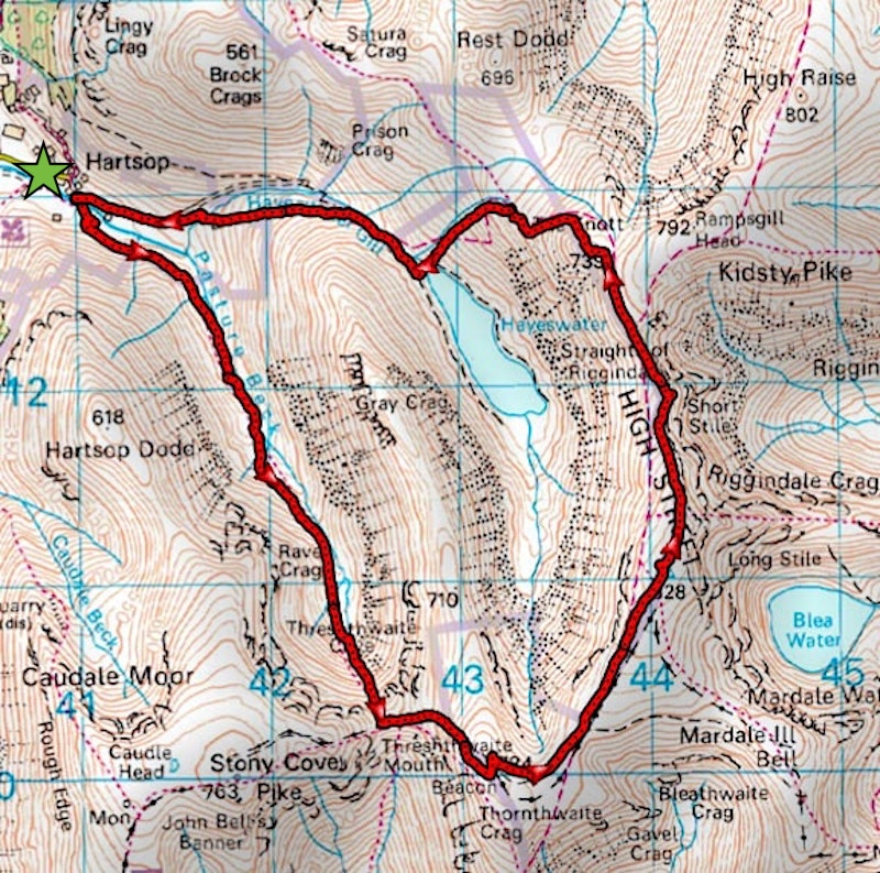
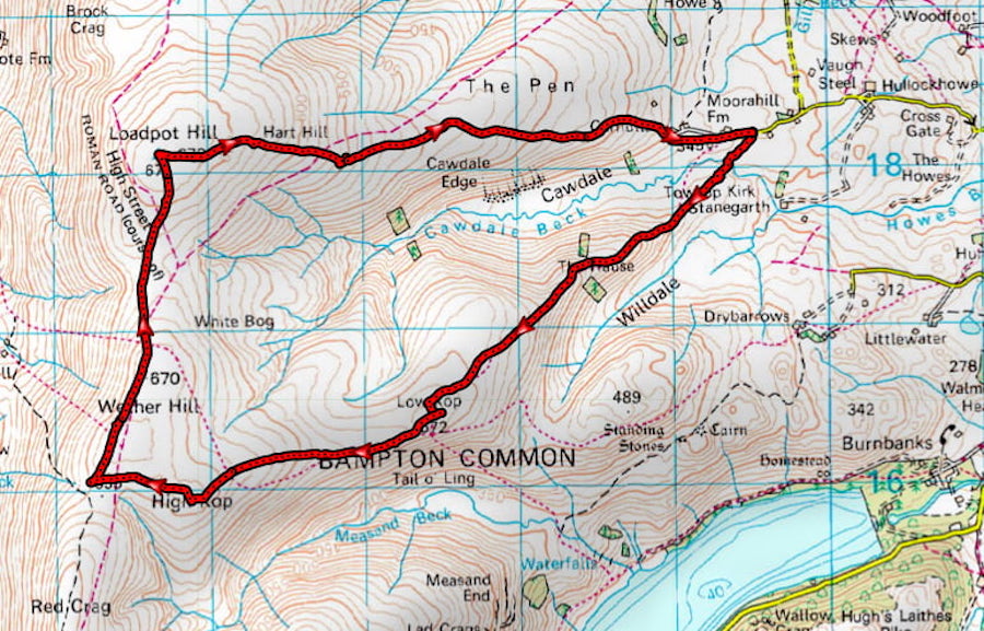
The South Sheet on the OL19 map ended at Beacon Hill and the next part of our route was overleaf on the North Sheet, isn’t it generally the case? Anyway, the first map shows the bulk of the route we took and the one beneath it shows the rest of the route going over to the Thunder Stone.

After parking the car in Orton we walked from Kennedy’s Chocolate Shop, in the middle of the village, up the hill for a view of All Saints Church. We arrived five minutes before the service began at 10.30 am and people were arriving for it so we didn’t go in for a look around. The building dates from the 13th century but there have been a few restorations since, both inside and out. In 2007 the tower was treated with a coat of lime plaster to help prevent damage from damp, the almost white colour making the tower visible for some distance around.

At the church gate we turned left and walked down to the end of the lane, which joins the B6260, where we turned left again, crossed the road and carried on until we reached the vicarage. At the vicarage a lane goes off to the right but before we turned down it we walked straight on for a few paces to get this shot of the front of the vicarage.

We then retraced our steps back to the start of the lane with this view of the vicarage as we walked up alongside it.

Its only a matter of a few paces until we reach the bridge over the beck and here we turn left and carry on up this lane, walking past some of the houses at the northern end of the village. Almost at the end of the little lane we take a left turn up a tarmac drive. It looks like the private drive to someone’s house but it is a public footpath nevertheless and leads to …..

….. the beginning of this old walled path winding through …..

….. a tunnel of greenery which was surprisingly dry underfoot given the rain we’ve had lately. This is a look back shortly after we began walking along it.

The old walled path eventually gives way to this wider green path which …..

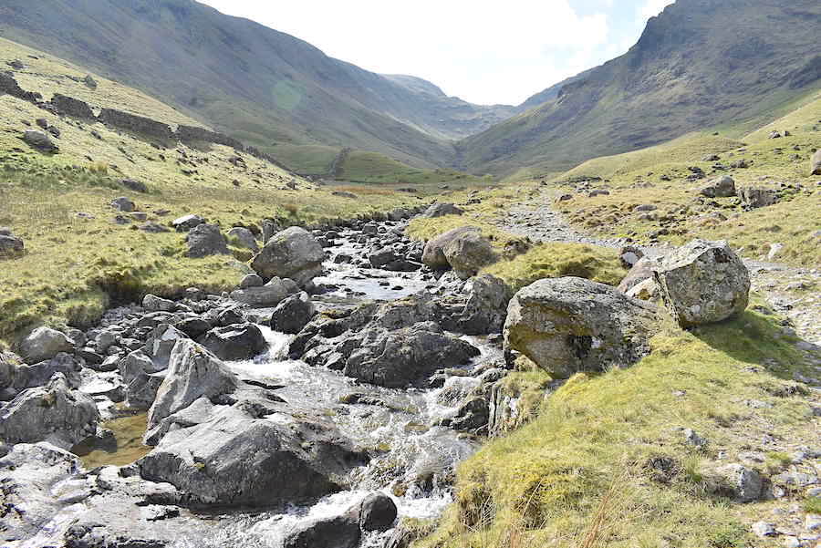
….. eventually carries on alongside a clear stream a little further on. The walk so far has been quite flat but ahead the ground is rising gently.

On we go, just following the clear and easy path over the ever so slightly rising ground.

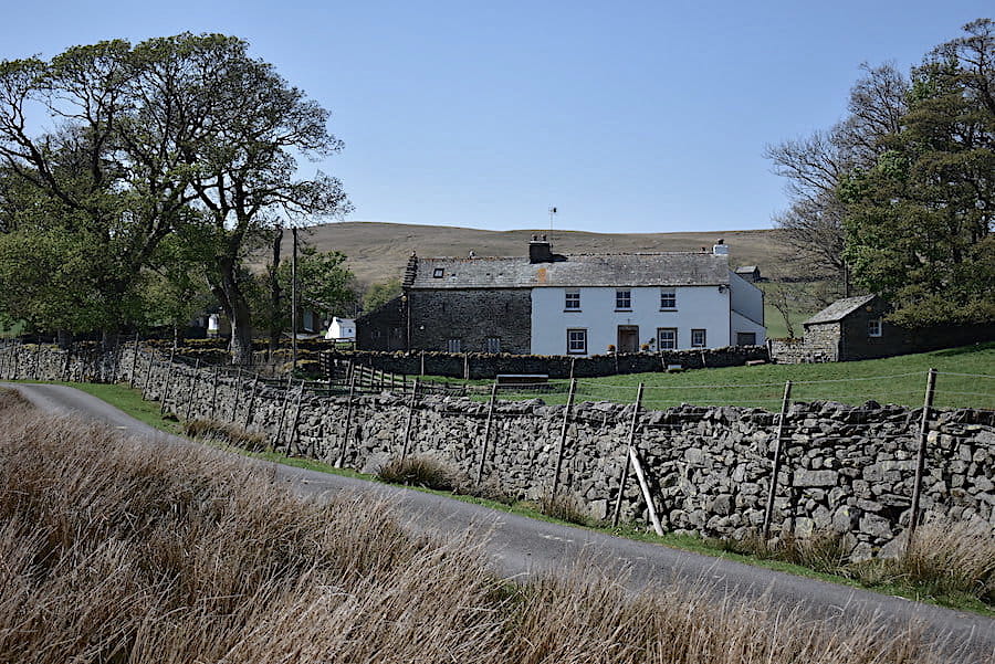
Broadfell Farm, nestling amongst the trees, comes into view a little further on …..

….. and as we approach it has a stillness about it which suggests that it may not be a working farm any more.

The path keeps to the left of the buildings and eventually we have a view of the front of the farmhouse. One of the upstairs windows was slightly ajar but there was no-one around and the whole place was deathly quiet, not even a dog barked as we walked through and everything looked very dilapidated and uncared for.

We veered away from the farm buildings towards the green path alongside the wall and eventually I looked back to see if anyone had emerged following our passage through the buildings. Not a soul was to be seen though. The white van was quietly going rusty although the blue car parked up over on the left looked in good repair and roadworthy. A strange sort of place, I thought.

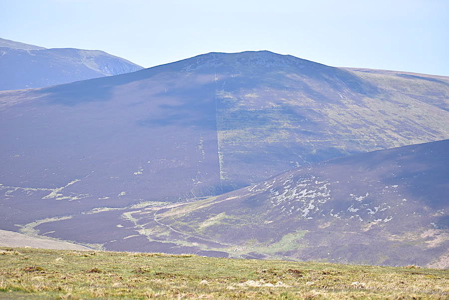
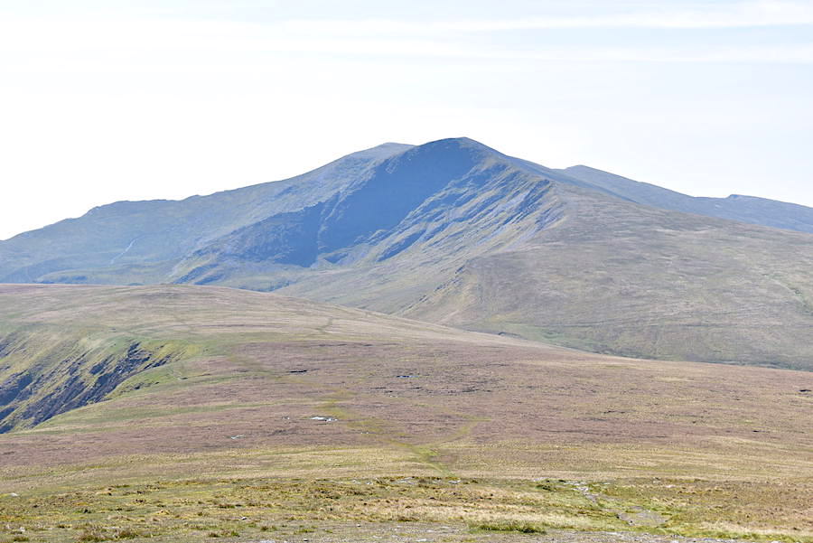
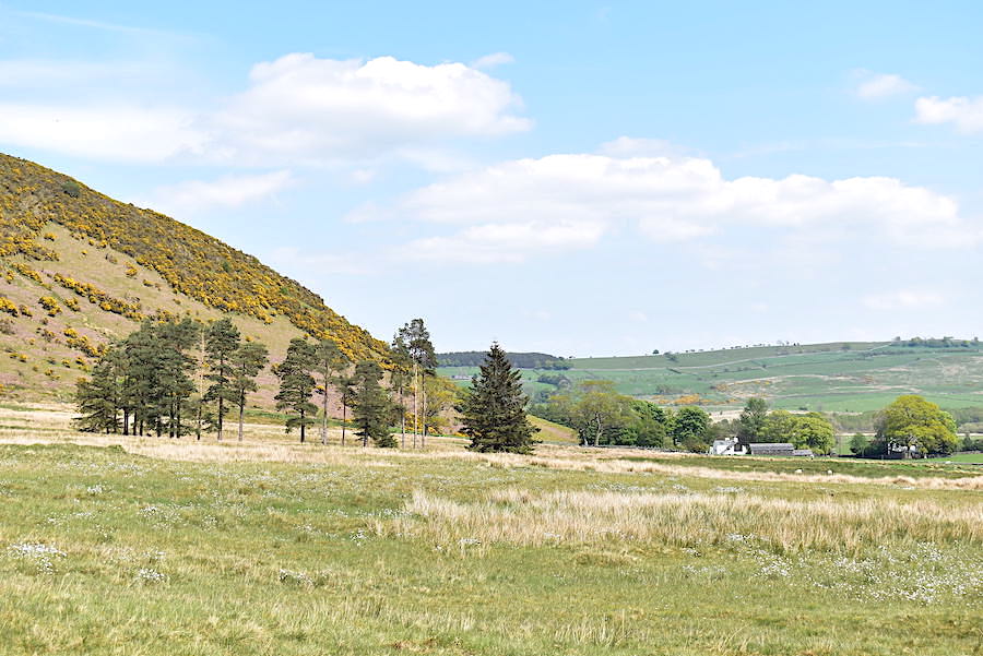
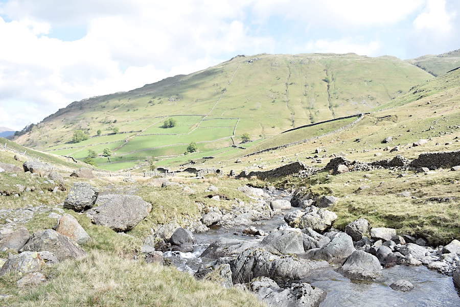
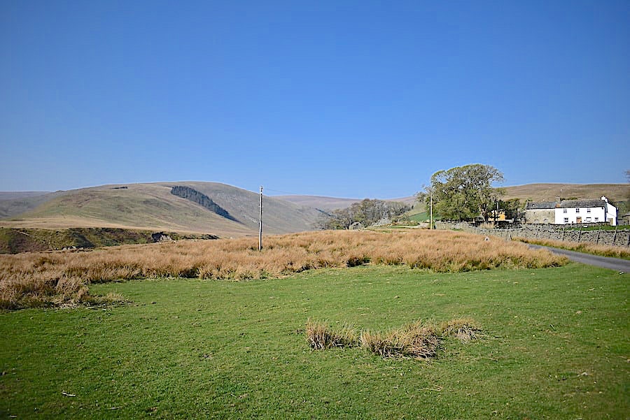
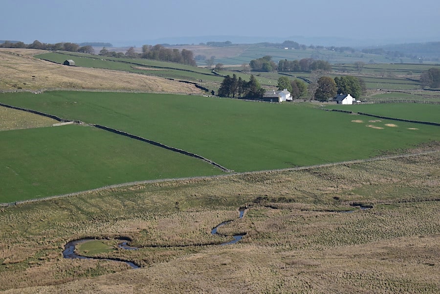
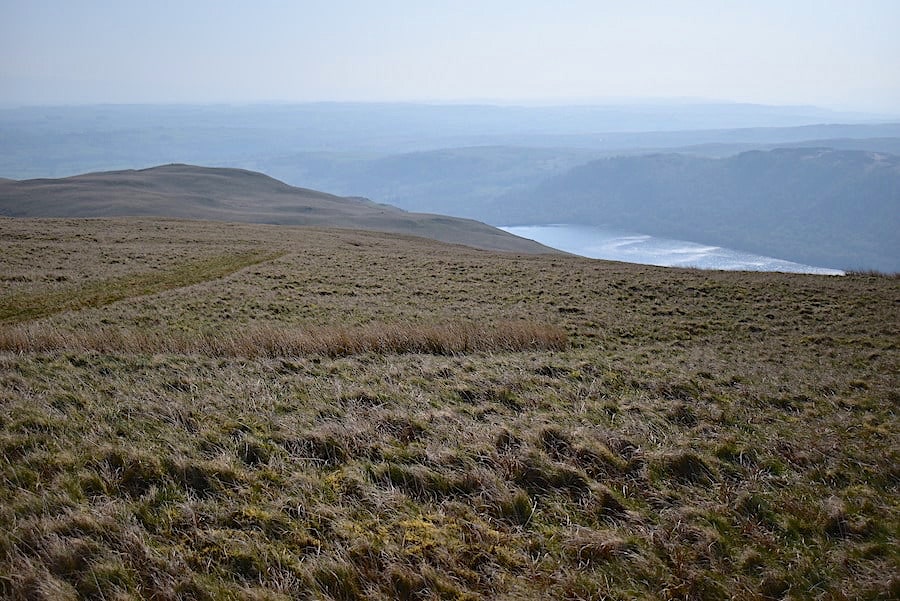
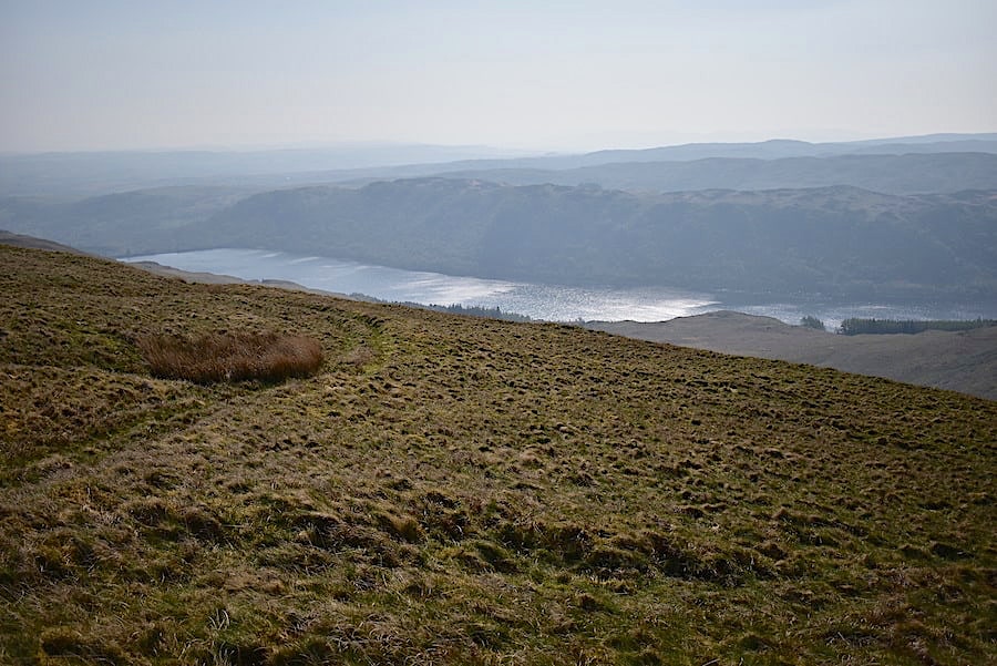
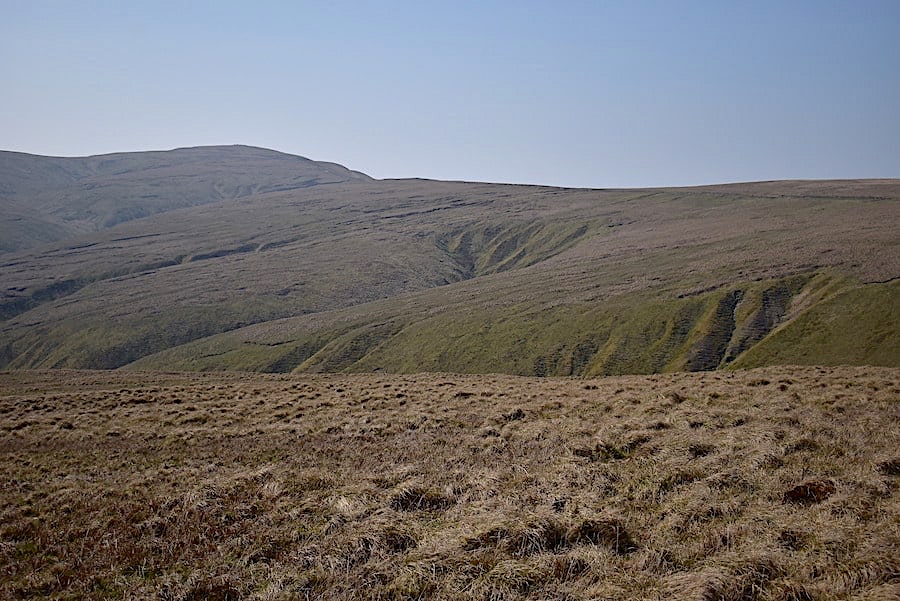
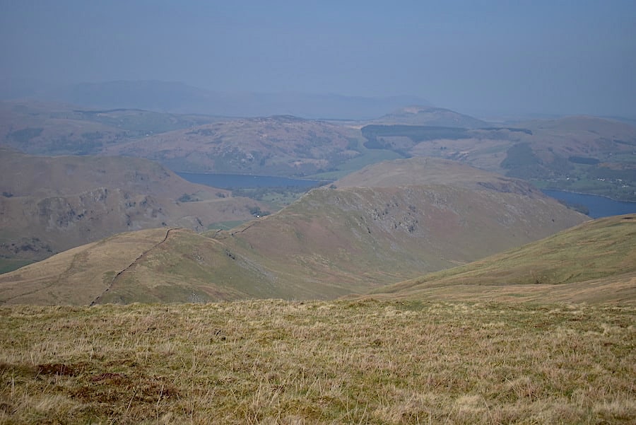
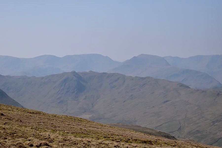
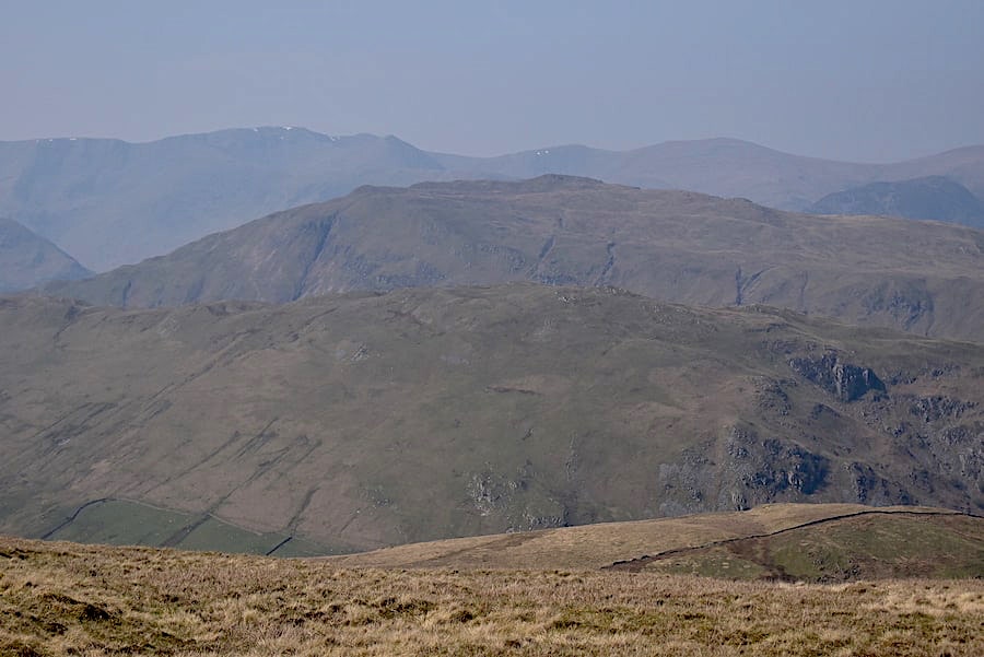
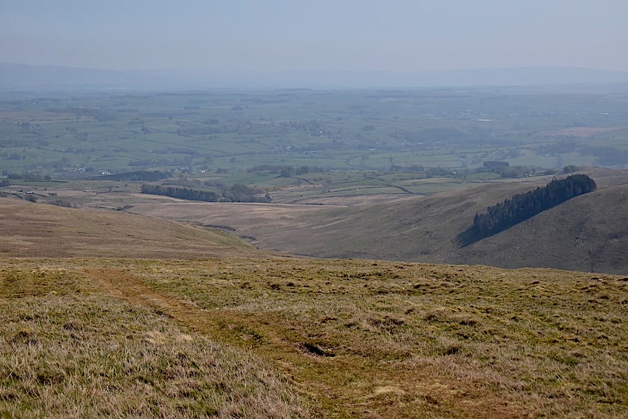
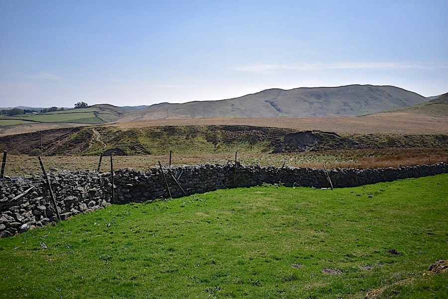
A little further up and I took a look back at the Howgills across the gentle countryside of the Lune valley. The higher tops of the Howgills are smothered in cloud. We had briefly considered a walk over there today but one look at the low cloud base everywhere this morning soon changed our minds. The ground begins rising more beyond the farm but it isn’t steep by any means, there’s just a gentle gradient up to …..

….. this old lime kiln which is almost at the top of the hill.

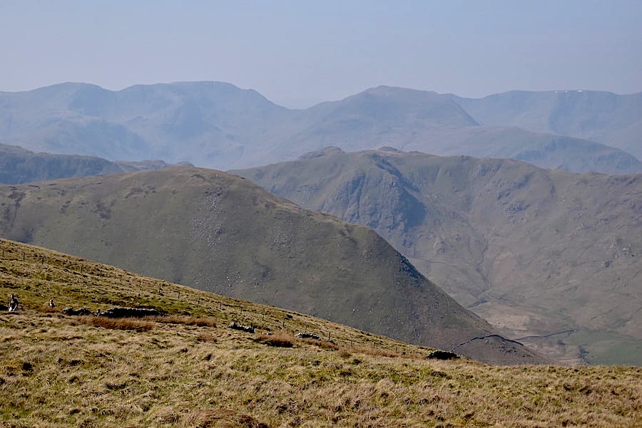
The view of the Howgills across the Lune valley from the lime kiln …..

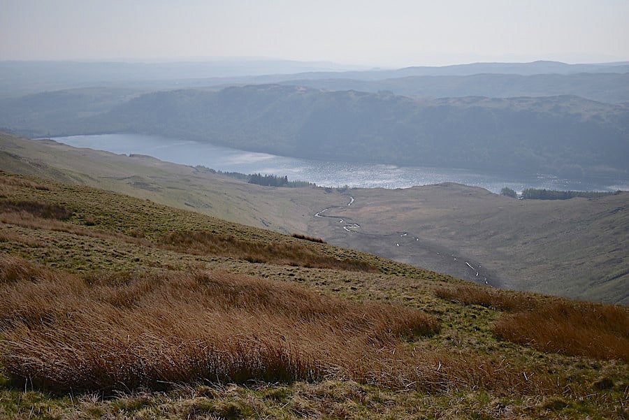
….. and from the same spot a view of the Shap fells over to my right.

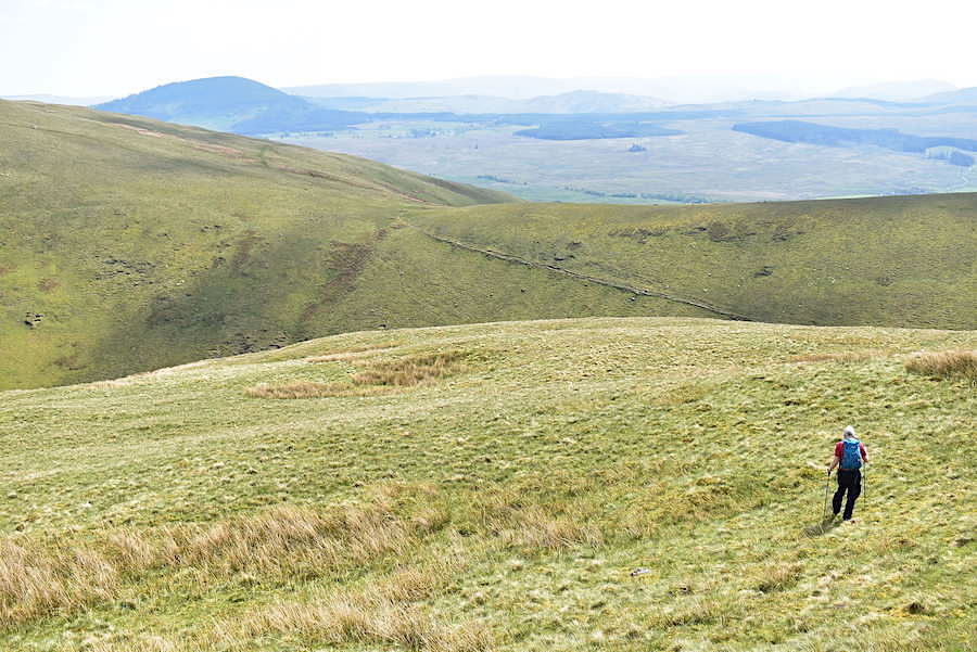
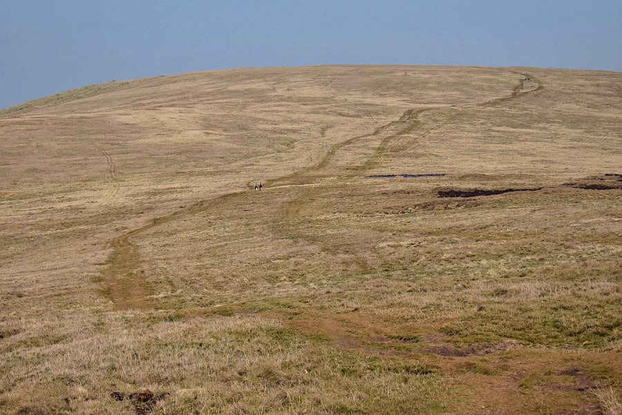
From the lime kiln the path rises a short way over to left of it where we reached a metal gate. A group of walkers coming down towards it offered a chorus of cheerful “good morning’s”. From the gate the path zigs up to the right and after about a dozen or so steps we emerge at the point where the walker in the dark jacket can be seen. He’s just about to descend the same path with his companion, with the green pack, just a few steps behind him. More cheery greetings from both of them. We’ve reached the B6260 coming up from Orton which we could also have walked up but it wouldn’t have been quite so interesting. It can be quite busy too as its a decent road between Appleby and Tebay.

I crossed back over the road to join J who is making his way up beside the wall to the little rise on the skyline ahead. We’re beginning to feel the wind now we’re out of the shelter of the valley.

A look back to the point at which we emerged from the path onto the road, on the other side of the wall, roughly at the point where you can see the stretch of road between the white camper van in the middle and the tall tree to its left.

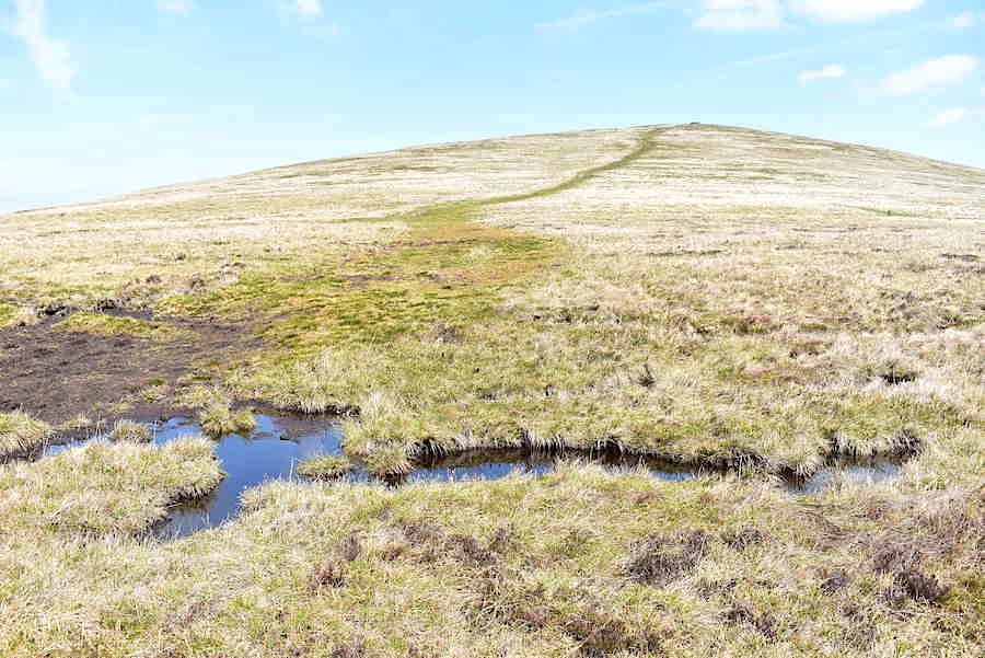
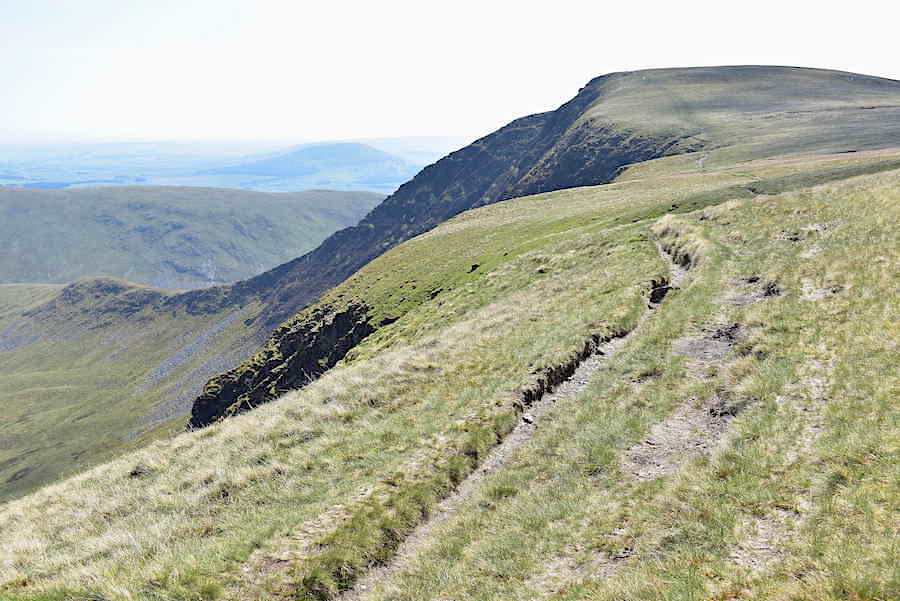
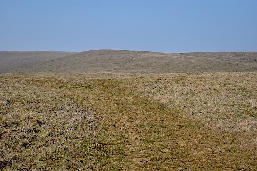
We approach the crest of the rise which is just about the only part of the walk which isn’t following a gentle gradient, its only a short pull up and could hardly be called excessively steep.

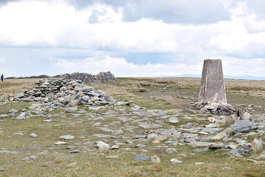
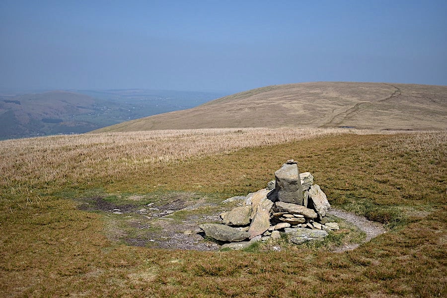
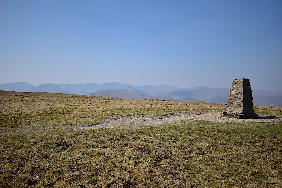
Once over the rise the monument comes into view and there’s just a very short and easy walk over to it.

It sits atop a low limestone escarpment, mostly grass covered, but a few of the scarps are visible here and there.

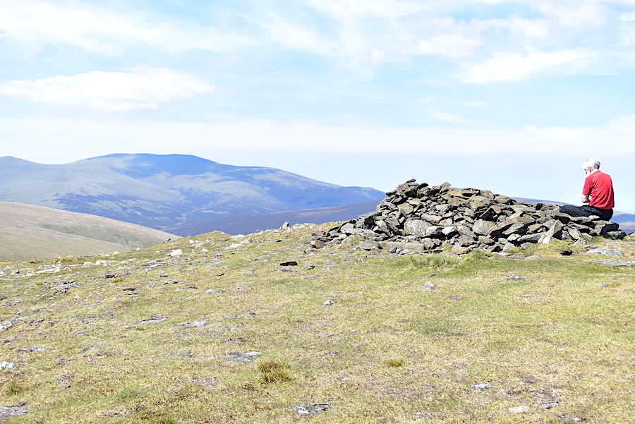
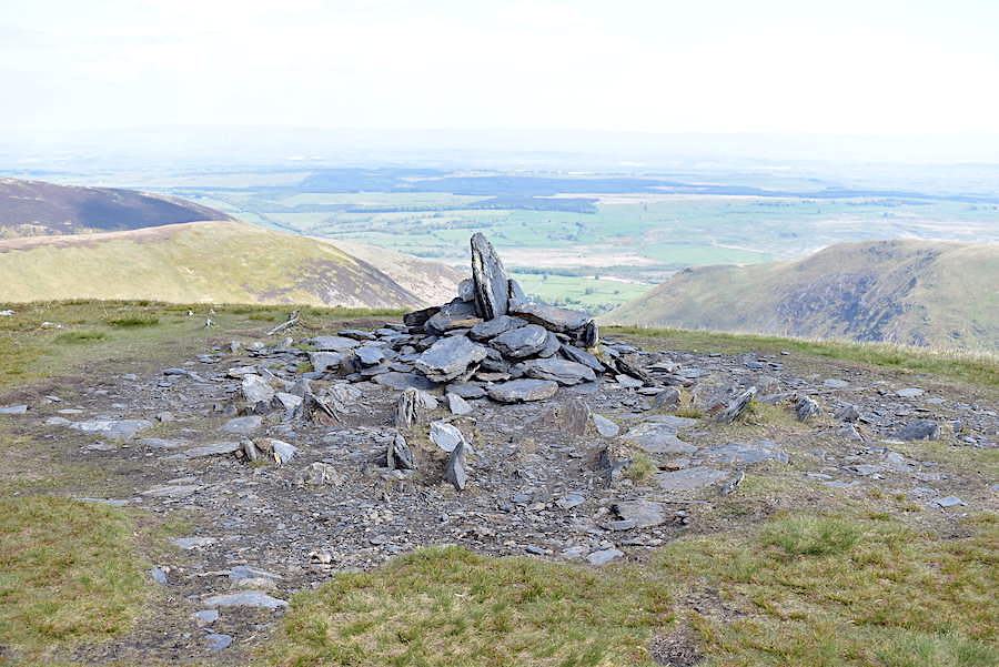
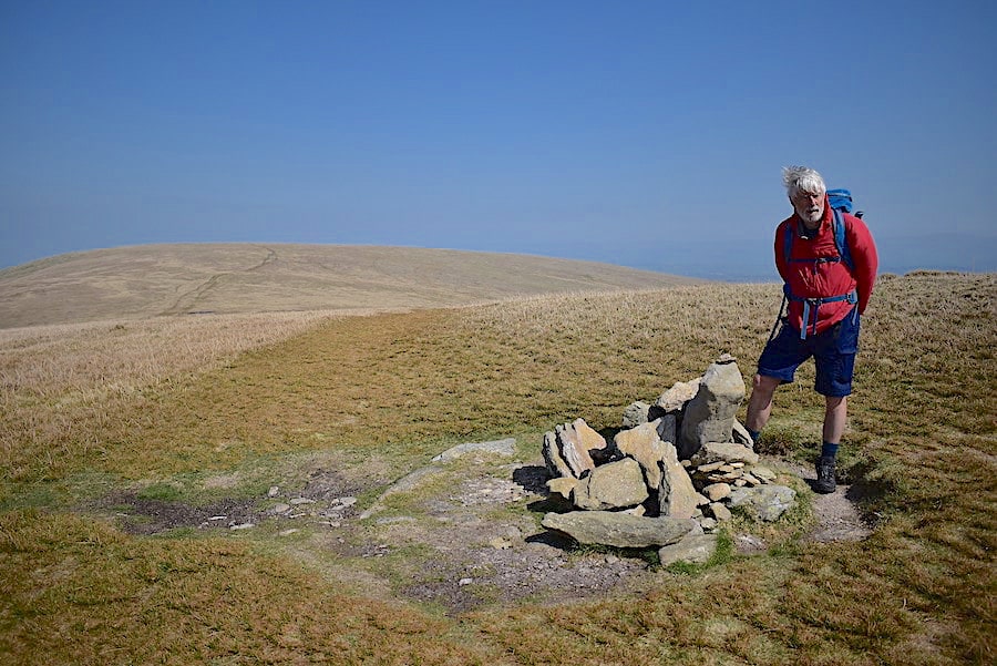
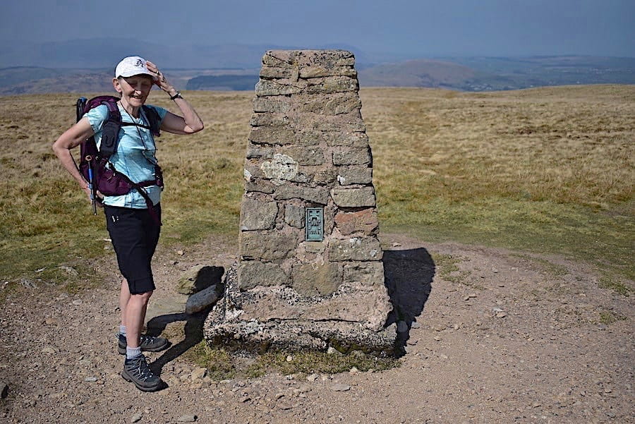
J studies the inscription set into the monument …..

….. and when he wanders off I took a shot of it and also …..

….. the inscription which tells you nearly all you need to know, it omits to mention that 1887 was Queen Victoria’s Diamond Jubilee year. The loyal subjects of the time would have known that of course but never thought to mention it for future generations, so if anyone’s history dates were a little shaky walkers would be left scratching their head or Googling it on their iphone.

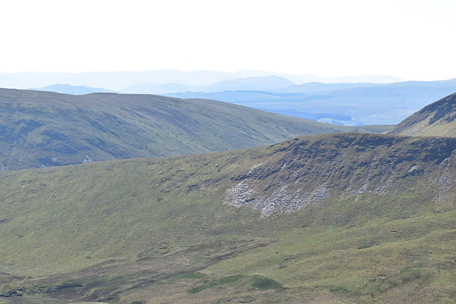
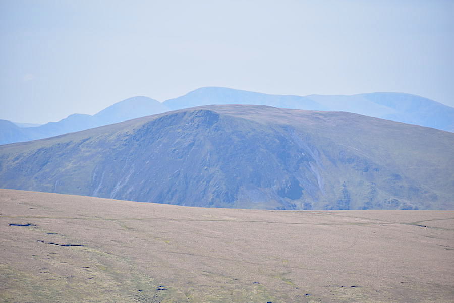
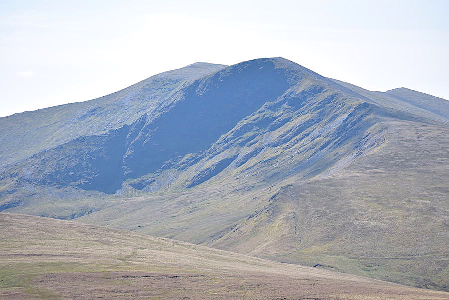
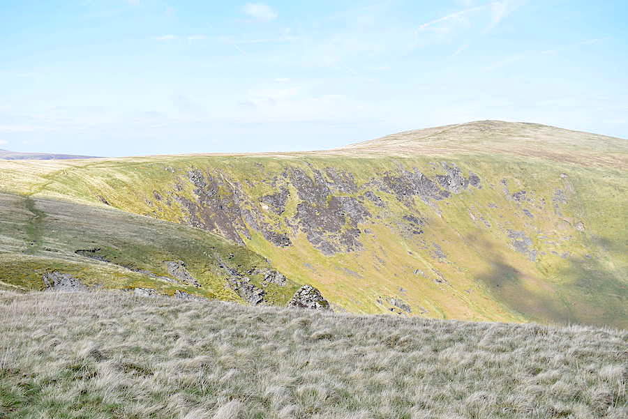
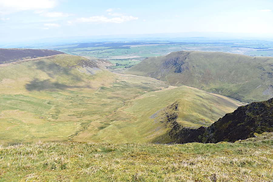
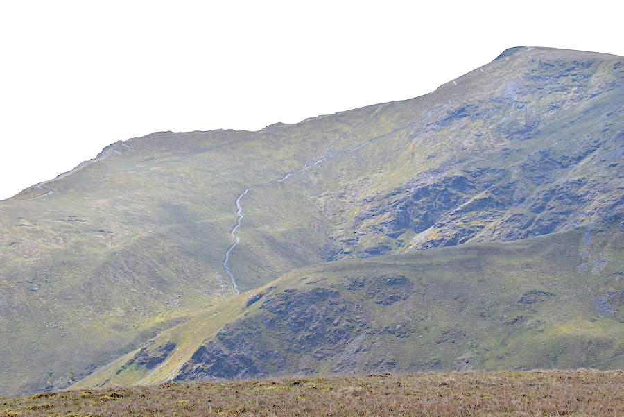
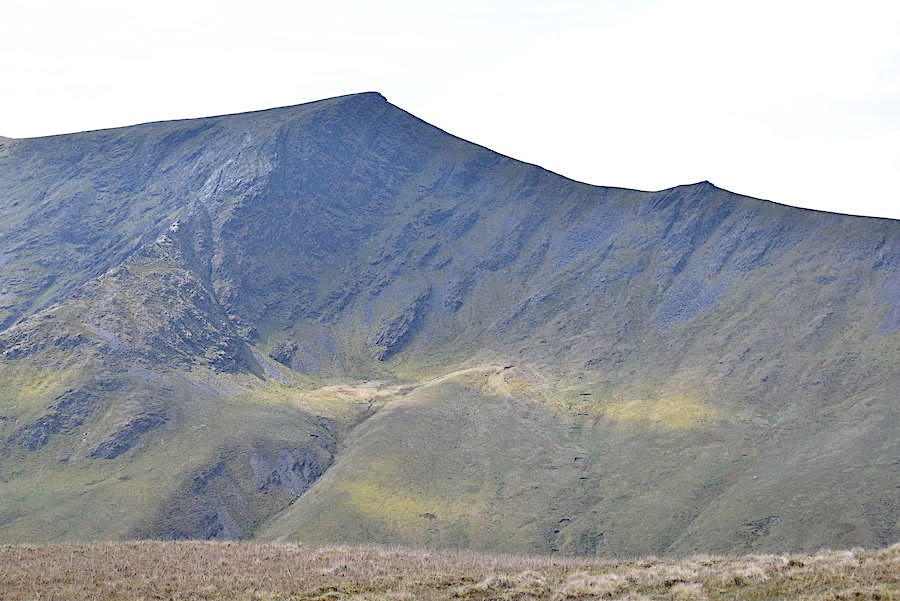
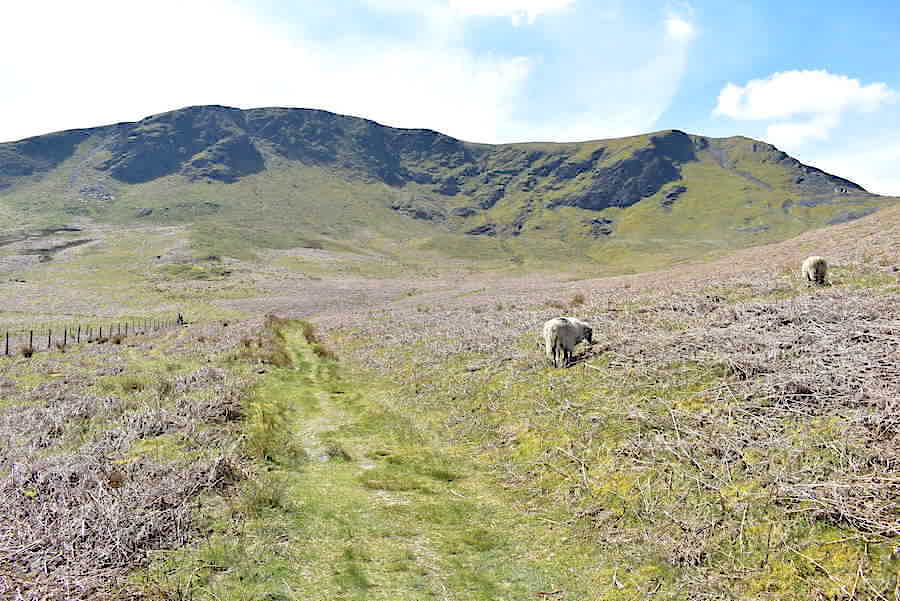
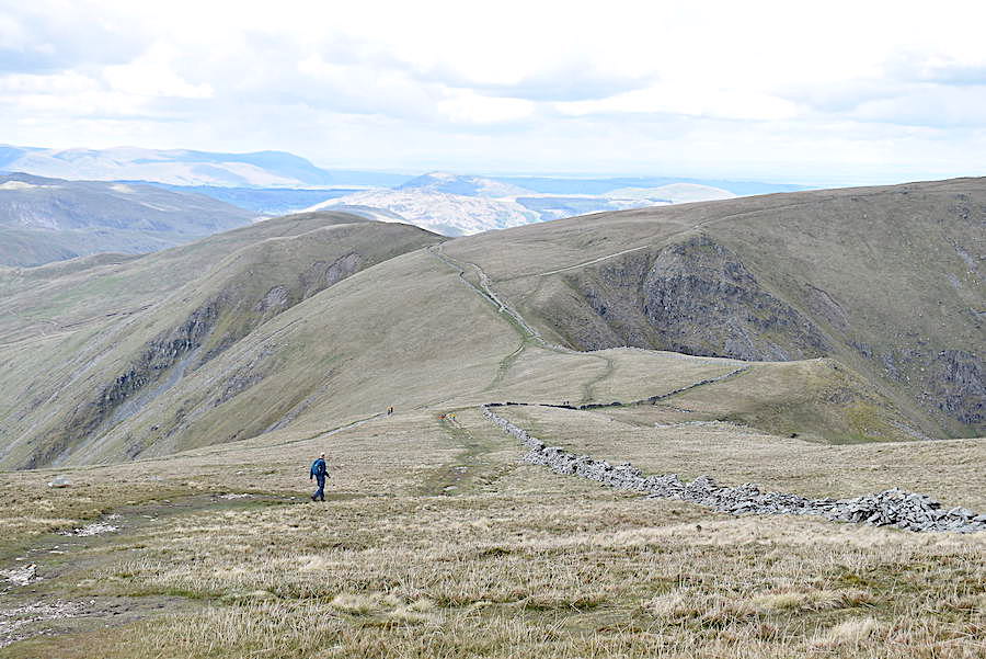
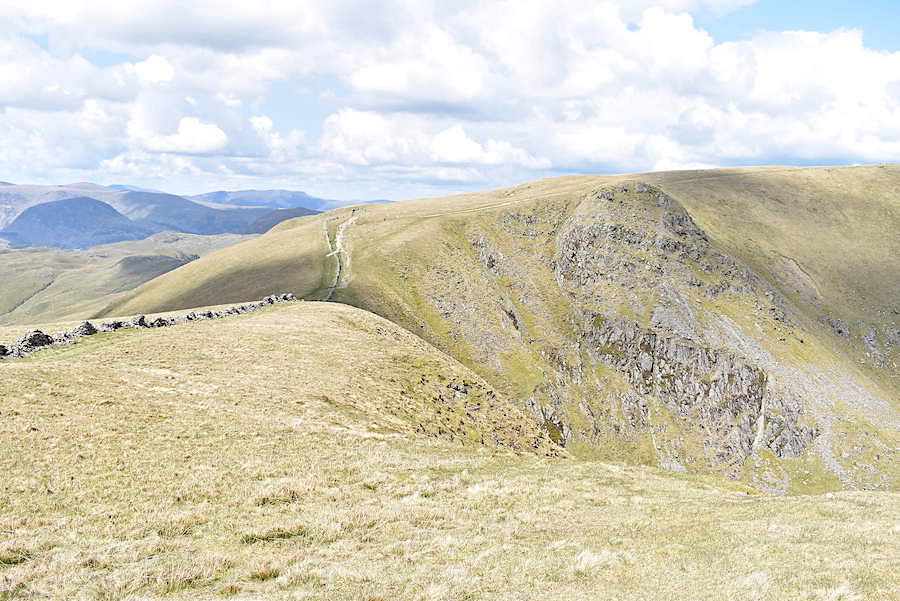
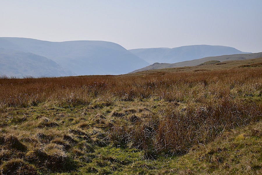
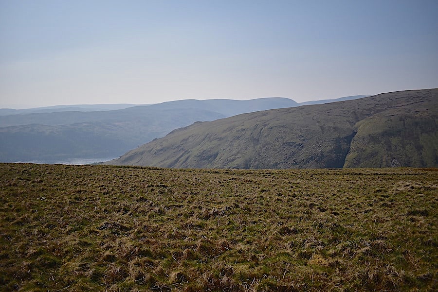
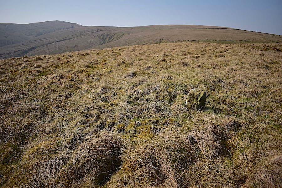
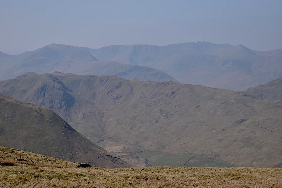
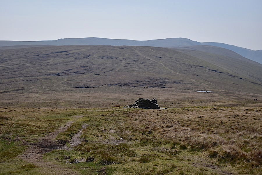
A summer’s day view across to Great Asby Scar and Knott. Blue skies and gentle, balmy breezes have been very thin on the ground just lately. It was very blowy up here so we didn’t stay long …..

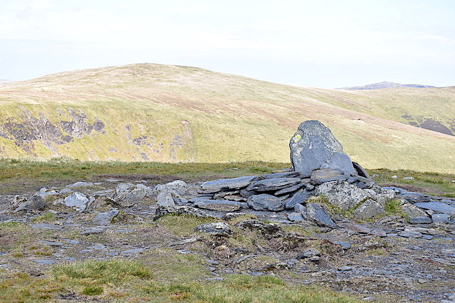
….. I took another shot of the monument looking northwards and then we made our way back to the wall and carried on with our walk. We walked with the wall to our right until we came to a gate, passed through it and carried on with the wall now on our left until we came to …..

….. the Thunder Stone, a glacial erratic of pink Shap granite, put to good use as a support and buttress for the wall. I have seen photos of this before so I knew it wasn’t going to take our breath away and had it been lashing with rain we wouldn’t have bothered making the detour because its nothing out of the ordinary, the Bowderstone in Borrowdale it isn’t! Our walk over Great Asby Scar in April 2017 has a photo of another similar, and a little larger, erratic also with a wall built around it about a mile or so to the east, that one is known as Mitchell’s Stone.

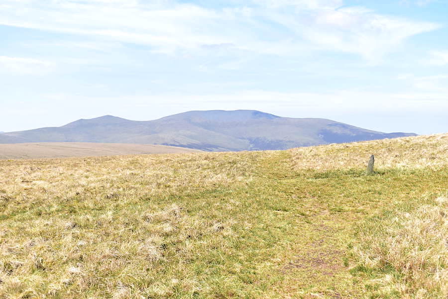
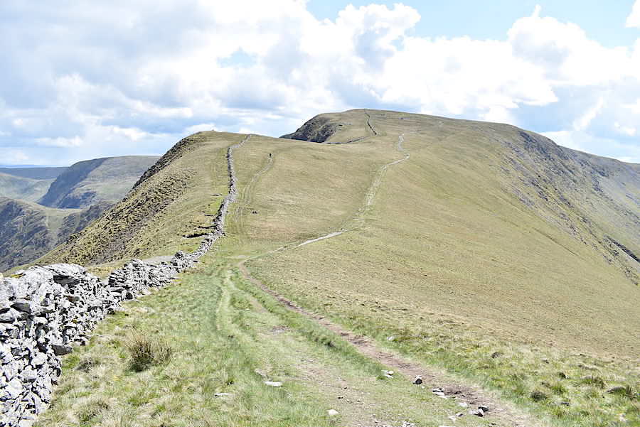
We retrace our steps from the Thunder Stone back to the gate but this time we don’t pass through. Instead we leave the wall, bear left and follow a gently rising trod which is out of shot to the left. In this shot the monument on the Beacon Hill skyline is still just about visible.

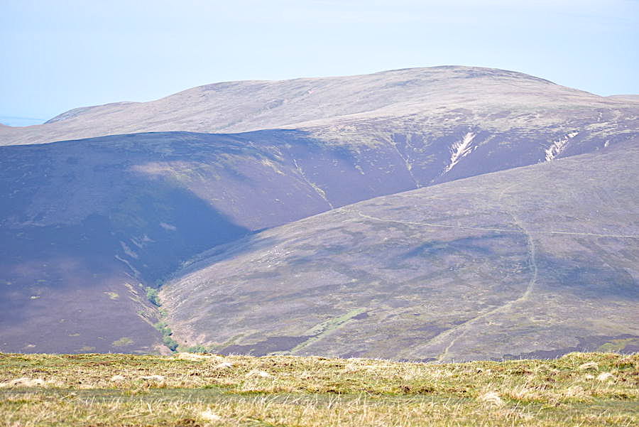
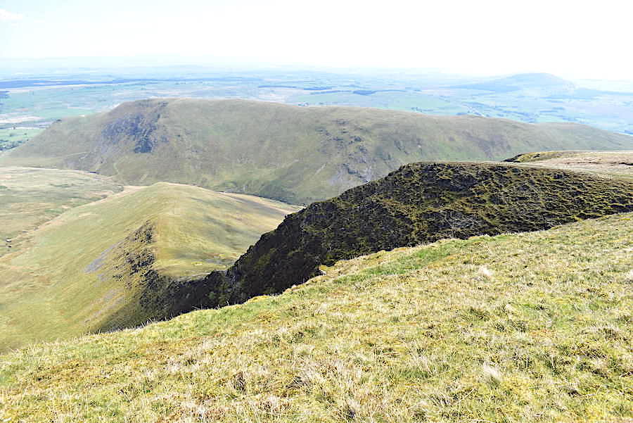
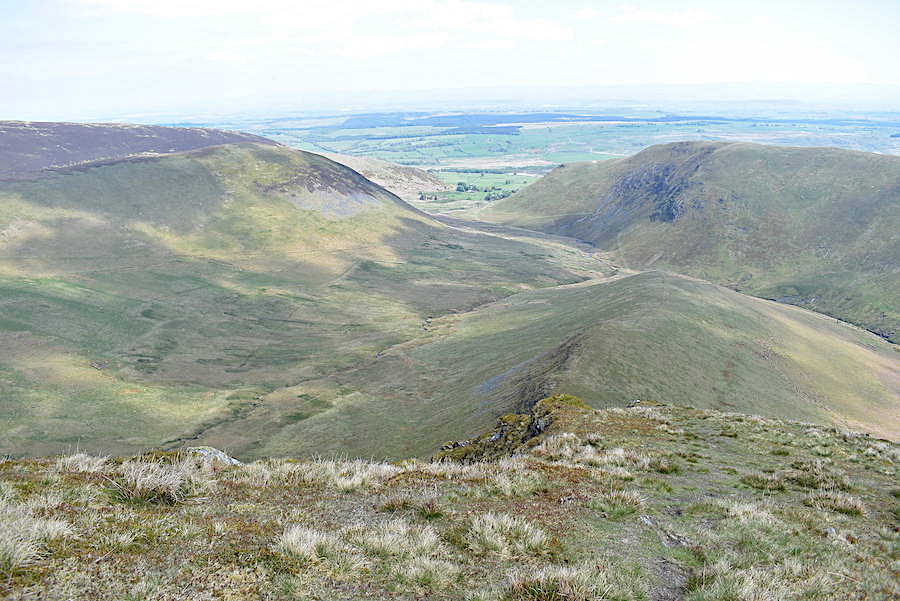
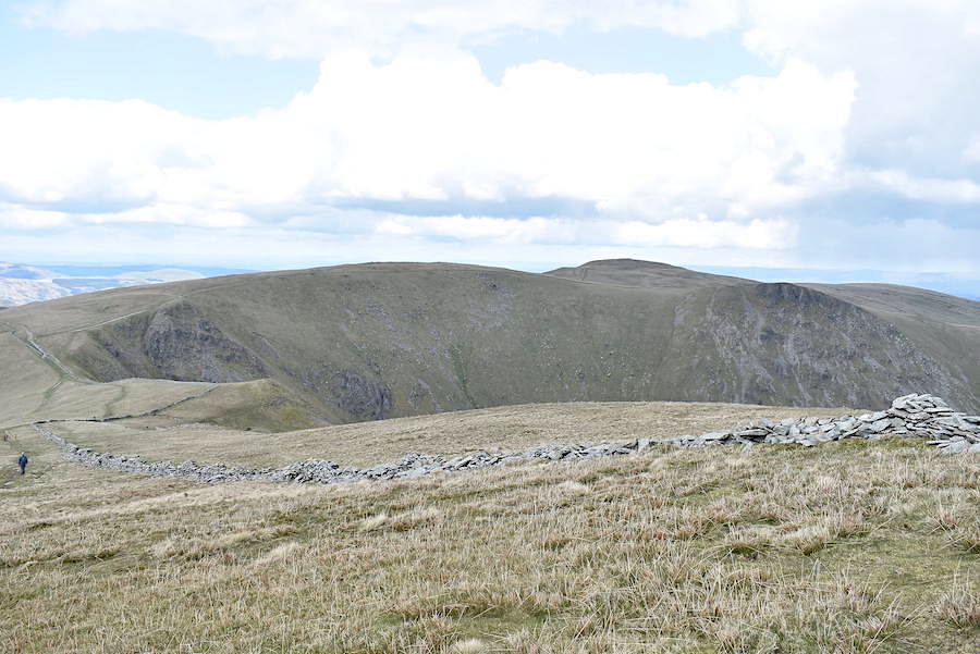
The trod eventually widens out and the Howgills fill the skyline once again as we begin to descend the green path.

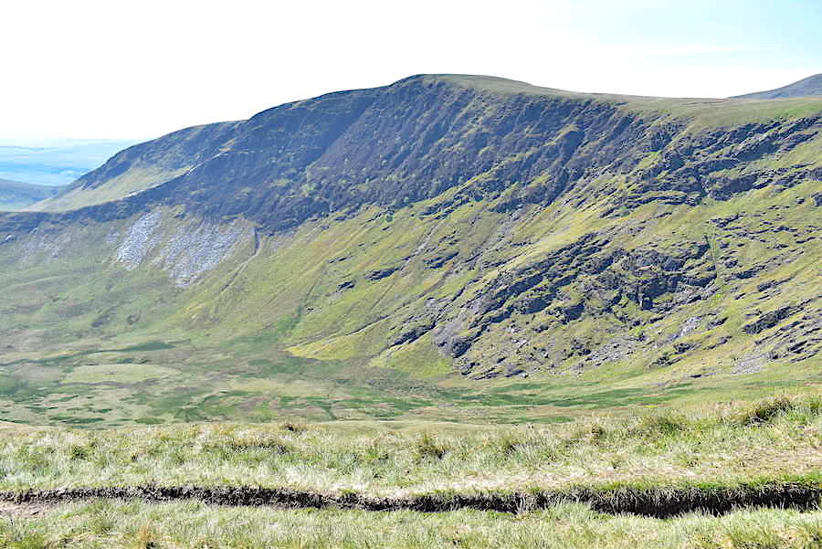
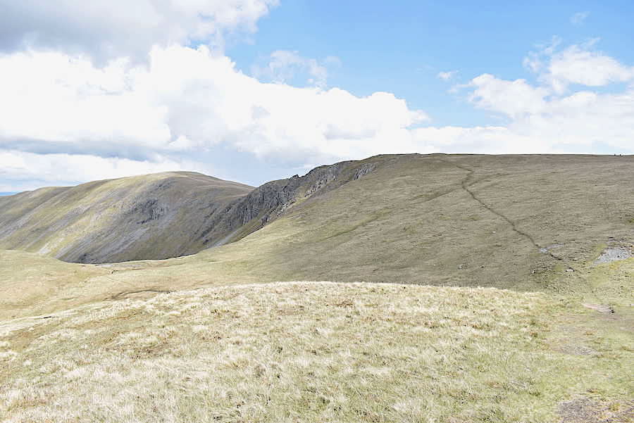
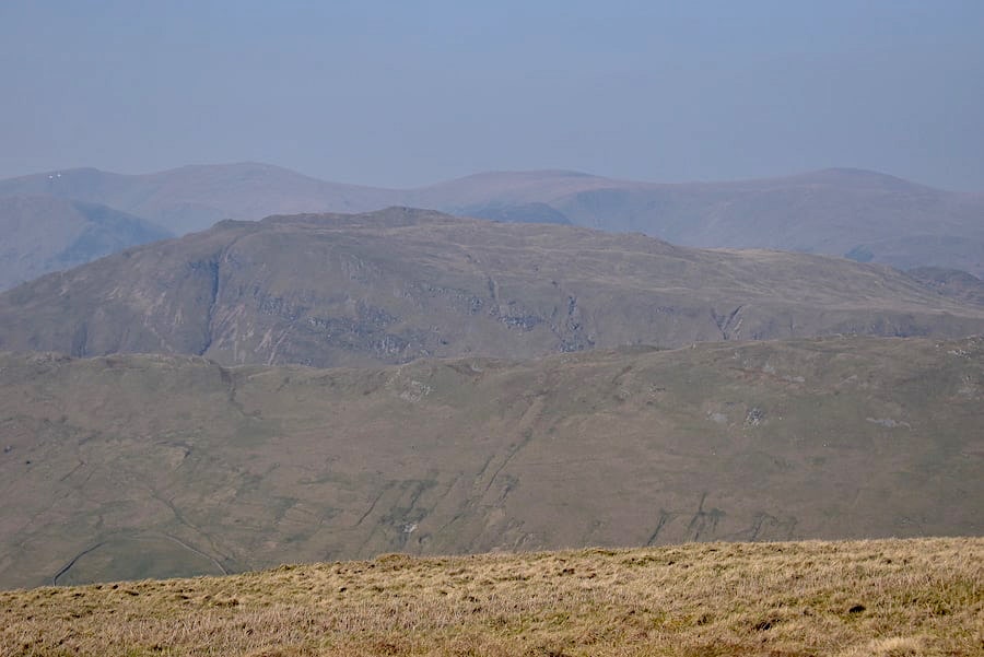
Limestone pavements in abundance on Great Asby Scar to our left as we descend …..

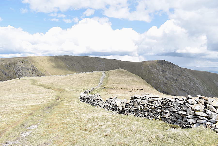
….. to the four-way signpost by the gate, with the lower slopes of Knott behind the wall.

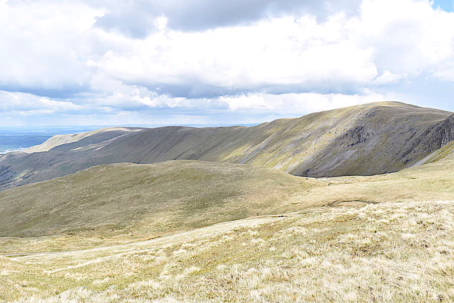
The way signs are very weathered and hard to make out so its just as well we know where we’re going, through the gate and straight on …..

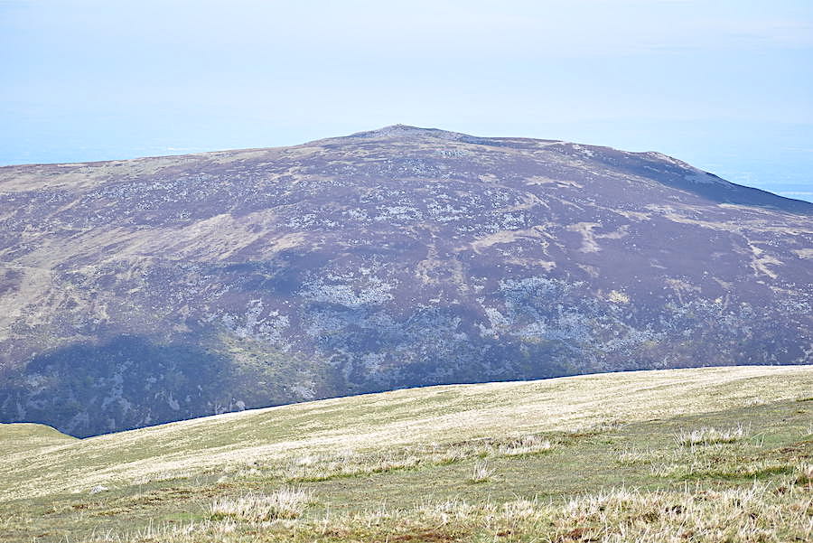
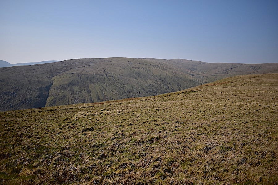
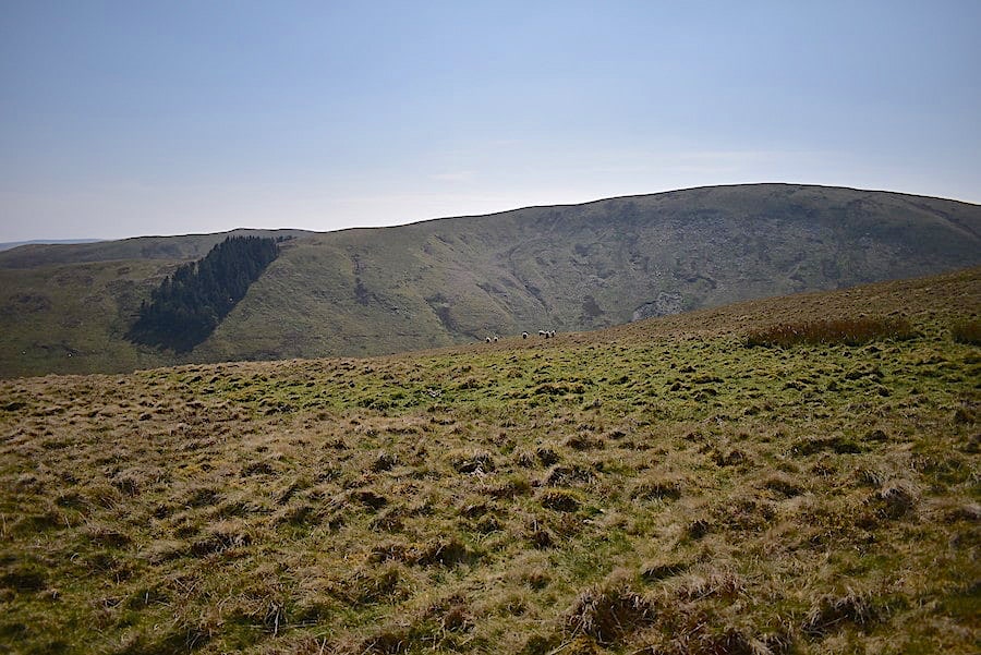
….. following the grassy path curving around the lower slopes of Knott. J’s jacket sleeves ballooning and hair blowing every which way in the strengthening wind.

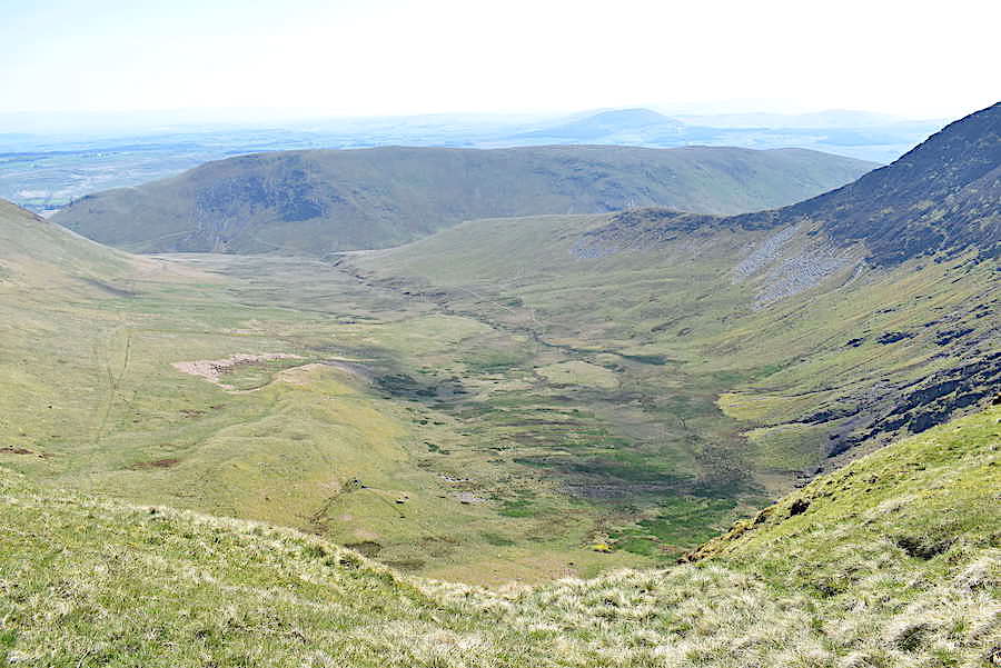
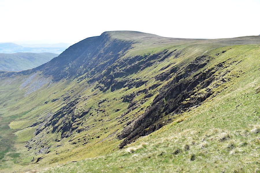
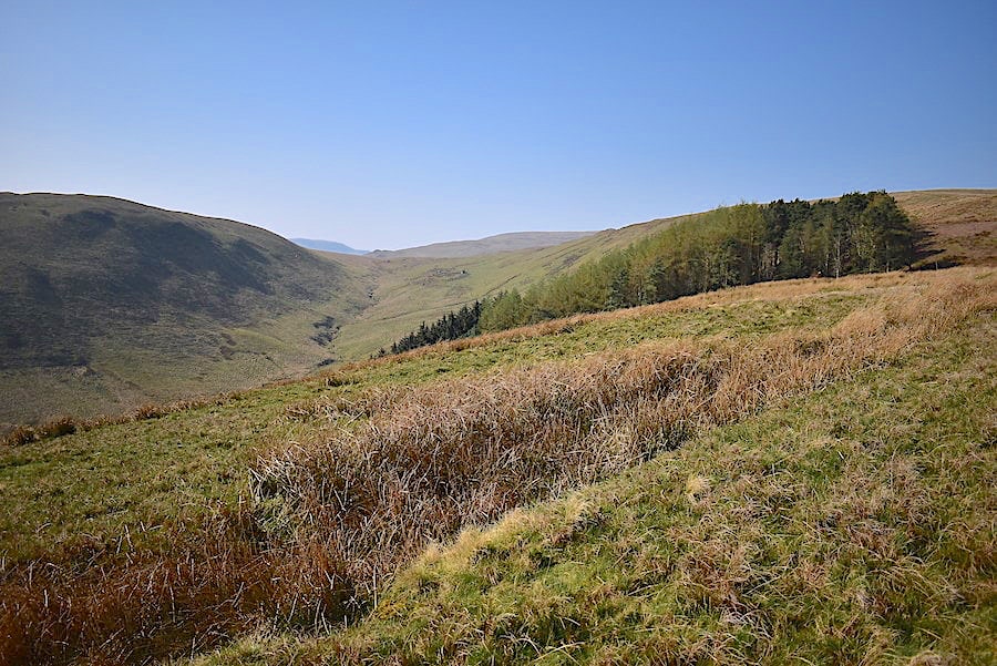
The wind was a nuisance but it didn’t really spoil our very enjoyable tramp over these upland slopes.

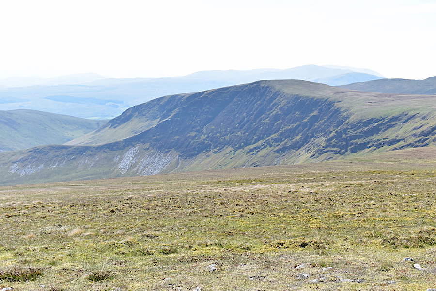
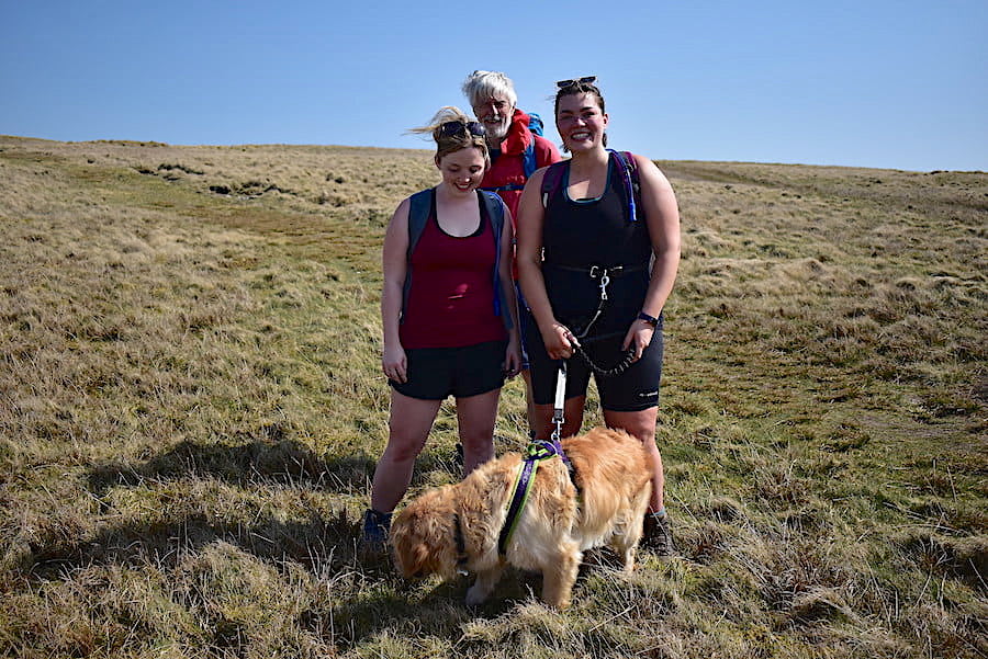
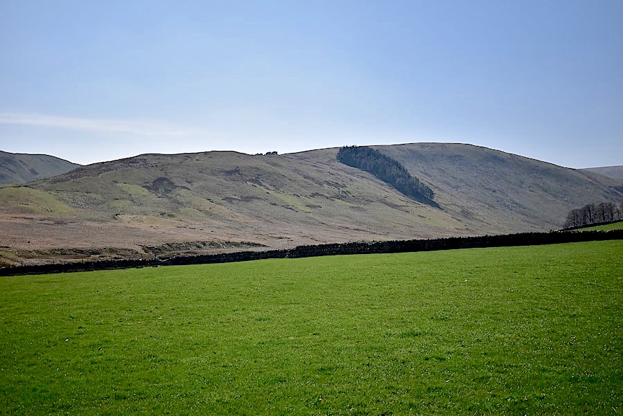
Dry stone walls criss-crossing the ground and marking out the fields below Beacon Hill. Lovely open countryside which is wonderful to roam across and you can generally have it all to yourself. Other than the people I’ve already mentioned we’ve met no-one else.

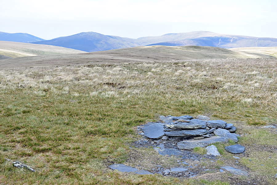
That line of hollows on Knott came in handy when we reached them, they offered shelter from the wind and flat stones to perch on so we took a short coffee and snacks break and let the world roll by for ten minutes or so.

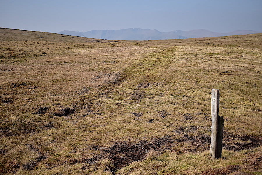
At the point marked ‘Resr’ on the map. The reservoir is up the slope and out of shot on the left but its an undergound one covered by an unattractive structure so I didn’t bother taking a shot of it, especially as the view ahead was much nicer. The path and wall drop down to Knott Lane, the narrow lane which is visible to the left of the big tree beside the wall, but before we reached the lane there was …..

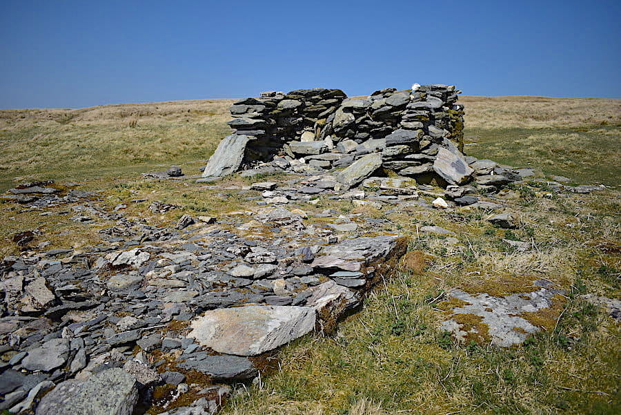
….. a gate to go through and close by, hiding away between the tree and the sloping ground, this lime kiln. When descending from the gate a passing glance would have you thinking that it was just another piece of wall so it would be easy to pass by without a second look.

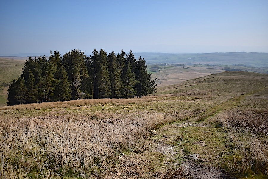
A look back at Knott as we reach Knott Lane. Our route map show a variety of routes and paths leading to and from Orton but we were feeling the occasional spits and spots of rain so rather than take any further scenic routes we stayed on the lane and carried on to meet the road at the end of it.

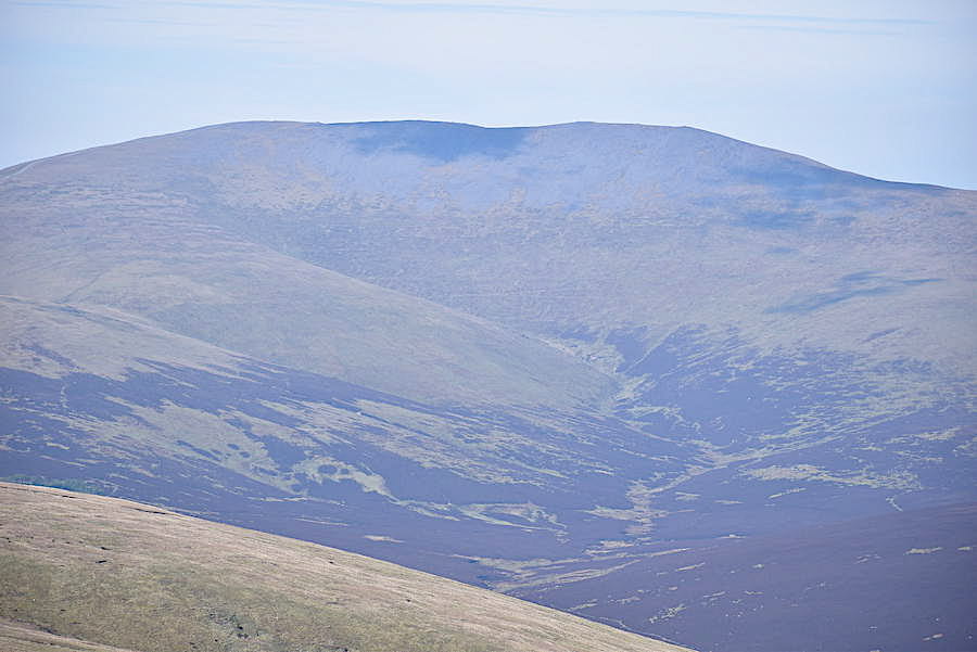
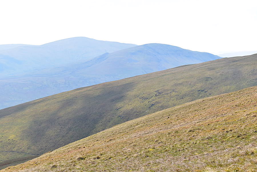
A look over to the Howgills as we walk the lane, by the time we reached the road at the end of it the rain set in so I put the camera away until it stopped.

Its only about a ten/fifteen minute walk back to Orton and by the time we were almost back in the village the rain had stopped so I took a last look across the fields from the road before we entered the village.

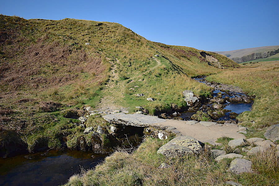
The charming double bridge over the beck in the village. Its Sunday afternoon and folks are out for a drive, or Sunday lunch, or a visit to the chocolate shop so there were plenty of cars going across in both directions. We walked a little way along the lane beside the beck …..

….. and crossed the footbridge back over the beck and into the village.

Orton village where we are the third car on the left beside the George Hotel, the chocolate shop car park further up where the light coloured car is parked on the opposite side was full when we arrived earlier. The road to the right, with the yellow roadworks barriers, is the one we walked up when we headed for the church as we started out. We sat outside the pub and enjoyed a drink before getting back in the car and going home. As we drove past the roadworks and up past the chocolate shop and its cafe its visitors were queueing out of the door. Hardly surprising though because they do make very nice chocolates. So that’s the end of our walk , quite short but very enjoyable especially since the soggy, cloudy weather we’ve had so far this last few weeks has restricted our walking lately. Its supposed to improve this coming week so, with fingers firmly crossed, we hope to get out again before much longer.


Roughton Gill from Fellside

Walk date – 13th July 2019

Distance – 4.5 miles

Weather – mild and overcast to begin with, sunny later


We haven’t been out on the fells for a while as we’ve been busy with various other pursuits, and we only just had enough time for today’s short walk as we were aiming to be in Hesket Newmarket in the afternoon to cheer on a musician friend who was performing his own compositions in his first solo set. A nerve-wracking occasion for anyone so a bunch of us decided to turn up to provide familiar faces and moral support, together with loud cheers and enthusiastic applause, which turned out to be well-deserved as the set was excellent, just as we all knew it would be. Since we would be in the area anyway we decided to have a quick walk up to Roughton Gill and have a look round the old mining area before dashing back to the music venue to cheer on our mate. Its just a little over two miles up to the gill from the little hamlet of Fellside so we had to crack on bit to get there and back in the time we had available, having been slowed down along the narrow lanes by a herd of sheep being moved from one field to another, oncoming cars and vans, and the occasional tractor or three, but we got there in the end.


Route – out and back

Fellside – Dale Beck – Roughton Gill

There is enough space for about five neatly parked cars on the lane just above Fellside, four of which were already taken when we arrived so we were in luck for once. The lane leads up to a gate beyond which there is an information board and where we take a right turn and follow the old track up to the mining area at Roughton Gill.

From the parking area a look back down the lane to the little hamlet of Fellside where we are just about at the northernmost edge of the Lake District National Park, and where the fells of Caldbeck and Uldale have been scoured by mineral mining activity for hundreds of years. The Roughton Gill mine was regarded as one of the richest sources of minerals and was finally abandoned in 1894.

Heading down the slope along the good track with evidence of mining already beginning to come into view even though we’ve only just started out. The small building above the curve of the track had warning signs plastered all over it informing us that the building was unsafe. Given that it looked as sturdy as the day it was built the signs seemed like overkill to us, but in these over-cautious and litigation-minded days I suppose the need to cover one’s back is paramount. It looked like an old water works building, probably linked to the one we saw when we reached the mining area, and set into the track at intervals between the two were several small inspection covers so water would probably be the connection between them all.

We were joined by some fellow travellers as we followed the track curving over Ingray Gill.

A look back along Dale Beck and the flatter landscape to the north. If you peer very hard you might be able to pick out two telecommunications masts on the skyline.

There’s still a good way to go as we look ahead to some of the Caldbeck Fells so we maintain a swift pace over the more or less level track.

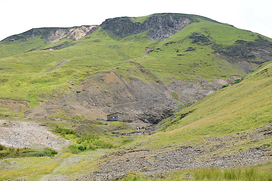
Further along in the valley bottom we see the remnants of old mine buildings, circular in construction, judging by what remains, rather than the more usual rectangular shapes to be found in these old mining areas. Round buildings can often suggest a mill of some kind but that’s as much information as I can offer in this case.

J makes his way across the footbridge over Hay Gill. The pool was very inviting because it was very warm and muggy in the enclosed valley and had we not been in a hurry we might have been tempted to linger a while.

Approaching Roughton Gill mine with Iron Crag rising steeply above it.

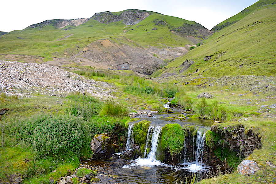
The remains of mine buildings can be found everywhere but very little is easily recognisable to our untrained eyes, although we do know a spoil heap when we see one! You can’t move for them up here spread as they are over a very large area. In the next gill along, on the left of the shot, are the remains of another mine, possibly the Mexico Mine although there are so many gills with workings in them its difficult to be certain. Apparently the Mexico Mine was a commercial flop since hardly any significant mineral finds were made there.

As we get nearer we can see three other people up ahead leisurely exploring the mine area, we charge, huffing and puffing, up the last few yards and take a quick look around.

As is obvious, its difficult to get very close to the falls in Roughton Gill without endangering life and limb, and the abundance of foliage at the moment made it hard to see them clearly so I had to be content with this shot of them for the time being. If we hadn’t been so pushed for time perhaps we could have found a better spot but at least it gives some indication of the nature of Roughton Gill.

Another building with signs warning of dire consequences should anyone be considering breaking in although it probably contains very little else but spiders. In any case, how on earth would anyone get in since all possible entrances have been bricked up? Its situated immediately beside the gill so it probably performs, or performed, some water based function in connection with the earlier one we saw back down the valley. Whatever it does, or did, its clear that no-one has been inside to check on things for a very long time. The wall alongside came in handy for a quick breather and drinks before we turned around to make our way back down.

From our perch on the wall a view of the scree slopes of what I think is Peterhaw. Not in the shot but just a short distance away to the north east of it is High Pike. We could see a number of paths going in all directions across the fellsides around here which had us thinking about all manner of new routes to follow across the Caldbeck and Uldale Fells from this particular spot.

A look back at Roughton Gill and the abandoned building as we begin the return leg down the valley. We would have like to have climbed the hillside above the gill but there was no chance of that today so its on the ‘to-do’ list in the pending tray.

Roughton Gill in more benign form as it trickles down from the mine to join Dale Beck in the valley bottom.

In the valley bottom now where the infant Dale Beck is filled by a number of feeder becks emanating from the numerous gills, and a look back at the mining area as we begin to make our way back to Fellside. I think the flattish area on the centre skyline is the long plateau between Great Lingy Hill and High Pike.

Dale Beck squeezes its way between the enclosed fell sides where the track has naturally narrowed quite a lot. We’ve temporarily lost our sunny spell but it was still quite warm and muggy along here.

We’re making good time and are well on our way back to the car so I had time for a quick shot looking back along the valley from the bridge across Dale Beck.

Back at the bridge over Hay Gill where we notice a sheepfold which, for some inexplicable reason, we didn’t see on the outward leg. Perhaps because we were in such a rush. There was a narrow path going up the right side of the gill and in the distance more evidence of mining activity can be seen. Apparently the Hay Gill Mine was a copper mine with a very long history.

The clouds break up once more and we are back in the sunshine as we curve around Ingray Gill once again and climb the last slight rise before …..

….. dropping down to the information board at the bottom of the hill. The track curves round to the left and …..

….. back to the gate at the top of the lane above Fellside. Once through the gate its only a matter of yards before we are back at the parking area. The two and a quarter miles from here to the mine took us fifty minutes on the outward leg and forty minutes on the return leg. Now we have twenty minutes to drive back to Hesket Newmarket to be in time for the set. There were no delays on the return journey and we made it back with just enough time to park the car, get the drinks in and find a seat, phew! Our walk was very pleasant despite being a little on the hasty side, and no doubt we will be making a return visit in order to carry on up over Roughton Gill and follow new routes over the familiar Uldale and Caldbeck Fells.


Dale Head, Hindscarth and Robinson

Walk date – 21st June 2019

Distance – 9.8 miles

Weather – cool and cloudy morning with some sunny spells, warmer and brighter from late morning, windy on the tops


The dire weather we’ve experienced over the past few weeks isn’t worth mentioning, and with a much better forecast in prospect we took the opportunity to get out onto the fells again today. It was still on the cool side when we started out, under large clumps of heavy cloud, but things gradually improved and with the sunny spells increasing in length the temperature eventually climbed to something closer to what it should be in June, although there was a cold and blustery wind on the fell tops .We haven’t walked over today’s fells since 2015 so it was definitely time for a return visit and the weather improved enough to provide us with some wonderful views and a very enjoyable outing.


Route

Church Bridge – Newlands Beck – Castle Nook – Mine access path to Dalehead Crags – Dale Head – Hindscarth Edge – Hindscarth – Littledale Edge – Robinson – Little Dale – Scope Beck – High Snab – Church Bridge

Only one car was in the little parking area by Church Bridge when we arrived, its occupants had just started walking up the lane towards Little Town as we drove down it. Once we were kitted up and the gps had located us we followed in their footsteps up the lane with this view of Causey Pike on the skyline.

A little further up the lane I took a look back towards Hindscarth, Scope End and Robinson, looking very grand in the morning sunlight. Its very much on the cool side for June with lots of large clouds around but there are enough gaps between them for us to be hopeful that, as the morning warms up, they will break up even more and let the sun through eventually. We could do with some sunshine having seen none for what seems like an eternity.

Rather than walk into Little Town we cut up the banking between the lane and this valley track using a short, narrow path, which is easily missed if you aren’t looking out for it. Now we can see the three fells we’ll be visiting during today’s walk, Dale Head on the left of the skyline, Hindscarth in the middle and Robinson over on the right. The hill nearest the camera is Scope End which is just the tail end of Hindscarth.

The old mine road provides a great walking surface and extends up the valley as far as the Castlenook Mines so we have two miles of flat and easy walking which should warm the muscles up very nicely. An easy walk in is helpful especially when the leg muscles haven’t done much lately, other than potter about locally.

Newlands Beck winds its way along the valley and beyond it Dale Head and Hindscarth get some splashes of sunshine, the recent heavy rains have really ‘greened up’ their slopes.

From the same viewpoint a look back along the valley where Causey Pike and Rowling End are prominent on the left skyline. We haven’t seen a soul along here so far.

Ahead is the building marked on the OS map as a climbing hut but having seen different vehicles and occupants around it on previous walks along here we have come to the conclusion that it is probably now a holiday cottage rental. It certainly had visitors in it today, one of whom came outside just as I took the shot. He’s hard to pick out but he’s wearing white trousers and a black t-shirt and is standing on the grass just by the back door. By the time we reached the cottage he was back indoors so we passed by without an exchange of greetings .

The numerous spoil heaps dotted around indicate that we are approaching the Castlenook Mine area. Castle Nook is the prominent craggy precipice jutting out into the valley on the left of the shot. Behind the highest of the spoil heaps in the centre you might be able to pick out a path rising across the lower slopes of Dale Head, that’s the old miners path that we are heading for.

Looking back along the valley where the sight of heavy grey cloud building did nothing for confidence in the ‘it will be a dry day’ forecast. Fortunately they passed over without dumping their contents on us. As we approach the spoil heaps of Castlenook Mine we walk alongside the beck towards the crossing point. It took us a while to find a safe (ish!) place to cross as the recent rains had swollen the swiftly flowing beck. Maintaining balance with our walking poles on the wet and slippery stones was a little precarious but we eventually made the crossing with nothing more serious than a few splashes on our boots.

Once across the beck our jumpers and jackets came off in readiness for the climb. The initial part of the path is rather sketchy but the main path could be seen very clearly ahead of us so we had no difficulty in getting on to it. As we climbed I took a look over towards the waterfalls in Newlands Beck which, if you were up close to them, must have been quite a spectacular sight today after all the heavy rains.

The path is all grass and easy to see ahead of you as it rises steeply up the hillside from the beck. Castle Nook is the craggy prominence in the foreground on the right and below it you may be able to pick out the path we followed down to the beck crossing. From this viewpoint it looks as though the crossing would be straightforward given the multitude of stones to be seen in it, and it probably is when the water level is lower than it was today. Other walkers must have had similar problems in the past for there was a well trodden path extending a good way along the bank where walkers had also searched for a dry and risk free crossing.

Higher up now and approaching the crossing of Far Tongue Gill indicated by the cluster of rocks in the sunlight just up ahead. The intimidating cliffs and crags over to the left have the same name as their much more famous, and not too distant neighbour, Great Gable. The grassy shelf just below the flattish ridge on the skyline is where the path will eventually pass above the crags and bring us out to join the path to the summit coming up from Dalehead Tarn. No scrambling is necessary on this route.

Just below us is a neat and tidy sheepfold, built just above one of the cuttings of what was once the Long Work copper mine, dating from Elizabethan times and long abandoned. More cuttings and workings, indicated by the brownish areas, can be seen over on the left. The waste rocks have a metallic content which inhibits regeneration of the vegetation so the area remains more or less as it was when it was abandoned.

We’re about to lose this view back down the valley so I took a shot before we rounded the hillside. The cloud is breaking up well and has finally lifted from the summit of Skiddaw. It was lovely in the sunny spells but occasionally a little goose-bumpy under any larger patches of cloud.

The path levels out a little, giving grumbling muscles a brief respite, as we approach the Far Tongue Gill crossing. It curves around to the right, crosses the gill and continues up the slope below the outcrops in the centre.

Another look back before we cross the gill as I realised the valley was in full sun for the first time this morning. Dotted here and there all the way along this route are some very useful rocks. Most of them flat topped and miraculously occurring just about the time my back was saying ‘Whoa, I need a break’. Yes, its started giving me a few twinges again, which is hard to understand since I haven’t done anything untoward, or even mildly strenuous, to make it flare up again.

After crossing the gill the path follows a zig-zag route around some of the steeper contours which provides a stretch of slightly easier walking, together with a grandstand view of the crags of Maiden Moor and High Spy.

The zig-zags lead us up to a flatter area above Far Tongue Gill where a derelict building and more abandoned mine workings are located. We met our first walker of the day around here, a young man with his dog who was walking the same route as us but in reverse so we had a few minutes of chat. We were already beginning to feel the breeze up here and he mentioned that it was a bit stronger up on the tops so we make a mental note to get the jackets back on just before we reach the ridge line. We part company …..

….. and make our way up the next section of the path above the crags from where …..

….. the views are simply breathtaking, showing the full length of the sunlit valley …..

….. the craggy eastern face of Hindscarth with Causey Pike in shadow behind, and below us the deep cleft of Far Tongue Gill.

On the other side of the valley the soaring cliffs, crags and scree runs of the Maiden Moor – High Spy ridge, which always reminds me of the Whin Rigg – Illgill Head screes alongside Wast Water.

We reach another level area, where there are more mine workings, from where we are able to view the very last section of the route above the crags up to the point where it meets the grassy ridge line and the path rising from Dalehead Tarn. I have no feeling of exposure but J doesn’t want to linger so we press on up to the ridge.

It isn’t long before we are standing on the path coming up from the tarn looking eastwards across Borrowdale with the Dodds, the Helvellyn range and Fairfield on the distant skyline.

Beyond High Spy are Blencathra, to the left, with Clough Head and the Dodds over on the right.

We climb a little further up the path and get a view of Binsey on the extreme left, followed by the Skiddaw group and Blencathra, before carrying on up the steep and rough path to the summit.

From the summit area a look around at some of the views. Here’s a closer look at the distant skyline for a clearer view of White Side, Helvellyn, Nethermost Pike, Dollywaggon Pike and Fairfield across the intervening ridges of Armboth Fell and Great Crag.

On the skyline to the south east are Glaramara, Swirl How, Bowfell and Esk Pike …..

….. and on the skyline a little further to my right are Great End, Ill Crag, Broad Crag, Scafell Pike, Lingmell and Great Gable …..

….. and still further to my right is Kirk Fell with Stirrup Crag on Yewbarrow just peeping out behind it on the right.

The skyline remains the same but now immediately below is the path along the side of Grey Knotts coming up from the Honister Slate Mine.

Just a short distance from the summit cairn we find a small shelter where we can have our lunch break, minus our jackets, in the warm sunshine and out of the strong wind. This was our skyline view, from left to right, as we tucked in – High Raise, Thunacar Knott, Harrison Stickle, Pike O’Stickle, Combe Head and Glaramara.

After lunch we eventually got around to visiting the splendid cairn on Dale Head summit, seen here with a view of the Skiddaw group and Blencathra across the Vale of Keswick …..

….. followed by a look eastwards to Clough Head and the Dodds …..

….. and finally, J taking in the view along the valley below. Then it was jackets back on again before we turned into the wind and carried on along the top towards …..

….. the first rocky rise along Hindscarth Edge where hoods went on and were pulled as tight as possible. Just beyond the rise we met a couple in similar mode, hats on, jackets zipped, hoods up, gloves on, the female walker was so well wrapped up that only her eyes were visible. Its hard to convey just how chilly it was given the sunny view. I gave in a little further on and put my gloves on too as the first signs of numbness were beginning in the tips of my fingers.

Proceeding in a windblown fashion along Hindscarth Edge with High Crag, High Stile, Red Pike and Great Borne on the skyline across the Buttermere valley. If your peer closely enough you might just about make out the top of Starling Dodd between Red Pike and Great Borne.

A good vantage point from which to view the Honister Pass road making its way far below us beneath the crags of Fleetwith Pike. Pillar is lurking in the shade over to the left.

Never mind the views, watch where you’re putting your feet along here. In the middle distance are the paths over to Hindscarth and behind is the steep climb up to the summit of Robinson.

Hindscarth Edge is crossed without incident and we take the path up to Hinsdcarth summit, seen branching off to the right in the previous shot. A good path with a steady gradient from where …..

….. there’s a good view back to Dale Head.

A little further along the Hindscarth path and more of Dale Head comes into view together with the deep chasm of Far Tongue Gill towards the bottom left..

A closer look at Great Gable crag and the path we followed high above it. From the valley you would not imagine that there could be any way of avoiding those forbidding crags, and why would anyone even bother in the first place when it is straightforward enough to follow the course of the beck up to the pass between High Spy and Dale Head. But prospectors and miners weren’t climbing up there for the fun of it, they were looking for minerals and obviously weren’t too troubled by the lengths they had to go to to find them. With a zoom in it might be possible to pick out the derelict mine building, its directly below the light coloured scree running between the two lower, and smaller, sections of crags. From the building the path can be traced up to the next mine level, the larger greyish patch where J wasn’t keen on lingering, and from there on up to the ridge line. An ancient and ingenious route, rising from one mining level to the next, which is more or less grass all the way and where hands never have to touch rock, those long forgotten miners obviously knew a thing or two.

It wasn’t very long before we were on the top of Hindscarth where, in lieu of a shapely cairn, is the haphazard pile of stones marking the summit. Right behind it is the grassy summit of Robinson, the next fell on our list today.

First though a couple of views from the top, here’s Grasmoor, with Wandope just below it, Crag Hill and Sail with Grisedale Pike in deep shade just behind it.

More or less the same view as the previous one but now including the Ard Crags – Knott Rigg ridge below Sail, while to the right of Grisedale Pike are Scar Crags and Causey Pike. Visibility was excellent today and it was great to be able to see plenty of detail on the surrounding fells.

The view northwards towards Keswick, the Skiddaw group and Blencathra.

Now looking eastwards across the Maiden Moor – High Spy ridge to Clough Head, the Dodds, the Helvellyn range and Fairfield.

Its still quite cool in the breeze, especially when we have cloud directly above us, so we’re soon on the move again and heading back over towards the Littledale Edge path and the climb up to Robinson.

From the path junction a view down to Littledale Edge followed by the stiff climb up to Robinson. ‘Lots of steep ups and downs on this walk aren’t there?’ observed a lone male walker who we met as we began to descend. He did have the wind at his back to give him a leg up but we agreed with him wholeheartedly nevertheless. The wind became much stronger along here for some unfathomable reason.

There’s plenty to look at as we drop down, the steep ridge and western flanks of Fleetwith Pike were showing up nicely in the sunlight, Haystacks, right behind it, had some brighter spots but still managed to look as dowdy as it usually does, while Pillar, on the right skyline, remained in deep shade.

The Honister Slate Mine takes centre stage in a distant sunny patch with the Glaramara – Allen Crags ridge looking grey and brooding right behind it.

We take a breather on reaching a very slightly flatter area on the climb and take a look back at the Hindscarth summit plateau, stretching out towards the left of the shot, with the summit of Dale Head right behind it on the right. After which its time to …..

….. get on with tackling the very last steep section of climbing today. I offer up a thank you to the fence gods for not allowing it to have fallen down since our last visit. From the very first time I climbed up here, and that’s more years ago than I care to remember, these fence posts have been invaluable in helping me get my weary and aching limbs up this last section of steepness. We didn’t have walking poles then so I dragged myself from one fence post to the next, leg muscles burning and desperately waving white flags, until the ground eventually flattened out. Now I have walking poles but you can’t abandon an old friend just because you have a new one can you? Me and the fence posts renewed our long-standing friendship and we finally arrived at …..

….. the cairn at the path junction and flatter ground at last. Grasmoor is over on the left and the summit of Robinson, our final fell of the day, is over on the right. Moses and the Israelites could not have been more relieved to see the parting of the Red Sea than I was to see the summit of Robinson at last, my legs always find that last little part of the climb a bit of a killer. Its still blowing strongly and we have some big cloud moving over us but I don’t care, there is only a short and level walk to the summit where …..

….. I can flop down in the summit shelter and take a well earned breather for a couple of minutes. Meanwhile J held one of his walking poles aloft and did a fair imitation of the radio ham hogging the entire shelter with all his  gear who we once came across up here – see 15th October 2015 walk for further details. I was still laughing at the impression he’d just done as he took this shot.

A short stroll across the broad summit area provides this view down to Rannerdale Knotts, jutting out towards Crummock Water, with Mellbreak on the opposite side. The high point on the skyline is Blake Fell.

Grasmoor, below which are Whiteless Pike, on the left, and Wandope on the right.

Crag Hill, or Eel Crag if you prefer, dropping down to Sail with Grisedale Pike just peeping out behind it, and Knott Rigg across the middle foreground. Clarity and definition in abundance today.

Ard Crags just behind the summit plateau with Scar Crags and Causey Pike just behind it. The Skiddaw group fills the right hand side of the shot.

The views from Robinson are extensive and would be even better were it not for its broad and extensive summit area which tends to restrict views of the surrounding fells to their summit areas for the most part. Wherever you look there are views to enjoy and marvel at, even though you may have seen them several times over. The summit itself is a little unusual in that it has two long, low outcrops running parallel to each other as shown in the following shot …..

….. and the path running between the two with the western side being slightly higher, not that it matters all that much as there’s almost no visible difference between them but some walkers are sticklers for reaching the absolute highest point.

We begin our descent in sunny mood and sunny weather, even the wind has lessened a little now that we are losing height and we have a lovely afternoon in which to enjoy the views and the tramp down.

The north Pennines in the distance as we gaze down on Scope End, Maiden Moor and Catbells during the descent.

The path carries on down towards Robinson Crags but we eventually leave it and go off path down towards Scope Beck.

There’s a fine view of Hindscarth along the way …..

….. and of High Crags above Scope End. We keep Scope Beck in view as we descend the grassy slopes, these become a little more rock strewn as we get nearer the beck but they don’t present any real problems, they’re more of a nuisance than anything else as we pick our way through them.

We eventually reach the rough path coming up from the old reservoir and continuing on into Little Dale. We did see a couple of walkers going up the path towards Little Dale as we were descending but they were out of sight by the time we got down to the path. From this vantage point the lovely green path along the valley beside Scope Beck can be clearly seen, however …..

….. between the previous photo and this one, down at the reservoir, the path weaves its way through a bouldery patch, rather like the slopes in the shot above the reservoir. Once again the rocks and stones are more of a nuisance as there are so many of them, and avoiding catching a boot on one of them, as the path weaves its way through, does require a certain amount of concentration.

Looking back up from the tarn at our descent route. We reached the path some distance behind the V notch on the right skyline and followed it through the boulder field down to this point. The path stays well above the beck but I suppose you could always walk down alongside the beck if you felt like it.

The rough bouldery path is well behind us now and for the remainder of the walk we can enjoy the easy path, the lovely views and the sunny weather. Some way back our jackets just had to be removed because it was so warm down here in the valley.

I turned around for a last look up this quiet little valley and its gentle path up to the reservoir. Hindscarth on the left, Robinson on the right, Scope Beck gurgling below us and blue skies above us, days like this have been in short supply this month so we’re enjoying every minute of it.

Maiden Moor across the valley …..

….. and the big three of Newlands, Dale Head, Hindscarth and Robinson, looking really lovely in the afternoon sunshine.

Arriving at the pretty little Newlands Church which is almost at the end of the lane we’ve been walking down once we were past the High Snab holiday cottage. After a few more steps we reach the end of the lane and turn right onto …..

….. the Church Bridge lane where our car, together with a whole lot more which have arrived since we left this morning, is parked. So our walk ends here and a really enjoyable one it has been too. Our legs are weary, not having had much to do during our rain enforced lay-off, but it was grand to be out on the fells once again and have some decent weather in which to enjoy them.


Rydal Water and Grasmere

Walk date – 3rd June 2019

Distance – 7.9 miles

Weather – mainly overcast with brief spells of sun, cool, windy


The weather has been very dreary and unsettled since our last walk with cool temperatures, strong winds, heavy showers, and monotonous grey cloud blanketing the skies. It wasn’t going to be a great deal better today but the forecasts did at least indicate a dry day. On the other hand the prediction for strong winds was the determining factor in our choice of walk today so we decided to stay off the fells and have a relatively wind free walk around Rydal Water and Grasmere. The weather stayed dull and overcast for the most part but that was more than made up for by the absolutely glorious display of colour provided by the overwhelming profusion of rhododendrons and azaleas in full bloom everywhere along the route. A truly memorable sight which we will always remember.


Route

Lay-by A591 –  Town End – Dove Cottage – Lady Wood – White Moss Common – Coffin Route – Rydal Hall – Pelter Bridge – Rydal Water – Grasmere Water – Grasmere Village – Lay-by A591

Heavy cloud above a very dour looking Helm Crag, taken from the lay-by just before we set off down the road towards Grasmere village. Even down here at ground level the wind is brisk and long trousers, fleeces and lightweight jackets are the order of the day.

We turn off at Town End and walk up past Dove Cottage which is undergoing some sort of makeover so there will have been a few disappointed visitors today. I couldn’t see any indication of when the work might be completed but on checking the website it states that it will be open from July to October for guided tours (exact dates to be confirmed) after which it will close again until 2020. The museum, close by, will be closed for the whole of 2019.

A sign of things to come when the rhododendrons make their first appearance as we continue on up the lane from Dove Cottage …..

….. and make our way up to the junction where the sight of the huge bank of rhododendrons pulled us magnet-like towards it.

My photography doesn’t do it justice but the sight of them all the way along the lane was spectacular. We had intended going further up beyond the junction and following the ‘coffin route’ but for now we just enjoy the spectacle, we can pick up the route later on.

The view across Grasmere to Silver How from the lane. A little further on we leave the lane and pass through a metal gate bearing a sign telling us we were about to walk through Lady Wood …..

….. which, although not a very long walk through, was very attractive and had some fine specimens of mature trees. It isn’t a very big wood but it was a very pleasant diversion nevertheless, light and airy, with many different varieties, (e.g. oak, sycamore, beech, ash, etc), it was lovely to walk through and much nicer than peering through the gloom of a conifer plantation.

We pass through the gate at the other end of the Lady Wood trail and back onto the lane once again, where the rhododendrons are still lining the edges and putting on a great show. ‘Blooming marvellous’ as the tabloid headlines might describe it.

Heading down the lane now towards the car park at the bottom with Nab Scar immediately ahead of us. The rhododendrons have vanished for the time being, they will be back!

From the car park we followed an indistinct path and began climbing over White Moss Common to pick up the coffin route a short distance above us. Once at the top of the common we found numerous trails and had a little exploration by following a few of them. The views were rather different from this area of the Common and this one in particular gave us a good view of Rydal Water, its usually quite difficult to get a full length view of it so it was a nice surprise when we saw it. The heavy cloud is keeping the Wansfell skyline looking decidedly gloomy.

More colourful blooms on White Moss Common, yellow azaleas this time.

Back on the coffin route proper now and taking a look past the gate up through Dunney Beck, one of the many routes leading up to Alcock Tarn. The sky is still thick with cloud but somehow the sun manages to break through it and brightens things up for a few moments. We keep saying we’ll walk up there but so far we haven’t got on with it, one of these days we will.

Another bright spell, plus the rare sight of blue sky, and the hitherto murky slopes of Loughrigg spring into a patchwork of colour and detail. The scree and rocks of Grey Crag were particularly well highlighted during the brief break in the cloud.

A view across the outflow end of Rydal Water from the path high above the A591 followed by …..

….. a look back across the gentle countryside to Loughrigg Fell above the inflow end.

As we head towards Rydal Hall the hillside to our left is littered with fallen trees which adds something of the surreal to the gentle and picturesque landscape. This one looked like a deathly claw scrabbling through the bracken. In places the bracken was already three feet high, I hate the damned stuff.

The coffin route path eventually tips us out at Rydal Mount where a very large tourist coach was having quite a struggle negotiating the turning circle at the top of the road. We carried on down the road passing St Mary’s Church on the way and where the rhododendrons are beginning to appear once more.

A break in the traffic on the A591 gets us across the road after which we have a short walk down towards Pelter Bridge from where I took this upstream shot of the River Rothay flowing out of Rydal Water, followed by …..

….. this shot of the bridge, after which it was back to the riverside path beside the bridge. There were plenty of cars parked at the bridge but no queue for ice-cream at the van so the seller was occupying himself with the back page of one of today’s tabloids, obviously more interested in sport than the US president’s state visit, details of which were plastered across the front page.

The day might be dismal but the fabulous colours more than compensated for it as we walked up the lane from Pelter Bridge.

After the usual dithering, and for no particular reason, we branched off to the right at the path junction but it makes very little difference which one is chosen, all the paths skirt the south side of the water and all have the same views so I suppose it comes down to how close to the water you’d like to be, particularly if you have a dog walking with you.

The view along Rydal Water as we drop down to the shoreline path. We’ve turned into the brisk wind now so its a little chillier than it was on the opposite, and more sheltered, side. I remember it being much warmer than this in February when we walked up Great Rigg in short sleeves, there’d be goosebumps aplenty if we did that along here today.

Another hint of brightness lands on Nab Scar across the wind-ruffled surface of Rydal Water.

Just before reaching this point we arrived at yet another path junction where we had the usual “which path shall we take” discussion. As ever it turned into the inevitable “I don’t mind, whichever one you want to follow” conversation which eventually resulted in me breaking the deadlock and taking the lower one of the two, naturally thinking that J would be right behind me. A little further along I stopped and looked back but there was no sign of him, I thought something must have attracted his attention and slowed him down a little. I carried on a short distance and then looked back once again, only to see him coming around one of the bends in the path and quite a way back from me. When he caught up with me I discovered that he had taken the upper path at the junction just at the precise moment I had taken the lower one without either of us noticing. I thought he had heard me saying “Let’s take the lower one then” but he hadn’t, and it was only when he got some way along the upper path and couldn’t see me either in front of, or behind him, that he decided which direction I must have taken and came back to check. What do you mean, poor communication skills? Anyway, be that as it may, back to the shot and below us the water from the Grasmere outflow is on its way to join Rydal Water, while on the skyline above the woods are Stone Arthur, Heron Pike and Nab Scar.

Loughrigg’s Grey Crag from the shoreline path …..

….. followed by a look along Grasmere towards Silver How, on the left, from the outflow weir. There were plenty of people around, dog walkers, family groups with young children, couples etc with quite a number of them sitting on the grassy banks just by the beach and enjoying the view. Nobody, not even the dogs, were venturing into the water.

Continuing around the shoreline and beyond the choppy water is the familiar U-shape of Dunmail Raise between Helm Crag and Steel Fell on the left and Seat Sandal on the right.

The shoreline path eventually disappears so we climb up from it and follow the track through Deerbolt Woods, another very pleasant saunter.

Across the water from left to right are Seat Sandal, Stone Arthur, Heron Pike and Nab Scar. Now we’ve lost the relative shelter of the outflow end the wind seems to have picked up even more so out come the tissues to wipe my brimming eyes.

A little area of beach appeared so I dropped down to take a look back towards Loughrigg, illuminated once more by another few seconds of brightness.

Despite the greyness of the day its still a lovely view northwards across Grasmere.

The laid path eventually turns away from the water when it reaches private land and leads us back up to the tarmac road coming down from Red Bank. The gardens of the houses bordering the road provided yet another magnificent display of rhododendron blooms.

Nearing Grasmere village now and its Seat Sandal’s turn for a spell of sunlight.

Every garden was a blaze of colour so here’s a couple of shots from along the road …..

….. absolutely stunning.

Almost back in Grasmere now so a last look across the water to Loughrigg Fell from the Faeryland Cafe where a queue of people were buying teas and coffees. We fancied an ice-cream which they only sold in tubs, not as good as a cornet though in our opinion so we carried on into the village hoping for better fortune in the ice-cream cornet hunt.

A recent addition to the Grasmere landscape judging by the amount of sawdust still lying around. Hope it lasts longer than something similar in the small public garden where we used to live. A tree which had been damaged in a storm was eventually turned into a carving of a monk, appropriately enough as the lovely gardens in which it stood had once been the vineyard of a monastery. Within a year it was covered in graffiti, by the second year the head had been chopped off, and great chunks gouged out of the rest of it. It had been completely ruined and became such an eyesore that the local council had little option but to saw it off at ground level. I do wish people would leave things alone.

Having tracked down the ice cream cornets we were looking for, and paying over the odds for the one scoop of ice cream plonked on top of them, we wandered back through the busy village, ducked down the riverside path next to the gingerbread shop and left the crowds behind. In the hotel grounds on our left was this magnificent island of rhododendrons, most definitely a ‘stop you in your tracks’ moment with the colours strikingly intense against the dull grey skies.

On the other side of the path in another garden was an equally eye catching display so I zoomed in on this particularly striking orange variety, it almost looks good enough to eat. A dazzling burst of colour amidst the softer pink and lilac tones of its neighbours.

As we walked across the fields back to the lay-by the clouds finally decided to thin out a little more allowing bursts of light to land on Helm Crag and Steel Fell. The cloud continued to thin and break and we drove back home in increasingly longer spells of sunlight, so much so that by the time we reached the Eden Valley the north Pennines, which we haven’t seen for days, were clearly visible and bathed in sunshine. The weather forecast later in the evening informed us that we’d be back to square one for the rest of the week, cool, wet and windy, so getting out again any time soon is somewhat unlikely, but we’ll keep an eye on things nevertheless.


Great End, Esk Pike and Allen Crags

Walk date – 22nd May 2019

Distance – 10 miles

Weather – sunny with a brisk, cold wind


With another fine day in prospect the sun cream was applied and shorts were donned in readiness for a warm and sunny walk up Grains Gill, followed by a leisurely perambulation over the three fells around Esk Hause. Great End would be visited first, then we would return to Esk Hause and on to Esk Pike. From there we would return to Esk Hause, for the third and last time, and make our way up Allen Crags, before eventually descending down Allen Gill via the route given in AW’s Pictorial Guide to The Southern Fells, ref. Allen Crags 4. The day did indeed remain sunny but the forecast did not make any mention of the brisk and cold wind we would eventually meet and which kept the temperatures well down on all the three summits we visited. It wasn’t until we were much lower down the valley and on our way back to Seathwaite Farm that we finally escaped the cold wind, and where the warmer valley temperature finally put paid to the goosebumps on exposed skin.


Route

Seathwaite – Grains Gill – Ruddy Gill – Esk Hause – Calf Cove – Great End – Calf Cove – Esk Hause – Esk Pike – Esk Hause – Allen Crags – High House Tarn – Allen Gill – Grains Gill – Seathwaite

From the parking field at Seathwaite Farm a look up the Grains valley and a view of Allen Crags on the centre skyline. The sun may be shining but a cold wind was blowing across the field so our windproof jackets went on immediately. Our bare legs could only hope that things would improve as we walked further into the valley. A good number of cars were already parked along the approach lane to the farm but their occupants were nowhere to be seen, so it looked as though early starts had already been made by quite a few people.

We walk through the farmyard where two young women passed by us as I stopped for this shot of Base Brown.

There they are on the path just ahead of us and not too much further along they came to a halt and we could see them delving into their packs. When we reached them we learned that they had discovered a slight problem. An energy drink had burst inside one of their packs so they were busy trying to sort out the resulting sticky mess, which of course had managed to soak into everything in the pack. They still had other drinks to get them through the day but its always annoying when something like that happens, especially when you’re only ten minutes into your walk.

All we could do was leave them to get everything back in order again so we carried on up the valley heading for …..

….. Stockley Bridge, where a pair of walkers took such a long time to take a photo of each other on the bridge that another pair had to ask them to move so they could take some too. I didn’t get involved and dropped down behind the bridge to take this view instead. By the time I’d done so both pairs had crossed over, one pair going up to Greenhow Knott and the other pair still standing beside the wall preparing for their walk up Grains Gill.

Approaching the gate in the intake wall as we climb the gradually rising pitched path through the valley. It was very warm along the lower reaches of the valley so, as faces began to glow, the windproofs had to come off.

A short distance along from the gate is this footbridge across Grains Gill and we’ll be using that to return to the pitched path at the end of our walk. As is clear from the photo there is no established footpath heading up the valley from the far side of the bridge.

Looking back from a little higher up the path. To give an idea of their proximity to each other, the footbridge is at the bottom right of the shot and the intake wall is coming down the fellside on the left.

A new footbridge has recently been installed across the point where Ruddy Gill tumbles down into Grains Gill. The old one was still there in September 2018 when we used this path on our return from Scafell Pike. The bags of rocks left over from the installation were still lying around on the ground off to the left.

A tempting pool and waterfall in the gill as we carry on up the valley and our faces, which now have a moist sheen over them, would have welcomed a few splashes of that clear, cold water. It was too far down to be able to get at it easily so we had to make do with brow mopping.

The imposing crags of Great End are a welcome sight after almost two and a half miles of continuously rising pitched path, it heralds our impending arrival at the crossing at Ruddy Gill, and the end of the long walk from Seathwaite Farm. Forget the gym and its stair climber machines, just take a walk up Grains Gill, where muscles and cardio-vascular systems will get an intensive workout completely free of charge. At this point we are beginning to feel the brisk wind, its not too uncomfortable at the moment as we are still very hot from the climb up.

The view back down the valley as we near the end of the climb. The summit of High Spy has come into view, towards the left of the shot, and behind it is the Skiddaw group of fells. Looking as though it is bisecting Derwentwater, at the far end, is the diminutive Castle Crag, a mere pimple amongst all the surrounding giants.

A look across towards Glaramara before we round the corner to the Ruddy Gill crossing and lose the view. The steepest climbing is almost at an end now and although there are more climbs to come they are shorter and not quite so demanding.

A grandstand view of the deep clefts in Great End’s craggy face. We found ourselves a sunny little spot beside Ruddy Gill and treated ourselves to a short break, much enhanced by coffee and, of course, a Mars Bar. We also put our windproofs back on before the cold wind brought up the goosebumps on our bare arms.

A look over to Allen Crags from our coffee break pitch beside Ruddy Gill. Two separate pairs of walkers crossed the gill while we were sitting there, one of the pairs had passed by us just after Stockley Bridge. They charged up like hares but every so often they had to stop so inevitably we kept leap-frogging them, a process which was repeated two or three times until we, the tortoises, ended up at Ruddy Gill ahead of them. Not because we race up anywhere on our walks, we just maintain a steady pace, quite happy to get there when we get there. There’s no point in wearing yourself out unnecessarily by rushing at things, the fells will always be there, patiently waiting for you to turn up.

After our break we cross the gill and pick up the path coming up from Sty Head where, at a junction we keep to the right hand path which will lead us over to Esk Hause. A look back along the way provided this view back to Great Gable, Green Gable and Sprinkling Tarn, with Grasmoor just beginning to peep up over on the right.

The cliffs and crags of Great End as we turn up the slope towards the Esk Hause path.

Ill Crag from Esk Hause where the wind came funnelling up from Eskdale, flapping our windproofs and turning things quite a bit chillier. This sunny view is quite deceptive and although quite a lot of the people around were wearing shorts (and, like me, probably wishing they weren’t) just about everyone was wearing either a jacket or a long sleeved jumper.

Hard Knott and Harter Fell are in view across the middle foreground as we trek up the slope making for Calf Cove.

A shot of Esk Pike as we were passing and which we leave for the time being, Great End is our first objective at the moment.

A look across Eskdale to Harter Fell and Ill Crag from the exposed, and windy, slope below Calf Cove.

Heading towards Calf Cove where there is no-one visible on the path at the moment as everyone ahead has rounded the corner and is hidden from view. I am fervently hoping that we will gain a little protection from the cold wind when we eventually enter the cove, at the moment I’m feeling quite chilly despite the sunshine.

We’re up on the rim of the cove now and about to walk over to the various viewpoints dotted around the edges of Great End. Before setting off I took a look across the cove for this view of Esk Pike, Bowfell, Crinkle Crags and, over on the far right, the Coniston fells ……

….. and now a look down to the path through Calf Cove which we’ve just walked up. You can, if you wish, leave the path lower down and climb to the summit of Great End through the jumbled acres of scree, stones, rocks and boulders which litter its slopes. We did that once, a long time ago, and vowed never to do it again.

Finally, after three and half miles, we walked up to the summit where we had a good view of Scafell Pike, lording it over Broad Crag and everything else since its the highest piece of ground in England. The ant like forms of walkers already up there aren’t visible in the shot but through the zoom I counted about two dozen folk and there would have been a good few more sitting around in close proximity to the summit. Hardly anyone came across to Great End, it doesn’t have Scafell Pike’s seductive allure for the majority of walkers. Great End’s very stony summit area admittedly has little of interest but as AW wrote ‘here one may enjoy, uninterrupted, a view scarcely less extensive or interesting, and certainly not less beautiful that that from the Pike.’ 

We made our way across the stony summit area towards the viewpoint on the western side with a fine view of Lingmell and the Corridor Route below. On the skyline beyond Lingmell is Seatallan, the white buildings of the Sellafield site and the Irish Sea. A zoom in towards the left reveals the irregular skyline of the Isle of Man.

Pillar, Kirk Fell and Great Gable across the middle foreground with the High Stile ridge appearing on the centre skyline.

Looking across the valley for this superb view of the Mosedale Horseshoe.

We continue around the perimeter to the north west cairn and the extensive view from it. Great Gable and Green Gable are soaring above Styhead Tarn, behind them to the right are Brandreth and Grey Knotts, Robinson and Hindscarth are right behind them with the Grasmoor group on the right skyline. Visibility and air quality are much  better today and the long distance views benefit as a result. What are not benefitting are my hands which are now only just on the plus side of numb so we retreated to a nearby shelter to get out of the cold wind and have a lunch break. It was a borderline situation regarding putting my gloves on or not. Once we were sheltered from the wind and gaining some warmth from the sun things improved a little so the lunch break was a much pleasanter interlude. Hardly anyone bothered to visit the summit, a runner, two solo walkers and a couple came across during the time we were there but only stayed long enough to take a couple of photographs before going on their way, it really was too chilly in the wind to stand around for too long.

After lunch our perambulations continued and standing above the precipitous north facing cliffs provided this view across the tarn studded length of Seathwaite Fell, over to Dale Head, High Spy and Derwentwater, and culminating with the Skiddaw group and Blencathra.

A few steps further to the east and just behind the cairn column are Allen Crags and Glaramara. Our outward path up Grains Gill can be clearly seen far below in the valley.

Looking north west again with Grasmoor, Wandope, Crag Hill, Sail, Grisedale Pike and Scar Crags on the skyline. On the extreme left below Green Gable is Windy Gap which probably more than lived up to its name today.

Standing directly above one of Great End’s steep gullies, which I think may be the one indicated on AW’s drawing as ‘the branch gully’, for this breathtaking view down to Sprinkling Tarn.

We carried on around to the south east cairn for a view of Allen Crags, directly below us, with the Langdale Pikes to the right.

Further to the right is our next objective, Esk Pike, with Bowfell just behind it and a little smidge of Windermere over on the left.

Back to the Allen Crags/Glaramara ridge where Blencathra, Clough Head and The Dodds are now occupying the skyline. The views from Great End are simply spectacular in every direction and it is well worth a visit.  AW, as usual, summed it up perfectly …..

‘Nobody will regret a day that includes Great End in its itinerary: it is a magnificent mountain, scarcely inferior to the Pike, and, in some respects, to be preferred.’ – AW

….. and from the way he is absorbing everything around him I think J would wholeheartedly agree with him.

Having warmed up a little during our lunch stop our summit perambulation in the wind had left us feeling chilled once more so we made our way back down through Calf Cove (sheltered and so a tad warmer) and onto the Esk Hause path (exposed and nippy) to cross over to Esk Pike, with a couple of views as we went along …..

….. Skiddaw and Blencathra beyond Derwentwater …..

….. and a look back along the path to Great End, Great and Green Gables and Grasmoor.

The windproofs are still on as we head up the path to Esk Pike summit, there’s no point taking them off with the wind still funnelling up Eskdale and which will only get chillier as we climb higher.

Views of Slight Side, Long Green, Scafell and Ill Crag across Eskdale. The summit of Scafell Pike can just be seen above the top of Ill Crag.

Much the same view but now including the River Esk snaking its way through Great Moss …..

….. while on the other side we become more closely acquainted with the Langdale Pikes.

Yours truly on Esk Pike summit trying to tuck my lower limbs in out of the chilly wind, and with the temperature up here and on Great End only about three or four degrees Celsius it definitely wasn’t as warm as it might appear.

A couple of quick shots from the summit where just below us is Rossett Pike and its next door neighbours, the Langdale Pikes …..

….. followed by this view of the north and south tops of Bowfell with a good path between here and there although that’s not on our itinerary today.

Unwilling to stay in the wind any longer we scrambled our way back down the gully, with a view of Ill Crag, the Calf Cove path and Great End opposite.

We’re almost down at the Esk Hause cross shelter with the last climb of the day in front of us. It’s not a very long or steep climb up to the top of Allen Crags, although some parts of the path are a little on the loose and slithery side. The three walkers ahead turned off to the right and followed the path down to Angle Tarn above Langdale.

Looking back to Great and Green Gables as we crossed Esk Hause.

Bowfell and Esk Pike from the path up to Allen Crags. The veil of cloud we’ve been noticing throughout the day was beginning to arrive but it was quite thin and patchy so it didn’t plunge us into deep shadow and it created some attractive skyscapes from time to time.

Looking back to Ill Crag above Esk Hause as we climb Allen Crags.

The Gables and a partial view of Sprinkling Tarn from Allen Crags …..

….. and the place to be, if you’re a tarn fanatic, is the top of Seathwaite Fell, they’re scattered all over it.

Left to right are – Allen Crags summit cairn, Bowfell and Esk Pike …..

….. while behind us are Ill Crag and Great End. Views which we are about to lose as …..

….. we leave the summit and follow the path down to the depression between Allen Crags and Glaramara. We have lost a lot of height now but the wind is still as brisk and cold as ever …..

….. evidence of which is provided by the ruffled surface of the first, and nameless, tarn we arrived at …..

….. and again at the second tarn, also nameless, along our route. By way of a little bonus we have a view of Thunacar Knott, Harrison Stickle and Pike O’Stickle on the left skyline. I’m now wondering how much further we will have to descend before the surrounding fells provide some respite from the wind. I am also keeping a lookout for …..

….. AW’s ‘perfect mountain tarn’ and here it is. It isn’t immediately beside the path as the previous two were and you have to step away from the path to get to it. We walked across the grassy boulder area on the left behind which …..

….. we sat on the sheltered grassy bank, an ideal spot to enjoy the tarn, have a drink and simply do nothing for five minutes. Beyond the ruffled surface of the tarn is Bowfell, totally unruffled by anything. A lovely five minutes of tranquillity and rugged beauty.

However, there is still the walk back to Seathwaite to be done so its back to the path and down to the Lincomb Tarns with only this one having a name, High House Tarn, the other two or three around it remain nameless.

High House Tarn below the rocks with its nameless neighbour in front …..

….. and a couple more just to the north side of it. It was at this point that we turned down from the depression to begin the descent beside Allen Gill.

The descent is initially very steep, there is an abundance of crags and tall cliffs to negotiate, the gill itself is steep sided and there is no path over the rough ground so we descended with great care. Several places further back from this shot required a sit down to get down from one ledge to the next and it was only when we reached this point, with the crags and cliffs well behind us, that the camera came out. The route we followed can be seen ahead, located above the gill is a small clump of shrubs, above the tallest shrub is another smaller shrub beside which is a low line of small mounds. This is the moraine referred to by AW in his route description and where we are heading towards.

For the time being we keep to the left of the gill and don’t cross it until we are much further down and well below the group of shrubs at the bottom of the shot.

A large boulder along the route with complex and intriguing striations. What upheaval was taking place on our planet as these were being formed I wondered? I love finding things like this but its a history book which I can’t read, unfortunately. Geology never appeared on the curriculum when I was at school.

We’re well below the group of shrubs now and with the gradient a little easier to deal with I am able to take a look back at our descent route so far, the crags and cliffs at the top right being the ones I mentioned previously. J took a look back, once his heart rate had resumed normal service, and said he never wanted to walk down it, or up it, ever again. Somewhere around this point we crossed the gill very easily and made our way over to the grassy moraine …..

….. and here’s the view down the valley from the top of it. Just below us, to the left, is a deep and tree lined gorge in Grains Gill and further along the gill, just in front of the next group of trees, is the footbridge over it and from where we will join the established path on the other side. We drop down off the moraine and, keeping to the right hand side of Grains Gill, make our way over the rough and pathless ground towards the bridge, crossing small becks feeding into Grains Gill all the way down. Apparently ‘grain’ is an old word indicating a tributary so Grains Gill is aptly named. At last the surrounding fells have stopped the wind in its tracks, the temperature down here is higher and finally we can take the windproofs off and stuff them into our packs where they ought to have been all day. Applying the sun cream to our arms this morning was a waste of time as things turned out.

Five minutes after we left the moraine a helicopter appeared right above us with the pilot taking the opportunity to do a bit of landing practice on top of the larger moraine on the other side of the beck. A zoom in to the centre right might be needed to spot it as its camouflaged by the grey cliffs behind.

It was just a very quick touch down and then it was off again, nicely silhouetted, quite by chance, against the bank of cloud slowly drifting in from the west.

No bank of cloud directly above us though as they flew off northwards and quickly disappeared from view.

Approaching the bridge and the ground continues to rise steeply from the gill, most of this return route has been walked with one leg always higher than the other, it’ll be nice to stand on level ground again.

Looking back up the valley from the bridge where I started to reflect on this particular route. If you wanted to walk the Allen Crags/Glaramara ridge then it wouldn’t be the right way to go about it, far better to approach Allen Crags via the Ruddy Gill route and continue on to Glaramara. If Allen Crags was the only objective then either route could be used. The Allen Gill route is slightly shorter than the Ruddy Gill one but it is much steeper, more rugged, completely pathless and negotiating the steep cliffs and crags below the depression in the connecting ridge needs a lot of care and concentration, especially when descending. We used it for our descent just to avoid walking across to Glaramara and then descending the long way round back to Seathwaite. Its obviously up to individual preference as to which route to use but the Ruddy Gill route is probably the easier option of the two.

A very short climb from the bridge gets us back on the established path once more and we have a warm and sunny walk back down to Stockley Bridge and the farm. There isn’t anyone on the path ahead, or following on behind us.

A last look back along the valley as we walk the last mile back to Seathwaite Farm. The cold wind was a nuisance and kept the temperature pegged back but apart from that it has been a lovely sunny day with an abundance of spectacular views from the top of each fell we visited. Well worth the effort and with the option of returning via Grains Gill or Styhead Gill if the Allen Gill route doesn’t hold any appeal. There were still dozens of cars parked along the farm lane as we drove away so the majority of walkers had yet to make their way down. However it is only mid afternoon so over the next couple of hours there’ll be a steady stream of weary legged walkers making their way back to the comfort of their car seats.


Dollywaggon Pike, Nethermost Pike and Helvellyn

Walk date – 15th May 2019

Distance – 8.25 miles

Weather – warm and sunny with a light breeze, very hazy


There was much discussion last night about where we should walk today and a good deal of looking back through the walking diaries to establish which fells we haven’t visited for a while. We gradually whittled things down to a shortlist from which J decided he quite fancied the Helvellyn fells, which we haven’t walked since 2015. It was an excellent choice for another good weather day and we had a thoroughly enjoyable walk.


Route

Lay-by A591 – Raise Beck – Dollywaggon Pike – High Crag – Nethermost Pike – Helvellyn – Birk Side – Comb Crags – Wythburn – Lay-by A591

Our walk started here at the stile just to the left of the lay-by on the A591. The lay-by is easily identifiable as its the site of the old black and yellow AA box and a bus stop. As we were getting ready a bus pulled in, two walkers alighted, crossed the path, climbed the stile and headed over towards Raise Beck. Once we were kitted up we did the same.

The two walkers are a little way ahead, but they are difficult to pick out amongst the rocks and boulders. They are following the grassy path over the lower slopes of Seat Sandal towards the right hand edge of the shot. On the skyline is the craggy Reggie Knott, on the slopes of Willie Wife Moor, and a zoom in will also reveal two more walkers on the path below it.

We’re climbing the rough, and occasionally steep, path alongside Raise Beck from where I took this look back towards Steel Fell on the other side of Dunmail Raise on the A591. We definitely aren’t rushing up here, its a warm morning, there’s nothing by way of air movement along here, and the sun is directly on our faces. We keep catching sight of the two walkers ahead of us from time to time as the sun glints on their walking poles.

The wateralls, cascades …..

….. waterslides …..

….. and gin clear pools in Raise Beck are keeping the interest going as we walk and, from time to time, scramble up the beckside path.

We emerge from the beck path and enjoy a spell of easier walking as we head for the path junction, between Seat Sandal and Dollywaggon Pike, just above Grisedale Tarn. We stop to take a look over at Dollywaggon and discuss whether to take the route up to the summit alongside the wall. We defer making the decision until we reach the junction.

When we reached the junction we had a brief stop for yet another discussion. Should we go the direct, but very steep, route up Dollywaggon or carry on around Grisedale Tarn and follow the stone pitched path from there up to the summit? Here I’m looking back at the path and up to Seat Sandal, I’m standing on the direct path to Dollywaggon Pike with the steep climb right behind me, so now you know which route we chose. We could see no sign of the two walkers who had got off the bus and had been some distance ahead of us up to now.

There’s plenty to look at as we climb but there’s a lot of heat haze around so the fells weren’t showing up clearly today. Stopping for a breather we can see the familiar shape of the Langdale Pikes across Far Easedale and on the skyline behind are Pike O’Blisco, Crinkle Crags and Bowfell.

A little higher up from where Grisedale Hause and Grisedale Tarn are in full view.

We’re above the very steepest part of the climb at this point so time for another breather and a look back down. When we had our discussion back at the junction we decided to give it a go because on previous occasions we have only walked down this path so we thought we really should give it a go. Its a tough climb with no engineered path although it has been well trodden over the years and is easy to follow. They aren’t in the shot but we spotted some walkers heading this way although they were far below us. We saw them emerge over the slight rise from the junction and then they came to a halt for quite a while. we assumed they were just having a breather after labouring up Raise Beck. We turned around and carried on up the slightly easier gradient keeping a look out for the one thing that tells you the agony is almost over …..

….. and here it is. The old fence post at the path junction and where you can confidently stand upright again. The path ahead leads over to Helvellyn and a path to the right leads gently up to the summit of Dollywaggon Pike. Before going up we flop down on the banking on the right and get the coffee out. After all that effort a caffeine fix will put bodies to rights again. When we checked the time it had taken us to reach this point we were surprised to see that it had taken us just thirty minutes from the junction, and that included quite a few ‘get your breath back’ stops. We didn’t think that was too shabby a time for two old ‘uns.

We had just finished our coffee break and put our packs on again when the little group we had seen far below us popped up beside the post. They were three young men, two of whom were pushing bikes. The one without a bike appeared first, followed a few minutes later by his two companions. “I found it hard enough just to get myself up here,” I said to them, “I don’t know how you manage it with a bike as well.” “You just keep pushing,” the two lads replied, just a little wearily. “Mind you,” said one of them, “I have had a little sulk on the way.” “Did you stamp your foot as well? I asked, continuing the banter. “Yes, in fact I stamped both of ’em,” he replied, which made us all laugh. Perhaps the ‘little sulk’ occurred during the long stop they had before starting the climb. After a bit more chat they climbed back on the bikes and set off for the descent to the tarn down the pitched path with J watching them as they departed. That’ll be a bone-shaking ride down I was thinking, I’d be applying liniment to my aching joints for days afterwards if I’d had to descend by bike down that path.

The group disappears down the path and we carry on up to the top of Dollywaggon with a view of Steel Fell just below us. On the skyline we now have the last of Crinkle Crags, Bowfell, the Scafells and Great End. There isn’t much clarity today but their shapes are easily discernible.

Looking along The Tongue and through Grisedale from the summit cairn on Dollywaggon Pike, with Place Fell and Ullswater at the far end of the valley.

We spend a few minutes on the top just gazing around, enjoying the sunshine and the light breeze which drifts around every now and again. Its very nice to have it too as its keeping the temperature, and us, very comfortable. I take a look across Ruthwaite Cove towards High Crag, Nethermost Pike and Helvellyn, with the top of Catstycam putting in an appearance over on the right.

To our right is the vast bulk of Saint Sunday Crag across Grisedale.

We move on from Dollywaggon and head towards High Crag. On the way over there is this fantastic view down into Ruthwaite Cove with a glimpse of Hard Tarn on the left hand edge of the shot. J remains on the path as I peer down and take the shot.

From the top of the crags below Dollywaggon a look ahead to High Crag and Nethermost Pike. The lower path on High Crag is the one which has continued on from the old fence post where we chatted with the three lads. When we get there we will take the right hand path up to the summit.

A look back at the route we’ve travelled from Dollywaggon. The lower path coming from the old fence post has now joined the one we used coming down from Dollywaggon. At this point we have left the main path and following the right hand path up to High Crag.

The huge mound of stones marking the summit of High Crag. The flatter ground beyond is Nethermost Pike with Helvellyn on the skyline. There are a few walkers dotted around here and there but it isn’t at all busy.

A close up view of Hard Tarn way below us, we really will have to make the effort to get up to it one of these days and see it first hand, up to now all we’ve ever done is peer down at it.

Leaving High Crag now with a view of Birks and Saint Sunday Crag on the other side of the valley but not much else to be seen beyond them.

Next on our to-do list is Nethermost Pike and its a very leisurely stroll across the spacious plateau.

As we arrive at the cairn on Nethermost Pike we have glimpses of Helvellyn, Catstycam and High Spying How beyond the edge.

A little closer to the edge, but not too close, for a view of Striding Edge from The Chimney, towards the left, across to the peak of High Spying How on the right. The Chimney seems to be the sticking point and where the queues eventually begin to form as walkers have to negotiate the rocky descent to the little col below. There were walkers crossing over but in nothing like the numbers which would be present if this was a sunny Saturday or Sunday.

Walking the rim of Nethermost Pike for this dramatic view down into Nethermost Cove …..

….. and a look over to High Spying How keeping watch above Grisedale. The walk through the valley provides an abundance of dramatic and very impressive views of the sheer rock faces of the Helvellyn fells, few of which are visible from up here.  A walk up and down this quiet valley is a very satisfying little outing if the weather isn’t favourable for a walk on the high fells. Our walk to Saint Sunday Crag via the valley in June 2015 takes a look at some of the views on offer.

Its time to leave the edge and return to the path for the final climb of the day up to the top of Helvellyn. The path looks deserted but there were a few walkers making their way over it.

A little further on and I’m living on the edge once more for this shot of Striding Edge and the steep and rocky climb up the headwall to the summit.

Looking back to Nethermost Pike where three paths now converge on the one leading up to the summit of Helvellyn. On our return leg we’ll be using the lower of the three which will take us down the Birk Side route.

Just below the summit shelter and I’m back on the edge looking down at a very blue Red Tarn with Striding Edge to the right of it.

I leave my pack with J at the shelter and have a wander around before getting my lunch box out. The fells below haven’t fully developed their summer green covering yet so they still look a little anaemic in the bright sunlight. In the foreground is the path from Swirral Edge over to Catstycam with White Side and Raise beyond it. I couldn’t see anyone at all on any of those paths.

From Helvellyn’s summit cairn is a view along to Catstycam and Birkhouse Moor with Ullswater stretching away in the distance.

Also from the summit cairn, Helvellyn’s infamous headwall between the Swirral and Striding Edges. It looks positively benign today but its a different creature altogether when the snow is down and the cornice builds up across it.

J has downed his pack too and joined me on the summit. There were people using the shelter but everyone was sitting on the sunnier sides of it. A nice place for lunch but not strictly necessary today as the weather was so good. Most of the folk up here had taken to the grassy edges of the headwall to enjoy the views and their sandwiches. When we returned to the shelter who should we see sitting behind us but the couple who had walked ahead of us up Raise Beck. They hadn’t been there when we reached it, nor did we see them anywhere along the tops, so we assumed they must have taken the long way round and walked up Dollywaggon via the pitched path. I should have asked them if they met any cyclists on the way.

After lunch we strolled over to the trig column with a glance down to Catstycam and Raise as we passed by.

A hazy view from the trig column, without the haze you would see the northern pennines stretching across the horizon.

Yours truly enjoying the good weather.

The forecast did mention that there would be some cloud build-up during the afternoon and we’ve been watching it coming in from the west all morning. Its still some distance away though so we aren’t too bothered by it.

The path to White Side beyond the rocks of Swirral Edge with Skiddaw and Blencathra on the skyline.

Time to begin our return leg and as we make our way back down from the summit we pass by this commemorative stone with details of the exploits of two early aviation pioneers almost ninety three years ago. More information about the two airmen can be found via this link: https://www.yorkshire-aircraft.co.uk/aircraft/lakes/ebph.html

A final look back at Helvellyn as we begin our descent down Birk Side …..

….. where the path snakes it way over Comb Crags and eventually leads us down to the permissive forest road at Wythburn.

We’ve only had glimpses of Thirlmere during our perambulation across the summits but the views of it begin to open up as we descend the Birk Side path. There’s also a tiny view of Harrop Tarn nestling in the trees above the far shore.

A lovely view into the comb as we cross over Comb Crags.

Another look down to Thirlmere just before we begin the steep descent.

There’s a good path all the way down, stone pitched over the steeper sections, with the usual loose stone and gravel surfaces over the less steep ones.

From lower down the comb I took a look back up to the crags around the rim. No crag climbing is involved as the path weaves its way up the slope and brings you out above the crags between the two rocky cliffs over on the top right.

The welcome sight of the forest road below us where we are looking forward to taking the brakes off and striding out over some level ground for a while.

Reaching the bliss of the forest road we take a break for drinks and kick our feet back comfortably in our boots. We’ve just arrived down the path on the right, the forest road ahead leads over to the car park at Swirls, and off to the left the path continues down to the car park by the church at Wythburn. Behind me is the direction we take for the walk back to the lay-by.

The forecasted cloud has finally arrived but its nothing more than the candy floss variety so we have a sunny walk back to the car.

A few views along the way as we walk the forest road, here I’m looking across West Head Farm along the Wythburn valley …..

….. a last look along Thirlmere before it disappears behind the trees …..

….. and the steep route up the north ridge of Steel Fell which we walked up in January this year.

We have to leave the forest road where it begins to swing away back down to the A591 and to the left of this shot …..

….. is this notice board indicating the route ahead which leads us to …..

….. the footbridge crossing Birkside Gill and its waterfalls, although they weren’t very spectacular today as we haven’t had a lot of rain lately.

The path back to the lay-by crosses the gentle pastures above the busy A591 which keeps us well away from the traffic although not from its noise.

The view back to where the forest path came to an end. As we walked the forest track and this path we met walkers coming towards us who we had exchanged greetings with up on the summit, each of us walking the same route just in opposite directions. Another round of ‘Hello’s” again.

Seat Sandal from the crossing of Raise Beck. The sides of the beck are piled several feet high with boulders which look to have been placed there during the repairs to the A591 after Storm Desmond. The water rushing down the beck swept away a huge section of the road resulting in long detours for motorists for a few months until things were back to normal. We weren’t expecting a scramble at the end of today’s walk so it added a bit of fun to an otherwise straighforward walk back.

Eventually we’re back at the lay-by, the bus stop, the AA box, the sheep and the car, the black one at the back, so that’s the end of our walk today. Its been a super day, a lovely walk and we’ve both thoroughly enjoyed it, even the steep bits. It will be great to sink into the car’s comfortable seats though and let our legs finally clock off.


Bowscale Fell and Bannerdale Crags

Walk Date – 13th May 2019

Distance – 7.1 miles

Weather – sunny and warm, light breeze


Another fine day arrived as the good weather continues to hold so we headed for the northern fells for a short walk up to Bowscale Fell. It was only going to be a morning walk but, inevitably, it dribbled over into the early afternoon as we strolled, lingered, dawdled and sat in the warm sunshine just enjoying the day. Our route up to the top of Bowscale Fell is one we haven’t used for many years and its probably one of the easiest ways to climb a two thousand plus footer in the Lake District, just the ticket then for a warm day like today.


Route

Mungrisedale – The Tongue Bridleway – Bowscale Fell – Bannerdale Crags – White Horse Bent – Glenderamackin Valley – Mungrisedale

We park up in the small parking area by the ‘phone box in Mungrisedale, just around the corner from the Mill Inn. The smell of freshly cut grass is wafting around as a workman wields a strimmer over the grassy verges, carefully working his way around the clumps of bluebells and forget-me-nots as he went along. Five cars are already parked with only one space left after we had parked ours, there is no sign of their occupants and all is quiet apart from the buzz of the strimmer. The lane alongside Bannerdale View cottage is the starting point for today’s walk.

Going through the gate at the top of the lane we have our first view of The Tongue, the rounded hill behind J, and to the left of it are Bannerdale Crags. As can be seen from the photo the light was extremely bright this morning.

A little further along the track out of the village a new path has been created with a waymarker indicating the direction walkers should take, which is off to the right.

The old path used to head off to the left down here and follow the course of the river before rising up the embankment below The Tongue. Storm Desmond put paid to the path in 2015 as the swollen river rushed down the valley, undercutting and tearing away anything in its path, evidence of which is clear from the many landslips all the way along its course.

The initial gravel track soon gives way to this unexpected smack in the face. A glaring white arc of large slabs, placed well away from the river, crossing the flat and boggy ground just above the village. I can understand the thinking behind all this but, as can be seen, in places the slabs are beginning to wobble and sink, and the wet ground seems determined to show who is the boss around here. It will probably end up sinking below the waterline as stepping stones placed across boggy ground often do. Its a quick fix but it might not stay the course. Archaeologists have found that the Romans would use sticks, reeds and/or sheepskins as foundations across boggy ground before laying the final surfaces of their roads, I wonder if they have done that here?

The slabs come to an end and we are back on a gravel surface once more as we cross the new footbridge over Bullfell Beck, the previous one didn’t actually get washed away but after the storm it was left in a very precarious position although it was usable with care.

Across the bridge and before carrying on up the embankment I took a look back where the remainder of the old path is rising up the far embankment. The new slab path forms a junction there, at the top of the old one, and carries on in the wide arc, to the left of this shot as you look at it, eventually bringing walkers over to the bridge.

The path heading towards The Tongue initially rises quite steeply up the embankment and a look back shows how the new slab path has been set out to link the two sections of the existing path. In its favour, I suppose, is that there is little chance that any walker, however navigationally challenged, could fail to spot it.

We’re more or less over the embankment now and as we climb the tops of Bannerdale Crags begin to appear. The path is still stony and gravelly up to here but a glance further along shows that it eventually gives way to an old and mostly grassy bridleway which is nice and easy on the feet.

A little more of Bannerdale Crags comes into view as we begin to round The Tongue. On the left is Souther Fell and between the two is the River Glenderamackin.

There’s not a whole lot more to look at for a while, other than the crags of the east ridge soaring above Bannerdale, as we follow the easy path around the base of The Tongue and …..

….. once we round the corner there’s only the wide col between Bowscale Fell and Bannerdale Crags to gaze at as we make our way along the gradually rising bridleway. The shot amply illustrating why this must be one of the easiest ways of climbing over two thousand feet that I mentioned at the beginning. That’s not to say it doesn’t give the heart and lungs a good workout because there are some stiffish pulls along the way, particularly as you get closer to the rim of the escarpment, but its clear that there are no difficulties whatsoever.

The cairn marks the point at which we branch off to the right since we’ve no desire to drop right down into Bannerdale …..

….. where the basin below the crags looks to be a little on the mushy side. The east ridge of the crags is catching the sunlight and I mention it to J. He’s not a fan of ridges with steep drops, he’s quite content with viewing them from a distance.

The bridleway has narrowed quite a lot now that we are further along and here I took a look back at Souther Fell. Over on the right, between us and the rising ground leading over to the east ridge is Bannerdale Beck making its way down to join the Glenderamackin River below Souther Fell.

The very tip of Blencathra appears as the path rises towards the col, a little more steeply now, which makes it rather warm work in the strong sun and with no breeze along here to help cool things down a little.

Even though we’ve gained height there isn’t much of a view as I take a look across the east ridge of Bannerdale Crags and Souther Fell behind it, the warmer weather has brought the haze back again.

Spoil heaps litter the slopes below the steep and craggy escarpment. The path at the bottom of the shot was another fairly level section but further along began to rise more steeply to reach the col. Just before we stepped over the rim and onto the col we took time out for a coffee break. Earlier, we had noticed two separate pairs of walkers walking some distance behind us and eventually they drew level, exchanging greetings and commenting on the lovely weather before continuing. Neither of the pairs took the right hand fork in the path which leads over to the top of Bowscale Fell, instead keeping to the left hand and carrying on in the direction of the crags. It seemed a little strange to ignore Bowscale Fell when it was quite close at hand, you might as well go over to it while its handy, but perhaps Bannerdale Crags were their only objective today.

Coffee break over and done with so we walk the last few yards over the rim and across to what AW called ‘a straight stone cairn’, beyond which is a hazy view of the Skiddaw massif. We turn up to the right by the marker stone and take the gentle stroll up to the top of Bowscale Fell.

The long lens came out once we were on the top for a closer look at some of the summits of the northern fells. Here I’m looking north west over to High Pike …..

….. then due west to the heather clad slopes of Great Calva …..

…..  followed by a look across to Knott …..

….. then south west to the summit plateau of Skiddaw …..

….. and a little further to the left for a shot of Lonscale Fell with some of the very hazy north western fells peeping up behind it.

Closer to hand, and pretty much dominating everything, is Blencathra

Next up, across the northern slopes of Bowscale Fell and the Caldew valley is Carrock Fell …..

….. followed by a turn to the south east for Bannerdale Crags and the hazy fells beyond. Bright sun and haze meant there was no chance of good views in this direction.

Having taken a shot of everything I could clearly see around us I walked back to join J at the shelter. We did have a light breeze up here but nothing that required a jacket or hunkering down in the shelter. The shelter is of limited use since it is only as high as J’s knees anyway so you’d practically have to lay full length in it before escaping any strong wind.

Back down we go across the broad, and sometimes squelchy, col with Blencathra taking up the whole of the shot.

A look back up at the gentle path leading up to the summit of Bowscale Fell. A fell runner, clad only in shorts and running shoes came splashing by, heading towards Bannerdale Crags and he was soon lost from view.

We, on the other hand, are in no such hurry and take a leisurely saunter across the col to reach the top of the escarpment for the dramatic view along Bannerdale with Souther Fell blocking what there is of a view at the other end. We can just about make our Great Mell Fell but nothing else after that.

The view ahead as we walk over the rim of the escarpment. There isn’t a soul anywhere to be seen, not even the two pairs of walkers who came by us during our coffee break. We commented on how different it might have been yesterday when a sunny Sunday would have drawn plenty of walkers to Blencathra.

Heading across to the top where J is walking behind and a little above me and keeping well clear of the edge. The path has been worn down into a deep groove over the years which makes it rather awkward to walk in so most folk take to walking the grass above it.

The view along Bannerdale from the top of one of the deep gullies with which the crags are riven. Below us on the left is The Tongue with Souther Fell to its right.

A look back at the broad col above the escarpment with Bowscale Fell in the distance, it was a grand little tramp across.

On Bannerdale Crags now at the cairn on the viewpoint overlooking Bannerdale and the Vale of Keswick.

Looking across to Bowscale Fell and Carrock Fell from the viewpoint cairn.

Looking along Bannerdale from the viewpoint with the crags of the east ridge on the right of the shot.

Turning slightly to my right for a fuller view of the east ridge.

The cairn at the viewpoint doesn’t mark the summit. This is the summit cairn, such as it is, which is set a few yards further back up the slope from the viewpoint. On the centre skyline are Great Calva and Knott and we stand chatting about their steep climbs and the route we took between the two when we walked them last month.

I walk a few yards further on from the summit cairn and take a closer look at Blencathra. Its impossible to see them in the photo but I counted half a dozen walkers making their way over Sharp Edge. The slabs of rock on the climb out look very dry today so that should make things a little easier for them when they get there.

For those not wishing to savour the delights of Sharp Edge (us included) you can always walk up to Scales Tarn and then follow the path up from the tarn to join the one coming across over Scales Fell to Blencathra’s summit. I enjoy the walk up to the tarn while at the same time not looking forward to the walk up the path from it. It is quite steep and I struggle with it, others on the path seeming to take it in their stride. Maybe they’re just better at not letting on about their burning muscles and the agony they’re in than I am.

Back to Sharp Edge where the walkers were steadily making their way across although one seemed to be having a problem making any further headway at one particular point because he/she hadn’t moved from the point at which I noticed them on the shot before last. It looked as though they had decided to go around one of the rockier pinnacles and were now faced with the problem of getting back up again.

We walked back down the slope to the top of the exit path from the east ridge. I mentioned to J that we could descend by that route if he wanted to so he came and peered over, gave it all of two seconds worth of consideration and then said “Er, no thanks, I don’t think I’ll bother.” Nothing for it then to turn around, go back up the slope a short way and pick up a path which kept us close to the rim of the crags for much of the way across.

Away from the escarpment rim now, gradually descending White Horse Bent and dropping down to the path alongside the River Glenderamackin. The slope across the middle foreground belongs to Scales Fell and beyond that is the hazy view of Clough Head and Great Dodd. We stopped again along here, had our drinks and snacks and, with it being such a warm day, had J stretched out on the grass I would have put money on him nodding off for ten minutes. I have known him to fall asleep in the middle of a sentence occasionally. I wish I could fall asleep as quickly.

The col above Mousthwaite Comb with Souther Fell on the left and Scales Fell to the right. The path on the slopes of Scales Fell eventually leads up to the col between Bannerdale Crags and Blencathra, and about halfway along it you have the option of turning left off it and climbing up to Scales Tarn. A further decision awaits at the tarn if heading for Blencathra, its a choice between Sharp Edge or the steep path up Scales Fell, a situation where being caught between a rock and a hard place springs to mind.

J gazes over at Souther Fell although I don’t think he’s expecting to see the ‘spectral army’ marching over it any time soon. More than likely he’s recalling our previous walks across it.

The walk back down the Glenderamackin valley is very pleasant with a good path for much of the way, although the scenery is limited to views of The Tongue, the east ridge of Bowscale Fell and the fenced off tree plantations which, surprisingly, had a good number of flourishing trees poking up out of their protective plastic tubes which was encouraging to discover.

Well on our way back down now with a look back up at the Bannerdale Crags escarpment.

Men at work down by the riverside as they put in place some new wooden barriers across the river. These structures will no doubt have a  particular name but I simply call them ‘sheep stoppers.’

A sunny day, a gurgling river, a good path and a pleasant valley walk, what more could you ask for?

However, its not all cakes and ale along the full length of the valley because there is a long stretch of wet, boggy and muddy ground to flounder through after the crossing of Bannerdale Beck. On reaching one of the few dry sections along here I took a look back to where the beck flows between here and that steep and flat-topped embankment a little further back. Crossing the beck and climbing that embankment would get you onto the path over to the east ridge of Bannerdale Crags.

The boggy section is eventually left behind and before long we are back at the new bridge over Bullfell Beck and the new white slab path.

The yellow gorse flowers, the stand of trees and the white buildings let you know, if you didn’t already, that you are almost back in Mungrisedale and only a couple of hundred yards further on …..

….. we are back in the village again where the parking area is just beyond the building with the blue door, bringing us back to where we started.

Yes, we did put our £2 in after we had parked up with J reporting that, judging by the sound the coins made as they dropped in no-one else had, even though several cars had already parked when we arrived. £2 for an unlimited time is nothing at all when you think about the £7 or £8 the official car parks charge. The charges are always reasonable and money placed in such boxes will go to a village, a school or a church and provide all manner of little extras which wouldn’t be available without it. So please, look out for them, dip into your pocket and give a thank you for providing the parking space you needed.


Thornthwaite Crag, High Street and The Knott

Walk date – 11th May 2019

Distance – 7.8 miles

Weather – dry with sunny spells, lots of fair weather cloud, cool breeze


Today was forecast to herald a change in the weather which will gradually become sunnier and warmer during the coming week so fingers crossed that the forecast holds firm. However a heatwave wasn’t expected today and the temperature wouldn’t be a great deal different, maybe just a degree or so higher than lately, but it was an encouraging start to see blue sky and fair weather cloud ahead of us when we set off for Hartsop. The little car park in Hartsop village already had about half a dozen cars parked when we arrived about quarter past nine with their occupants busy getting themselves geared up for their day’s adventure. We do the same and once the gps had located us off we went.


Route

Hartsop – Pasture Bottom – Pasture Beck – Threshthwaite Cove – Threshthwaite Mouth – Thornthwaite Crag – High Street – Short Stile – The Knott – Hayeswater – Hayeswater Gill – Hartsop

Hartsop Dodd looked splendid this morning, with its new green covering absolutely glowing in the bright morning sunlight. We’ve just passed through the car park gate in the wall on the right and will go through the gate in the shot and make our way over to Pasture Bottom. As I put the camera away I saw J heading up towards the stock pens so I had to call him back, we’ve walked the path beside them so many times now that he just went on automatic pilot I think. The couple on the path beyond the gate were heading up Hartsop Dodd alongside the wall by the time we reached the Walker Bridge crossing so they haven’t had much by way of a warm up. That’s a very steep route whichever way its approached and I was glad to have a long lead in along the valley before our particular bit of steepness needed to be tackled.

A peep over the wall at the remains of the old Myers Head lead mine as we head for Pasture Bottom.

Progressing along the old cart track through Pasture Bottom. Today’s first summit will be Thornthwaite Crag which is the rounded hump just peeping up to the left of the centre skyline. Its a pleasant sunny walk along the valley although we keep our jackets on for the time being as the air is still on the cool side.

Once through the gate the cart track comes to an end and the path …..

….. and ourselves, become more closely acquainted with Pasture Beck which is splashing its way along to join Goldrill Beck in Patterdale. There’s a lot of fair weather cloud around so we have a shady view ahead of us.

Its a different story though behind us as I take a look back to Brock Crags which is also showing off its new spring green covering.

From the gate the path has been fairly level but as we approach Raven Crag it begins to veer away from the beck and rise steadily through a cluster of drumlins. We eventually caught up with the pair of walkers on the path just ahead of us when they stopped for a break in the mass of boulders on the left, just behind the wall.

A look back at some of the drumlins before pressing on and, after a quick exchange of greetings with the pair of walkers enjoying their break, make a series of mini scrambles through the boulders below Raven Crag.

The western slopes of Gray Crag catching a few rays of sunlight as we climb steadily towards Threshthwaite Cove.

The steady climb brings us to Threshthwaite Cove where we have a stretch of easier walking for a while. We’ve made good progress so far but up ahead is the steep climb out of the cove up to Threshthwaite Mouth so progress is bound to be down to snail’s pace when we reach it.

A look back down the valley from just above the ‘halfway rock’, so named, presumably, because you are only halfway up the steep climb when you’ve reached it. A group of walkers can be seen below on the left making their way over the level stretch before beginning their climb. We took a breather here and got the walking poles out. From the rock the path is stone pitched which is a big help, but eventually our leg muscles were crying out for mercy and the latter half of the climb felt as though it would never come to an end.

Finally the torture ended, and on reaching Threshthwaite Mouth packs were downed, out came the coffee, and the Mars Bar, and we flopped by the wall to enjoy a well earned break. The other walkers eventually arrived and did exactly the same. Our legs returned to something resembling normality and after our break I wandered back over the wall to take a look back along the valley and the two and a half mile walk through it that we had just completed.

However, that’s not mission accomplished as we now have the steep and scrabbly path up Thornthwaite Crag to deal with. Just before I took this shot a couple of young lads came by and virtually sprinted up the rocky crag face route leading over to Stony Cove Pike, barely needing to put out a steadying hand as they did so. Oh, to be so young and agile! At the other end of the age scale, coming down towards them, were two older chaps who were using every point of contact they possessed as they very carefully made their way down over the rocks and boulders. When they reached us they had a bit of joke with us about how unfair it was of the fells to drop you down to a col and then make you climb up from it again. Yep, we feel just the same we replied. They looked at the path ahead, looked at each other and said “Well we’d better get on with it then” and off they went.

Before we got going I took this shot looking south along to Troutbeck Tongue, in the valley bottom to the right, with Froswick, Ill Bell and Yoke on the skyline to the left of it.

Here we go then, J and the other walkers are already on their way …..

….. but I stop once more as I glance to my right. Out comes the camera again to capture this sunny view along the Troutbeck valley.

With nothing much, other than a steep and very loose path, to look at ahead of me I took a look back at the craggy route to Stony Cove Pike from Threshthwaite Mouth. The two young lads have made short work of the climb and are long gone and there’s no sign of the two older chaps on the route ahead of us either.

A look back across to Stony Cove Pike, the summit of Caudale Moor, from one of the places on the loose path where I could actually stand still long enough to take a shot. A handy flat rock providing the stability needed otherwise I’d have been slithering slowly back down.

Its a tedious ascent but the steep, loose path is now behind us and we’ve reached the much easier level path just below the summit area so it was a good point at which to take a look back at our route and the surrounding scenery. Sunlight streaming through the broken cloud is dappling the fells all around us and we have a view all the way back down to Hartsop village nestling in the trees in the green fields below Brock Crags.

A look across to Windermere, on the far left, with the Coniston fells and Red Screes on the right beyond the intervening ridge.

After three and a quarter miles and two very steep climbs a lifting of spirits and an unspoken ‘hurray’ as Thornthwaite Beacon comes into view  …..

….. followed by a look over towards the Ill Bell ridge and Windermere from just below it.

As usual it was busy although a slight zoom made it appear not to be the case but, to be fair, most walkers were sitting against the wall either already eating their lunch, or rummaging through their packs in search of it. Just after taking this shot the two older chaps we had joked with back at Threshthwaite Mouth appeared which explains why we hadn’t had sight of them ahead of us. They must have taken the grassy route going off left of the scree path which adds a little more to the distance but is certainly easier on the feet. We had other ideas about where to take our lunch break so …..

….. we made our way to the old sheepfold some distance away from the Beacon where we settled down for a very welcome, very sunny and very breeze free lunch break.

After our break we headed across the grass to join the path leading over to High Street. Beyond the path, on the skyline, is the broad plateau of Harter Fell with Kentmere Pike to its right.

On the way we pass below the Beacon and see one of the two chaps we shared a laugh with back at Threshthwaite Mouth putting on his jacket and getting ready for the next leg of their walk and that was the last we saw of them.

Rounding the head of the Hayeswater valley which I had hoped would be a lot sunnier than this. We did wait a little while in the hope that the cloud would drift away and provide a sunny spell but this was as good as it got during the time we were there.

A look back along the well trodden highway towards to the beacon with a constant stream of walkers heading in both directions.

More dappled fells across the Gray Crag ridge as we make our way over to High Street. Fairfield and the Helvellyn range are prominent on the skyline.

Gray Crag is just below us and the silhouette of Blencathra is on the distant skyline towards the right.

A very short diversion from the main path provides this bird’s eye view down to Hayeswater, flanked by Gray Crag, on the left, and the slopes of High Street to the right.

Looking back along the steadily rising highway to Windermere and the Ill Bell ridge.

The Hellvellyn range clearly silhouetted against the candy floss clouds.

A sunny spell lights up the skyline view of Fairfield, Dollywaggon Pike and Nethermost Pike beyond the Gray Crag and Hartsop Dodd ridges.

On the distant skyline are the shadowy shapes of Crinkle Crags, Bowfell, the Scafells, Great End and Great Gable.

Only a sprinkling of walkers were around as we reached the trig column on High Street. It was pretty nippy up here in the cool breeze and my gloves have been on for a while now. I was glad we’d had lunch back at the beacon because it was much too chilly to sit up here and eat. Everybody else seemed to think so too because no-one was hanging around.

I moved west away from the trig column and took a few shots of the views across from us. Great Gable peeps up between Dove Crag and Hart Crag on the left. Then comes Fairfield and Cofa Pike followed by Dollywaggon Pike and Nethermost Pike.

Looking north west across Hartsop Dodd we can view Helvellyn, Catsty Cam, White Side, Raise, Stybarrow Dodd and a tiny bit of Great Dodd.

Blencathra is over on the right skyline with just the tops of the Skiddaw range peeping up behind Hart Side to the left of centre. If you zoom in and peer very hard you should be able to spot just a smidge of Angle Tarn below the north top of Angletarn Pikes, towards the bottom right. I didn’t spot him at the time but a hang-glider has also managed to sneak into the shot.

You might well be wondering what the heck is this supposed to be. Well, its a look down at a little piece of High Street and if you zoom in and look carefully you may well spot quite a few white specks, also known as hailstones. While we were walking along the plateau we were treated to a five minute hail shower. I think I mentioned it was chilly up here. Quite incredible, especially when we looked over at all the sunlit fells and valleys around us.

Its still pretty gloomy up here but the hail cloud has passed over and we have an uneventful descent off High Street. A few people were making their way up, some opting for the lower path with its views of Hayeswater with others keeping to the path we are on.

J carries on while I stop for a shot of High Raise beyond the craggy face of Kidsty Pike over to the right.

We make a slight diversion here and cross the wall over to the cairn on Short Stile to take in the views along Riggindale.

Looking along Riggindale with a section of Haweswater at the end of it.

The view back up to High Street from the cairn on Short Stile …..

….. followed by a look across to a sunlit Caspel Gate between the shadowy ridges of Rough Crag and Long Stile.

Kidsty Pike looking a little more pike like now that we are closer to it.

Returning to the path from Short Stile with a view of Twopenny Crag. Once back on the path we’ll drop down the hill across the Straits of Riggindale and then make the short climb back up the other side to make our way over to The Knott.

A look back to High Street at the point where we pass through the wall and pick up the path on the other side.

A short walk followed by a short climb brings us to the summit of The Knott, from where the path over to Rampsgill Head and on to High Raise can be clearly seen.

Turning the camera slightly to the left brings in the view of the long ridge from High Raise down to Bonscale Pike.

The partial view down to Hayeswater from The Knott.

J is smiling because he knows what my feelings are about summit hogging and here is a prime example of such inconsiderate behaviour. The bloke sitting on top of the cairn was so engrossed in some piece of electronic technology that our presence never registered with him and not once did he look up from whatever gadget he was studying, despite numerous camera shutter clicks. If you see this, whoever you are, please remember that other walkers may like a shot of the cairn minus you and your belongings. In addition to marking a summit cairns are also used as a foreground feature for a landscape shot, as a setting for a group photo, or simply because they have a particular characteristic, none of which are enhanced by those who selfishly fail to consider other walkers.

Only one thing for it then, if they won’t shift try to block ’em out. Pity we didn’t have a third walker with us then we could have blocked out the other guy too.

Still irritated as I take this shot of The Nab and Steel Knotts below us as we begin our descent of The Knott. We met a couple making their way up who looked very weary indeed, its probably just what we looked like when we finally reached Threshthwaite Mouth.

A very sunny Rest Dodd ahead but no more climbing for us today as we’ll cut off to the left shortly and drop down to Hayeswater and the walk back to Hartsop.

Hayeswater below the steep slopes of Gray Crag, and where a pair of fell runners have just bounded along the path below me heading down the same route, chattering away to each other as they went. How anyone can run and talk at the same time is a mystery to me, I can’t even run never mind talk as well.

I stop to remove my jacket now that we’re a lot lower and its much warmer. I also take the opportunity to get a clearer shot of the skyline beyond the tree lined slopes of High Hartsop Dodd. There’s a little piece of Brothers Water on view below it too.

Almost down at the Hayeswater outflow where the dam used to be. No dam now since the water is no longer used as a reservoir but its still easy enough to get across. There is a proper footbridge a little lower down though if the water is too high to cross easily.

Hayeswater and High Street from the outflow.

On the other side of the outflow now with a look back across at The Knott. Its much less breezy down here and much warmer so it was a very pleasant walk back.

The footbridge I mentioned is just below us with Brock Crags towering over it. The path we’re using is the old track which would have been used by the water company to gain access to the dam.

One of the many water slides, falls and cascades along the length of Hayeswater Gill. Why is there always a tree blocking the view?

The old filter house across the gill comes into view as we drop down towards Hartsop. We often start our walks up to Brock Crags along that path along the fellside from the filter house.

Saint Sunday Crag dominates the skyline ahead of us now that Helvellyn and Catstycam are slowly disappearing from view.

Hartsop Dodd looked even more colourful in the afternoon sun as we descended the lethal (in my opinion) path. Its covered with loose gravel and small stones and you feel as though you are walking on ball-bearings. I took to walking over the grass, and a little lower down the stones beneath J’s boot slid away under him, tipping him over but, fortunately, landing him rucksack first on the grass banking. Luckily no physical damage ensued although the rucksack and the seat of the pants needed a bit of dusting down.

The old mossy roofed barn sitting in the shade of the trees …..

….. and the newish water intake building sitting below an imposing Gray Crag.

Looking towards Thornthwaite Crag along Pasture Bottom where its very much brighter than it was when we started out …..

….. followed by a view of the full length of the Gray Crag – Thornthwaite Crag ridge.

Back at the stock pens with the car park just beyond. Other than the two fell runners we’ve met nobody during our walk down and the car park still looks very full so I guess most folks are still out on the fells, and why not as its turned into a lovely afternoon with lots of daylight still to make use of. As for us, we could at last shift out of low gear, take the brakes off and let the legs walk freely over the last couple of hundred yards back to the car where packs were hoyed into the boot, a bottle and a half of fruit juice swiftly polished off., followed by a nifty bit of car manoeuvring out through the car park to get us on our way home where a nice cup of tea will go down very nicely.


Buttermere

Walk date – 5th May 2019

Distance – 5.4 miles

Weather – cool with heavy cloud


Another Bank Holiday weekend arrives and the weather is back to how it usually is at such times. Gone is the southerly air flow and the warmth it brought with it and we’re back to cool and cloudy conditions once more. We had a couple of decent days last week, but they were spoken for as far as we were concerned so we couldn’t use them, and since then the weather has been rubbish. Anyway, we were supposed to have a reasonable morning today before it completely clouded over again in the afternoon so we decided to keep off the fells and just enjoy a gentle stroll around Buttermere before treating ourselves to lunch in one of the village hostelries. We weren’t late arriving but, as its a holiday weekend which has managed to coincide with the blooming of the Rannerdale bluebells, the parking areas were filling up rapidly and the village was already bustling with visitors. We paid for the privilege of parking alongside the Fish Inn from where we started our walk. Thanks to the heavy cloud the light was generally quite poor for photography so the shots taken during our walk are a bit on the gloomy side. That’s what I think anyway, J thinks they are dramatic and atmospheric so feel free to choose whichever interpretation you prefer.


Route

Buttermere – Scale Bridge – Burtness Wood – Horse Close – Peggy’s Bridge – Gatesgarth – Muddocks – Hassness – Buttermere

We emerged from the parking area alongside the Fish Inn to find High Snockrigg nicely illuminated, behind the Croft House Cafe, thanks to a brief chink in the heavy cloud. The shot makes it seem as though the village is quiet but I had to wait for a gap in the general hustle and bustle before I could take it.

Walking down the path from the Fish Inn with Haystacks and the High Stile ridge ahead of us. Small chinks of blue sky would appear now and again and allow enough light to land on the slopes and brighten things up a little.

A view of Mellbreak across the field as we turn onto the path leading to Scale Bridge. The footbridge across Buttermere Dubs at the foot of Buttermere still hasn’t been replaced and there is a notice informing walkers of that on the gate to this field and that they should use the Scale Bridge route instead. Despite that we saw walkers returning from where the missing footbridge should have been, reading the notice on the gate and then taking the correct route. We’ve all done something similar I suppose, I know we have, usually because we’re talking and not concentrating on what we’re doing! The patch of blue sky to the west looked promising but that’s where it remained unfortunately.

Still walking the field path to Scale Bridge and a look behind us reveals the long ridge of Rannerdale Knotts, across the centre of the shot and, in the Rannerdale Valley behind, the vast swathes of bluebells may still be putting on a show despite flowering earlier than usual this year. Grasmoor looks to be getting a bit of sun but Whiteless Pike remains obscure under the cloud.

Scale Bridge, which we cross and then turn left onto the path which will take us back to where we should have been in the first place. This diversion doesn’t add much to the overall length of the walk but the path is always on the wet side. I still remember walking along it some years ago when it had turned into an ankle deep stream all the way over to Crummock Water. It wasn’t as bad as that today but it still had its moments.

Now we’re back to where we should have been crossing Buttermere Dubs to begin with. There was a notice close by which informed us that the bridge would be back in place in June. The pile of building materials beside the path indicates that something is on the cards so we’ll just have to wait and see if it actually happens.

We join the lakeshore path with a view over towards High Snockrigg. Plenty of walkers have been ahead of us and behind us on the watery path from Scale Bridge but at this point there was a parting of the ways. Some took the pitched path up through Burtness Wood making their way up to Red Pike, others kept to the path through Burtness Wood just a little higher than the lakeside one. We, along with a couple of others, dropped down and opted for the shoreline path.

From the lakeshore path a look back to the Grasmoor group of fells and that tantalising piece of blue sky stubbornly remaining out to the west. We keep hoping that it will eventually come our way and brighten things up a little but we were way too optimistic as things turned out.

The blue sky wouldn’t have made much difference through here though since the tree canopy is quite extensive. Its a very pleasant walk along here with a solid dry path underfoot and plenty of opportunity to leave it and drop down onto the shingle beaches for a paddle and a picnic. Quite a few people had perched themselves along the shoreline just to take a break, throw sticks for their dogs or just generally take in the views. Nobody was paddling or picnicking since it was definitely ‘keep your jacket on’ weather.

A little further on and our lakeshore path has joined forces with the one slightly above us and brings us out at this little shingle bay beyond which the path diverges once more. We take the left hand option which continues to hug the shoreline as it passes through the trees on the little headland in the centre of the shot. A zoom in will show it more clearly. The engineered path continues on through Burtness Wood.

From the same standpoint a retrospective view of Mellbreak and the blue sky beyond. Its beginning to look as though all the brighter weather will be hugging the west coast all day because it certainly isn’t coming this way at all.

Around the next bend and Fleetwith Pike comes into view. The rocky tops of Grey Knotts also appear just to the right of it.

Low Snockrigg, High Banks and Goat Crag across the ruffled waters of Buttermere

Hassness House nestles amongst the trees below Muddock Crags with the summit of Robinson on the skyline.

We’re approaching the end of the walk through Burtness Woods now and when we pass though the gate we’ll be walking through Horse Close and out in the open again. This was a very popular walk today and every time I stopped to take a shot along the path groups of walkers would appear so I kept having to wait until everyone had passed by and the route was clear again. However, there’s no need to rush as none of the pubs in Buttermere will start serving lunches until noon and that’s over two hours away, so we aren’t in any hurry.

Walking along Horse Close we stopped for a view up Comb Beck to High Stile. We’ve had many a cooling paddle in the beck after walking the High Stile ridge on hot summer days in years gone by. The inscription on the memorial seat is dedicated to a young man who died in 1995 when he was only nineteen years old. We always wonder if High Pike played some part in that given the location of the seat.

An impressive view of Fleetwith Pike, in sombre mood beneath the heavy cloud, as we continue along to the head of Buttermere.

A look back along Buttermere and the path as we reach another memorial seat just before we drop down to Peggy’s Bridge. Nobody leaves the path at the junction a few yards back to make their way up to Scarth Gap.

Looking straight along Warnscale Bottom as we drop down to the bridge across Warnscale Beck. The heather clad slopes of Fleetwith Pike on the left, Green Crag in the centre and Haystacks on the right makes them all look very dowdy, and just a little forbidding, in the low light.

The blue sky remains firmly anchored over in the west as I look back along Buttermere from Peggy’s Bridge. On the plus side at least, the thick haze of recent weeks has been banished, but on the minus side the light is so low that we still haven’t a great deal more clarity. Nevertheless its always a lovely look back.

A view of Green Crag and Haystacks looking upstream from the bridge.

Moving on from the bridge and another view of Fleetwith Pike as we make our way across to Gatesgarth Farm. The path up to the summit via that ridge is very steep although you do get a couple of mini breaks after each of the lower crests have been reached. We haven’t used that route for a good few years now, on the last occasion we had just reached the second crest when, out of nowhere, thunder began rumbling, the heavens opened and the rain came down in stair rods. We turned round and went straight back down again, being up high with the possibility of lightning crackling around you is not the safest of places to be.

Despite appearances to the contrary the clouds fail to dispose of their contents and even a hint of brightness appears above Haystacks and Scarth Gap …..

….. although things still look very dour along Warnscale Bottom.

A closer look at Haystacks …..

….. and then my attention was drawn to the merest hint of sunlight on the slopes below Seat and much greater clarity on the crags below its summit. Will we get a sunny afternoon?

The view back to High Crag as we walk between the fields heading for Gatesgarth Farm …..

….. and a zoom in for a closer look now that the cloud has thinned a little and the light is brighter.

A look over to High Stile and Dodd too, both of which have a little weak sunlight warming their tops.

Turning back to the path from the previous shot I noticed more sunlight breaking through and landing on the lower slopes of Haystacks so I quickly grabbed a shot. Get ’em while you can on a day like this because you never know if there’ll be another chance. I’ll go with J on ‘dramatic and atmospheric’ for this one. We’re almost at the farm now and I’m hoping that the refreshment van usually parked beside it will be there and open for business because we packed nothing to eat or drink, the reasoning being that because its a holiday weekend there will be lots of visitors so we could be sure it would be open. I hurry along to the end of the path, peer round the corner and seeing that the serving hatch flap is propped up turn back to J and give him the thumbs up. I even paid for the coffees and very good they were too. We sat at one of the picnic tables as we enjoyed the coffee and watched frantic motorists trying to find somewhere to park. The parking area across the road from the farm was full to bursting yet cars continued to pull in only to have to reverse back out again. Then they drove past the refreshment van into the farm access lane to try the extra parking facility in the area behind the farm but that was also full. Out they came again, stopping to shout across to the young lad manning the refreshment van and asking where they could park. He could only direct them back to Buttermere so off they went to try to find somewhere in the village. Good luck with that we thought as it was practically choc-a-bloc at just gone nine o’clock this morning and its just on eleven now. Meanwhile the van was doing brisk business, two more couples waiting to be served after us, then four cyclists arrived, rapidly followed by a procession of walkers in groups of varying sizes. Hardly anyone went straight past the van without buying something even though most people could walk round Buttermere without the need to eat or drink. Even if you weren’t fancying a coffee, tea, fizzy drink, bar of chocolate or a bag of crisps its amazing how much you do when a refreshment van comes into view.

Before we set off again after our coffee stop I tried to get a full frontal view of Fleetwith Pike but the area was so crowded with cars, cyclists and walkers that I gave up in the end and waited until we were a little further along the road to take this rather chopped off shot of it. Its better than nothing I suppose but its not the shot I had in mind.

A short section of road walking is unavoidable but it doesn’t last long. Its a busy road today though so it was necessary to keep ourselves well tucked in. The little group of sheep just ahead weren’t worried about tucking themselves in, they were more worried about not being able to get back in, and were peering longingly through the closed gate at their companions who were munching away happily in the field. We decided we’d open the gate slightly to let them back in but by the time we reached them they had skedaddled so we couldn’t help them.

A grand view of Burtness Comb, flanked by High Crag and High Stile, and good to have that little piece of blue sky adding a lovely touch of bright colour at last.

You can walk the road all the way back to Buttermere if you wish, but just up ahead there is also the opportunity to branch off again and take to the lakeside path. This rough path is often very wet, puddly and muddy but the white notice up ahead at the beginning of it declared that improvements are about to be made. About time too as it has always been something of a trial to get through. It begins just below Muddock Crags which are to the right of the shot with Goat Crag towards the left. I forgot about taking a shot of the notice at the time but there is one coming up soon.

Off the road and onto the Muddock path where I stopped to take a look back at the Buttermere Pines …..

….. and a look across to Burtness Comb where a striking display of light and shade caught my attention.

As I turned from the shore to regain the path I noticed this lovely moment of backlighting on the pines …..

….. within seconds though it had disappeared and all that remained was the hint of sun on the slopes behind.

Another notice at the end of the section which will be undergoing improvement very soon. The shot gives all the details so I won’t witter on about them other than to say that the alternative route will involve a little more road walking.

After the notice the path returns to normal and swings around the point towards Crag Wood. On the other side of the water Red Pike has appeared beyond High Stile and Dodd.

Another look back to the Haystacks skyline across the calmer waters of the little sheltered bay …..

….. and even though its a grey old day its still a very striking sight.

The view ahead as we walk the shingle beach towards Crag Wood …..

….. with a look back at the rugged skyline before the full view of it disappears.

Heavier cloud comes over and the lights are dimmed once again. We’ve also turned into the breeze so jackets are zipped up again, mostly to stop them flapping around and being a nuisance.

Mellbreak is back in view as we reach the footbridge over Hassnesshow Beck. We’re continually meeting walkers taking the clockwise route around the water.

Approaching the rock tunnel from where the usual yelps and cries are emanating as unsuspecting first time walkers blunder their way through the puddles and stumble against the rock walls. If you’ve never walked through it you might be grateful to have a phone light or a pocket torch handy.

A sunlit Red Pike and a shady Dodd through a gap in the trees.

High Stile, Red Pike and Dodd are silhouetted against the clouds, Burtness Wood cloaks the opposite shoreline and the breeze still ruffles the water.

The path meanders along just above the shore and again its very easy to drop down to the little beaches and spend a few moments just gazing around.

A final look back to Haystacks and High Crag where a little brightness still lingers.

The path continues along the lakeshore but its closed at the moment so we had to keep to the direct route back to Buttermere. There’s still a patch of blue above Lingcomb Edge but it looks as though the cloud is finally closing in over to the west.

We turn up the path back to the village and have a view of Grasmoor and Whiteless Pike ahead of us …..

….. and across the fields Sourmilk Gill makes its way down from Bleaberry Tarn which is hidden away up there in the deep corrie between High Stile and Dodd.

Buttermere village comes into view flanked by Mellbreak and Rannerdale Knotts as we cross the last field before the path leads us straight into …..

….. a very busy Syke Farm cafe. The cafe was full and had a queue and that empty bench was the only piece of unoccupied seating. The guy in the light blue jeans sitting at the white table was heartily tucking into a large slice of cake, the cyclist looked around for somewhere to prop the bike, and a couple of cars swung in only to have to swing right back out again as all the parking spots were taken. Busy, busy, busy.

We threaded our way back to The Fish Inn stepping aside smartly as the white cars on the left and right whooshed past hoping to find somewhere to park. We’re parked down towards the end of the right hand lane but take to the left hand one making for the entrance and our lunch. The pub was nicely busy, if you were the owner, but not so busy that you couldn’t find a table, if you were a customer. Its just about 12.30 so we found a table and plonked ourselves down. They didn’t do a regular Sunday roast so only their everyday menu was on offer but there was a decent amount of choice and we both finally plumped for the Steak and Mushroom Pot Pie with chips and, wait for it, salad! Now call me old fashioned if you wish but this trend of putting a dollop of salad on just about everything you order these days really irritates me. I love salads of any kind but, in my opinion and for my taste, they don’t sit well with any dish that has gravy on it. That apart, the pie, the pastry and the chips were excellent but a portion of carrots, cabbage, broccoli,  peas, or indeed any vegetables but salad, would have been a far better accompaniment and just as healthy. As always, I treated the hot and cold portions of my meal as two different dishes and ate them completely separately. Anyone for lettuce, cucumber and tomato in gravy?  What nonsense! I’ll get down from my high horse now and end by saying that by the time we’d finished our lunch and walked the few yards back to the car the clouds had completely closed ranks and there wasn’t a chink of blue to be seen anywhere. The afternoon had become even darker and duller so, as things turned out, we did have the best of the day’s weather for our leisurely Buttermere stroll. As always it was grand to be out walking again.


Wether Hill and Loadpot Hill

Walk date – 22 April 2019

Distance – 7.8 miles

Weather – very hazy, sunny and warm, breezy

After the steep ups and downs of our walk in the Howgills the other day we opted for something a little less strenuous today by walking up to Wether Hill and Loadpot Hill via Low and High Kop. We haven’t walked this route since August 2015 and, as the weather was still set fair, we thought it would be a good way to round off an unusually, and very welcome, sunny and warm Bank Holiday weekend. We didn’t have far to drive either as the walk starts from Moorahill Farm, just above Bampton which is only about seven miles from where we live. Its a pleasant drive through traffic free country lanes and just before entering the village we turn up the steep hill beside the famous red telephone box (Withnail and I) and follow the road to its end at Moorahill Farm where open land provides plenty of space to park.


Route

Moorahill Farm – Towtop – Hause End – The Hause – Low Kop – High Kop – Keasgill Head – Wether Hill – Loadpot Hill – Hart Hill – Cawdale Edge – Moorahill Farm

Another lovely day to enjoy as I take a look up Cawdale from the parking area at Moorahill. A lively breeze becomes evident the minute we step out of the car so, as the sun hasn’t been up long enough to provide much warmth, we decide that our lightweight windproof jackets would be just enough to keep the goosebumps away until the morning warmed up a bit more. Behind me a signpost points in the direction of the flat topped area over on the left of the shot where a path can be seen rising up the embankment above the beck. If you’re thinking of doing this walk just keep that path in view and you will eventually come to the old clapper bridge crossing Cawdale Beck.

Immediately ahead of us, as we head for the embankment path, is Willdale, another of those places which we’ve never got round to exploring, perhaps we will one of these days. Willdale is flanked on the left by the Pinnacle How and Four Stones Hill group of hills above Burnbanks and Haweswater, and Hause End and Low Kop on the right.

We arrive at the clapper bridge crossing Cawdale Beck which I mentioned earlier. Its obviously for pedestrians only but there is a ford crossing a couple of hundred yards further upstream which would have provided a crossing point for horse drawn carts in the past and nowadays a farmer’s quad bike.

They are ancient forms of bridge, simple constructions of large flat stones supported on stone piers, over a wider crossing or, as in this case, simply being supported by the banks on either side.

Having clambered up the embankment we leave the path and spend a few minutes examining the area known as Towtop Kirk. There are differences of opinion as to what type of structure this once was, and what purpose it served, but it is listed as an ancient monument nevertheless. The name Kirk suggests a church or some form of religious structure. Even our untrained eyes could see evidence of a large circular enclosure with a low banking of stones still visible in places. Within the enclosure we noticed an elongated oval mound and a small circular arrangement of large stones which may once have formed the base of a platform of some kind. It obviously had a use in the distant past but that’s open to interpretation now, especially as you have to look very carefully to notice anything at all. We left the enclosure and made our way back to the path with this view straight into Cawdale ahead of us. That’s another place we should go and explore as there are some old mine workings up there which might be interesting to examine at leisure. It could be an outing for one of those dull cloudy days which are bound to arrive eventually.

Having rejoined the path we begin making our way up Hause End and the steady walk up to The Hause, a flattish area with a stand of trees on either side of it one of which is evident in the shot. The climb is gradual although parts of it are a little steeper than others.

When we came here in August 2015 this low signpost at the path junction had only just been installed. It was bright new wood then and very obvious, but it has weathered in nicely over the past four years. The path on the right is the one we have just arrived on, the one to the left heads over to the ford across Cawdale Beck.

Cawdale Beck meanders below us as we continue climbing up to The Hause. J mentions he’s having problems with his calf muscles as we walk up, explaining that they are feeling a bit tight at present, so he’s taking things more slowly than he usually does.

I take another look up to the head of Willdale as I wait for J to catch up with me once more. The stand of trees to our left indicating that we have almost reached The Hause where I decide we should pause for a few minutes to give J’s tight calf muscles a bit of a rest.

Looking back to The Hause after our pause but J’s calf muscles continued to be troublesome. The nature of the climb isn’t helping them either, all the way over to Low Kop there are a number of short, but steepish, sections where tight muscles are a handicap. These are followed by flatter sections but which aren’t long enough for them to fully relax before the next bit of ‘up’ occurs.

Still heading up to Low Kop where Selside PIke, Branstree and Harter Fell now appear on the hazy skyline, with the rocky top of Lad Crags on Measand End just below them towards the centre of the shot. We meet and greet one solo lady walker along here.

As we head for Low Kop the ground eventually levels out, the short hilly sections are left behind and J’s muscles begins to feel the benefit of the long stretches of flatter walking. It has taken up to this point for them to fully settle though. Behind us we have a limited view of Haweswater and above it the group of hills, which include Pinnacle How and Four Stones Hill, above Burnbanks which provide some good low level walking when the cloud descends.

As can be seen the track is wide and easy to follow and as dry as the proverbial today. Ahead of us is High Kop but instead of carrying on …..

….. we head over to the one which overlooks Measand Beck and Fordingdale Bottom just to have a change of view. Approaching it we have a better view of Measand End and Lad Crags but the murky haze only provides us with the silhouette of Selside Pike and Branstree beyond them.

A view of Long Grain across Measand Beck as we cross over.

Haweswater is sparkly enough though and provides a bit of brightness in the haze. The path we are now on is the one which comes up alongside Measand Beck, and its waterfalls, from Haweswater,

From the path we can look down into Fordingdale Bottom where Measand Beck is meandering gently along before it begins its rough ride down the rocky gill just below the tree line.

Looking upstream its clear that Measand Beck has already had a rough ride down from its source below High Raise. We sat for a while just here to enjoy the view and get the coffee and Mars Bar out. A group of sheep gradually wandered towards us so we waited to see how close they would come since they all were looking at us very inquisitively. Perhaps they don’t get many visitors up here! Anyway, as they always do they got within about thirty feet, decided we weren’t worth bothering with and wandered off well below us.

We return to our original path having crossed over from our viewing point via the path on the right, from where I take a look back at Low Kop. One solo male walker appeared on another track off to the left of the shot but we were too far away from each other for any greetings to be exchanged so a wave to each other had to suffice.

A steady tramp over the moorland eventually leads us up to High Kop where we located this upright stone. Obviously deliberately placed here, who knows how long ago, but we couldn’t decide why. It might be a boundary marker, but there were no traces of initials to give us any clues, or maybe its an an old waymarker placed, approximately, on the summit as a guide for anyone passing this way.

I took a short diversion from the path for this view of High Raise across Keasgill Sike and the deeply gouged slopes of Red Crag.

Back on the path and the post indicates the route over to Keasgill Head, its usually a very wet crossing but dry and firm all the way today. Its no great distance and the Helvellyn range is already in sight. If your only objective is to get to Wether Hill then there is a path heading over to the right a little further along which will take you straight to it. However, I like the drama of the view from Keasgill Head so we keep straight on until we come to it, which is at the point where it meets up with the path coming down from High Raise. It was just as well we did or …..

….. we wouldn’t have met up with Ruth, Jenny and Henry who had just descended from Red Crag. Turned out that Jenny is a regular viewer of this site and recognised me as I was looking at the view across from us. I persuaded J to join them for a group photo and told them I would include it in the walk report, so here it is girls. Apologies to Ruth though for taking the shot just as she looked down at Henry. Henry was busy checking out the grass before having a good old stretch out on it to be too bothered about having his photo taken. J is still in his windproof, although he did turn out in shorts today, I removed my windproof a while back so I’m down to short sleeves, but Ruth and Jenny are down to bare arms and legs. Oh, how nice to be young and hardy! They were a couple of very cheerful and friendly lasses and it was lovely to meet you both, hope you both enjoyed the rest of your walk as much as we did ours.

I took a couple of views from Keasgill Head although the haze prevents seeing them to full advantage. Immediately below is The Nab behind which are Angletarn Pikes. On the left skyline are Hart Crag and Fairfield, followed by Deepdale Hause, Saint Sunday Crag and the Helvellyn fells.

A few patches of snow still linger on the Helvellyn range.

A little further along and I take a look across Beda Fell to Place Fell across the middle foreground.

A couple of glimpses of Ullswater on either side of Hallin Fell and Steel Knotts as we make progress along the ridge. Blencathra is over on the extreme left but appears as nothing more than a blue-grey smudge in the distance.

The summit cairn on Wether Hill and the track stretching along in the distance over to Loadpot Hill. Up ahead of us Ruth, Jenny and Henry are temporarily hidden in the dip between the two tops.

J at the summit of Wether Hill, he’s got his legs out but the windproof is still on. It is only a single layer of fabric though so he’s unlikely to be overheating. He’d have probably taken it off by now if we were climbing anything steep because its really warm now despite the lively wind.

The tiny specks on the path below us are Ruth, Jenny and Henry who are now well on their way to Loadpot.

Meanwhile I stop to take a couple more photos of the views across from us from slightly different aspects than the previous ones as we descend Wether Hill.

The remains of the former grouse shooting hut, or should that be lodge since it was once the property of the Earl of Lonsdale, often referred to as ‘the Yellow Earl’ thanks to his liking for that particular colour, and who probably wouldn’t have been seen dead in anything so ordinary as a hut. In its day this would have been well kitted out for lunch during a day’s grouse shooting, and the well-heeled ladies and gentlemen of the day would have no doubt enjoyed a good lunch and the warmth of a roaring fire. A section of the chimney could be seen a few years ago but even that has gone now and the whole things looks to have been transformed into a wind shelter.

I imagined the grouse shooters of those days being transported up here by horse and carriage when I looked back at the ‘Lodge” and Wether Hill from the gradual climb up to Loadpot …..

….. where I have to hang on to my hat in the gusty wind. I’m also trying to get the camera lens cap into my back pocket in case I drop it and the wind whisks it away. I didn’t manage it, thanks to the makers of the pants I’m wearing who seem to have forgotten that female walkers also need plenty of pockets in their walking trousers. Only in my very, very ancient trousers are there enough pockets, my more recent purchases have very skimped storage space in them which will hold a couple of tissues each at best, and you can forget all about outside pockets altogether, they just don’t seem to be provided any more. Of course the less material they use for pockets means more material towards the next pair of pants and so on. It goes without saying that the less you get the more you pay, just as you do with chocolate bars, bags of crisps and all the rest of it. Oh, I’d better not get wittering on about any of that or I’ll be here all day. Pants manufacturers please note – female walkers need deep pockets just as much as men do.

We spotted Ruth, Jenny and Henry heading away from Loadpot in a different direction to the one we took and as we left I took a look back at the trig column and the layers of hazy fells to the west. The southerly wind and the warmth of the high pressure system over us at the moment are great to have but they don’t half mess up the scenery. Ne’er mind, there’ll be plenty of clear and cooler days ahead I expect.

From the trig column we head off eastwards, gradually dropping down off Loadpot and making our way down to the farm again. We met two elderly gents a little way back slowly making their way up and we paused to pass the time of day. One of them was red in the face and looked grateful for the chance to stop and he might have continued chatting a while longer if the other one hadn’t started walking again. We weren’t overheating though because the wind was now blowing straight at us. Not a cold wind  at all just a nuisance one and it kept doing its best to remove my hat. It succeeded on one occasion but I felt it going and managed to grab hold of the brim before it went flying back up to the trig column. If you peer hard enough you might be able to make out the North Pennines in the hazy distance.

A look over my right shoulder at The Hause and Low Kop, part of our outward route this morning.

Moorahill Farm comes into view and …..

….. as we cross the fields another look over my shoulder at our outward route over Hause End, The Hause and Low Kop.

Looking across Towtop Kirk to the little clutch of fells above Burnbanks and Haweswater.

A few minutes later and we are back at the car at Moorahill Farm. A couple of other cars have parked since we arrived this morning so perhaps they belong to the two gents who we met as they were hauling themselves up Loadpot Hill. So, that brings the walk and the Bank Holiday weekend to a close and everyone will get back to their normal routine tomorrow. Now its time to nip back home and have a cuppa. As we crossed over the M6, just before reaching home, I saw the heavy stream of cars, caravans and camper vans heading southwards and was thankful that in another five minutes one of us would be filling the kettle and we’d both be looking forward to a relaxing brew.