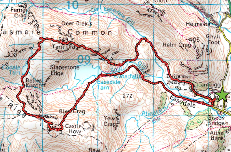
Blea Rigg and Tarn Crag
Walk date – 14th June 2022
Distance – 7.7 miles
Weather – overcast at first, sunny spells later, cool breeze at height
The weather forecast did exactly what it said on the tin today, dry with a light breeze, a cloudy start with the cloud eventually breaking and leading to warm sunny spells as the day went on. Well all of that made quite a contrast to the windy and showery weather we’ve been having recently. One day last week was particularly bad and resulted in several plants in the garden being bashed to the ground, they were newly in bloom too. Anyway, today offered a respite from strong winds so we decided to go over to Grasmere and walk up to Blea Rigg and Tarn Crag. Grasmere is often very busy but being a weekday and not school holiday time we thought it would be quieter, and so it turned out to be. The cloudy conditions at the start impacted the views but overall the weather was on its best behaviour and we had a good day.
Route
Easedale – Easedale Tarn – Blea Rigg – Codale Tarn – Tarn Crag – Far Easedale
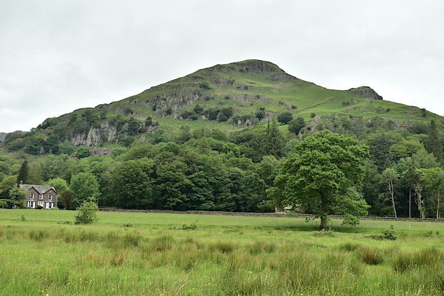
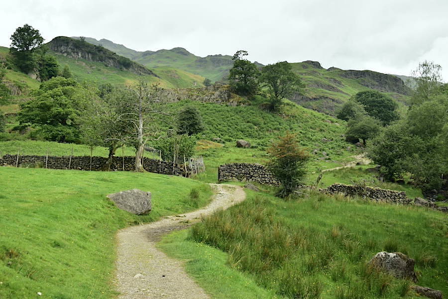
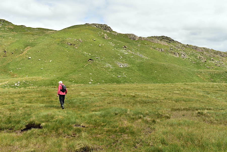
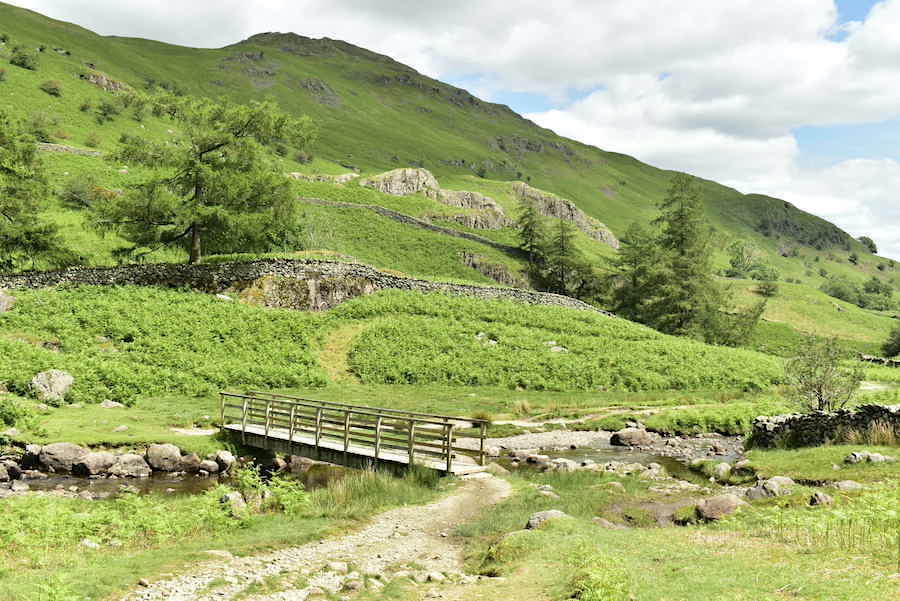
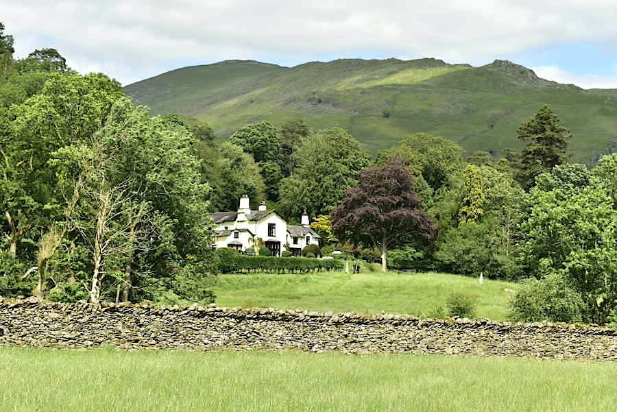
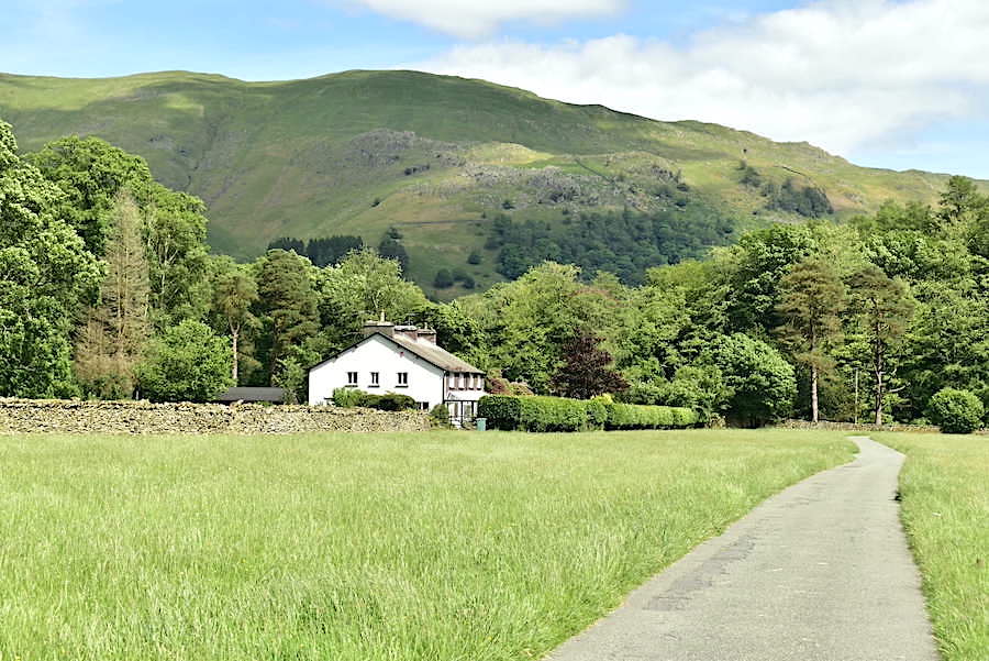
Helm Crag across the field as we begin our walk through Easedale.
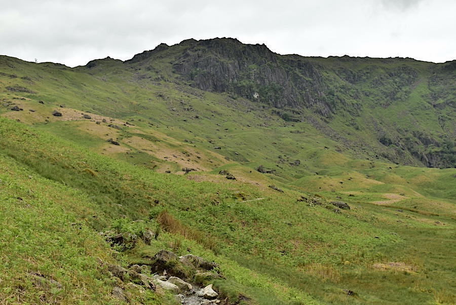
Cloud drifting around Tarn Crag from the path junction, we take the left hand path leading to Easedale Tarn.
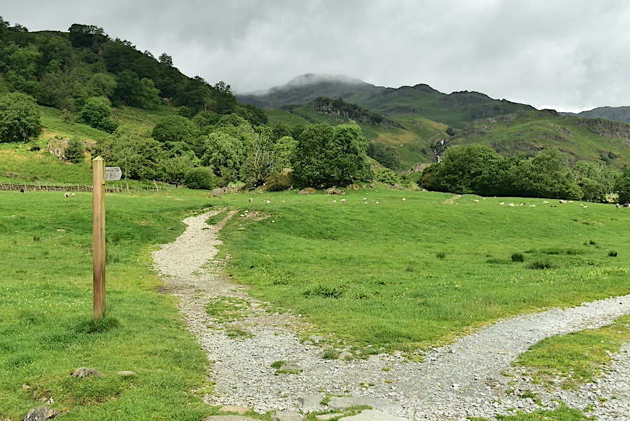
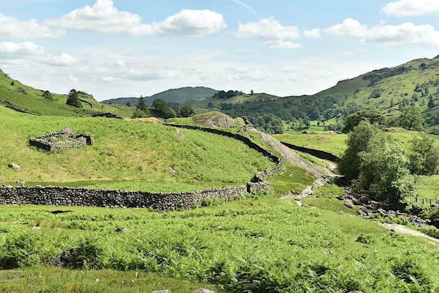
The gently rising path wends its way along Easdale.
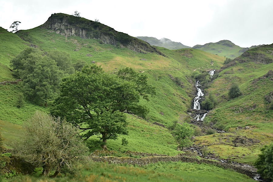
Further along the path we get a better view of the falls in Sour Milk Gill. We meet the first person of the day along here, a solo fell runner who gave us a cheery ‘Good morning’ as he passed by us.
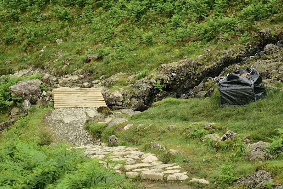
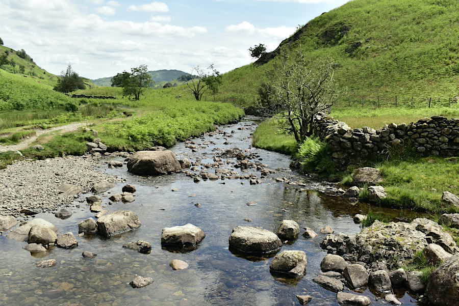
A new footbridge across one of the becks. The remains of the previous one have been packed into the black dumpy bag, presumably waiting for a passing helicopter to take it away sometime. The path becomes a little steeper along here …..
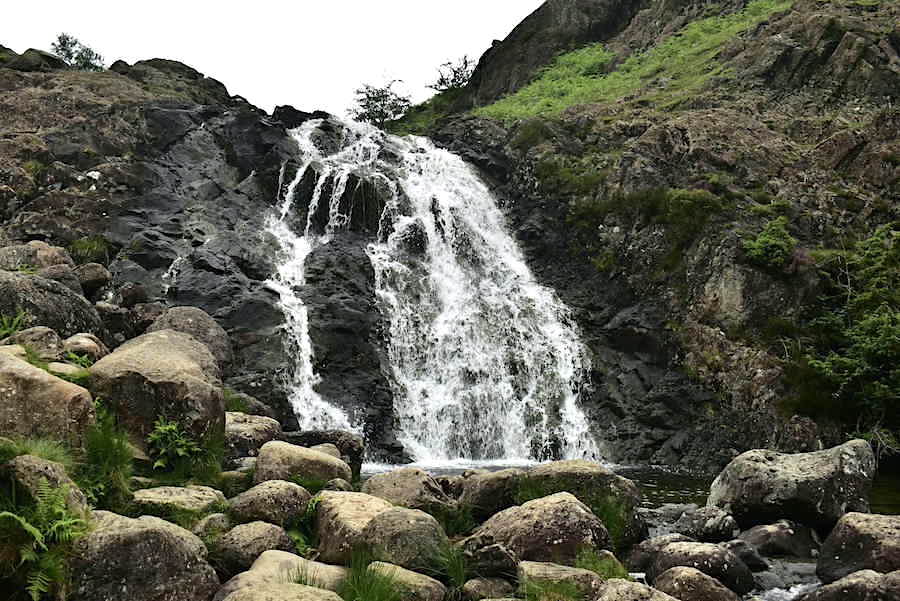
….. as it rises alongside the waterfall in Sour Milk Gill.
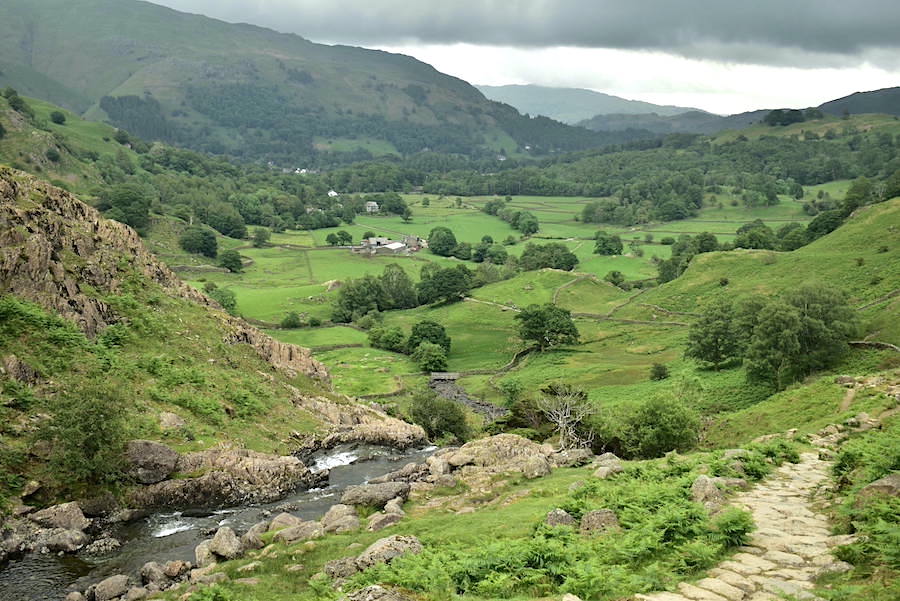
A look back along Easedale from just above the waterfall. A few minutes after taking the shot we noticed a very large group of walkers emerging from the patch of trees down there onto the open footpath. Time to get a move on methinks.
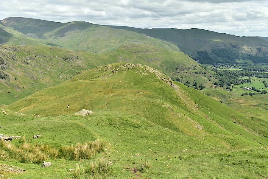
Tarn Crag comes into view as we round the bend at the top of the rise …..
….. and from the same point a look behind us to see cloud drifting around Grisedale Hause between Seat Sandal and Fairfield.
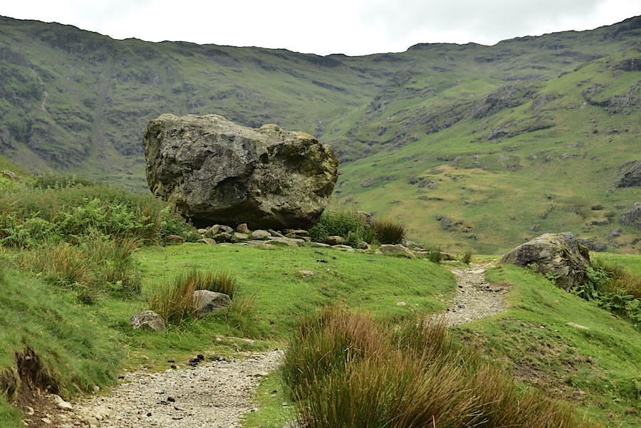
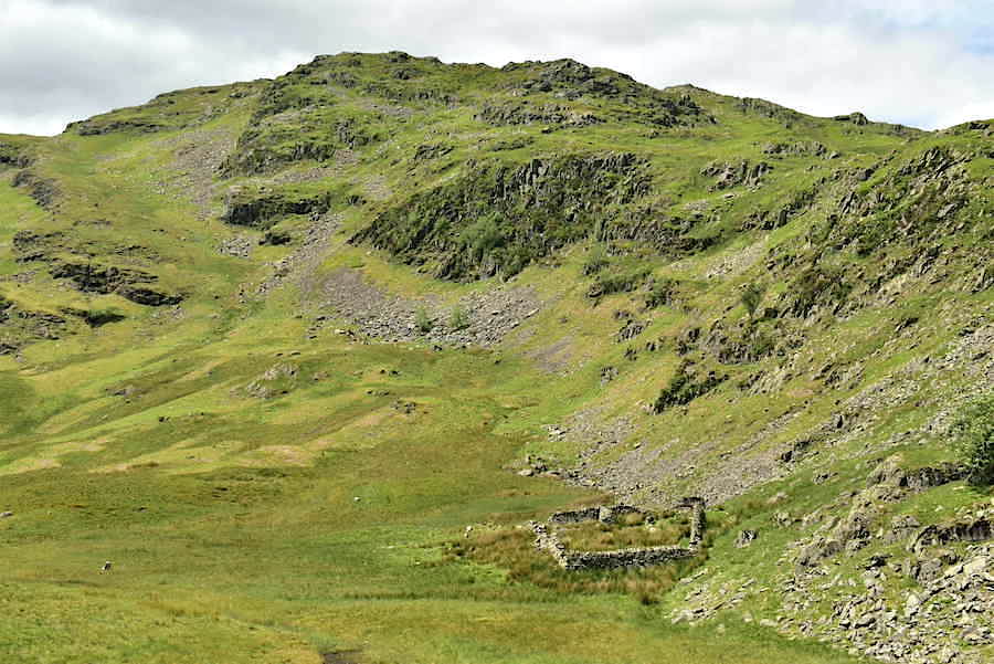
The path levels out as we reach the site of the former refreshment hut. If you want to see what it used to look like photographs are available if you do a search for it. The large boulder was used to make up a good proportion of the hut.
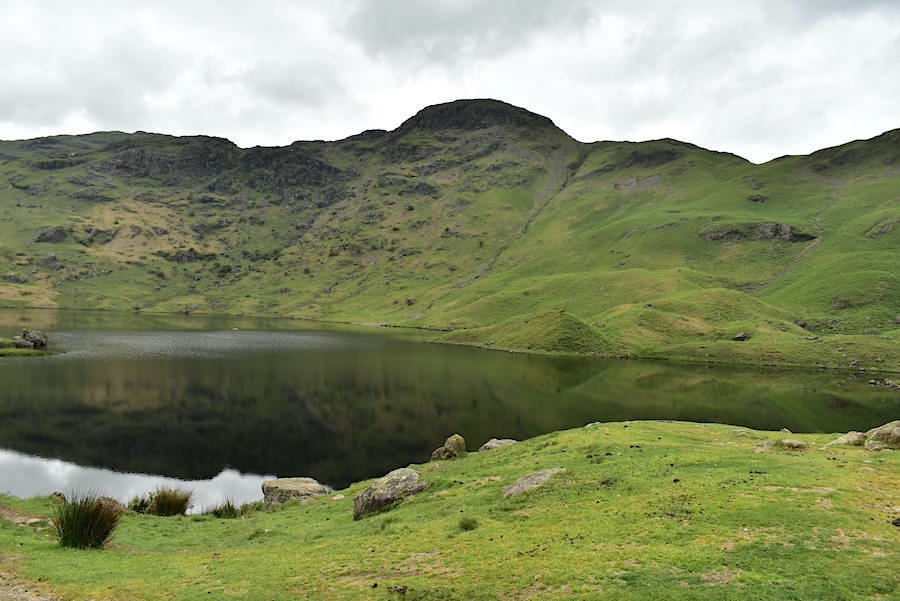
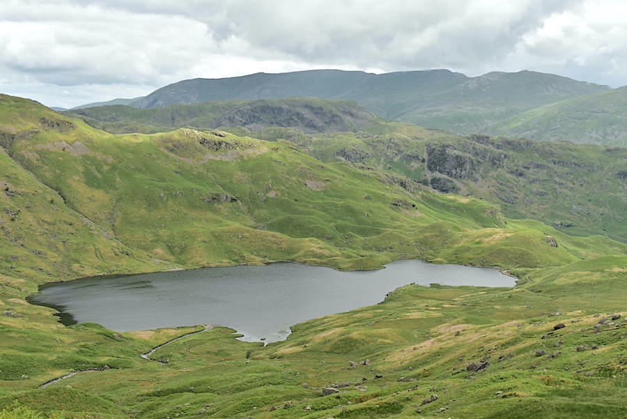
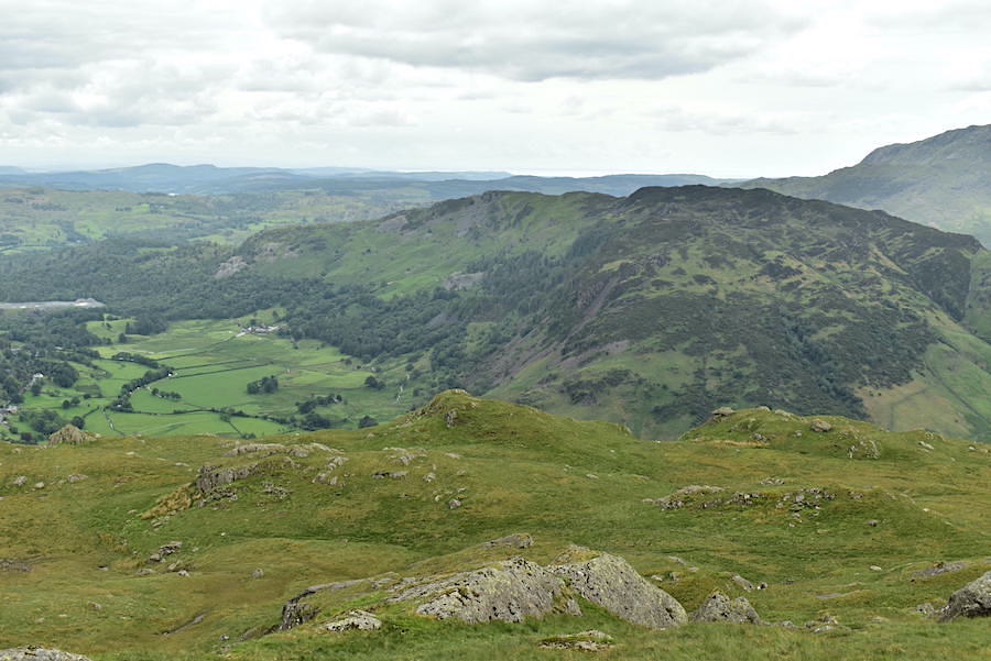
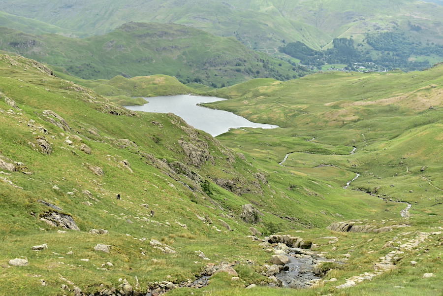
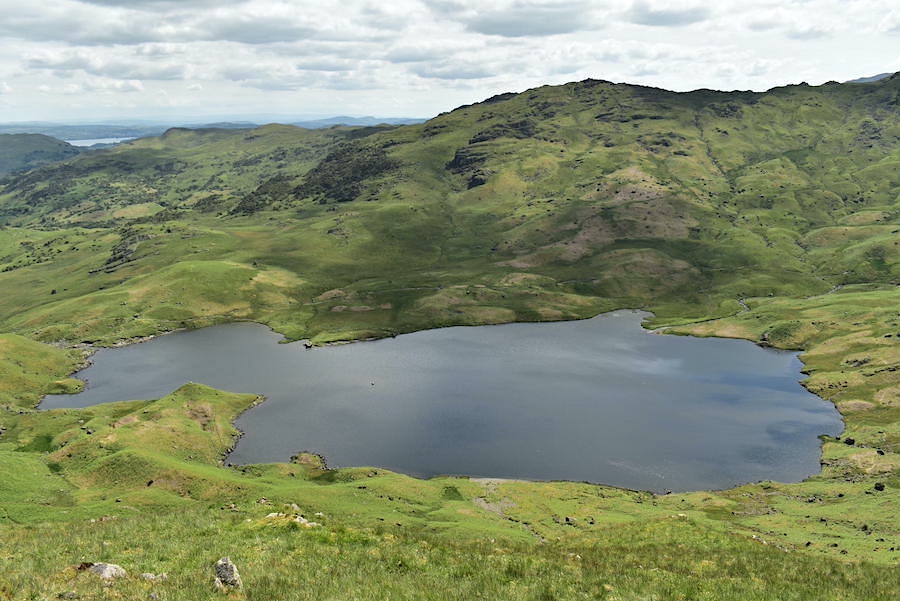
Easedale Tarn and Tarn Crag. The path we used to descend Tarn Crag is visible on the right, it begins at the v-shaped notch on the skyline. While we here taking our photos a few of the leading walkers from the large group began to arrive. Time to move on then. Would they be using the same route as us or the Belles Knott route we wondered?
We left the path beside the tarn and followed the one up the Blea Rigg ridge, as we climbed we could see the walking group below us making their way over towards the Belles Knott path and that was the last we saw of them.
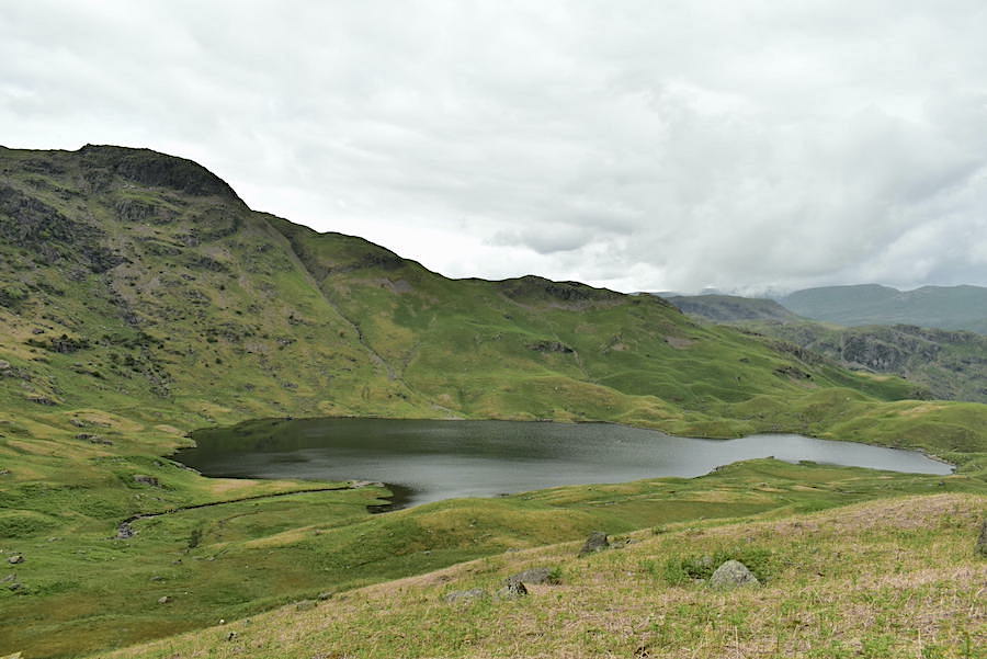
High enough up the path now for a shot of Tarn Crag and all of Easedale Tarn. The sky is still heavy with cloud so the light is poor.
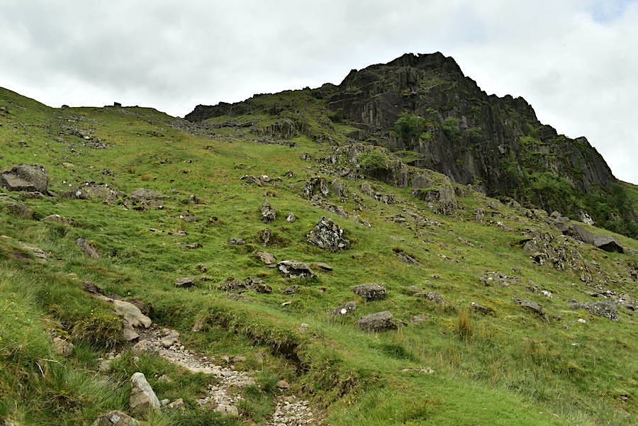
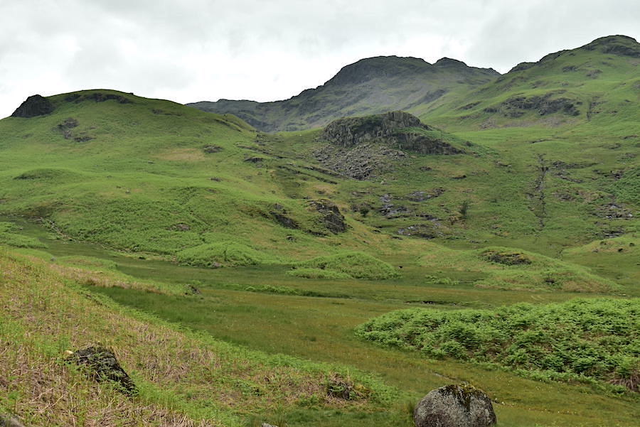
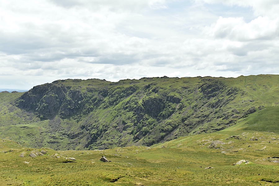
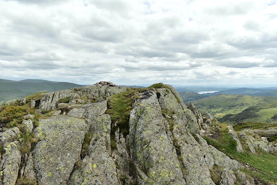
Almost on the ridge line now with Blea Crag in full view.
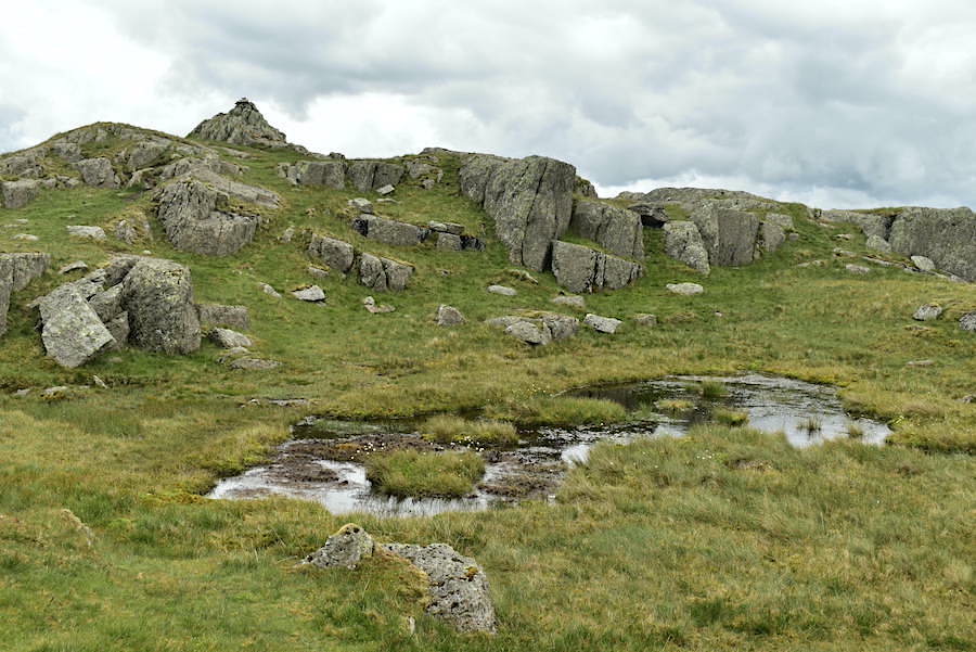
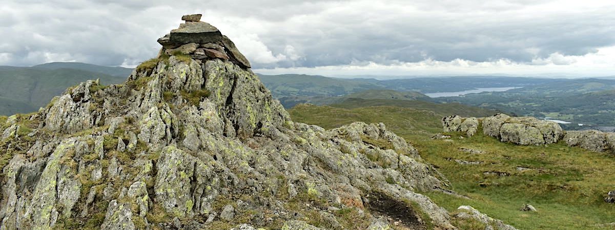
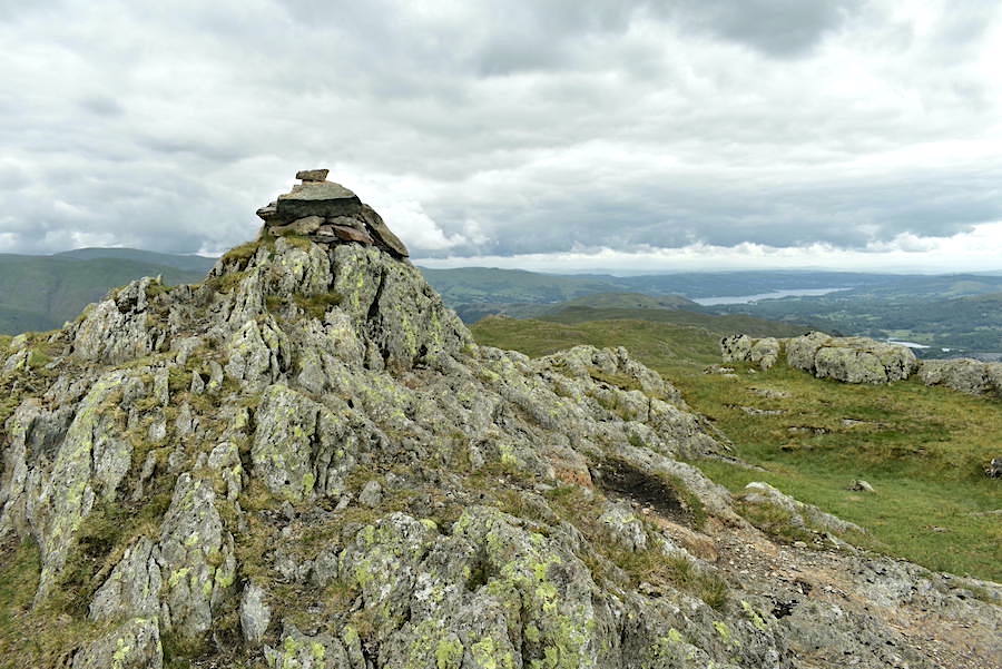
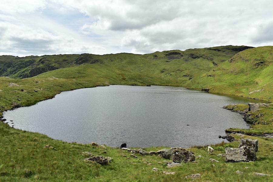
The summit cairn on Blea Rigg. The summit area is squelchy with lots of little pools, easy to see in the summer months but they will be something to be aware of when the snow is down. Getting your boots full of icy water would put a real damper on anyone’s day.
A grand view of Easedale Tarn and the Helvellyn group from the top …..
….. and, a little further to the right, a view of Seat Sandal, Fairfield and Great Rigg. Across the middle foreground are Gibson Knott (L) and Helm Crag (R)
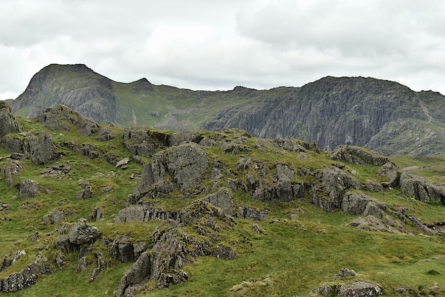
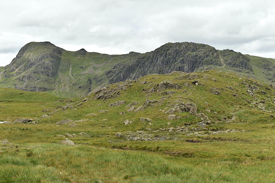
Harrison Stickle and Pavey Ark are also in view. While we were here another solo walker arrived and asked for directions back to Grasmere. He did have a map but seemed unsure about where he was and in which direction he needed to point himself. It can be a confusing ridge so a compass would help, don’t know if he had one though.
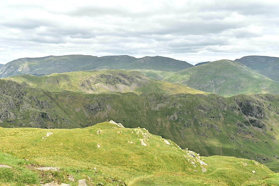
Below is Lingmoor Fell and Great Langdale. The heavy dark cloud seems to have gone but the sky remains dull and overcast.
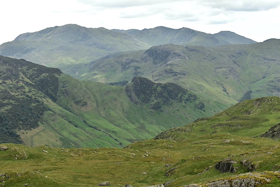
Immediately opposite us is Side Pike, the north western end of Lingmoor Fell, behind it is Blake Rigg leading up to Pike O’Blisco and on the skyline is the Coniston group of fells.
Pike O’Blisco, Cold Pike and Crinkle Crags on the skyline and another uncetain walker, checking his route, below us. He did eventually manage to make his way over to us to check that he really was standing on the summit. It can be very confusing up here but there are helpful indicators along the way if you know what to look out for, a split boulder/makeshift shelter being one of them. For photos see walks 17th July 2012 & 21st Nov 2015.
The view eastward from Blea Rigg summit. Windproofs go on as the breeze is quite cool and very lively up here.
Windermere in the distance.
Harrison Stickle and Pavey Ark as we leave the Blea Rigg path and go off path to begin the descent to the Belles Knott path.
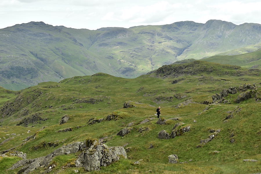
Sergeant Man as we cross the very squelchy ground.
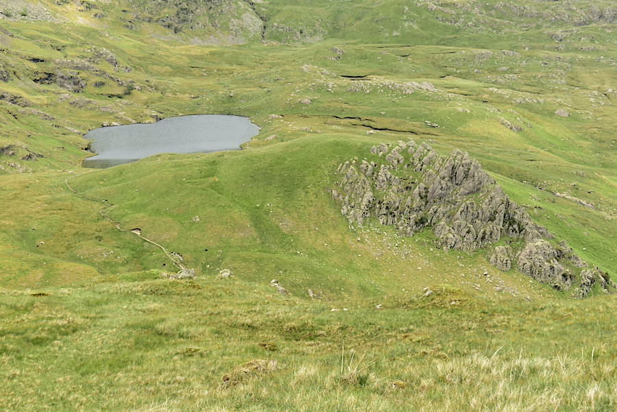
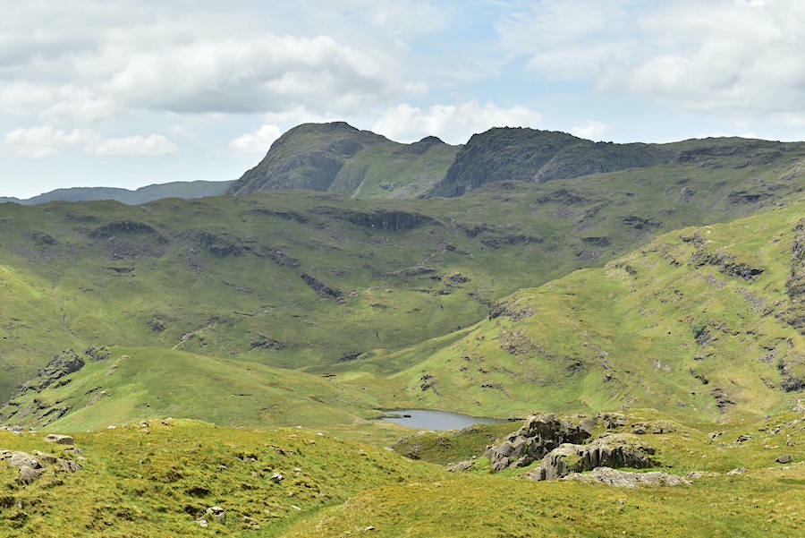
Codale Tarn and Belles Knott below as we make our way down to the path below. The walk down looks steeper than it really is and the soft grassland is easier on the feet than the established stony path.
A view of Easedale Tarn as we cross the path below …..
….. Belles Knott.
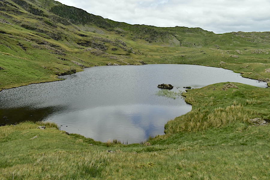
A steady climb up the path behind Belles Knott leads us to the south end of Codale Tarn …..
….. and after a few more minutes we reach the north end of it. A lovely quiet spot which very few people seem to visit, other than ourselves the place was deserted today.
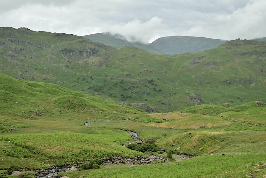
J leading the way across the wet ground above Slapestone Edge. This is the kind of terrain which sucks all the energy out of your legs, it certainly slows you down and it was a relief to be on solid ground again when we reached the path in the distance.
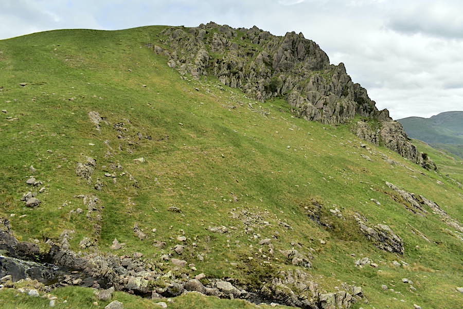
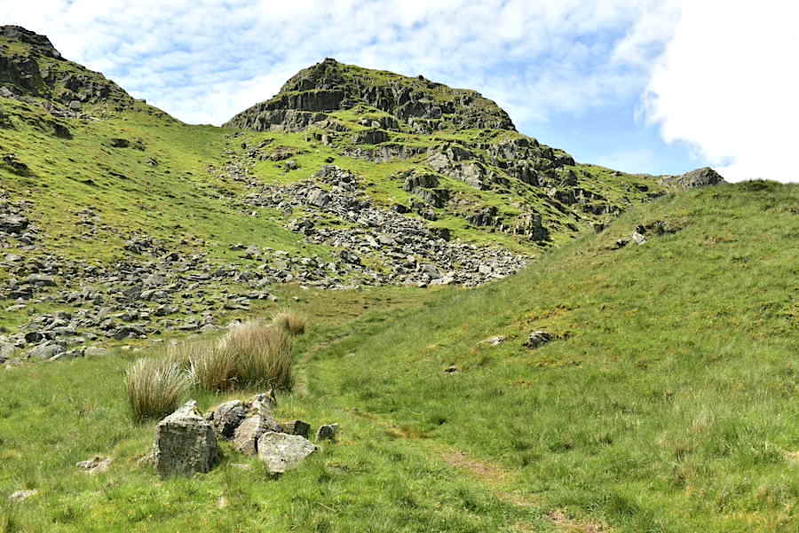
An old sheepfold nestled below Lang Crag as we climb up to Tarn Crag …..
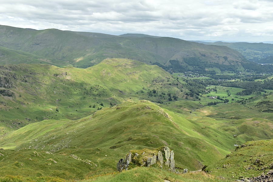
….. with a look back at the Blea Rigg ridge beyond Slapestone Edge.
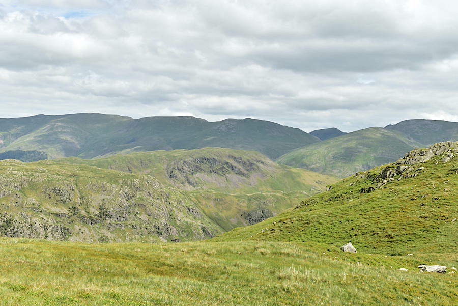
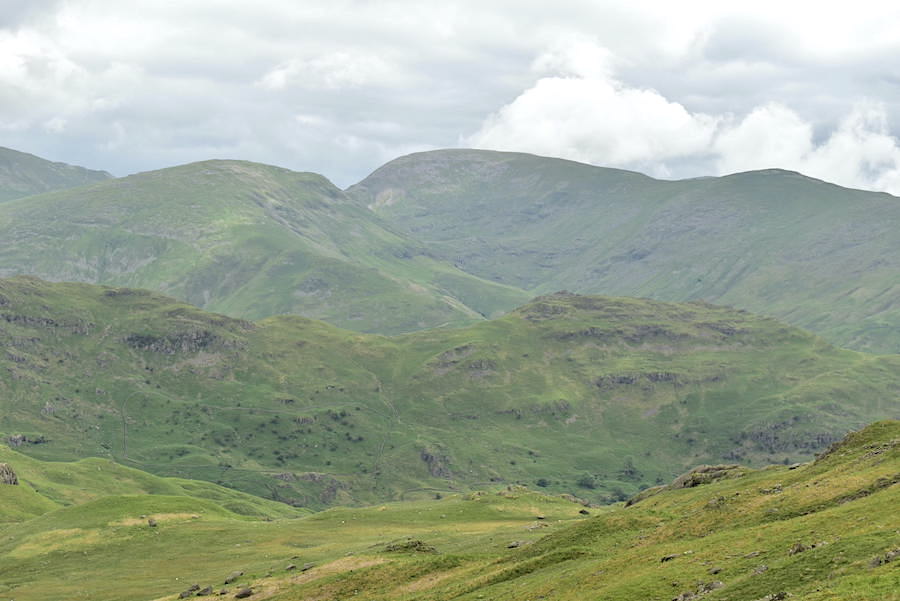
The view to the east as we make our way over to Tarn Crag. Slivers of blue are beginning to appear and the cloud is at last beginning to break. We’re high enough now to see Saint Sunday Crag between Dollywaggon Pike and Fairfield on the right hand skyline.
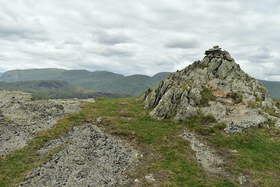
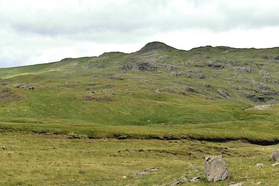
Nothing very impressive marks the top of Tarn Crag, just this insignificant heap of stones …..
….. although when you stand on the top you do get this very impressive view below. Nab Scar and Heron Pike are still rather muted but Helm Crag across the middle foreground is having a sunny spell
Harrison Stickle and Pavey Ark looking less gloomy now that the cloud is breaking up.
We dropped down just below the summit, found a sheltered spot out of the breeze and had a little light refreshment. This was the sunny view from our picnic spot.
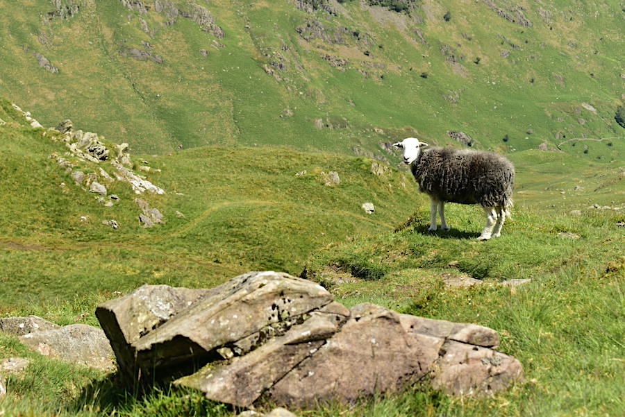
High on a hill stood a lonely Herdwick, yodel, yodel yodel! This was our picnic companion who joined us and, after checking us out, proceeded to bleat at regular intervals. There wasn’t another sheep anywhere in sight and no calls came in return so she bleated in vain. She eventually gave up and trotted off down the path.
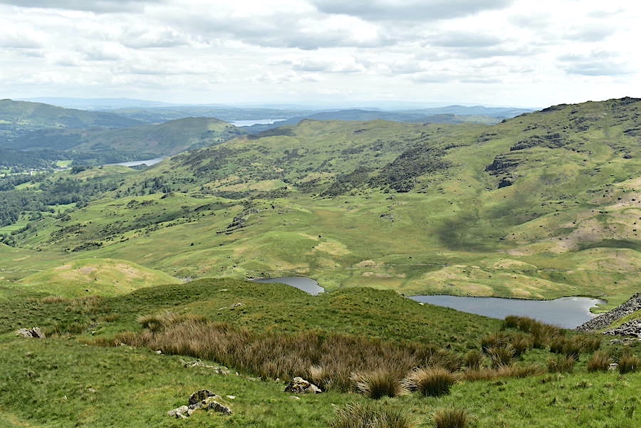
Three stretches of water were in view from our perch, Windermere in the distance, Grasmere below that, and Easedale Tarn just below us.
A look back at Tarn Crag as we begin the descent back down to Far Easedale.
A good view of Easedale Tarn below us.
The view ahead as we continued the descent. We turned off to the right, just before the main path starts rising up to the rocky area towards the end of the ridge, and followed that path down to Far Easedale. Initially the descent, through the new bracken, is steep so the brakes were on for a while.
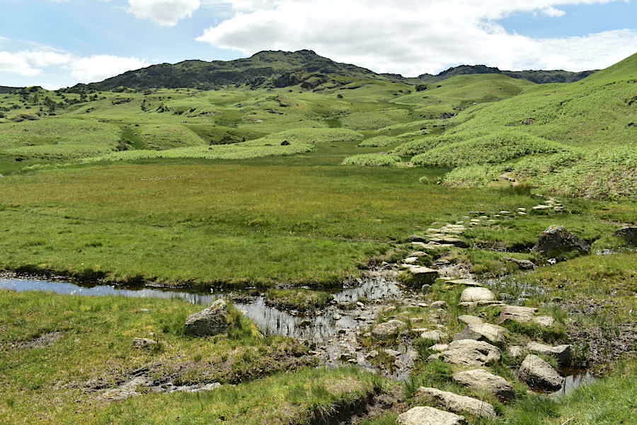
A look back at the stepping stones across the marshy area below Cockly Crag. Lots of black dumpy bags full of rocks were in place beside the path so its a work in progress.
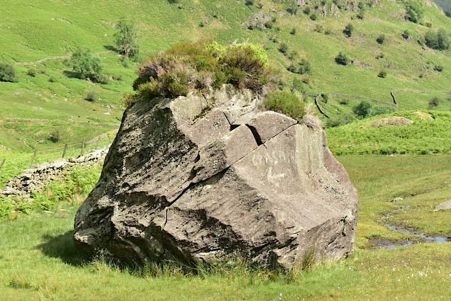
The boulder with multi-coloured ‘hair’ acting as a signpost and indicating the way back to Grasmere. More black bags full of rocks waiting to be put to good use were around here too.
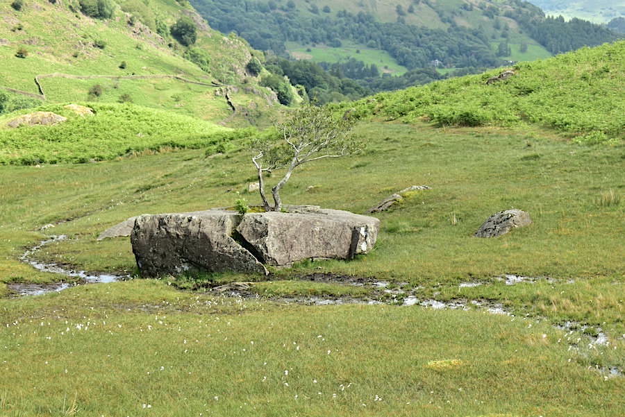
On the other side of the stream from the big boulder is the split rock with the tree growing through it. Both are a welcome sight as they indicate that you are almost back down in Far Easedale.
Helm Crag watching over Far Easedale as we reach Stythwaite Steps and the footbridge over Far Easedale Gill.
Stythwaite Steps from the footbridge. The footbridge provides a crossing when the gill is running high and covers the stepping stones. It was very sunny and warm by now and the gill proved too much of a temptation for hot feet. Off came the boots and socks and in went the feet – bliss! Several walkers came by as we were cooling off but nobody else partook of the foot spa treatment.
Boots and socks back on and we continue the walk back down Far Easedale.
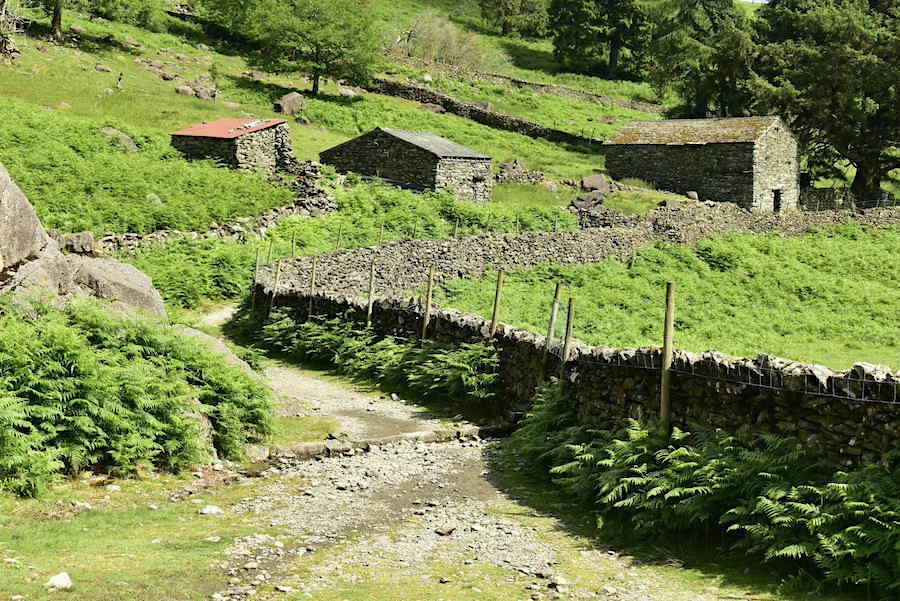
Three old barns along the way, the middle one having had a new roof recently. It was a lovely walk back, very sunny, no breeze at all now and a very pretty valley to look at and enjoy.
A view of Great Rigg and Stone Arthur on the skyline and the Lancrigg Hotel nestling in the trees below.
On the skyline ahead is the Heron Pike/Nab Scar section of the Fairfield Horseshoe and we are almost at the end of the walk through Far Easedale. It is very warm and sunny now, such a shame that we had heavy cloud cover at the beginning, the views would have been so much better. However, the weather stayed dry and a rain free walk is always a bonus. Now its back to the car and the drive home and, of course, getting the kettle going. A good day, all things considered.