Grisedale Tarn
Walk date – 8th July 2022
Distance – 8.5 miles
Weather – sunny and very hot, hardly any breeze
Following a couple of weeks of dull grey skies and very strong winds today’s forecast seemed rather better, with much lighter winds and the possibility of some sunny spells once the cloud began to break. As we haven’t been out on the fells for a while we decided a walk through the tranquil and picturesque Grisedale valley up to Grisedale Tarn would be just the thing to get the legs used to walking uphill again. The early cloud cleared very quickly and we remained in sunshine for the rest of the walk.
____________________________________________
Route
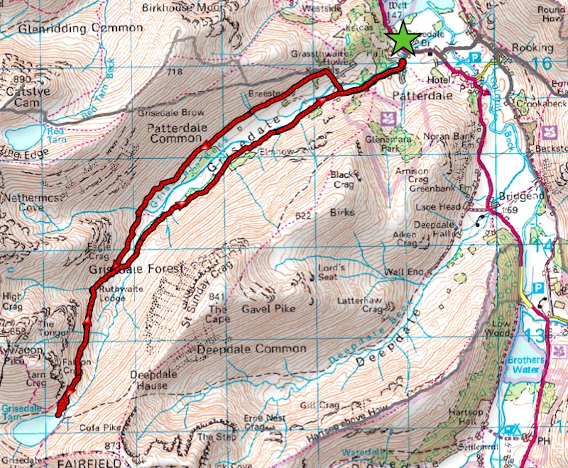
Patterdale cricket ground – Grisedale – Ruthwaite Lodge – Grisedale Tarn – Ruthwaite Lodge – Grisedale – Elmhow Plantation – Thornhow – Patterdale cricket ground
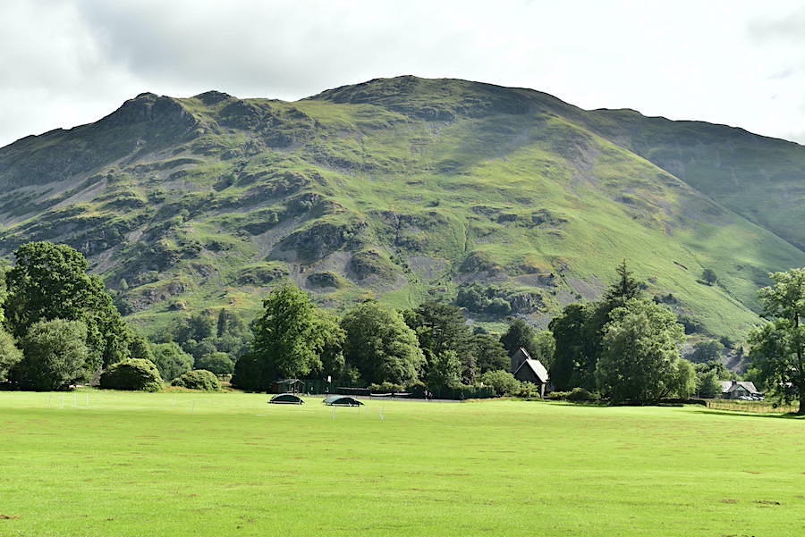
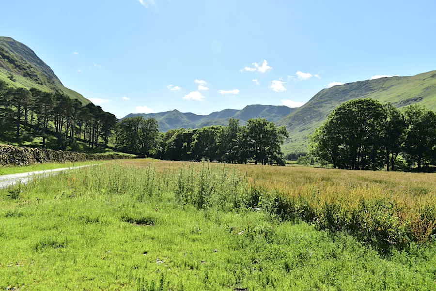
Place Fell from the cricket ground in Patterdale. Plenty of parking spaces available today and after popping £5 in the honesty box, with all donations going to the cricket club, off we went to walk up the tarmac lane leading on to Grisedale.
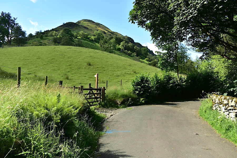
The lane climbs fairly steeply but begins to level out beyond the signpost. The path off to the left takes you on a pleasant stroll through Glenamara Park and back into Patterdale. If you fancy something a little more strenuous you could always branch off the park path and have a steep climb up Thornhow End, the one rising skywards beyond the signpost.
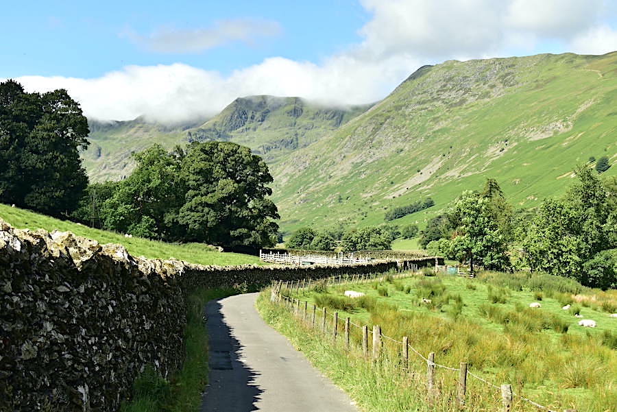
A few clumps of cloud still hanging over the Helvellyn range but it was clearing quickly and the temperature was rising steadily. A couple of farmers were busy in the sheepfold just ahead, we thought they might be getting ready to shear but on our return the sheep were still wearing their ‘jackets’ so it must have been something else that was needing their attention.
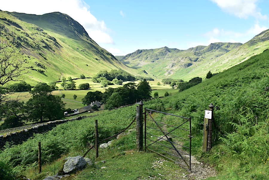
The tarmac lane comes to an end just before a double gate but the path, now a rough track, carries on through Grisedale. We have decided to take the path on the opposite side of the valley so, rather than pass through the gate, we follow the lane down to the right where a small bridge crosses Grisedale Beck. Only a few minutes separate this photo from the preceding one but the tops of the Helvellyn range are already cloud free.
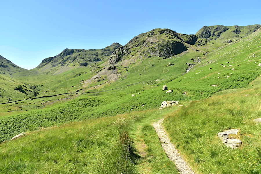
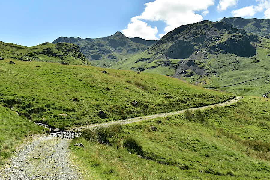
A look along Grisedale as we climb the slope up to the gate, beyond which is the path we need to take. Once on the path there’s only a very few steps before you reach a junction, the right hand path leads up to the ‘Hole in the wall’ and the beginning of the Striding Edge route up to Helvellyn, the left hand path carries on through the valley and up to Grisedale Tarn.
Starting out on the path through the valley with a clear view of the other path on the opposite side, both paths meet up at a footbridge below Ruthwaite Lodge. We’ll be using the opposite one for the return leg. Birks and Saint Sunday Crag rise steeply from the valley bottom.
Its single file only along here as the narrow path threads its way through the acres of bracken fronds.
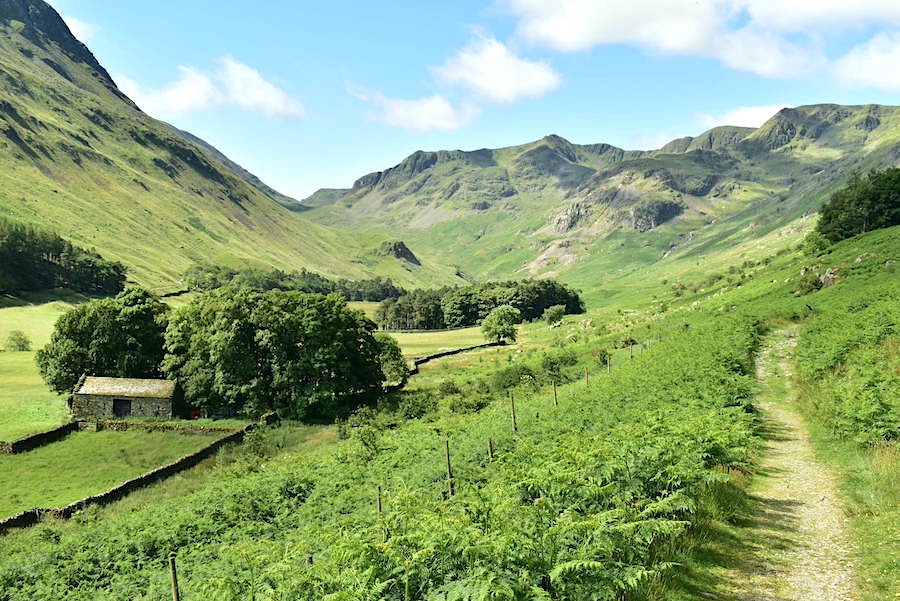
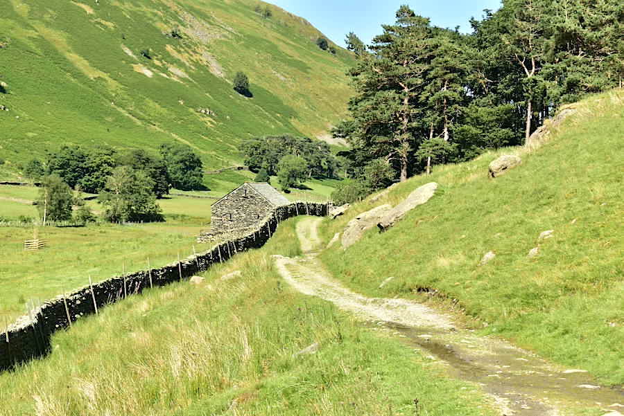
Passing a stone barn just below us, it more than likely belongs to Braesteads farm.
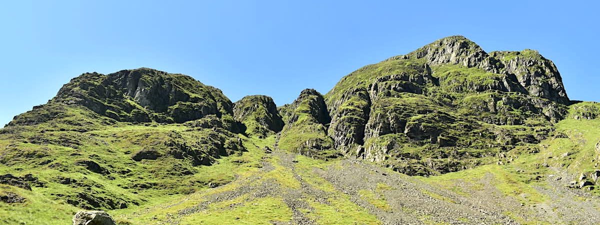
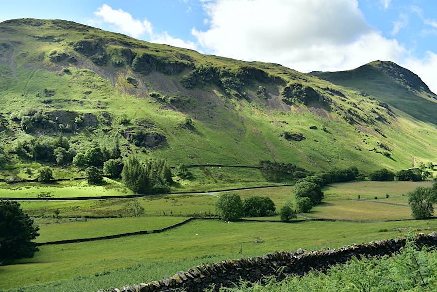
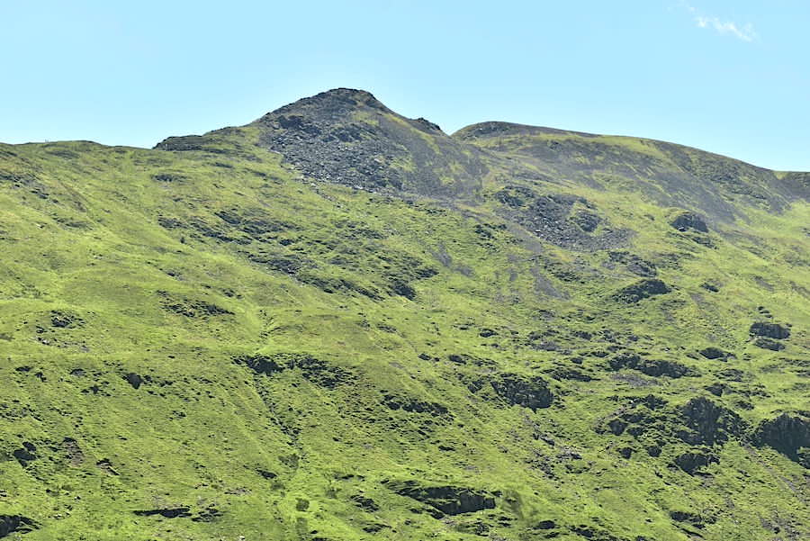
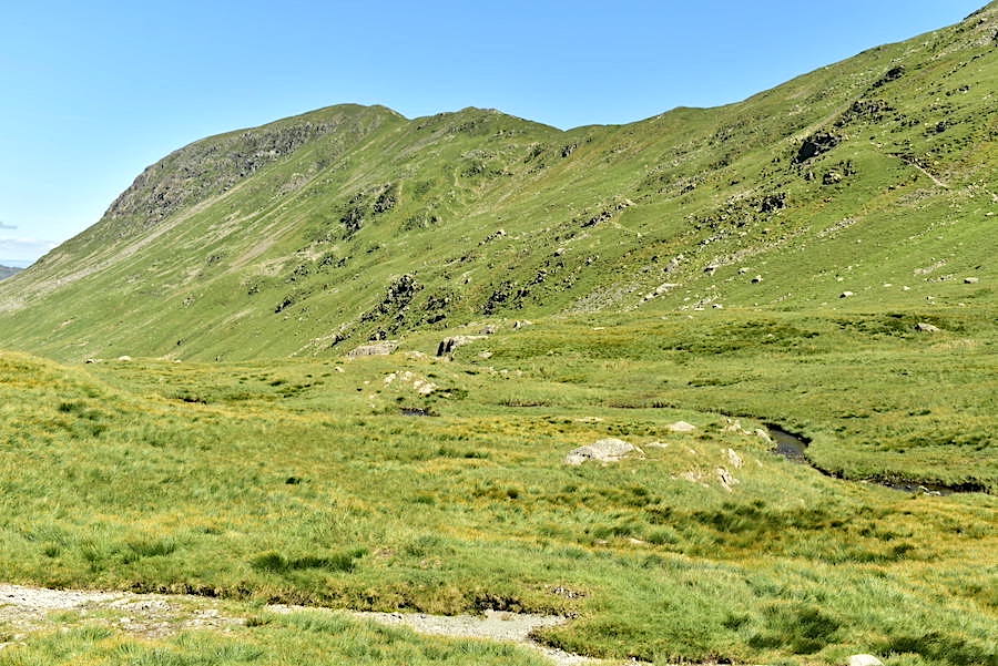
The path begins to curve its way around a few drumlins along the way and now we can just about identify Ruthwaite Lodge mountain hut. Unless you know exactly where it is you might not be able to spot it in the photo, even with a zoom in. Much easier to see is the mining area and the spoil heaps below Eagle Crag. The multitude of crags below Dollywaggon Pike and Nethermost Pike create a dramatic and formidable barrier in the upper reaches of Grisedale.
Still weaving single file around the drumlins on the lower slopes. We’re hardly doing any climbing at the moment but nevertheless our faces are constantly shiny and damp and the mopping up towels are working overtime.
The track widens and we have a temporary respite from the bracken. Its nice to see where you are putting your feet for a change. Eagle Crag and its mine workings are getting closer.
Nethermostcove Beck from the footbridge across it …..
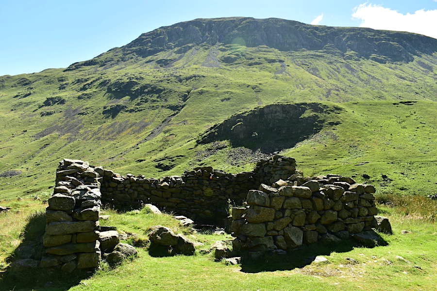
….. and the ruins of the former smithy just beyond it. The OS map has it marked as a sheepfold but its too small and too sturdily built for that purpose. Its very close to the mine workings too.
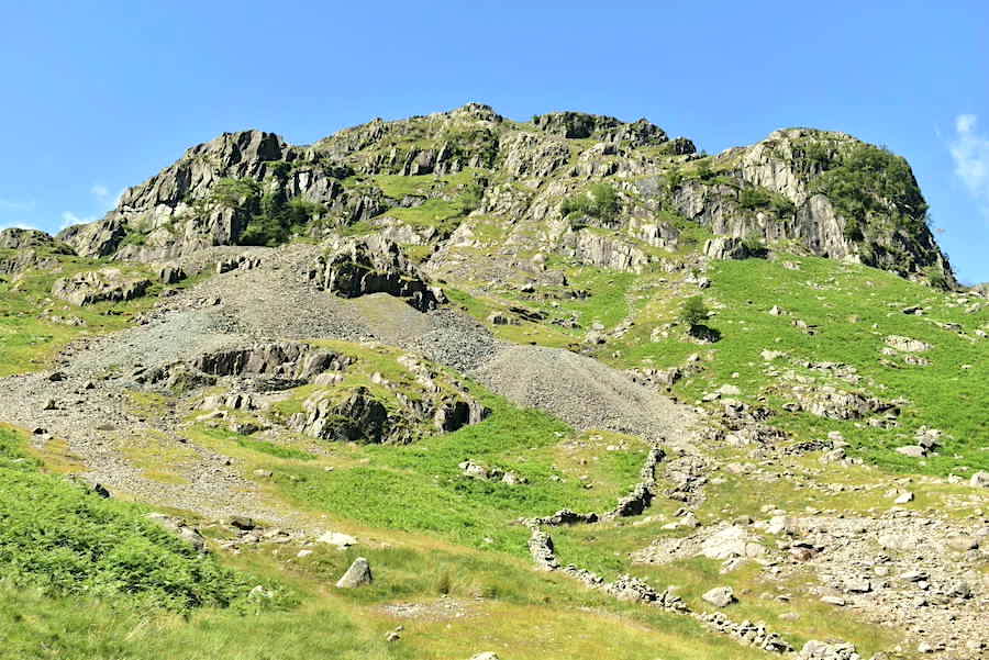
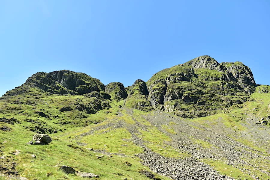
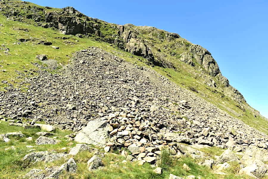
Eagle Crag and its lead mine workings which probably date back to the mid to late 1500s, during the reign of Elizabeth I. Work at the mine seems to have ended sometime in the 1880s. The main vein looks to have been the deep cleft running from top to bottom with numerous levels on either side appearing all the way up. Imagine the working conditions during the period the mine was being worked.
Another large spoil area lies just below the main area where some of the spoil stones have been used to create a large enclosure. Was the enclosure built for some mining purpose, a dressing floor perhaps, or created for some other reason after the mine closed? We keep intending to go over and explore the area but somehow it hasn’t happened, yet!
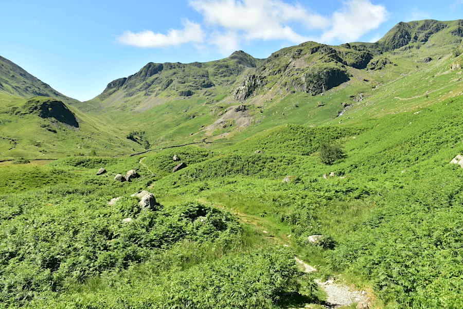
We move on from the mine area and the climb out of the valley becomes a whole lot steeper and much more strenuous. The path varies from good and firm, as can be seen in this shot, to very rough indeed and the old saying about ‘taking the rough with the smooth’ becomes very appropriate from this point on. The high temperature doesn’t help either.
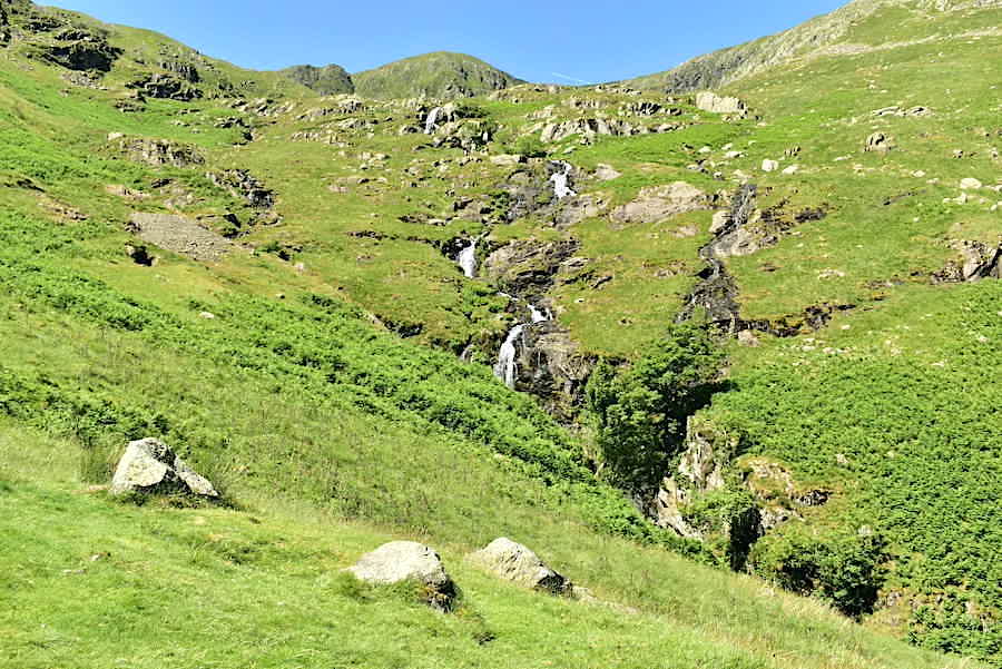
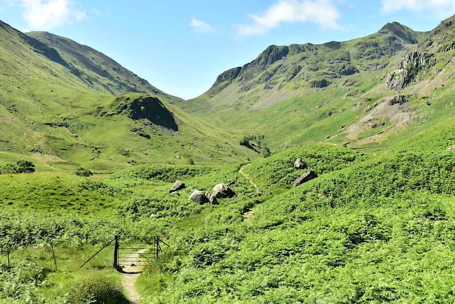
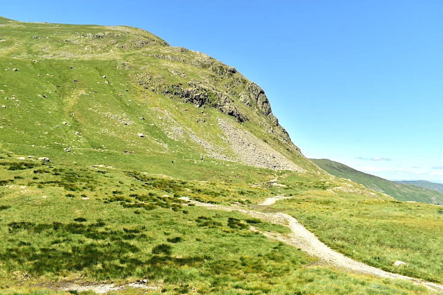
We’re just below Ruthwaite Lodge at this point and that’s High Crag just peeping up above Ruthwaite Cove. Hard Tarn is located in the cove and that’s another place we should explore some time in the future, preferably when the bracken has died down. The various becks flowing out of the cove aren’t named on the OS map, too many of them probably.
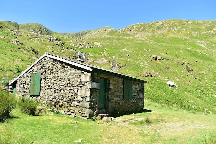
Ruthwaite Lodge mountain hut. The flattish area on which the hut is situated always provides a bit of welcome relief from the rough gradient up to it and its a good viewpoint too so we took a very short break and give the legs a couple of minutes to recover. On the skyline above the hut are High Crag and Nethermost Pike.
From the hut we rounded Spout Crag to begin the last leg of the climb up to the tarn. Its about a mile or 1.75k up to the tarn, which isn’t a great distance but the gradient becomes steeper, and in many parts much rougher, from hereon. Its also turned very warm indeed and there’s no breeze to speak of which doesn’t help matters. At some point along the way we met a couple of walkers coming down so we had a brief chat in passing during which we learned that the Prime Minister had resigned. What mediocrity will we have foisted upon us next we wondered, not that whoever it is will make the slightest bit of difference, they are all puppets and simply follow their puppeteer’s orders. Ah well, onwards and upwards, as the saying goes. Cofa Pike and Fairfield on the skyline.
Passing below Tarn Crag and Falcon Crag on the way up to the tarn. The numerous ‘streams’ of rocks and stones on the slopes below them are likely to be washed down onto the path below eventually, thus creating some difficult walking conditions underfoot in various sections. As we pass below Tarn Crag, on the left of the shot, we begin looking to our left in order to locate …..
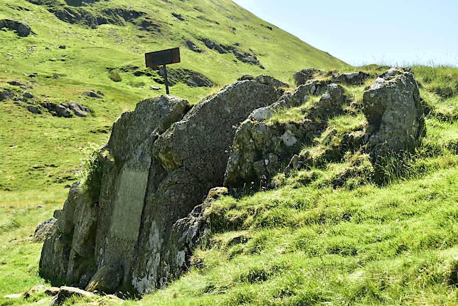
….. The Brothers Parting Stone. It is situated a short distance from the outflow of Grisedale Tarn and is midway between the footpath and Grisedale Beck below Tarn Crag. The iron sign bearing the name was clearly visible in the bright light today so we had no trouble locating it. Its difficult to photograph because of its position but the shots I took didn’t turn out to be too bad in the end.
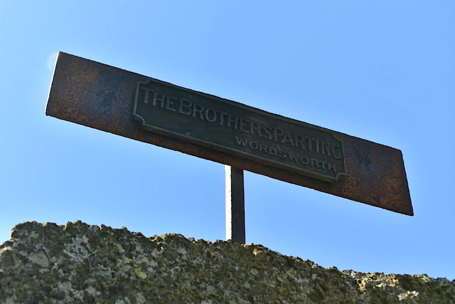
‘The Brothers Parting’ and the name Wordsworth. The iron plaque marks the place where a stone, carved with two stanzas of William Wordworth’s poem of the same title, is sited to mark the spot where William and his brother John said goodbye to each other, though neither of them knew that it would be for the very last time. John, a ship’s captain, died when his ship, ‘The Duke of Abergavenny’, hit the Shambles, a bank of shingles off Portland, and sank during a strong tide. William felt the death of his brother very keenly and subsequently wrote the poem in memory of their last goodbye. It was interesting to read on this site https://scafellhike.blogspot.com/2019/08/the-wordsworth-brothers-parting-stone.html that the iron marker plate went missing for a few years but was eventually found in Grisedale Tarn and subsequently returned to its rightful place above the stone inscription at the head of the valley.
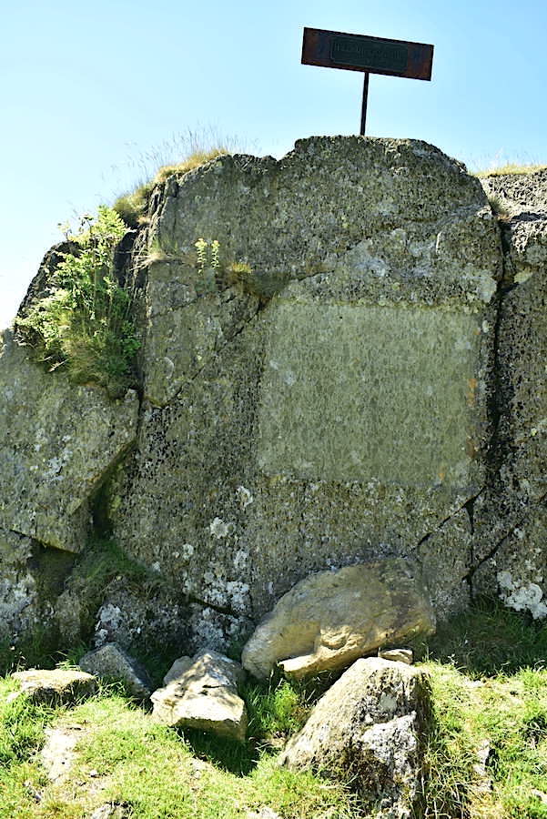
Below the iron plaque is the stone itself but it is so weathered now that it is impossible to read. It should read as follows:
‘Here did we stop; and here looked round
While each into himself descends,
For that last thought of parting Friends
That is not to be found.
Brother and friend, if verse of mine
Have power to make thy virtues known,
Here let a monumental Stone
Stand—sacred as a Shrine.’

From our short diversion to the stone we carried on to the tarn. I took a look back towards the iron plaque, clearly visible in the bottom left corner of the shot, and thought about how the surroundings will have hardly changed since the two brothers said their goodbyes all those years ago, no doubt experiencing the same feelings as we do when cars drive away or trains and buses pull out of the station.
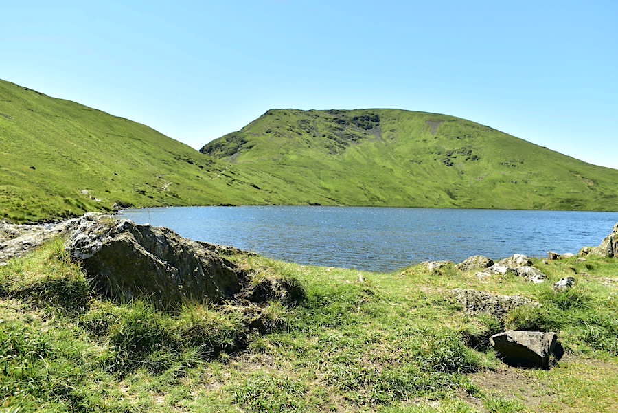
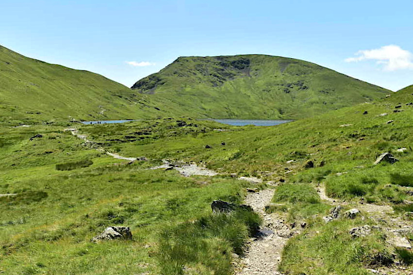
A lovely sight to banish any lingering melancholy as we walk the last few steps to Grisedale Tarn with Seat Sandal forming the backdrop …..
….. a very light breeze ruffled the water and the sunlight bounced off the surface in thousands of twinkling diamond sparkles. It was busy with walkers who, like us, had made it their destination for the day. Swimsuits and shorts were on and there were many intakes of breath as hot bodies immersed themselves in the cold water. Only a handful of walkers made their way up Dollywaggon and we saw no-one at all on Seat Sandal or climbing up the col between Fairfield and Saint Sunday. Midday under a blazing sun the banks of Grisedale Tarn were the best place to be it seemed. Most walkers dabbled their toes, as we did, happy just to enjoy the sun, the scenery and the contents of their lunch boxes. Here’s a few of the shots I took while we were there …..
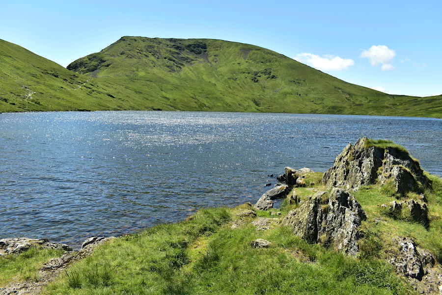
….. Cofa Pike and Fairfield and the start of the path up to the col …..
….. Saint Sunday Crag and, in the upper right corner, a section of the path leading up to the col between it and Fairfield …..
….. Tarn Crag, to the right of and below which is The Brothers Parting Stone.
All good things must come to an end and so we set off back to Patterdale with a last look back at the tarn and Seat Sandal.
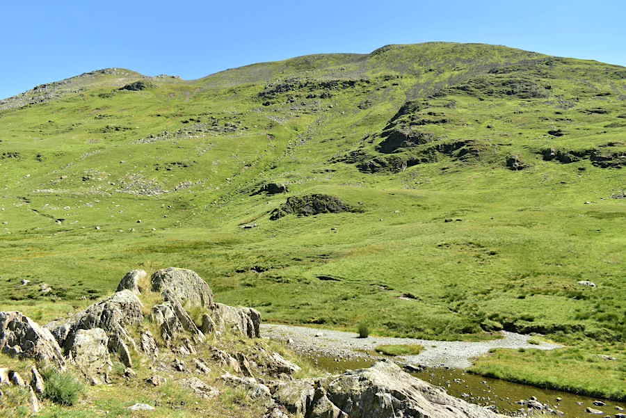
A waymarker cairn below a slope of scree on Tarn Crag, although its difficult to separate one from the other.
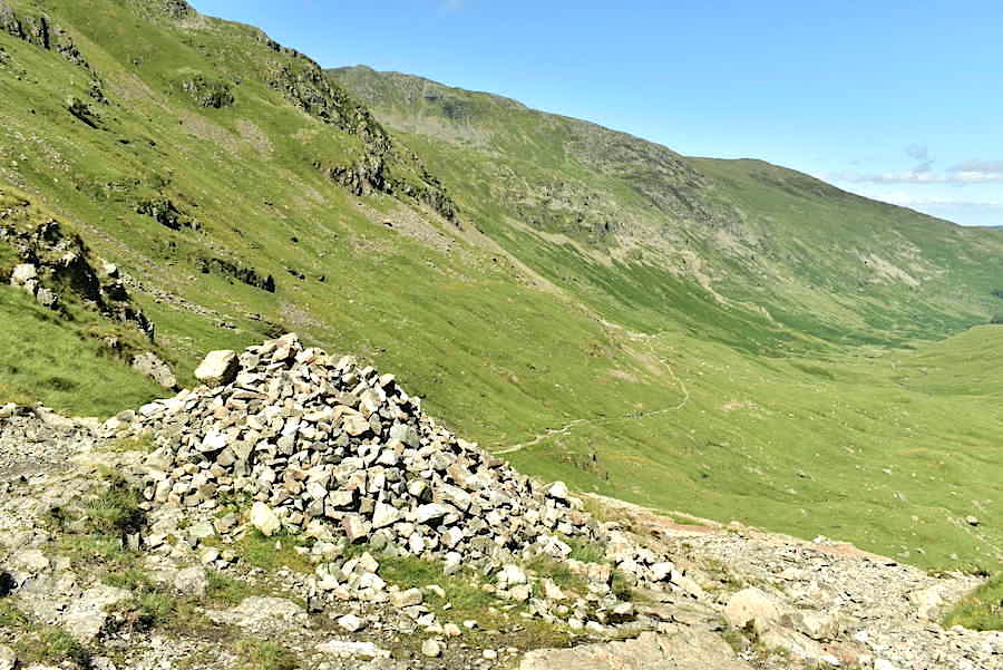
Further down the rough and rocky path another waymarker cairn appears plus a view of part of Striding Edge and Birkhouse Moor on the skyline. The camera went away at this point until we were back at Ruthwaite Lodge as I needed all the concentration I could muster in order to stay upright. You definitely need to watch where you’re putting your feet along this section.
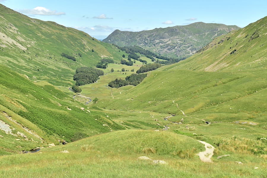
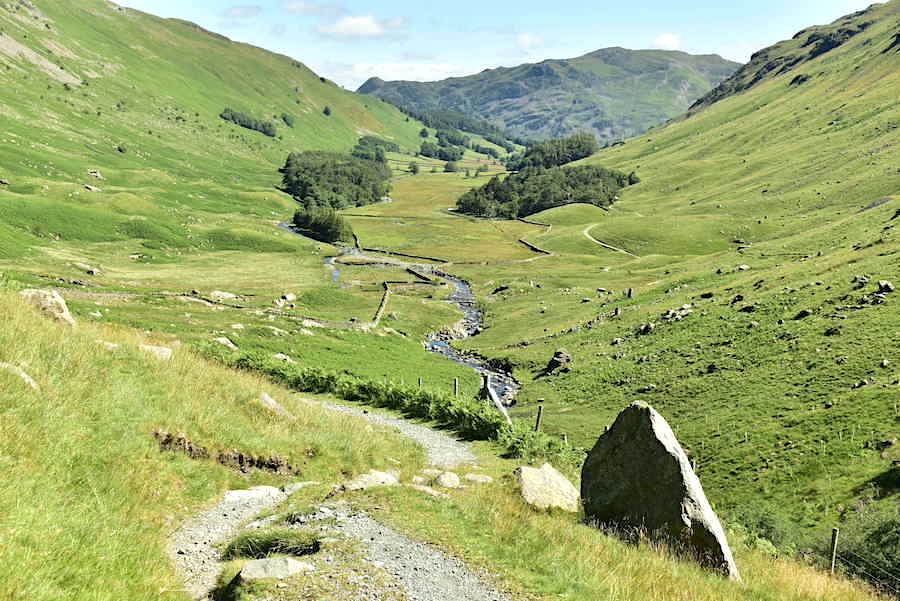
A superb view along Grisedale from Ruthwaite Lodge. A school party, of what looked like sixth formers, had settled by the hut for their lunch break so we didn’t linger.
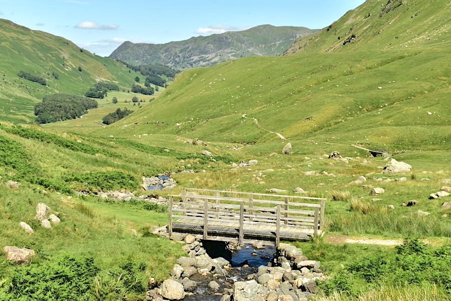
Back down to the bridge just below the mountain hut where we take the path leading off to the right for the return leg down to Patterdale.
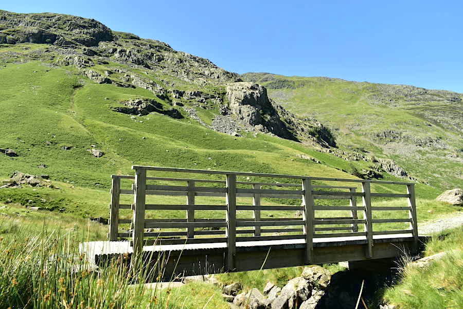
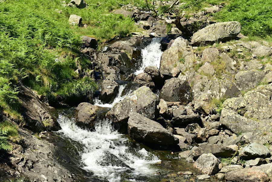
We stopped by this bridge over a feeder beck, dunked our towels in the cold water and hung them around our necks, instant cool down and absolute bliss.
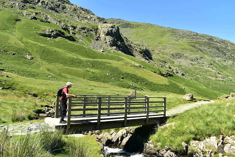
J waits for me on the bridge and contemplates Eagle Crag again while I fill one of our empty juice bottles with fresh cold water.
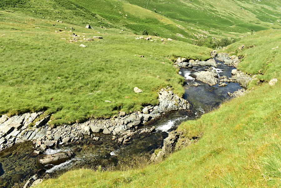
Grisedale Beck looked very inviting but it was too far below us so all we could do was look at it.
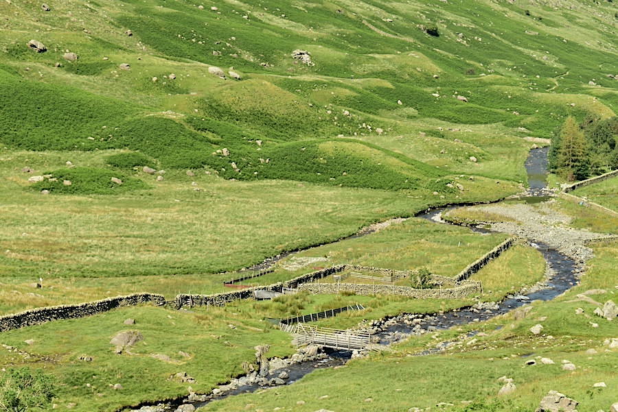
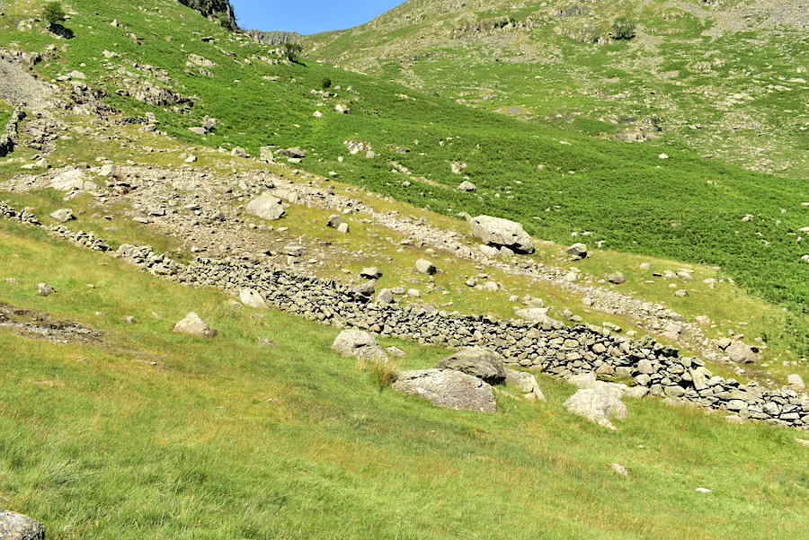
Another footbridge down below and the path from it links up with the one we used on our outward leg. The spit of land between the two arms of the beck contains a sheepfold/washfold, and the green drumlins that we walked around earlier now looked like clusters of barnacles clinging to the keel of a boat.
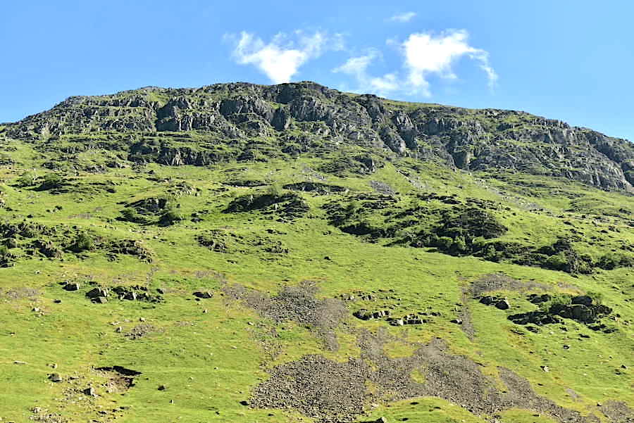
Above us are the crags and pinnacles of Saint Sunday Crag.
A view back up the valley where it is now very hot and every feeder beck we come to has us dunking our towels in it in an effort to stay comfortable.
The old barn below Elmhow Plantation. The shade provided by the trees was very welcome even though it was short lived.
Walking back to Patterdale along the car access track to the holiday rental cottage at Elmhow which now sports a new satellite receiver dish so holidaymakers aren’t quite so incommunicado as they used to be.
Blimey, its very hot now but we’re almost at the end of the car track. When you see Keldas, the little hill in the distance, you know that some welcome shade isn’t that far away.
A look back into Grisedale as we reach the gate and hit the tarmac lane again. Its a long walk back down through the valley, about three miles, especially in this heat, so once through the gate we had a short break on the old iron park bench beside it just to have a breather before …..
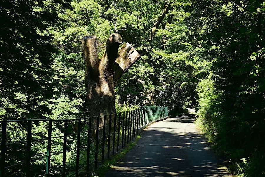
….. entering the cool and shady tree tunnel above Grisedale Beck, giving us a few minutes of blissful respite on the way back down to the cricket ground.
Back at the car and the cricket ground with a view of Angletarn Pikes to round off our walk on an absolutely glorious day. Although we haven’t visited any fell tops today it definitely feels as though we have. Grisedale Tarn’s surface elevation is 538 metres or 1765 feet so there’s a good bit of climbing, over some very rough sections, up to it from where we are parked. Time to go and get the kettle on, a cup of tea will round off the day very nicely thank you. Hope you’ve enjoyed the walk just as much as we have. Back soon, we hope, weather permitting.