
Borrowdale
Walk date – 9th July 2026
Distance – 6.5 miles
Weather – hot and sunny, very light occasional breeze
Well, would you believe it, summer turned up at last. After writing that the day after our walk on Monday the weather up here had reverted to type, along came Wednesday, bringing with it stifling heat, sunshine, blue skies and a very light breeze. The forecast for Thursday promised more of the same so we opted for a walk in Borrowdale starting from Grange. Its much the same walk as we did on 17th December 2016 but today we didn’t go up to the Rigghead quarries or climb up Castle Crag. One of the appealing aspects of this walk is that the majority of it goes through woodland which provides plenty of dappled, cool shade, just the ticket for today’s sweltering heat.
Route
Grange – Hollows Farm campsite – Low Hows Wood – High Hows Wood – Longthwaite – Borrowdale YHA – Johnny Wood – Scale Close Coppice – path to Castle Crag – Broadslack Gill path – Gowder Dub – Dalt Wood – Hollows Farm campsite – Holmcrag Wood – Grange


We started out from Grange having parked the car just in front of the Methodist chapel. The chapel is located immediately after crossing the bridge across the Derwent river. In the shot above is the Grange Cafe and just beyond the outdoor picnic tables is the signpost pointing the way to Hollows Farm campsite. The cafe doesn’t open until 10.00 am so it was closed when we passed it about 9.30 am.

Here’s the signpost pointing the way over to the campsite, the road on the right goes over to Manesty. The walk along the lane to the left goes through Holmcrag Wood which provided plenty of shade for us as we ambled along.

The Hollows Farm campsite, not completely full at the moment but it is quite large and has lots of space. I forgot to take a shot of the info board at the entrance but I did remember as we passed it again on our return leg and all the information about the site is included towards the end of today’s report.

We kept on the path to the left as the path over on the right doesn’t go anywhere, it simply provides extra car parking space for the campsite.

The pebbly track eventually became a concreted one for a very short distance down a steepish section, presumably to assist anyone using the track in keeping upright. If you’ve ever walked down a steep and pebbly path you’ll probably know that the pebbles have a habit of rolling away beneath one’s boots and if you aren’t quick or nimble enough you can easily end up sprawled all over the path. I think we were walking through Dalt Wood when I took the above shot and a number of small becks were dribbling into the river as we walked along the track.

Looking up at one of the impressive crags on the Maiden Moor to High Spy route. I don’t know precisely which set of crags it is as there are quite a few along that particular route.

At the signpost we took the left hand option which takes walkers along the riverside. The path to the right is the one up Broadslack Gill and passes below Castle Crag. I took a couple of shots of the river as we walked along beside it …..

….. where everything was cool, green and shaded as …..

….. the river Derwent flowed silently downstream into Derwentwater.

This group of rocks looked like a school of sharks as they jutted out across the path through Low Wood.

A short climb took us into High House Wood where we began to meet other walkers, some of whom were making their over to Millican Dalton’s cave, others were just walking along and enjoying the cooling shade. They were all coming from the Rosthwaite direction and that’s the direction in which we’re heading.

I didn’t take many photos on our walk through the woodland as one woodland shot is pretty much like another. Here we’ve arrived at the end of this particular woodland walk and are about to enter the sunlight again.

Walking across Pennybridge Dub now with a view of High Scawdel. Over on the extreme right of High Scawdel part of the Rigghead quarries can be seen. We’ll be heading for the path below High Scawdel before long and we weren’t looking forward to the climb to it from Johnny Wood as we know there are no trees to provide us with some cooling shade.

The path brought us around to the river’s edge at this pretty spot so we sat on the grass and had a short break. We had intended to spend only a couple of minutes but we could see a large group coming towards us so we waited a little longer until they had passed by. They turned out to be a group of girls, each one carrying identical backpacks bulging with their gear, possibly a D of E group or one of the other enterprises which organises similar groups for teenagers to participate in. The backpacks looked very heavy and cumbersome and most of the girls didn’t look like they were enjoying themselves much.
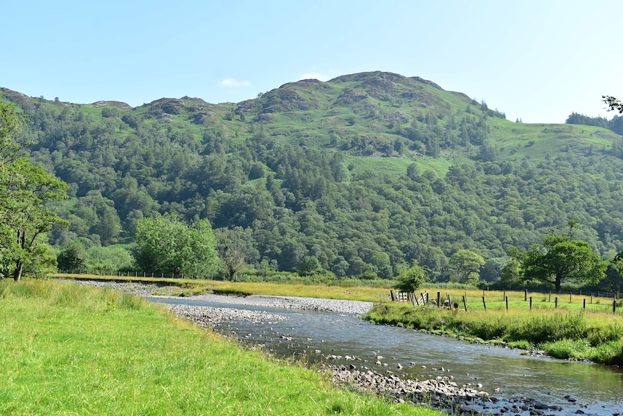
From our perch on the grassy bank a look back at the river flowing downstream behind us. I’m not sure what the fell is which is prominent on the skyline, it could be Brund Fell, which is part of Grange Fell but it could also be one of the nameless bumps around Puddingstone Bank.
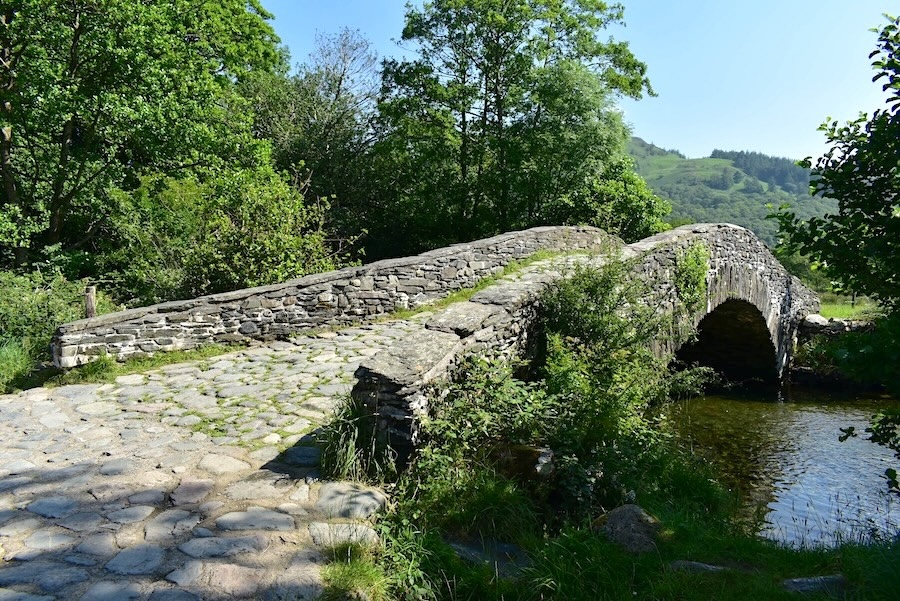
After our short break we continued on our way but we hadn’t gone very far when we found ourselves in the middle of a separate group of teenagers. They were also wearing identical backpacks but which were different from those the previous group of girls were carrying. Some were being called out to not to go any further and there seemed to be an air of consternation around this group. Perhaps they were missing a group member, as one of the adults in charge of them seemed to be describing something that someone was wearing. We walked through the mayhem rather than get involved in something in which we couldn’t be of any assistance. We walked on to the bridge across the river where there was another and much older group of walkers who were deep in conversation so I took a quick shot and we moved on.

Great Crag came into view as we walked on towards the …..

….. difficult to walk on riverside path as initially it consists of rather larger rounded stones all of which were of different height. I felt a bit like a grasshopper as I hopped from one stone to the next.

Further on were the stepping stones where for the first time I noticed a lady of middling years actually using them as I took the following shot …..

….. I was actually taking a photo of the path, now made up of tree roots as can be seen in the bottom left of the shot, and even harder to walk on than the previous rounded stone section. The woman stepped nimbly across them as though she had been doing it for years, and probably has since she was carrying nothing and was probably a local person just out for a walk by the river. We were to see her again later on.

We eventually arrived at Longthwaite Farmhouse where the woman came by us as I was taking the photo and we didn’t see her again. The house is a holiday rental but there wasn’t any activity going on when we passed it so probably no-one is staying in it this week. Further details here – https://longthwaitefarmhouse.com/house.

A look back to Castle Crag from Longthwaite farmhouse …..

….. and a waterside view of the bridge at Longthwaite across the Derwent. The road bridge leads to Peat How and on into Rosthwaite.

Just a little further on from the Longthwaite farmhouse is the Borrowdale YHA. These are some of the camping pods which are available for rent, but they also offer ‘pitch up’ camping, where you provide your own tent and just pay for the pitch. Internal accommodation is also provided in the hostel building itself either as private rooms or in a shared room. The path we needed which goes through Johnny Wood is located at an opening between the trees on the extreme right of the camping pods field.

Back in the cooling shade of the Johnny Wood trees as we walked through the woodland on a well used path and eventually …..

….. we stopped to watch, for a few minutes, a farmer cutting his grass in the fields of Borrowdale below Castle Crag. The ‘Jaws of Borrowdale’ can be seen over on the right where the Derwent river squeezes itself between Castle Crag (L) and King’s How (R). Wonder if the driver realised that he was making wave patterns in the grass?

We’ve just emerged from Johnny Wood and were now subjected to the intense heat without any hope of much more shade. By ‘eck it was hot. At this point there was a tiny dribble of water flowing down the hillside so we each dropped something into it to drape around our necks to keep us cool, J used a square neckerchief, I used the face mopping towel. Only partially protected we climbed up the hill which kept on going up, up and further up.

We reached the little sign marking the existence of Scale Close Coppice …..

….. before immediately dropping down to the bridge across Scaleclose Gill where I took the above shot immediately after crossing the bridge.

A little further on there was another obstacle across the path, this time in the form of a rock slab, which was dry enough to walk safely across …..

….. and which had this inviting little pool to one side of it. I was sorely tempted at this point being very hot and in desperate need of cooling down. We resisted temptation, left the pool undisturbed and continued on up the path which, by now was almost non-existent, and included a couple of landslips above a deep gully below us through which ran Scaleclose Gill. We negotiated the non-existent path above the landslips by various means, J progressing gingerly across the bare soil and holding on to whatever was available, me by curling myself around the back of a tree and somehow getting my legs through, with both of us emerging on the other side dripping with sweat and cursing like troopers!

We finally reached the end of the steep climb out of the valley when we reached the gate behind me and could see just ahead of us the path we were aiming for which had a bridge crossing over one of the many becks. From the gate I took a look back across the Borrowdale valley before joining the path and crossing the bridge in search of some shade.

We’ve reached the bridge crossing Tongue Gill from where, if you wished, it is possible to walk up to Rigghead Quarries and have a look round the old workings. We had no desire to do any further climbing and were still on the lookout for some shade where we could stop and have a rest and a bite to eat. As the photo shows no such shade was available so we pressed on and just around the far corner there was a small hawthorn bush which we made do with.

There was enough of a gap below the hawthorn bush for us to sink down into without its lower branches sticking its thorns into us or bothering us too much so we made it our lunch spot. The above shot shows the view along Borrowdale that we had from the hawthorn bush.

Almost half an hour passed as we sat under the hawthorn bush before we got going again. The next objective wasn’t Castle Crag but the first beck we came to so we could soak our neck coverings in cold water again.

A look back along the path we’ve just been walking along. High Doat is the hill in the middle below the skyline and it offers wonderful views from its summit should anyone care to climb such a lowly fell. The range of fells on the skyline includes Bessyboot (Rosthwaite Fell), Comb Head, Glaramara, Allen Crags, Esk Pike, and Great End but they aren’t clear enough to identify each one individually. We had expected to see lots of folk walking this path today but from the moment we stepped onto it until we reached the Broadslack Gill path we didn’t see anyone at all.

A glimpse of Derwentwater with the Skiddaw group behind it as we reach the start of the path along Broadslack Gill.

Passing below Castle Crag and its craggy western face …..

….. lower down we noticed another path running between the spoil heaps, I suppose it leads up to the summit of Castle Crag but we haven’t used this particular path before so its only a guess.

We’ve reached the end of the very trying path down Broadslack Gill and have arrived at the footbridge at Gowder Dub. Using the footbridge wasn’t strictly necessary today as there was so little water in the beck. Once across the beck we entered Dalt Wood again and began the last leg of today’s walk.

We passed Hollows Farm campsite again so here is the photo I forgot to take on our outward journey.

The Grange Cafe was open and every outdoor table was occupied so J popped in and bought a can of Pepsi for us to share, not the diet one either as neither of us like the taste and I can’t drink a whole can of anything, diet or otherwise. The car is parked on the left just around the corner so today’s walk is almost at an end. Its been a very hot day and the climb out of Borrowdale from Johnny Wood up to the western path below High Scawdel was very trying and won’t be easily forgotten but all things considered we have enjoyed today’s walk. Thank goodness we didn’t attempt anything more strenuous today!