
Clough Head, Great Dodd, Watson’s Dodd, Stybarrow Dodd and Hart Side
Walk date – 8th August 2019
Distance – 12.25 miles
Weather – warm and dry, large broken cloud with frequent sunny spells, light wind
Today looked like being the best weather day of this week, and with extreme weather likely to keep us indoors for the next couple of days at least, we thought we’d take advantage of a dry and settled day to do a longish walk over some higher level fells. Although we have walked most of today’s fells during the past two or three years we haven’t set foot on Great Dodd since 2012 and I can’t really remember why we haven’t. More than likely it was to do with not having enough time or the weather, or a combination of both. We started off from High Row just above Dockray so we wouldn’t need to have a very long drive before we could get started. Only one car was already parked there when we arrived but a sizeable group of youngsters were standing around with packs hoisted and obviously ready to go. The adult in charge was wandering to and fro making a phone call so it looked as though they were still waiting for someone to arrive. The group leader ended his call, returned to the waiting group and they all set off through the gate onto the old coach road so presumably the missing group member wasn’t going to be joining them today. We got our kit together, flashed up the gps and followed on behind them about five minutes later.
Route
High Row – Old Coach Road – White Pike – Clough Head – Calfhow PIke – Great Dodd – Watson’s Dodd – Stybarrow Dodd – Hart Side – Birkett Fell – Dowthwaite Head – High Row

The parking area is just behind me as we set off along the old coach road, beyond the gate, to begin the three miles of coach road walking before we could turn off and start the first of today’s climbs up White Pike on Clough Head.

We didn’t have much sunshine above us when we started out along the coach road as there were some very large lumps of cloud around, but they were well broken, with large amounts of blue sky between them. There was very little wind and the air was pleasantly warm so we knew it wouldn’t be very much longer until our lightweight windproofs would have to be removed. The tiny figures on the skyline ahead are the last of the group we saw waiting in the car park, their companions have already disappeared over the rise. They look to be making for Great Dodd via Randerside on Matterdale Common so they’ll be on the summit well before we are. They’re in for a squelchy walk if that’s where they’re going because the route crosses over some very wet ground.

Groove Beck in good flow over the ford but …..

….. we made use of the bridge just a few feet below, no point in getting one’s feet wet unnecessarily and furthermore …..

….. it was a good vantage point for a shot looking upstream towards the ford and the sheepfold just above it. The little speck on the right skyline is a chap just packing away his tent after a spot of overnight camping.
From the ford we carry on up a slight incline, round a bend and reach a flatter section of the road looking towards Great Mell Fell. Lightweight jackets are now taken off, are tucked into our packs where they stay until we get back home again.

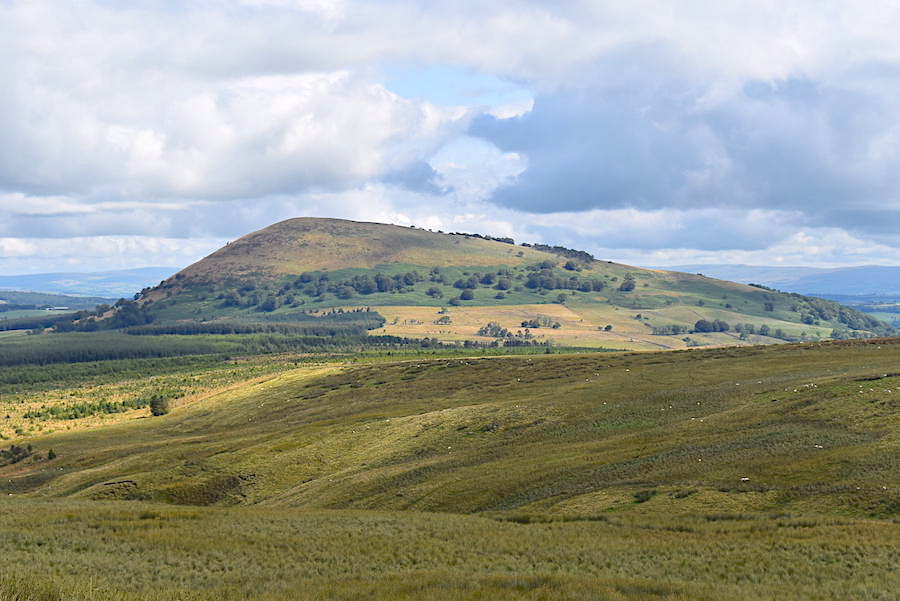
Down to short sleeves now and feeling much more comfortable as we carry on along the road, where Great Mell Fell’s nearest neighbour, Little Mell Fell, has now come into the picture.

The sunny spells came and went, some longer than others, but all of them pleasantly warm and without the high humidity we’ve been having recently. We comment on the good walking weather as we tramp steadily towards Clough Head and how the lack of high humidity will be more than helpful when we do begin to climb.

Eventually the Northern fells come into view across the marshy terrain of Threlkeld Common. Various areas of the marshland have names, Whitesike Moss, Sandbeds Moss and Barbaryrigg Moss, but establishing where one ends and another one begins is pretty difficult given the lack of any distinguishing markers.

A closer look at Blencathra …..

….. and Lonscale Fell and Skiddaw to the west of it.

We’d been watching this little group of pony trekkers coming towards us for a quite a while, the ponies and riders were plodding along quietly, enjoying the sunny spell, the dogs bounding along back and forth beside them and giving the occasional bark. They looked as though they had found some fairly deep water to cool off in as they were both wet through up to their shoulders. Good morning’s and hello’s were exchanged as the riders came by us…..

….. and I’m thinking what a great morning they have for their ride.

We’re still a long way off our turn up to White Pike but its a lovely morning with a very light breeze moving the air around every now and again. Apart from an occasional bird call the only other sound is that of our boots padding along the track. We can see no-one else anywhere up ahead and I’m hoping that a group of off-roading enthusiasts won’t turn up and disturb the peace and quiet.

Passing by sunny Wolf Crags on the lower slopes of Great Dodd. The marshy area below them is named, unsurprisingly, Wolfcrag Moss.

White Pike, the grey area peeping up on the right, is becoming clearer as we get closer to Clough Head. The approach path is up the steep slope on the right skyline, veering off to the left just a few feet below the Pike and then following an easier gradient over to the top of it.

A short distance ahead of us is the gate just before the Mariel Bridge crossing at Mosedale Beck. A zoom in will just about show a signpost on the left by the gate which indicates the route, on the left hand side of the beck, up to Calfhow Pike.

Through the gate and a pause just to take a shot of Mosedale Beck before crossing the bridge. From what I could see of the path I’ve just mentioned it looked as though it kept close to the fence line all the way up to Calfhow Pike. Not having walked up there though I can’t say for certain that it does though.

A look over to Clough Head, before crossing Mariel Bridge, where White Pike is now standing out clearly against the sky. We still have a little further to walk though before we reach the path leading up to it.

A look back across the marshes towards Wolf Crags and the path running below them. The little glint over to the right of the crags is Mosedale Beck and the bridge across it. Not too much further on we meet a solo walker who stops for a chat, telling us that he was quite new to walking and he seemed to be following the route on his mobile. He was looking for a path up to Clough Head so we mentioned the goods wagon and that the gate to the path he was looking for was quite close to it. He remembered passing the wagon and now, looking back at the steep slope up to White Pike, decided he would miss out on Clough Head, walk up to Calfhow Pike instead and continue his planned walk over to Helvellyn from there. He said he was thinking about walking over Striding Edge tomorrow so we mentioned the very bad weather forecast and advised him not to try it until the weather was much better. He told us that other people had also given him the same advice so we hoped that he would take notice and wouldn’t try doing it in the predicted stormy conditions. We pointed out where he would find the signpost indicating the route up to Calfhow Pike and after wishing each other an enjoyable day out we parted company and went our separate ways.

When the old railway goods wagon comes into view we know we have just about reached the gate where we need to turn off. The poor thing has seen better days and will eventually fall to the ground in an untidy heap, which sounds a bit like me when I reach the top of a fell. When I was a youngster such wagons were the standard means of carrying all kinds of freight by rail. They would be pulled along by a steam engine, a couple of dozen at a time I suppose, although I don’t remember ever counting them, to a child they just seemed to go on forever. Dragging myself back from memory lane and returning to the lane I’m standing on …..

….. and around a bend just a few strides further on from the goods wagon is the gate giving access to the path up to White Pike. J checks the mileage on the gps and informs me that from High Row we have walked 3.3 miles which took us 85 minutes, or so the times on the photos tell me. An enjoyable stretch of steady walking, in warm sunshine for the most part, but as we still have a lot of ground to cover we downed packs and took a short break before carrying on up to White Pike.

J demolishes a Mars Bar, we both take some liquid on board, get out the walking poles, hoist the packs once again and set off on the steep climb up to White Pike. The view back down shows the proximity of the goods wagon to the gate and the start of the path.

This is a steep climb so we take it at a steady pace. I noticed during one of our ‘get your breath back’ stops that Blencathra had a little more sunshine on it now and the route up Hall’s Fell Ridge was standing out quite clearly. These big clouds are wonderful for creating a variety of different lights, colours, drama and atmosphere and as they drift across the landscape their effects on the views are usually short-lived. Today was one of those days and the camera needed to be in your hands as quickly as possible to catch the view you wanted.

From the gate to the top of White Pike I counted that it had taken me 1210 steps, and no, I’m not wearing one of those step counter gadgets or trying to do 10,000 steps per day because I can’t be doing with any of that. I counted simply to take my mind off the steep climb and the lack of anything to look at, apart from dull green grass, in front of me. Anyway, here we are on White Pike and looking across to Great Dodd. Mosedale Beck is in the dip between here and there and I wondered if the solo walker had managed to locate the path up there and how he was getting on.

A zoom in will reveal the route we took along the coach road, over towards the right of the shot. I didn’t know it at the time but the rusty red roof of the goods wagon is also visible immediately below the rocks of White Pike.

The view east looking back down to White Pike, across Threlkeld Common and beyond the Eden Valley to the North Pennines where the three bumps on the horizon are Cross Fell, Little Dun Fell and Great Dun Fell. The gradient eases a little between White Pike and Clough Head summit but there’s still a bit of a climb to be done so …..

….. on we go with a look across the slopes of Clough Head, St John’s in the Vale and Derwentwater to where a handful of the north western fells were getting the benefit of a sunny spell. We don’t seem to have much luck with the views in that direction when we’re on these fells and I really can’t remember ever seeing them looking any clearer than they do today.

The Skiddaw group in sombre mood as we approached the summit of Clough Head.

A large walking group was taking a lunch break at the trig point on Clough Head when we arrived. There were lots of Hello’s as I walked by and returned the greetings, so many in fact that I didn’t really know which person I was saying hello to. I carried on towards the path for Calfhow PIke with J slightly behind me and when he eventually caught up with me he mentioned that one of the ladies in the group had recognised the two of us and had told him that she had been looking our website only the previous night. They were all members of the Kendal Ramblers I found out a little later.

The little handful of north western fells is still hanging on to the sunny spell. We are under a large patch of cloud right now so the light became a little muted as …..

….. we dropped down from Clough Head en route for the summit of Great Dodd, some two miles distant with an ascent of about 720′ across largely featureless grassland. The rock outcrop below us is Calfhow Pike which provides a good stopping point, as well as breaking up the monotony of the climb to Great Dodd.

Climbing up to Calfhow Pike, which is more of a rise than it would appear to be when viewed from Clough Head. The depression between the two is very wet in many places so one or two detours were made to avoid the worst of it.

A partial view of Thirlmere from Calfhow Pike.

Looking back to Clough Head from Calfhow Pike.

We decide to stop for a break when we reached the Pike and I was just about to get out my sandwiches when I noticed the sunlight brightening up the Skiddaw fells. I grabbed the camera for one of those ‘catch it while its there’ shots, especially as Skiddaw summit is often cloud capped and hidden from view. While we were having our lunch break the Kendal Ramblers arrived from Clough Head and we had a good chat with Judy, the lady who had recognised us on Clough Head. Nice to meet you Judy, hope you get some good weather for your walk to Frozen Fell. We talked for so long that the rest of the group had carried on and were already halfway up Great Dodd by the time we’d ended our chat.

Judy hurried off to catch up with them and we watched the group’s progress as we continued our lunch. While we were there I took a look across towards Great Dodd but the group had temporarily disappeared from view. Two of the group can be seen on the left hand path and Judy had already told us that the lady was not very well today, that the chap walking along with her was eighty-eight years old and that they had decided to detour around Calfhow Pike and carry straight on up to Great Dodd. We had a chat when we caught up with them.

After our break we packed our things away and started the climb up to Great Dodd taking a look back to the Pike and the Skiddaw fells along the way. The cloud base drifting over the top of Skiddaw would have given those taking their lunch break up there a foggy few minutes.

A longer view back along the path just to include Blencathra and Clough Head over towards the right.

We caught up with the two walkers from the Kendal Ramblers and had a brief chat. Irene, the lady in the red top, told us she was going into hospital next week and wouldn’t be able to go walking for a while so she was making the most of this opportunity to get out and about while she could. She remarked that we would get to the top before they did but my response is always the same, it isn’t a race and the most important thing was that they were out in the good weather and getting on with the walk. How long it takes anyone is neither here nor there. The gentleman with her, whose name I don’t know, nodded in agreement. I thought they were both to be congratulated for undertaking the walk in the first place. If I was looking at a stay in hospital in a few days time, or was eighty-eight years old, I would definitely be thinking twice about taking this walk on, so well done to both of you.

We plod steadily on over the long, and seemingly never-ending, uphill trudge, eventually reaching a slightly flatter area from where I took this shot. J joins me, looks up and gives his customary groan when faced with the last little section of any climb. I’m just relieved that the humidity is a lot less than it has been lately and that I can now see the end of it. We saw the rambling group reach the summit as we were talking to Irene and her companion so by now they we assumed they would be on their way to Watson’s Dodd. We really didn’t have much further to go from this point and it wasn’t long before we were on the summit, only to find a couple of walkers sitting on the summit cairn so I didn’t take a shot of it.

A look across to Clough Head, Skiddaw and Blencathra from Great Dodd.

The shelter was also occupied so not wanting to disturb someone’s lunch break by getting too close I took this longish shot looking beyond it where some of the Far Eastern fells were standing out particularly well in the sunlight.

From Great Dodd there’s a grand little tramp down to Watson’s Dodd so our legs can take things easy for a few minutes and we can take in the extensive views all around us. They aren’t visible in the shot but we could see the walking group making their way from Watson’s Dodd over to Stybarrow Dodd.

At Watson’s Dodd summit cairn and the handful of fells around Coledale are still hanging on to the sunny patch they’ve had above them for quite a while now.

A look back to a cloud dappled Great Dodd from the cairn and noticing that Irene and her companion were making their way over towards us. A zoom in on the path over to the right will show where they are. It was really nice to see that they had reached the summit and a huge well done to both of them for sticking with it. How long it takes is neither here nor there and I see little point in dashing around like a scalded cat and missing a whole load of things along the way. Wasn’t it AW who wrote that time was intended to be spent not saved? Its a good job he didn’t dash from one fell to another or we wouldn’t have the very informative little guide books he’s left for us.

Heavy clouds are now hanging over Stybarrow Dodd, where we’re heading for next, so there’s a possibility that we’ll probably have lost the present sunny spell by the time we get up there.

Before we left Watson’s Dodd I took a couple of shots of some of the higher, and easily recognisable fells over in the west. On the skyline in this shot from left to right, are Crinkle Crags, Bowfell, Esk Pike, Scafell Pike and Lingmell …..

….. and a little further to my right are Lingmell again, Great Gable, Kirk Fell, Red Pike and Pillar.

We leave Watson’s Dodd behind and make our way over to the path for the two thirds of a mile walk up to Stybarrow summit. Its a climb of about 200′ and although its not excessively steep its a stiffish pull up, especially on legs which have already completed a fair amount of up. The rambling group are visible on the skyline. The depression between here and there is always on the moist side.

The summit of Stybarrow Dodd is situated on slightly higher ground a little way to the east of the main path, which carries on over to the south west top overlooking Thirlmere and isn’t our direction of travel, so we leave it and walk up to the cairn at 2766′ (843m) which is just 4′ lower than AW’s original estimate of 2770′. That’s remarkably accurate given that no spot height was indicated on maps when his Eastern Fells guide book was first published. His explanation for calculating the altitude of Stybarrow included noting that the summit of Raise is directly below the summit of Helvellyn and making the calculation from their known heights. I don’t have the necessary mathematical ability (or inclination) for working things out like that but I do know what I’m looking at so, beyond the cairn is the path up to the summit of Raise and immediately behind it is the summit of Helvellyn, neatly framed by the two peaks of Catstycam and Helvellyn Lower Man. Ergo – we know we are standing on the summit of Stybarrow Dodd, thanks to AW’s observations, even if there wasn’t a cairn or a hand held gps to tell us so. Now if he had gone rushing about the fells without closely observing his surroundings we may never have known about that or any of the other snippets of information which make his books so interesting. Having gone completely off topic I’d better get on with the walk before everyone loses the will to live!

The heavy cloud was still above us when we reached the summit so things became a little gloomy for a while over here, but it was still very sunny over the Far Eastern fells thanks to the well broken cloud over there …..

….. and plenty of sunny patches to the west too. The main path we’ve just left is just a few feet below the grassy area behind the cairn. We’re unlikely to catch any further sightings of the Kendal Ramblers as we thought they would probably descend down towards Thirlmere via Sticks Pass in readiness for their journey back to Kendal. Judy, if you should happen to make contact with Irene before she goes into hospital please give her our best wishes for a full and speedy recovery following her stay in hospital.

Stybarrow Dodd marks our turn around point so we head off eastwards leaving the broken wall well away to our left and head for the narrow path leading over to White Stones on Green Side. We didn’t follow the path all the way over to White Stones and at the depression we branched off to the left, skirting below Green Side and made our way over to Hart Side …..

….. which is over on our left as we pick up the path down to the depression.

On the Hart Side path now with a look back up to Stybarrow Dodd while J checks that the gps is continuing to behave itself because it seems to have an off day now and again. Don’t we all?

Great Dodd from the path to Hart Side.

Another enjoyable tramp over to Hart Side but wishing that the cloud would hurry up and pass over us.

A view of Sheffield Pike and some of the Far Eastern fells as we make our way across.

By the time we reach Hart Side we’re back in the sunlight once again. Time to stock up on liquid again so we have a very short break for that and I took a look back at the view from the cairn. Stybarrow is on the extreme right then comes the long sweep across Sticks Pass up to Raise with Helvellyn and Catstycam in deep shadow over on the left.

From the cairn a lovely clear view of Blencathra’s component fells beyond the slopes of Great Dodd. From left to right these are – Blease Fell, Gategill Fell, Hall’s Fell, Doddick Fell and Scales Fell and its not often that the detail on all of them can be seen so clearly. A grand sight and a grand fell.

Somewhat humbler in stature is where we are heading next and its cairn is showing up quite clearly in the sunshine …..

….. and here we are on Birkett Fell where no fancy mathematics or gps are necessary since the location is quite clearly stated on the stone slab set into the cairn. The fell is so named in recognition of the successful campaign led by Lord Birkett to prevent Ullswater being turned into a reservoir.

The cairn overlooks Ullswater and is a fitting tribute to the person who did everything he could to preserve its natural loveliness.

From the cairn we cross over to the wall and follow it …..

….. all the way down to the stile which we cross and head off to the left and back down to Dowthwaite Head. I meant to take a shot of the stile but forgot, and I’m blaming the boggy, puddly mess around the stile for the omission.

Sheffield Pike across Glencoyne from the walk down to the stile.

The path to Dowthwaite Head from the stile with Little Aira Beck between us and Watermillock Common. There are many wet and boggy paths all over the Lake District but this one must surely count as one of the very wettest. Sucking, slurping and squelching noises issuing from every footstep with the bottom of J’s trousers dripping wet through before we were even halfway down. I had rolled mine up a few miles back simply because I was so hot so I wasn’t troubled by wet clothing sticking to my legs.

Dowthwaite Crag appears but Dowthwaite Head Farm is still out of sight below the brow of the hill. The tall rushes give you some idea of how very wet this area is but all we can do is splash our way through it and just appreciate the sunny view ahead of us.

Dowthwaite Head Farm comes into view but there is still plenty of wet and muddy path to be walked before we can put our feet on the firm tarmac of the lane back to High Row.

The boggy terrain is almost at an end as we reach the footbridge across Aira Beck. There’s no-one around to hear our sighs of relief when we eventually reach the tarmac lane at Dowthwaite Head Farm.

Neither of us really likes road walking but, after the wet and slithery path we’ve just walked, the firm tarmac surface was more than welcome. Here’s a look back from the lane to the farm, Birkett Fell and Hart Side.

There’s just a couple of hundred yards or so to go now before we reach the parking area near the trees on the left of the shot so we summon up the last few dregs of what remains in our respective fuel tanks and haul ourselves up the last little stretch of hill back to the car. Packs are stowed in the boot and thirsts are slaked once more before we finally flop down onto the seats and let our weary legs relax. J checks the gps before switching it off and informs me that we’ve walked twelve and a quarter miles today and I think my legs can feel every one of them right now. Well folks, that’s it for today and with the weather looking grim for the next couple of days and staying unsettled into the coming week when we’ll be able to get out again is very uncertain at the moment. We’ll probably need a few day off anyway just to get our legs back into shape.