Five Uldale Fells
Walk date – 8th April 2022
Distance – 6.8 miles
Weather – sunny start, cloudy later, light but nippy breeze
We made an early start today as the forecast was for a sunny morning with light winds with the possibility of a cloudier afternoon and maybe the odd scattered shower here and there. We’ve had quite a few days like that lately, the early mornings have started off bright enough but mostly by mid to late morning the cloud has taken over and by lunchtime the showers have arrived, well it is April after all. April showers may well bring forth May flowers but they don’t half muck up any walking plans you might have come up with. You could set off in bright sunshine but by the time you’ve reached your chosen start point the brightness is long gone and the gloomy skies and sleety showers have taken over. So after an early start and an hour’s drive from home we arrived at Green Head where there is plenty of off-road parking. We drove about a hundred yards up the hill from the flat parking area near the little bridge at Green Head and parked off road there. The further along that road you go the fewer places there are to park as the grass verges on both sides of the road become narrower and have deep ditches on either side of them. Our early start paid off and we had a very enjoyable walk across five of the Uldale fells in fine sunny weather.
Route
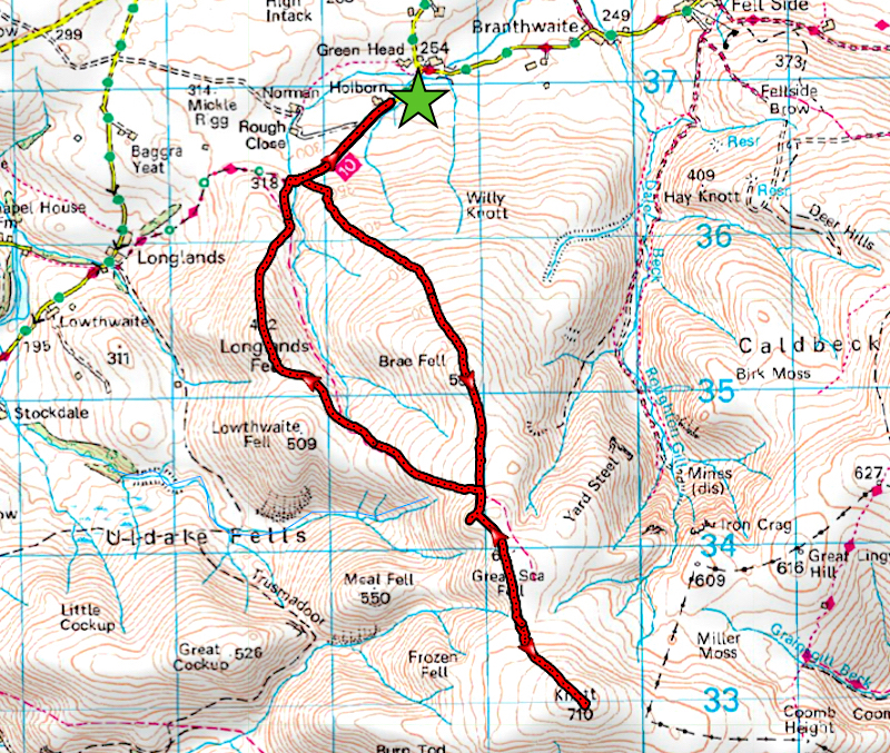
Green Head – Cumbria Way – Brae Fell – Little Sca Fell – Great Sca Fell – Knott – Great Sca Fell – Little Sca Fell – Charleton Gill – Longlands – Charleton Wath – Cumbria Way – Green Head
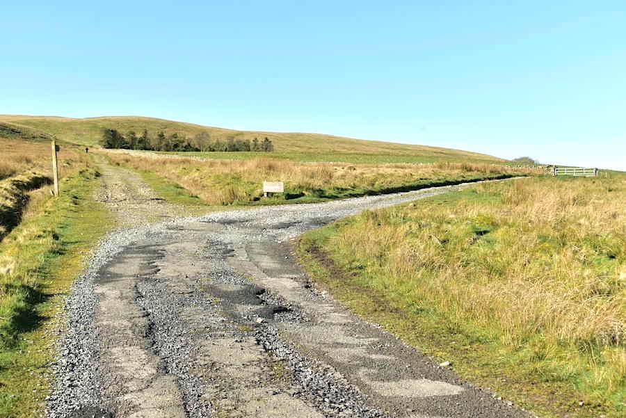
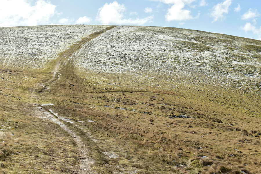
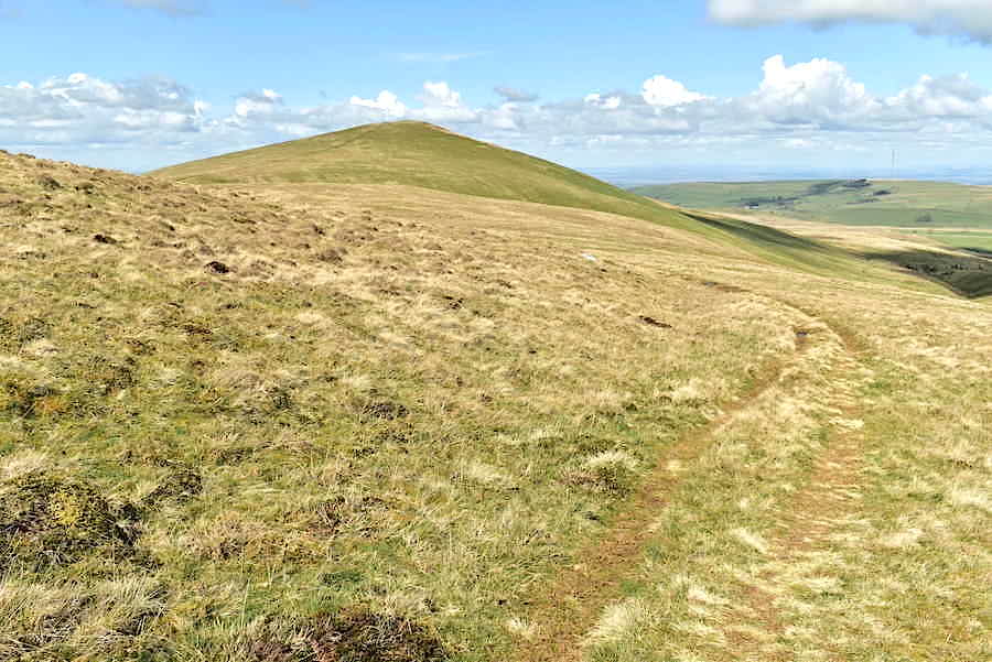
The farm access road up from Green Head starts off with a decent tarmac surface but gradually deteriorates the further up you go. It eventually veers off to the right, becomes a rough track and finally comes to an end at the next farm. We continue straight on over the rough and stony old cart track which forms part of the Cumbria Way. Ahead of us is a solo walker who passed alongside us just as we were getting out of the car.
The solo walker had been a good distance in front of us and, as we hadn’t seen him turn off and begin the climb up Brae Fell, we thought he must be going on to Longlands instead. Just before we got to this point, where we turned off to follow the path on the left, he re-appeared and began following another path which was roughly parallel to this one, and the contours of the fell eventually hid him from our view. The path to the left is quite obvious and turns into a groove, a bit like quad bike tracks, a little further up the slope. It can be located almost at the point where the Cumbria Way starts to drop down to the Charleton Wath ford so if you find yourself going down the hill and reaching the ford you’ve gone too far. There is an old bridleway path beyond the ford, on the lower slopes of Longlands, which runs a little above the course of Charleton Gill so we thought that the solo walker may have crossed the ford and taken that path instead. He would have then found himself on the wrong side of the gill for a direct ascent of Brae Fell, hence his sudden re-appearance just a short distance in front of us.
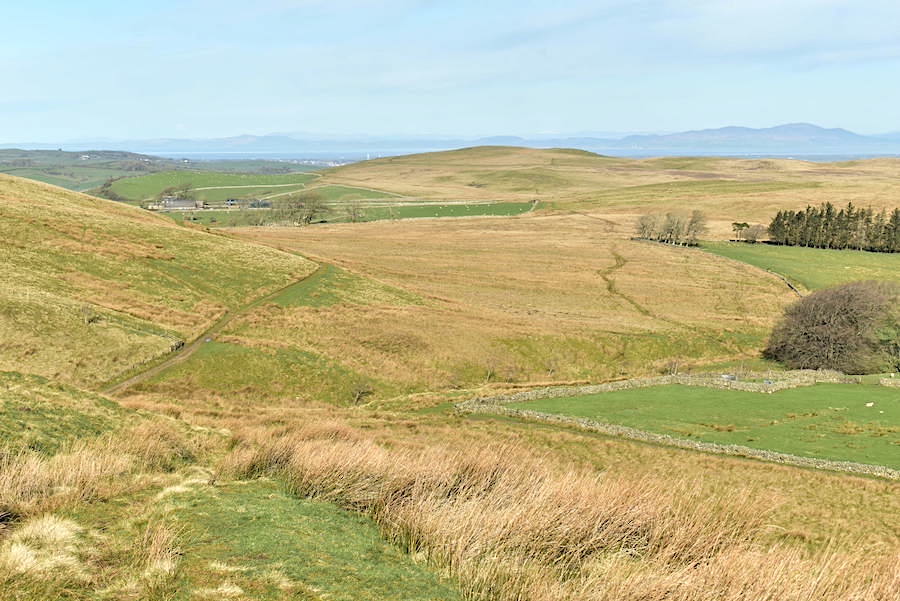
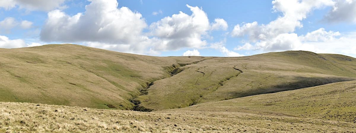
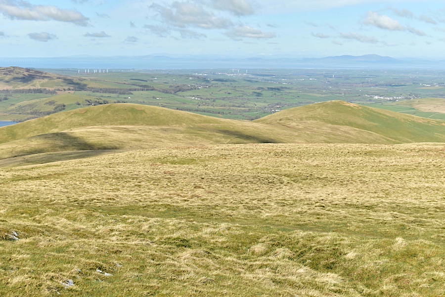
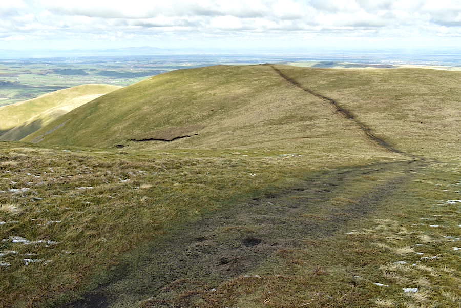
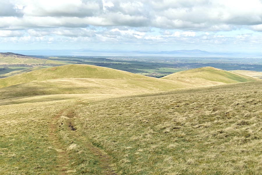
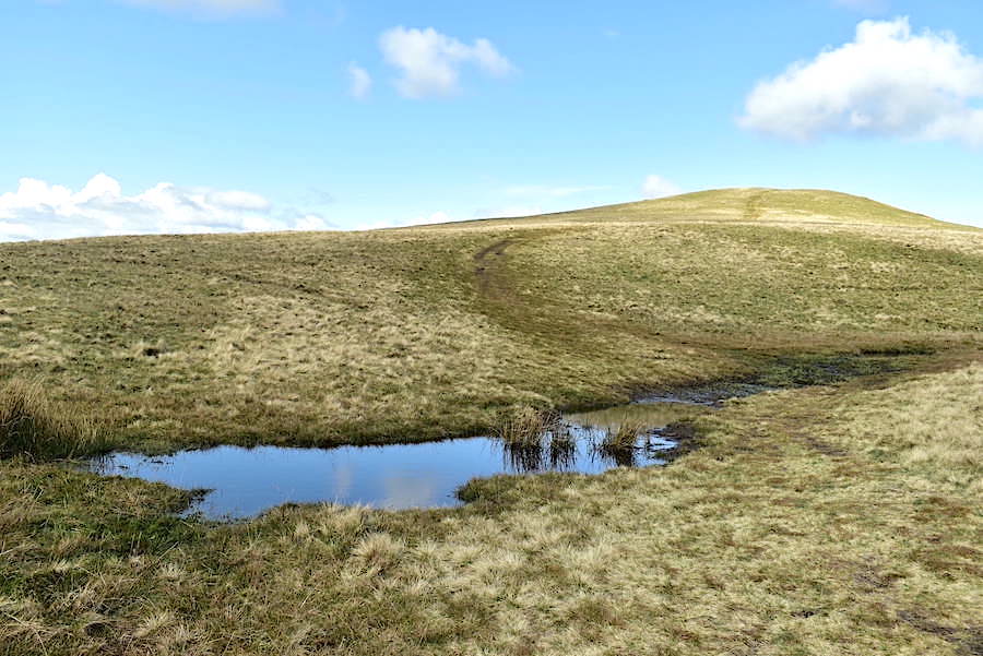
The view back down the path we took. The Cumbria Way path continues on over the ford at Charleton Wath, around the lower slopes of Longlands Fell and makes its way back to the narrow road at the little hamlet of Longlands. In the distance, across the Solway Firth, are the misty grey-blue hills of Dumfries and Galloway where Criffel can be seen over on the right of the shot.
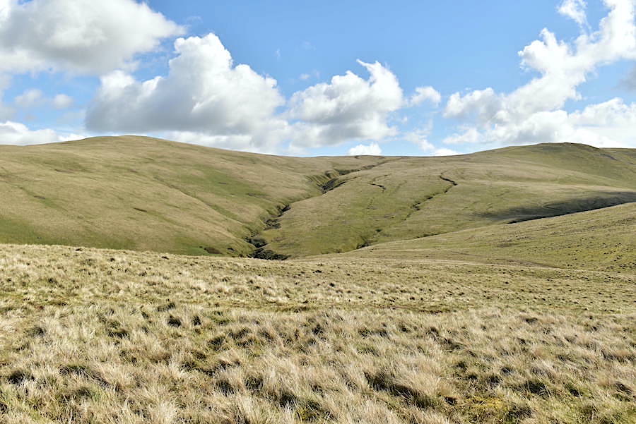
We reach a slightly more level area offering a reasonably uninterrupted view of Longlands Fell and the old bridleway path which is clearly visible, in this shot, above the steep sides of the gill between us and Longlands. We took the opportunity of the pause to remove our mid-layer jumpers. We’ve been climbing steadily since leaving the Cumbria Way path and with the sun directly in front of us it didn’t take long to build up a head of steam and begin over-heating. Our jackets went back on though because the light breeze was just a little on the chilly side.
Before continuing along the path I also took a look back at Binsey from the same spot and where there isn’t a cloud to be seen at present.
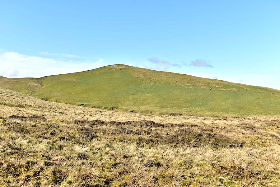
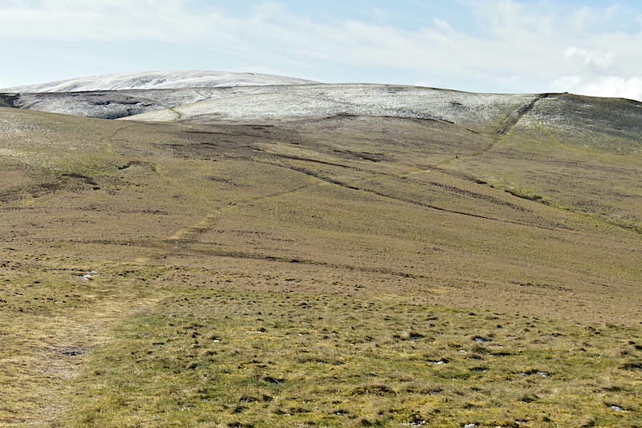
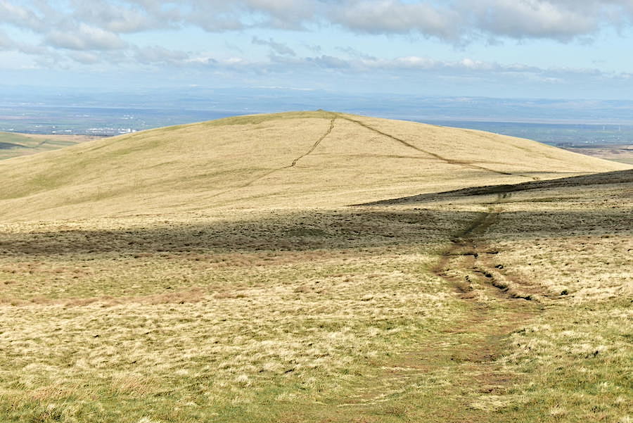
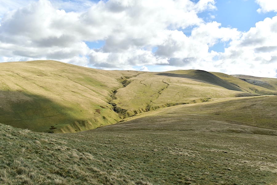
Its a steady pull, of about a mile and a half, from the start of the path above Charleton Wath ford all the way to the top and apart from acres of vegetation, there isn’t a lot to be seen at the moment. The path, on the other hand, remains quite obvious all the way. On the right skyline the solo walker suddenly popped into our view so we assumed that he must have walked Brae Fell’s lower slopes above Charleton Gill and then followed the path which climbs steeply out of it. He paused at this point, to get his breath back I guess, before carrying on over to the summit which is just out of shot over on the left.
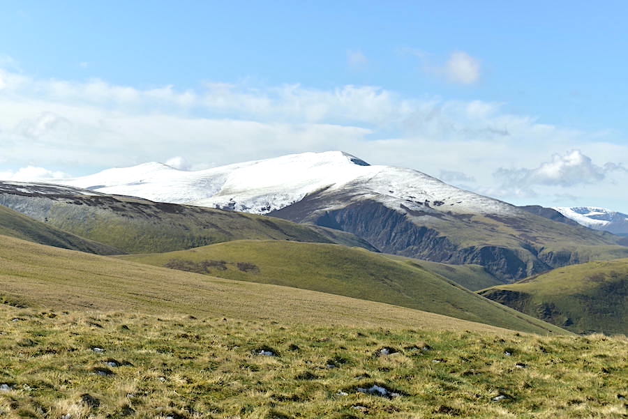
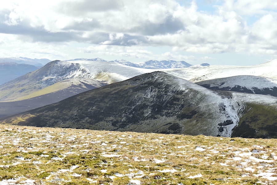
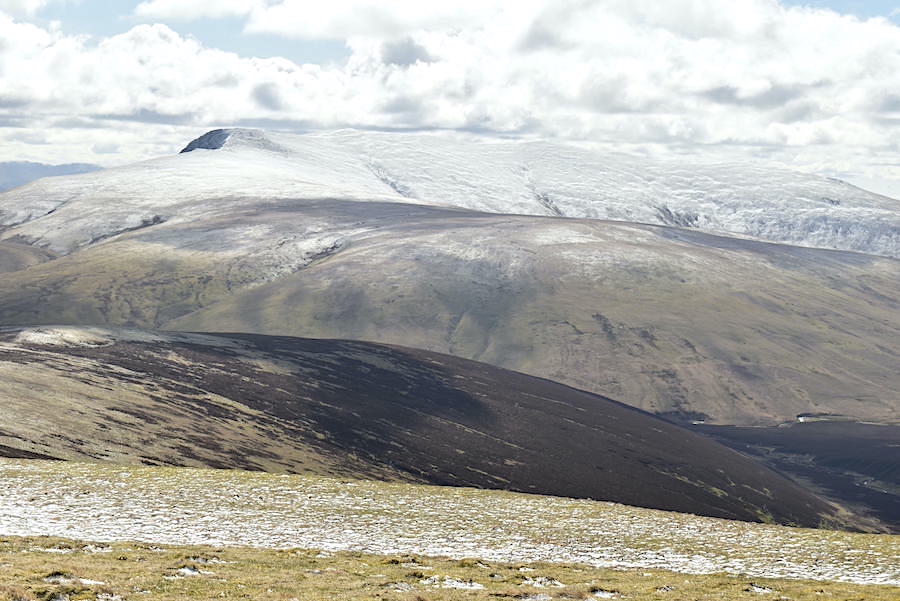
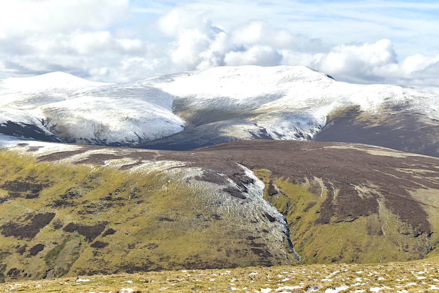
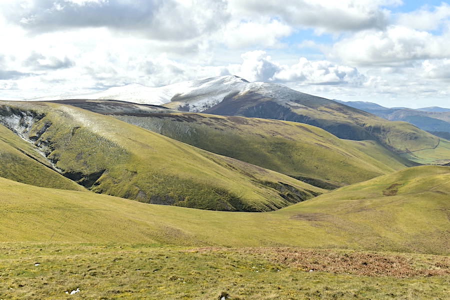
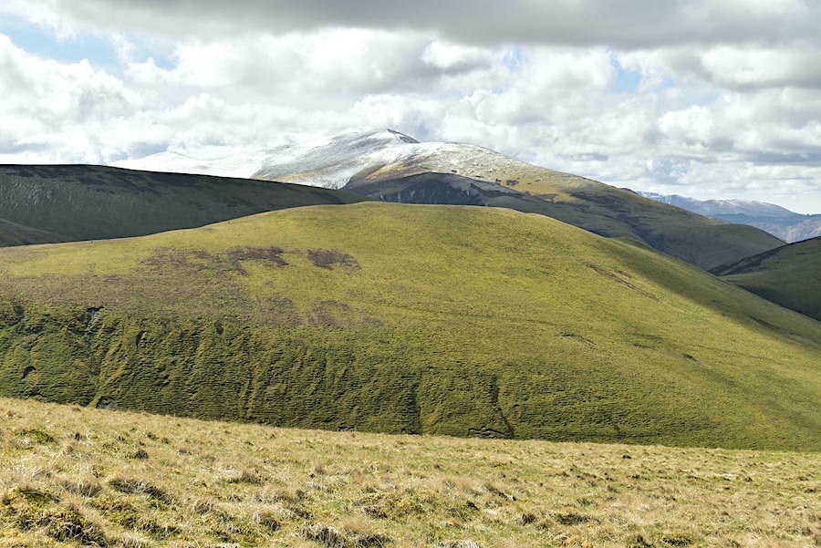
This view of the snow covered Skiddaw range looked magnificent in the clear morning sunlight. As we drove over to our start point we noticed that the snow distribution over all the Lakeland fells was somewhat uneven, some having a good covering while others had barely any. All attributable to the frequent scattered snow showers we’ve been having lately no doubt. Whatever the reason it was certainly a beautiful sight.
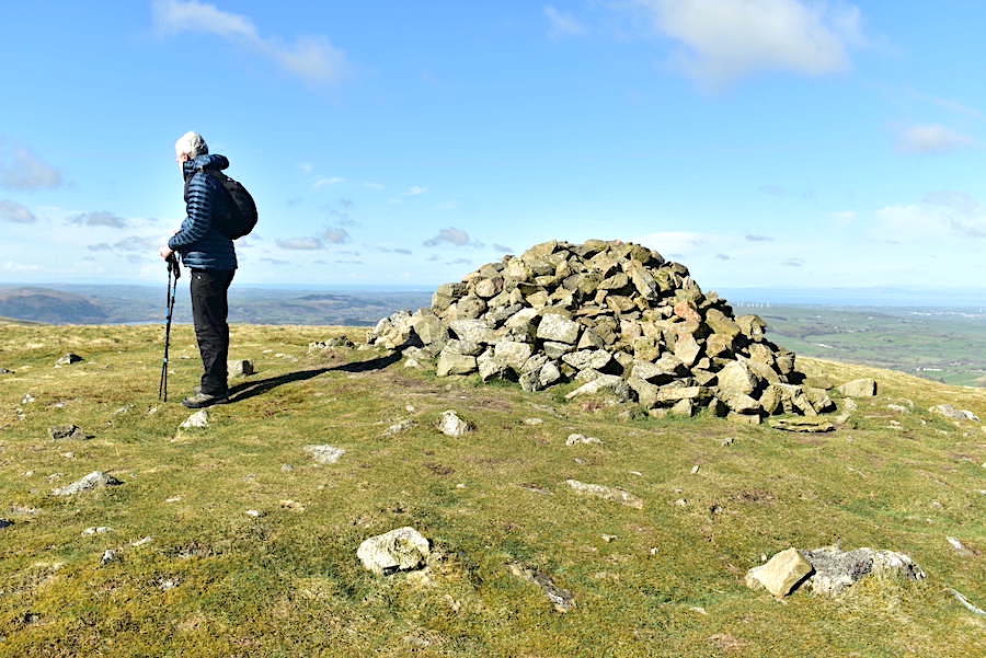
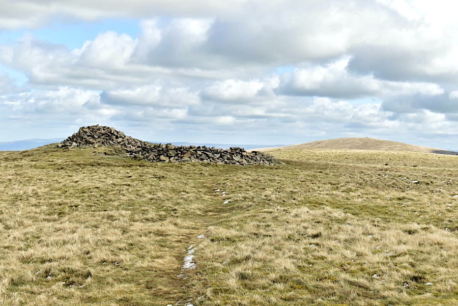
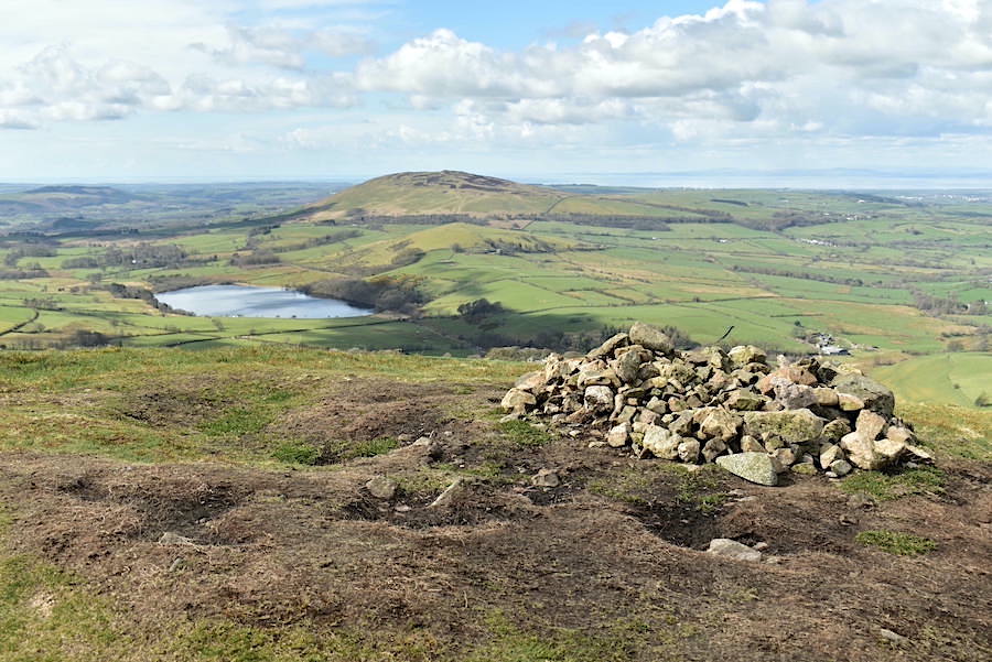
J was also enjoying the beautiful sight while I took a shot of Brae Fell’s summit cairn. The solo walker at this point was some distance away making his way down the path leading over to Little Sca Fell, we didn’t see him again after that.
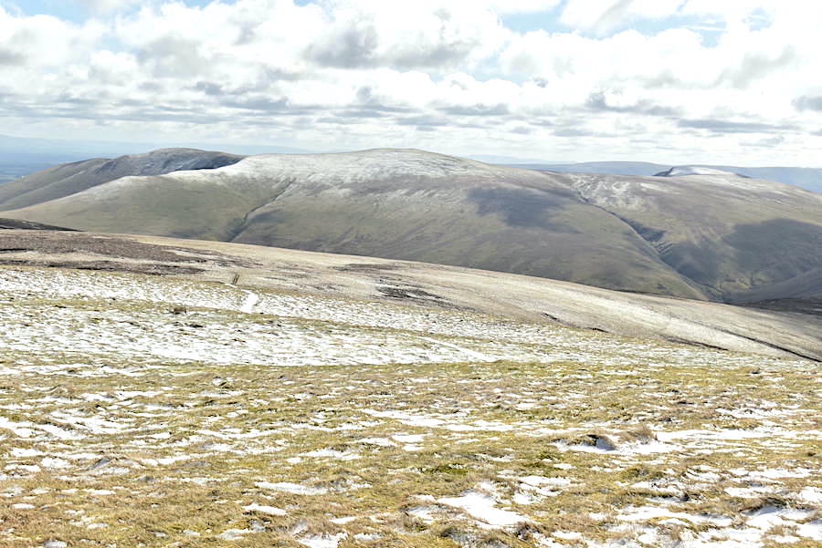
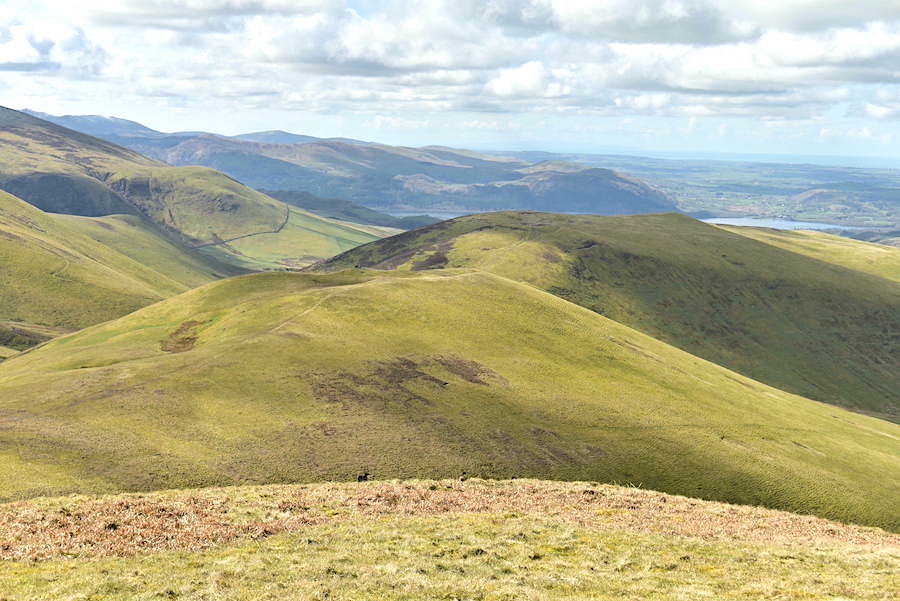
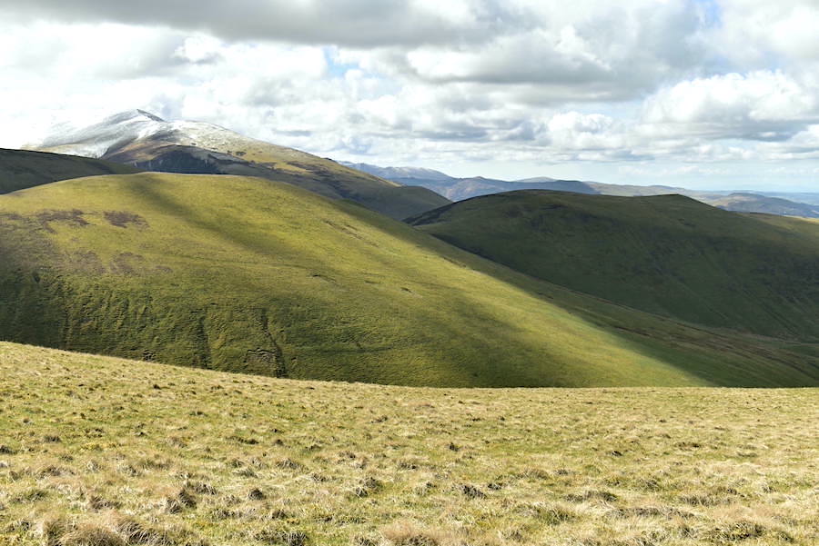
A view of our route from Brae Fell across to Little Sca Fell which is over on the right, Knott is the snowy mound just visible over on the left. Thanks to last night’s frost the ground is firm although we did encounter a few soggy sections along the way.
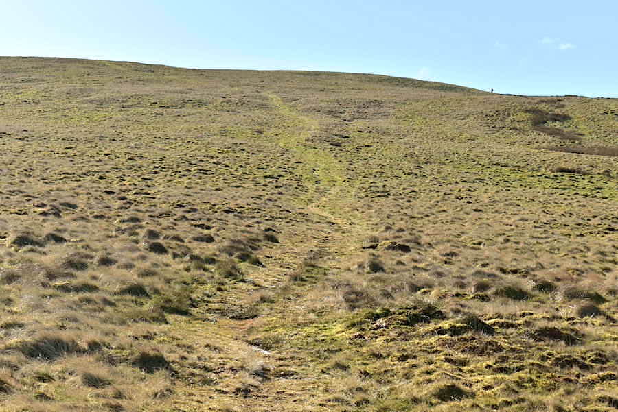
Another short climb ahead as we approach Little Sca Fell …..
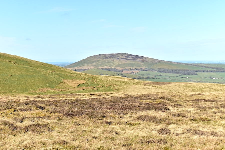
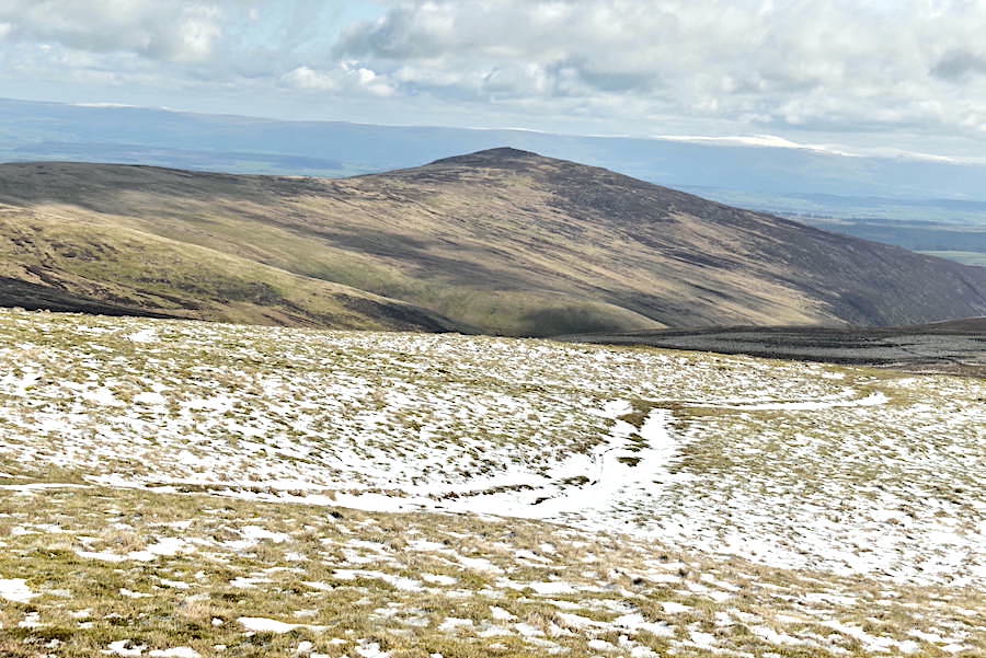
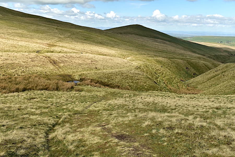
….. but just before we begin to climb here’s a view of Lothwaite Fell and Longlands Fell. Towards the bottom of the shot the green line is the path we’ll take over to Longlands on our return leg.
A look back to Brae Fell as we begin the climb where we can see a pair of walkers, on the left hand path, making their way over to the summit. They are the only people around that we can see at the moment. Cloud is beginning to build although it was forecast for later on in the afternoon rather than during the morning.

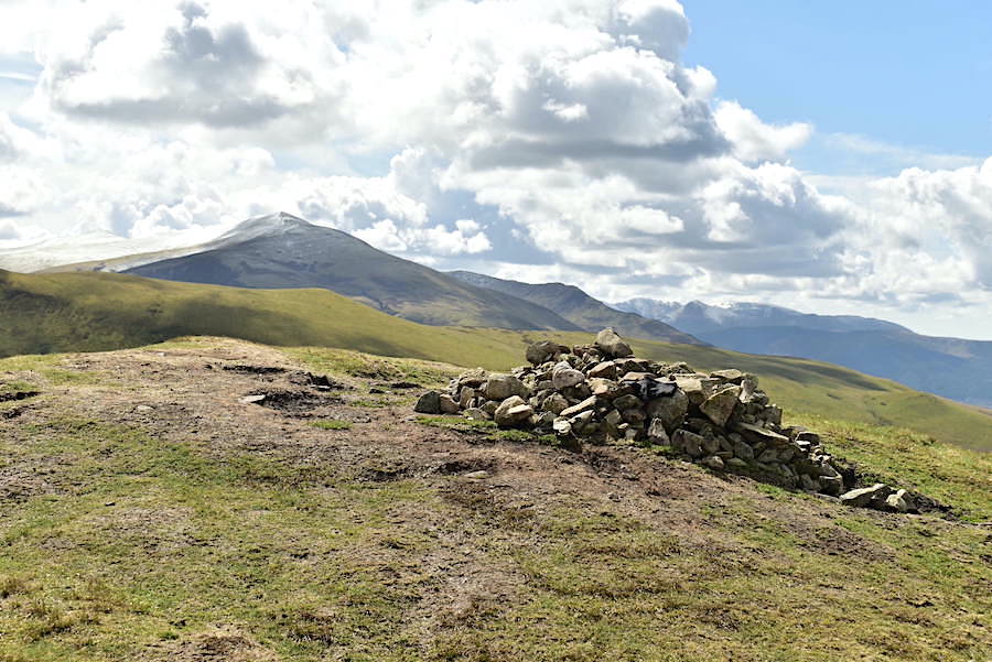
Clouds drifting over a sunny Skiddaw from the summit cairn on Little Sca Fell.
Also at the summit is the wind shelter which has been created in a little hollow beside the cairn. Binsey and Over Water over on the right.
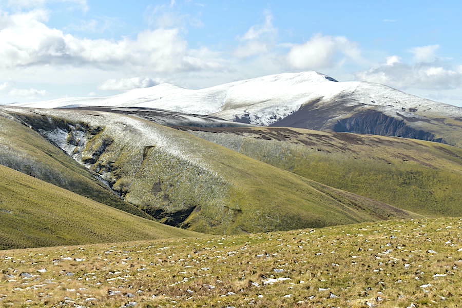
The Skiddaw group behind Frozen Fell and Burn Tod, both of them only getting barely a sprinkling from any passing snow showers.
Approaching another hill climb as we make our way over to Great Sca Fell which only had a skittering of snow here and there.
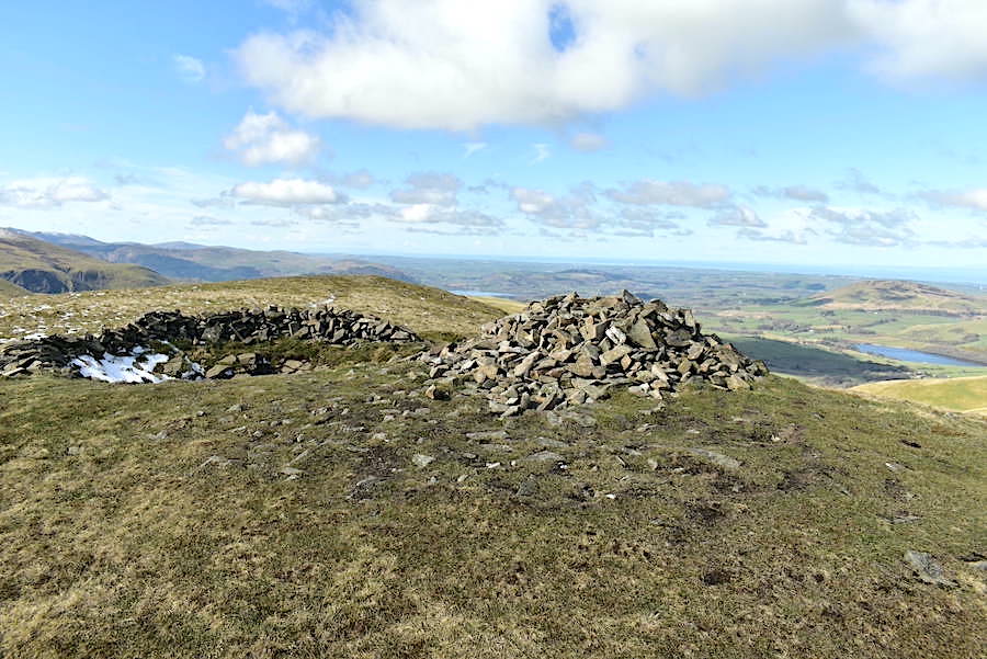
Great Sca Fell’s summit cairn with Knott right behind it. Conversation went as follows: Shall we go over to Knott? Might as well while we’re here. It’ll be soggy. That’s nothing new, it always is. OK let’s get on with it then. As we reached the inevitable squelchy area in the dip between here and Knott a family of three, Mum, Dad and young daughter, plus dog also arrived at the same time. They suddenly popped up on our right suggesting an approach from the Frozenfell Gill direction. They turned up towards Knott but a few minutes later stopped to let us go past them. They didn’t really need to as negotiating the boggy morass slowed us and them down considerably and we weren’t gaining ground on them at all. Perhaps they were just happier to have us go on ahead of them.
Boggy section well behind us now and we arrive at the summit of Knott accompanied by a slightly stronger breeze than we’ve had so far. Strong and chilly enough to make us put jacket hoods up anyway. Here’s a look at where we last walked with High Pike on the left and Carrock Fell on the right, plus a few more views from Knott summit …..

….. on the right of the skyline is a very snowy Blencathra, the dark shape of Atkinson Pike showing up quite clearly, and below Blencathra is Mungrisedale Common. Over on the left and sporting a dusting of snow are Bowscale Fell and Bannerdale Crags …..
….. the middle foreground has Great Calva behind which, on the left, is Lonscale Fell with Sale How, looking like an iced bun, on the right …..
….. Bowscale Fell across the middle foreground and Bannerdale Crags to its right …..
….. no snow at all on Carrock Fell …..
….. and none on High Pike either …..
….. a sunnier view of Blencathra and Mungrisedale Common with the heather clad slopes of Pike just below us …..
….. and an even sunnier view of the Skiddaw group, complete with some very dramatic cloud activity, behind Little Calva across the middle foreground. A simply fabulous sight.
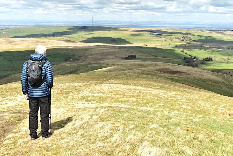
One last look over to High Pike from Knott’s summit cairn and then its time to begin the return leg of today’s walk. The family of three who came up behind us have already taken their leave after taking in the views and a few photographs to remind them of the fabulous views they experienced.
Making our way back down from Knott heading for Great Sca Fell and not looking forward to dealing with the squelchy morass between here and there once again, but needs must.
Boggy section just about behind us now as we walk the steady gradient back to Great Sca Fell. Despite the cloud build up there were plenty of decent spells of sunshine on offer …..
….. although the walk over to Little Sca Fell was one of the lengthier shady spells. More people were out and about by now and we met several walkers along the way from Knott to Little Sca Fell.
Back on Little Sca Fell where we dropped down from the summit to a slightly lower point for this view of Meal Fell and Great Cockup just below us. Smidges of Bass Lake can be seen beyond them.
The Skiddaw group again from the same vantage point.
Walking back to the shelter and the cairn on Little Sca Fell with High Pike in the distance. Time to drop down now and …..
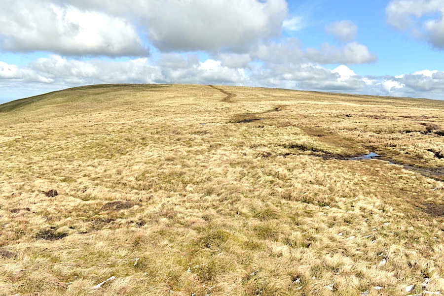
….. follow the path over to Longlands Fell. An enjoyable tramp over these wonderful open spaces where its never crowded, where there are never any queues on the paths and a good, uplifting place to spend a few sunny hours.
Meal Fell got the benefit of a sunny spell but its next door neighbour, Great Cockup, didn’t.
Even when Meal Fell got even sunnier it never landed on Great Cockup.
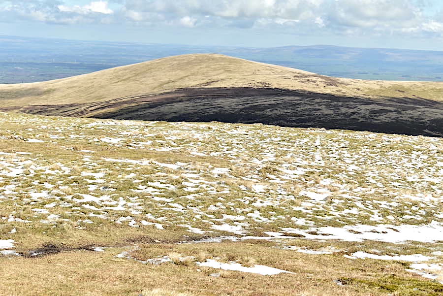
The tramp down from Little Sca Fell is over all too soon and here we are, approaching the Charleton Gill crossing. If we hadn’t been going over to Longlands we would have taken the old bridleway path on the right to return to the Cumbria Way path. Longlands Fell is looking a bit chilly at the moment.
After crossing the gill we had another sunny spell so Longlands looks a lot more inviting now.
Another soggy patch to deal with as we head towards Longlands.
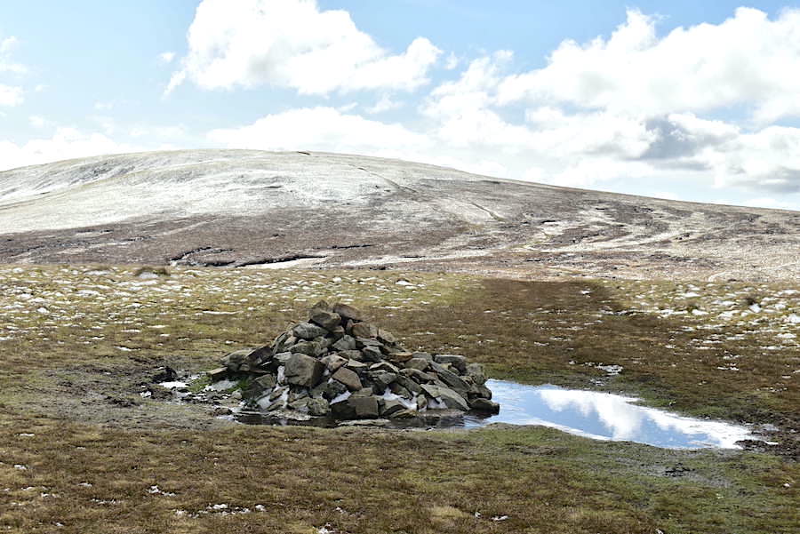
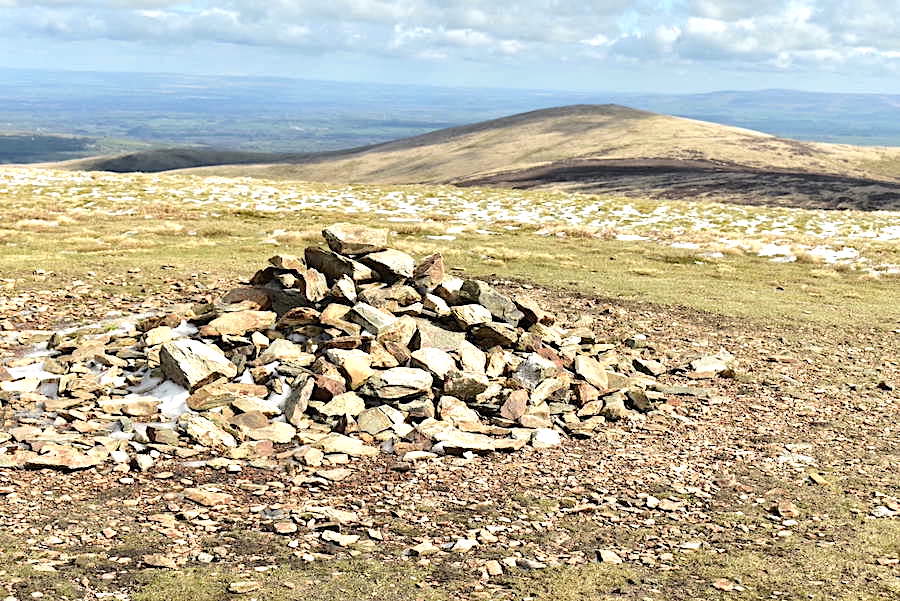
Before going up Longlands summit we had a short stop for drinks when a convenient heap of flattish stones came into view and provided somewhere to sit and contemplate the scenery around us for a few moments. Other than the wind shelter on Little Sca Fell, which we didn’t bother with, there aren’t many places on this particular route where walkers can sit and take a break for a few minutes so it was very pleasant to have a break and look back at the fells we’ve walked over today. Here’s a look across to Brae Fell and Little Sca Fell from our drinks break.
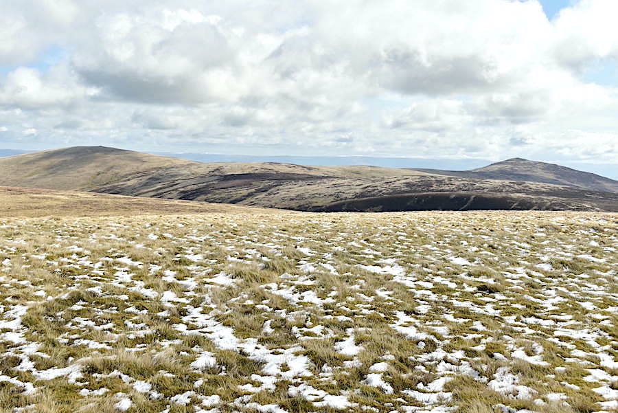
Brae Fell, Little Sca Fell, Great Sca Fell and Knott on the skyline, so that’s 80% of today’s walk. Can’t show the remaining 20% as its behind us at the moment …..
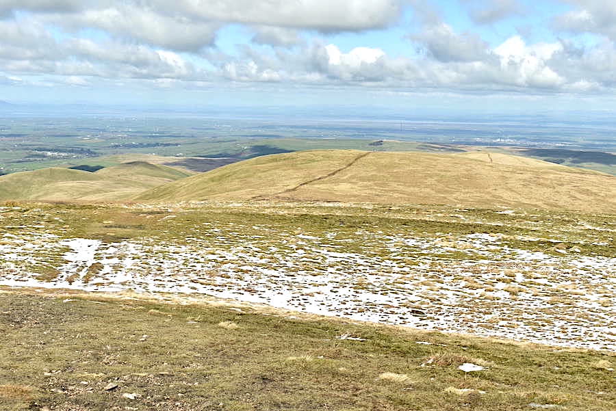
….. but a few minutes later we’re standing on top of that last 20%, Longlands Fell, with its view across to Over Water and Binsey …..
….. not forgetting its view of Skiddaw before we descend and lose sight of it.
J contemplates the cloud dappled view down Longlands and across the Solway Firth. We’re planning to leave the main descent path just before we reach the brown reedy patch just below us and take an off path route over to the fence line above the gill .
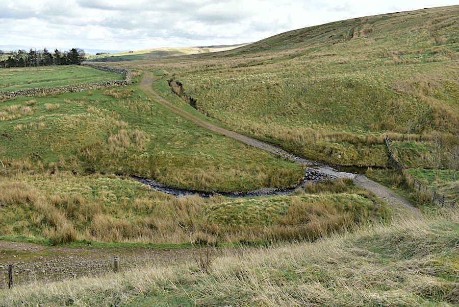
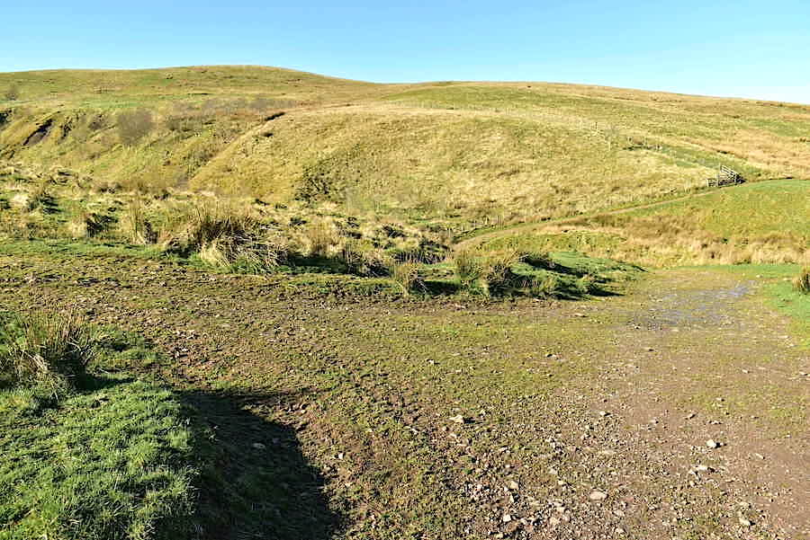
Charleton Wath ford from just above the Cumbria Way path. We dropped down just a few paces from here onto the path and made our way to the ford. The water level was too high to cross on foot so we followed the gill downstream on the left and found a convenient jump across point and made our way back onto the path. The outward path we followed earlier can be seen quite clearly rising up the slope to the right.
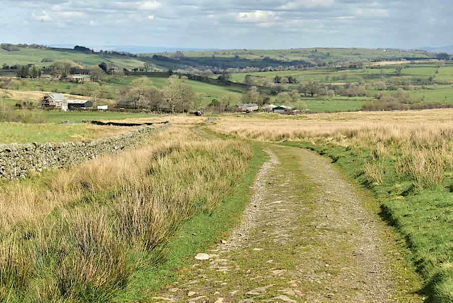
From the ford there’s about half a mile of walking back along the old cart track back down to Green Head. We didn’t know it at the time but this was our last sunny spell. The sky was now seriously grey, the clouds were looking ominous and thankfully, as it turned out, we had decided that we’d wait to have something to eat until we got back in the car. We were back at the car by 1.25 pm so we stowed our gear, ate our sandwiches, packed everything away and prepared to drive back home. J had just started the engine when we noticed it had started to rain, which then turned to sleet, which finally turned to hailstones. As we drove back towards Fell Side and Hesket Newmarket the car roof rattled with the sound of hail bouncing off it and the fells we’d walked over during the morning had disappeared beneath a wall of white stuff. Thank goodness we made an early start this morning.