High Edge, Little Knipe and Great Knipe
Walk date – 12th June 2021
Distance – 6 miles
Weather – cloudy with sunny spells, breezy
The Lake District is understandably busy so we decided to walk a small section of the Northern Pennines today. This is definitely a get away from it all walk and we neither met or saw anyone during our time there. Most of the land has Restricted Access status as it is used by the Ministry of Defence for training purposes. This particular section however is only occasionally used for military purposes and therefore has been classed as an Open Access walk with the route we followed being the one suggested, and no doubt preferred, by the MoD. Roadside parking is available on a minor road, at the Bank Gate turn off, which is about three miles east of Brough on the A66 east bound carriageway at Slapestone Bridge. Access to the Bank Gate turn off is also available from the westbound carriageway. Despite our late morning arrival the parking area was deserted which would probably not have been the case at any of the parking places in the Lake District.
Route
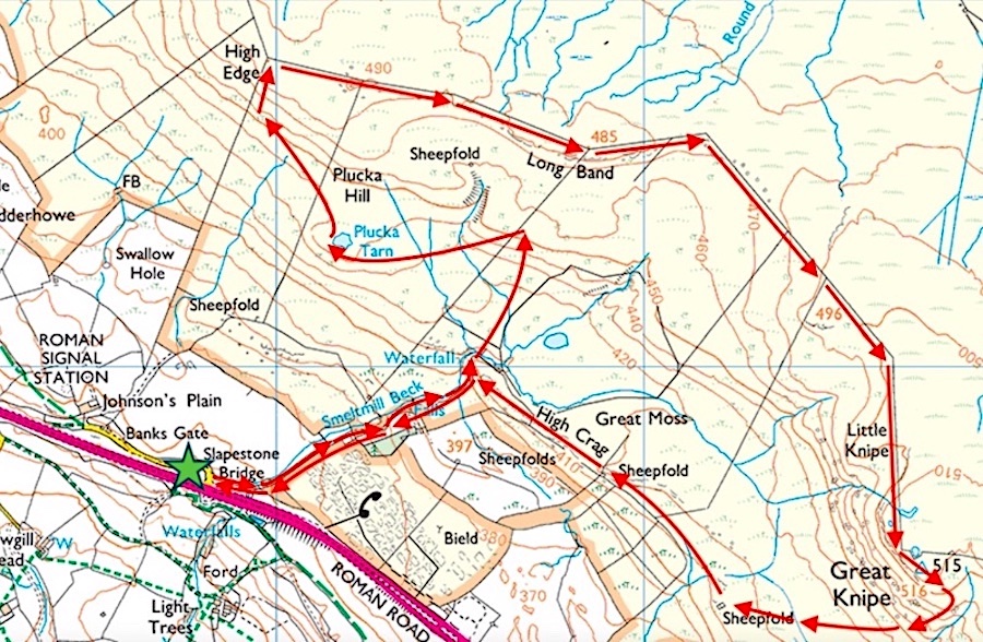
Slapestone Bridge – Smeltmill Beck – Plucka Tarn – Plucka Hill – High Edge – Long Band – Little Knipe – Great Knipe – High Crag – Smeltmill Beck – Slapestone Bridge
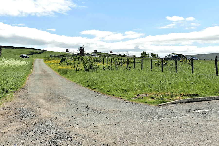
A few paces from where the car is parked, behind us to the left, brings us to this tarmac lane and the start of today’s walk. The A66 runs parallel to the lane up to where the black car is parked, at which point the lane swings round to the left and the A66 curves away over the hill to the right. It was busy on the A66 so I had a long wait to get anything approaching a traffic free shot, this was as good as it got. The owner of the black car up the lane was nowhere to be seen and probably belonged to a local resident walking their dog.

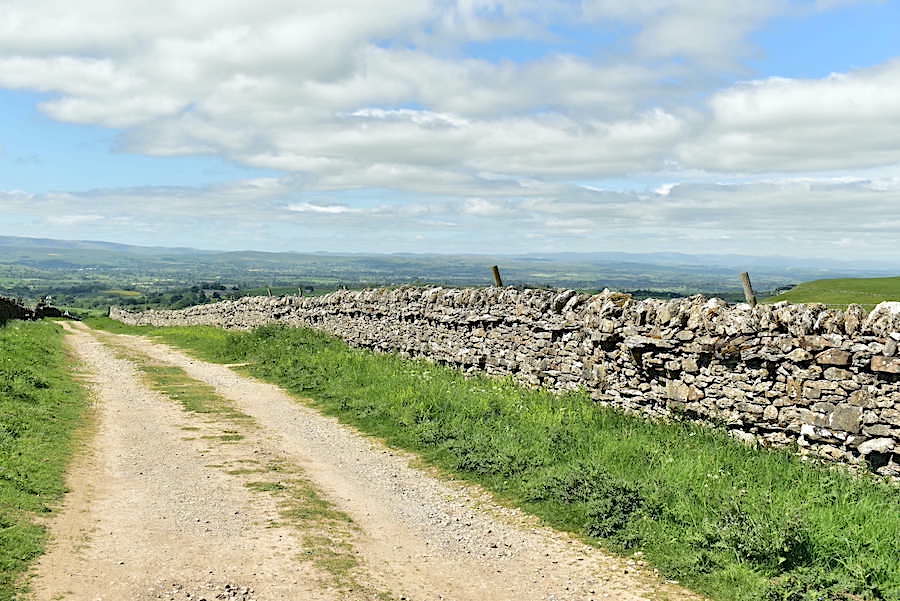
Having swung away to the left the lane then tracks alongside Smeltmill Beck which makes for a very pleasant start to our walk. Not a great deal of water in the beck though, just an occasional pool here and there, because the last two weeks have been very dry. The tarmac ends at the top of the rise and gives way to a gravel track. At the top of the bank on the right is a hand-gate whose gateposts have been topped with limestone finials. There’s no fancy carving on them, they’re just a couple of unusually shaped pieces placed on top to add a decorative element.
From the gravel track a look back across the Eden valley towards the Lake District fells but it was much too hazy today for good long distance views.
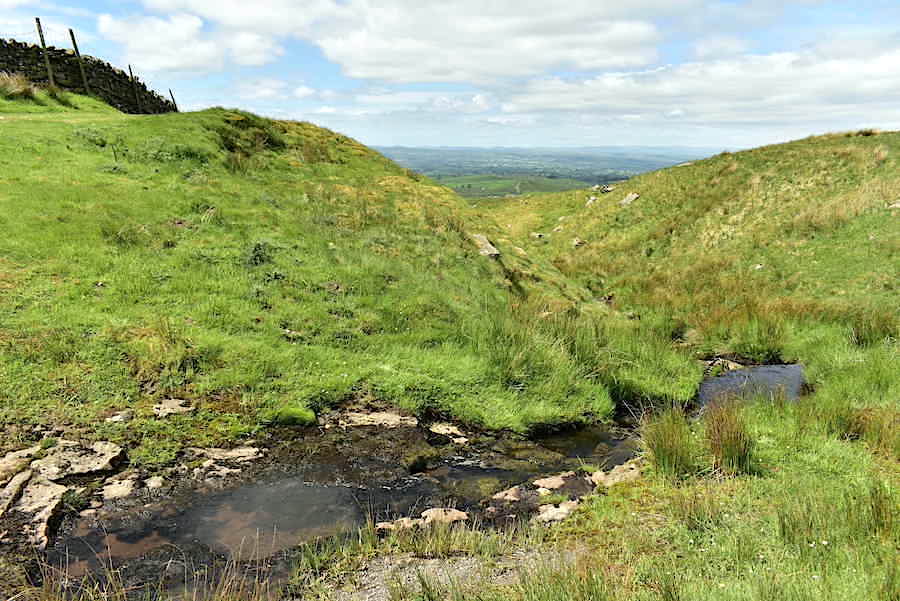
Very little water in the beck but just enough to create a pretty little cascade over these limestone outcrops.
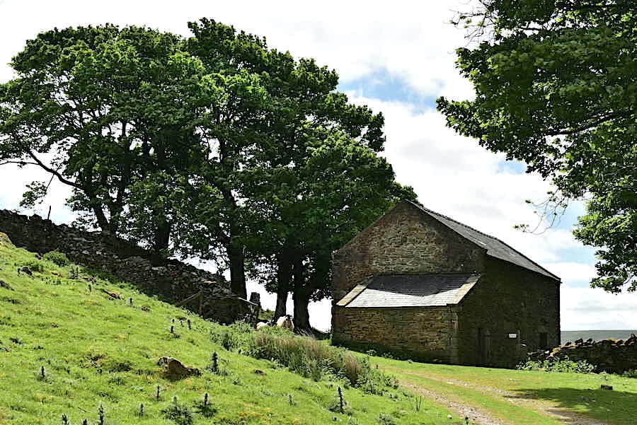
A sturdy barn in good repair over on the right of the track.
The track levels out and as the wall swings away to the right we drop down from it to cross Smeltmill Beck via this small ford and …..
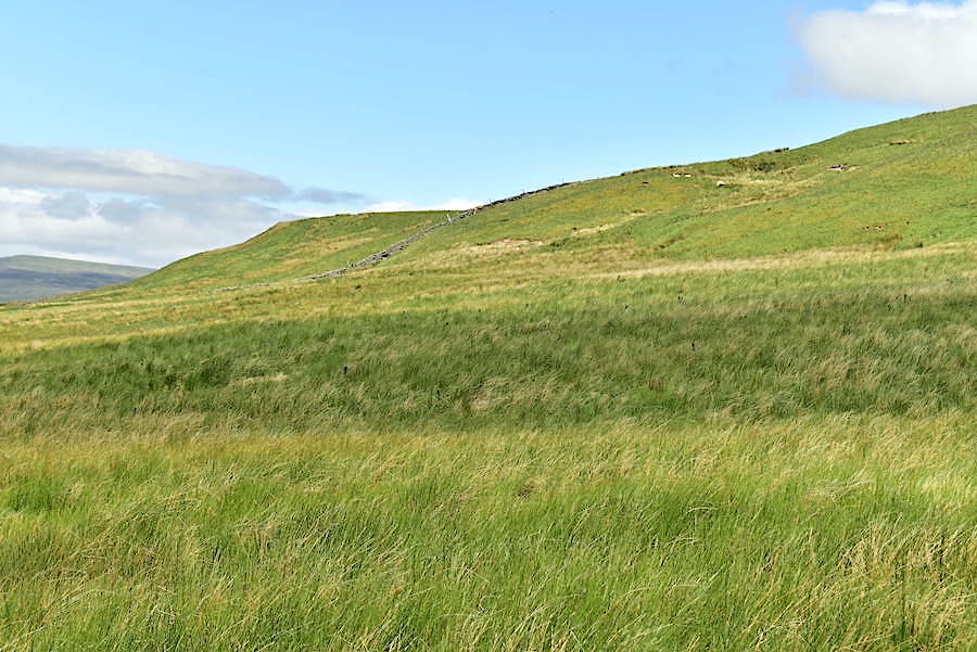
….. climb the opposite bank which leads us to this gate. From this point there is no established path just rough moorland grassland to deal with, sheep trods came in handy from time to time. We’re making for the ladder stile up there on the skyline. We could have veered off to the left beyond this gate but ploughing through large swathes of these reedy grasses held no appeal so we headed for the shorter grassy slopes straight ahead instead.
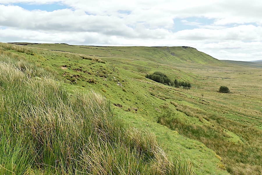
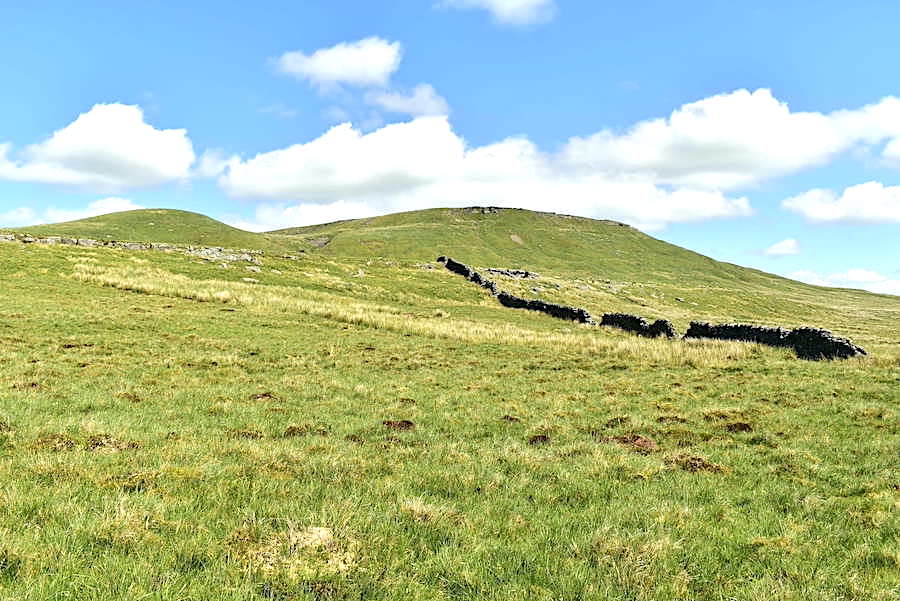
On the way up to the ladder stile with a fine view of Great Knipe to our right.
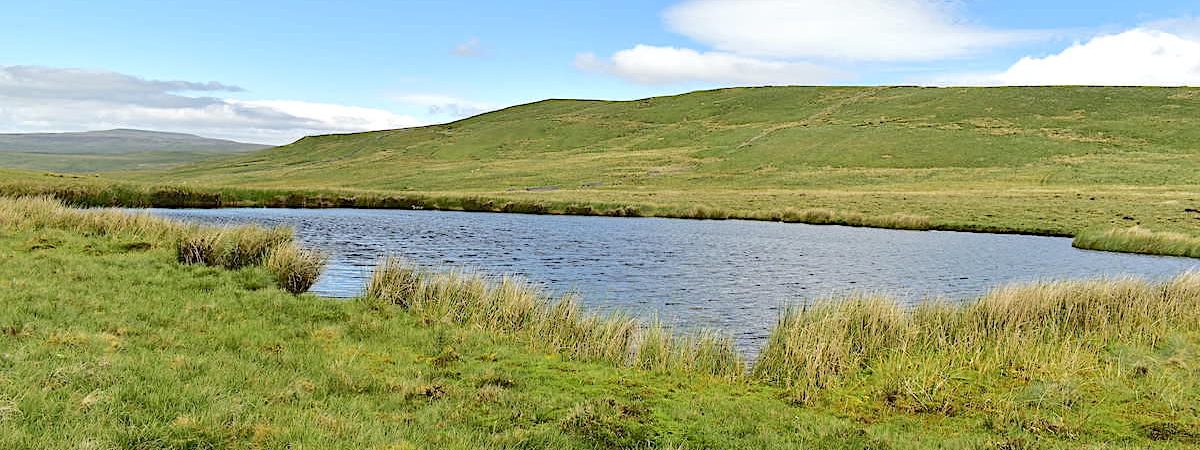
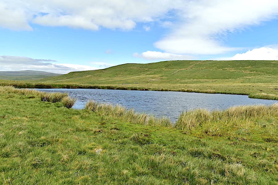
Over the ladder stile now and Plucka Tarn, the next objective, comes into view so its a straighforward tramp across to it. Beyond is a view of the Eden valley and the smoky blue line of the Lake District fells.
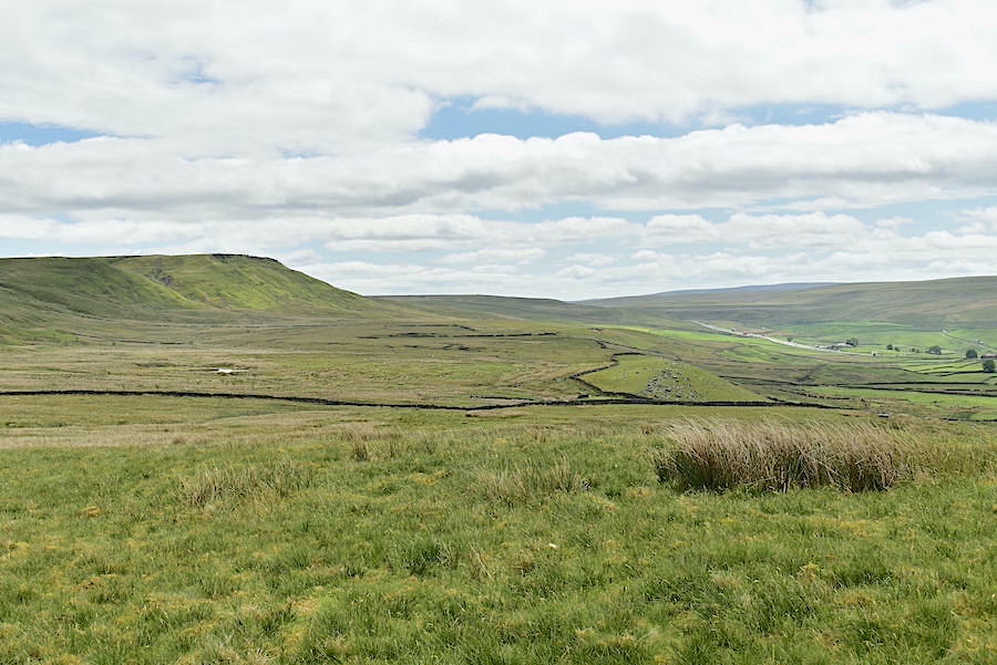
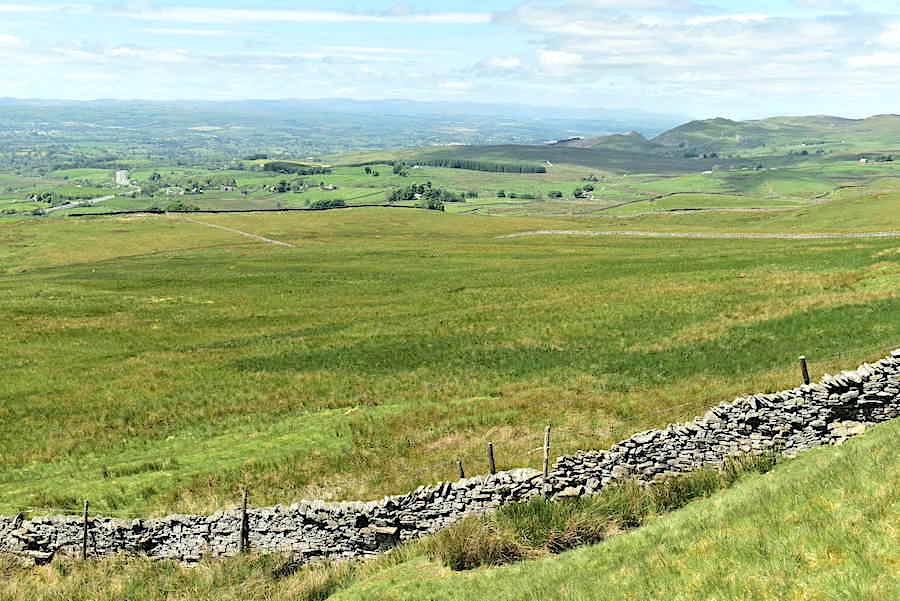
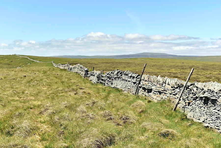
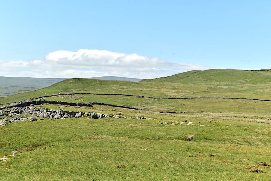
The view east from Plucka Tarn to where the A66 snakes its way below Great Knipe. The return leg of our walk will follow the line of the wall you can see stretching along the length of the lower escarpment.
View towards High Edge from a very breezy Plucka Tarn. As the shot shows there is little by way of shelter around these parts and although we weren’t at any great height the westerly breeze was constant and coming straight at us across the Eden valley. Eyes and noses were not happy and the supply of tissues was being depleted rapidly.
From Plucka Tarn we make a steady traverse across Plucka Hill and make our way across to the wall rising up the hillside. It was harder walking through these long grasses than it was climbing the last part of the hill beside the wall where the grass was much shorter.
A brief pause to remove some of the scratchier bits of grass from sock tops as we reach the shorter grass and begin the steep but brief climb up to High Edge. Below us the A66 is making its way to and from the Eden valley.
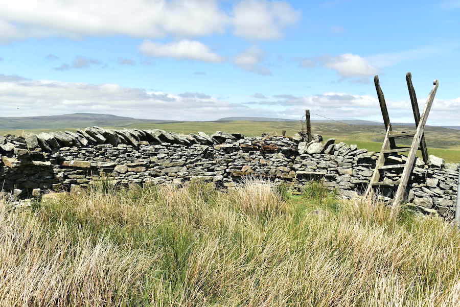
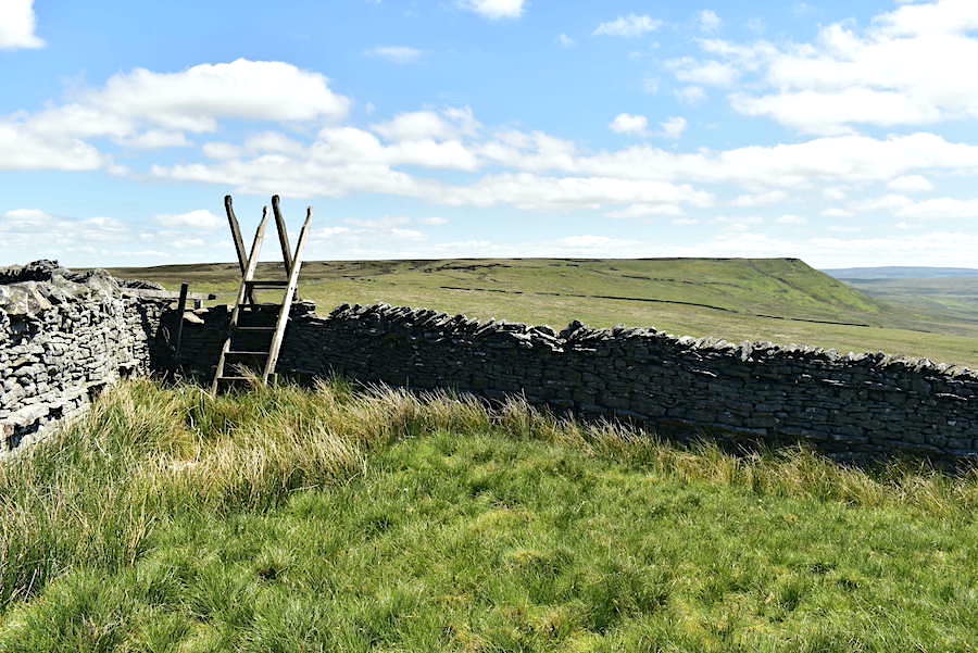
The rickety ladder stile on High Edge is not for public use as the land beyond the wall is MoD property used for troop training purposes and therefore access is restricted for the likes of you and me. The wall came in handy for keeping the constant breeze out so we found a nice little patch of sheep mown grass and had a sunny and windless break. J took the opportunity for a full de-seeding/de-twigging of his socks and boots, copious amount of same having given him much grief on the way up here. The fells in the distance are Murton Fell and Mickle Fell. Mickle Fell used to the the highest point in my home county of Yorkshire, now its the highest point in County Durham since the boundary changes which took place in the 1970’s. There’s plenty of us ‘tykes’ who would like to see it returned to its original county.
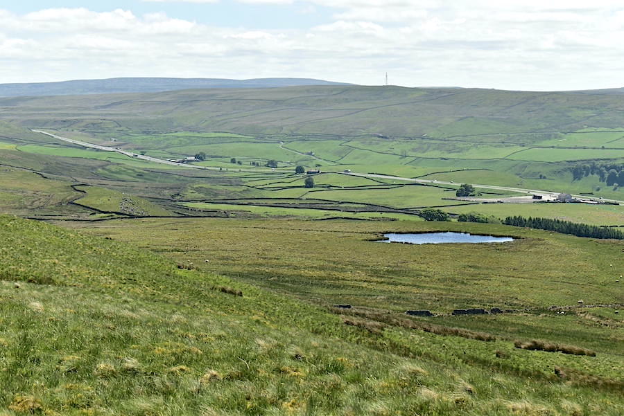
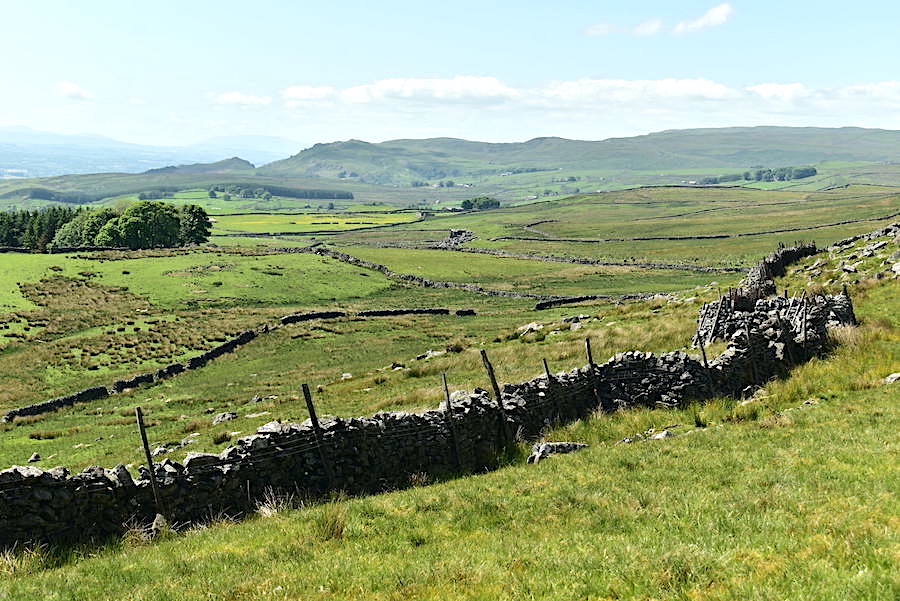
After our break we wandered over to the edge for this view back down to Plucka Tarn and the ever present A66 which, being less than a mile away from any point on today’s walk, was either constantly in view, or earshot, or both.
The view ahead as we make our way across Long Band towards Great Knipe.
A sheep creep at one of the wall corners. Any sheep wanting to creep through would have a hard time of it though as this, and the couple of others we saw further on, were blocked with large rocks, so in addition to the occasional walker the MoD has also restricted access for the sheep too.
We came across small areas of quarrying in one or two places which would no doubt have provided the raw material needed for the building of the wall. No need to cart it from some distant quarry when its right there under your feet.
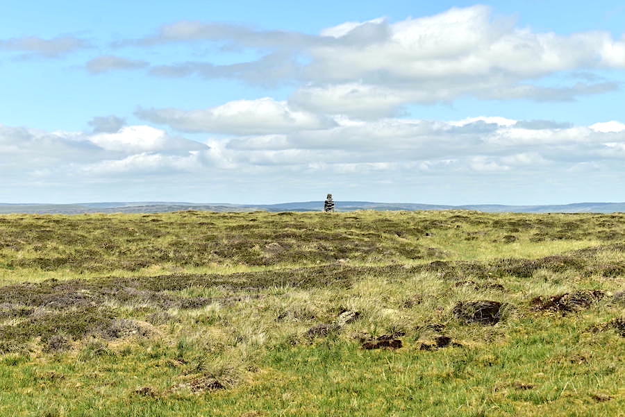
Over the wall we spotted this cairn standing in splendid isolation on Stainmore Common. Strands of barbed wire atop the high wall prevented further examination of the cairn so there’s nothing more I can add.
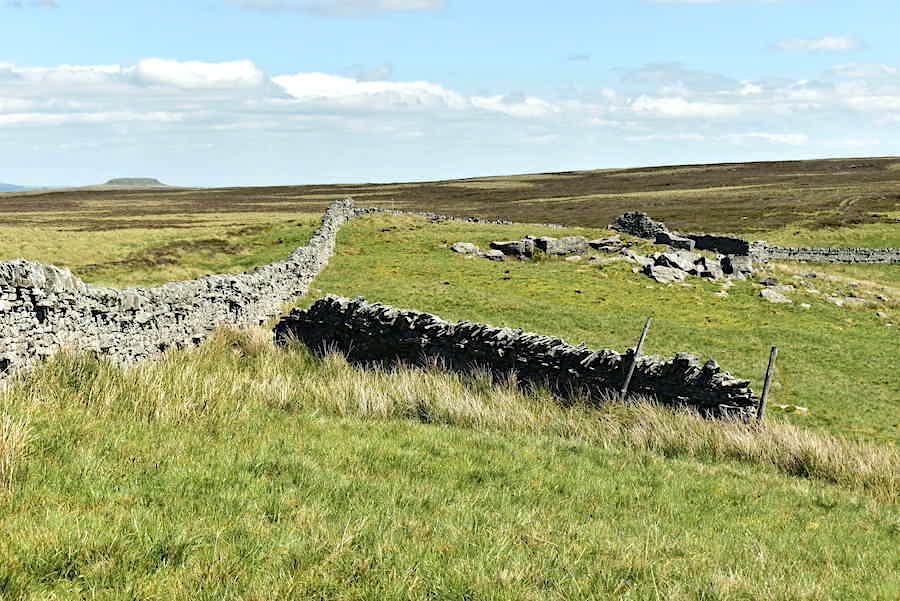
Still trekking over Long Band with a look back along the wall towards Murton Fell.
Another wall corner and another even more rickety ladder stile to cross. Great Knipe doesn’t seem to getting any closer.
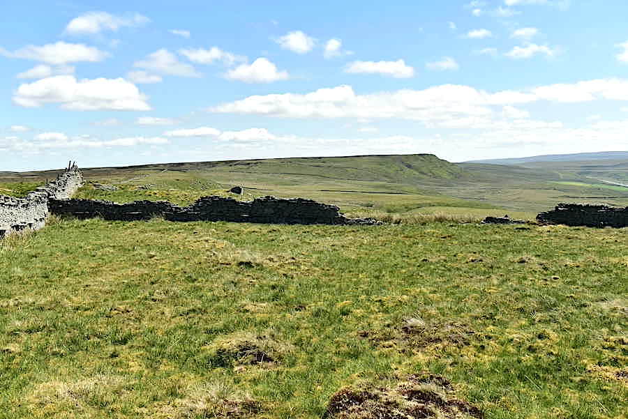
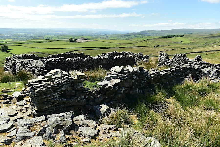
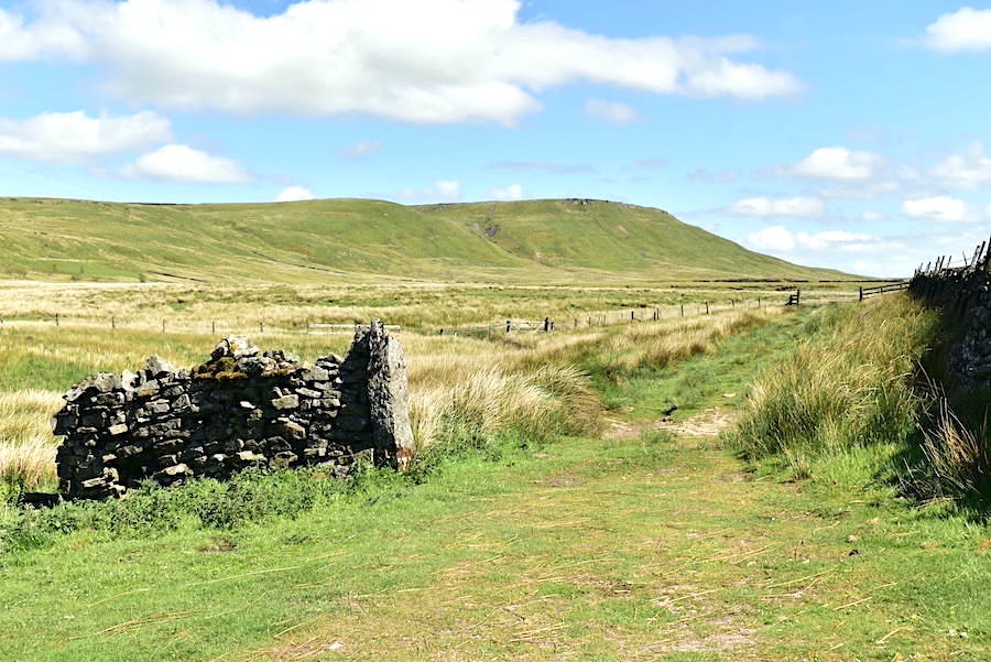
Beyond the rickety ladder stile we arrive at an old sheepfold and shepherd’s cot or bothy.
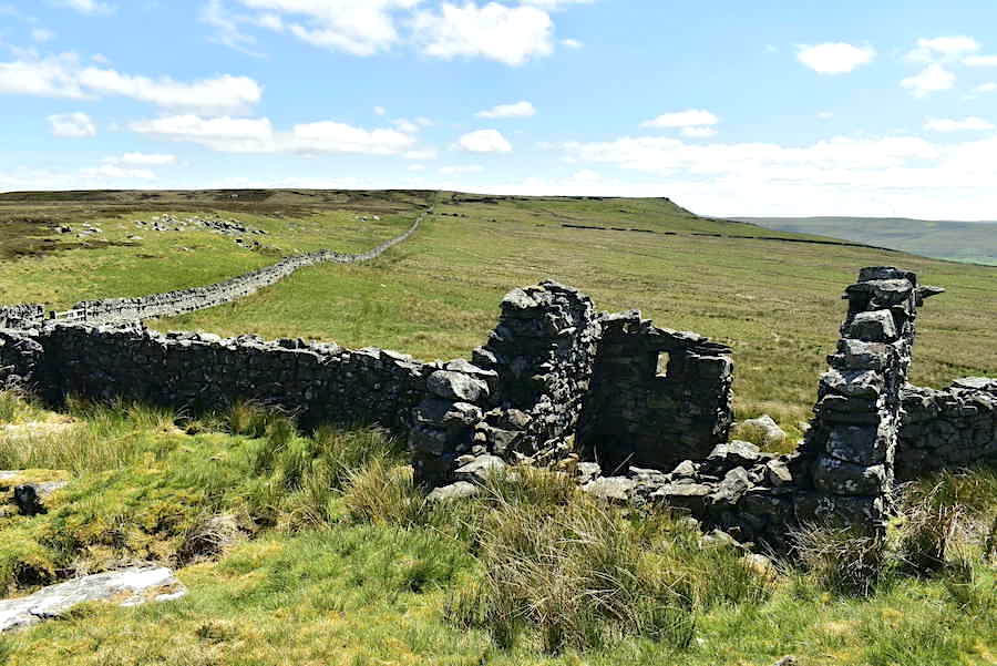
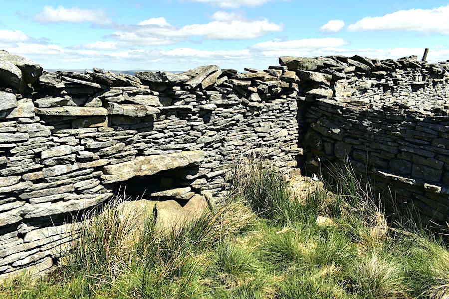
The bothy is a well built single room with a tiny peep-hole in one of the walls and an opening for a door although there were no indications of how a door might have been attached. The shape of the end walls indicate that it once had a roof so it must have been a very welcome place of shelter. Imagine a shepherd closing the door against the wind and perhaps setting a small fire to keep him and his dogs warm and to provide a basic but warming meal before settling down for the night. Did they keep fleeces or woollen blankets here to wrap themselves in on cold winter nights, did they store some basic foodstuffs or a supply of dried peat for fuel? Many questions come to mind when you look at these shelters to which we’ll never really know the answers I suppose.
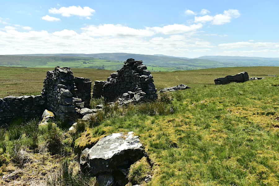
Another view of the single roomed bothy and the roof supporting walls.
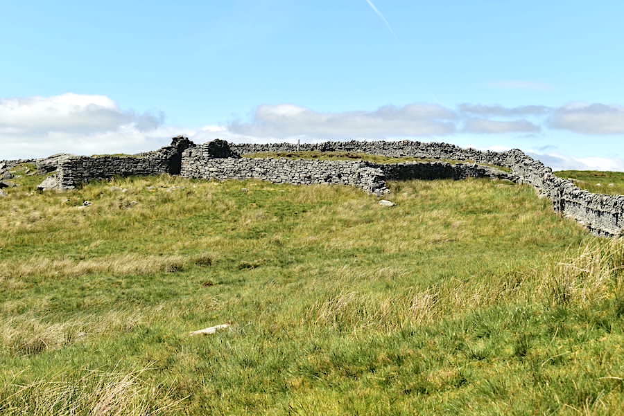
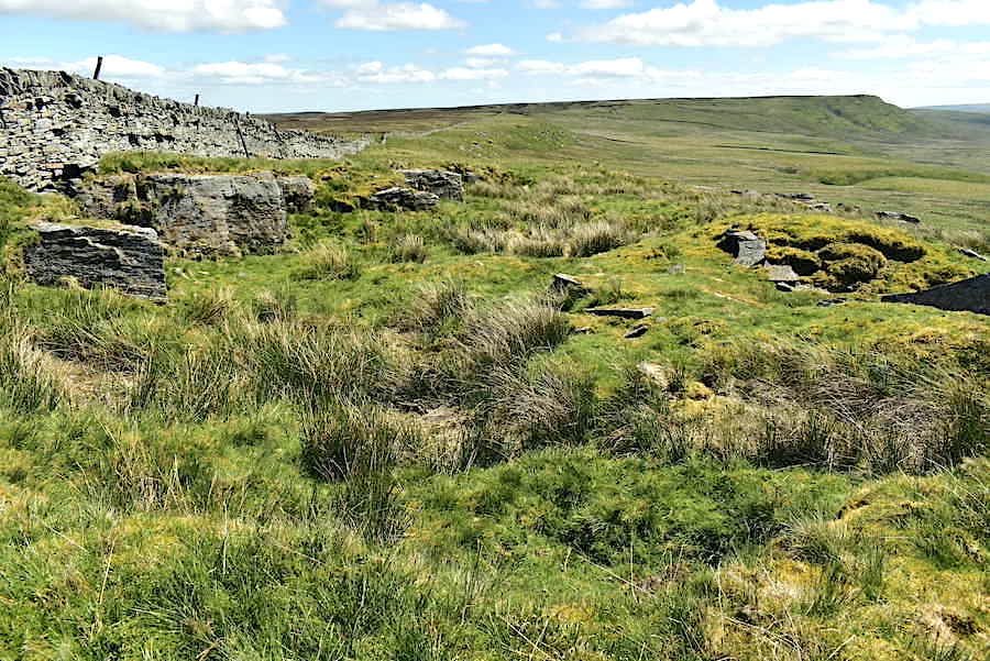
Looking back to the shelter and sheepfold as we start to move on towards Great Knipe.
Another look back across Long Band and the shepherd’s bothy. As we turned to carry on walking the wall gradually disappeared and gave way to a fence which continued until we reached …..
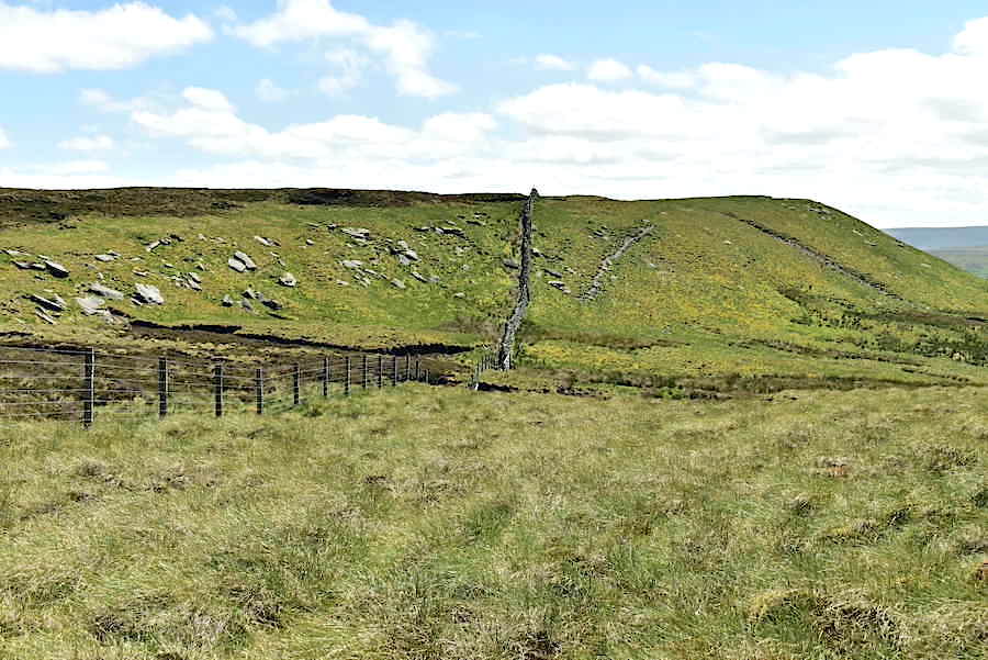
….. a peaty little hollow which made me think of Captain Whelter’s Bog on Selside Pike and was just as messy to negotiate. Beyond it the wall re-appears and we begin the short climb up to Little Knipe.
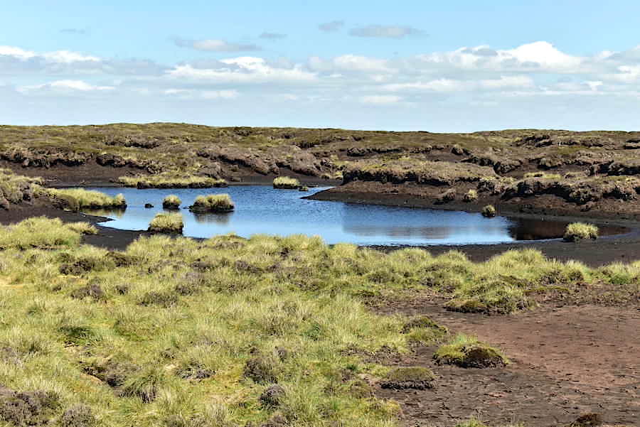
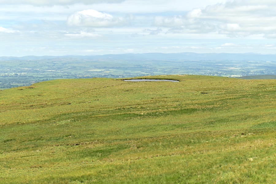
Over the wall and just shy of the summit of Great Knipe I noticed a sliver of blue which turned out to be this peaty tarn. A little further on we came by another smaller tarn on our side of the wall but which didn’t look quite as appealing so I didn’t bother with a shot of it. The largest tarn close to the summit trig point was completely dried out so there was no point taking a shot of that one either.
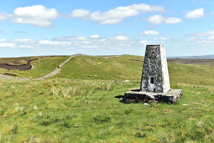
The trig point on Great Knipe at 1693 feet. The breeze was still swooshing across the Eden valley and trying its best to wrench my cap from my head.
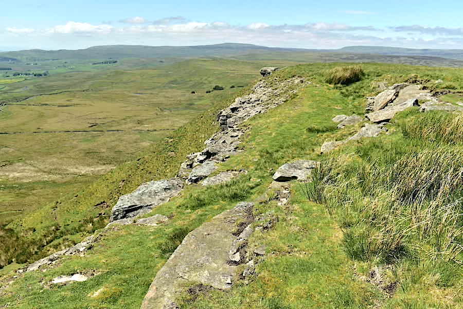
Looking along the Great Knipe escarpment.
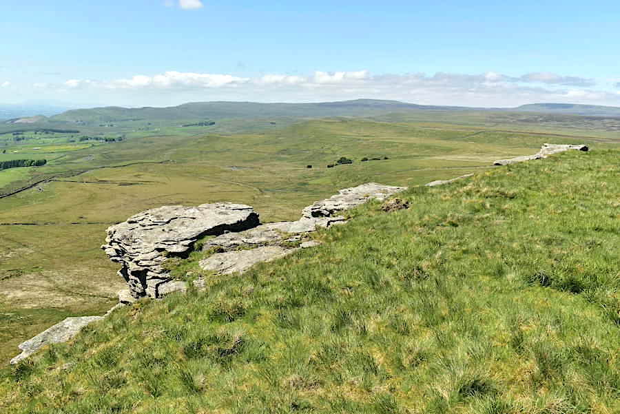
Another view along the escarpment looking towards High Edge with Murton Fell and Mickle Fell on the skyline.
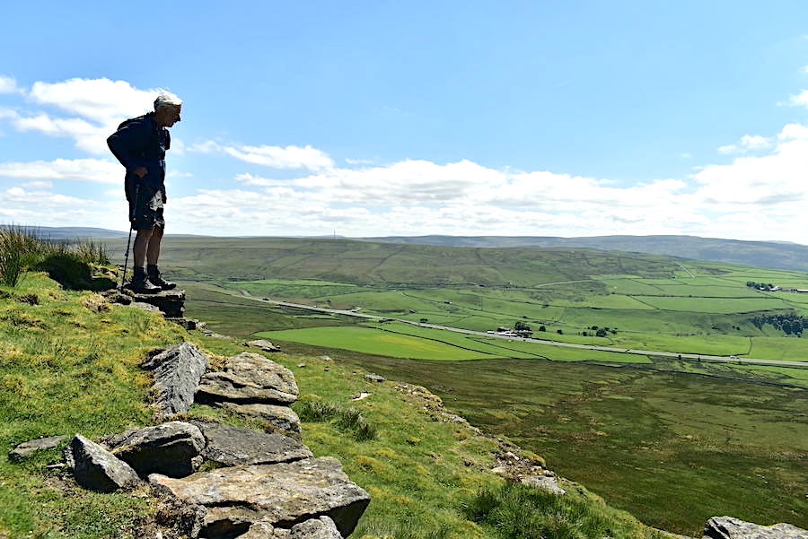
J takes in the view from the escarpment.
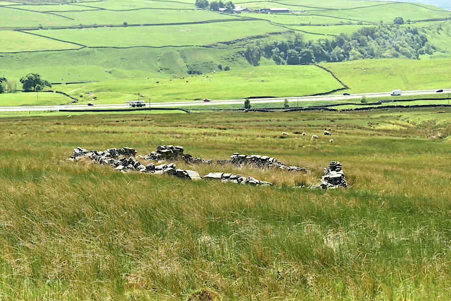
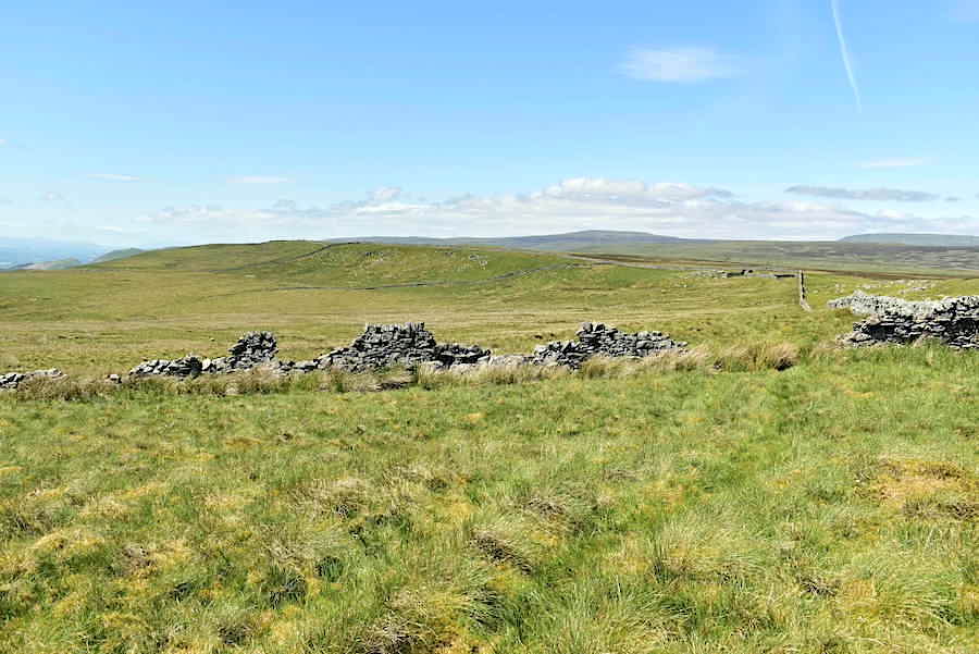
Descending Great Knipe towards one of several sheepfolds dotted along the ridge line.
From the lower ridge line the view back up to Great Knipe.
Another sheepfold along the way, this one rather more complex than the previous one.
Looking back at Great Knipe as we return alongside the broken wall.
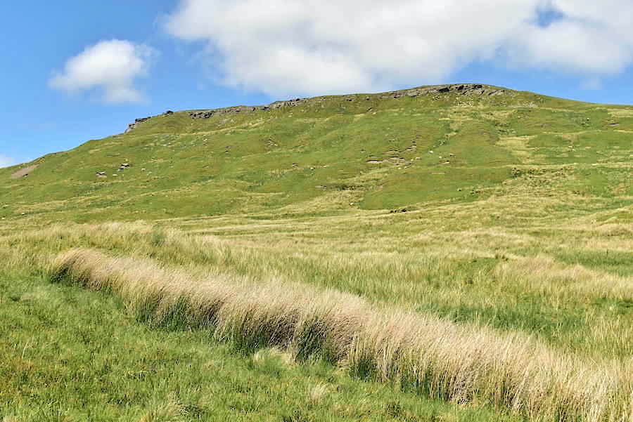
Approaching High Crag with High Edge over on the right skyline.
The pastures below High Crag.
Looking back to Great Knipe now that we’ve reached the point where we crossed Smeltmill Beck via the small ford on the outward leg.
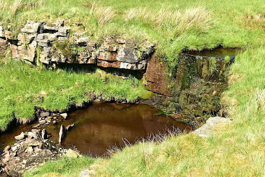
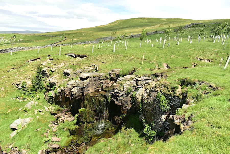
The ford crossing is out of shot to the right as we rejoin the lane by this trickling waterfall in Smeltmill Beck.

A very pleasant sunny stroll back down the lane. A small group of young deciduous saplings have been planted around the beck.
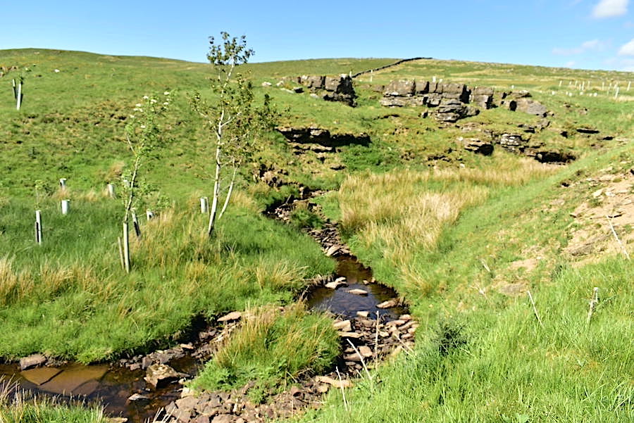
The group of young deciduous trees were growing well around the beck. All the plastic tubes had healthy trees growing from them, some further on than others and probably planted earlier. A great example of planting trees where they have the best chance of survival and good to see.
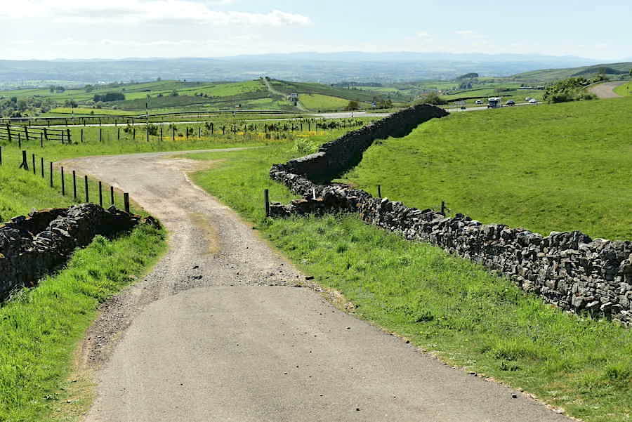
Almost at the end of the track now and the car is parked just below the slope on the right. The traffic still constant on the A66.
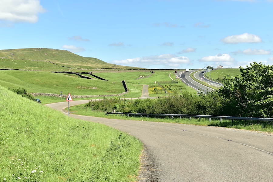
You can just see the car parked in front of the trees over on the left. I walked up the road a short distance for a view of the ancient (Great Knipe) and modern (A66) and the little lane where we began and ended today’s walk. Hope you’ve enjoyed this short walk in this small area of the Northern Pennines, I know we have.