
Mardale Ill Bell, High Street, Rampsgill Head and Kidsty Pike
Walk date – 16th March 2024
Distance – 8 miles
Weather – very foggy start, a sunny spell on High Street, cloudy thereafter, gusty south wind at times
The forecast for today indicated the possibility of a decent weather day with no rain (the first dry day we’ve had this past week), not too windy and the possibility of sunshine during the morning after which the skies would turn cloudy with the likelihood of some rain later on in the day. Knowing that such a forecast was likely to be an attractive prospect for walkers, in which case parking space at Mardale Head would likely be at a premium, we set off early leaving the Eden Valley under blue skies and bathed in sunlight. When we arrived at Mardale Head there were only a handful of cars already parked and two chaps were just folding down their car’s rooftop sleeping quarters, presumably having spent the previous night there. We could see immediately that the surrounding fells were covered in fog and even down in the car park the sun had already been covered by large billowing clouds so we knew that the first leg of our walk today was likely to be foggy with little or no views and so it turned out. However once on Mardale Ill Bell things slowly began to improve and remained so until we began descending Kidsty Pike when the skies began to cloud over. As we reached The Rigg it began to rain and only started to ease off as we reached the footbridge across Mardale Beck leading back up to the car park. Our weary legs just about managed the final slope back up the hill from the beck.
Route
Mardale Head – Small Water – Nan Bield Pass – Mardale Ill Bell – High Street – Short Stile – Twopenny Crag – Rampsgill Head – Kidsty Pike – Riggindale – Mardale Head
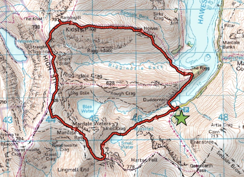
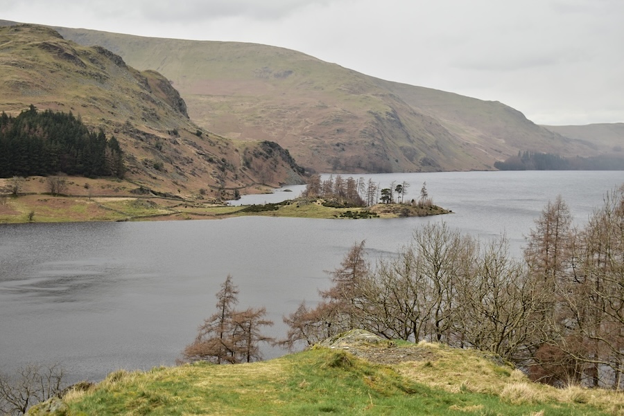
The view from the parking area at Mardale Head where the morning sun is just about managing to penetrate the cloud and illuminate Haweswater and the puddles in the road. We drove through some very large stretches of water spread at intervals along the road between here and Burnbanks.
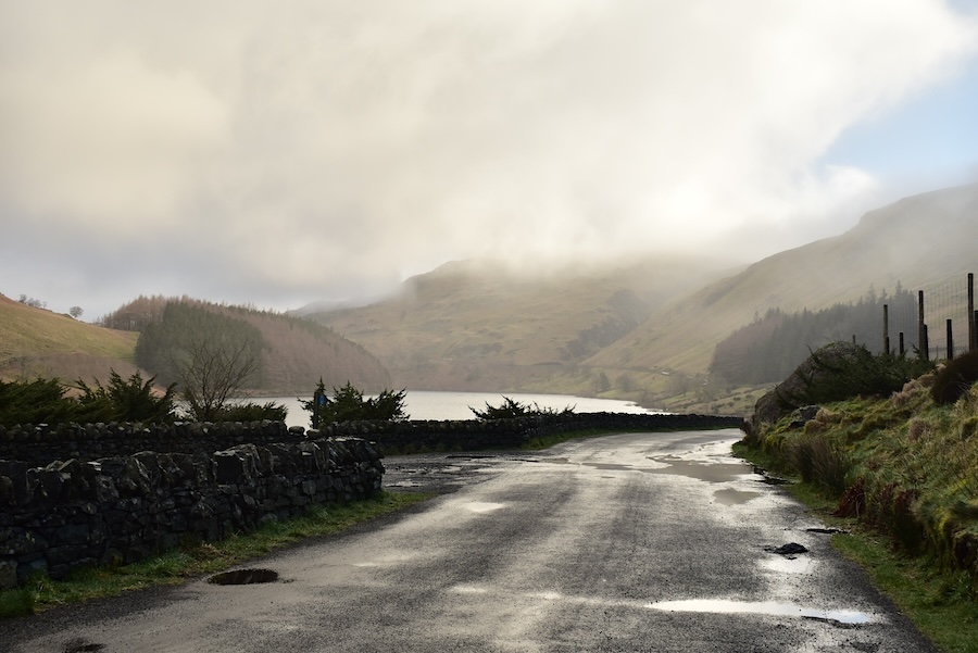
Mardale Waters is the name for this area. Most of the water emanates from Blea Tarn and becomes Blea Water Beck. The path we’re following leads up to Small Water and the outflow from that tarn is Small Water Beck. The two becks eventually join forces lower down to become Mardale Beck which in turn discharges into Haweswater. Every beck, stream and rivulet was full, hardly surprising given the amount of rain which has fallen during the past week, and any water that hadn’t managed to find its way into one of the above mentioned water courses had simply taken the easy way down and used the paths instead.
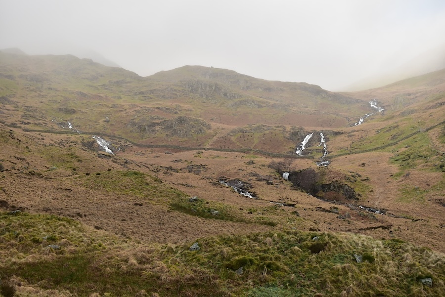
Approaching the gate on the path up to Small Water and looking up at the foggy conditions which we will soon be entering. Small Water Beck is over to the right of us.
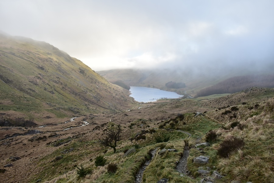
From the same vantage point a look back at Haweswater and noting the fog drifting down from Harter Fell.
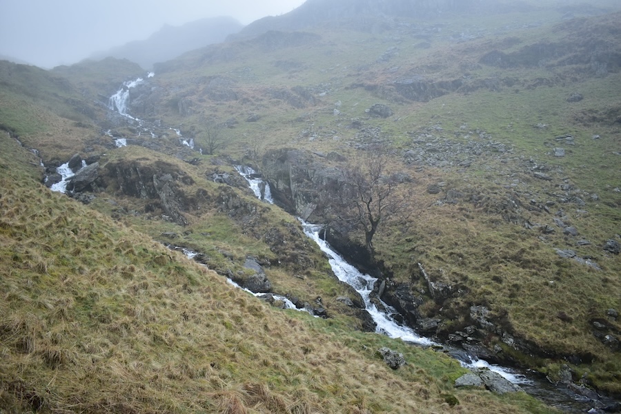
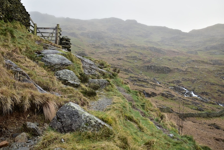
The path moves closer to the beck and where we are just about to enter the fog.
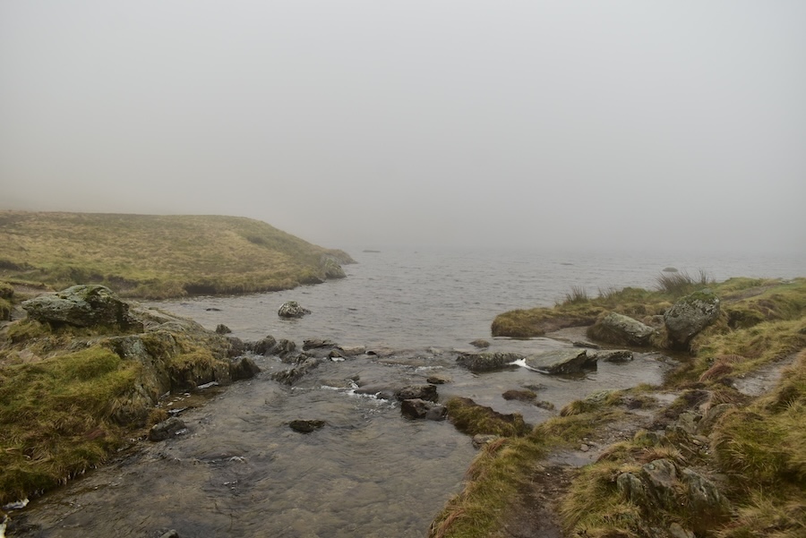
The outflow at Small Water tarn where there is absolutely no sign of any of the fellsides which encircle us. The crossing was a little tricky as some of the stones were below the water line and even those above it were wet through. Just to add to our general enjoyment we had a brief spell of rain. Should we call it a day and go back down? We decide to continue on up to the shelter at the top of Nan Bield Pass.
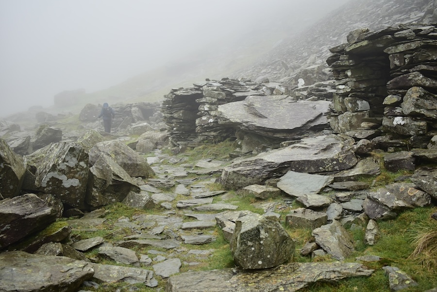
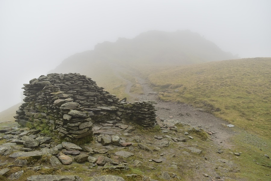
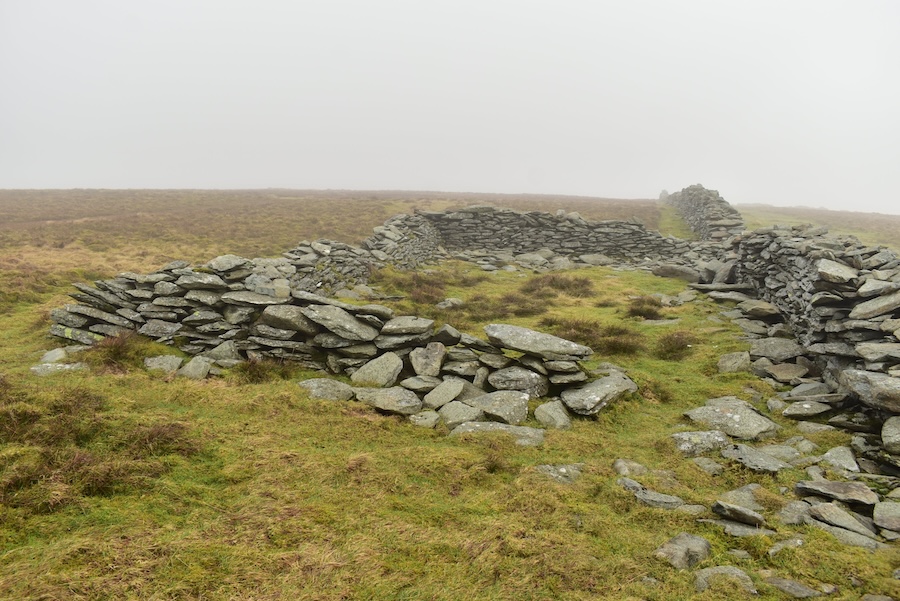
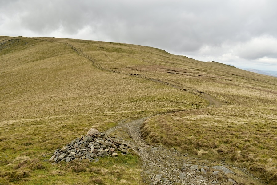
Passing by the ancient shelters alongside Small Water as the fog becomes denser so I call out to J not to get too far ahead of me in case we lost sight of each other.
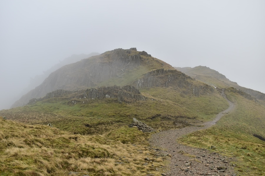
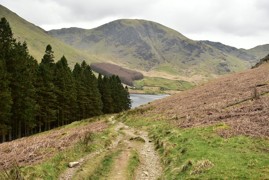
There was nothing to take photos of on the way up the Nan Bield Pass so this was the first shot I took after we climbed up. We had brought breakfast with us so we stopped here, made ourselves comfortable and tucked into it. While doing so we had company at intervals, the first person to arrive was a runner from the Harter Fell direction who paused briefly to check the route on his phone before setting off up the Mardale Ill Bell path which is the one in the shot. Next was an older chap, who also came down from Harter Fell and stopped for a brief chat before turning down onto the Nan Bield Pass and rapidly disappearing into the fog. Then two chaps carrying large packs came down the Mardale Ill Bell path, they paused for a natter about the weather and the prospects for some sunshine before carrying on up Harter Fell. I got the impression that they had been wild camping overnight and their packs were certainly large enough for that. Finally and also from the Mardale Ill Bell path came another runner who didn’t even pause but carried on straight past us and up onto Harter Fell.
Fortified by bacon and egg sandwiches and cups of hot coffee we packed our gear away and set off up the path to Mardale Ill Bell. Above is a look back towards the wind shelter area from the little col which separates the Mardale and the Kentmere valleys. Very windy along here with cloud being pushed up from the Kentmere side before dropping it down on the Mardale side. Once again we walked along in thick fog seeing nothing at all of the surrounding views so I took no more photos until we reached …..
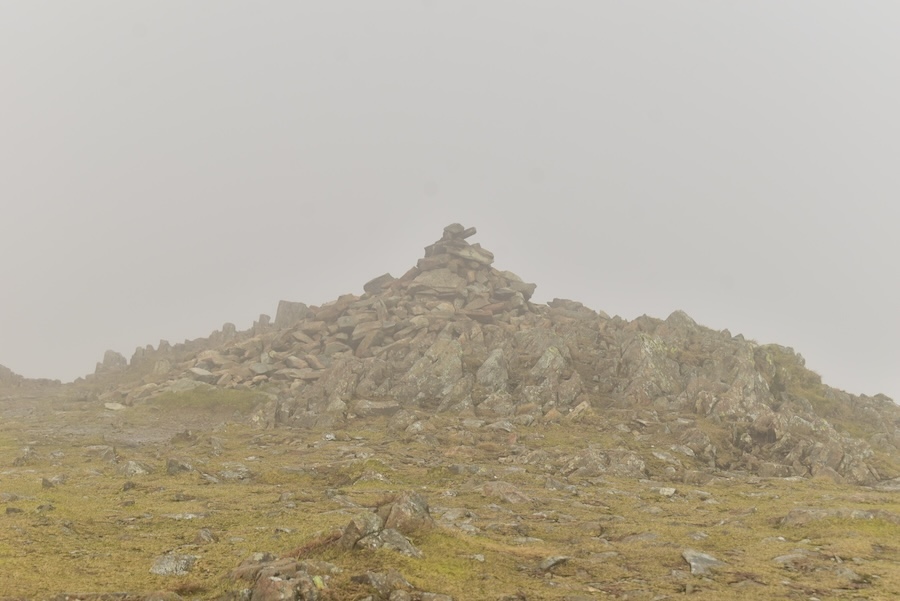
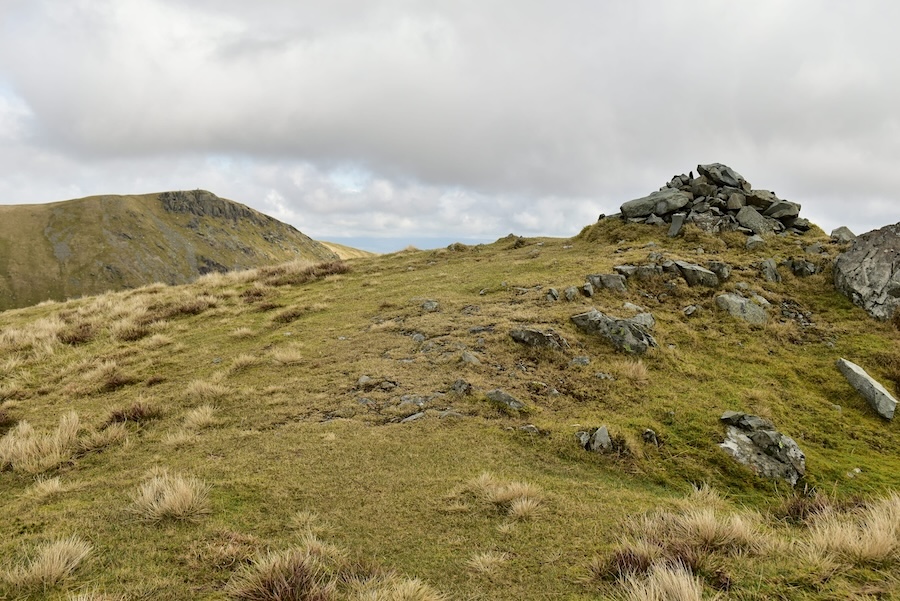
….. the summit cairn on Mardale Ill Bell where a slight thinning of the fog came just as we reached it. There were no views at all so we didn’t linger.
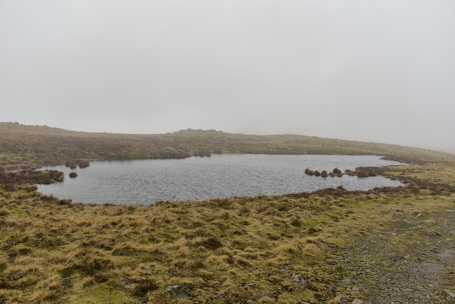
Passing the tarn alongside the path just beyond the summit area as we make our way over to High Street. Plenty of ripples on its surface as the gusty wind tried to push us sideways as we walked along. You can normally see Thornthwaite Beacon from this path but today – zilch.
![]()
We met a couple of solo walkers making their way from High Street over to Mardale Ill Bell while we were walking across to join the path coming over from Thornthwaite Beacon. Here’s the junction of the two routes, the one on the left is the one we’ve just been walking and the one on the right is the path to Thornthwaite Crag and Beacon.
We joined the High Street path at the junction and continued on our viewless journey. I recognised the entrance to the old sheepfold so I stepped beyond the wall for a look at it. In the days when the wall wasn’t broken down the entrance in the wall on the right, at the far end, would have allowed sheep to have been herded into this fold for whatever purpose the shepherds had in mind. The walls of the fold would have been higher then of course to prevent the sheep jumping over them and escaping. Those days are long gone now and I can’t recall ever seeing any sheep up here but nevertheless its nice to have this reminder of how things used to be.
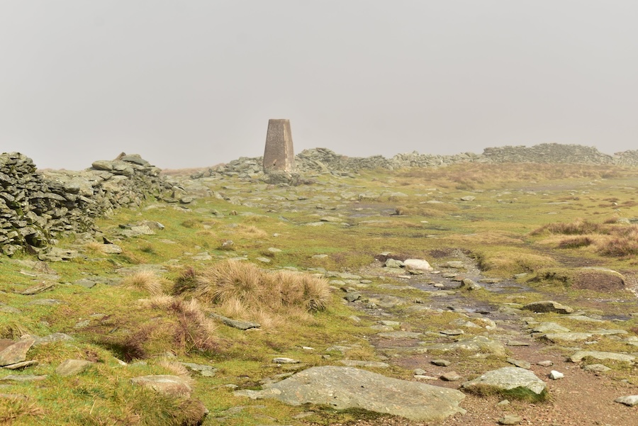
As we approached the trig column there was a sudden glimmer of light so I took a quick shot …..
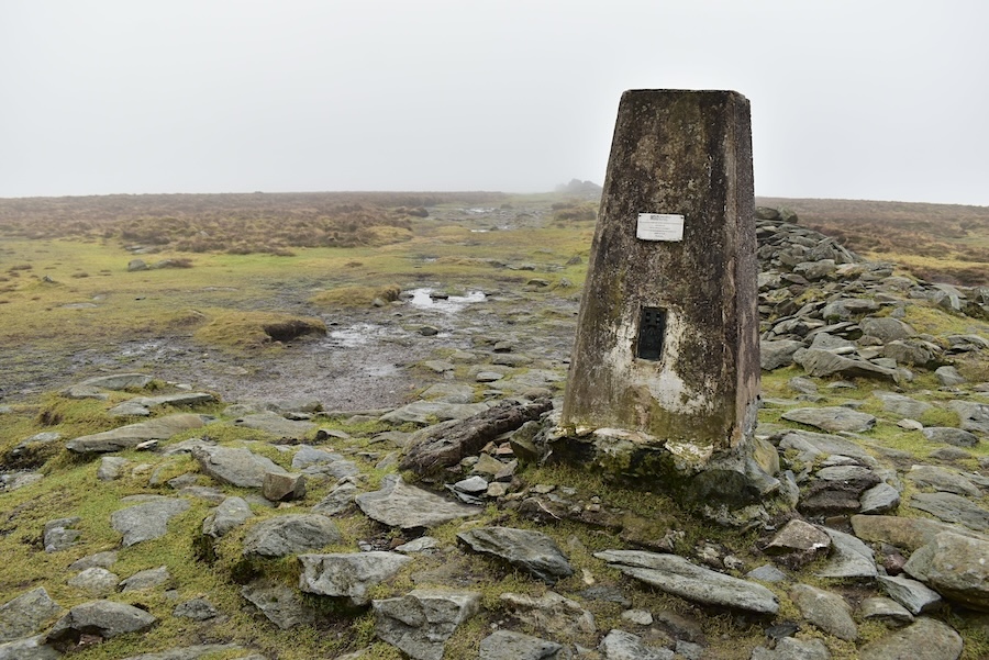
….. by the time we reached it the glimmer of light had disappeared and we still don’t have any views although the fog doesn’t seem to be quite so thick up here.
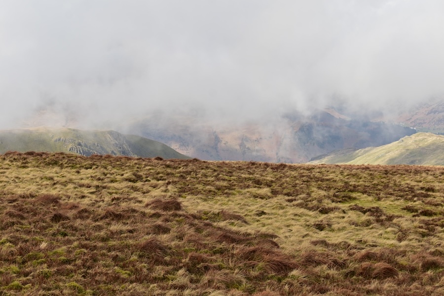
We carried on from the trig column and suddenly saw that we had a partial view of the fells to the west. Cloud continued to drift along over the higher fells, blown along by the wind, but we caught a glimpse of Gray Crag on the left and Brock Crags on the right.
Brock Crags now on the left, behind them comes Angletarn Pikes merging into Beda Fell with the dark lump of Place Fell over on the right.
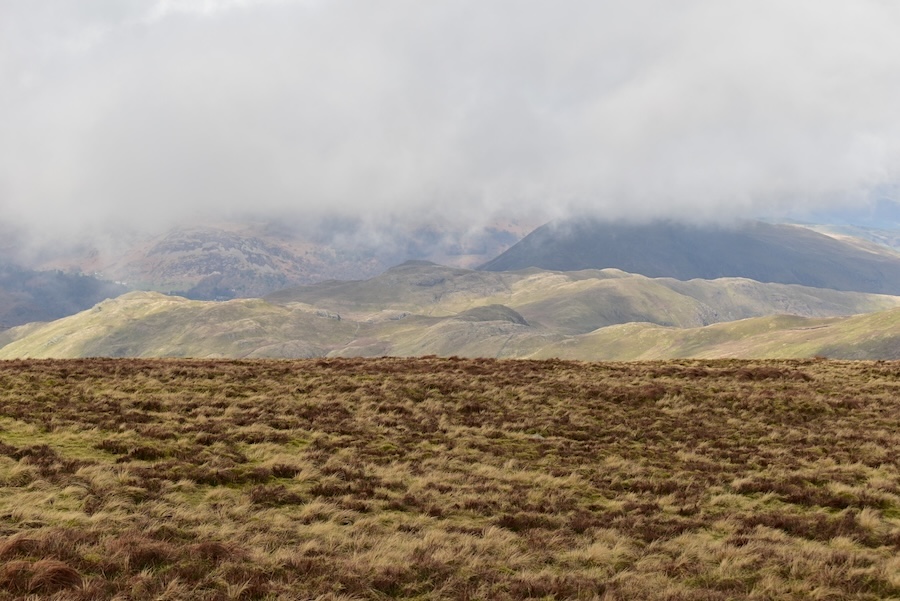
Suddenly the fog disappeared and we now have some very welcome sunshine and long distance views, even if they are only of those towards the east. Rampsgill Head and Kidsty Pike are just behind the point where High Street’s summit area begins to drop down and behind them the high point of the skyline is High Raise.
Towards the western side the cloud has cleared from Place Fell, the fell in shadow on the left, to the right of which is Gowbarrow Fell also partially in the shade. Below Place Fell is the long ridge of Beda Fell and below that is the climb up to a shadowy Rest Dodd. In full sun in front of Rest Dodd is The Knott. The paths leading to and from The Knott are crossing the lower slopes of Rampsgill Head from the Straits of Riggindale. Annoyingly there are blue skies over the distant Eden Valley where we live.
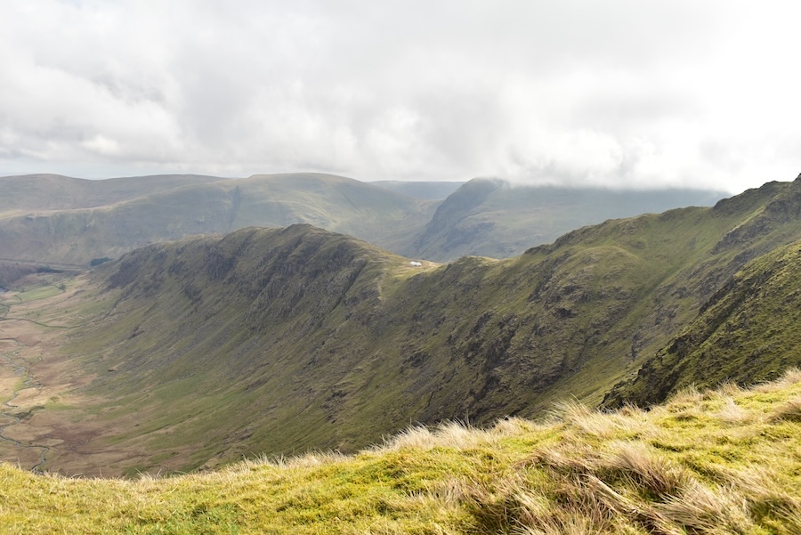
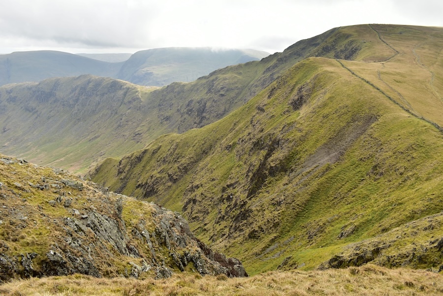
Below us is a better view of the description given above. Below us are the Straits of Riggindale, the section between Short Stile and the slopes of Rampsgill Head, leading over to The Knott. Nearest the camera on the right is Short Stile beyond which is Twopenny Crag at the head of Riggindale. Walkers making their way up High Street are spread out along the various paths and it doesn’t really matter which path is chosen all of them eventually lead to the summit area. Obviously getting to that point involves a fair amount of effort.
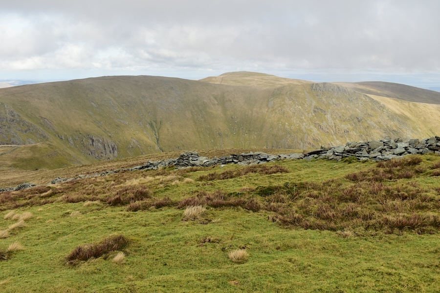
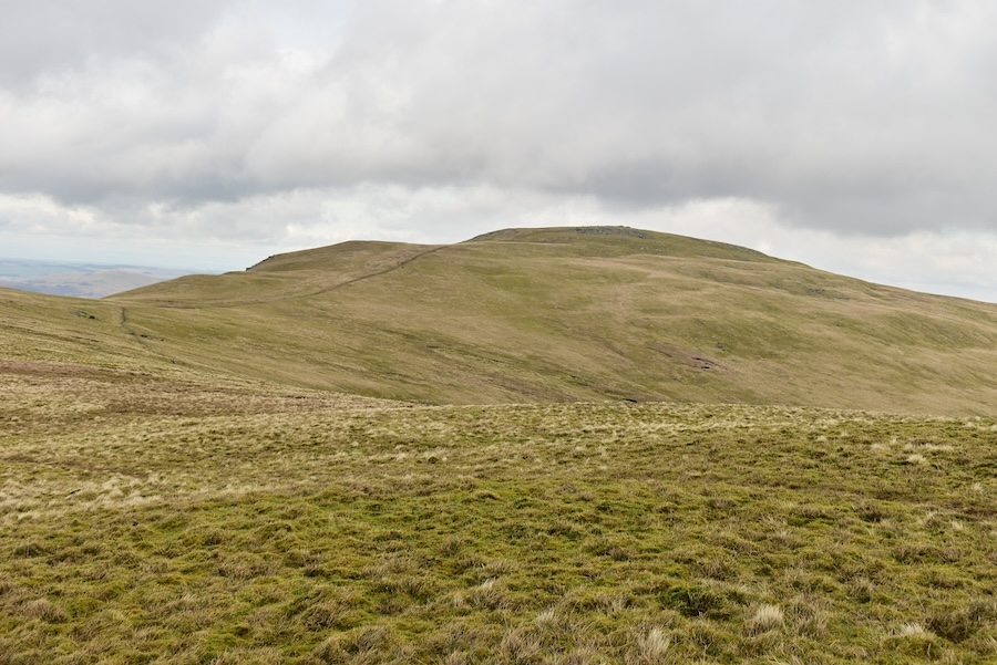
A closer look at Rampsgill Head, High Raise and Kidsty Pike from our descent as we made our way towards Short Stile.
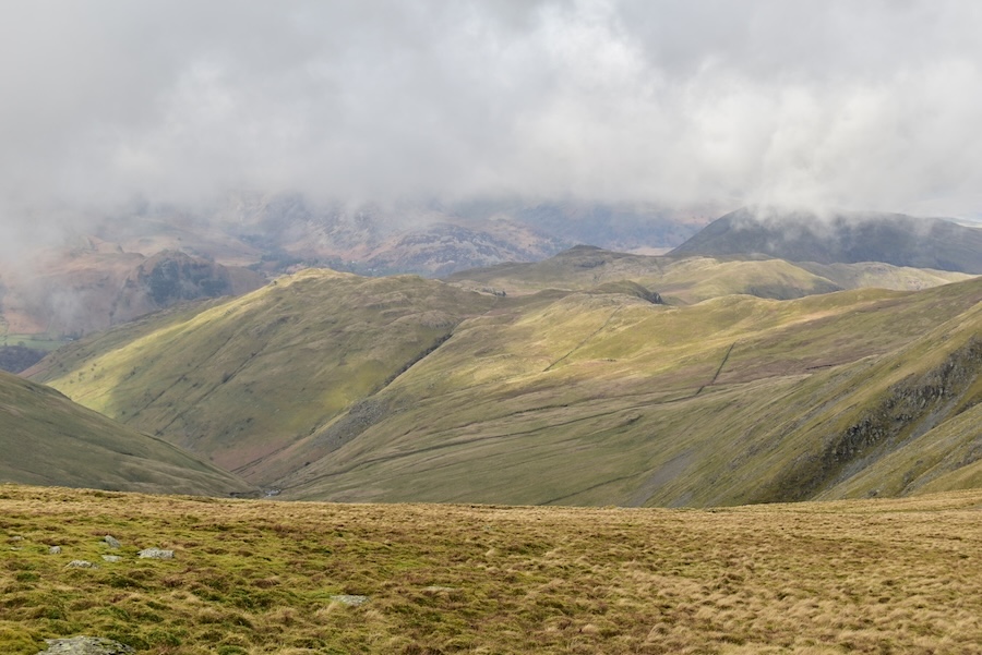
Over towards the west the cloud is back only allowing us a view of Brock Crags and Angletarn Pikes. Place Fell behind them has gone dark again.
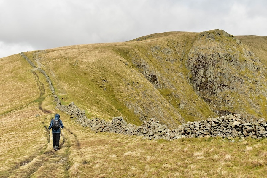
At the convenient gap in the wall we headed over towards Short Stile across the middle foreground.
Kidsty Pike dominating the northern side of Riggindale as we make our way across to Short Stile.
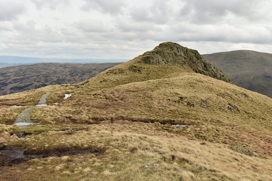
The cairn on Short Stile and the camera angle making Kidsty Pike look a bit less prominent.
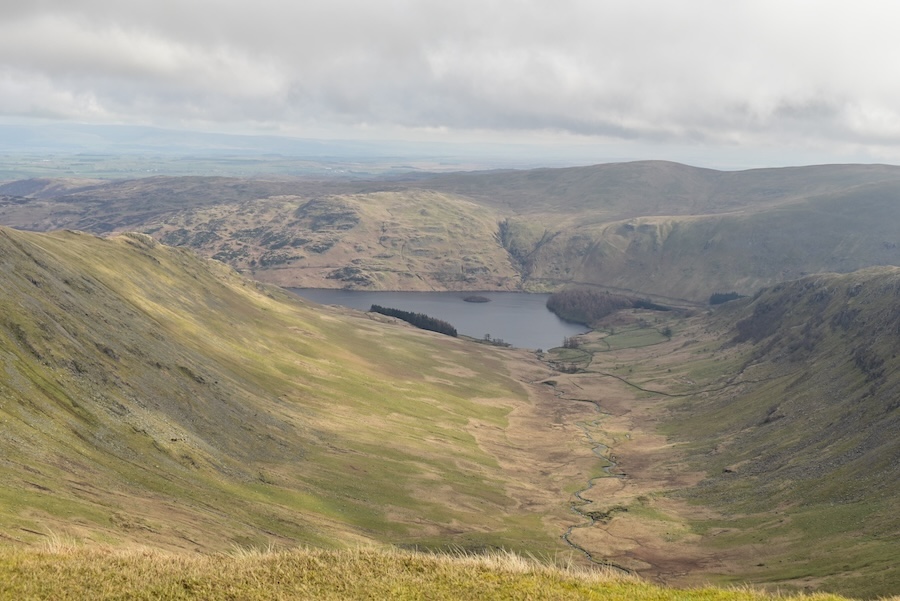
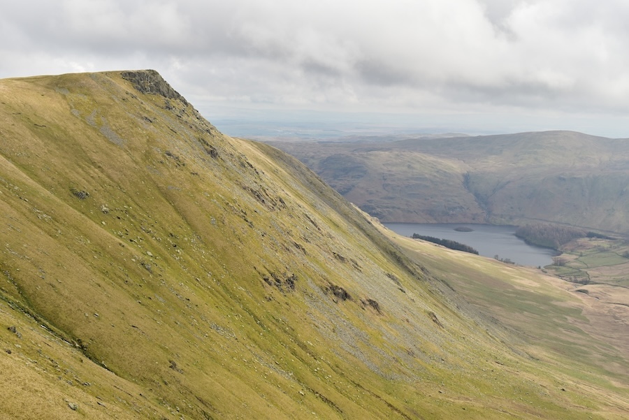
The view along Riggindale from Short Stile. Water draining from both sides eventually finds its way down into Haweswater. In the sunshine beyond Haweswater is Brown Howe and across the V shape of Rowantreethwaite Beck to the right of it are the lower slopes of Branstree. The slight bump on the skyline beyond is Selside Pike.
From Short Stile the view across to Caspel Gate tarn with Rough Crag to its left and Long Stile rising to its right.
On the western side we now have a view of part of Hayeswater with part of Gray Crag on the left and Brock Crags on the right. The cloud has once again lifted to reveal a hazy view of some of the fells beyond.
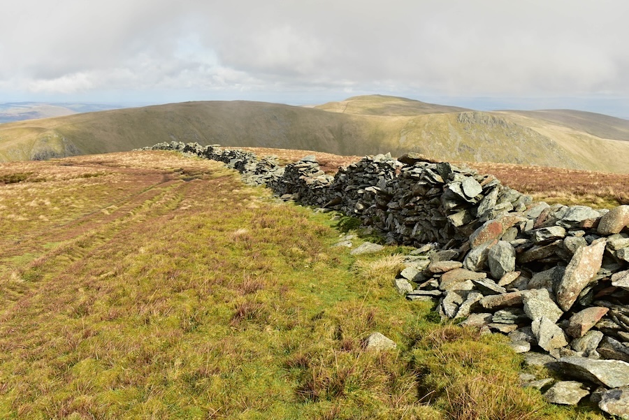
Crossing the Straits of Riggindale now and when we reach the lighter coloured patch just a little way up the slope we’ll bear off to the right and make our way over to Twopenny Crag and beyond.
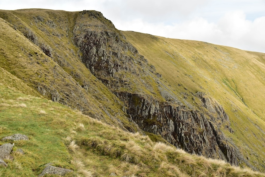
There’s an impressive view of Twopenny Crag from the Straits.
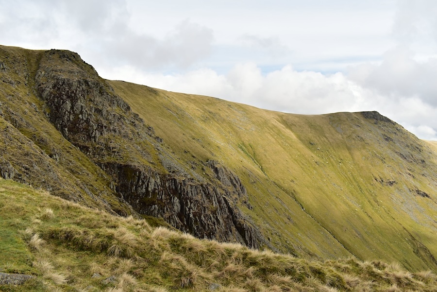
A longer view of the crag to include Kidsty Pike and a bit of blue sky!
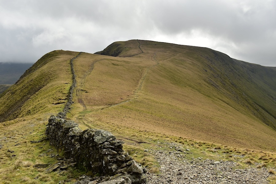
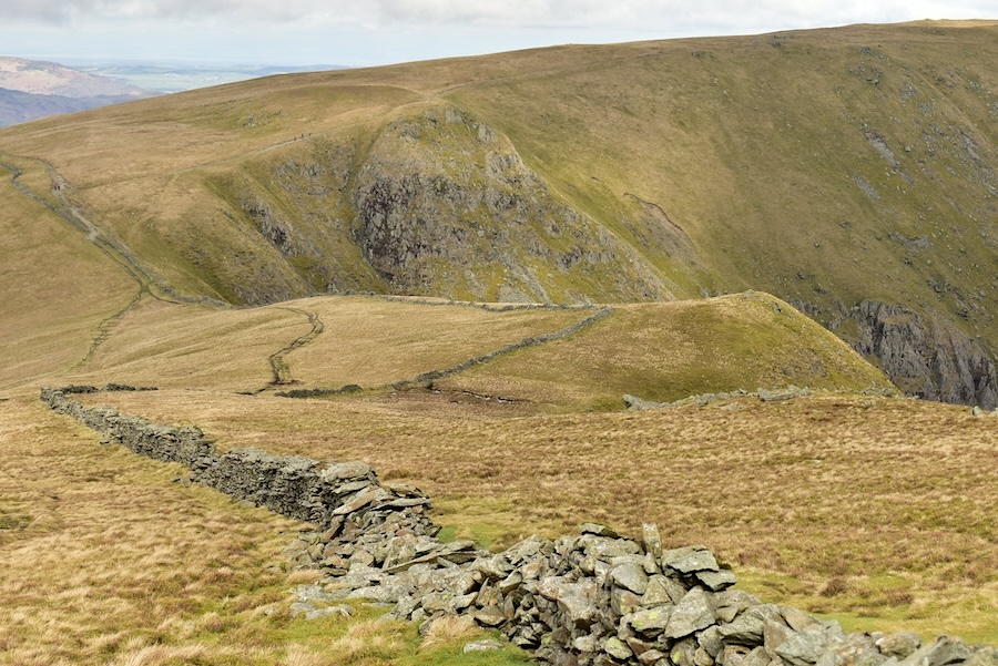
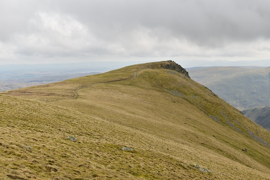
A look back at High Street as we reach the point at which we left the path leading towards The Knott to begin making our way over Twopenny Crag. Lots of walkers were coming down towards us so it had to be a quick take it or leave it shot.
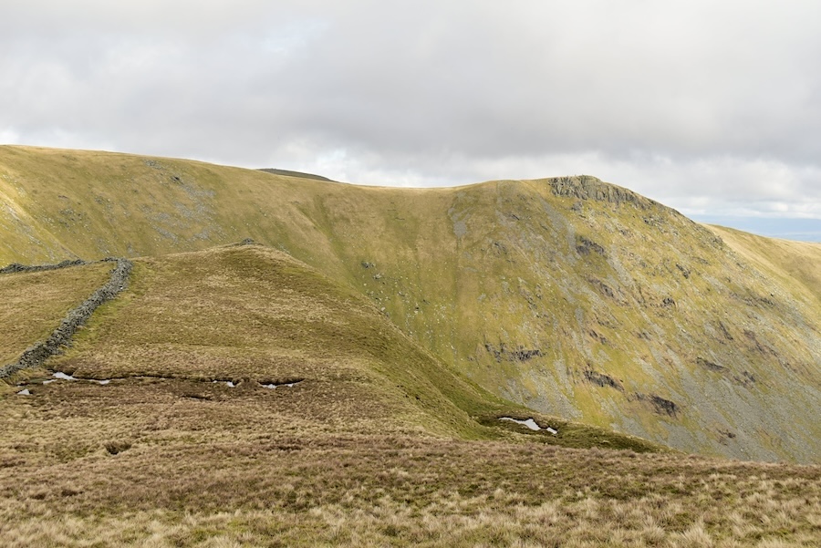
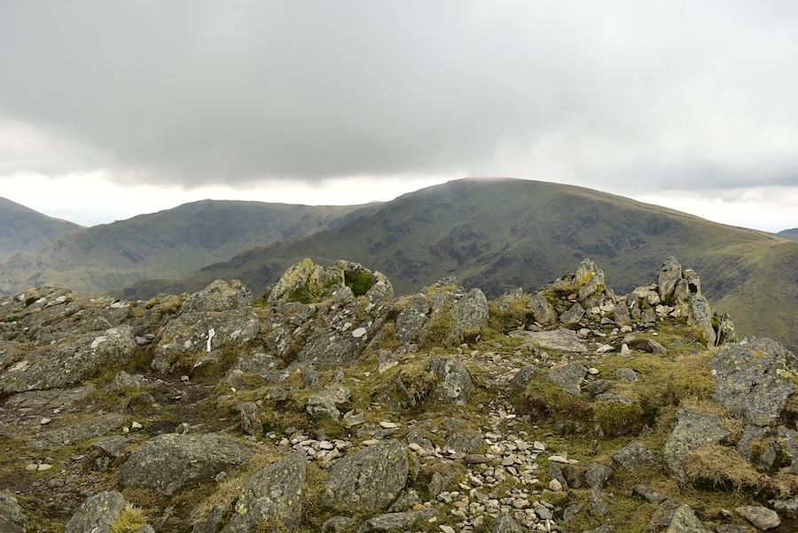
Crossing Twopenny Crag and looking towards Short Stile. Behind it is the Long Stile/Rough Crag ridge to and from High Street.
Kidsty Pike keeping watch above Haweswater. On the way over to Kidsty we made the short diversion over to …..
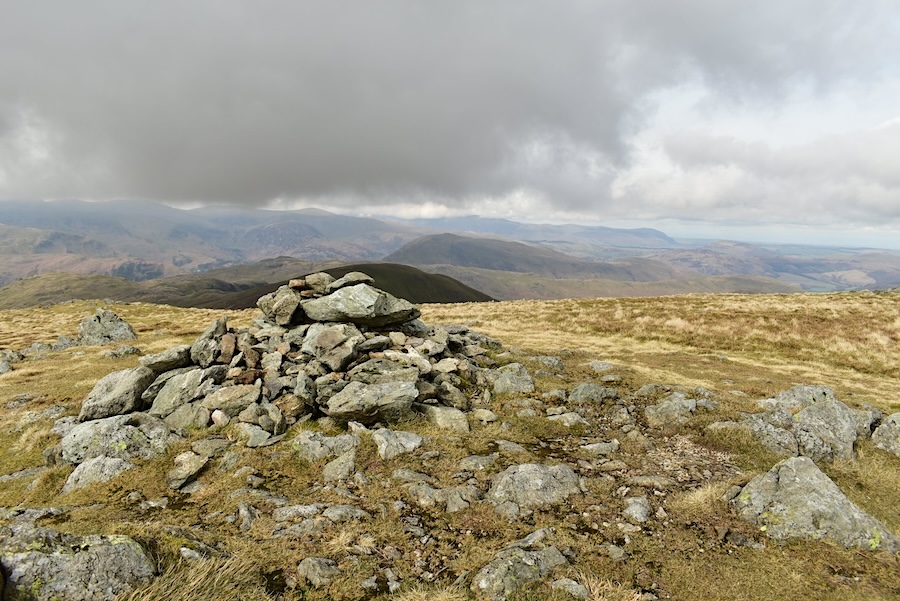
….. the summit cairn on Rampsgill Head. It was very windy up here so J did his usual stabilisation routine while I took the shot. I’m surprised it came out so clearly as we were both being battered by the strong wind. Naturally we didn’t linger and hot-footed it back to the somewhat calmer conditions on the path over to Kidsty Pike.
No shelter from the wind on the path across to Kidsty so jacket hoods remained pulled up tight. Cloud is building as forecasted from lunchtime onwards. Neither or us is hungry so we didn’t stop for a lunch break …..
….. not that there is anywhere which would provide any shelter from the wind along the route from Rampsgill Head over to Kidsty Pike.
On the way over and from the same spot as the previous shot I took this view of High Raise. Its a detour from Rampsgill Head but we didn’t bother with it in today’s windy conditions but it would be a pleasant enough walk over on a sunny summer’s day.
Kidsty Pike summit has no trig column or cairn its just a very rocky area with a steep drop into Riggindale beyond where I’m standing. Best not to get too close to the edge then in today’s windy conditions. High Street is the fell nearest the camera with Mardale Ill Bell right behind it. The cloud is getting heavier and darker.
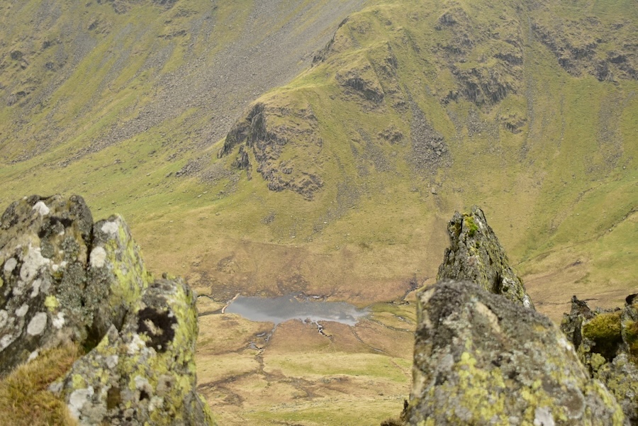
Between the spiky rocks on Kidsty Pike a shot looking down to the little tarn below Short Stile. The area where the tarn is situated is marked as Sale Pot on the OS map, a flat basin collecting the water draining down from Riggindale Head which eventually flows into Riggindale Beck.
We only had a very dull view of Harter Fell from Kidsty Pike today but at least its better than the ‘no view of it at all’ that we had from Small Water up to Mardale Ill Bell at the start of our walk. Some view is better than no view even if its not quite as shiny as you’d like it to be.
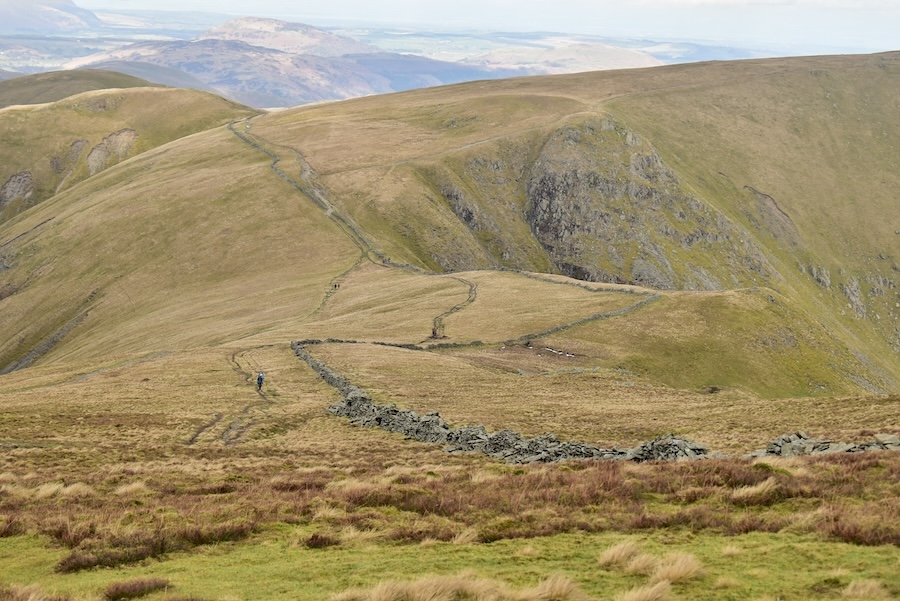
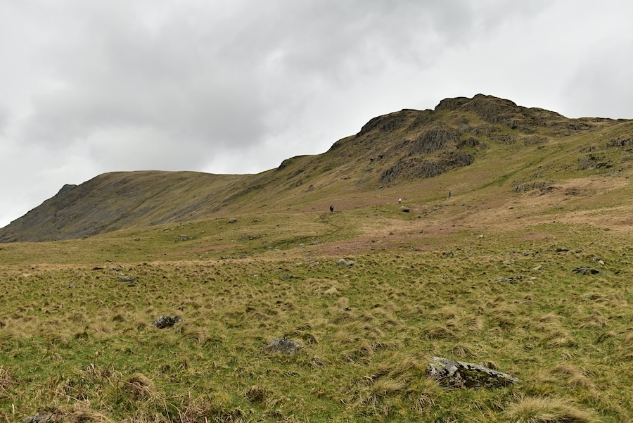
Well on the way down from Kidsty Pike now and heading towards Kidsty Howes.
The approach to Kidsty Howes with a smidge of Haweswater thrown in for good measure.
The path over on the left leads around the rock pinnacles and goes through a series of gullies all of which were dripping wet today. They are becoming quite eroded and a series of bags of large stones scattered along the route indicated that some future work was planned. The descent route through the gullies slowed us down quite a bit, many of them were very awkward to deal with and all were rocky, very wet and slippery. Some had longish drops down from one part of the path to another, difficult for me, and my little legs, at the best of times as I can’t reach the lower level so I have to sit and sort of slither down to it. Sitting on pointy rocks running with water added an extra dimension today. It wasn’t at all pleasant and seemed to go on forever. We were both glad when it was all behind us.
The path veers off to the right over the grassy area so we didn’t have to deal with that last one. I finally had a place where I could stand and take a shot down into Riggindale too.
The view back up to Kidsty Howes where more people had emerged from the nightmare descent through the gullies and were making their way gingerly down into Riggindale across the very wet grass. We had noticed some flattish stones off to the side of the path to perch on so we went over to them, got the coffee out and had a short break while our legs returned to something approaching normal.
A moment of relief on reaching the flat ground of the valley bottom as we cross Bowderthwaite Bridge across Riggindale Beck. Rough Crag is opposite us and forms the skyline above Riggindale. High Street is just in shot over on the right.
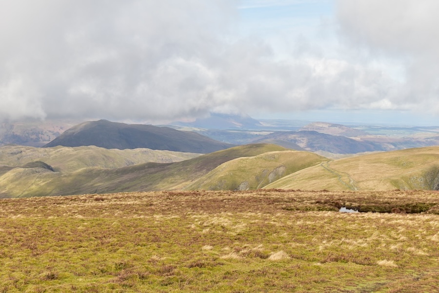
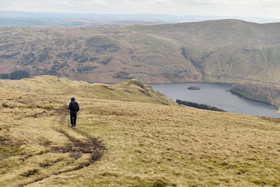
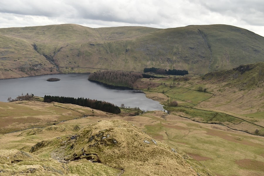
A look back at some of the fells we walked today before we leave Riggindale and the views disappear.
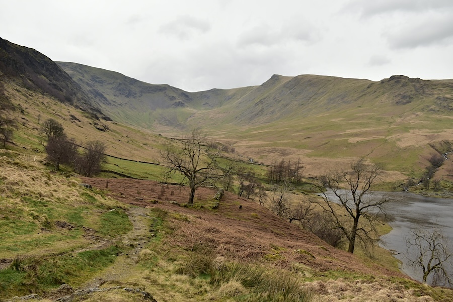
We climb the short path leading up to The Rigg and take in the view of Speaking Crag jutting out into Haweswater below Birk Crags and Castle Crag. The surface of the water is slightly ruffled by nothing more than a light breeze. Now that we are back down in the valley the wind is nowhere nearly as strong as it was and if the cloud hadn’t joined forces and thickened it would be a really pleasant afternoon because its not at all cold.
We had just left The Rigg to begin the walk back to Mardale Head when it started to rain so hoods went back on and the camera put away …..

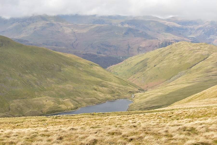
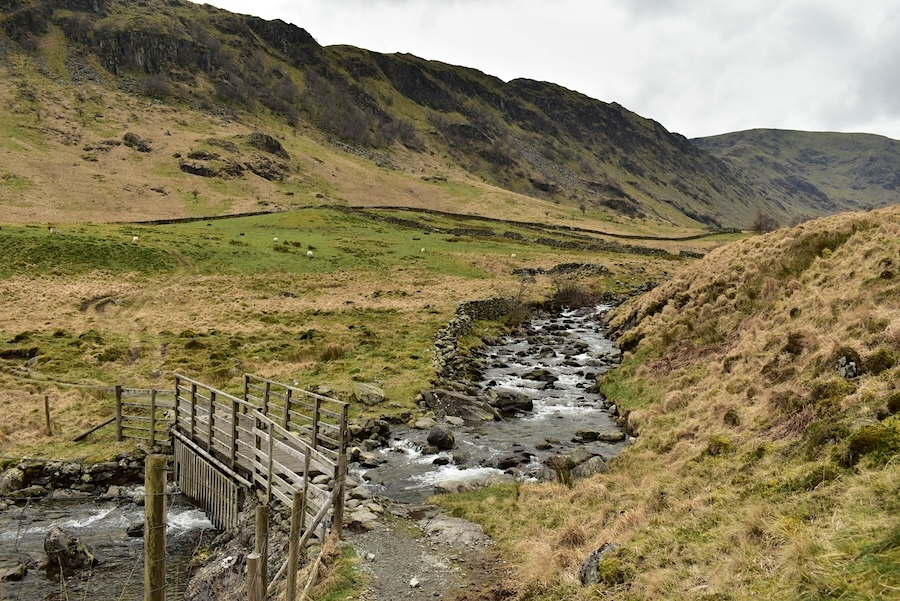
….. and I didn’t take another shot until it began to ease off just as we reached the footbridge over Mardale beck and the fine view of Harter Fell. This is the first clear view we’ve had of the fell today.
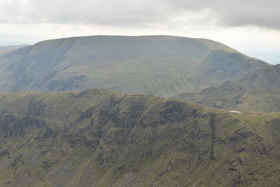
As we hauled ourselves up the final slope back to the car park I took this shot of Mardale Ill Bell, another of today’s fells that we haven’t had much of a view of today. When we reached the full car park we noted the long line of cars parked along the roadside, and in every little ‘tuck yourself in’ spot that latecomers had been able to find and were thankful that we had made an early start. By now it was well past lunchtime so before driving home we each had a sandwich to keep body and soul together and, after a 35 minute drive back home, we’ll be able to have a cup of something hot to wash it down with.