
Buttermere
Walk date – 4th March 2024
Distance – 4.1 miles
Weather – dry and mostly sunny with a brisk and gusty easterly breeze
We had a walk around Buttermere today after another incorrect weather forecast resulted in us being fooled again. We had entertained vague thoughts of taking a little saunter somewhere for a couple of hours should the weather eventually turn favourable, but we had nothing definite in mind and we hadn’t even bothered to make up lunch boxes or get out our walking gear. Beats me how these forecasts can be so wrong. After a bit of ranting and grumbling about it we eventually settled on a drive over to Buttermere to take a leisurely stroll around the water, which is always a very pleasant way to spend a couple of hours. As we travelled from east to west we noticed that the snow which fell through the night of Friday/Saturday during this last weekend had covered, quite considerably, the North Pennines and most of the fells on the eastern side of the county, even the two Mell fells were covered from top to bottom. Clough Head, the Dodds and the Helvellyn range were similarly decked out but Blencathra and the rest of the northern fells seemed only to have the same amount of snow which had fallen previously and there was nothing much to the north of the A66. The same applied the further west we went so it seemed as if the snow clouds had dumped their entire contents over the east during the night with not much left for the western side.
Route
Gatesgarth Farm – Buttermere circular path – Gatesgarth Farm

Gatesgarth farmhouse, which is situated at the bottom of the Honister Pass road, opposite the parking area. The first photo of the day turned out to be problematic with the camera stubbornly refusing to work and it gradually dawned on me to check that the SD card was properly in place. Not only was it not properly inserted it wasn’t even there! After our last walk I had forgotten to replace it but I did have spare cards with me so I inserted one of them and we were good to go. What I didn’t realise at the time was the amount of bother using that particular card was eventually to create. More on that later.
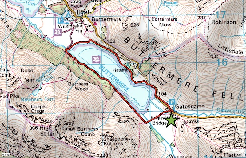
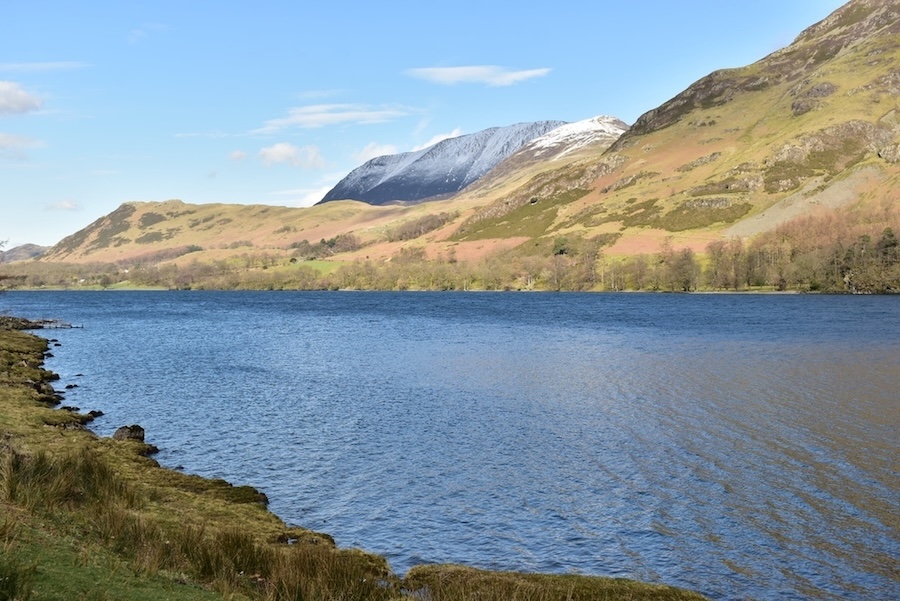
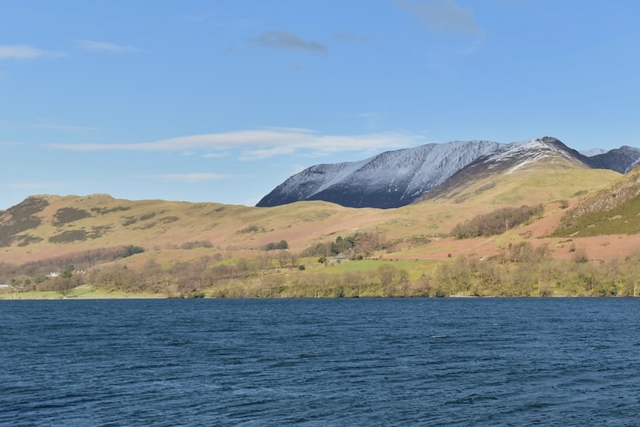
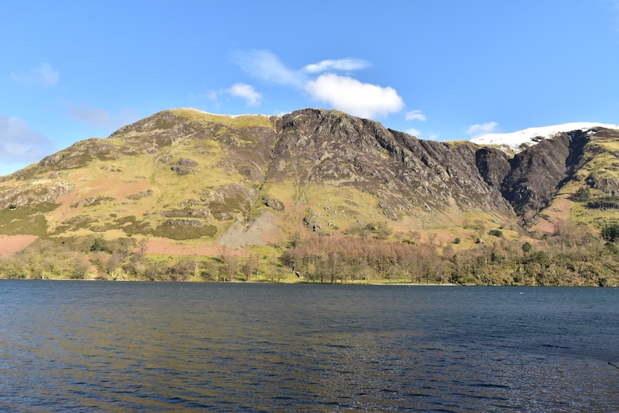
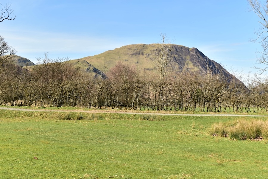
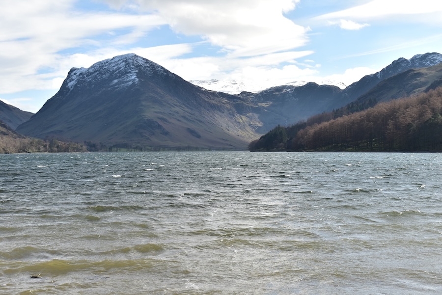
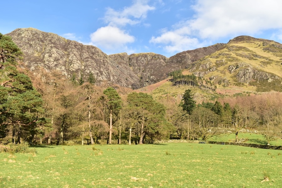
High Crag and High Stile as we began walking away from the farm towards the path around Buttermere. Having already noticed the difference in snowfall from east to west we weren’t at all surprised to see so little snow cover on them. I guess that is old snow up there which just hasn’t melted yet.
Haystacks and Seat across the farm fields, not much snow on them either.
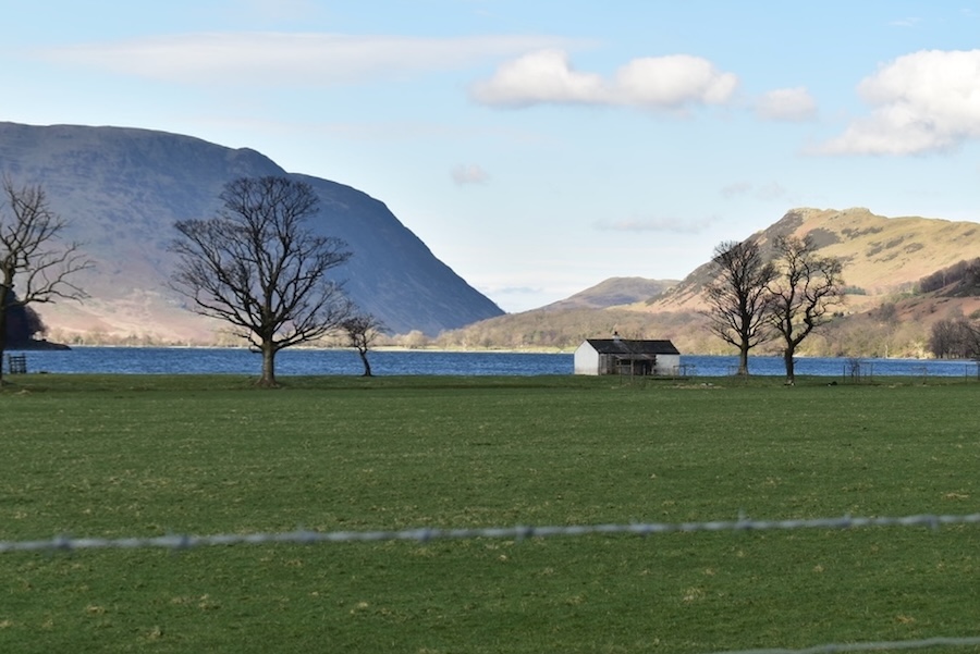
Nothing at all on Mellbreak or Rannerdale Knotts either. The building in the shot is Char Cottage, now known as the Char Hut which was once used as a fishing hut although I don’t know if it is still in use for that purpose as I can’t find any mention of its present usage. The barbed wire in the foreground was unavoidable even with the camera lens on maximum zoom.
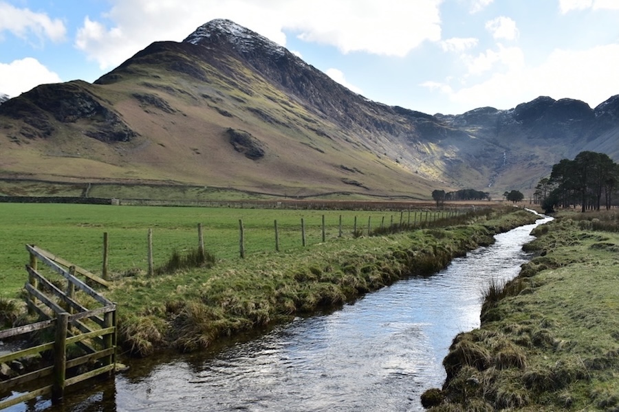
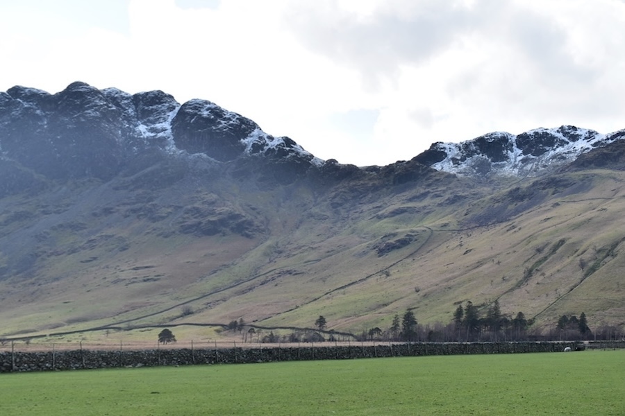
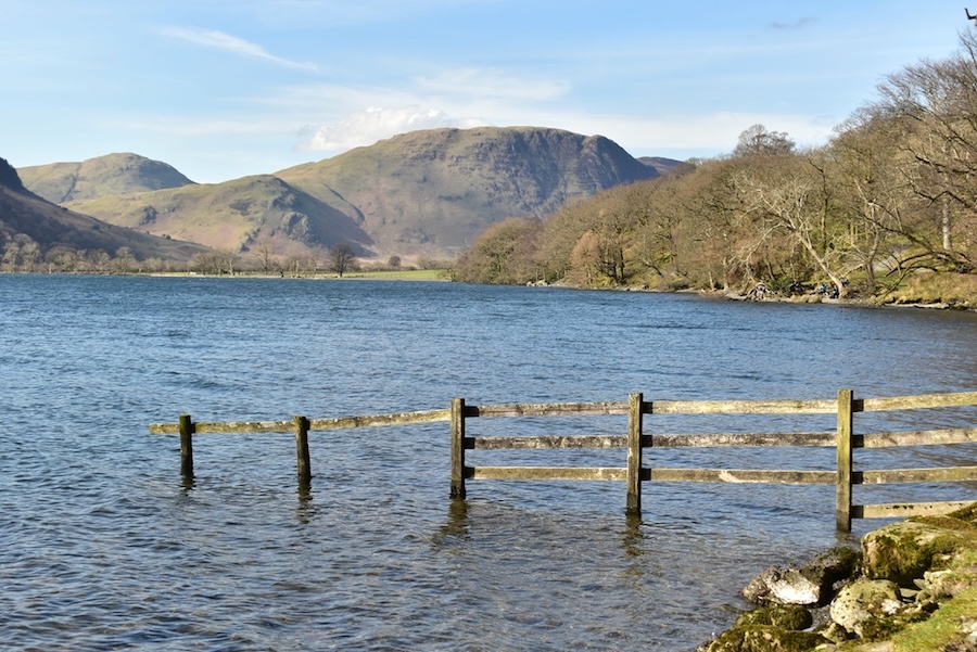
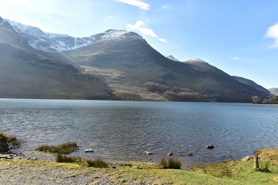
Crossing Peggy’s Bridge over Warnscale Beck, notice the lack of snow on Fleetwith Pike.
Sunny High Snockrigg across the water. A lot of people were out today and we’ve just passed a family group who had paused at the bridge to show their younger members the group of Highland cattle which always seems to congregate around here.
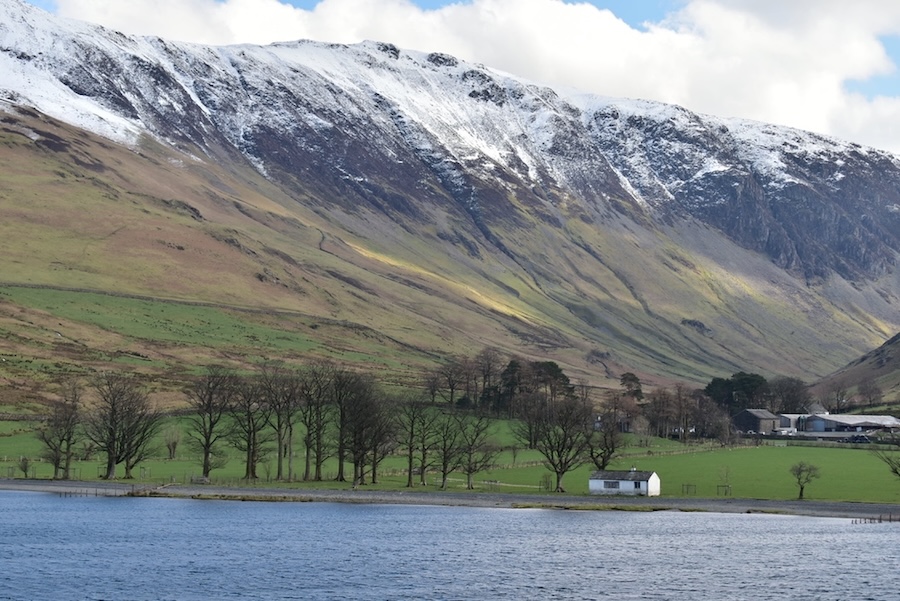
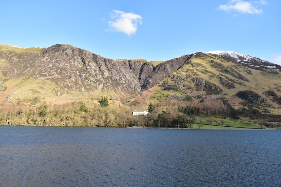
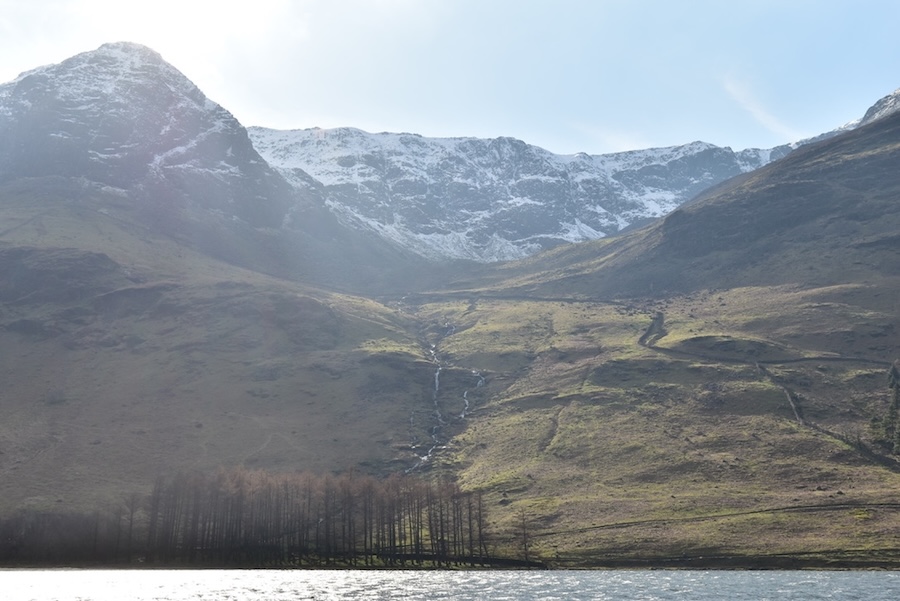
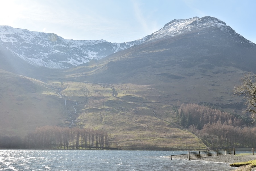
The Char Hut and Gatesgarth farm tucked in at the bottom of the Honister Pass below the snowy top of Littledale Edge.
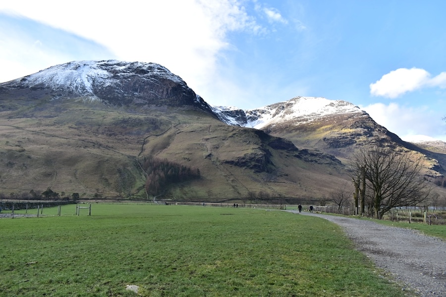
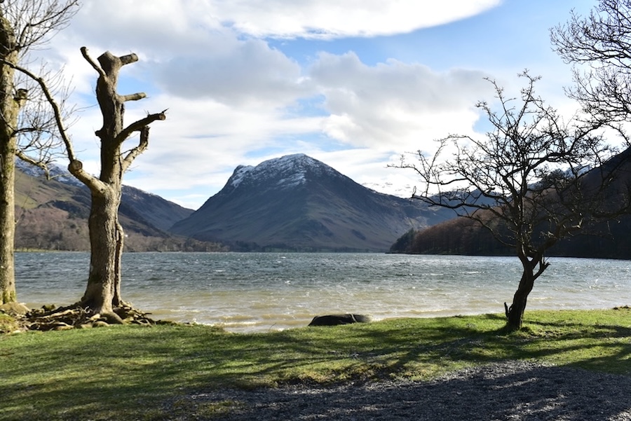
The view up Comb Beck brought back memories of the first time we walked the Red Pike/High Stile/High Crag ridge as we were walking back towards Buttermere on a very hot afternoon. Our feet were aching by the time we reached the beck and the minute we set eyes on it our boots were off and our hot weary feet plunged into the cold water. It was sheer bliss and something we always remark on whenever we’re here. Not today though, especially as there’s a brisk and nippy breeze coming straight at our backs.
Shaded Grasmoor and sunny Whiteless Pike come into view as we walk further along the path. The lively breeze is creating waves on the water.
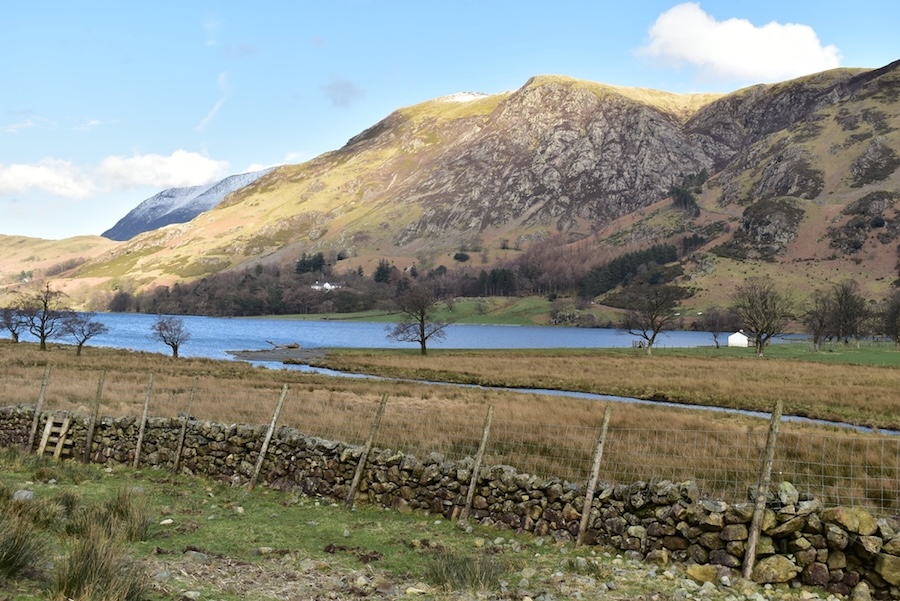
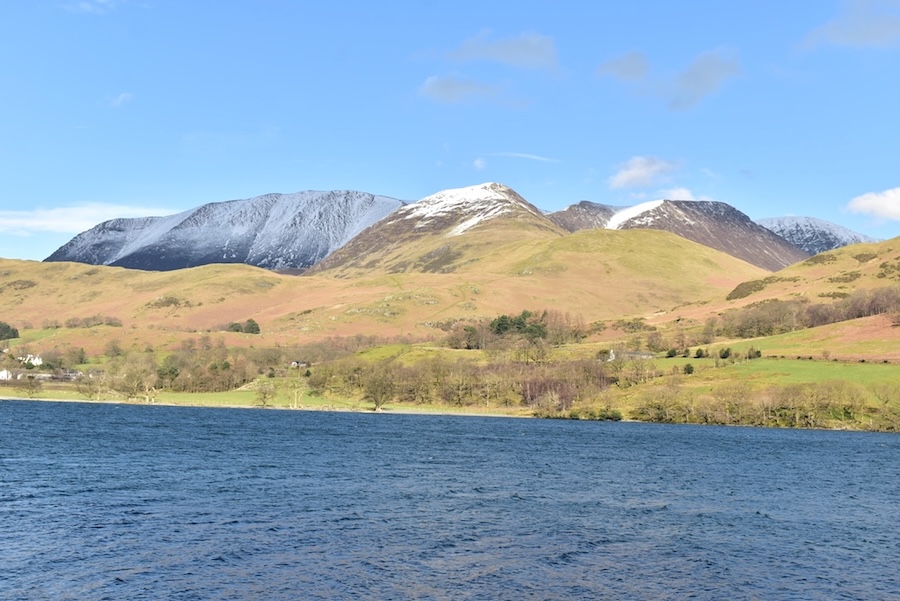
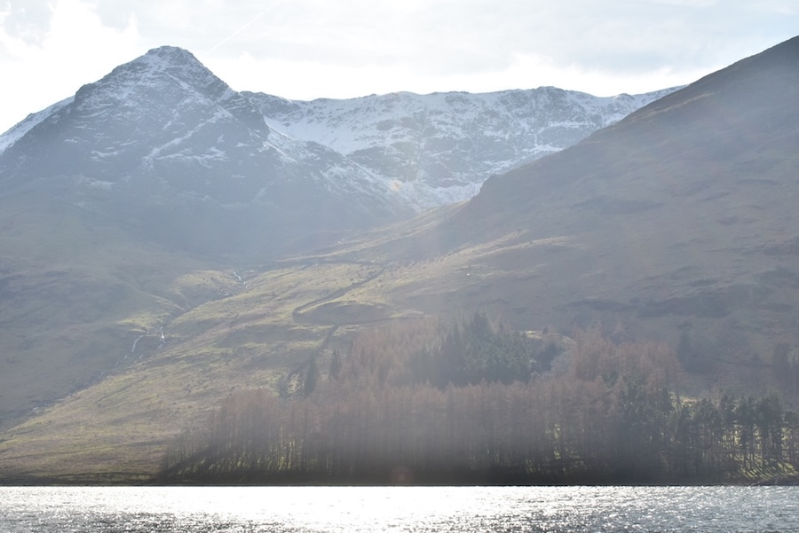
Across the water above the building at Dalegarth are the deep gullies of Goat Gills flanked on the left by Goat Crag, and on the right by Muddock Crags. The snow covered area behind Muddock Crags is the summit of Robinson.
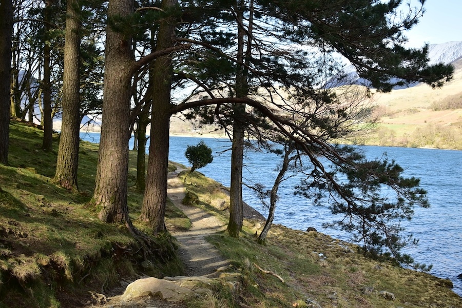
Progress along the shoreline path alternated between exposure to the wind (jacket hoods up) and shelter from it (jacket hoods down). This was a hoods down section!
I turned for a look back towards Gatesgarth and noticed that the waves were now beginning to have white tops on them and the wind was beginning to pick up speed. Eyes began watering so after a swift about turn and a quick wipe of the eyes it was jacket hoods up again.
I was hoping that by now the sun would have landed on Grasmoor and I would be able to take a sparkly, snowy view of it but it was not to be. Even Whiteless Pike has lost its sparkle now.
Looking ahead towards Mellbreak as the waves build and bunch closer together.
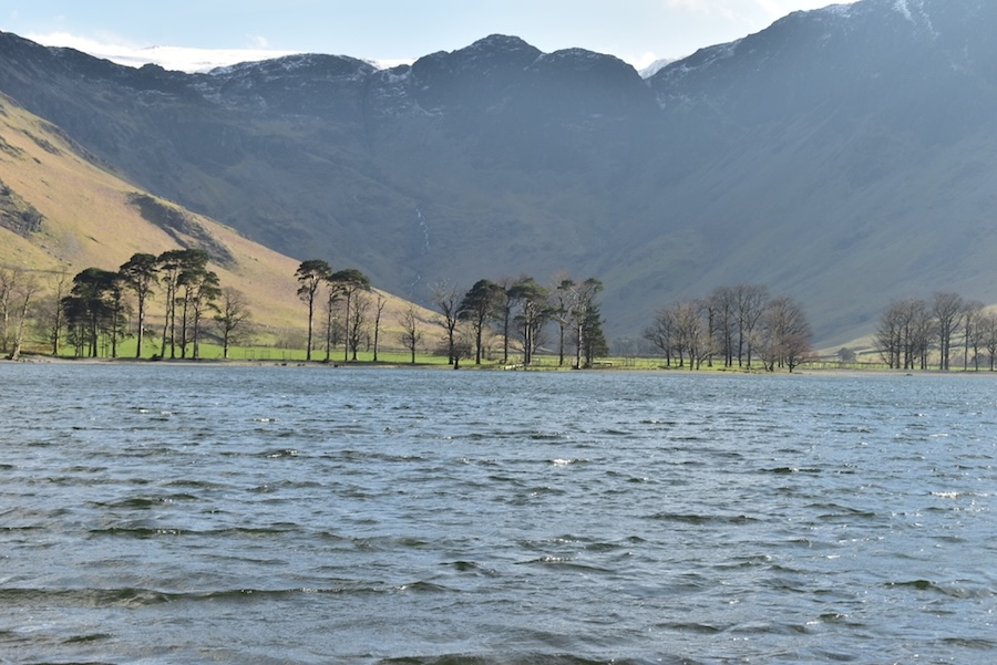
A young woman came running by as I stopped to take this shot and gave us a quick greeting before disappearing into the tree lined path. The photos would make you believe that there was no-one else around but that was far from bring the case and it seemed like every few seconds we were saying Hi to the next walkers coming along the path.
Whiteless Pike now sunny again but still none on Grasmoor. I’m beginning to be obsessed by the lack of sunlight on it. A series of shadowy shots isn’t what I was wanting.
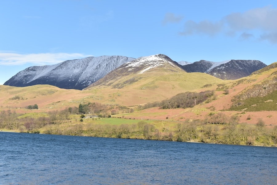
To compensate I turn my attention to a sunnier view of High Snockrigg and the snowy slopes of Robinson over to its right.
Still no luck, or sunlight, on Grasmoor so I’ll just have to be patient.
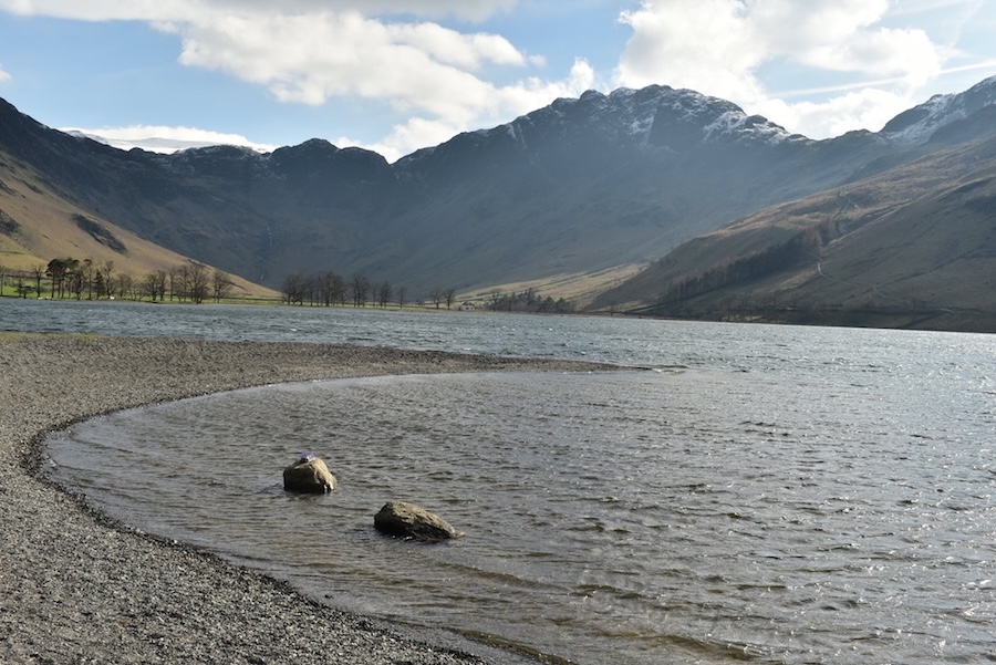
Running the risk of an eye-watering few seconds for a look back along Buttermere and the snowy tops of Robinson and Littledale Edge.
At least the sun is shining on the tops of Whiteless Pike, Wandope and the Ard Crags/Knott Rigg ridge.
It started ever so slowly. To begin with we noticed that a bright spot of sunlight had landed on Grasmoor’s lower slopes just behind Whiteless Pike. The bright spot slowly turned into a streak which very gradually crept up the mountain side as the cloud casting its shadow slowly moved away. We waited, and we waited, and then we waited some more until …..
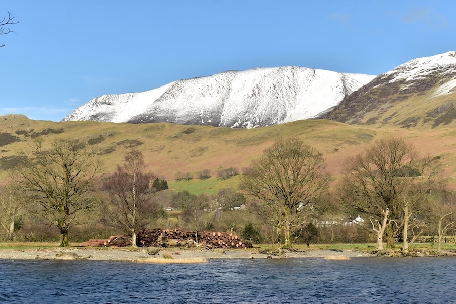
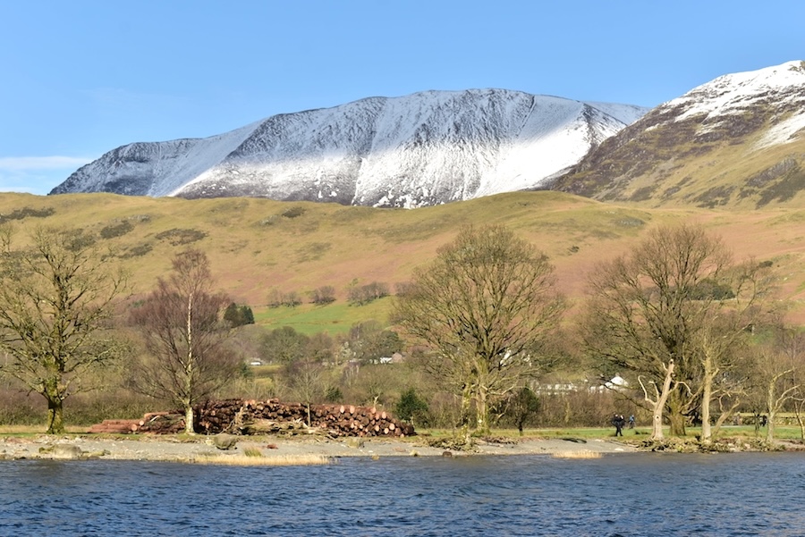
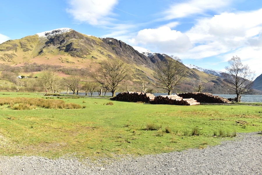
….. Grasmoor was in bright sunlight at last and I had the view I had been wanting. Obsession over! We couldn’t miss the pile of sawn tree trunks over there on the grass but we’ve never seen stacks of logs placed there before. Ah well, I suppose it was the only available space at the time.
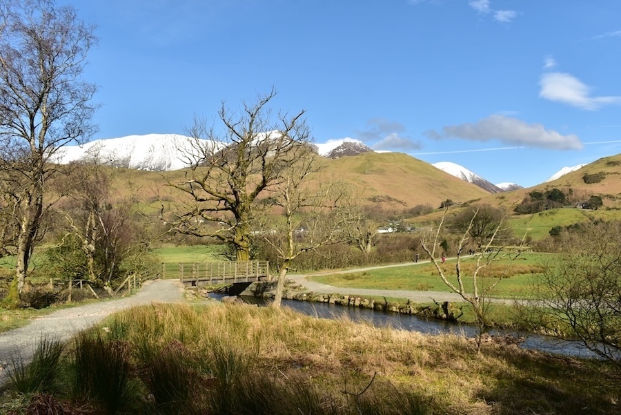
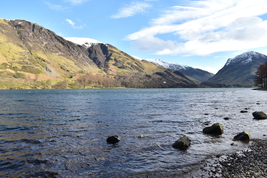
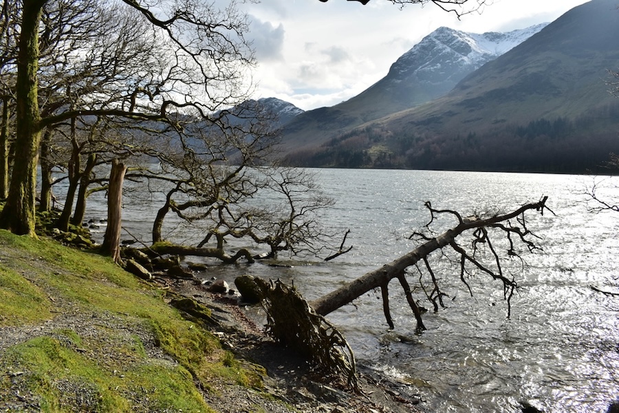
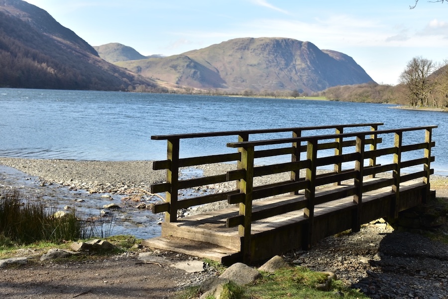
We reach our turn around point as we approach the bridge across Buttermere Dubs …..
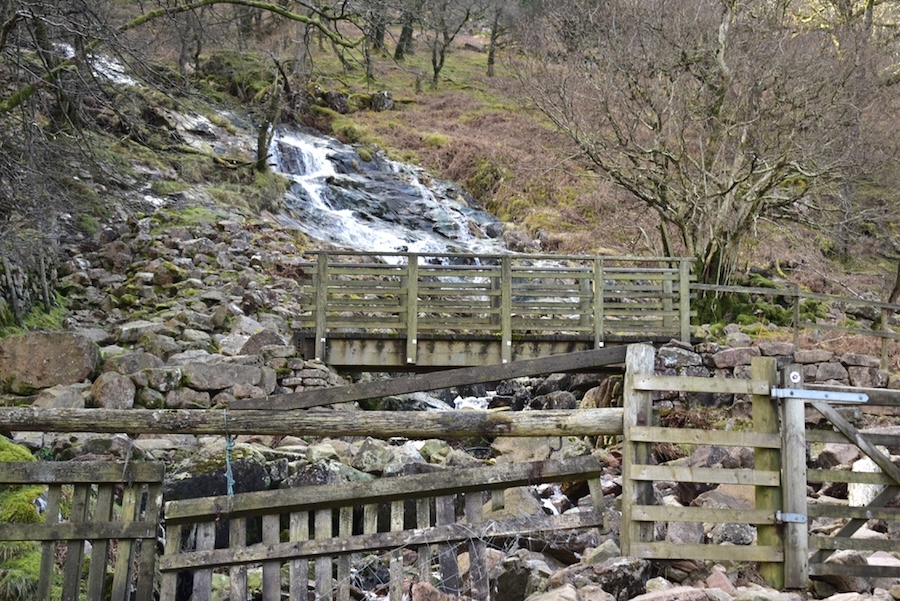
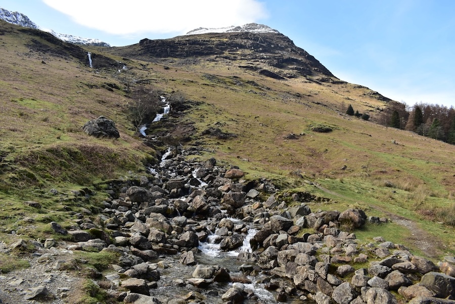
….. where I looked back for this view of the water pouring down Sourmilk Gill amid the jumble of rocks and stones at the bottom.
Well, it may be a blue sky and sunshine day but as we make our way towards the foot of Buttermere we’ve turned full into the wind so its tissues at the ready.
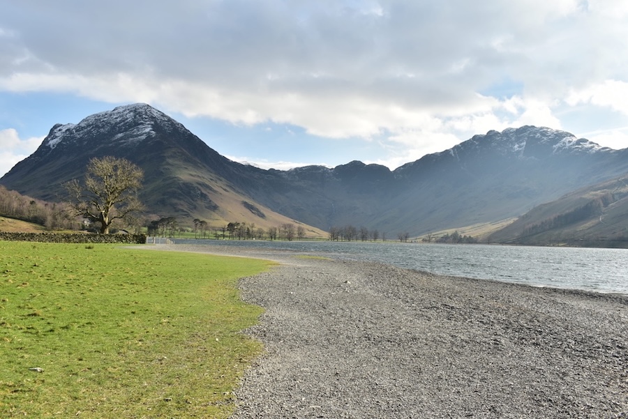
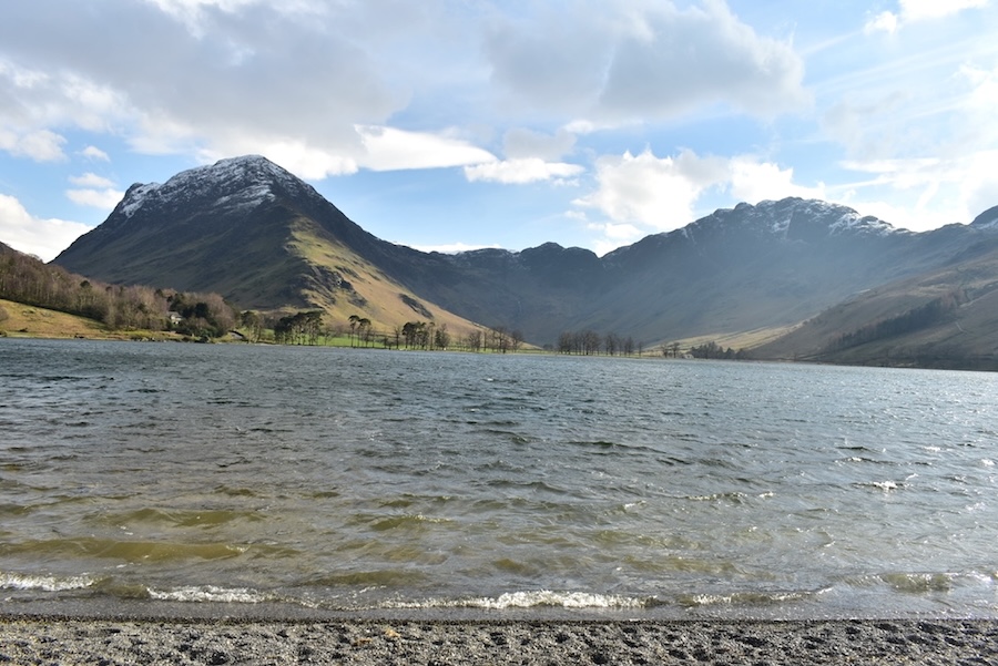
The view of a snow free Mellbreak from the tree trunk stacks …..
….. and Grasmoor is still in full sun. It looks wonderful but we did wonder how strong the wind would be today up there on its flat and open summit, because its rough enough down here in the valley.
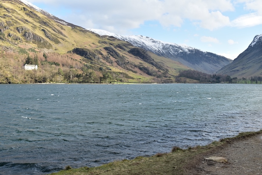
Plenty of waves and white tops today on the waters of Buttermere and …..
….. I thought that viewers might appreciate a closer look. The wind was strong enough for me to need some stabilisation so J obliged as he always does.
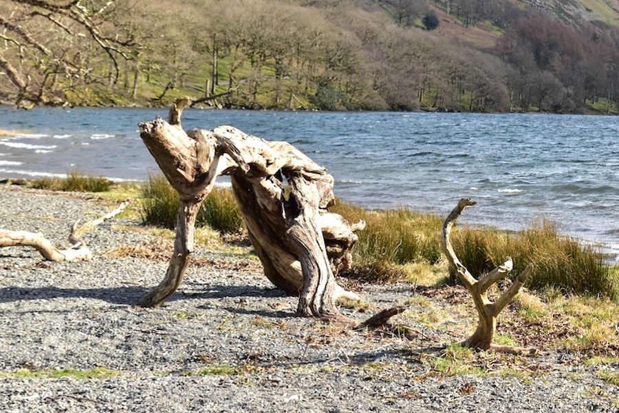
This piece of weatherbeaten tree trunk is what I call the ‘On your marks’ sculpture. It reminds me of the posture that athletes take up when they are positioning themselves on the starting blocks at the beginning of a race. Head down, arms forward and holding them steady, placing one foot forward and one foot backwards as they settle their feet into the blocks.
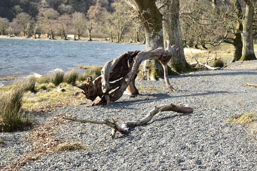
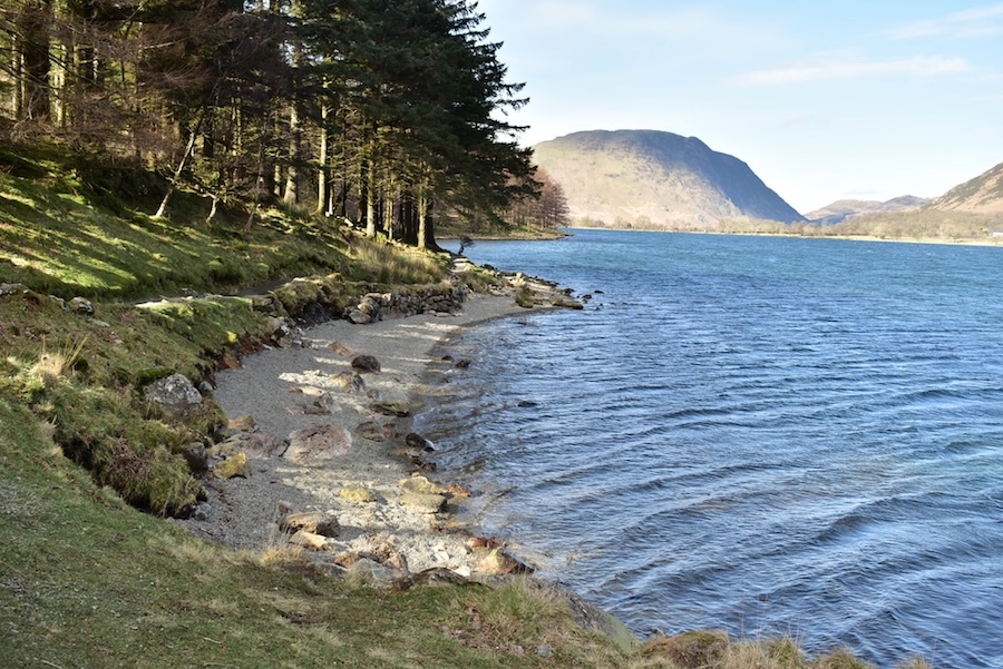
On the opposite side I see something completely different which I call the ‘Crawling out of the water’ sculpture. It makes me think of someone whose boat has overturned quite far out, who has had to swim all the way back and on reaching the shoreline, utterly exhausted, drag themselves out on their hands and knees with their waterlogged clothing dragging behind them. Strange isn’t it, how imagination works? When we reached the path on the opposite shoreline we found ourselves a sheltered sunny spot amongst the trees, got out the flask and treated ourselves to a short coffee break while watching other walkers battling the wind as they crossed the shingle beach.
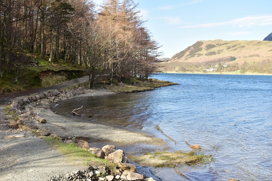
Warmed by the hot coffee and fortified with a few things to eat we started out on our return leg back to Gatesgarth. This turned out to be less windy than one might imagine in today’s conditions but there is plenty of woodland along the route which did provide shelter from the worst of it. Haystacks is in the distance with High Crag closer to the camera.
Looking back towards Mellbreak as we reached a break in the trees which provided a more open view than we’d had so far.
Much further along now so I took a chance at getting a shot of Burtness Comb flanked by High Crag. The sun was directly opposite so I didn’t expect the best of shots, it didn’t turn out too badly, all things considered.
Crossing the bridge over Hassnesshow Beck with another look back at Mellbreak. We’ve been meeting many of the walkers who we said hello to when we met them on our outward path so we all said hello to each other all over again. Well you can’t just ignore people, can you?
Back out into the open again now as we cross the shingle beach beyond Hassness Crag Wood so J had to do the stabilising again. Some of the gusts were quite strong along here. The view of Fleetwith Pike, Green Crag and Haystacks at the head of Buttermere is spectacular but difficult to photograph as there is always some part of it in shadow.
The view from the shingle beach of Goat Crag, Goat Gills and Muddock Crags.
Another attempt at a shot of Burtness Comb and its beck, and that’s probably as good a shot as I can get under the circumstances.
Still struggling to keep the camera level in the very gusty wind as I took this shot of Haystacks from the shingle beach. Even with J’s stabilising I still took a lop-sided shot …..
….. although this one showing the rough water is marginally better.
Just as I was taking a shot of this view a dog came bounding along and jumped up straight in front of me. I took a look at the shot using the camera’s Preview facility and could see most of the dog’s back and part of its head so I deleted it and prepared to take another. Meanwhile the dog’s owners, a couple with a toddler, arrived and Mum spent a good few minutes at the water’s edge and looking around. She eventually re-joined Dad and toddler but I’d had to delay taking the shot until she did so. It took the best part of ten minutes just to take the above view showing Burtness Comb, High Stile, the very topmost part of Red Pike and, below that, the rounded hump of Dodd.
The Buttermere Pines and the silhouette of Seat across the choppy water.
Burtness Comb again, this time accompanied by High Stile.
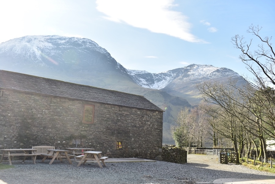
The last of today’s shots, taken from Gatesgarth farm, showing High Crag, Burtness Comb and High Stile. Well, that’s us done for today and there’s just the drive home left to do, so let’s hope there isn’t a build up of traffic for some reason, to delay us and spoil the day. We always enjoy a walk around Buttermere and today was no exception, even though we could have done without the gusty wind. Come to think of it, its probably just as well we didn’t walk any of the fells today, we’d have been well and truly battered if we had. When we got back home I discovered that the spare SD card I had used was the same one that had let me down on a previous walk to Crag Fell on 19th April 2022, and so once again it had not saved any of the photos I took. It was a devil of a job to get them downloaded on the laptop, then put them all in the correct order, not to mention re-sizing and re-labelling them but we managed it eventually and so a walk report could be created. The offending SD card has been discarded so it can’t be inadvertently used again and a new replacement purchased. I don’t want to have to go through all that ever again!