
Stone Arthur, Great Rigg and Heron Pike
Walk date – 11th May 2026
Distance – 6.3 miles
Weather – a large amount of fair weather cloud but dry with sunny spells, a northerly breeze, quite chilly below large cloud cover
Having studied the weather outlook for the coming week, today i.e. Monday,’ looked like the one most likely to offer ‘dry with sunny spells’ weather, although there would be plenty of fair weather cloud around. We ended up deciding on a walk up Stone Arthur and then up to Great Rigg. We initially decided to just to do an out and back but changed our return route during our time on Great Rigg and returned via Heron Pike and Alcock Tarn. As its a climb of more than 2500’/770m from valley level up to Great Rigg the steepness began the moment we began walking up Greenhead Gill lane and continued until we reached Great Rigg. Despite the sunshine the northerly breeze, together with a large amount of fair weather cloud, kept things mostly on the cool side so jackets remained on for most of the walk, although we did remove our mid-layers when the path leading up to Stone Arthur became much steeper. During the drive over to Grasmere we noticed that Blencathra, Great Dodd and most of the Helvellyn group had a dusting of snow around their tops. Overnight snow flurries over higher tops had been mentioned in the outlook forecast but we were still surprised to see it. By the time we passed them again during our drive home all of it it had melted away and their tops were clear again.
Route
Lay-by parking on A591 (opposite Michael’s Nook) – Michael’s Nook – Greenhead Gill lane – Stone Arthur – Great Rigg – Heron Pike – Lord Crag – Alcock Tarn – Greenhead Gill lane – Michael’s Nook – A 591 lay-by parking


Walking from the lay-by up to Michael’s Nook …..

….. and as we reached our turn off point onto Greenhead Gill lane a shot of Helm Crag. It had been in sunlight as we walked up but just as we reached the beginning of the lane along came a cloud and that was that.

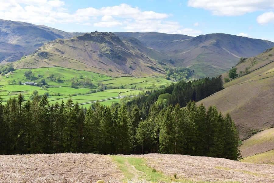
From the lane along Greenhead Gill we went through the gate at the end of it, turned left and began the steep walk up the stepped path which seemed to go on forever. Work on the path was under way the last time we used this path (see our walk of 26 May 2023) but it is has now been completed. I took the above shot showing the path, alongside the conifers, to Alcock Tarn just to have a break from the seemingly endless staircase. It was like being on one of those ‘step climbers’ that gyms have for strengthening leg muscles, but one can have too much of a good thing sometimes!

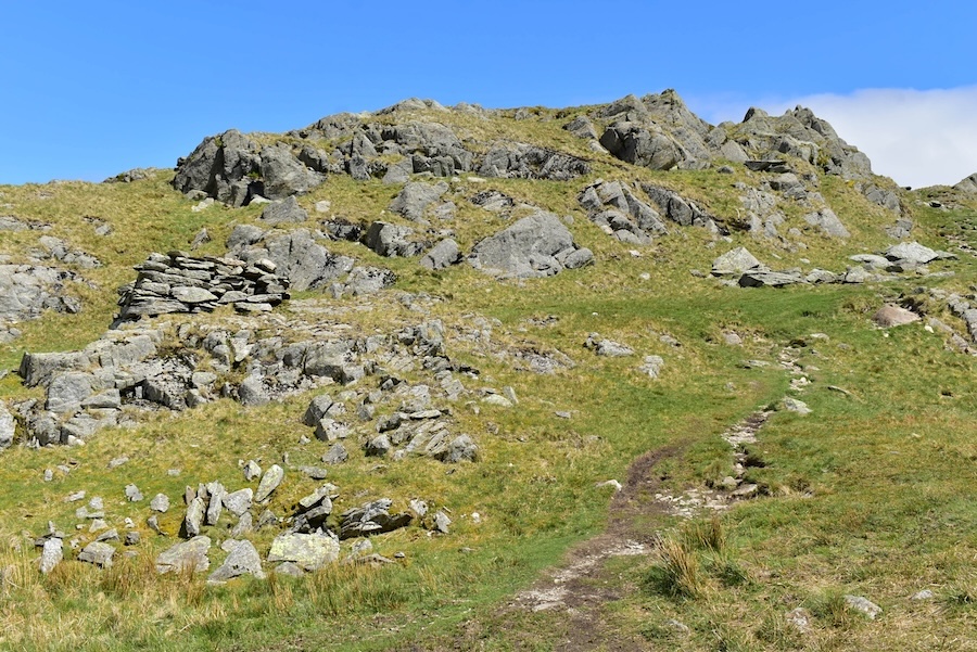
Eventually the ‘staircase’ came to an end and we began walking over grassy paths again, In this shot we were approaching the first set of crags where the path curves around to the right. This craggy area marks the summit of Stone Arthur although there are higher crags further behind them. We followed the path in the above shot and then turned up to the left to follow it up to the summit. Part way up it we found that the path had partially collapsed and dislodged several large rocks which had to be clambered over, mostly in an ungainly manner in our case.
The view to the west from Stone Arthur looking across Easedale Tarn. On the skyline (L to R) are Crinkle Crags and Bowfell, the latter being just above Harrison Stickle and Pavey Ark. Next comes Scafell Pike, which is just about visible, and the little pimple jutting out over on the right is Sergeant Man. The light wasn’t that great for photography today, too much hazy stuff in the air, so the visibility wasn’t ‘excellent’, despite the Met Office saying it would be.
Looking back to Stone Arthur with the Coniston fells behind it. There’s still a lot more ‘up’ behind us to deal with and …..
….. we eventually reached Stone Arthur’s next set of crags. The fox bield, on the left, looked a little different as we walked up to it, but then the last time we walked up Stone Arthur was in 2010, although we have walked down it a number of times between then and now.

The ‘down path’ view of the fox bield as we’ve become accustomed to seeing it.

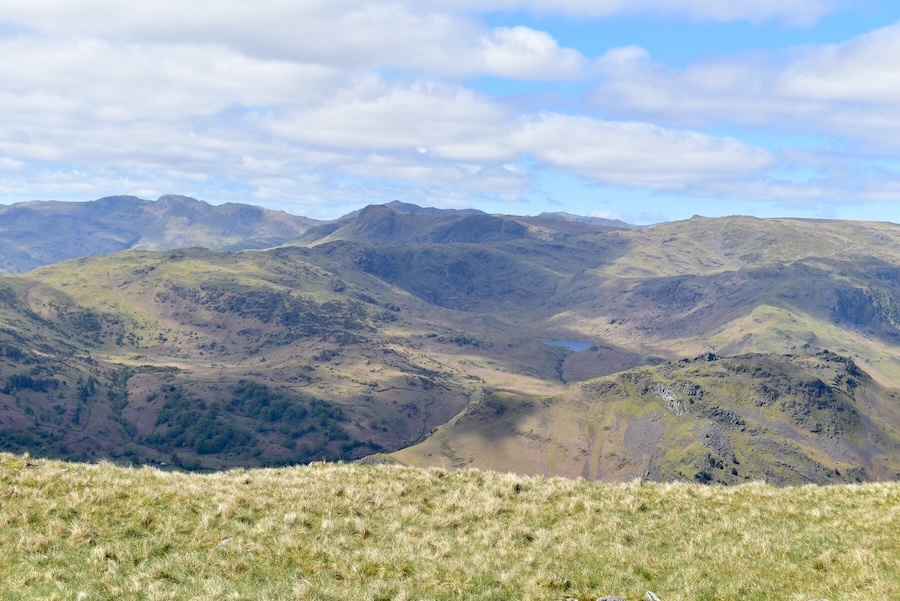
Leaving the rocks and crags behind we continue upwards where I noticed four stretches of water, two are somewhat distant, but two, Grasmere and Alcock Tarn, are just below us. The one, to the right, above Grasmere is Coniston Water and the one on the left, above Alcock Tarn, I think might be Esthwaite Water, although I’m not absolutely certain.

A few more skyline views from the walk up, Pike O’Blisco, Cold Pike and Crinkle Crags …..

….. Bowfell, Esk Pike, Scafell Pike …..

….. and the assorted bumps of Great End, Great Gable, Glaramara, Combe Head and Pillar.

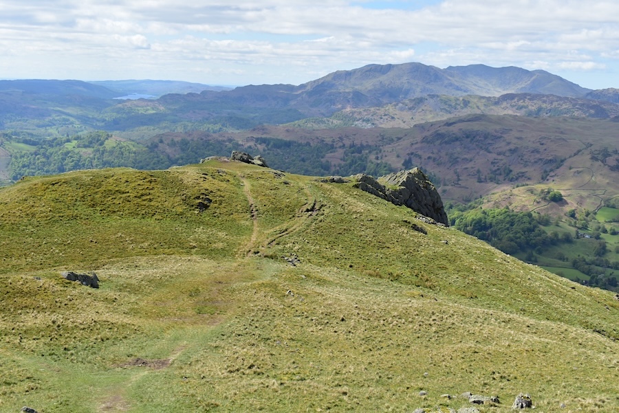
The view across to Erne Crag and Heron Pike …..

….. and looking up at Great Rigg. The only way is up and its about to get steeper and rockier, both for us and the few walkers already up there.

Another shot from further along the path, the closer we get, the steeper it becomes. Thank goodness its over grass and not a stone staircase!

A clearer view of Scafell Pike, Great End, Great Gable, Glaramara, Combe Head and Pillar, from L to R on the skyline.

Directly below is a shaded Steel Fell, across from it, separated by the valley of Greenburn, are the tops of Helm Crag, Gibson Knott, Pike Of Carrs and Calf Crag.

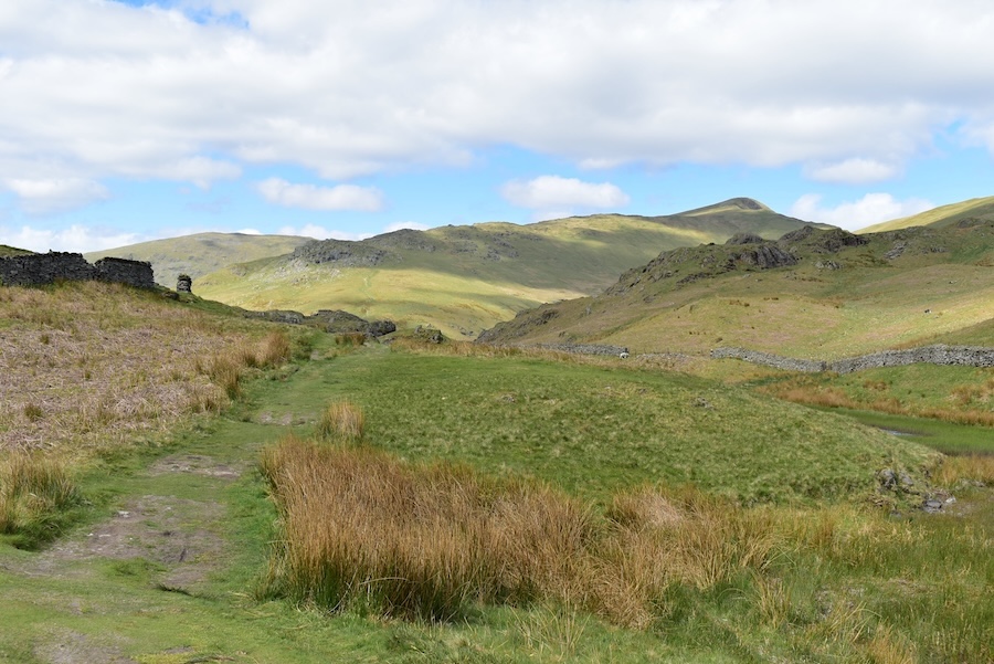
We had a brief pause when we reached the main path between Erne Crag and Great Rigg and took a look over what was to be our return route. The cairn on the right indicates the path down to/up from Stone Arthur. A couple of minutes worth of leg muscles recovery time and then we turned around and get stuck in to the stony/rocky last section of the climb to Great Rigg.

Looking down towards Rydal Beck and not getting too close to the edge since its much windier up here. The sheepfold which always reminds me of an ice cream cone is beside the beck in the lower right corner of the shot although a zoom in will be required to see it clearly.

Looking south from the cairn on Great Rigg with a great view of Windermere beyond. The sun had disappeared behind a big cloud for the time being so it became rather chilly for a while.

Just across from Great Rigg are Dollywaggon Pike, Nethermost Pike and Helvellyn. The shaded part just below Helvellyn is Striding Edge and the steep climb out up to the summit of Helvellyn. Beyond Striding Edge is the pointed top of Catstye Cam. The grassy slope between us and them belongs to Fairfield.

The view across to Fairfield about one mile away. AW seemed to be less enthusiastic about Fairfield’s summit than he was about the summits of other fells. He wrote that it ‘is an extensive grassy plateau’ with an ‘absence of distinguishing natural features’. J describes it as ‘there’s nowt there’ and ‘its just an empty space’ and, as we didn’t particularly look forward to a cold and windy walk across to visit ‘nobbut an empty space’ we didn’t go across to it today. J’s summing up of Fairfield matches the one I have about Ullscarf.

Despite the nippy breeze I did manage to take a few shots, this one looks across to the steep sides of Link Hause and Hart Crag …..

….. Hart Crag’s almost vertical, west facing side …..

….. and the less craggy, from this side at least, Dove Crag. Behind it on the left are High Raise, Rampsgill Head and Kidsty Pike.

We dropped down from the summit, found a sheltered spot out of the cold breeze and had a break with a drink of hot coffee to warm us up a bit. While we were there we decided to return along the path below us. I think we’d both had quite enough of stone stepped ‘staircases’.

The marker cairn indicating the path down to Stone Arthur with the Coniston Fells and Coniston Water in view.

A look across towards the Helvellyn group and Striding Edge as we began descending …..

….. and the south facing ridge of Seat Sandal which …..

….. drops down quite steeply to High Broadrayne.

Another look over Greenburn to the fells dotted along the skyline …..

….. and those Crinkly Crags, Bowfell and Scafell Pike again which we seem to have been seeing quite a lot of on our walks recently.

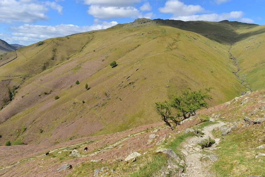
Treading carefully through the last part of Great Rigg’s awkward section at this point and looking forward to reaching the grassy path below it where we could walk normally again minus the risk of a twisted ankle.

Looking ahead towards Erne Crag and Heron Pike …..

….. and looking back towards Great Rigg, Fairfield and Hart Crag. As we walked along here we met a female runner and her dog. The dog’s paws and underbelly were very wet and dripping all over the place so it had obviously found a pool of water along their route and had plunged straight into it …..

….. and we thought this tarn might have been where the dog had plunged in for a cool down. Its owner also looked as if she might have benefitted from a plunge into it as she just about managed to gasp Hi to us as we passed by each other.

The cloud looked to be joining forces at this point as the blue bits were becoming ever smaller and the sunny spells became shorter as the path up to Heron Pike came into view.

However, on the western side of Heron Pike there were still larger sections of blue sky to look at although we didn’t get any sun shining through it.

Even though the sunlight was hidden from view we did have a view of a section of Windermere although it was rather a cloudy one. When we reached the top of Heron Pike we came across two women who were sitting at the summit. They seemed to be having a lunch break as one of them was eating a sandwich, while the other one asked us where we had been. When we told them we had come from Great Rigg and Stone Arthur they seemed not to know what or where they were so we pointed them out plus all the others making up the Fairfield Horseshoe. They asked us how long it would take to complete the Horseshoe so we replied that it all depends on how quickly one walks, but the sun wouldn’t set until about 9 pm so they would have daylight until then. This seemed to dismay them as they told us they were due back in Ambleside by 7 pm. We thought they probably were visitors and had started out with good intentions but when we told them where they were, how much further they still had to go and given that they had to be back in Ambleside by 7 pm we suggested that it might be possible to walk half the Horseshoe today and walk the other half on another day. We’ll never know what they decided to do, but they thanked us for the info and, as another pair of walkers had arrived and joined the conversation, we said our goodbyes and left them chatting to the other pair.

The descent from Heron Pike passed without further incidents and as we reached Lord Crag, pictured above, we noticed a faint path leading down to the path leading to Alcock Tarn. The sun had come out again as we descended Heron Pike so once we were on the Alcock Tarn path we removed our jackets, had a drink and then made our way down to the tarn.

Ullscarf on the skyline. This view of it might explain why my opinion of Ullscarf matches J’s thoughts about Fairfield. AW described it as ‘a cheerless place, even in sunshine’.

Not a cheerless place, with or without sunshine, was this view of Grasmere Water with the partially sunlit Coniston Fells providing the backdrop …..

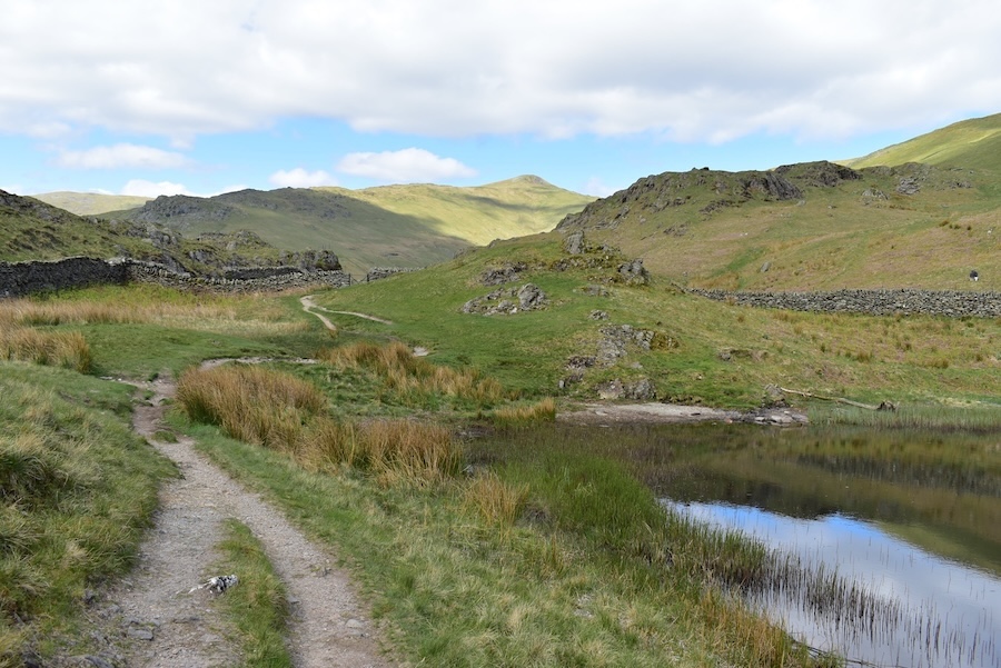
….. and Alcock Tarn isn’t a cheerless place either but it will be unless something is done about all the grasses taking hold of it.

Looking along the length of the tarn as we walked across the dam wall …..
….. in order to reach the path on the opposite side. Seat Sandal, Stone Arthur and Great Rigg form the dappled skyline.

The path we used to reach the tarn is over on the right, behind the wall, and as we were walking along this side of the tarn a burst of sunlight landed on the Erne Crag/Heron Pike area giving them a much less gloomy appearance.
We’re almost at the end of the tarn at this point but the path carries on and threads its way past Butter Crag, on the right, and then descends steeply back down to Greenhead Gill.

There’s a mushy section to deal with beyond the end of the tarn but it can be crossed without being on the receiving end of wet boots.
Looking along the path, where more stone steps have been installed since the last time we used this path in 2023. Directly opposite is Stone Arthur and you can just about follow the route that we took earlier. The point at which the path changes from the very steep ‘stone stepped’ one and back to a grassy one is clear to see. It also become a little less steep at that point, although not by much, and we continued to gain height all the way up to Great Rigg, in shadow in the upper right corner.
Sunshine lands on Helm Crag and the green fields of Grasmere, and us as we make our way back down to Greenhead Gill …..
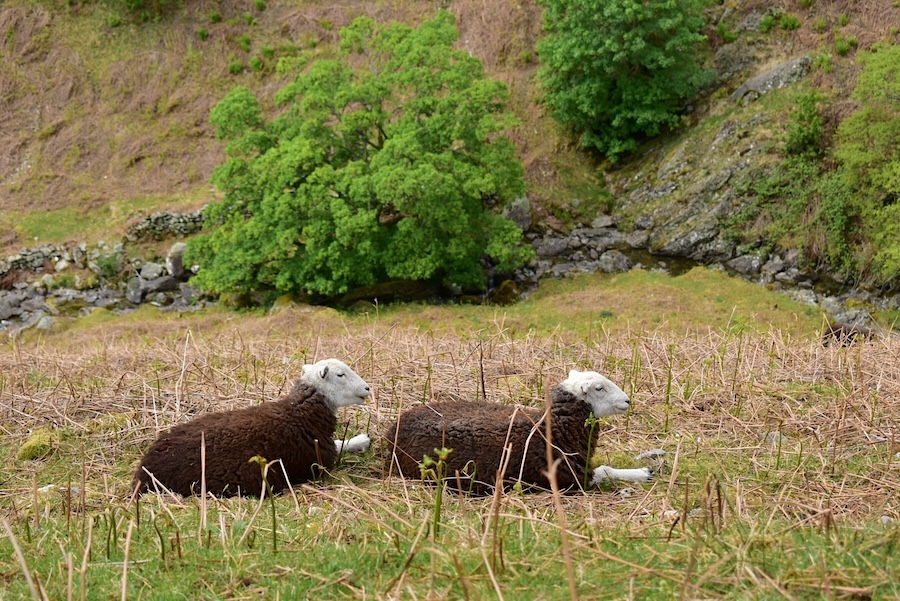
….. where these two Herdwicks were having a bit of ‘down time’ amongst the newly emerging bracken. When the bracken is in full leaf and covering the whole fell side shots like this, and often the paths through it, will be hidden from view. At the beginning of our walk we saw some of the new stems had reached quite a lot of height already and were much taller than the stems in the above shot.
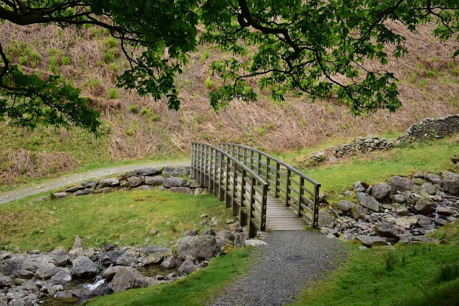
Down at the bridge crossing Greenhead Gill. The former stone built bridge which was located lower down the gill was washed away by Storm Desmond in 2015. This bridge is located much higher up the gill and its installation was finally finished in 2017 I think, so its nearly ten years old and therefore we’re all ten years older now! How did all those years pass us by without us noticing?
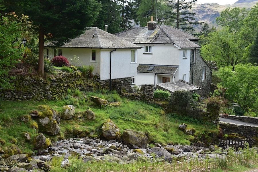
Pride of place as the last photo of the walk goes to ‘Greenhead Tower’, well that’s what was written on a sign attached to the house. Its a very ‘des res’ tucked in at the top of the Greenhead Gill lane and directly opposite the beginning of the stepped path we started out on. The old stone bridge used to be located here and the former path to and from it can still be seen going up the banking on the other side of the gill. I can still recall that we ended up in the garden of the house the first time we came up here and the embarrassment of discovering that we had mistakenly crossed their driveway instead of the bridge crossing just a few paces beyond it. I can’t remember if the house at that time looked exactly the same as it does today, but I have a feeling though that some re-modelling has taken place in the intervening years. How quickly time passes and memories fade. With that quick trip down memory lane over and done with we walked back down the lane, through Michael’s Nook and back to the car. An enjoyable walk despite the chilly breeze and the ‘stone staircases’!