The Other Borrowdale
Walk Date – 7th May 2018
Distance – 9.25 miles
Weather – dry, warm and sunny
Bank Holiday Monday brought another sunny, blue sky day and once again we steered clear of walking in the Lake District fells. Today’s walk has been tucked away in our back pockets for a while as we waited for the right set of circumstances, and today seemed to be the ideal day for it. Its an area just a fifteen minute drive from home, it doesn’t attract large crowds, there are no visitor attractions, pubs, shops or cafes, it offers plenty of variety, and was once described by AW as ‘the most beautiful valley outside the Lake District’, although since the extension of the National Park a couple of years ago it is now well and truly part of the Lake District. This is not the well known rugged Borrowdale located just to the south of Keswick, this is the ‘other’ gentler Borrowdale in the former county of Westmorland. The old county disappeared in 1974 when the new administrative county of Cumbria came into being. The name may have changed but the charm and loveliness remain in this lovely, unspoiled patch of land sandwiched between the A6 and the M6 about eight miles to the north of Kendal.
Route
Lay-by on A6 above Huck’s Bridge – Ashstead Fell – Combs Hollow – Mabbin Crag – Castle Fell – Whinfell Common – Whinfell Beacon – mobile phone masts on Whinfell Ridge – Borrow Beck – Low Borrowdale – High Borrowdale – Huck’s Bridge lay-by


Looking back at the lay-by on the A6 at Huck’s Bridge where we are parked with only one other car already there, which presumably belonged to the lady walking her dog nearby. The point of reference for the lay-by is the grey telephone box, which still houses a telephone and which, presumably, is still functional although we didn’t give it a go. The occasional car whizzes by on its way to Shap and Penrith after which peace and quiet returns. We cross the road carefully, well below the sharp bend at the top of the rise, and walk up the hill from the lay-by to the end of the crash barriers.
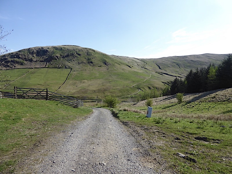
At the end of the crash barriers there is a short stretch of tarmac road leading down to a gateway. In this shot the gateway is just behind us and in front of us is Greenside Crag with the curiously named Breasthigh Road winding its way round the side of it up to the Whinash and Winterscleugh ridge.

To the right of the gateway we follow a narrow track, which offers no gentle stroll in, and begin the steep climb onto Ashstead Fell. Sun cream has been liberally applied and shorts and t-shirts are the order of the day along with plenty of liquids tucked into our packs.

Shortly after beginning the climb I took a look back, the short stretch of tarmac road we started out on has morphed into a rough track across the near foreground and leads down to Borrow Beck. Beyond the A6, which still has hardly any traffic, is High House Bank and Whatshaw Common.

Phew, hot weather and steep climbs are not a good combination and with the sun directly in our faces we are soon indulging in plenty of brow mopping. Mercifully the steepness is offset by the shortness of the climb and on reaching a level shoulder just below the summit I took a look back westwards into upper Borrowdale to the left of High House Bank. I also noticed that no other vehicles have pulled into the lay-by.

Another look back along upper Borrowdale from the heather and bilberry clad level shoulder.

The path rises through the heather and bilberries to a neat square cairn on one of the three nameless high points on Ashstead Fell at 455m/1493′.

The conifers close by at this point are a bit of a nuisance but despite that the views from such a modest height are surprisingly extensive.

In the centre of the distant skyline the Coniston Fells are just beginning to appear and to the left of them Black Combe can be seen, although it may require a zoom in to identify it.

Also just beginning to appear above the upper Borrowdale skyline are the Kentmere fells.

From the cairn we follow the clear track which undulates southwards towards the next high point at 469m/1539′. High above us two large birds, probably buzzards, were engaging in some very spectacular aerial manoeuvres. Soaring and spiralling around each other in what appeared to be a very aggressive situation as they stretched their legs and talons towards each other, occasionally making brief contact before breaking away and continuing the squabble. Maybe one was trying to snatch the other one’s prey or had trespassed into the other one’s territory, but whatever the reason it was spellbinding to watch. Eventually they flew off in different directions so the matter had somehow been settled.

The views from the second high point are no less impressive. From here we can look across Borrowdale to the opposite ridge with its high points of Whinash and Winterscleugh and which culminates at Jeffrey’s Mount overlooking the M6 snaking its way through the Lune Gorge.

Along Borrowdale far below us are the old farm buildings of High Borrowdale situated alongside the lush green fields, which will blossom into lovely hay meadows in the summer, while ahead of us the ridge continues on over to Combs Hollow and then on to the third high point on Ashstead Fell above Mabbin Crag.

Over to the south west lies Kendal and Morecambe Bay so I zoomed in for a closer look.
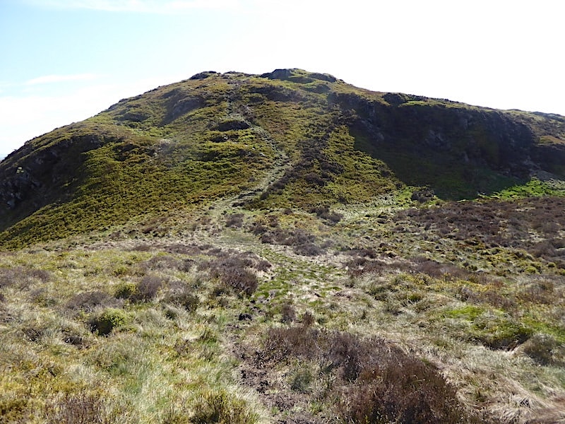
The path was generally on the dry side today, and was always clear to see as it wandered across the lovely, heathery ridge and, just as we did yesterday, we had a slight breeze up here which was always very refreshing, especially when walking the steeper slopes.

A look back along the heather and bilberry clad ridge …..
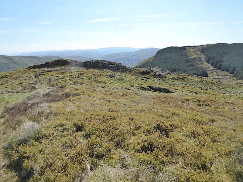
….. and a look ahead just before we drop down into Combs Hollow. My attention was caught a couple of times along here by the briefest of glimpses of very small reddish brown creatures scurrying through the undergrowth. They were probably voles but having only seen the very top of their backs I can’t positively identify what they were.

Just a little further along is a small escarpment where we have to negotiate this steep rock step before dropping down into the hollow …..

….. and then taking a look back at the rock step.

We drop down into the depression, pass through the cross wall and then follow the moist peaty path through the fire break to make our way up to Mabbin Crag. The only sounds to be heard are bird calls and our occasional conversations. Its very peaceful and there is no-one else to be seen anywhere.

At the end of the fire break the path veers off to the right and before too long the cairn atop Mabbin Crag appears. Another short climb leads up to …..
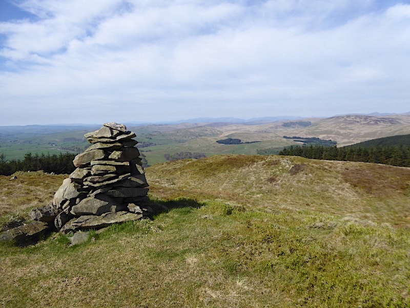
….. the small cairn at 482m/1581′. A spectacular viewpoint with many of the Lake District fells on the distant skyline. There were too many to fit into one shot so I took close ups of two very familiar ones …..

….. Bowfell and its neighbours …..
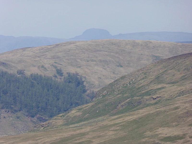
….. and Great Gable.

To the east it was just possible to make out the hazy profile of the north Pennines beyond Borrowdale’s eastern ridge. The thin veil of cloud drifted away and we were bathed in sunshine once again. It was too good a spot to leave so we stopped for a short while, took some liquid on board and, apart from gazing at the views around us, mostly did nothing but soak up the sun and enjoy the serenity for a few minutes.
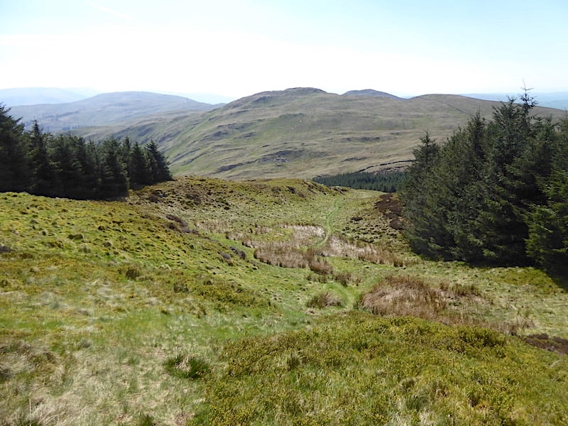
The view to the south from the top of Mabbin Crag. The three hilltops to the right of centre, from left to right, are Castle Fell, Whinfell Beacon and Old High. Rising above the trees on the right is a wall going across Old High which we will follow for a while before veering off and climbing up to Castle Fell.

Before that though we have to drop down off Mabbin Crag, although first we spend a minute or two gazing down in Borrowdale where Low Borrowdale farm can be seen beside the stand of trees alongside the track wending its way through the fresh green fields. The fells beyond the valley are the Howgills, where there are plenty of fells and ridges just waiting to be walked over.

The path winds its way down to this stone built hut/shelter/bothy, call it what you will, complete with seating, albeit just a wooden board supported by stone slabs. It was far too nice a day to use it as a shelter today but in poorer weather walkers would be glad of it. The building alongside has long since collapsed and what their original purpose would have been wasn’t at all obvious. They might once have been peat storage huts but that’s just a guess. At this point navigation needs a little care and attention because the path seems to continue on down the hill alongside a conifer plantation. The path to follow is the very muddy one, more or less opposite the bothy, which heads straight into the plantation, which in this shot is out of view on the left. This goes against natural instincts, i.e. avoiding walking through dense conifer plantations because it often means becoming tangled up in spiky branches, old tree stumps and decaying tree brash and getting nowhere fast. However, the path goes through a relatively open area of light shrubby growth and the trees present no problems. On the other hand a stream drains through this flattish area so on the minus side we have a few minutes of very juicy terrain to deal with.

We emerge from the wetness and gain drier ground as the path rises up to this broken fence stile. It was easy enough to cross, no barbed wire to be wary of, so its one foot on one of the posts and the other foot over to the other one and on we go to …..

….. this ladder stile in the wall just a few yards further on. Once across the stile we have the wall, rising up across Old High which I mentioned earlier, on our right and dry ground under our feet once again. The heathery undulating path through secret hollows and across rocky knolls now gives way to rolling grassland and extensive open views.

We follow the wall for a short distance but before we reach the top of Old High we bear off to our left and cross over to Castle Fell, which is out of shot to the right as you look at it. On the way across I took a look back at Mabbin Crag, a lovely little spot, apart from the very wet exit right at the end.

There was no obvious path across to Castle Fell but from the slopes of Old High it was easy enough to make our way over to it. Castle Fell is just a little higher than Old High so it was simply a matter of heading eastwards until we reached the cairn on the highest point. The view to the west had become much hazier and the individual fells were blending together to form an indistinct blue-grey mass.

Looking south east from Castle Fell where the views of the Howgills were just as hazy. Over on the right across Whinfell Common are two phone masts, sited on Greyrigg Common, and they will be the turn around point on our walk today. From the masts we will drop down towards the old arboretum below them and from there carry on down into Borrowdale.
![]()
Before that though we will be heading over to Whinfell Beacon so …..

….. we drop down Castle Fell and make our back towards the wall which we left a little earlier.

The view back to Castle Fell as we follow the path across Whinfell Common which …..
![]()
….. eventually leads us through two gates, this first one being the standard metal variety, just minding its own business and quietly rusting away …..

….. and then across to the more traditional wooden gate style where the only thing holding this together was the equally traditional use of baler twine. No hinges, no latch, just baler twine, whose multifarious attributes provide the solution to many a countryside repair job. How the whole thing didn’t simply collapse into a ready made heap of kindling as we opened it was quite remarkable, but it didn’t, much to our relief. Rickety didn’t begin to describe it. The area between the two gates is somewhat damp. We turn around and start the climb up to Whinfell Beacon.
![]()
The view back to the gate, thankfully still in situ just as we left it, with Castle Fell beyond …..
![]()
….. and then we continue on with the shelter/cairn eventually coming into view after a couple of false summits. An old metal gate has been propped behind the narrow stile in the wall for some reason, probably to prevent sheep scrambling through since the wall opening is set quite low. If it was there as an aid for walkers negotiating the stile it failed dismally because it was more of a hindrance than a help. The haze on the distant fells seems to be getting thicker by the minute.
![]()
Apparently a beacon of one kind or another has been located on the summit of Whinfell for a very long time. Initially the wood burning variety which could be lit to warn of impending danger, and later two tall stone built ones standing on a mound of stones. Now there is just one cairn so perhaps it and wind shelter have been fashioned from what remained of the previous two. We made good use of it and settled ourselves down to enjoy a very sunny lunch break for the next fifteen minutes or so.

Refuelled and refreshed we leave Whinfell Beacon and head eastwards towards the hideously obtrusive phone masts. I can now hear mutterings about progress, technology and all the rest of it and I can understand all of that, but do they have to be quite so obvious and ugly, and look so out of keeping with their surroundings.
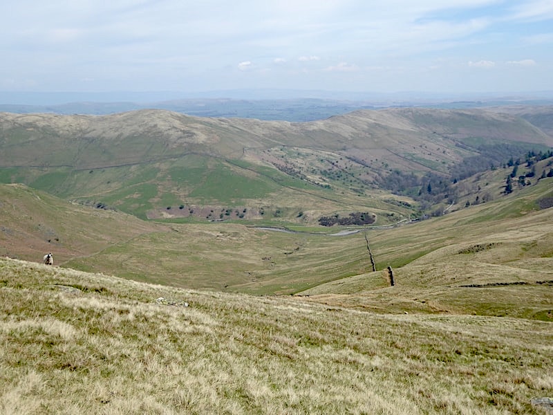
A lovely view into Borrowdale with the Whinash-Winterscleugh ridge above it as we walk down from Whinfell Beacon towards …..
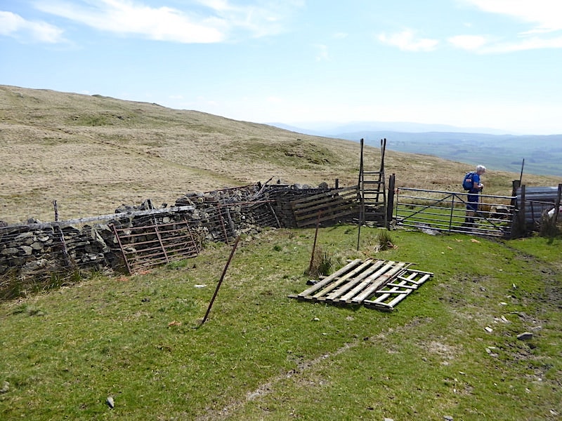
….. this dry stone wall with a ladder stile and gate plus an assortment of ramshackle sheep pens, out of shot on the right, constructed from whatever their creator apparently had to hand. Old gates, wooden pallets, corrugated metal sheeting, wire netting, other odds and ends and, inevitably, the ubiquitous baler twine. The gate did at least have one lower metal hinge but the upper one was missing which of course had been replaced with, yes, you’ve guessed it, baler twine.
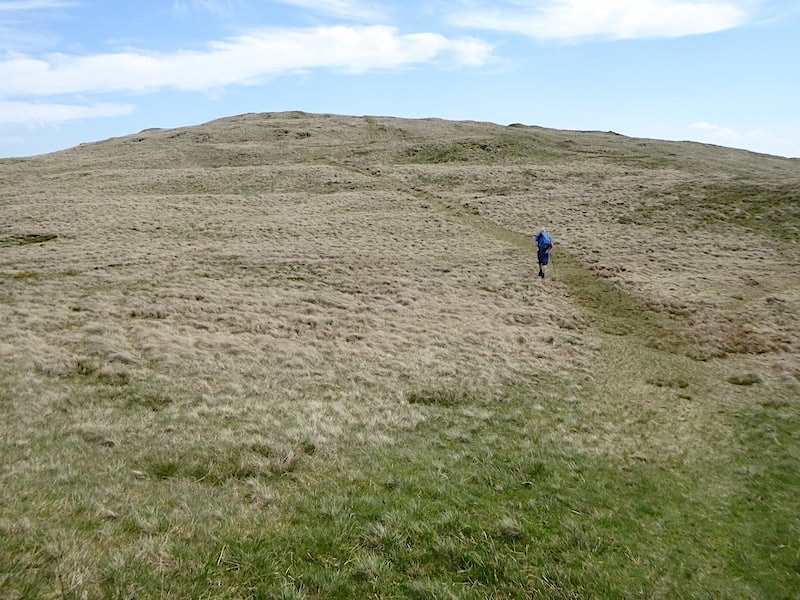
We pass through the gate and continue up the path leading from it …..
![]()
….. with a look back at Whinfell Beacon and the makeshift arrangement of sheep pens below it.

The eastward path leads us to this stile and once across it …..
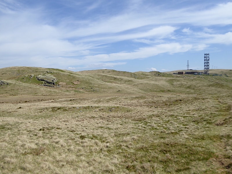
….. we headed towards the masts …..

….. eventually joining the mast station access road beyond which is the summit of Greyrigg Common.
![]()
From the access road a look back to Whinfell Beacon where I saw a lone walker who had just appeared at the summit. Apart from the dog walker we saw when leaving the car this is the only other person we’ve seen all day. If we’d known his mobile number we could have given him a call, there’d be no problem getting a signal.

We follow the access road up the hill and curve around the first mast. At this point we could have carried straight on and walked across up to the summit of Grayrigg. Instead we veered off to the left to begin the descent down into Borrowdale.

Looking down for a view of the track which awaits us along Borrowdale. Low Borrowdale farm is tucked in beside the little copse of trees further along the track.

We had started out on a defined path which eventually disappeared, as they often do, but all we had to do was continue on towards the arboretum …..

….. from where we simply tracked down into Borrowdale alongside the wall. A good number of the trees in the arboretum had suffered storm damage over the years and their decaying remains littered the slopes.

Some distance down this little beck appeared so we crossed over …..

….. to take advantage of the better views of the charming little waterfalls splashing down it. It was very tempting to linger but a long walk along the valley awaits us so we left this lovely little spot somewhat reluctantly.

Over the wall we have a view of the bridge crossing Borrow Beck and a bit of nifty manoeuvring at the end of the wall close by the beck gets us onto the bridge where we cross Borrow Beck.

It would have been possible to cross Borrow Beck over the rocks and stones in the bed of the beck, the water level was shallow enough, but a view from a bridge is almost mandatory so here we are looking upstream from it …..

….. and the view downstream where Borrow Beck continues on its way to join the River Lune. Two lady walkers, and their dogs, were coming towards us as we crossed the bridge, hmm, its starting to get busy. Greetings were exchanged after which we each carried on our respective ways.

Once across the bridge we join the track along the valley bottom and come across this unusual structure. It seemed to have been created with willow stems simply stuck into the ground and then interwoven to form the arch. Several willow stems were strewn across the grass below the arch. It didn’t seem to serve any particular purpose so perhaps it was intended to be some kind of art installation, or maybe it was a group activity/project.

Looking back, after passing the willow arch, at our descent route from the phone masts, alongside the little beck and the arboretum and down to the valley track.

Looking ahead along the valley track where it is now very warm indeed with not a hint of a cooling breeze.

The water alongside us was extremely tempting but Borrow Beck was guarded by a fence so no cooling foot spa was available over there. However, at the very bottom of this shot a little stream was dribbling its way down to the beck and that was absolutely irresistible. Off came the boots and socks and two pairs of very hot feet were plunged into the blissfully refreshing water, with a lovely view of Mabbin Crag further along the valley thrown in for good measure. Another pair of walkers, heading for the bridge, came by as we were sitting here and looked on with some amusement. That’s four people we’ve seen since leaving the bridge, now its getting crowded!

With feet well and truly cooled and refreshed we continue along the track and reach Low Borrowdale farm. The track winds its way up to the farm house where an occupant of the house was sitting on the step enjoying a glass of wine, with signs of a recent barbecue to the side of him. We exchanged hellos and pleasantries about the weather before following the track as it swung away from the house up a slight rise which …..

….. took us through this lovely beech lined lane alongside the fields. The shade provided by the trees was more than welcome and walking along here was a lovely little interlude.
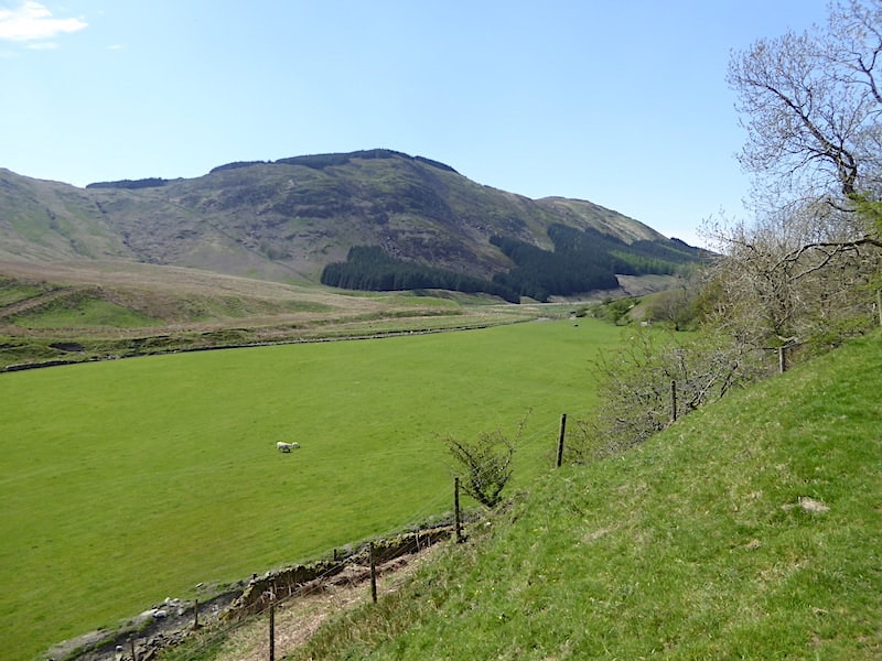
Another look at Mabbin Crag across the valley meadows.

Further along we reach the buildings of the now uninhabited High Borrowdale farm. It was inhabited until the late 1960’s apparently but had become somewhat derelict by 1971. The Friends of the Lake District Charity now owns the buildings, and two barns have been restored and the roofless farm house stabilised. They have also created the two hay meadows, rebuilt some of the stone walls and planted a large number of native trees. A walk along here in summer to see the hay meadows in their full splendour is firmly on the to-do list. Fingers crossed for another lovely day in which to enjoy them.
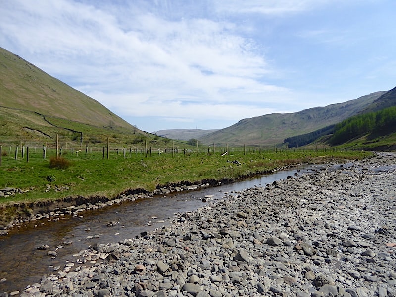
We cross Borrow Beck once again with another look back along the valley where one of the phone masts is still visible on the centre skyline.

The tracks keeps company with the beck for much of the way and the splashings and gurglings were the only sounds to be heard on the peaceful and thoroughly delightful walk back.

We’re almost at the end of Borrowdale now so before the view disappears …..

….. I took a couple of shots looking back along the valley.

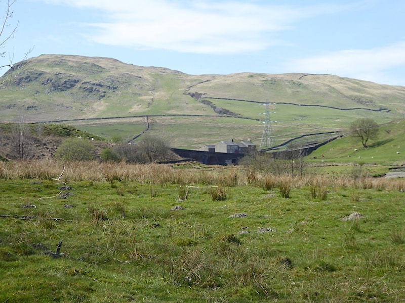
Back at Huck’s Bridge where we leave the valley path and join …..

….. the rough track leading us back up to the A6 from where I took this look back at Greenside Crag with the Breasthigh Road meandering up the slopes alongside it.

Back at the lay-by on the A6 where today’s walk comes to an end, and one which has been an absolute delight, in beautiful weather, from start to finish. We’ve threaded our way over grassy hollows and hummocks of varying sizes, strolled across crags, knolls and rocky scars, wandered through copses, dells and thickets adorned with native flora and fauna and tramped across undulating open grassland, all rounded off with a magnificent walk back alongside Borrow Beck through the exquisite natural beauty of the valley of Borrowdale. A very special walk indeed.
