Great Crag and Grange Fell

Walk Date – 8th August 2015

Distance – 6.2 miles

Weather – sunny at first, then cloudy with a nippy wind


Route

From the lane where we parked in Stonethwaite, and over on the right is the high point of Grange Fell, we’ll be over there a little later. Sorry about the unsightly deer fencing but I couldn’t get the camera through the gaps in it.

Leaving the little hamlet of Stonethwaite.

The weather is looking promising, here I’m looking over the High Scawdel and High Spy area.

The path up Lingy End begins just by this sheepfold.

We turn off to the left to climb up Lingy End. The main path below us continues alongside Stonethwaite Beck, Eagle Crag is the dark craggy fell to the left of centre.

Up we go on the pitched path through woodland on Lingy End, with the following photos showing some more of the climb through the woods ……

Its beginning to look like we’re nearing the top.

We’re clear of the woods now and the view opens up. This is looking towards Seatoller and the fells of Grey Knotts, Fleetwith Pike and Dale Head.

The undulating top of Rosthwaite Fell, or Bessyboot as it is more often called.

For a while Greenup Edge and Eagle Crag were under a large grey cloud so the photo was an exercise in hope, not expectation.

Further up Lingy End is this ruined building, a bit of research revealed that its a shepherd’s bothy.

Willygrass Ghyll. Can you imagine what it must have been like building that wall up the side of it?

Another stile to deal with before we get to Dock Tarn.

Dock Tarn. Just as we reached the cloud came over so its doesn’t look as sparkly as it should. One of these days I’ll get a decent photo of this tarn.

This is the other end of the tarn. A hint of weak sunshine giving a bit of sparkle to the tarn, but you can see the grey clouds above it reflected in the water.

Leaving a gloomy looking Dock Tarn, it wouldn’t surprise me if the sun comes out when we’ve left it behind.

The shadow of the cloud extended well past the little hamlet of Watendlath and its tarn so everything looked a bit gloomy.

A bit of zoom to show High Raise, left of centre, on the skyline, and Pike O’Stickle just visible to the right. Cloud still over us but it looks nice and sunny over there.

A little patch of sunlight on Rosthwaite Fell with the dark mass of Glaramara just behind it.

Fells at the head of Borrowdale, the dark curved one is Great End, to its right is Great Gable, drop below that and its Green Gable, and below that is Base Brown.

Great Gable again on the extreme left, with Pillar on the extreme right.

We’re still under that big grey cloud, the fells to the south and west have sun, grrrr.

Looking over towards High Spy and Maiden Moor, also bathed in sunshine.

Still on Great Crag summit with Kings How, just above the trees towards the bottom right.

Looking across to Grange Fell and beyond that is Skiddaw. I am now heartily fed up with this large grey cloud hanging over us.

At least Watendlath tarn has a bit of brightness, unlike High Seat just above it.

Looking east towards the Dodds and the Helvellyn range from Great Crag summit.

The Dodds over on the left and the start of the Helvellyn range on the right.

Looking across to High Saddle and Ullscarf, I wish this cloud would shift, its taking all the colour from everything.

On the skyline, High Raise on the left and Pike O’Stickle on the right, below them the two dark masses of Eagle Crag and Sergeant’s Crag.

On Great Crag summit with Maiden Moor behind me, and in case you hadn’t noticed, the cloud returned and the jacket has had to go on.

We’ve walked down off Great Crag and are approaching Watendlath Tarn. On the way down we met a young couple with two very young children coming up. They asked us for directions to Stonethwaite which we gave them. When I noticed Mum was sockless and wearing flat, thin strapped sandals I pointed to my mud caked boots and mentioned the state of the path and that she might ruin her sandals and get very muddy feet. She didn’t seem in the least concerned about any of that though and off they went.

Two men in a boat concentrating on their fishing in Watendlath tarn.

Watendlath Tarn and Great Crag from near the bridge at Watendlath. The net across the outflow stops the fish doing a runner, or should that be a swimmer?

Watendlath bridge. Loads of people around here today, I was glad to leave, it was too busy.

On the right skyline is Great Crag where we have just spent what seemed like a lifetime under a great big grey cloud. Now its sunny over there, typical.

A view to the east from the path over to Grange Fell. High Saddle on the right skyline.

Time to leave the Puddingstone Bank path and head over the squelchy grass to the stile down there. Looks like some much needed stile repairs are about to take place.

On Brund Fell, the summit of Grange Fell. I think somebody will be going for a haircut before much longer.

On Grange Fell summit and sheltering from the keen wind behind this handy rock.

Looking east over the High Tove and Armboth ridge to the Dodds and the Helvellyn range.

Looking south to the Borrowdale Fells from Grange Fell.

Huge outcrop on Grange Fell, Maiden Moor beyond.

Looking towards Great Gable, on the centre skyline, across Borrowdale.

A longer view of the valley and the fells at the head of it as we descend from Grange Fell.

Watch out for nettles, there’s often one lurking below a stile just waiting for an unwary bare leg!

We’re back down in the valley now and heading back to Stonethwaite, there’s a lot more detail showing on Eagle Crag than there was this morning.


Seven Langdale Fells – Sergeant Man, High Raise, Thunacar Knott, Pavey Ark, Harrison Stickle, Pike O’Stickle and Loft Crag

 Sergeant Man, High Raise, Thunacar Knott, Pavey Ark, Harrison Stickle, Pike O’Stickle and Loft Crag


Walk Date – 6th August 2015

Distance – 7.5 miles

Weather – rain in morning, dry but cloudy and windy in afternoon


Route

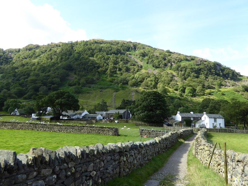
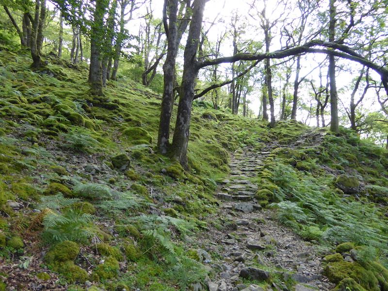
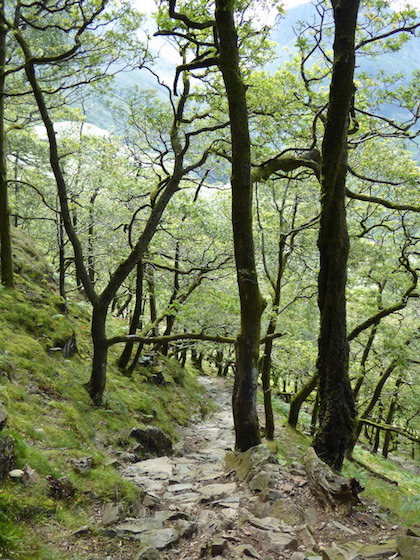
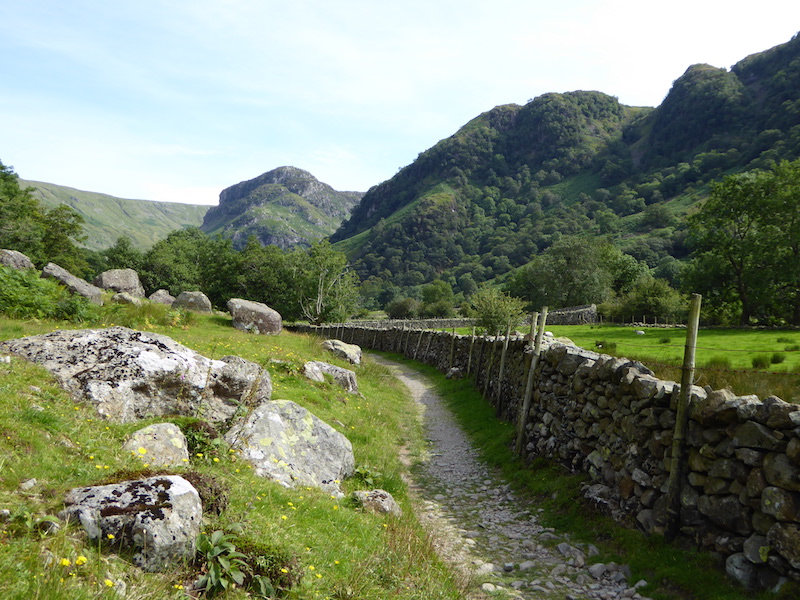
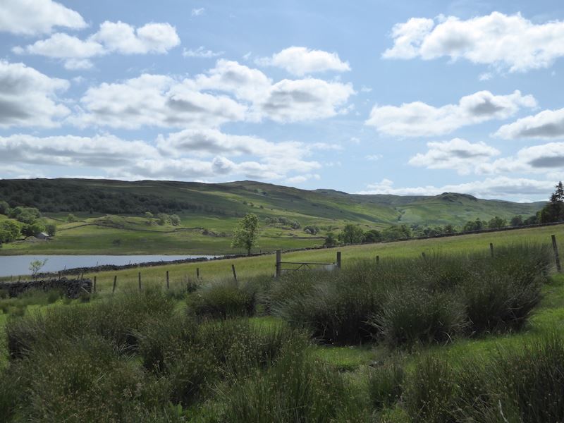
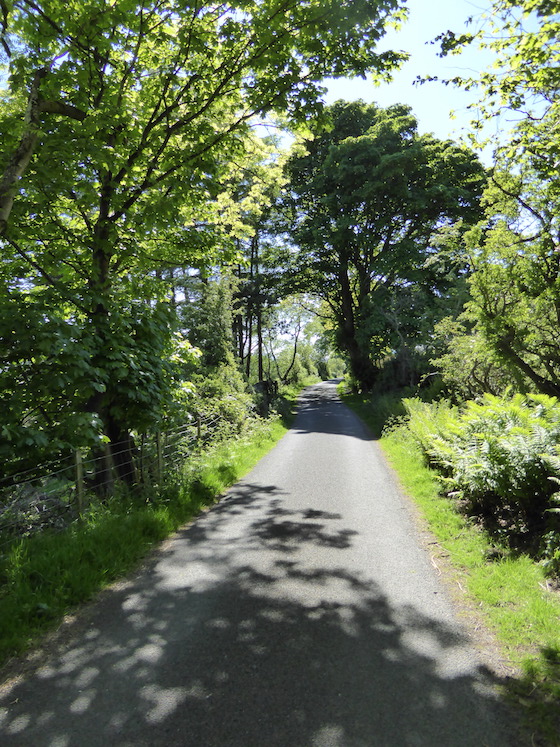
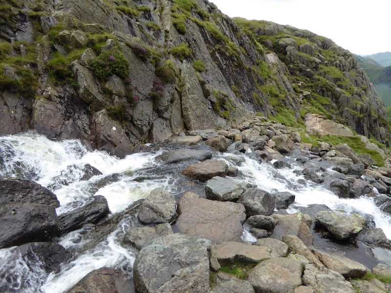
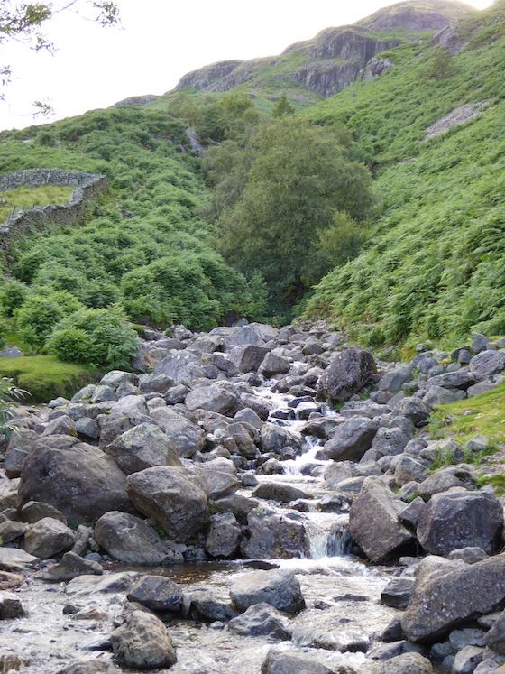
After waiting in the New Dungeon Ghyll car park for the rain to stop for almost an hour we finally set off, taking the path alongside the waterfalls in Stickle Ghyll.

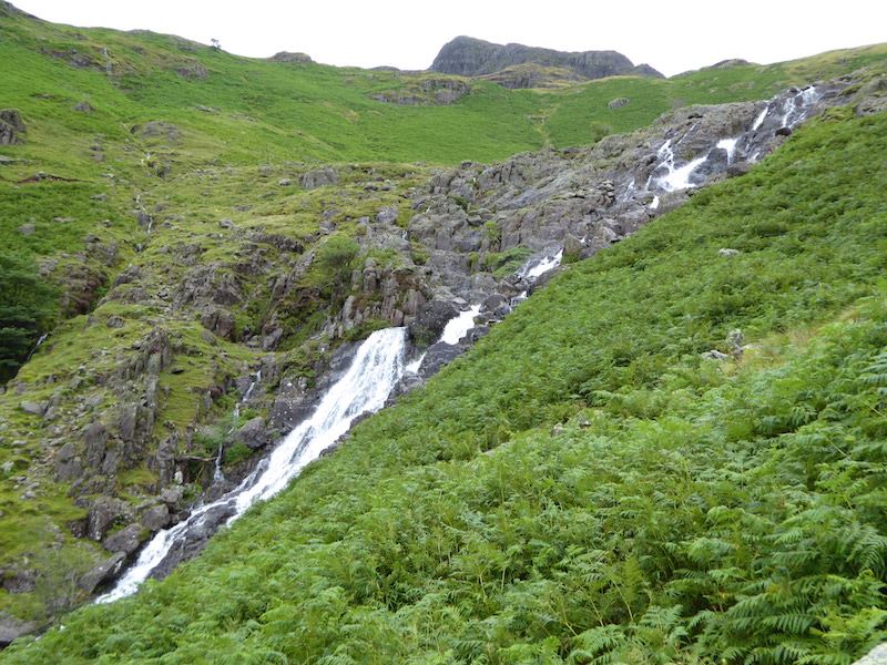
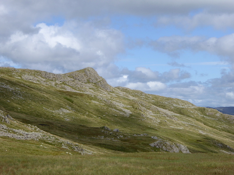
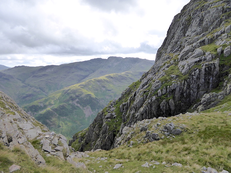
Pike How towering above us as we climb alongside Stickle Ghyll.

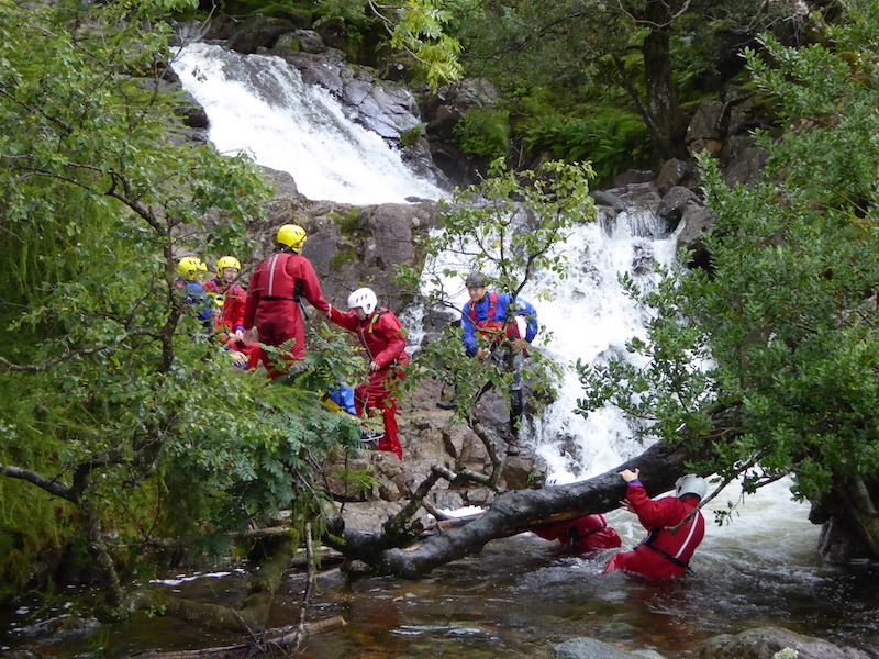
A group of ghyll scramblers further up the ghyll. The youngsters in the group grumbled in the car park (it was raining), grumbled on the way up (it was steep and a long way) and were still grumbling when the activity got under way (it was cold and slippy). I wonder if they already knew that there might not be a mobile phone signal either?

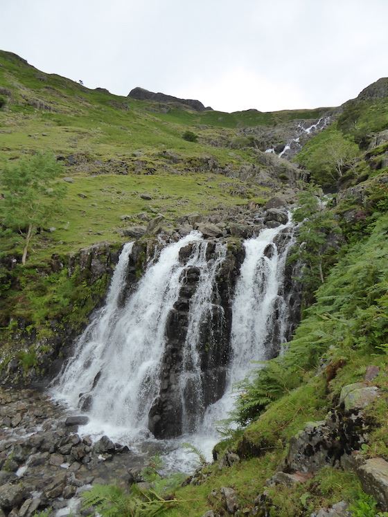
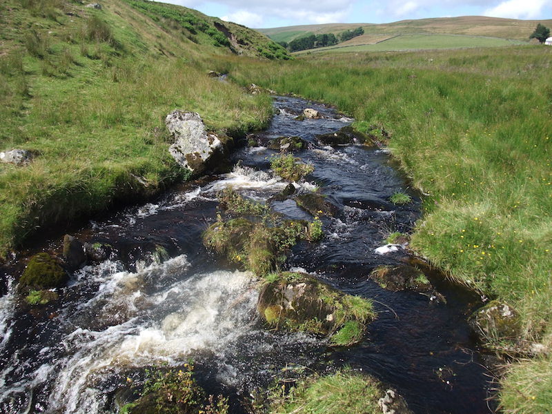
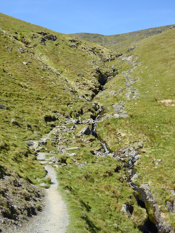
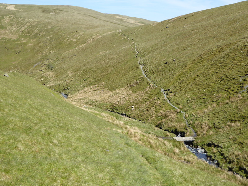
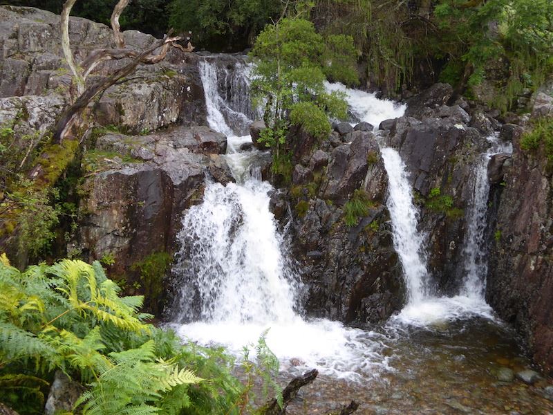
There was a lot of rain last night so there’s plenty of water in the ghyll today.

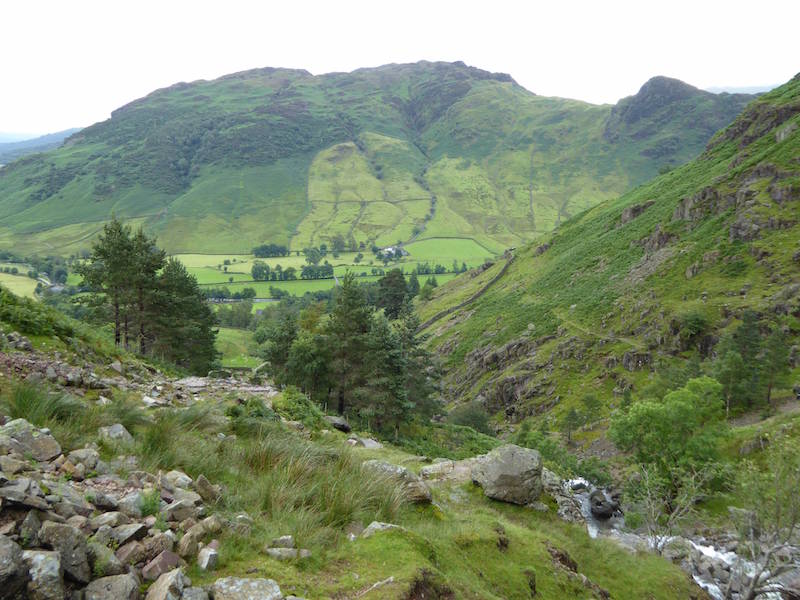
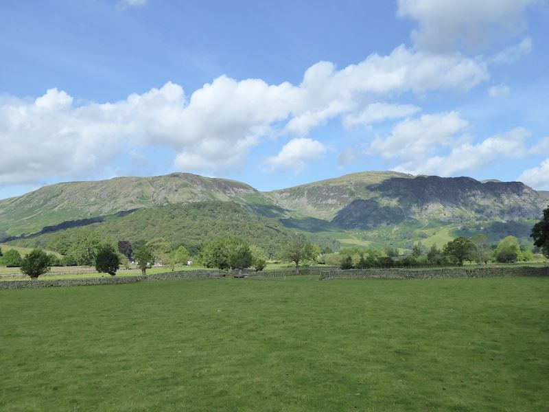
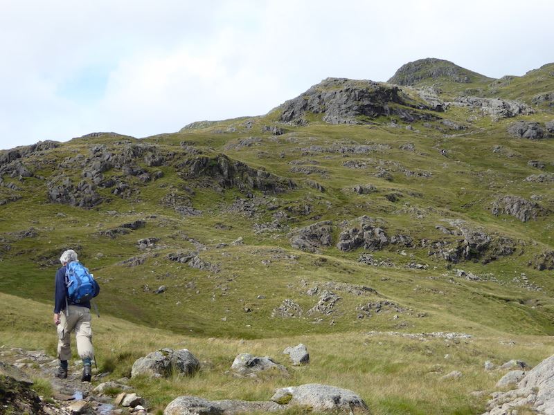
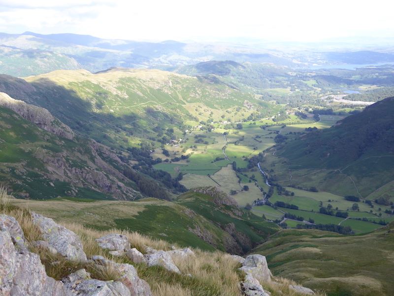
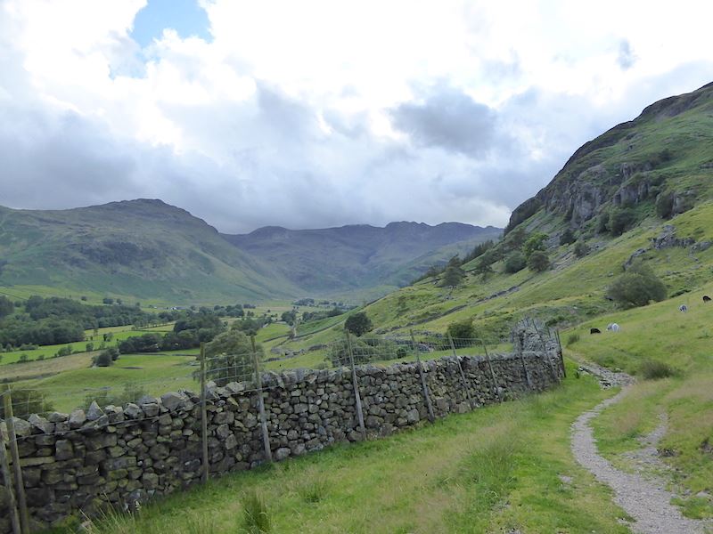
A good view of Lingmoor Fell and Side Pike as we gain more height.

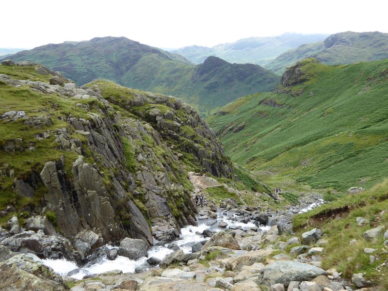
Harrison Stickle comes into view above the cascade.

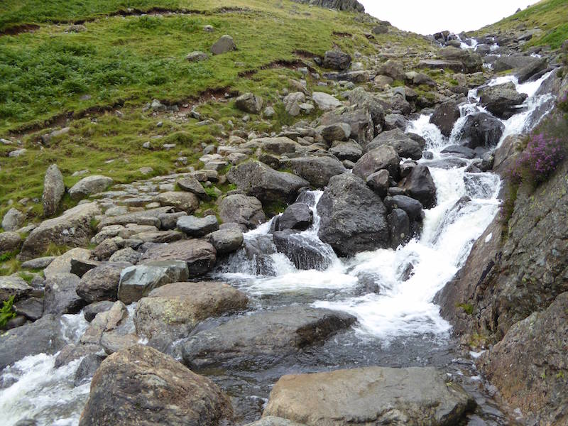
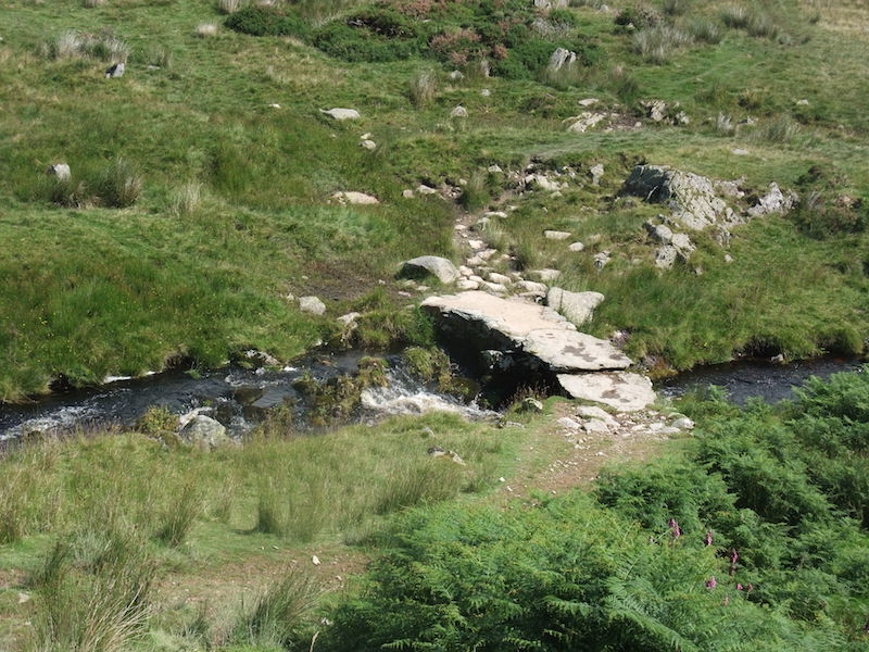
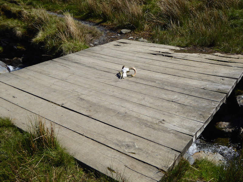
A little extra care was needed in getting across as the stepping stones were very wet.

Safely across and a look back at the crossing point.

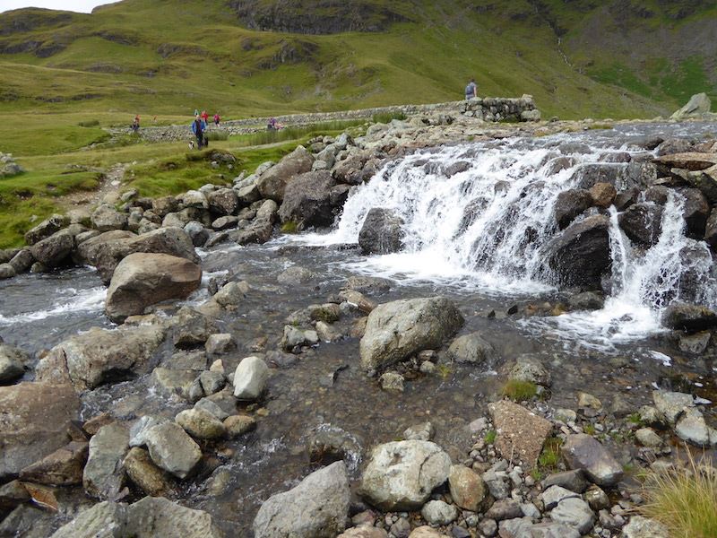
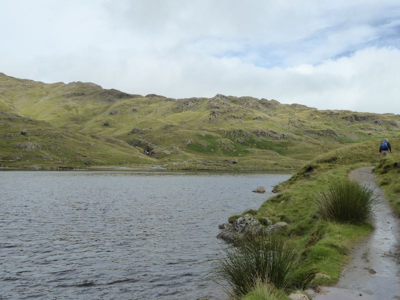
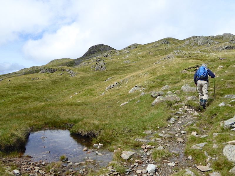
We’re almost at the top of Stickle Ghyll now. The path was very busy.

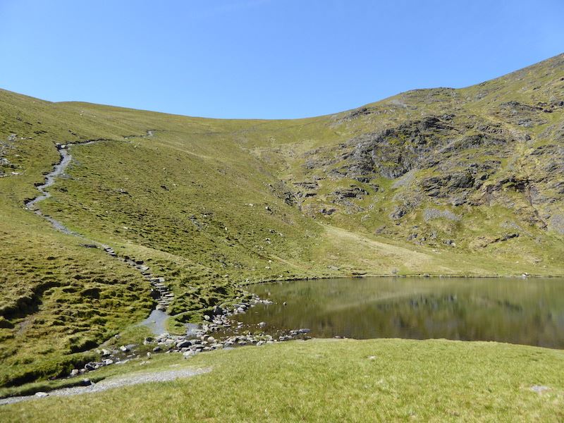
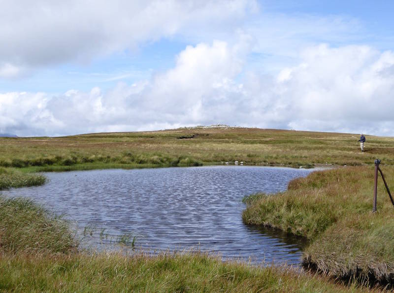
The outflow at Stickle Tarn, dozens of people up here today.

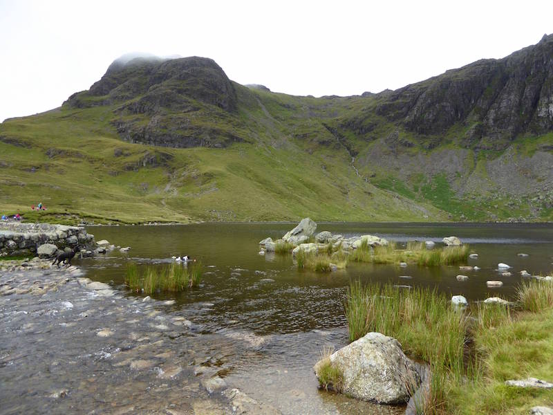
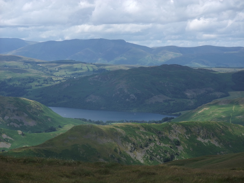
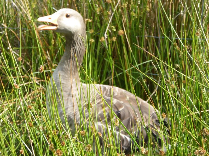
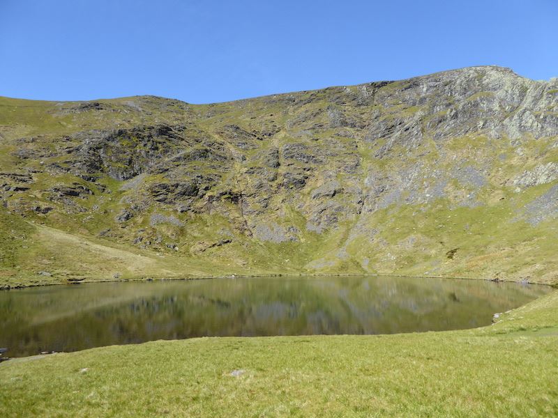
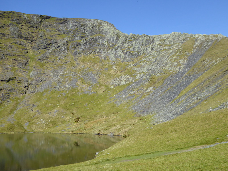
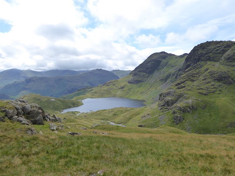
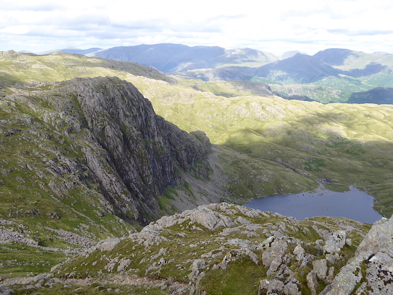
Stickle Tarn with Harrison Stickle behind it, and a bit of Pavey Ark on the right. I swear that black and white dog in the tarn wasn’t there when I lined up the picture.

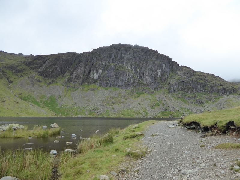
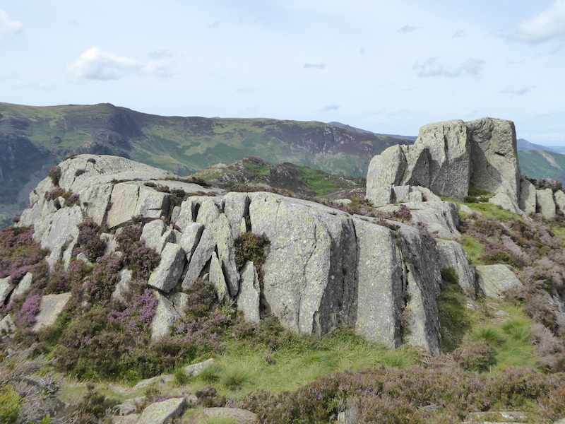
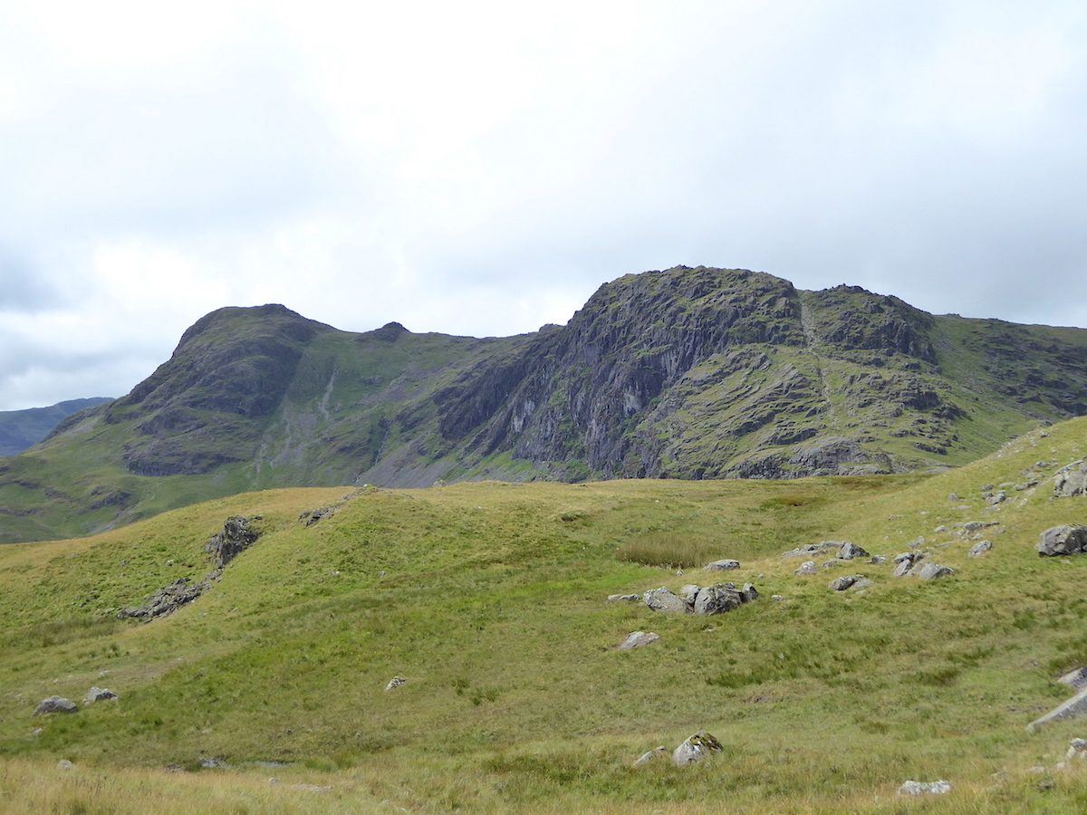
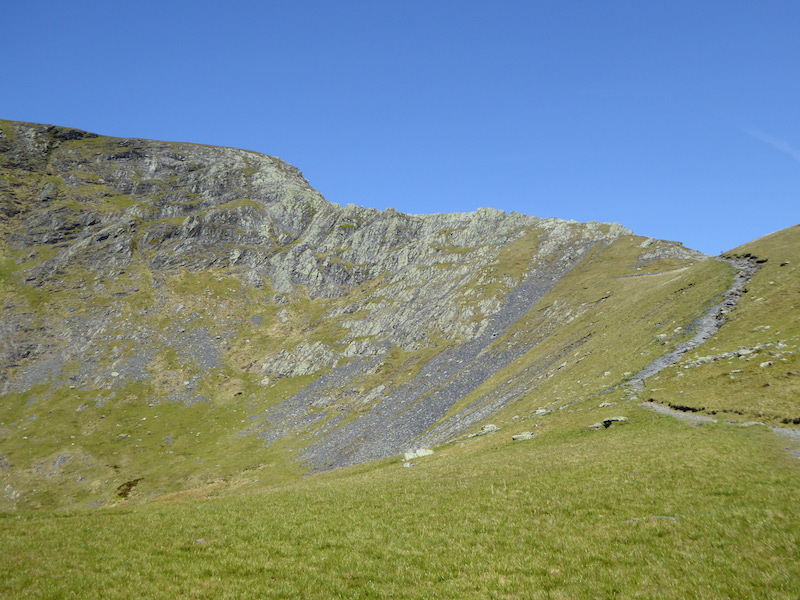
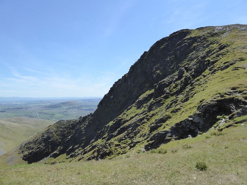
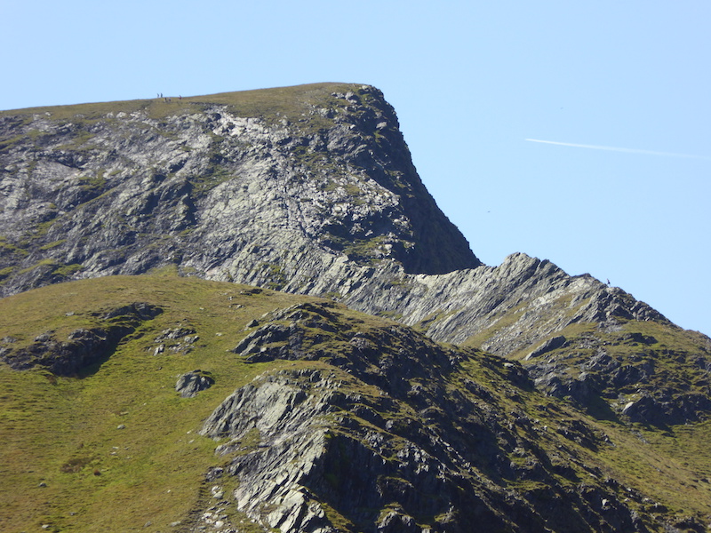
Pavey Ark, I couldn’t see anyone on Jack’s Rake today, maybe it was a bit too wet for safety.

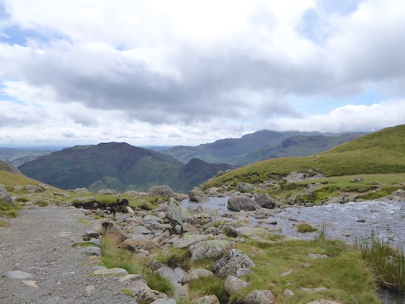
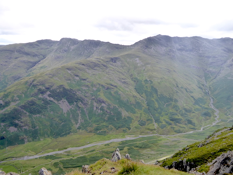
Stickle Tarn outflow with Bowfell just to the right of the centre horizon under the stream of white cloud.

After a short break at the tarn we carried on over to the Blea Rigg ridge to continue the walk. No-one else came along after us from the tarn and it was a relief to escape from the crowds and the barking dogs.

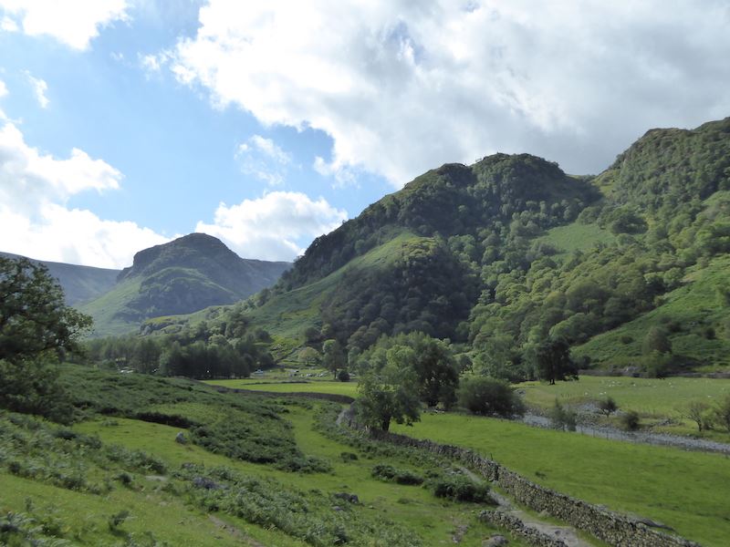
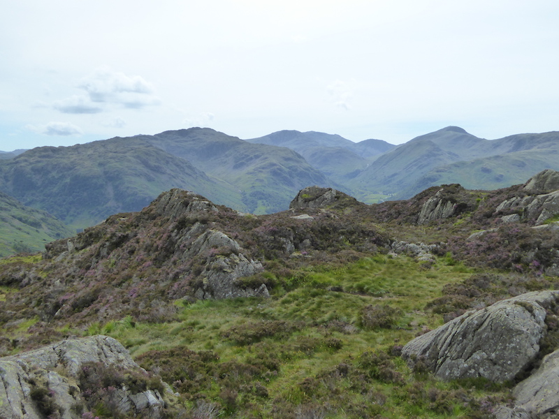
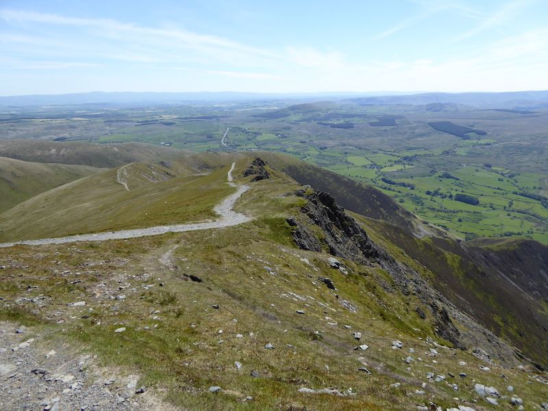
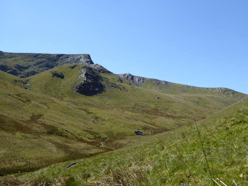
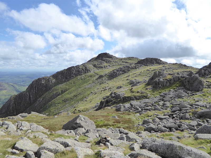
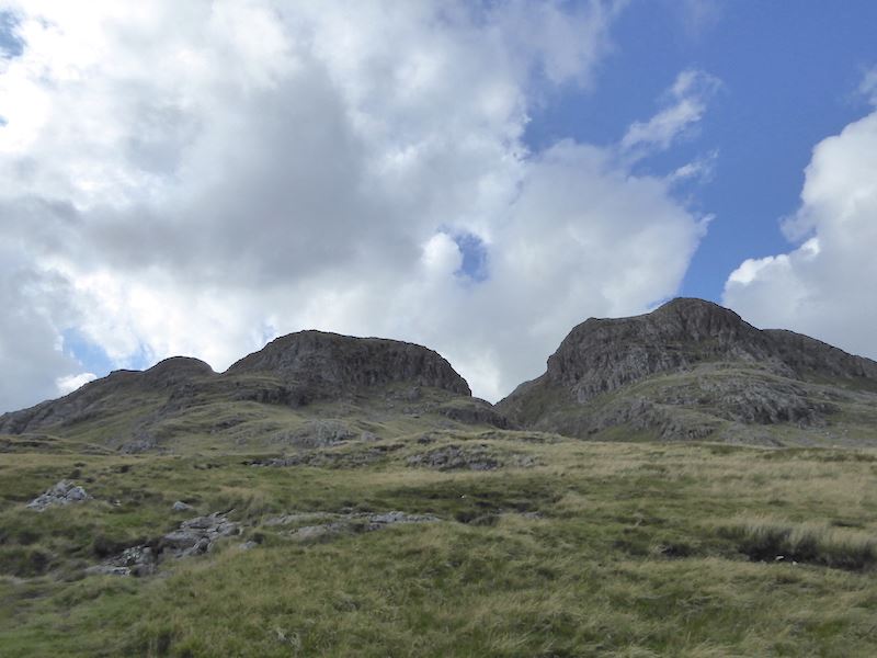
Pavey Ark on the left, as we head for Sergeant Man, that large bump over on the right skyline.

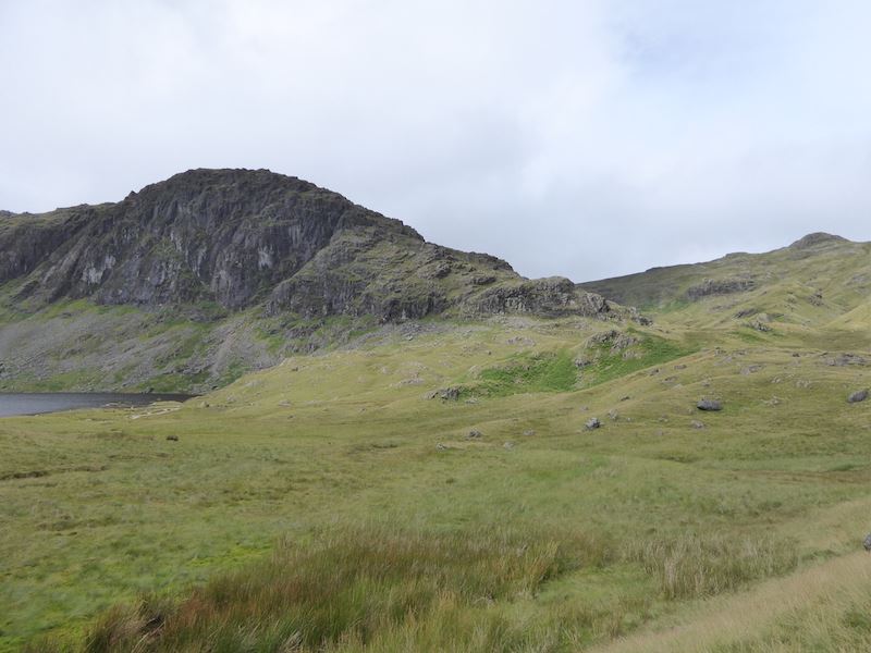
Harrison Stickle on the left and Pavey Ark, looking a bit like a hot cross bun, on the right.

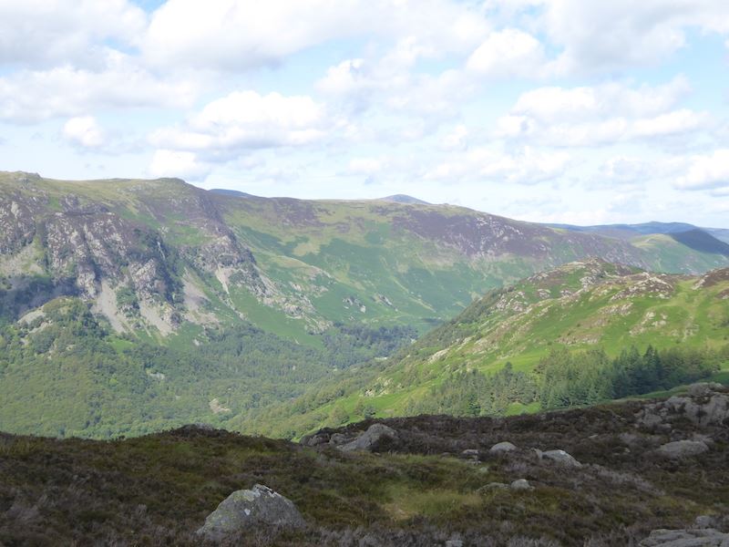
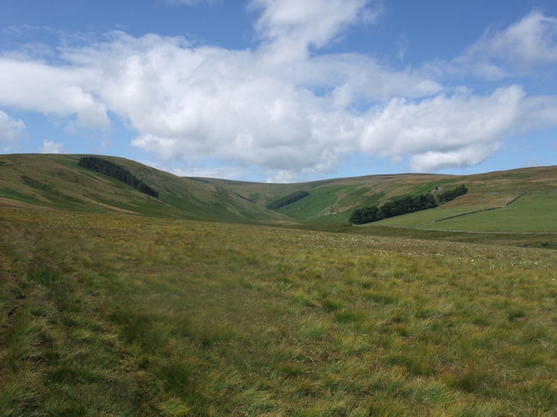
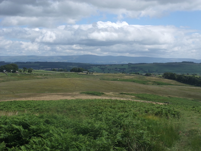
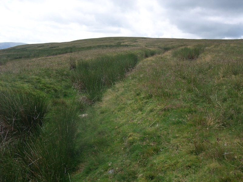
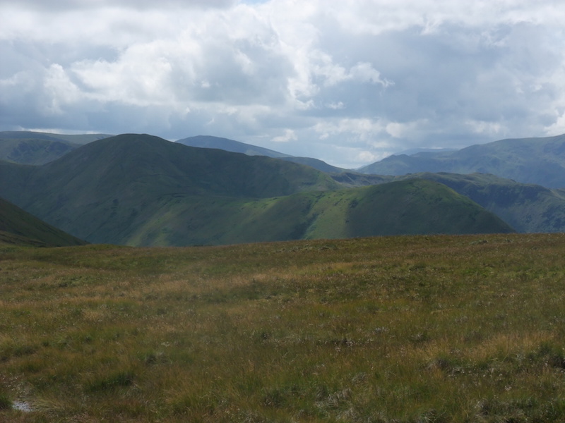
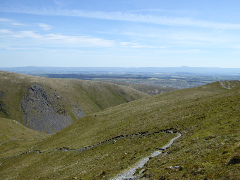
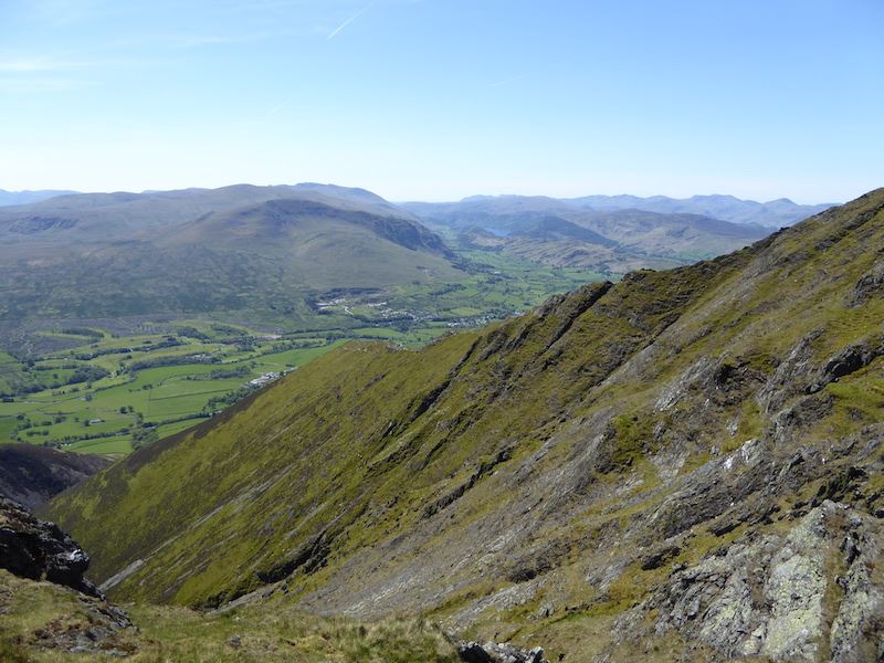
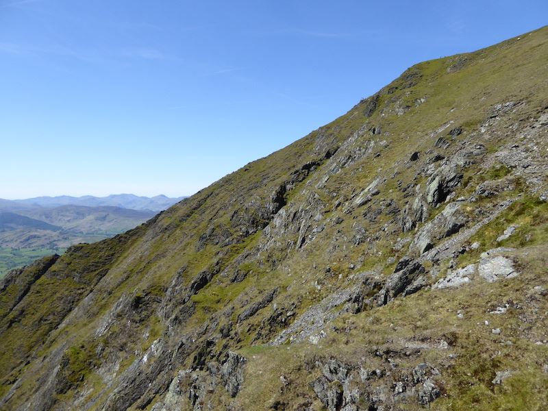
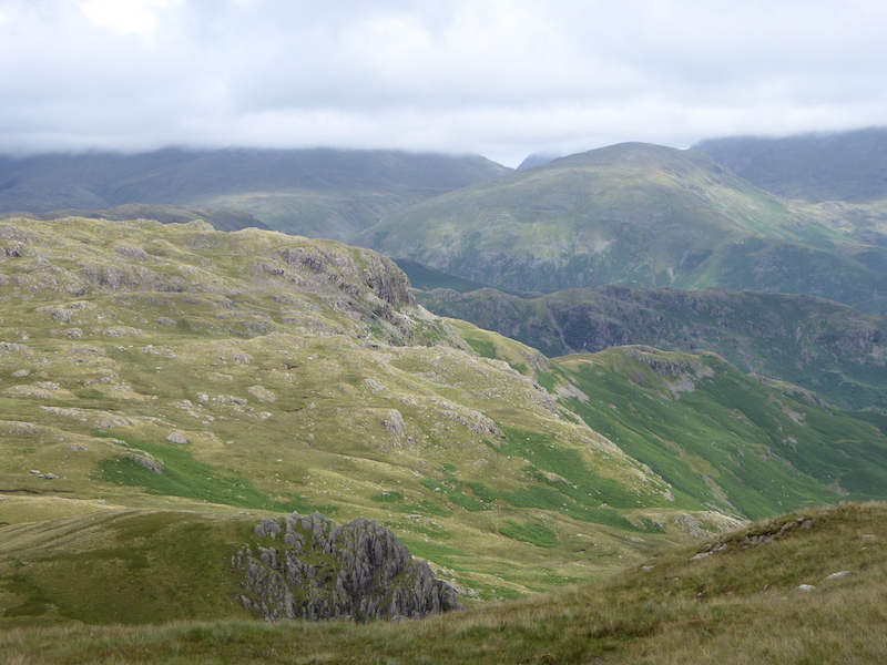
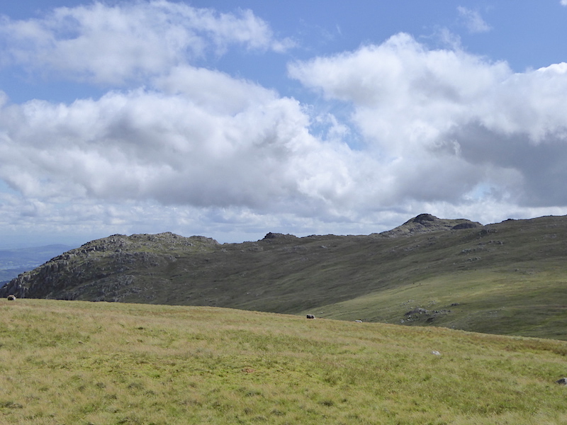
A view from the ridge as we squelched our way along it.

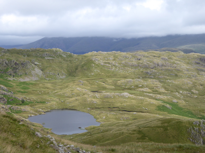
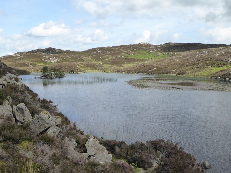
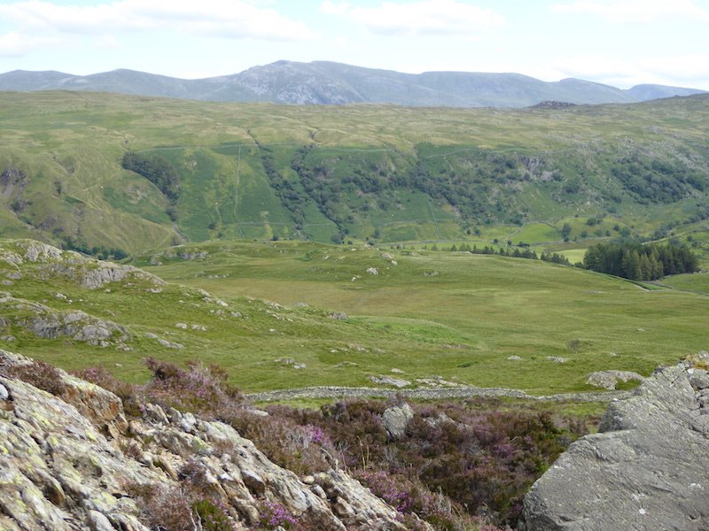
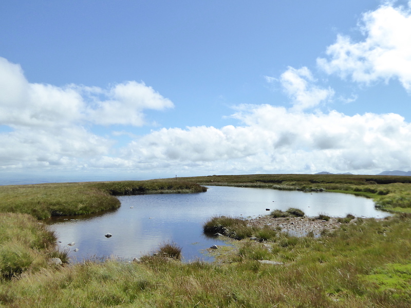
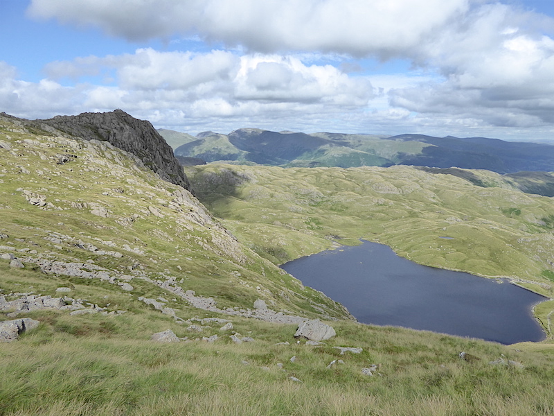
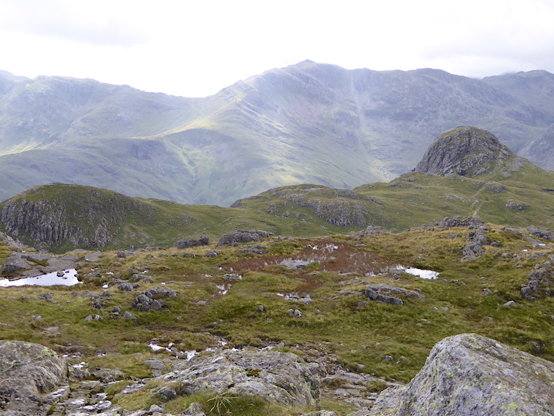
Just off the path we found a sheltered spot with this view of Codale Tarn, so we took a break here and had something to eat.

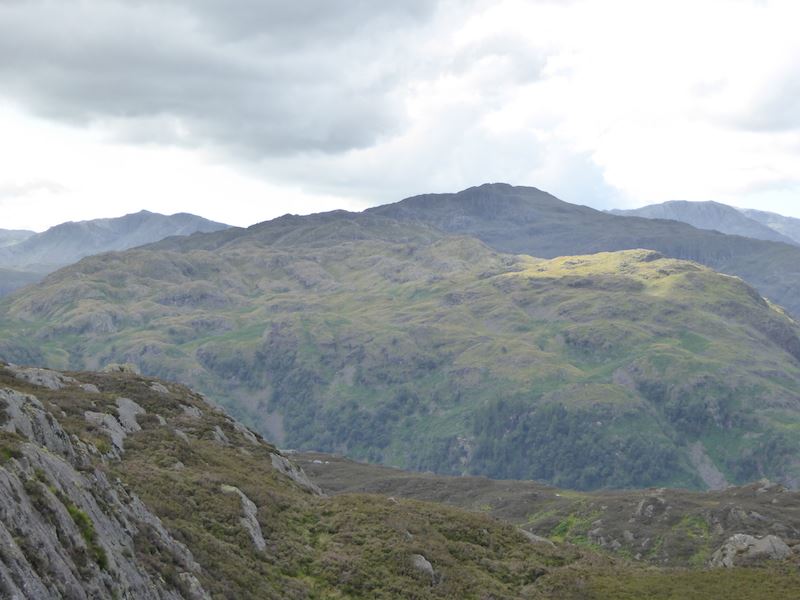
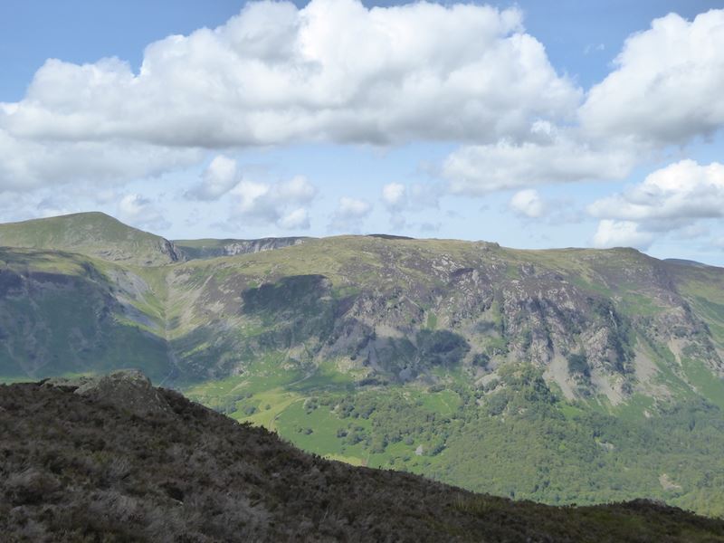
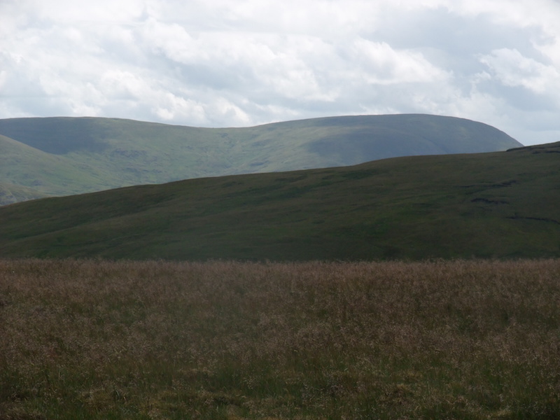
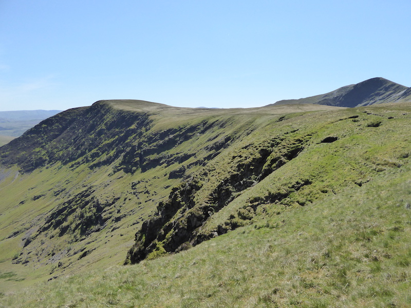
The rocky outcrop below is Belles Knott with Tarn Crag behind it. The cloud is beginning to break up.

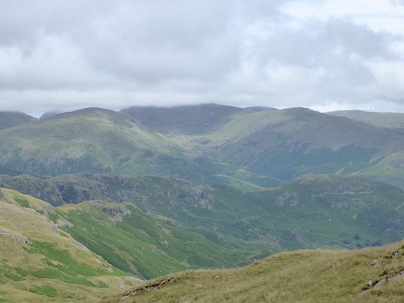
Looking to the east and under the cloud in the centre is Fairfield.

Looking back from higher up the ridge for a view of Codale tarn and Easedale tarn. The cloud is slowly lifting from the eastern fells.

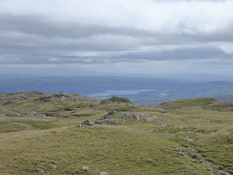
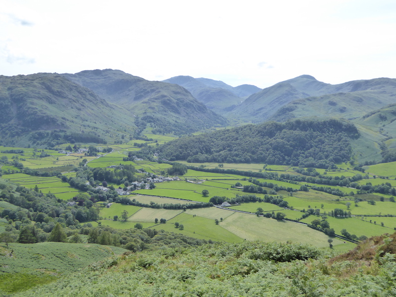
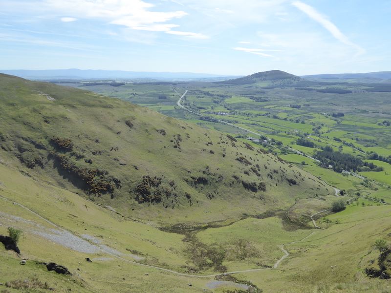
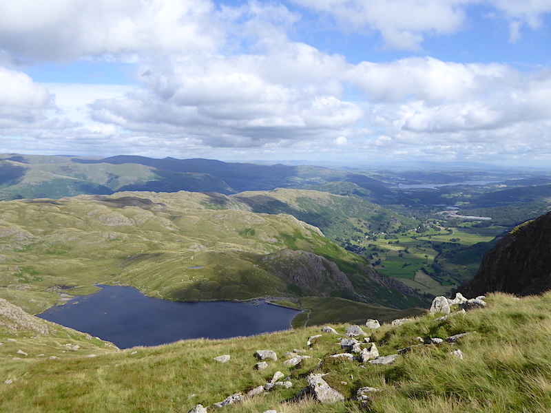
A grey Windermere in a grey landscape under grey skies, what a grey day.

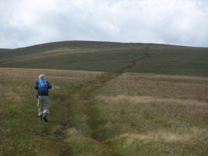
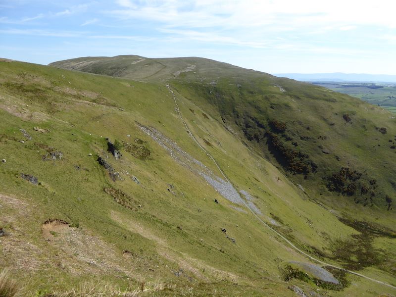
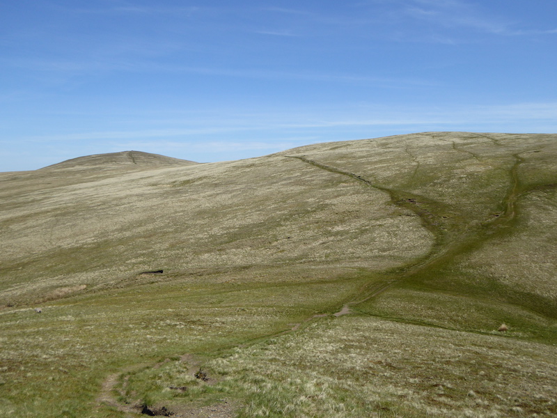
Further along the ridge and we get a glimpse of the sun for a while. Sergeant Man up there on the right seems as far away as ever.

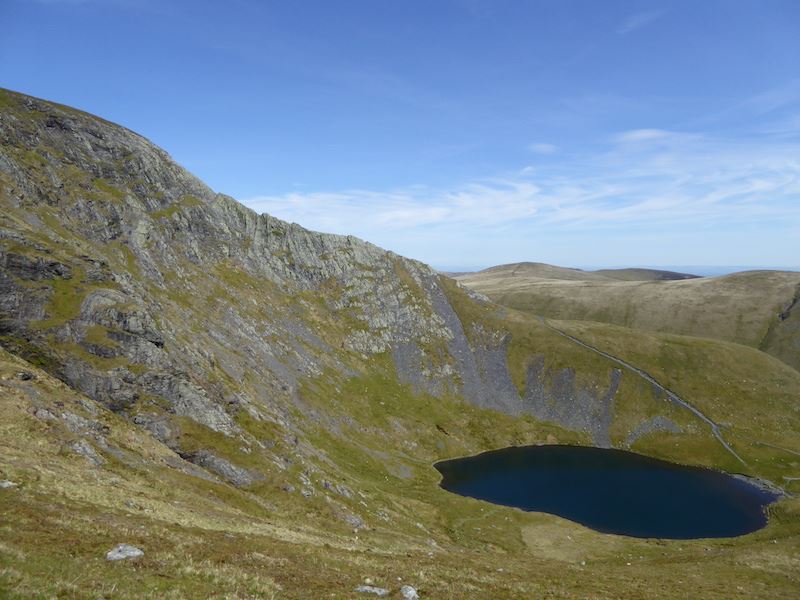
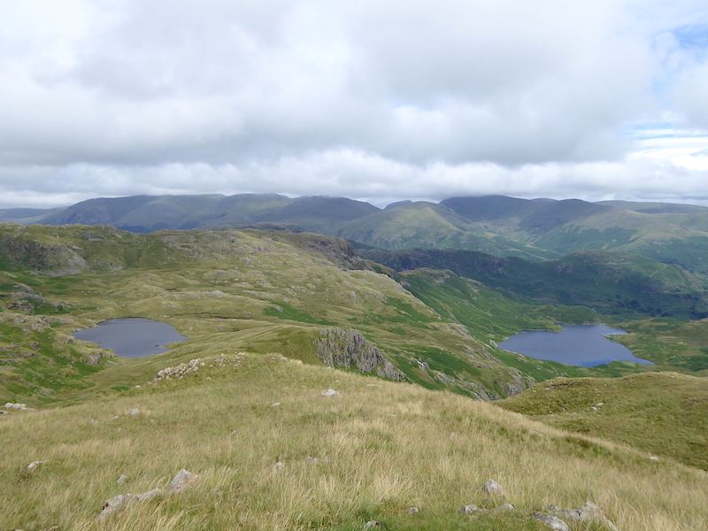
There was a good view of Stickle Tarn as we walked along a very, very soggy ridge up to Sergeant Man.

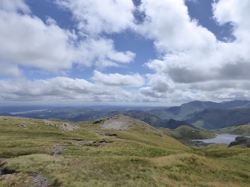
Hallelujah, the cloud has lifted. Now we can see Saint Sunday Crag, centre skyline, Fairfield to the right of it and Dollywagon Pike to the left ot it. The large hump in the middle is Seat Sandal and below that is Tarn Crag.

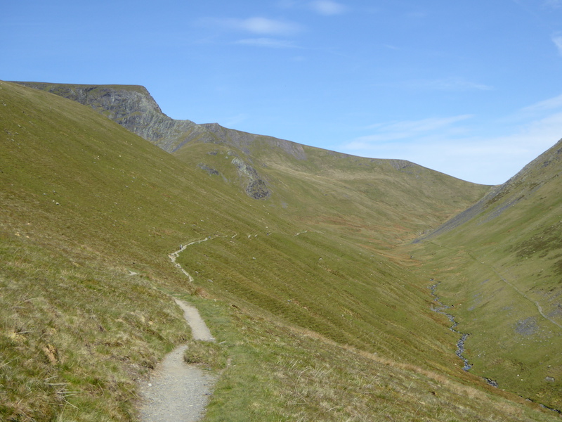
Will we ever get to Sergeant Man? The ridge route seemed never ending and a lot further than I remembered, or perhaps I was just getting impatient. At least we can see a couple of walkers on the summit.

The clouds are finally breaking up and allowing some sunshine through now and then. Down below us in the right hand corner is Stickle Tarn.

At last Sergeant Man is within reach. To the left of it Bowfell is now clear of cloud and its pointed peak is clearly visible.

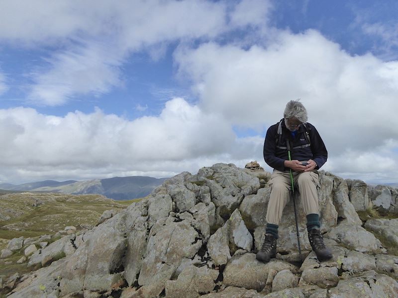
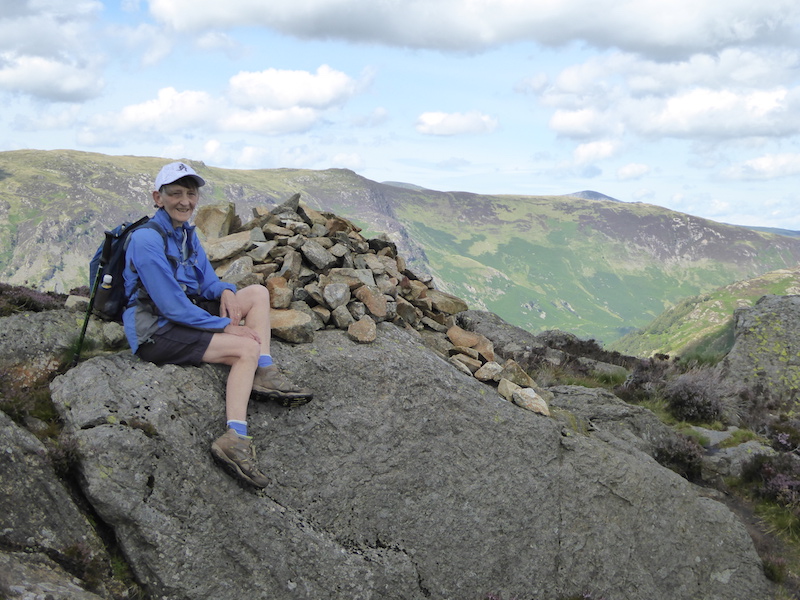
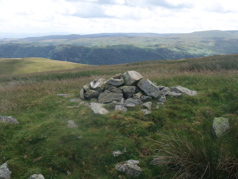
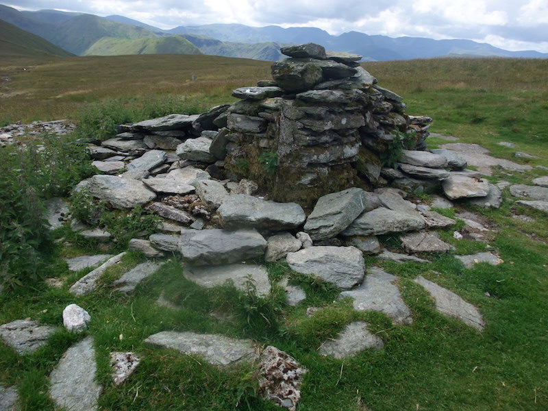
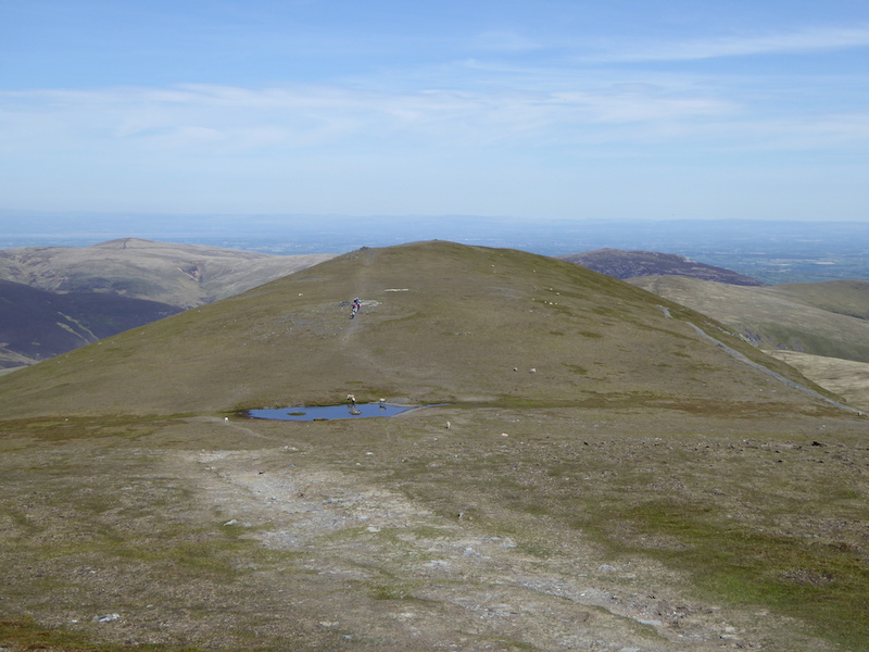
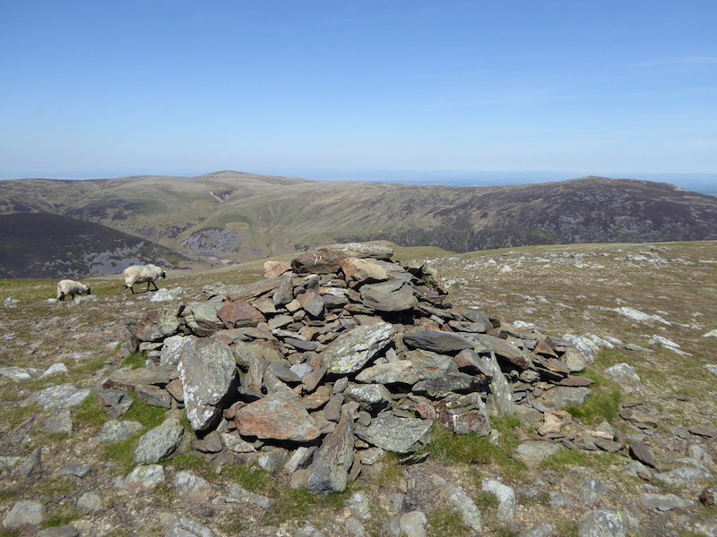
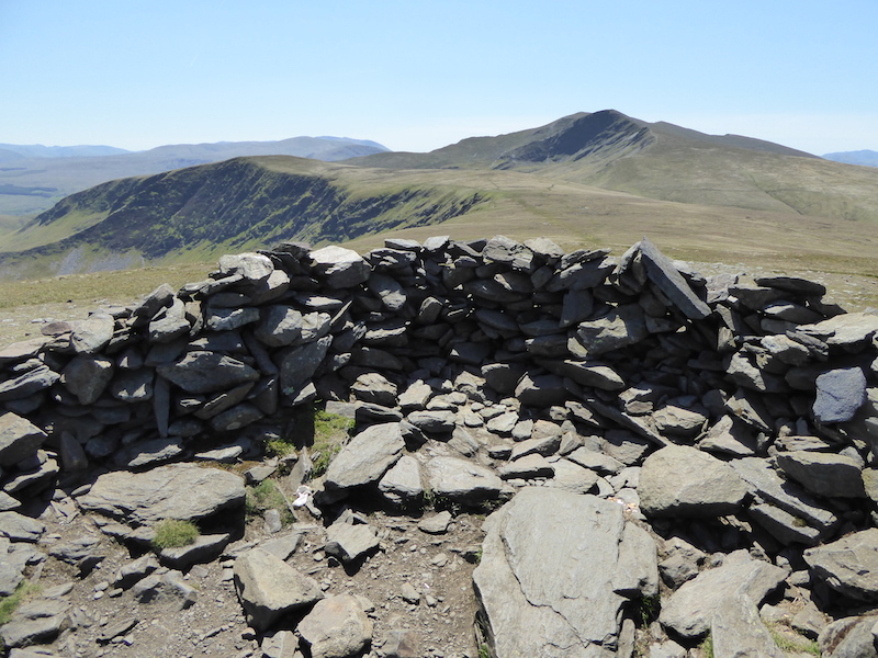
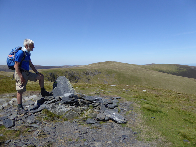
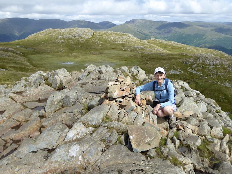
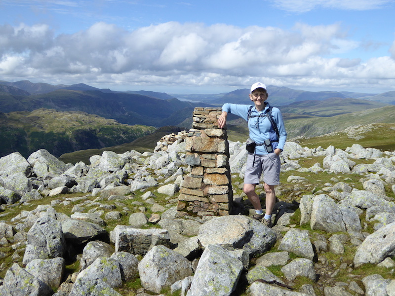
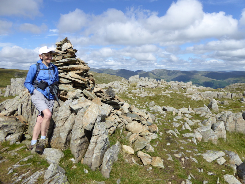
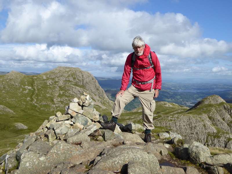
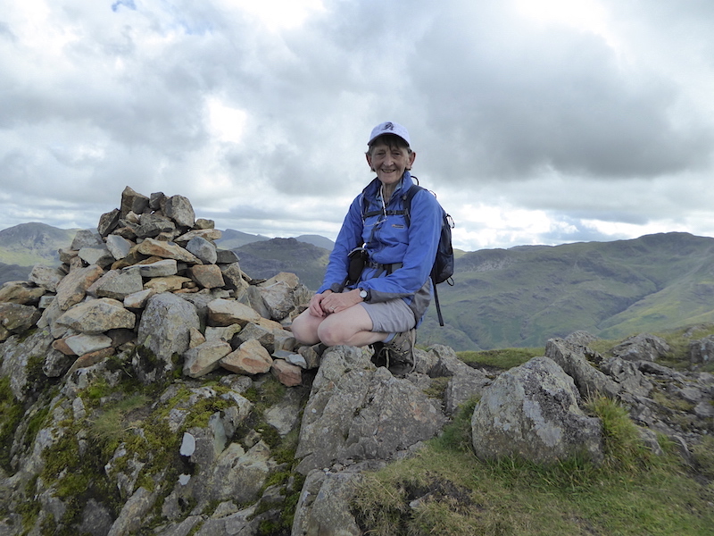
Sergeant Man summit and a chance to sit down for five minutes. If that GPS doesn’t say Sergeant Man then we are in serious trouble.

Sergeant Man summit and the soggy, boggy area behind it. At last a spell of sunshine and some good clear views of the Eastern fells on the horizon. When we reached the summit there were a couple of young men there already so we had a bit of a chat. They had planned to camp out overnight but as they were setting up camp the torrential rain began, so they hot-footed it down to the Dungeon Ghyll hotel. A hot meal, a few drinks and a good night’s sleep had brightened their spirits and they were spending the day just exploring up here. They had to be back at work the next day and their plan was that one would drive the other to Doncaster to catch his train to London, and the car driver would then continue on his journey over to Norfolk. Neither seemed in any hurry to be setting off as we kept seeing them when we continued our walk, oh, the freedom of youth eh?

Wishing the two lads a safe journey, we headed off to High Raise from Sergeant Man.

A look back at Sergeant Man and its tarn as we squelch over this boggy ground towards High Raise.

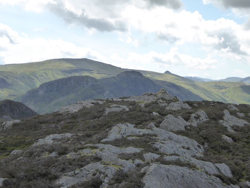
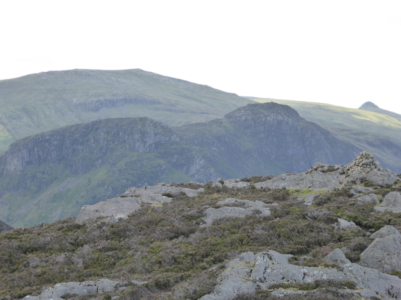
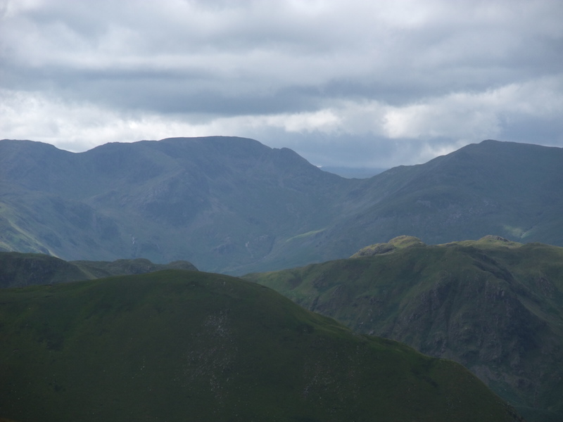
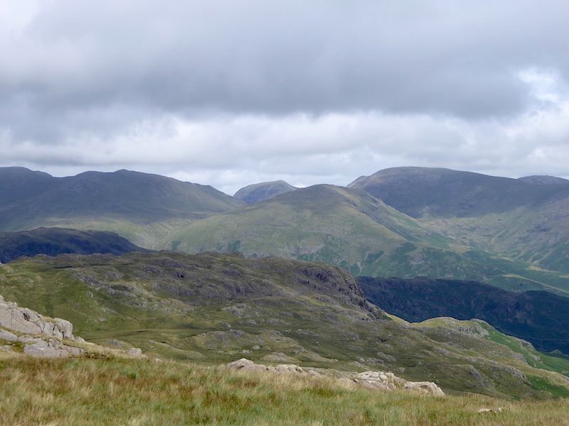
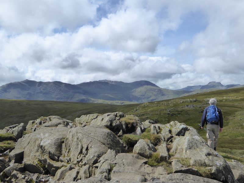
On the left skyline is Bowfell and over on the right skyline, to the left of the rocks, is Scafell Pike.

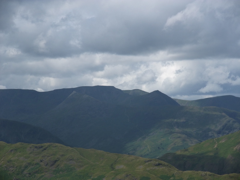
From left to right and looking rather grand are Dollywaggon Pike, Saint Sunday Crag and Fairfield. Seat Sandal is the fell just in front of Fairfield.

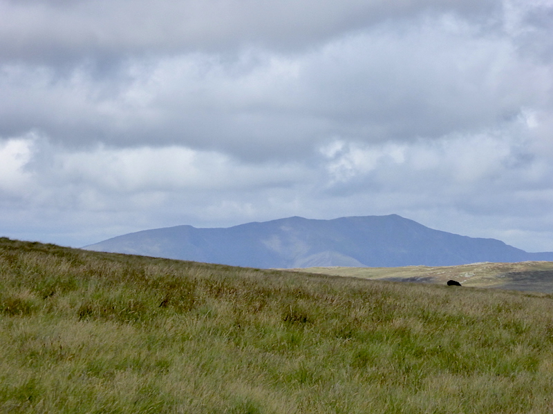
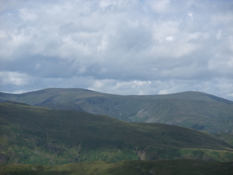
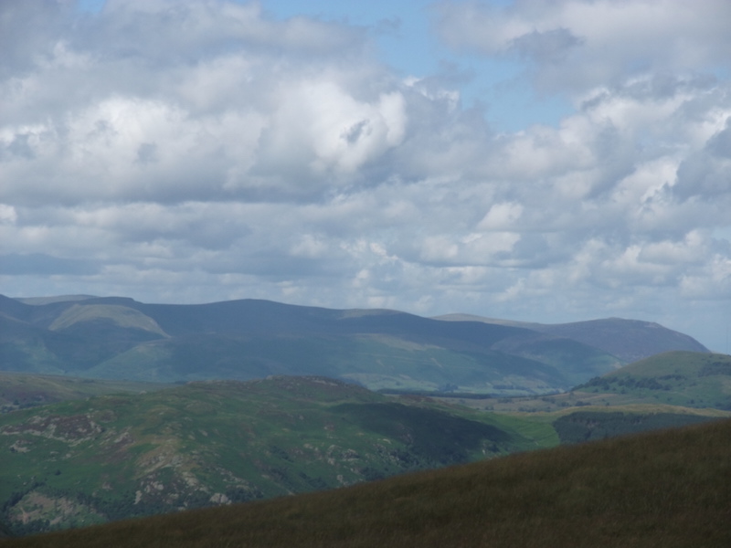
A close up of Blencathra way over in the distance.

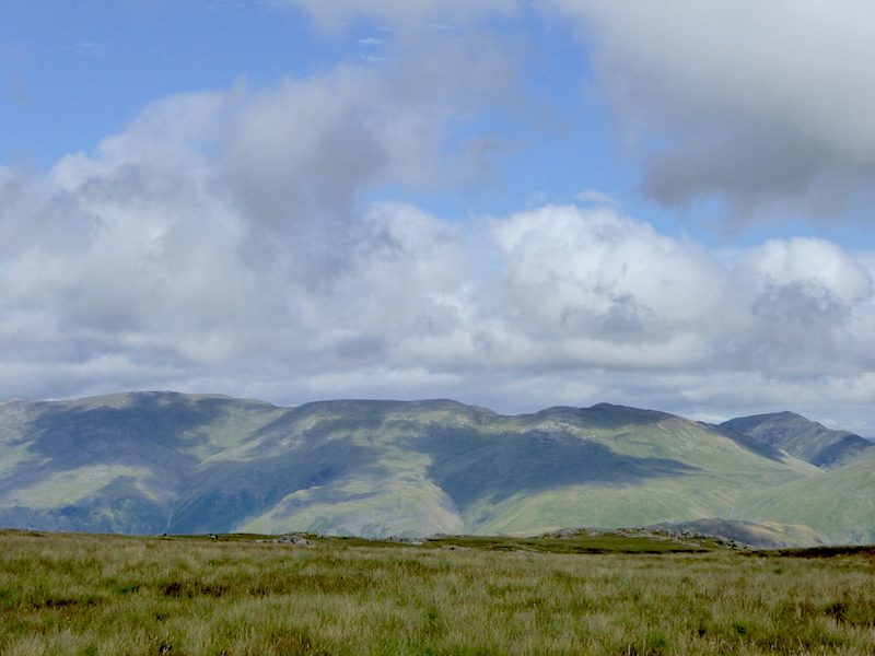
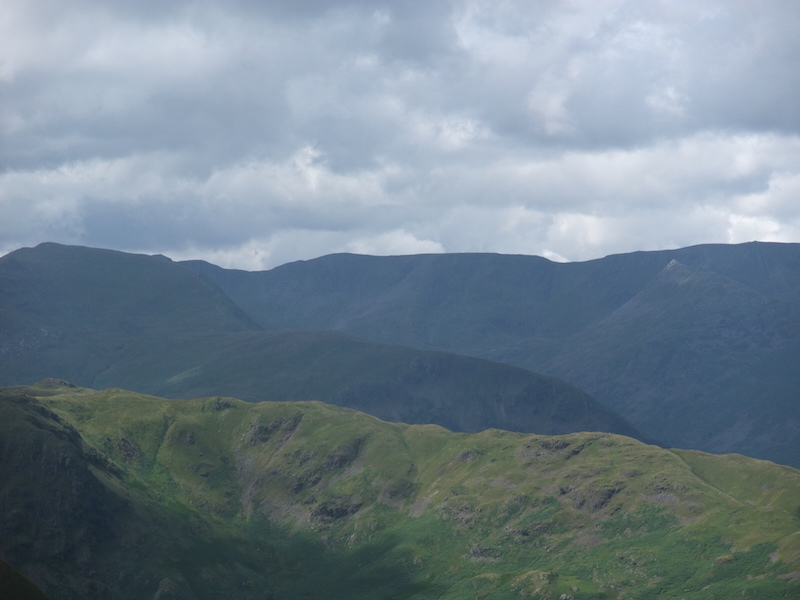
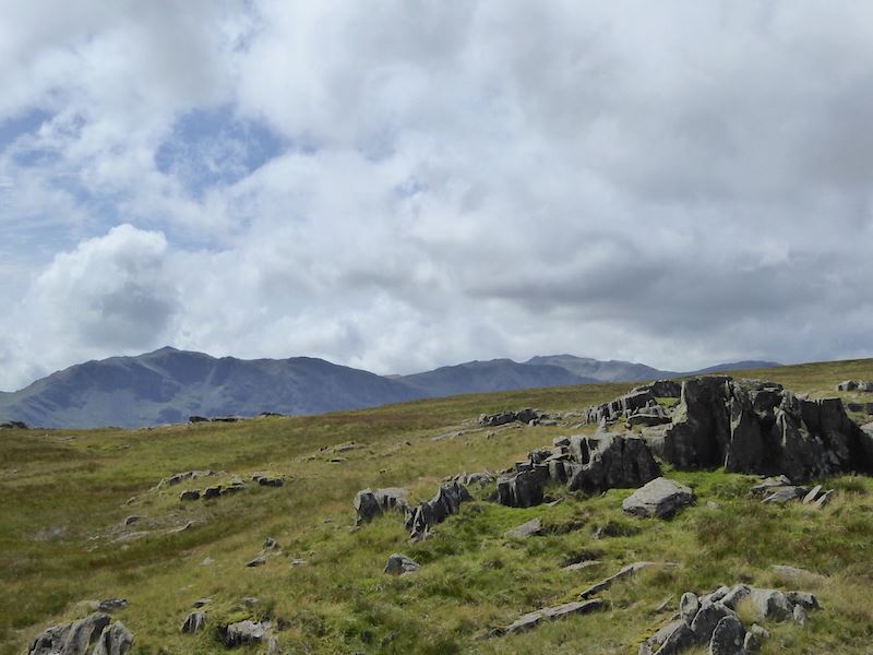
There are some good views of the eastern fells as we tramp along across here. From left to right are Helvellyn, Nethermost Pike, Dollywaggon Pike and Saint Sunday Crag.

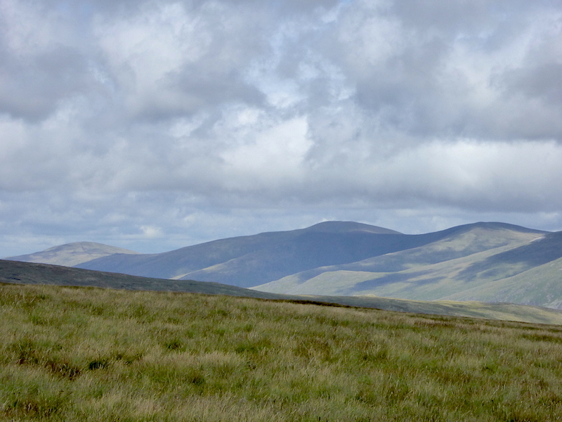
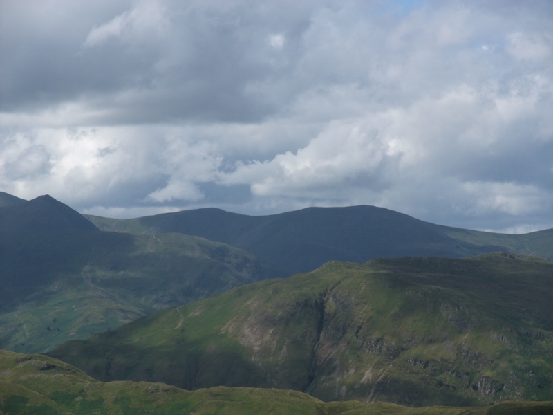
To the left of the fells in the previous photo are these, collectively known as The Dodds.

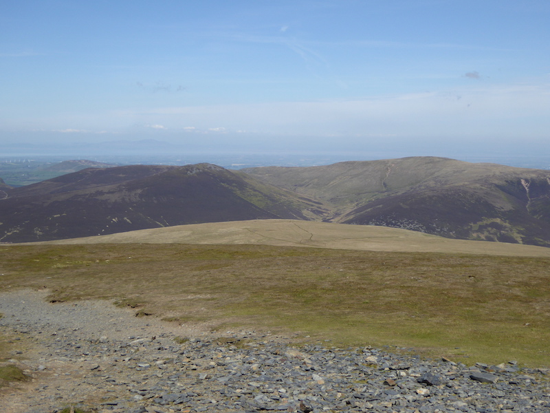
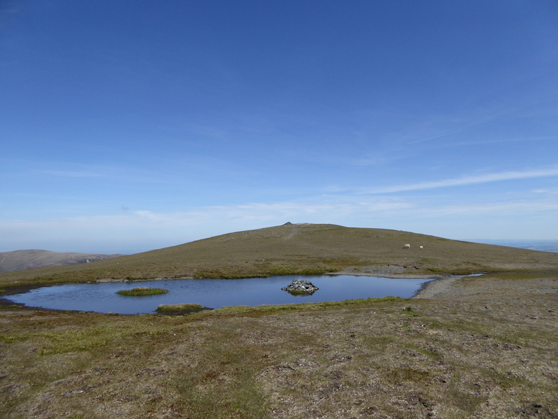
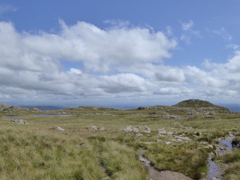
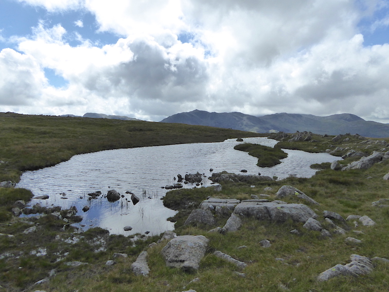
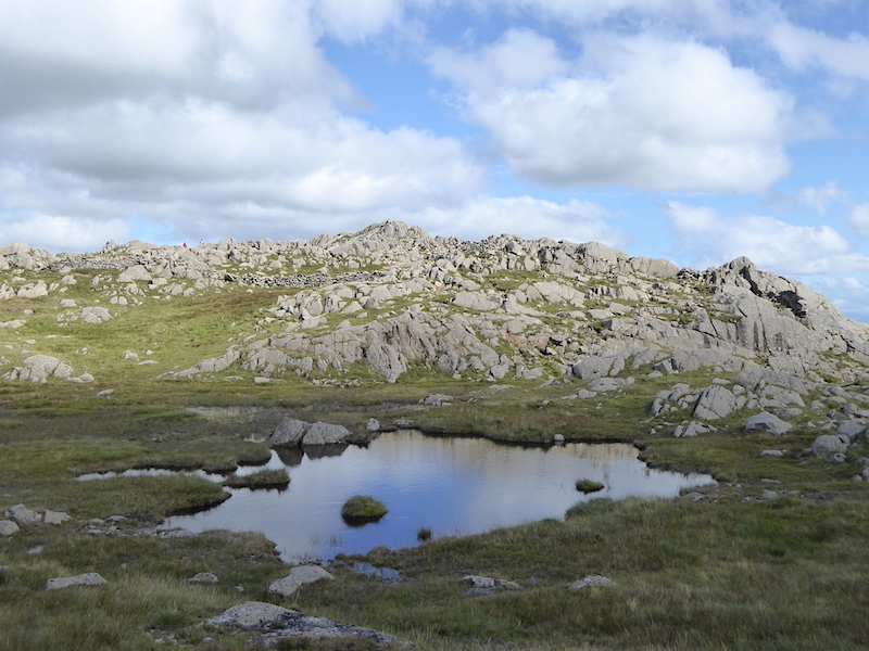
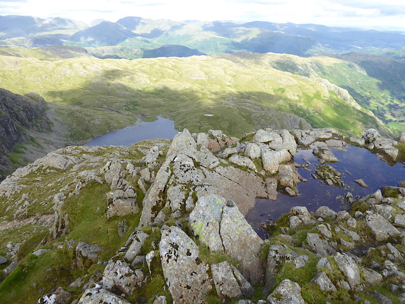
High Raise on the horizon from one of the many tarns across here, a strongish wind rippling the surface. It was more than a bit draughty across here.

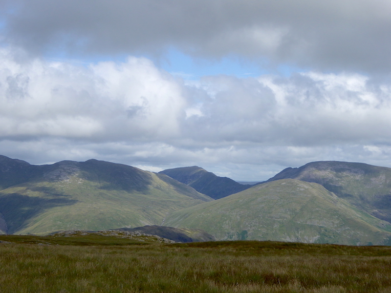
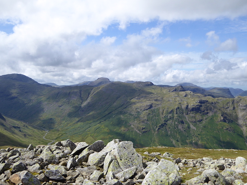
Great Gable rearing up like a hump back whale.

Yet another pool, this place is littered with them. The blue sky was most welcome but it was quite a bit chilly across here.

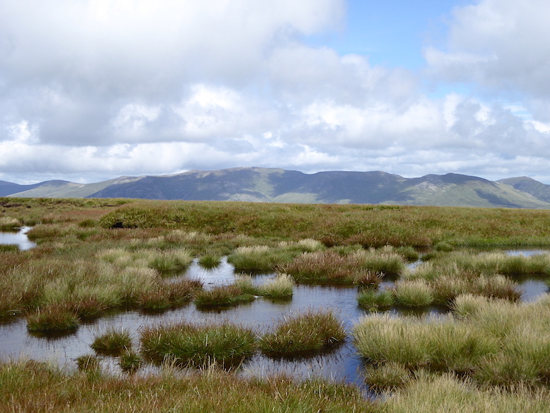
See what I mean about the pools? The Dodds and the Helvellyn range across the boggy pools, it seemed wetter than usual across here, no doubt helped by the heavy rain last night.

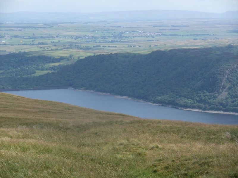
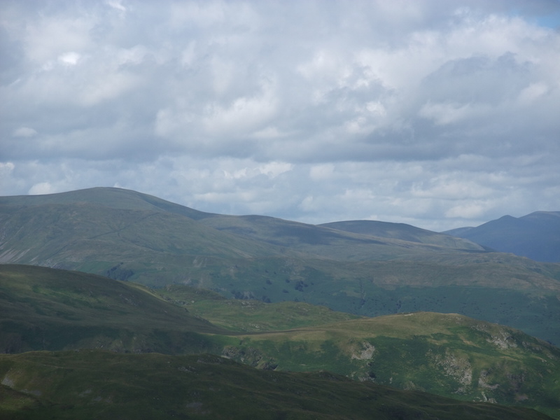
From High Raise, Skiddaw and Blencathra with a little bit of Bass Lake over on the left.

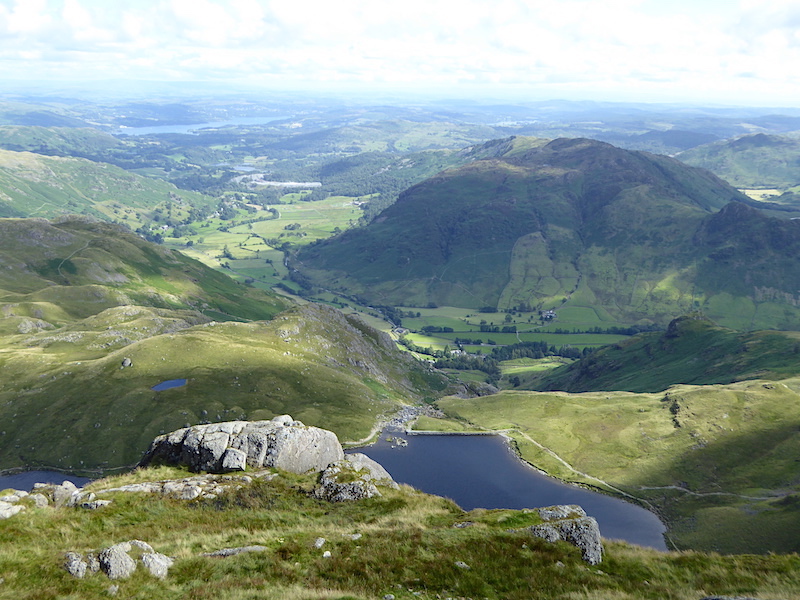
Looking down at Sergeant’s Crag, the rocky bit on the left, from High Raise with Bass Lake in the distance. What a fabulous view.

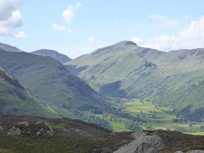
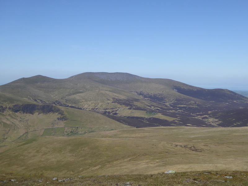
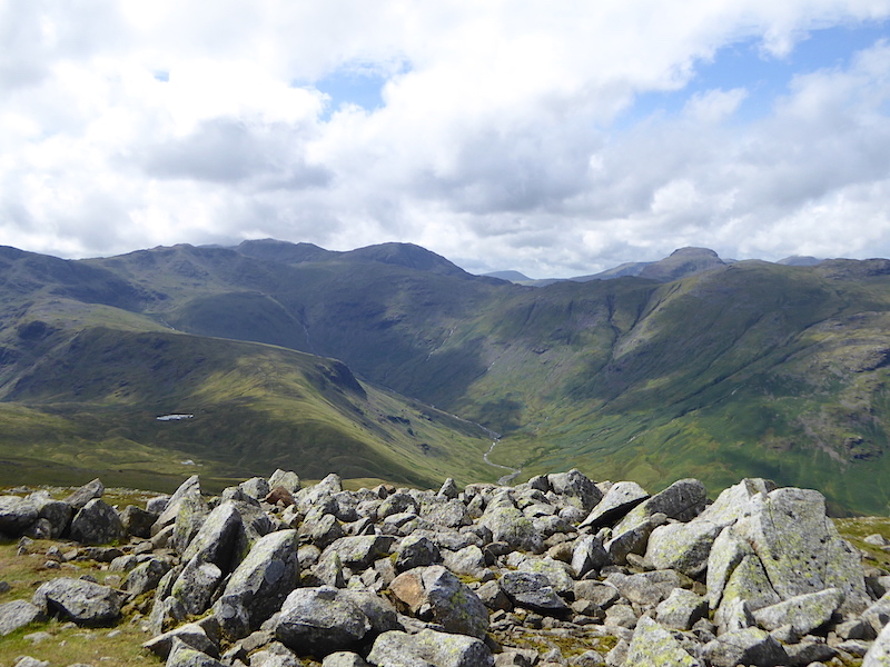
Mind you, the views to our left are just as good. Here we have the green covered slopes of the Glaramara ridge and all the fells beyond from High Raise summit.

Still on High Raise and now looking across the Glaramara ridge at the fells to the west. Bottom left is the lovely valley of Langstrath.

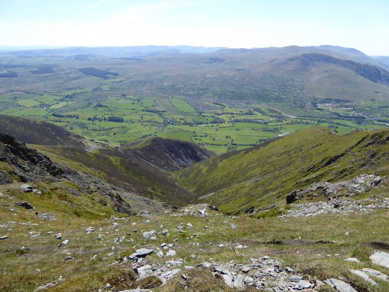
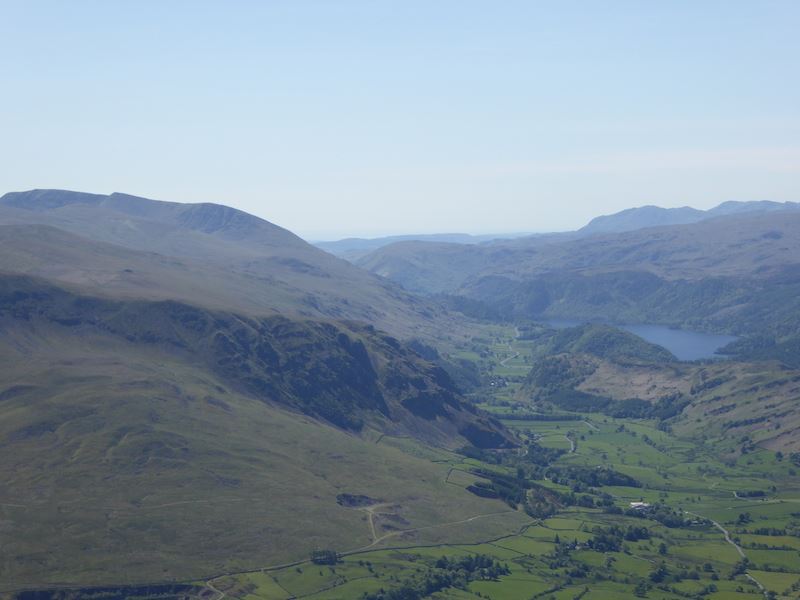
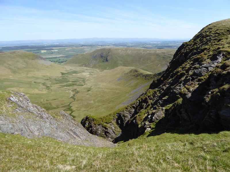
Looking into the head of Langstrath.

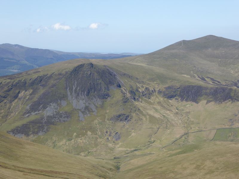
Bowfell taking centre stage with Crinkle Crags on the left and Esk Pike on the right. The Scafells on the extreme right behind Esk Pike.

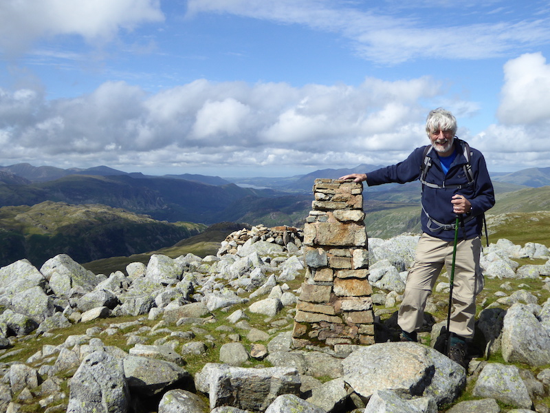
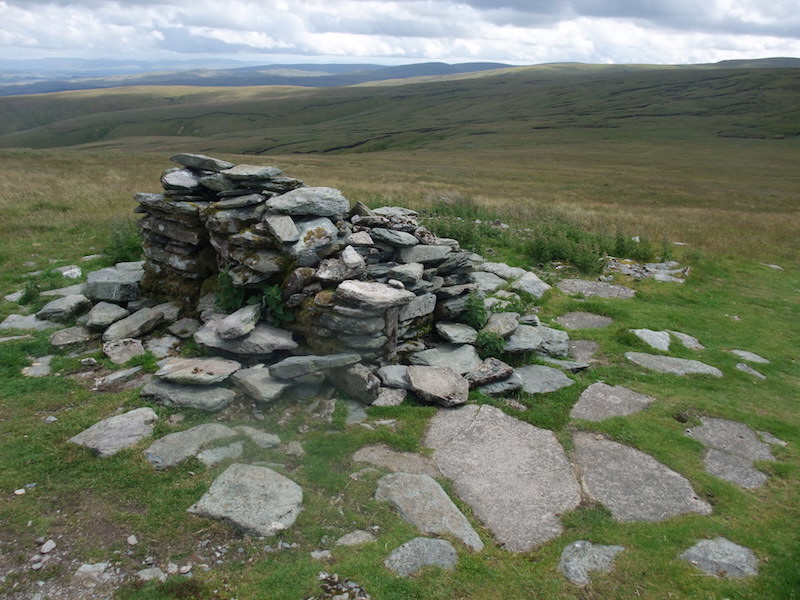
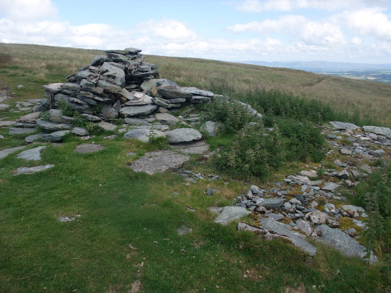
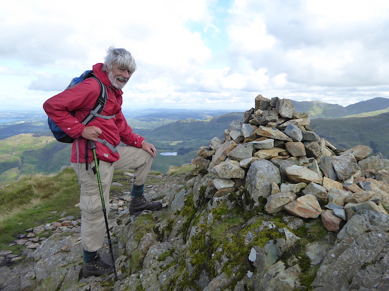
Back in the sunshine at High Raise trig column.

The wind dropped for a moment or two so no need to hold on to the hat. We had another chat here, this time with two men. They were climbers not walkers but had decided that things were a bit too wet to climb safely today so they had stowed their climbing gear in the car and opted for a walk instead.

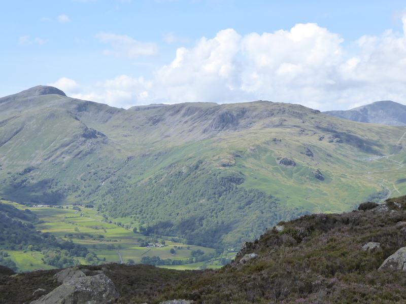
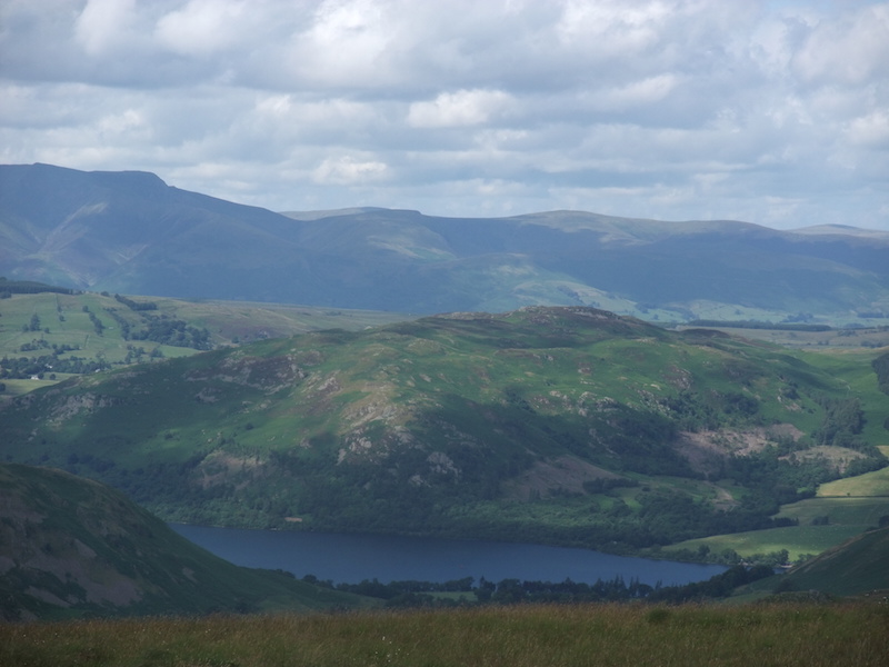
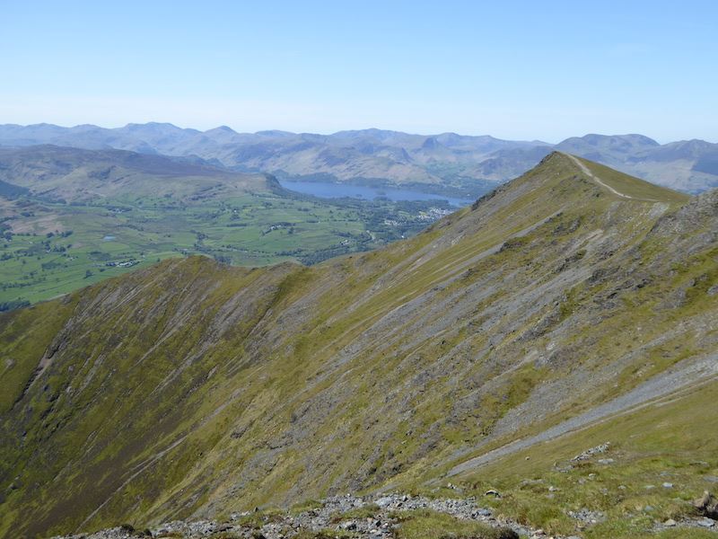
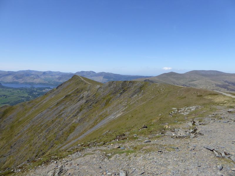
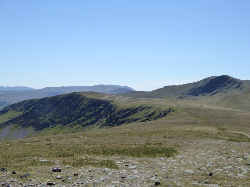
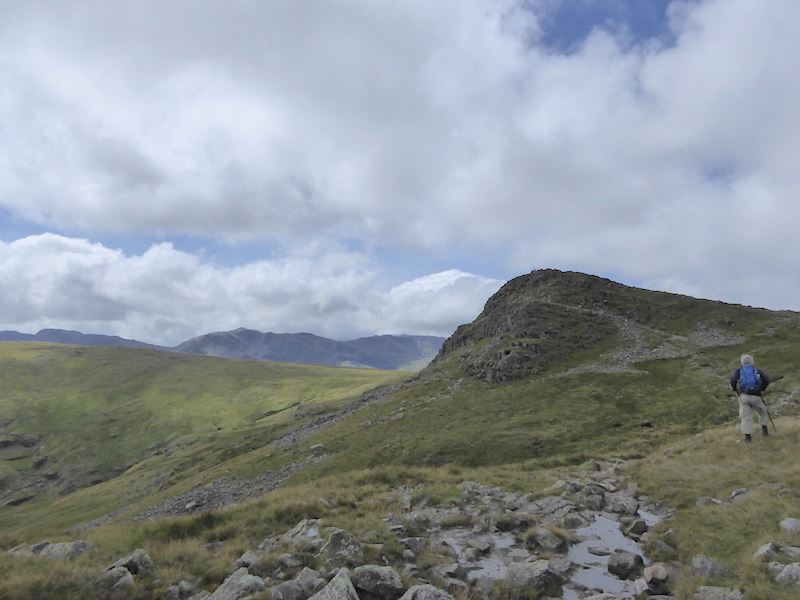
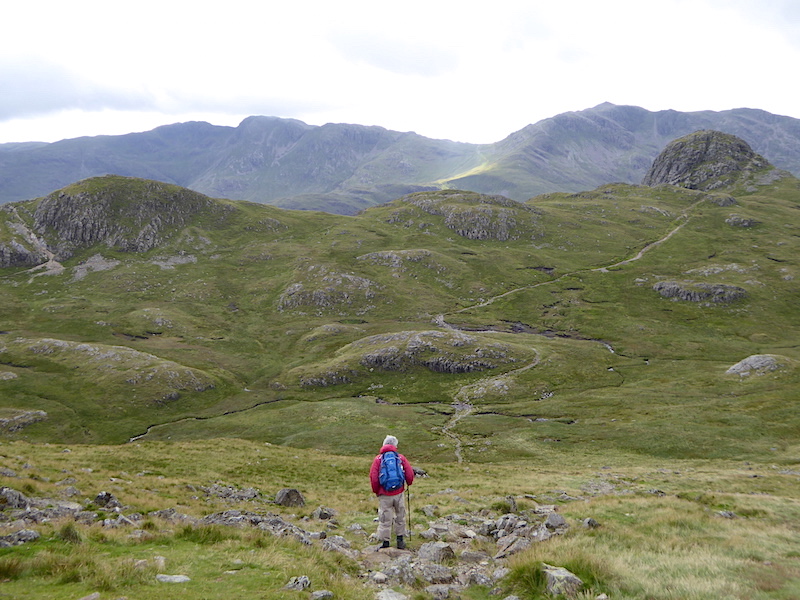
We’re now on the return leg from High Raise and not looking as fearsome as they do from Stickle Tarn, Pavey Ark on the left and Harrison Stickle on the right, showing their gentler sides.

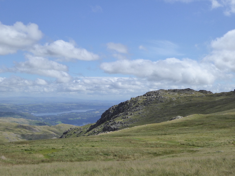
Approaching Pavey Ark with Windermere to the left of it.

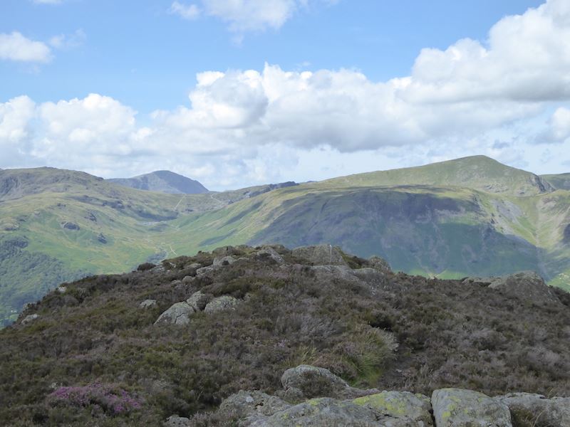
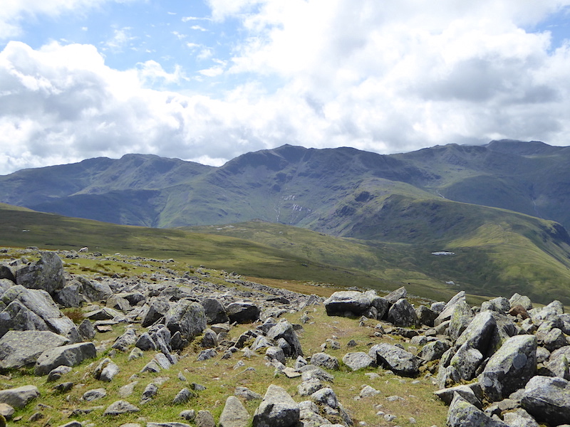
Looking back at Sergeant Man on the right, and on the left in the shade, is High Raise where we’ve just come from. Lovely grassy terrain for the most part and we were able to get into a good stride coming down from there.

A close up of Sergeant Man.

Beyond the tarn is Bowfell again. It turned very dark and very windy at this point.

Still under the cloud on Thunacar Knott, Harrison Stickle over on the right.

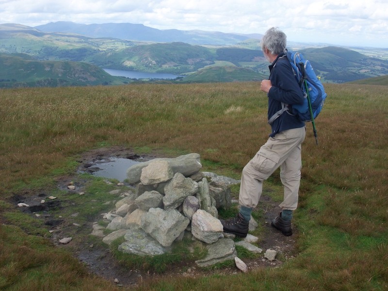
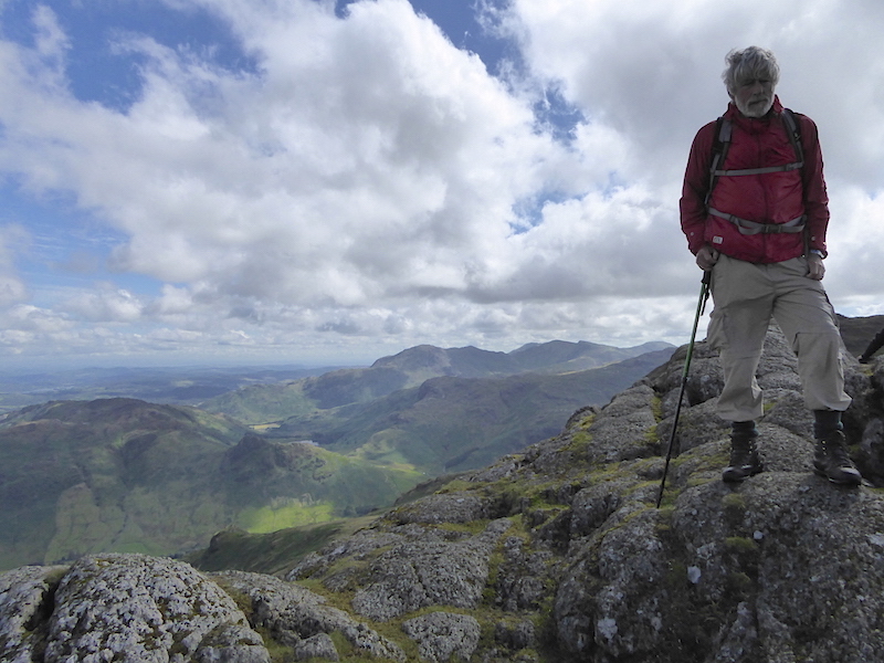
Thunacar Knott summit looking towards the eastern fells. The sun might be out again but that wind is a bit nippy hence the windproof jacket. My lower limbs could have done with a bit of wind proofing too ‘cos it was a bit parky up here, and I’m huddling against the sunny rocks to try and get a bit of warmth from them.

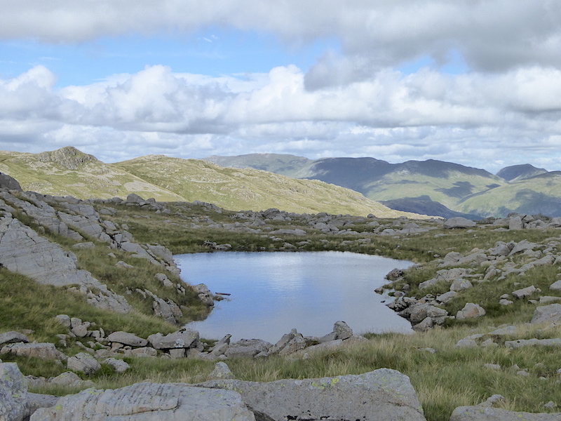
We’re making our way over to Pavey Ark, passing by one of the many pools found in the area.

Yet another pool as we near Pavey Ark summit.

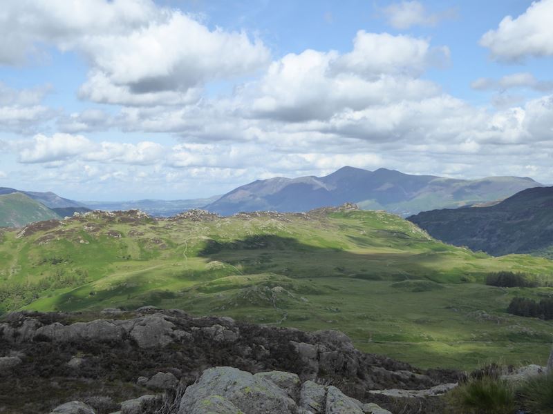
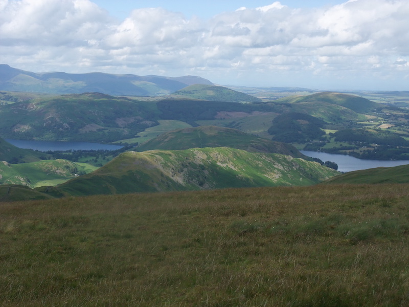
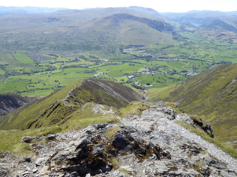
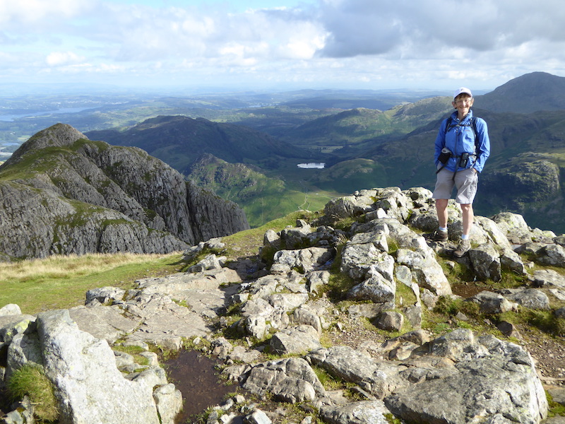
A view down to Stickle Tarn and beyond from Pavey Ark summit.

From Pavey Ark a close up of Harrison Stickle and the path we’ll be taking to get to it.

Pavey Ark summit. This was the best I could manage as two other inconsiderate sods were hogging the very topmost bit just to the right of the shot. It makes me really annoyed when people think they have the right to keep the summit all to themselves by spreading their gear and themselves all over it.

Righto then, now I’ve got that off my chest let’s go over to Harrison Stickle.

There’s a nice view of Stickle Tarn as we cross to Harrison Stickle.

Pavey Ark, on the left, towering above Stickle Tarn.

On Harrison Stickle summit looking down to Stickle Tarn and over to the eastern fells.

From Harrison Stickle a look back to Pavey Ark.

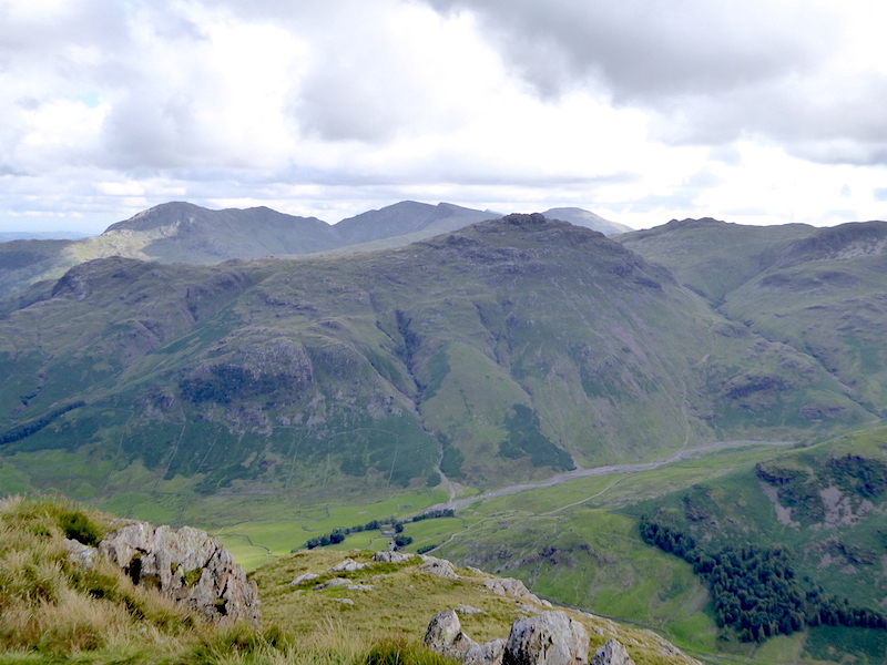
Bowfell on the centre skyline enjoying a spell of sunshine.

Well, seeing as we’re so near, we might as well go over to Pike O’Stickle and Loft Crag as well.

Looking back at Harrison Stickle as we make our way to Pike O’Stickle.

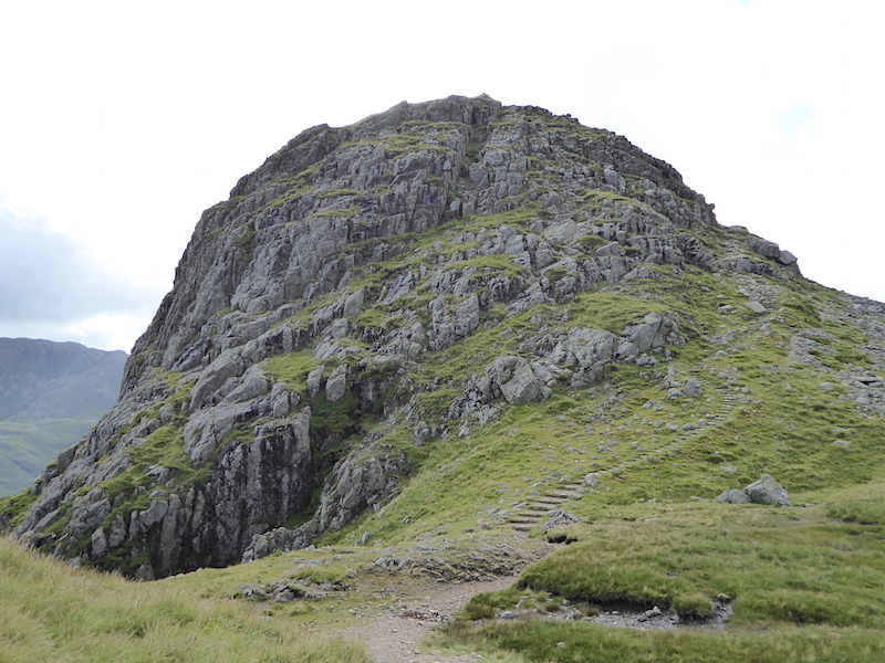
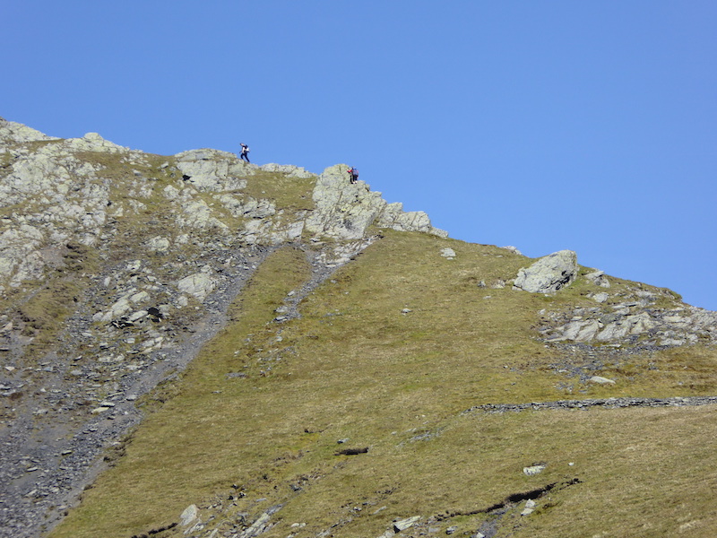
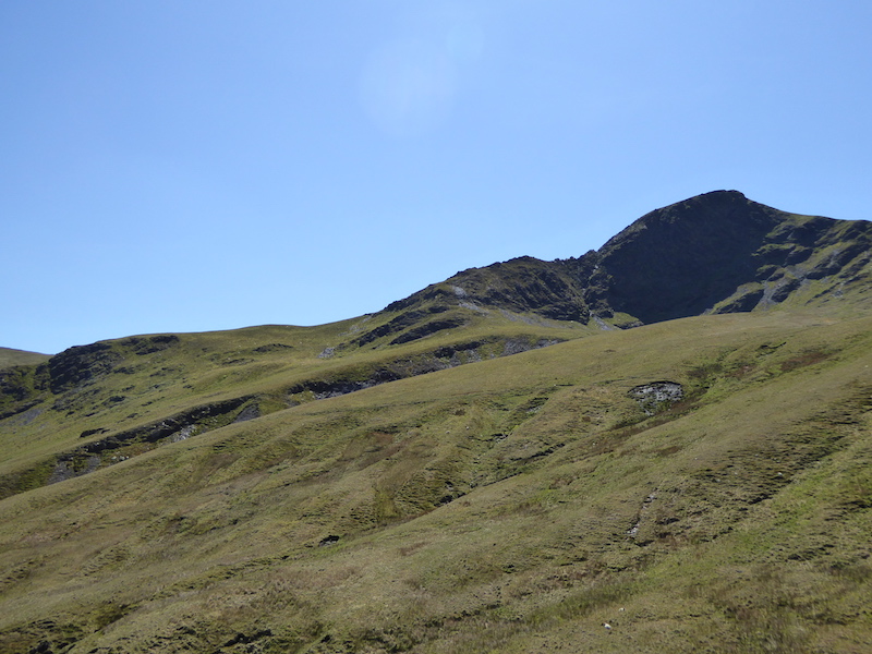
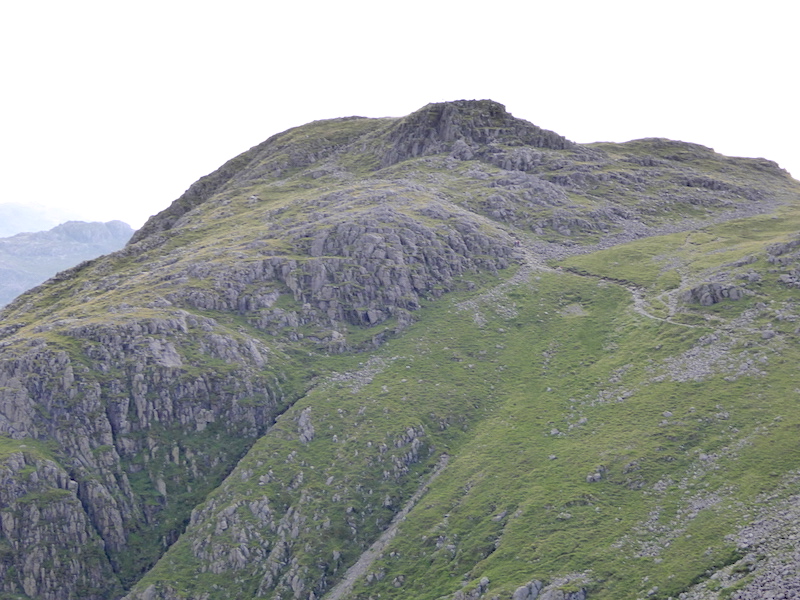
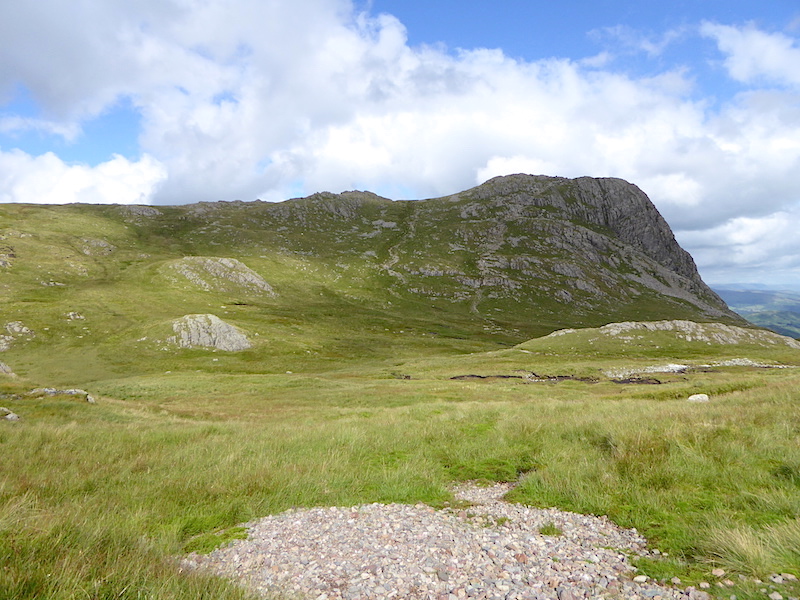
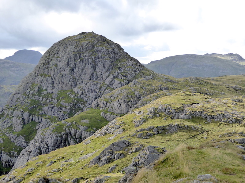
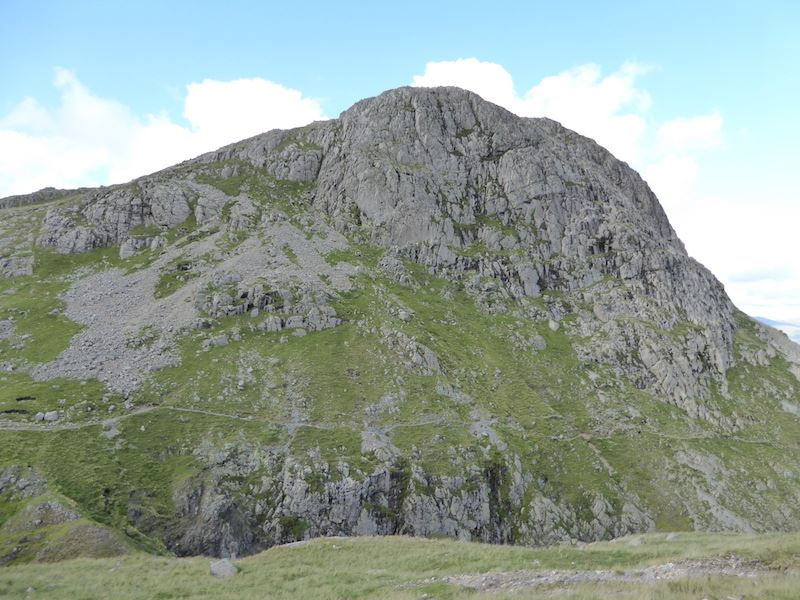
Approaching Pike O’Stickle and its not as fearsome as it looks, well not from this side anyway. Those steps don’t carry on all the way to the top, they end a bit further up the slope leaving just a roughish track.

The path ends at this gully, so its a left turn and then its just a very short scramble up to the top.

On Pike O’Stickle summit, Harrison Stickle on the left and Loft Crag on the right.

Its not as cramped as you might think on the top of Pike O’Stickle.

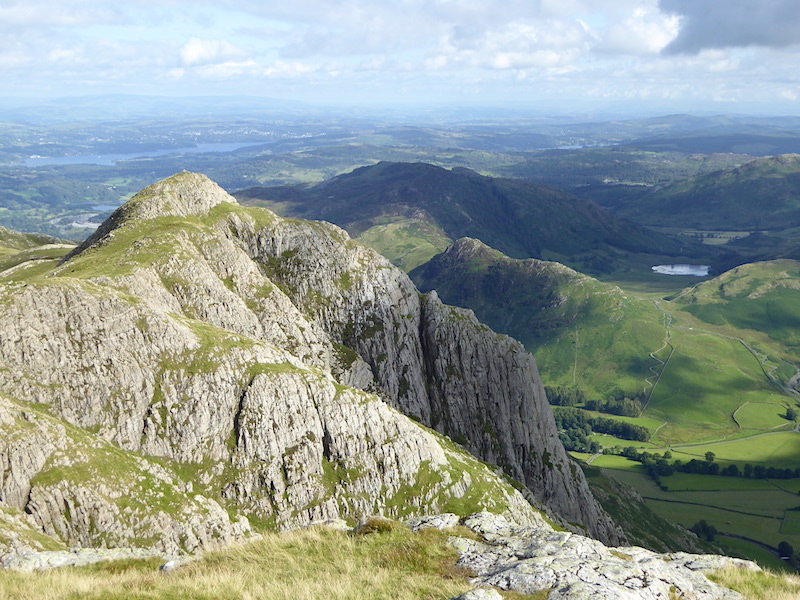
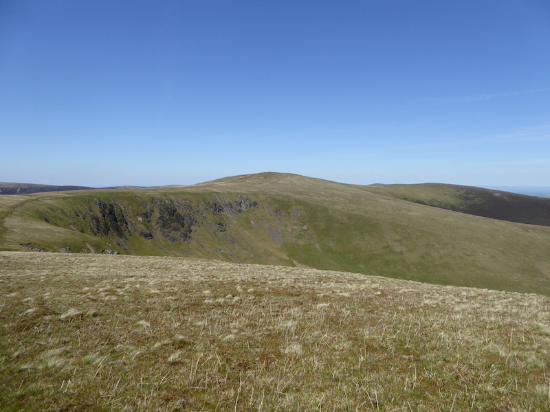
A close up of Loft Crag, the last fell on our walk today.

Harrison Stickle and Loft Crag.

Descending down the groove from Pike O’Stickle and a view of High Raise over Martcrag Moor.

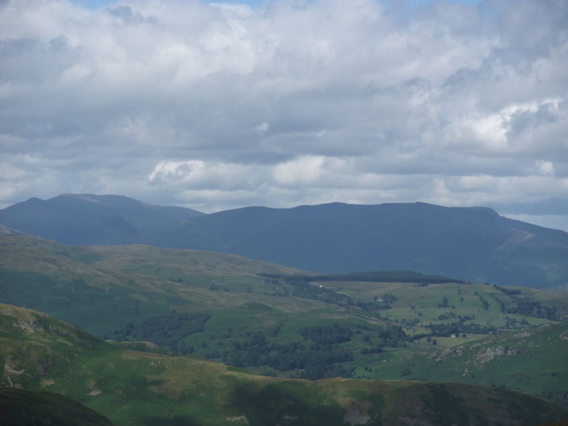
Skiddaw on the left skyline and High Raise under cloud on the right.

Making our way over to Loft Crag we pass one of the deep gullies beside Pike O’Stickle. Crinkle Crags on the skyline.

Loft Crag, the last summit of the day.

Loft Crag summit, so its downhill all the way from now on then.

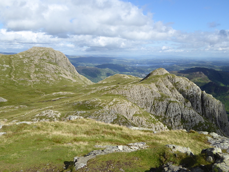
A look back at Pike O’Stickle from Loft Crag.

There’s a great view down into Mickleden from here, and up to Crinkle Crags on the left and Bowfell on the right.

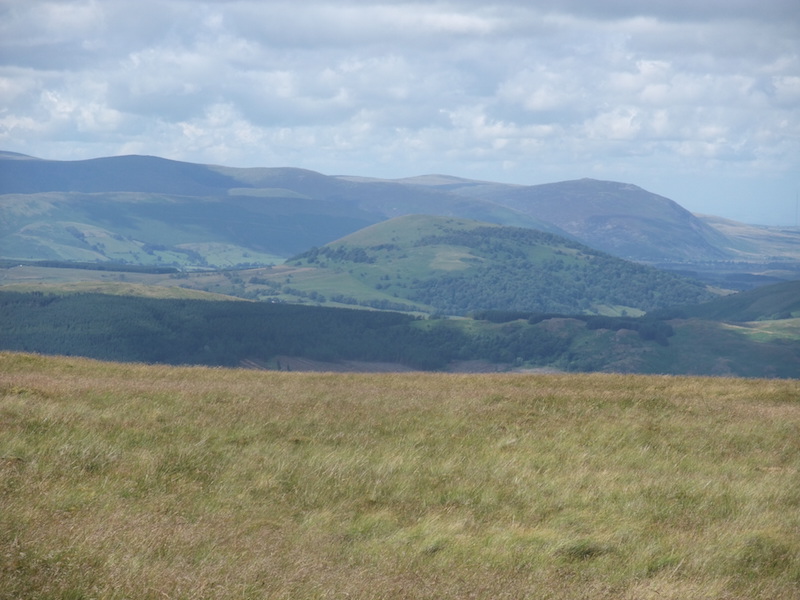
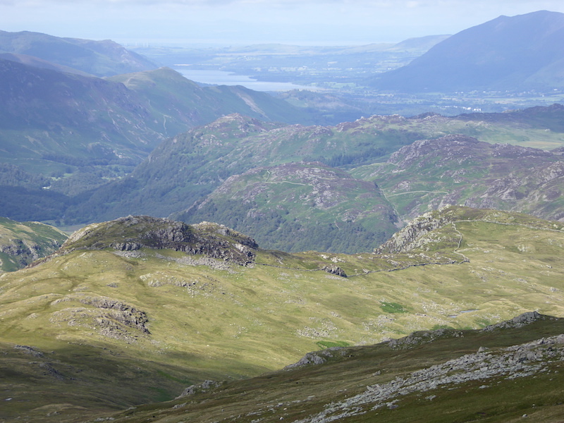
This is the view looking down into the Oxendale valley with Pike O’Blisco in the middle foreground, and the Coniston fells behind it.

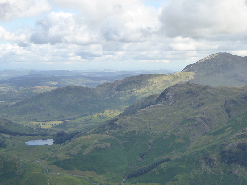
Over on the right is Coniston Old Man.

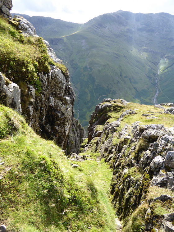
Harrison Stickle from our descent route. The path on the opposite side is not my favourite route down, it runs alongside a very steep drop down into Dungeon Ghyll, and I’m not good at very steep drops. The first time I walked on it I froze, just where it begins to cross over the rocky section in the middle. One minute I was walking OK, the next minute I just couldn’t move. I managed to get across at the second try but it was touch and go for a while. Matters weren’t helped by the fact that a helicopter had arrived, to carry out a rescue for some walkers stuck on Jack’s Rake, and was making quite a din just beyond us.

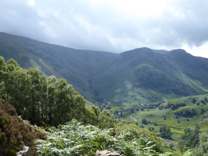
Great Langdale down below us as we start to descend.

Looking back up at Loft Crag on the left and Harrison Stickle on the right.

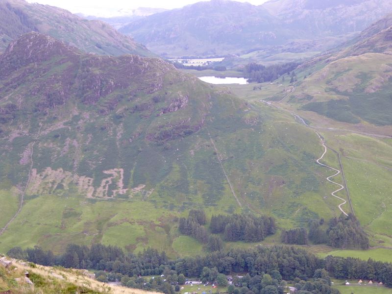
A closer look at a newish zig zag path at the lower end of Side Pike. Its been a while since we came down here so I’ve no idea how long the path has been here.

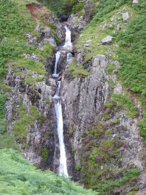
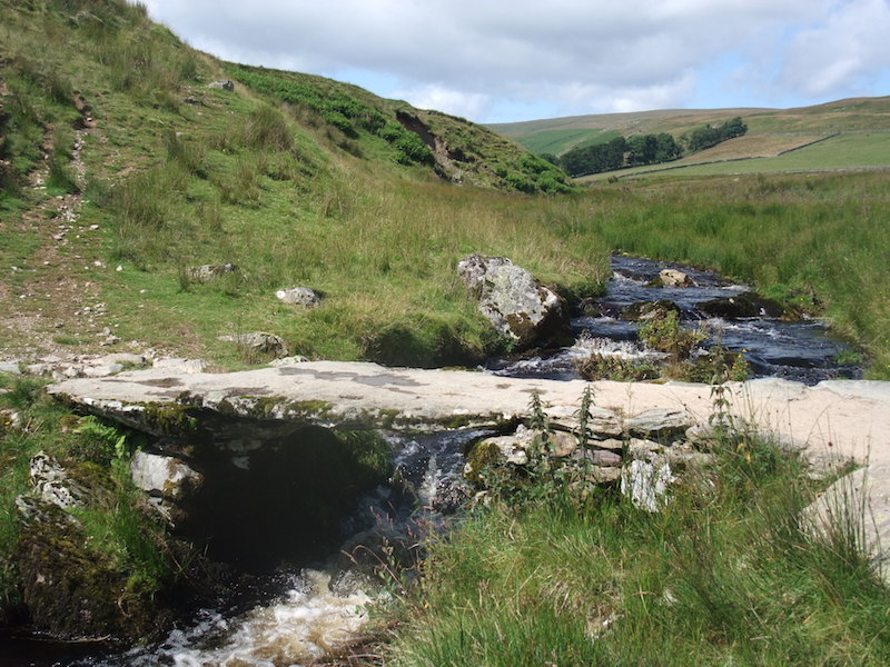
Waterfalls in Dungeon Ghyll.

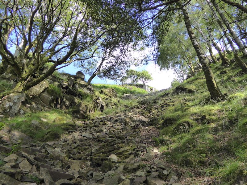
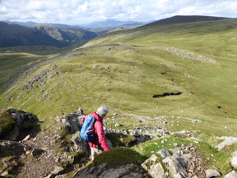
Crossing Dungeon Ghyll at the end of a very disagreeable descent. We’d not been down this route before and it must count as one of the most tiring and trying descents we’ve ever done. Perhaps we were just weary from the long walk we’d just done, but it was a very awkward path to come down, gravelly bits which slid away underfoot, pitched paths with downward sloping stones, many of which were wet and slippery so a lot of care was needed, bits of path which were eroded and muddy, wet grassy bits which were lethal if you weren’t ultra careful and so it went on and on and on. I thought we’d never get to the bottom. I think this section took more toll on our legs than the rest of the walk put together. Note to self – do not use this as a descent route ever again.

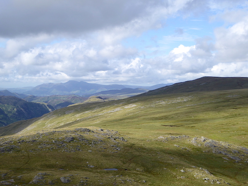
A last look back up Great Langdale before we get back to the car and head for home.


Wether Hill and Loadpot Hill

Walk Date – 1st August 2015

Distance – 7.1 miles

Weather – cloudy start, then fine and dry with a brisk south westerly


Route

We parked up near Moorahill Farm just above the village of Bampton and headed off towards the slab bridge over Cawdale Beck. We thought the two horses over there would start walking towards us, or away from us, as they usually do, but no, they just stood there apparently watching us. Behaviour which we thought was a little odd.

It soon became apparent why they were so immobile, they were having a morning nap. We walked right up to them, I took this photo and even the click of the camera shutter didn’t disturb them. They made no movement whatsoever and were still in the same position when we looked back after we had walked some distance away from them.

Other members of the herd were too busy eating to pay us much attention, this lot never even looked up as we passed by.

Over there is Moorahill Farm, the tarmac road ends at the farm so its our start and finish point today.

An old slab bridge across Cawdale Beck, also known as a clapper bridge.

There was a lot of rain last night so Cawdale Beck has plenty of water in it today.

A look back at the bridge as we climb up Towtop.

On Towtop looking into Cawdale.

Onwards we go, now heading for Hause End. It looks like there’s a fair bit of bracken up there.

Notice at Hause End from the Park Authority directing walkers to the slab bridge in order to avoid the ford over the beck. We have walked up the right hand path marked on the plan, so now you know where we are and where we came from.

Beside the notice the signpost pointing walkers in the right direction for the clapper bridge.

A look back over our route so far, with a view of the Pennines in the far distance.

A pile of stones, its marked on the OS map, and indicates the way to Low Kop. How long has it been there, who put it there? Who knows, but such indicators are useful in finding your way over such huge expanses of largely featureless moorland.

In the groove and heading for High Kop. This groove is another useful indicator of where you are, every little helps, as they say.

If you want a bit of peace and quiet this is the place to be, its not exactly crowded is it? I think the track is more the result of wheels rather than feet but its handy to follow as it keeps you out of the long, and in today’s case, wet grass.

On the skyline to the right is the flat top of Branstree.

A look back down at Haweswater now we have the height to see it. The area we are walking in today is right at the far eastern edge of the Lake District National Park and as you can see, beyond here there is no more high ground until you reach the Pennines over there on the horizon. The flat area in between is the Eden Valley.

We eventually reach Keasgill Head which gives us views of the fells to the west of us. The flat top of Fairfield is in the centre and on the right is Saint Sunday Crag. Angle Tarn Pikes just catching some sun towards the bottom right. I’m always intrigued at the dramatic change in the landscape and wonder how the rolling moorland that we’ve just been walking can turn so abruptly into this. Maybe I didn’t listen hard enough at school. Perhaps if I knew the answer some of the wonder of it all would be lost, so maybe in this case, ignorance is bliss!

Unfortunately we didn’t have a shilling for the meter so its all a bit hard to distinguish since the light went out, but on the skyline from left to right are Dollywagon Pike, Nethermost Pike and part of Helvellyn, Below and in sunshine is Beda Fell.

I turned a little to my right and now the plateau of Helvellyn is the highest point on the skyline with the pointed peak of Catstycam to the right of it, with Raise between them. Over on the right skyline is Stybarrow Dodd.

A little further to my right and now we are looking over Place Fell to the Dodds range.

Further to my right still and on the left skyline is Stybarrow Dodd and over on the right is Great Dodd.

On the left is Great Dodd leading across to Clough Head and the beginning of the Skiddaw range on the far right.

On the left skyline is the Skiddaw massif and over on the right is Blencathra. These two together with all the fells beyond them are in the northern fells category.

Blencathra is now over on the left with more of the northern fells to the right of it.

Looking towards the easterly end of the northern fells with Carrock Fell in shade on the right skyline and to the left of it and in the sunshine is High Pike.

Part of Ullswater down below us with Gowbarrow Fell immediately behind.

If you take a line from bottom to top straight up the centre from where I’m standing firstly you have Steel Knotts, then Hallin Fell, behind Hallin Fell are the wooded slopes of Swinburn Park, then Great Mell Fell and lastly Carrock Fell.

Looking over Ullswater from Wether Hill summit. Not to be confused with “weather” and “whether”, a wether is a ram or billy goat which was castrated when young.  I have no idea of the connection, if any, between that procedure and this fell.

Moving swiftly on, there’s Blencathra on the skyline with Ullswater down below.

We’re now making our way along to Loadpot Hill. In the middle foreground is the dark mass of Rest Dodd, on the left, leading down to The Nab on the right.

Looking back at the route from Wether Hill on the way to Loadpot Hill.

The remains of Lowther House, a former shooting lodge on the Lowther estate, with a couple of shots of it from different aspects …..

An estate boundary stone, this side is Lowther land, hence the L …..

….. and the other side of the boundary stone, marked with an M for Marshall. Territorial weren’t they?

On Loadpot Hill and looking over Great Mell Fell to some of the northern fells.

The trig column on Loadpot summit, its still windy as you can see from the ripples on the puddle.

From the trig point a look back at the path we’ve just walked along.

Moving down towards The Pen from Loadpot Hill.

Carhullan – a holiday let, sleeps 10. If you want to know how much a quick search will tell you, make sure you’re sitting down.

The clouds may have thinned out a little but it was still very windy, as demonstrated by the wool on the fence.

Here we are back at Moorahill Farm and the end of our walk. It turned out to be quite a nice afternoon after that cloudy start, although the wind persisted throughout the day and gave us a bit of a buffeting from time to time.


A wander round Wet Sleddale Reservoir

Walk Date – 15th July 2015

Distance – 2.8 miles

Weather – fine, dry and sunny with a cool breeze


We shouldn’t have been here today but having mixed up the dates of my dental appointment, which is tomorrow and not today as I had thought, it was a shame not to take advantage of a sunny afternoon. That means the walk we had planned for tomorrow (Thursday) up to the Langdale Pikes will now have to wait for another day.


Route

Wet Sleddale reservoir from the car park.

Wet Sleddale information board, courtesy of United Utilities.

Looking towards the dam end of the reservoir.

Cattle just watching us, and the world, go by, laid back and enjoying the sunshine.

Cotton grass blowing in the breeze.

A look back along the length of the reservoir with a view of the Pennines on the far horizon.

The view along Wet Sleddale.

Making our way down to the bridge to cross Sleddale beck.

Another look back along the reservoir. More of the Pennines can now be seen in the distance.

Down at the bridge over Sleddale beck.

An attractive little set of falls can be viewed from the bridge.

Looking across the reservoir and its very noisy flock of Canada geese.

On maximum zoom to get a close up of the geese. There were hundreds of them, no wonder it was so noisy.

A view across Wet Sleddale looking towards Sleddale Pike.

This old wooden cart has seen better days, but I’m sure it was once somebody’s pride and joy.

Wanted – a DIY enthusiast to put the cart back on the wheels.

As we walked down to the reservoir we came across this young Canada goose on the wrong side of the fence …..

….. hissing at us …..

….. and trying to find a way back.

It still can’t find an opening, that’s because there wasn’t one anywhere near here.

Trying again, OK up to the shoulders, but no go after that.

There must be a way through, how else would I be on the wrong side? Let me just think for a minute.

I know what, I’ll try lower down, maybe that’s where I got in.

The only opening was a gate about 100 yards along the fence so we tried shooing it along towards it …..

….. but it turned round and tried to go back the other way along the fence again, so we just kept shooing it along and eventually got it through the gate. A short waddle down to the water and off it went to the others. Anyone watching from the path further back would have wondered what the heck we were doing. All they would have seen would have been the pair of us dodging back and forth and flapping our arms in the air as the goose would have been too low down to be seen. Anyway, good deed done for the day we continued on on our way.

The scent of the newly cut grass was lovely as it drifted across on the breeze. All that was needed now was the sound of leather on willow, some polite applause and tea and cakes. England on a summer’s day.

Mum’s too busy eating, she’s seen walkers before, but the little one took a keen interest as we passed by.

Down to another bridge to cross back over the river.

Down at the bridge.

The river gently making its way through the countryside. Not Sleddale Beck any more, its now the River Lowther, at what point did that happen?

The view up river from beneath the bridge. I didn’t take any photos from this point as we had now turned back towards the car park and so the views were the same ones we’d had when we set off. An unplanned and off the cuff afternoon walk in an area near to home, with a little moment of drama thrown in. Sometimes those kind of walks turn out better than expected. Hope the young goose was no worse for its little adventure and made it back to the flock without further mishap.


Sour Howes and Sallows

Walk Date – 9th July 2015

Distance – 8.2 miles

Weather – dry, cloudy start, brighter later, light northerly breeze


Route

(the outward route is in red and the return is in blue)

The Garburn Road at the start of the walk.

Higher up the path the view opens up and we see the lovely Troutbeck Valley.

We leave the Garburn Road via this stile and make for the next stile in the far wall over to the right.

A view of Wansfell beyond Troutbeck, the stile we have just used is down at the lower right corner of the photo.

The long …..

….. and the short of it at the second stile. We’ve left the Garburn Road down below and we are now on the Dubbs Road.

Immediately behind us is a third stile, once again, long on this side …..

….. and very short on the other. I was hoping to get all three stiles in the shot but didn’t so these two will have to do.

Climbing the hillside from the stile in the previous photo with the Troutbeck Valley over to our left.

A close up of Dubbs reservoir which was over on our right, we’ll be along there later on.

A view up to the summit of Sour Howes.

The Dubbs Road continues along down there just beside the trees, The high fell on the centre skyline is Red Screes which is just beginning to come into view.

The light went out on Wansfell for a while so I zoomed in on the Scafell range in the distance.

The Coniston Fells.

The light got switched on again over Troutbeck which afforded a better view of Wansfell. Nanny Lane on the left looks different, new surface maybe.

Windermere, it makes a change to have a decent view of it for once.

A close up of the southern end of Windermere.

Getting closer to the summit of Sour Howes.

Approaching the top of Sour Howes.

A very welcome sit down on Sour Howes summit.

A close up of some old quarry workings which I noticed opposite us on the lower slopes of Sallows.

From Sour Howes a view of the western section of the Kentmere Horseshoe, Yoke on the right, then Ill Bell and just visible behind Ill Bell, the peak of Froswick.

Over on the left of the skyline is Red Screes, with Stony Cove Pike under some cloud over on the right. From this viewpoint it looks as though you could stroll across from one to the other, but you can’t because the Kirkstone Pass runs between them.

We’re now making our way over to Sallows. No great navigation skills required as its simply a matter of following the wall.

Wall work in progress. Flask at the ready, a radio for company. Nice day at the office.

I take a look back at Sour Howes as we follow the wall round to Sallows.

Across the stile en route for Sallows we pause for a look over at Red Screes and Stony Cove Pike.

The rather unimpressive top of Sallows, the views make up for it.

A view of the path up to Yoke from the top of Sallows.

Sallows summit mound.

From Sallows top looking over at the eastern part of the Kentmere Horseshoe. Shipman Knotts with cloud shadow, then Kentmere Pike and well over on the left is Harter Fell.

Yoke on the left and Harter Fell over on the far right.

Back down to the Garburn Road now and a look back at Yoke before we leave.

We have a view of the Coniston Fells all the way down the Garburn Road.

We left the Garburn Road at the junction and continued along the Dubbs Road, on the left is the route we took up to Sour Howes earlier.

A look back along the Troutbeck valley, the scene constantly changing as the clouds moved over the landscape.

We’re a good way along the Dubbs Road now and approaching Dubbs reservoir.

It wasn’t possible to get any closer, there were lots of ‘Keep Out’ notices, dire warnings about adders on the loose and a group of United Utilities employees on site just over to my left. Training course size group I would think. Of course we wouldn’t ever have thought of trespassing even if all of the above restrictions hadn’t applied, now would we?

From Dubbs we walked over to Borrans reservoir where there were no keep out signs, just notices reminding people not to swim, much better approach I thought.

Not much activity at the Borrans Activity Centre.

Not as qiuet and peaceful at Borrans as you might think …..

….. it was ‘head ’em up and move ’em out’ time. Non stop shouts of ‘gerrup ower theer’ and ‘gerr’arn’. Wonder if the men will have any voices left tomorrow?

The sheep have been gathered in and peace broke out again, here I’m looking over the reservoir towards Sour Howes.

The dam wall of Borrans reservoir, with the overspill channel on the right of the picture.

No, she’s not stuck, she’s just having a scratch. I think that fleece ought have been sheared off by now.

Having sorted out the neck area she moved on to deal with the back. The fallen tree stump is so well used its surfaces have been rubbed smooth.

Another look at the Scafell range, with the Langdale Pikes on the right, as we walk back along the Moorhowe Road. The verges, bankings and hedgerows contained a staggering variety of colourful wild flowers, wild roses, meadow sweet, buttercups and so on, most of them I didn’t know the names of, but the scent of them in the light breeze was lovely. The views of the fells in the distance were an added bonus.

Here we are, back in Troutbeck exactly six hours after we left it. A good walk, no crowds and in some lovely countryside, on a very fine day. A little less breeze from the north would have been preferable, but I’m not complaining, the sun was out and it didn’t rain, you can’t ask for much more than that.


Rydal Water and Grasmere

Walk Date – 2nd July 2015

Distance – 6.1 miles

Weather – overcast and cool


The heat has gone and the cloud has returned so for the time being we are back to an English summer. Undeterred we don shorts and t shirts and drive to Grasmere for a low level walk around the waters of Rydal and Grasmere. The cloud was very low this morning, very nearly at ground level so we waited in the car for a while until we could at least see the surrounding scenery. Not windy and not really cold but very much cooler than the last two days have been so the conditions were more comfortable for walking.


Route

Shortly after we started walking we passed this house, Dove Cottage, a former residence of William Wordsworth.

Walking up the back lane out of Grasmere. Dove Cottage stands to my left at the bottom of this lane,

The coffin stone along the way …..

….. and the accompanying information.

How Top Tarn, no water visible now that it has become so overgrown.

Another almost silted up tarn, variously known as White Moss Tarn, Wordsworth’s Tarn, or Skater’s Tarn since the afore-mentioned Mr Wordsworth used to skate on it.

The irises looked lovely against the lush greenery. Rhododendrons and irises everywhere along here.

Further along the coffin route we get the first glimpse of Nab Scar.

Looking up Dunney Beck, an alternative route up to Alcock Tarn, though probably best used when the bracken isn’t so high.

Loughrigg Fell below a very gloomy sky, not at all good for photos today as the light was quite poor.

A close up of Loughrigg Fell.

We start to descend to Rydal below the crags of Nab Scar.

The A591 below us, busy as ever, but up here things were much more peaceful.

A view of Loughrigg Fell over Rydal Water.

Over on the horizon is Wansfell.

A fallen tree loking like some pre-historic creature emerging from the undergrowth.

Looks like the Dead Tree Decoration Society has been busy again. Why do people hammer old coins in dead tree stumps, I just don’t get it.

Rydal Church.

Pelter Bridge.

Rydal Water from the path to the quarry. Not a patch of blue sky anywhere today, plenty of dog walkers though.

Yes, its definitely given up the ghost so the Dead Tree Decoration Society could be round very soon.

Nab Scar across Rydal Water. The bow wave near the shore was made by two ducks, the three bow waves on the right were made by wild swimmers of the human variety.

Looking north along Rydal Water.

Reminders of quarrying in years gone by.

There are some big holes around here.

This is the biggest one I think, it stretches quite a long way back too.

Its possible to go right inside the cave using the stepping stones, or by clambering over the rocky section on the right.

Cave reflections.

Dozens of tiny fish were swimming around in the shaded area just beneath the tree.

Lots of people were in the area but hardly anyone bothered to come to the cave. Perhaps the steep hill up to it had something to do with the lack of visitors.

Helm Crag and Steel Fell over on the left are now clear of cloud, Seat Sandal over on the right is still shrouded.

Looking over Grasmere to Silver How.

Looking north over Grasmere, with the familiar U-shaped gap of Dunmail Raise over on the right.

The view along Grasmere from our lunch stop.

Looking over Penny Rock Wood to a cloud free Seat Sandal and a view along Dunmail Raise.

Although those clouds look ominous, it didn’t rain, it wasn’t cold and it wasn’t windy, and that was as good as it got today.

Looking over the weir to Silver How.

Along the shoreline of Grasmere, only a few here today, give it a couple of weeks until the school holidays and then this place will most likely be packed.

A grey day in Grasmere but it wasn’t deterring two determined ladies who were donning wet suits back there on the beach in readiness for their open water swim.

A look back at Loughrigg Fell as we move along towards Grasmere village.

A tree trying to stand out from the rest.

Silver How across the meadows.

Grasmere Church.

Crossing the field to the lay-by and a view of Seat Sandal on the left and Stone Arthur on the right.

Behind us is a view of Helm Crag and Steel Fell. Well it wasn’t the best of days but nevertheless it was an enjoyable low level walk.


A Borrowdale Ramble to Castle Crag

Walk Date – 30th June 2015

Distance – 6.2 miles

Weather – hot and humid with sunny spells


We had a low level and relatively flat walk today, chosen with the hot and humid weather in mind, and started out from Rosthwaite for a ramble around Borrowdale.


Route

A view looking across to High Scawdel from the bridge at Rosthwaite, although the village itself is on the other side of the bridge and across the road from here.

Looking back along the pleasant woodland path beside Stonethwaite Beck. The bridge in the previous picture is at the far end of the path.

Looking towards Rosthwaite Fell across Stonethwaite Beck.

Looking across to High Doat (covered in trees) and High Scawdel (covered in sunshine) from the beck side.

Stonethwaite village nestling below the slopes of Rosthwaite Fell.

Looking along the valley with Eagle Crag in the middle of it. As we approached the bridge we witnessed the following …..

“Oh, oh, I’ve been spotted, I’d better get out of here before I get into trouble!”

“This is my third try, I don’t know why its so difficult to get out, I got in easily enough.”

“I don’t think anybody noticed so I should be OK.”

“I’ll just quietly wander back across and pretend it never happened. I just hope that walker over there with the camera doesn’t come over and tell Mum or I’ll really be in for a talking to.”

We crossed over into Stonethwaite after all the amusement and continued on our way.

Greenup Edge and Eagle Crag are on our left as we walk along the lane into Stonethwaite.

Passing by one of the cottages in Stonethwaite village.

The lane leading out of Stonethwaite.

Borrowdale church gate.

Around the corner from the church we get a view of Base Brown, that’s the one to the left. To the right of it are Brandreth and Grey Knotts. The bowl shaped area between them is the hanging valley of Gillercomb.

We’ve taken a right turn off the path by the wall there and are crossing the field to join the road. Over there is Rosthwaite Fell.

Still crossing the field but now looking across to Grange Fell. Its two high points are, Kings How on the left and Brund Fell on the right.

A bit of road walking along to Seatoller, with Thornythwaite Fell to the left and Combe Head above it on the extreme left. Base Brown is over on the right.

From the Seatoller road looking across to Rosthwaite Fell.

  Sunshine, whitewahed cottages and lots of flowers in Seatoller.

A potted history of Seatoller set in the wall by the bus turning point.

Looking back at the view as we take the path out of Seatoller.

A close up of Great End rising beyond Seatoller Fell. It was now very warm and muggy beneath those clouds.

We’re now on the path below HIgh Doat and on the skyline on the left are the peaks of Low Saddle and High Saddle with Ullscarf further along.

In the centre is Thornythwaite Fell with the rocky outline of Combe Head just behind it.

These two were panting furiously to try and cool down, and they weren’t the only ones feeling the heat. Humidity was high today with only the occasional breeze.

Very hazy now over Great End and very warm walking up here too.

Hints of blue sky appearing over Seatoller Fell.

Looking back at the path we have been following, not at all steep but there was still lots of brow mopping thanks to the energy sapping humidity.

Alongside the trees are the road and path to Honister. The mine buildings are just visible at the bottom of the sunny patch on Grey Knotts.

We take a break on the slopes of High Doat and enjoy the view down to Castle Crag with Grange Fell to the right of it. Its a nice view so I took a close up of it …..

Also from our perch on High Doat, a view over to our right of Brund Fell with High Seat in the distance …..

….. while to our left we have High Scawdel for company.

Between the slopes of Low Scawdel and Castle Crag is a glimpse of Derwentwater with Skiddaw in the background.

After our break we join the Allerdale Ramble path. On our right there’s a glimpse of Rosthwaite below the slopes of Great Crag. Low and High Saddle and Ullscarf are on the right skyline.

Approaching Castle Crag but can we get across to it?

We find a gate in the wall and make our way across the moist ground to Castle Crag.

Approaching the zig zag path up the slate spoil heap on Castle Crag.

Looking up the loose slate path …..

….. and the view looking down.

The old quarrying area at the top of the path.

The view towards Rosthwaite from the Castle Crag quarry, and below some views of the quarry area …..

The summit area of Castle Crag.

Over on the right is the path we followed to get here, and in the centre the tree covered slopes of High Doat where we had our break.

Another look down into the quarry from the summit.

Derwentwater and the Skiddaw fells from Castle Crag summit.

Castle Crag summit, with crosses from the 2014 Remembrance Day service still in place.

Kings How, part of Grange Fell, is the main feature here. Grange Fell was dedicated to the memoery of King Edward VII, as a sanctuary of rest and peace, on his death in 1910, by his sister Princess Louise who was president of the National Trust at the time.

Derwentwater and the Skiddaw range behind it, with the slopes of Maiden Moor over to the left.

Making our way down from Castle Crag.

Over on our left we spot this seat and plaque. I don’t know who made the seat but their carpentry skills are on a par with mine. Two lumps of stone, two planks of wood and some fixings, I can do that, wonder if they are recruiting?

The information on the plaque.

A look up at Castle Crag as we rejoin the main path.

The path ends beside the River Derwent, turn left for Grange and right for Rosthwaite.

We turned right and headed back to Rosthwaite along the pleasant woodland path beside the River Derwent.

We cross New Bridge and make our way to the Flock Inn Cafe for a cup of tea. We could have crossed over using …..

….. the stepping stones further along the riverside path.

After a refreshing cup of tea in the garden at the Flock Inn at Rosthwaite, we go over and have a look at the Bowderstone before we drive back home.

So many feet have stood on top of the Bowderstone that the rock has been polished like marble. The overcast skies have cleared and very strong sunshine is back again now. That often happens at the end of a walk and its is very, very annoying.

The Bowderstone ……

….. and from the other side. It might be a glacial erratic or the result of a rockfall from the hillside above. Its thought to weigh about 2000 tons and it stands about 30′ high. You sometimes see budding rock climbers practising their skills on it.

On the way back to the car we decided that it would be rather nice to round off our walk by stopping off at Keswick and treating ourselves to fish and chips from our favourite chippy. Very nice they were too, especially as we ate them sitting in the sunshine by the boat landings on Derwentwater and being entertained by all the hapless goings on in the rowing boats.


Little Langdale and Great Langdale

Walk Date – 23rd June 2015

Distance – 9.2 miles

Weather – dry, cloudy at first, warm sunny spells later


The forecast indicated a dry day with sunny spells later on in the afternoon, so we drove over to Elterwater to walk through the Little and Great Langdale valleys.


 Route

 Here we’re passing The Britannia Inn at Elterwater as we set off this morning.

Little Langdale Tarn with Wetherlam on the left.

Lingmoor Fell from Little Langdale.

A closer look at Little Langdale Tarn and Wetherlam.

Little Langdale Tarn.

On the way down to Slater’s Bridge which can just be seen on the far left of the photo.

The eternally popular Slater’s Bridge. If I had a pound for every photograph that’s been taken of this bridge, I’d probably be a millionaire by now. Its not obvious from these photos but there was a party of primary school children here at  the time so I had to choose my moments for these next few shots …..

We crossed the bridge and continued along the path to Low Hall Garth. I think its a holiday cottage.

The Langdale Pikes come into view as we continue along the valley.

We were completely ignored by the cattle, perhaps they couldn’t see us through those long fringes.

A look back at Little Langdale Tarn.

Cottage at Fell Foot. National Trust property the sign said.

Splendid views of the Langdale Pikes along here.

Mid June and the holiday season is in full swing apparently.

The Langdale Pikes dominate the view along Little Langdale.

Making our way over to Blea Tarn which is in amongst those trees ahead.

A sturdy bench to tempt the weary traveller, the temptation was resisted in favour of sitting by Blea Tarn which is just ahead. Below are some shots of Blea Tarn where we had a short break just as a bank of cloud came over and the wind got up …..

A sturdy bench to tempt the weary traveller, the temptation was resisted in favour of sitting by Blea Tarn which is just ahead.

Below are some shots of Blea Tarn where we had a short break just as a bank of cloud came over and the wind got up …..

Moving on after our break with the Langdale Pikes to the left and Side Pike over on the right.

A closer view of Side Pike.

The Langdale Pikes become even more prominent as we reach the end of Little Langdale.

A look back at Blea Tarn as we reach the end of Little Langdale.

As we leave Little Langdale, to our left we see Crinkle Crags on the left skyline, Bowfell in cloud in the centre, and the familiar shape of Pike O’ Stickle over on the right. The cloud has really built up now.

The Langdale Pikes – from left to right – Pike O’ Stickle, Loft Crag, Harrison Stickle and Pavey Ark.

Pike O’ Blisco on the left, Crinkle Crags next and then Bowfell, still with its head in the clouds.

The Band, in the centre, separating the two valleys of Oxendale on the left and Mickleden on the right.

Descending to Great Langdale with the Pikes still dominating the scene.

A look over into Oxendale from the descent path …..

….. and a view into Mickleden.

The fells above Oxendale now clear of cloud.

The dried roots of an upturned tree looking like a piece of modern sculpture, or my hair on a bad day.

Crossing the bridge into Great Langdale and there’s no water in this section of Great Langdale Beck.

The rough crags below the Langdale Pikes from Great Langdale.

Walking through Great Langdale.

The other side of Lingmoor Fell and Side Pike from Great Langdale. If you walked up to the top of Lingmoor Fell over there you would be looking down into Little Langdale, which, of course, we have just been walking through.

We’re much further down the valley now and still there’s no water in the beck.

The Langdale Pikes only just visible now as we continue through Great Langdale.

A side view of Side Pike from Great Langdale.

Looking back along the lane to Pike O’ Blisco.

The crags along Great Langdale towering over the New Dungeon Ghyll Hotel below them.

A look back at the Langdale Pikes, Harrison Stickle the most prominent.

Oak Howe, I was pleased we decided not to return via the path over there as it turned out to be a very warm afternoon.

Crossing the meadow I took this close up of the Langdale Pikes.

Crossing Great Langdale Beck which now has water in it, where did that come from, it was dry as a bone further up?

A dual purpose tree, a piece of modern sculpture with an incongruous touch provided by the grass growing out of the top, and a stanchion for the dry stone walls.

The beck flowing alongside Chapel Stile was crystal clear.

Nobody around today but this spot will be busy on a hot sunny day during the school holidays, its just perfect for picnics and paddling.

The Britannia Inn is now much busier than it was this morning. We did consider having something to eat here but we changed our minds when we looked at the prices on the menu. I love lasagne but I won’t pay £13.95 for a plate of it.

This jackdaw was not in least perturbed by my presence, it almost seemed happy to pose for a photo.

A look back at Elterwater village at the end of the walk.


Blencathra, Bowscale Fell and Bannerdale Crags

Walk Date – 11th June 2015

Distance – 8.1 miles

Weather – dry and sunny


Route

Another good weather day so we set off from Scales up to Blencathra. Across from us is Clough Head taken from the path out of Scales.

Its rather warm for steep walking, so a pause to mop the brow gives me a chance to take this view. We’re now high over Mousethwaite Combe and below us is the path we’ll be using to return to Scales.

A little higher up gives this view of the bottom of Mousethwaite Combe and Great Mell Fell over on the right, with the A66 cutting between them.

The path turns alongside Scales Fell and we have a stretch of level walking to enjoy. This route provides a good view of Sharp Edge at the eastern end of Blencathra. On the other side of the beck is the path we’ll be using on our return leg.

A male wheatear, who didn’t seem too bothered by our presence.

From the level path we turn up alongside Scales beck and start the climb up to Scales Tarn.

A short break at Scales Tarn and a good view of Sharp Edge. Several walkers made their way along while we were sitting here.

Scales Tarn and the path which leads on up to Blencathra. Its steeper than it looks and hobbling up with a calf muscle problem didn’t make it any easier either.

Scales Tarn.

Sharp Edge above Scales Tarn, the delights of which will remain forever unknown to me, I’m not good at walking on exposed knife edges.

These two chaps didn’t seem to have any such problem, or maybe they did as it took them quite a while to stop talking about it and actually make a start across.

The lone walker out in front had passed us earlier and had set out just before the back two, already he is well ahead of them and striding out almost as if he’s on flat ground, so I would think he’s crossed over here before.

Sharp Edge and Scales Tarn below. I had to gain a bit of height before I could get the whole tarn in the shot as its quite a big one.

Beyond the Sharp Edge path the fell over to the left is Bowscale Fell, to its right is Carrock Fell, and then on the extreme right, with the craggy face, Bannerdale Crags.

Stopping for a breather again on the way up the path we look east towards the northern end of the Pennines. Did I mention earlier that this was a steepish sort of path?

Looking southwards across the Halls Fell ridge on the final stage to the top of Blencathra.

The upper part of Halls Fell ridge which ends conveniently right on the summit of Blencathra. Look closely and you’ll see some tiny figures on the top.

Sharp Edge was still attracting attention. A group of walkers were having a good look down at it. They looked to be just taking photos rather than making their way down it.

Looking down into Doddick Gill between Doddick Fell and Halls Fell.

A look back at the path over Scales Fell which we joined from the path we took up from Scales Tarn.

Another route up Blencathra, this one is the ridge over Gatesgill Fell. Derwentwater in the middle.

From Blencathra summit a rather hazy view of Thirlmere on the right and the Helvellyn range on the left.

Behind us is Skiddaw Little Man on the left, rising to Skiddaw over on the right.

Looking over Mungrisedale Common, on the left is Great Calva and Knott on the right skyline.

Blencathra summit at the point where the Halls Fell ridge path meets it.

Looking south west along the ridge from Blencathra’s summit.

Proceeding in a northerly direction from Blencathra summit.

Blue skies reflected in the tarn along the way.

The white cross just a little further along from the tarn . A memorial created by the friend of a soldier who died in the first world war.

The Skiddaw massif from Blencathra.

The craggy face of Lonscale Fell to the left of Skiddaw Little Man.

We’ve now dropped down from Blencathra’s plateau to here alongside Foule Crag, where there is a handy little shelter and where we stopped for a lunch break.

A view of Bannerdale Crags as we walked along from Foule Crag after lunch.

Jacket on and hood up along here, it wasn’t half windy, blowing straight in from the east and cold with it despite the sunshine and blue skies. We’ll be taking the left hand path over to Bowscale Fell, the right hand one leads over to Bannerdale Crags.

Bannerdale Crags on the left and Blencathra over on the right. Nice easy walking today as the squelchy bits were quite dry.

Beyond the cairn on Bowscale Fell are High Pike on the left and Carrock Fell on the right.

Bannerdale Crags and Blencathra from the shelter.

Now heading for Bannerdale Crags, the last fell of the day.

Looking down into Bannerdale.

Looking back at Bowscale Fell.

At the cairn on Bannerdale Crags. Not the highest point but that only has a single stone marker which isn’t all that interesting.

Looking over at Sharp Edge as we descend alongside Blackhazel Beck.

Well into the afternoon and Sharp Edge is still attracting walkers.

Well down the valley now and a look back at Sharp Edge and the ridge we walked along over to Bowscale Fell.

Here’s where we leave the path on this side to join the one on the other side. Down at the bridge …..

“I’m the guardian of the bridge and nobody comes across without my say so.”

Being super brave and fearless we crossed over anyway.

From the col by Souther Fell we took the path down Mousethwaite Combe. In the very top right hand corner is the path we were on earlier when I took the photos looking down into the Combe, although you might have to zoom in to see it clearly.

A look back up at the path we’ve just walked down.

The lane back to Scales provided a pleasant flat walk and some very welcome shade, it was very hot down here with no wind at all.

A Coledale Round – Grisedale Pike, Hopegill Head, Crag Hill, Sail, Scar Crags and Causey Pike

Kinn, Grisedale Pike, Hopegill Head, Sand Hill, Crag Hill, Sail, Scar Crags and Causey Pike


Walk Date – 10th June 2015

Distance – 10.9 miles

Weather – dry, sunny and warm


Route

With the promise of warm, sunny weather we donned shorts and t-shirts and set out for a walk around the Coledale fells. The car park up the road was already full so we had to park roadside a bit lower down and then trek back up to the start point, here by the sign post. We’re going to Grisedale Pike, so its a left then.

There’s no chance of a nice easy walk in to get the legs up and running as its uphill from the word go. Here the rising path takes us through the woodland before we reach the open fellside.

Once you’re out of the woods behind you is this extensive view of the Skiddaw fells.

Bass Lake, and the lone fell in the centre is Binsey.

Looking eastwards and over on the right are Clough Head and Great Dodd.

Looking down at the village of Braithwaite with Keswick beyond.

Over the stile the highest peak on view is Causey Pike, we’ll be over there later on, much later on as there is a lot to climb before we get there.

More of the Coledale fells appear as we walk along Kinn, over on the left is Causey Pike again, and on the right the rounded hump of Sail which leads over to Crag Hill on the far right.

Grisedale Pike, our first objective, is over there on the right. A nice level stretch on Kinn before we get there though.

Looking across the Coledale valley to Barrow on the left with Causey Pike up there on the right.

A look down at Coledale beck in the valley below.

Looking up at the head of Coledale, the view is of Crag Hill in the centre, to the left is Sail and to the right is Grasmoor.

Oh dear, its getting closer to the time when the level path disappears and the climb begins. There’ll be a few ‘pit stops’ on the way up there I can tell you.

A look back over at Keswick with a little glimpse of Derwentwater as we start to climb.

A closer look at Sail and Crag Hill, they’re on the walk route too so there’s fair bit of climbing to be done today.

Looking across to the other side to the views of the Lord’s Seat fells, Lord’s Seat being the one over on the right, just peeping out above the tree line.The fell with no trees to the left of it is Broom Fell.

The views are really opening up now and we can see more of Derwentwater with Clough Head and Great Dodd to the right of it.

Kinn has been left behind and now we are on Sleet How looking again at the Skiddaw fells and the conifer covered Hospital Plantation.

Having just climbed this very steep bit we have a bit of a breather, a mop of the brow and a turn round to take in the view. The calf muscles are definitely complaining now and its not just down to the steepness, I’ve been having pain in them for a while now, even walking up a slight incline when shopping in Penrith, so I think there’s a bit of a problem which needs looking at. I’m hoping a visit to the sports injury massage therapist will sort things out.

Phew, that was warm work but we made it. Here we are on the summit of Grisedale Pike and over on the right is the next port of call, Hopegill Head. Grasmoor is over on the left.

Looking across at Hopegill Head which drops down to Ladyside Pike over on the right.

A brief moment of rest for the leg muscles on the summit of Grisedale Pike.

This is another path up to Grisedale Pike, this one comes up from Hobcarton End down there.

A good view of Derwentwater with Clough Head on the left and the Dodds stretching along to the right. The little fell below them alongside the water is Walla Crag.

Fells on view everywhere from Grisedale Pike summit, but what caught my eye was the building on Scar Crags indicated by the short red arrow. A bit of research seems to indicate that this is what remains of the Lake District’s only cobalt mine. It was opened by the Keswick Mining Company in 1846, who invested £7,000 in the project. A road and an inclined tramway were built to convey the ore down to Stoneycroft in the Newlands valley. Four adits were driven into the hillside, the longest being about 60 metres in length. The mine was not a success as it was impossible to extract the mineral from the ore in the expected quantities and it closed in due course. Just above the longer arrow you can see what looks to be the course of the old tramway.

Crag Hill and Grasmoor in view from the rocky top of Grisedale Pike.

Looking the other way the view is of Skiddaw, just below the little cloud, and over on the right is Blencathra.

Dropping down off Grisedale Pike now and following the path over Hobcarton Crags to Hopegill Head. Grasmoor immediately in front of us on the skyline.

Approaching the rocky section over Hobcarton Crags with Hopegill Head over on the right.

Crag Hill over on the left of the Hobcarton Crag section.

A look back at Grisedale Pike.

Another bit of climbing required to get over the rocky crag. People who haven’t lost their sanity will now be sitting on a  beach or in a park, eating ice-creams and enjoying the sunshine.

We will eventually take the path in the centre as we head for Crag Hill on the left. Grasmoor, on the right, is not part of our route today.

Before any of that happens we still have the little matter of Hopegill Head to deal with. Here we approach the paths over Hobcarton Crags, which one shall we take?

We chose the lower path. There’s a deep cleft in the crags alongside the path, this was as close to the edge as I was prepared to go.

A look back at Grisedale Pike and the long ridge down to Hobcarton End.

Grisedale Pike across Hobcarton Crags.

One of us is not happy on this section, the path is far too near a long drop for comfort.

The lower path has now joined the higher one which pleased the other member of the party no end.

We’re now on Hopegill Head summit and looking down to Ladyside Pike towards the left of the photo.

“If you think I’m going to stand up this close to the edge you’d better think again!”

A path from Hopegill Head goes along the ridge to Whiteside which is an interesting experience. On the left is Grasmoor and running between the two is Gasgale Gill. The water down there is Crummock Water.

A welcome sit down on Hopegill Head with Whiteside at the end of the ridge.

Here’s the path we need to take from Hopegill Head which will take us over Sand Hill and then down to Coledale Hause.

About to leave Hopegill Head so staying seated wasn’t an option. J’s about as good with exposure to steep drops as I am, but, strangely enough, Hopegill Head doesn’t have such a strong effect on me as it does him.

Leaving Hopegill Head and the path we took up to it is there on the left, we go straight on now to Sand Hill.

Looking back to Hopegill Head and the ridge across to Whiteside.

Dropping down to Coledale Hause from Sand Hill and aiming for a lunch spot alongside the gill over there. The path down is very loose and steep so its easy to end up on your backside if you aren’t careful.

“What’s in the sandwiches?’

“Ham and cheese.”

“Oh good, I like those.”

“Just as well because I didn’t make any others.”

The view across to Sand Hill from our lunch spot.

Peeping round the corner from the lunch spot and a view of the fells we have just walked across.

Lunch over and we resume our walk, now heading up between Grasmoor and Crag Hill. From the path this is looking back at the fells we have already walked over.

The path we were on in the previous picture is the one coming up from the right and it meets up with all the others up here. At the crossroads we came up to the left, the path to the right goes on up to Grasmoor.

As we climb up Crag Hill over to our right is a view of Wandope. (I think its pronounced Wandup, not One Dope.)

A close up of Wandope.

On the summit of Crag Hill and the cairn finally collapsed last year I think. There were bags of mortar under the stones so its going to be put back on its base at some point.

The poor thing looks to be in a sorry state and before you start agreeing, its the trig point I’m talking about.

Layers of fells on view looking south easterly from Crag Hill.

Here we go then, down the path from Crag Hill to Sail. We were approached just here by a couple of holidaymakers who had come up from Braithwaite to here via the path up to Coledale Hause. They wanted to take a different route for the return leg and were asking us about this path and possible difficulties. We reassured them it was OK and suggested they follow us down so they had some company and assistance if necessary, but they just didn’t have the confidence to do so. They watched us going down until we disappeared in the undulations of the ridge so I can only assume that they returned via the Coledale route.

Safely over the rocky section and another chance to take in the view. The long fell immediately below is the Ard Crags – Knott Rigg ridge with Robinson behind it.

That’s the bit we’ve just come down, not as bad as it looks though.

Quick, take my picture, I’ve just conquered the north face of the summit cairn on Sail.

On Sail with Crag Hill behind. As you can see the path on Crag Hill is straightforward enough, the little rocky section in the middle is more of a nuisance than a difficulty.

A view eastwards of the Dodds and the Helvellyn range from Sail.

Off we go down Sail making our way towards Scar Crags and Causey Pike.

Just below us is the Ard Crags and Knott Rigg ridge, and the long dark ridge just below the skyline is the Maiden Moor to High Spy one.

A close up of the Force Crag Mine down in Coledale.

Here we are on Scar Crags summit looking towards Causey Pike.

Taking a breather on Scar Crags summit.

Scar Crags summit cairn, and I’m about to attempt a daring ascent of its north face.

Ard Crags down below us. We used to play roly-poly down hills when I was a kid, but best not to try it down there though, eh?

Causey Pike in front us, the last fell of the day.

Robinson over on the left with the Ard Crags to Knott Rigg ridge in between.

Approaching the summit of Causey Pike.

On Causey Pike summit looking across to Derwentwater and the eastern fells.

Skiddaw and Blencathra across the vale of Keswick, Bass Lake over to the left.

A short ‘pit stop’ on Causey Pike.

Its good to know that there is no more ‘up’ today.

A look back from Causey Pike at the fells we’ve walked today and what a fabulous day to walk them too.

Making our way down towards Barrow Door, which is the gap between Stile End and Barrow.

On the way we pass alongside Causey Pike which we have just descended.

The path from Barrow Door takes us back into Braithwaite with this splendid view of Skiddaw and Blencathra all the way down. As we got back to the car we were approached by four people from the Phillipines asking where to find the path to the Force Crag Mine, which just happened to be a few paces from the car. They disappeared along the path through the trees only for two of them to re-appear a minute or so later. I had to ask why and found out that the male of the couple couldn’t stand all the midgy things that were flying around. I did say that they wouldn’t bother them for long once they were through the trees and out in the open but to no avail and back down the road they went. Perhaps they don’t have midgy things in the Phillipines.