
High Spy and Maiden Moor
Walk date – 26th February 2024
Distance – 7.2 miles
Weather – heavy cloud, occasional sun, north-easterly breeze, dry and cold
We are having a more settled spell of weather at the moment as the very strong winds have calmed down quite a bit. We didn’t have a great deal of sunlight though thanks to the heavy cloud layer which persisted throughout our walk, but now and again the sun managed to pierce through and provide us with some distant sunlit views. Four years have passed since we last walked up to High Spy and Maiden Moor so we decided that’s where we would go today. The parking area beside Chapel Bridge at Little Town had only a couple of cars already parked there and whose solo occupants were in the process of kitting up. By the time we were ready to go they had already departed but, as we didn’t see either of them anywhere along the route we took, they must each have had some other destination in mind. Despite the gloomy weather there were plenty of people out walking today.
Route
Chapel Bridge – Newlands Valley – High Spy – Narrow Moor – Maiden Moor – Yewthwaite Comb – Chapel Bridge
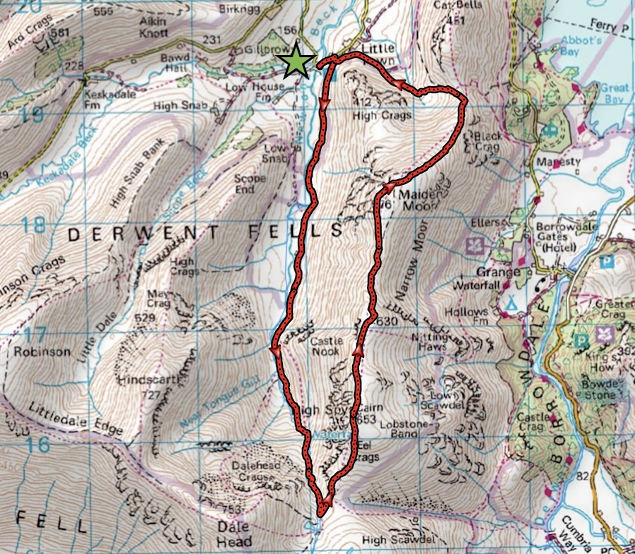
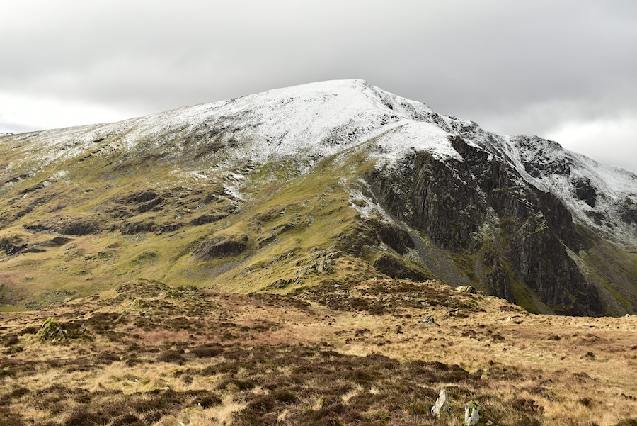
The parking area by the bridge is out of shot to the right and just a short distance up the road is a path which leads across the field to the path we are now standing on. The view ahead is of Hindscarth and Scope End (L) and Robinson (R) with just a section of a snow covered Dale Head over on the extreme left.
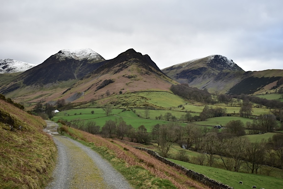
There’s no-one around and the only sound we hear is that of Newlands Beck as it gurgles its way through the Newlands valley. Up ahead it looks as though there is still a fair amount of snow on Dale Head.

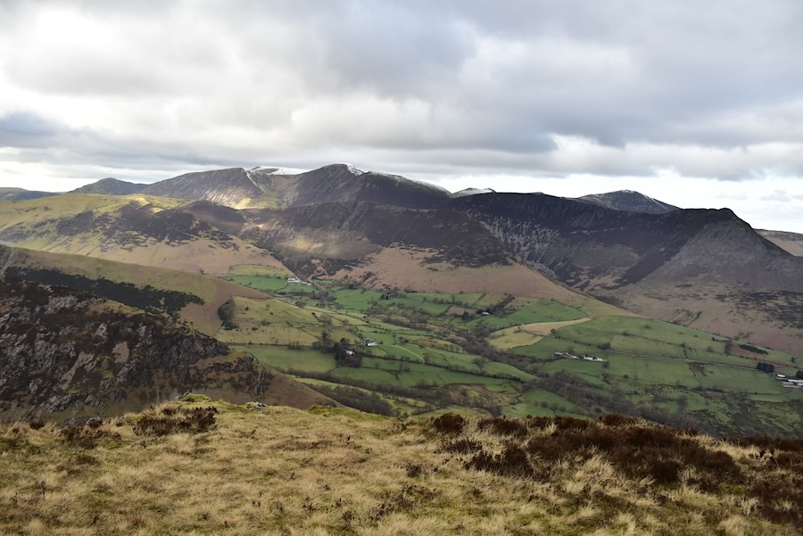
The view back to Causey Pike and Rowling End as we walk along the valley.
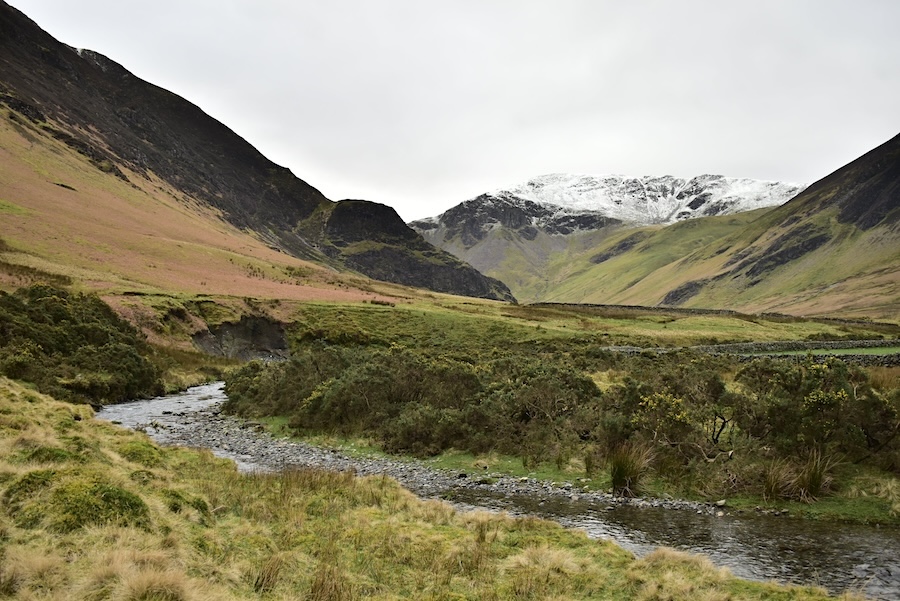
Some distance further along and we are approaching the remote holiday rental cottage. No cars parked outside and no other signs of anyone being in residence today but we have seen people staying there on previous walks through the valley. I expect that there is unlikely to be much by way of telecomms/internet connection hemmed in as it is by the steep sided fells on both sides of the valley.
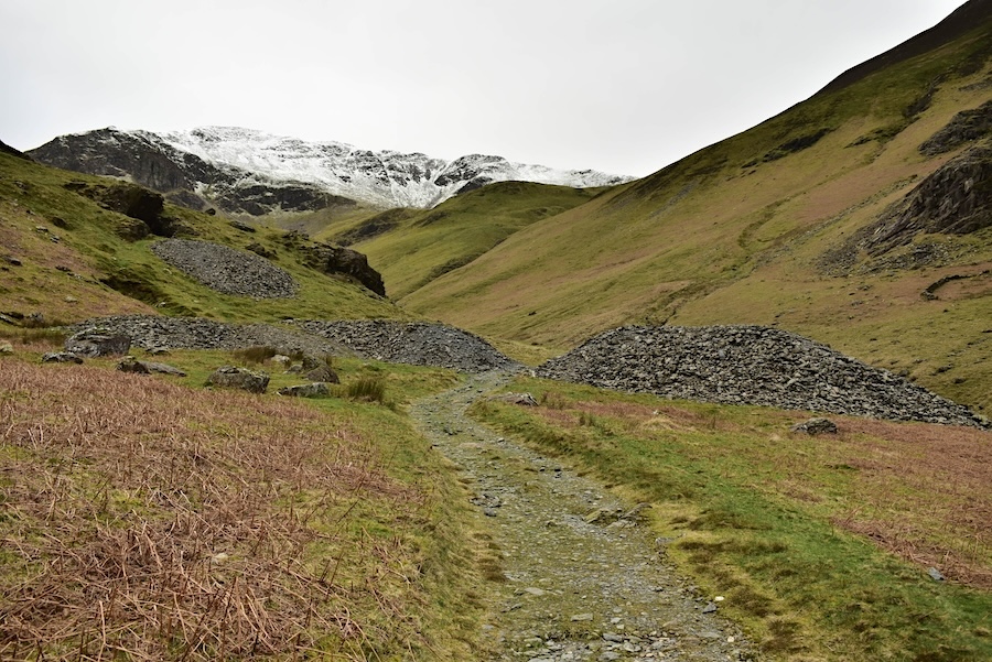
Spoil heaps from the former Castlenook lead mine which eventually stopped production around 1918 when cheaper imports became available. Did the ex-miners manage to find other employment when the mine closed?
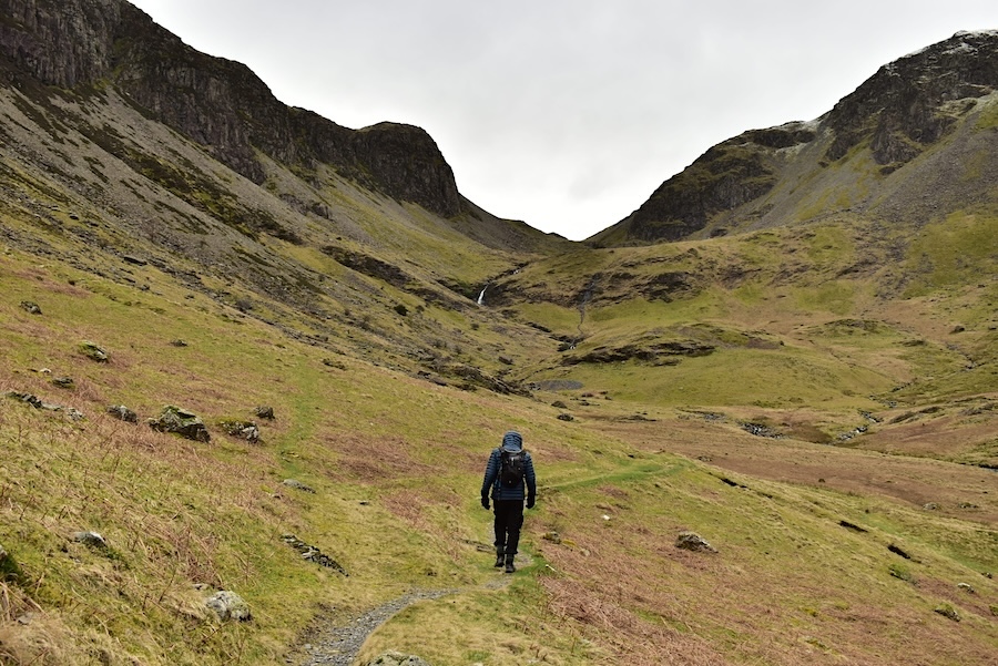
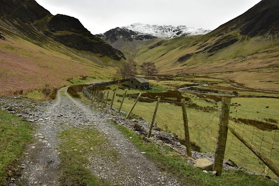
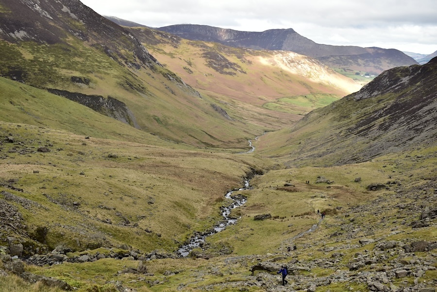
J heads on up the valley towards the waterfalls in the beck, jacket hood pulled up against the nippy breeze which has been to our backs all the way along the valley.
The path rises imperceptibly to begin with as we start to climb out of the valley passing this old sheepfold along the way. Behind it is another spoil heap on which no type of vegetation has managed to gain a foothold even though over a hundred years have passed since the mine closed. Its likely that the chemical nature of the spoil heap isn’t conducive to plant growth.
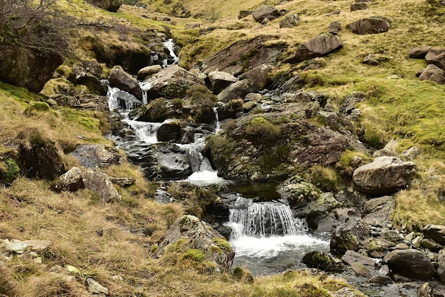
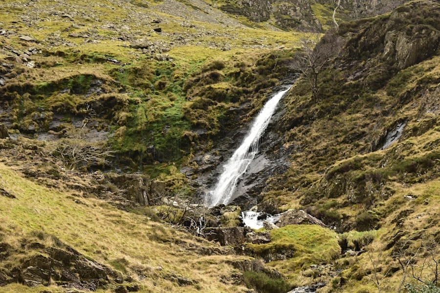
A pretty little series of falls indicates the nature of the climb now. The path threads its way through, around and often over the rocky terrain as it becomes steeper.
We reach the first of the waterslides where the tumbling beck splashes down into a series of lovely pools …..
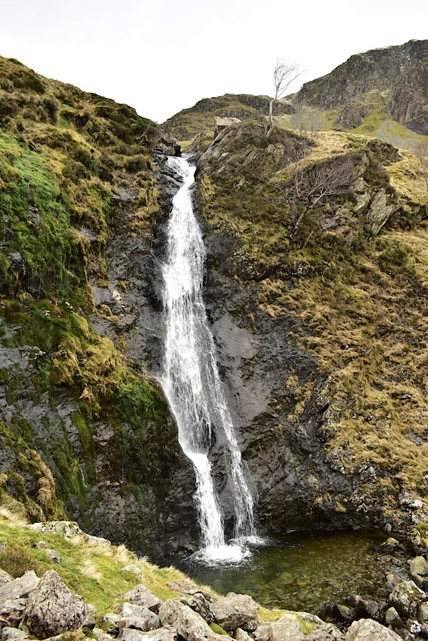
….. here comes another one …..
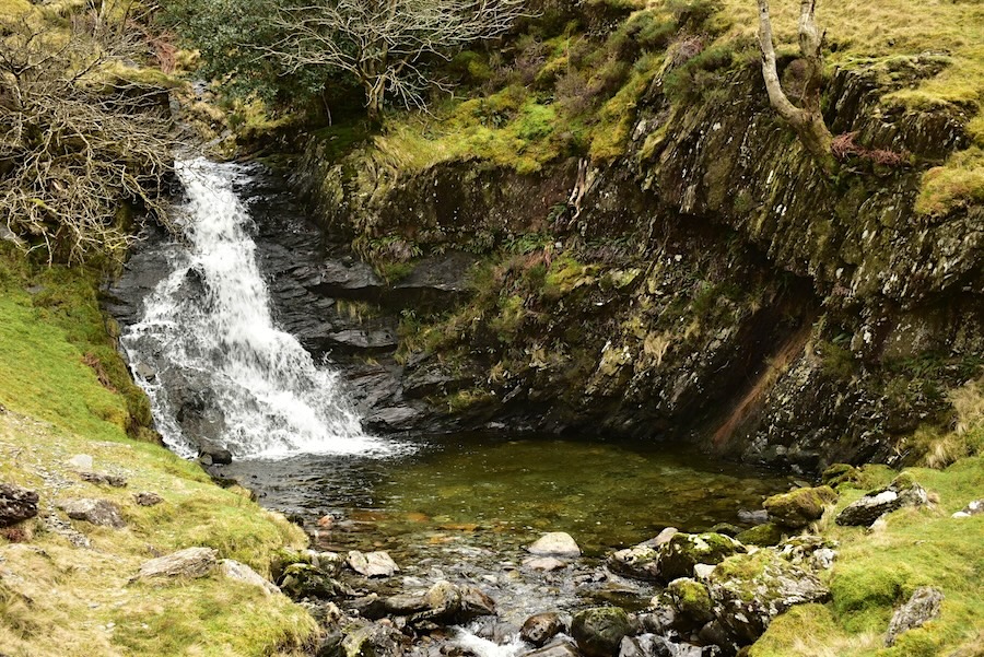
….. and then comes the grand-daddy of them all, sliding over the rocks and wearing them smooth in the process before dropping into yet another pool below it. We had a brief stop, as we always do, just to watch one of nature’s spectacular creations and watch, and listen to, the water as it falls down the steep sided rock face. The path from here is steep and rocky so we grit our teeth and carry on climbing around the waterslide until we reach the flatter area beyond the top of the fall.
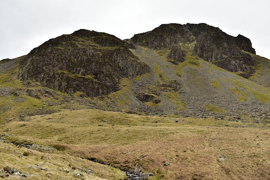
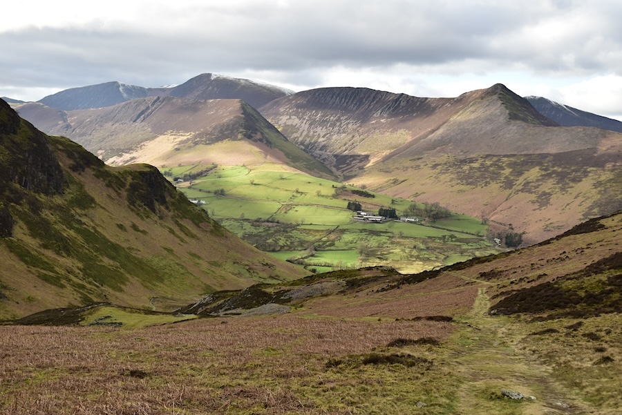
We paused for a breather after the steep climb, and in readiness for the next one, so I took this shot of Dalehead Crags while we got our breath back. The higher crag is named Great Gable although obviously not the more well known fell which carries the same name. There is a route up to Dale Head from the Newlands Valley which passes over those crags so have a look at our walk of 21st June 2019 for more information.
The view down to the point at which the beck falls over the tallest waterslide. Having regained our breath across the somewhat flatter area adjacent to the beck we are now climbing again. Several people are spread out at intervals along the path. Immediately below is a solo chap, behind him are a couple, beyond them three walkers who were making their way down to the valley, and last of all is another couple making their way up. It might take a zoom in to be able to see them all. We followed the continuously rising path all the way to the point where it joins other paths leading to either High Spy or Dale Head. After what seemed like a never ending climb we eventually reached the junction where we again had a short break. While we were there the two walkers who had been behind the solo walking chap came by and made their way along the path up to Dale Head, then came the solo chap who also made his way over to Dale Head and finally along came the last couple in the above shot who also went up the Dale Head path. We supposed that all of them would be following the Dale Head/Hindscarth/Robinson route.
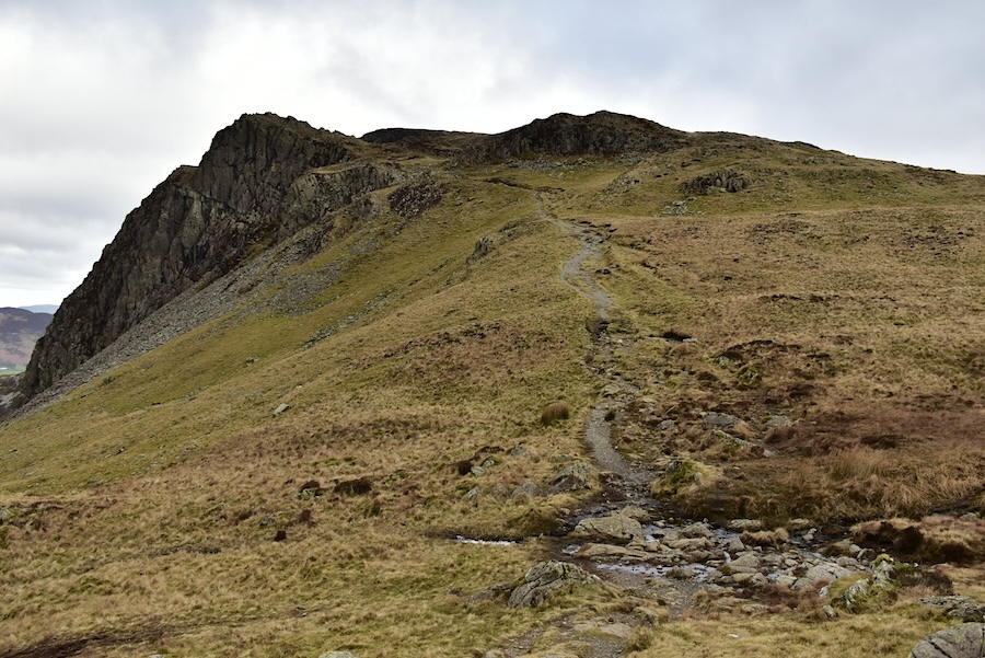
We eventually turned back on ourselves and made our way over to the path leading up High Spy passing the prominent Miners Crag, over on the left, as we went along.
J threading his way through the various rocks, boulders, crags and cairns on the way up High Spy.
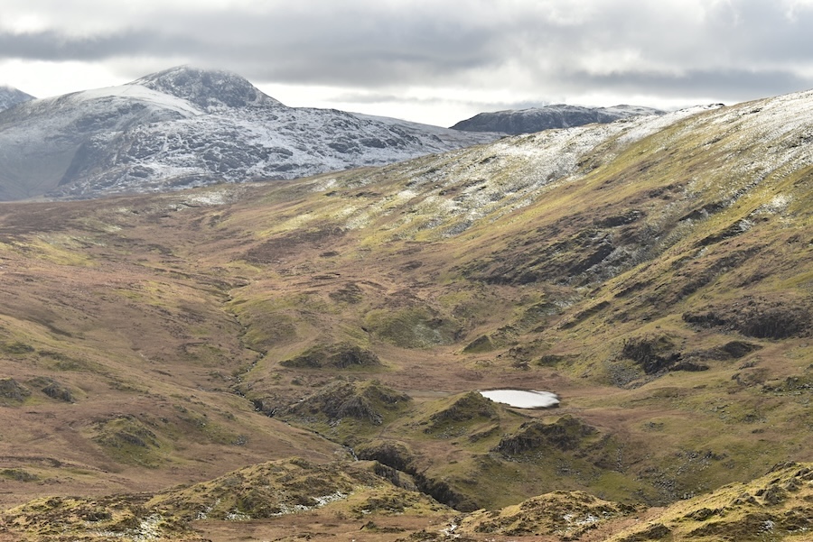
A look back at our route from the junction where Dale Head Tarn is now in view over on the right.
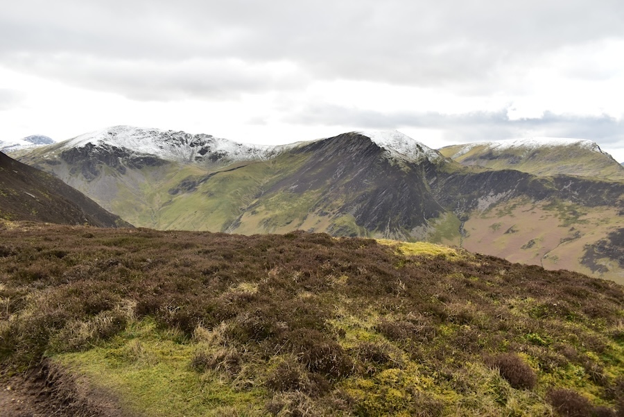
The view across to a snow covered Dale Head and with a zoom in it might be possible to make out one of the couples, almost at the top, who had passed us at the path junction.
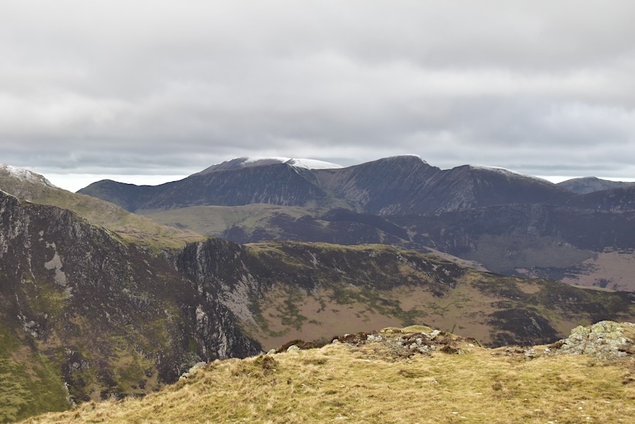
Now that we are higher, and the low cloud has lifted a little, we are getting a much better view of Great Gable and Green Gable over towards the left of the shot. A bit of cloud still obscures the very top but at least we can see it.
We decided to have something to eat before walking the remaining short distance to the summit of High Spy so we found ourselves a spot out of the wind with this view of Dale Head to gaze at. Great Gable’s summit is obscured by cloud again although Kirk Fell to the right of it manages to stay free of it. The walkers who followed the Dale Head path must be well on their way to Hindscarth by now and there’s no sign of anyone else over there.
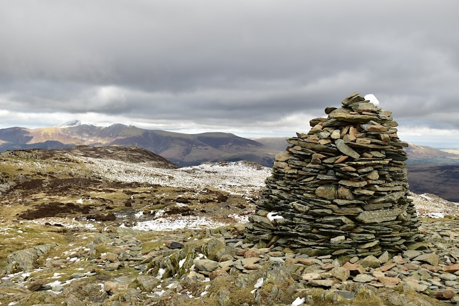
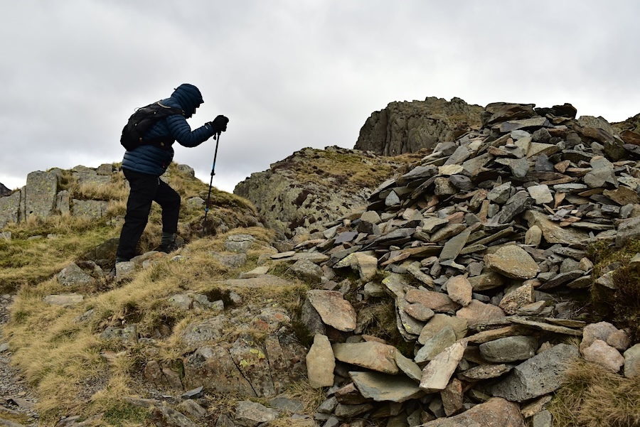
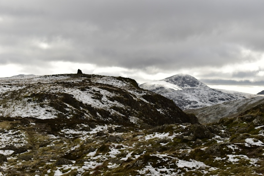
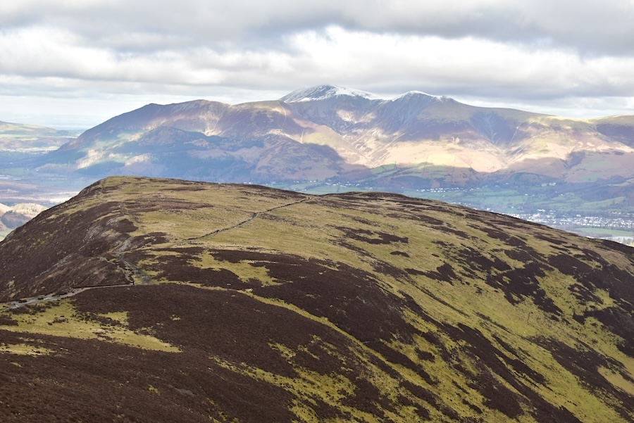
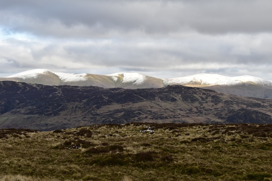
The cairn on the top of High Spy looks more weatherbeaten every time we see it. High Spy stands at 2,142 feet or 653 metres and the cairn is situated on the Newlands Valley side. High Spy’s North Top, is a little lower, standing at 2080 feet or 634 metres, and is about a kilometre to the north from this point, on the Borrowdale side. In the distance the Skiddaw group is getting a splash of sunshine. We could do with some of that sunshine over here because its absolutely freezing up here and, despite wearing a pair of fleecy lined gloves and a pair of waterproof and fleecy lined mittens my hands have turned numb. J is similarly afflicted.
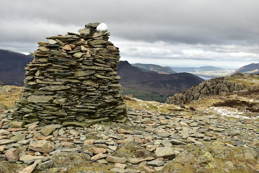
The cairn looks even more weatherbeaten from this angle.
If you zoom in you should be able to spot a woman wearing a blue jacket. A few minutes before this shot was taken she was taking a photo of the cairn as we arrived and she asked us for the name of the fell we were on. She also mentioned that they had only started out to climb up Catbells but had decided to continue further up. After telling us that the youngster was only seven years old she headed back down to where Dad and youngster were waiting. Mum had obviously decided to go on alone and take a shot of the cairn while Dad and youngster waited some distance further down. I did wonder why a seven year old wasn’t at school but maybe they were taking a holiday during term time. The Skiddaw group is still getting some sunshine and …..
….. so is Blencathra, grrr!
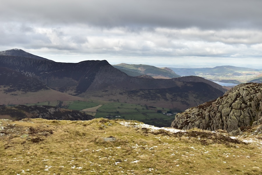
Hindscarth Crags are in full view on the opposite side of Newlands Valley, with a smidge of Robinson right behind.
On the skyline beyond Hindscarth is the snow covered top of Grasmoor and some of its neighbours …..
….. and a little further to my right is the familiar knobbly outline of Causey Pike with Grisedale Pike rearing up behind it on the extreme left of the shot.
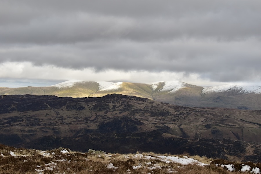
Still on the summit area but now looking to the east where The Dodds are also basking in the sun …..
….. looking northwards again and seeing the entire northern fells group as bright as a summer’s day made me wonder when it was going to be our turn to get a sunny spell. Not today, as things turned out.
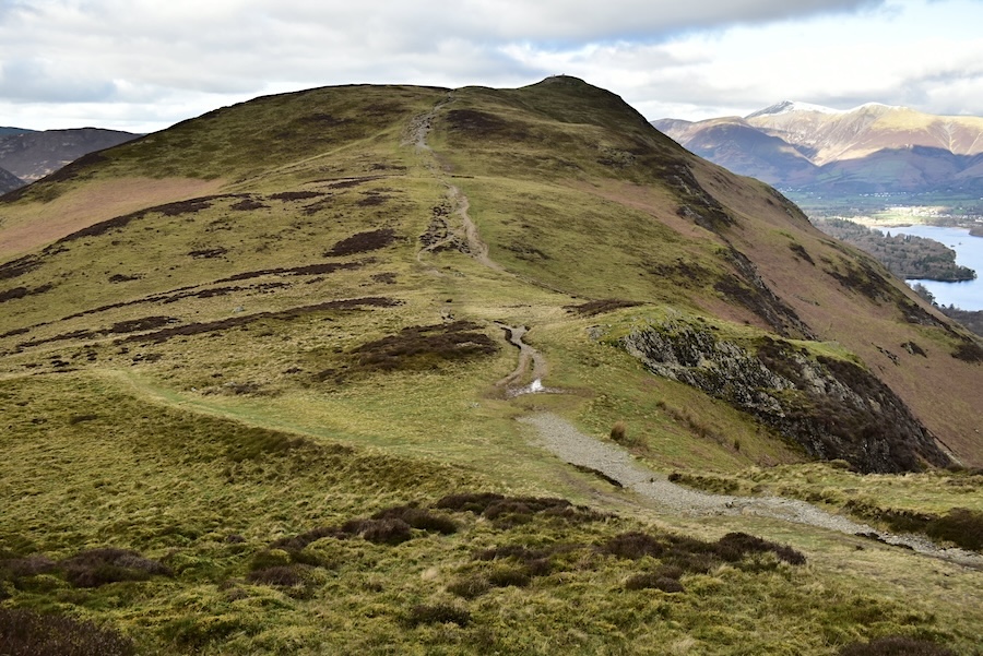
Despite only having spent five minutes or so on High Spy’s summit we were throughly frozen through by now so we started walking away from the summit and headed off over towards Maiden Moor in an effort to get warm again. Here’s a look back towards the cairn with Green Gable and Great Gable just behind it to the right.
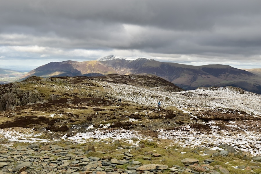
The view ahead across High Spy’s bleak and wintry plateau with the northern fells still bathed in sunshine, even more grrr now!
Things are even looking brighter over towards the rest of the north western fells so how come High Spy isn’t getting some of it? Because we are beneath a lump of heavy cloud which is hanging over us and the wind has dropped so its stuck there, that’s why.
Great Gable is still the most prominent fell as I take a look back across High Spy and to its left the Scafell group remains under cloud as it has been all the time we’ve been out.
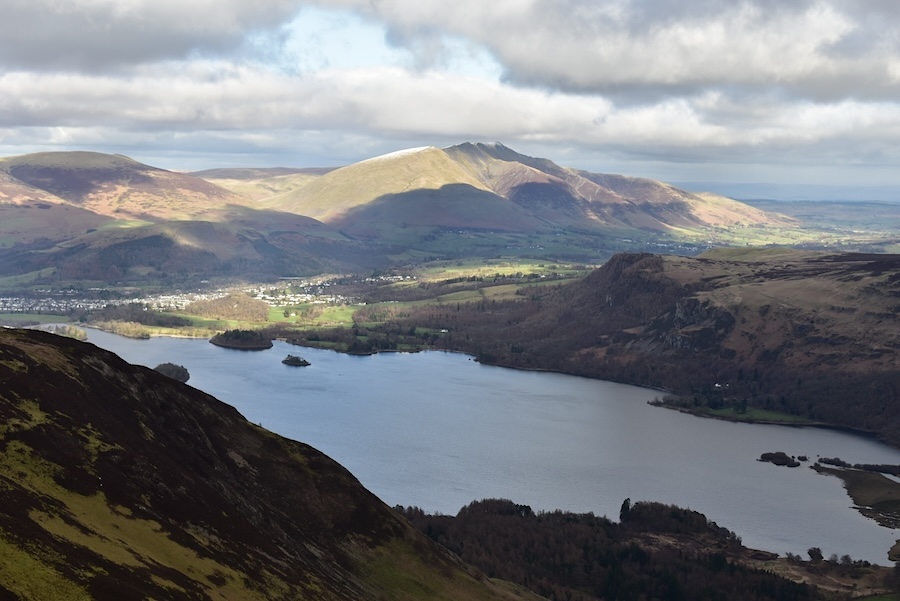
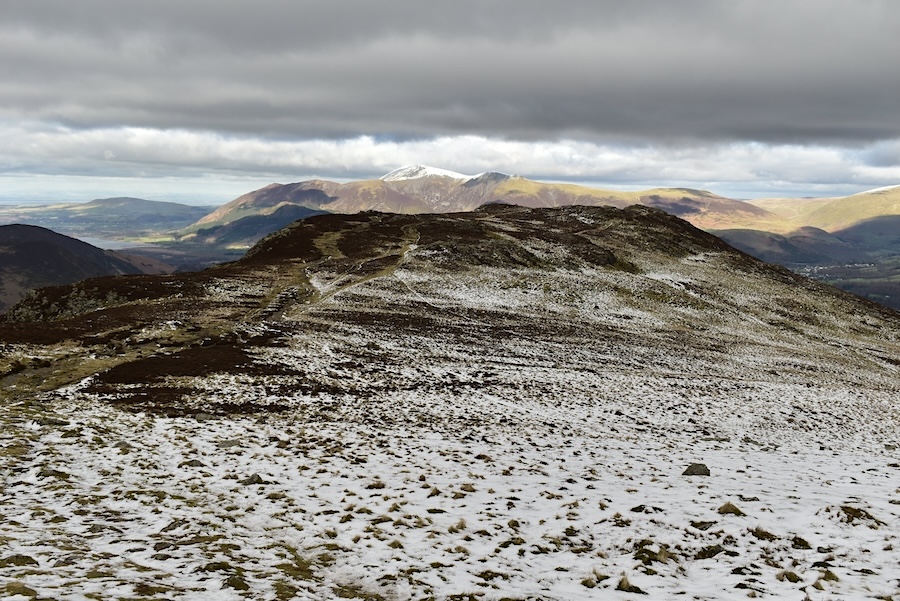
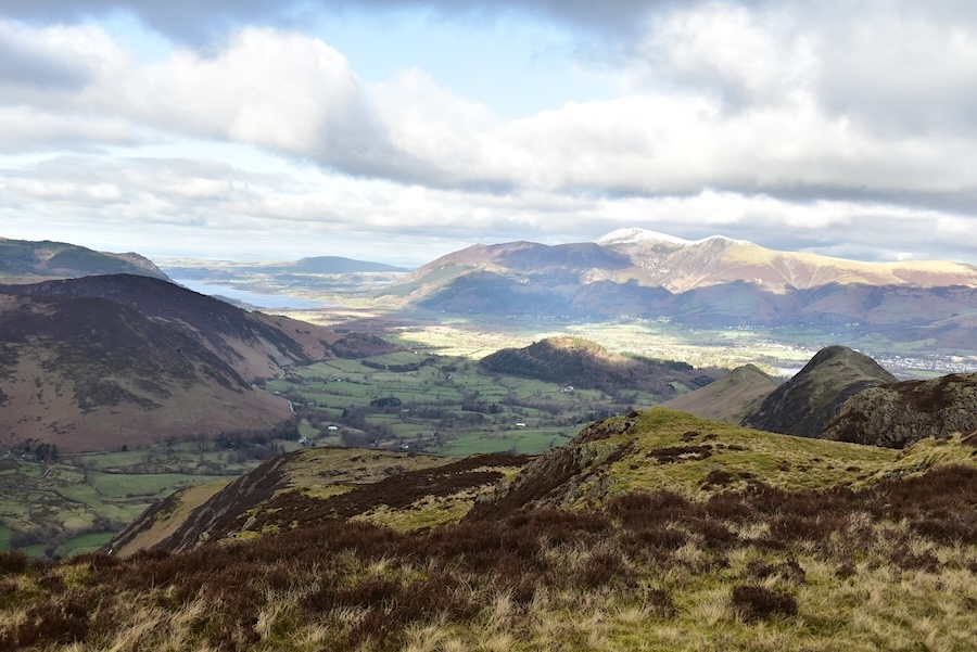
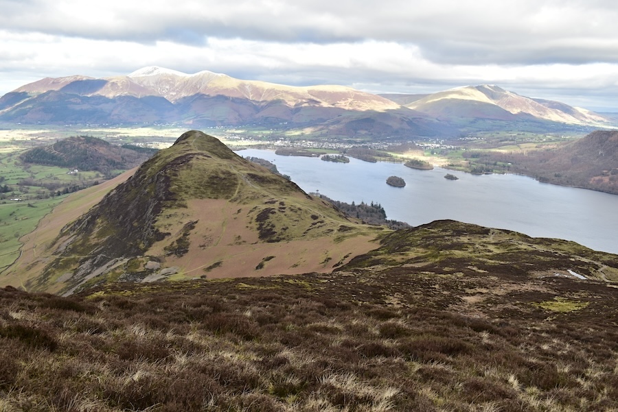
We’ve reached the craggy area just before Narrow Moor from where there are some fabulous views. From the viewpoints on the crags we look across Derwentwater towards the Vale of Keswick and Blencathra where even bits of blue sky have begun to appear. Its a simply fantastic view.
From the same viewpoint, below us is Maiden Moor and to the left of the path running across the middle of it is another path leading over to Bull Crag, the summit of Maiden Moor, where we’ll be heading next.
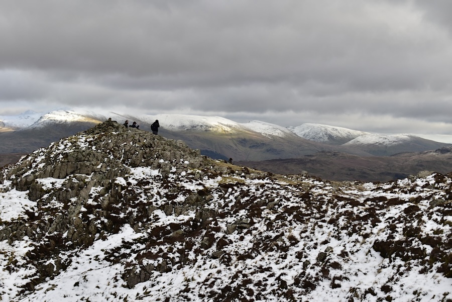
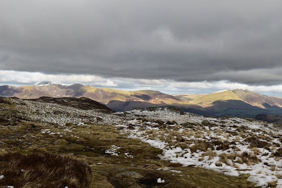
It was quite busy on the opposite crag so we didn’t go over today. Sunlight still accentuating the snow covered Dodds and the Helvellyn group, and to a lesser extent the snowy tops of Fairfield and Seat Sandal.
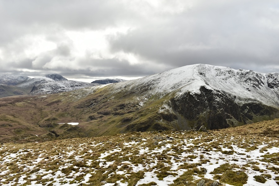
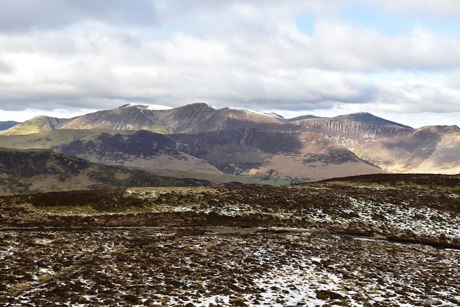
After crossing Narrow Moor we are now on Bull Crag and looking at the three fells, Dale Head, Hindscarth and Robinson, which make up the Newlands horseshoe …..
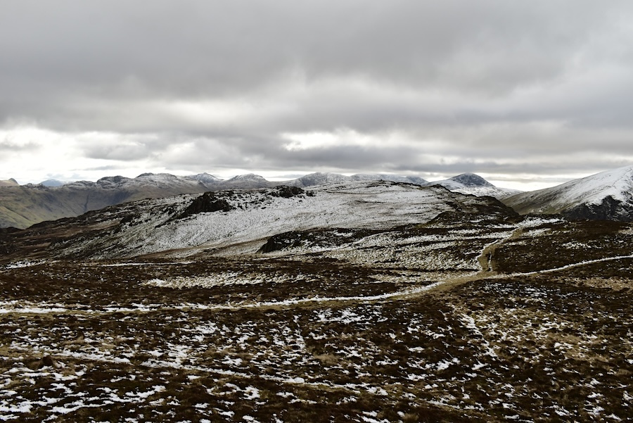
….. some of the rest of the group making up the Northwestern fells.
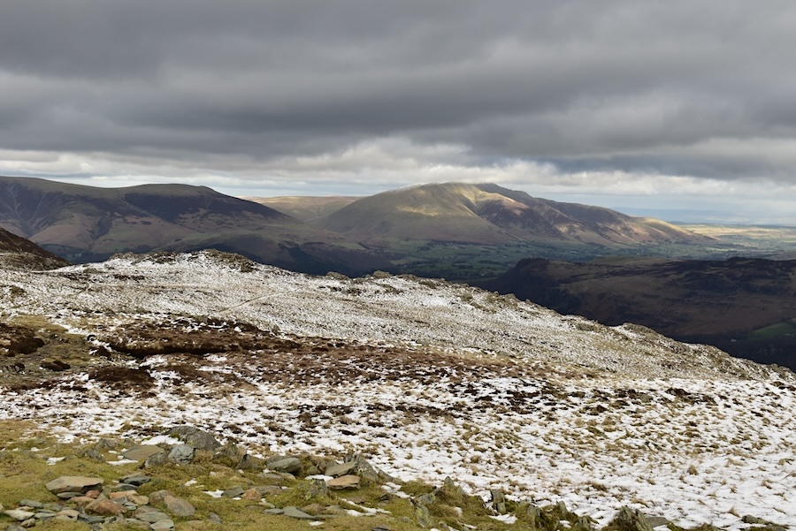
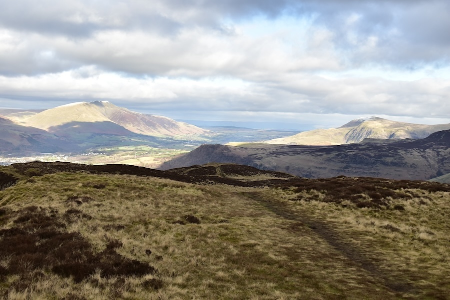
The Northern group of fells, still bathed in sunshine, from Bull Crag. The northern fells seemed to be getting the best of the sunshine today so it looks as though that was the place to be today.
Having left Bull Crag we begin our descent to Hause Gate, the col between Catbells and Maiden Moor. Sunny Blencathra and opposite it, and just as sunny, Clough Head form quite a majestic entrance to the Vale of Keswick.
The Dodds, Raise and the Helvellyn group create quite an eye-catching sight behind the drab appearance of the Bleaberry Fell to High Seat ridge.
Catbells and Derwentwater below us and the sunny northern fells in the distance as we make our way down to Hause Gate ……
….. which seems to appear in almost no time at all. There looked to be just one person on the top of Catbells and, as far as I could make out, nobody at all on the descent path to Hause Gate.
We take a left turn at Hause Gate and follow the path down to …..
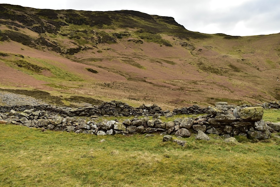
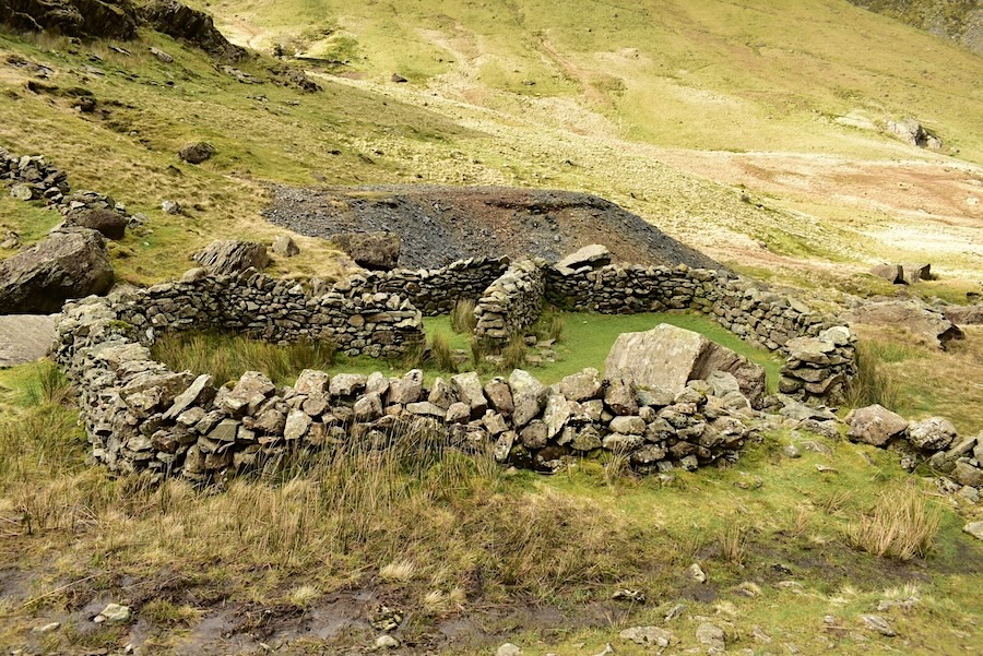
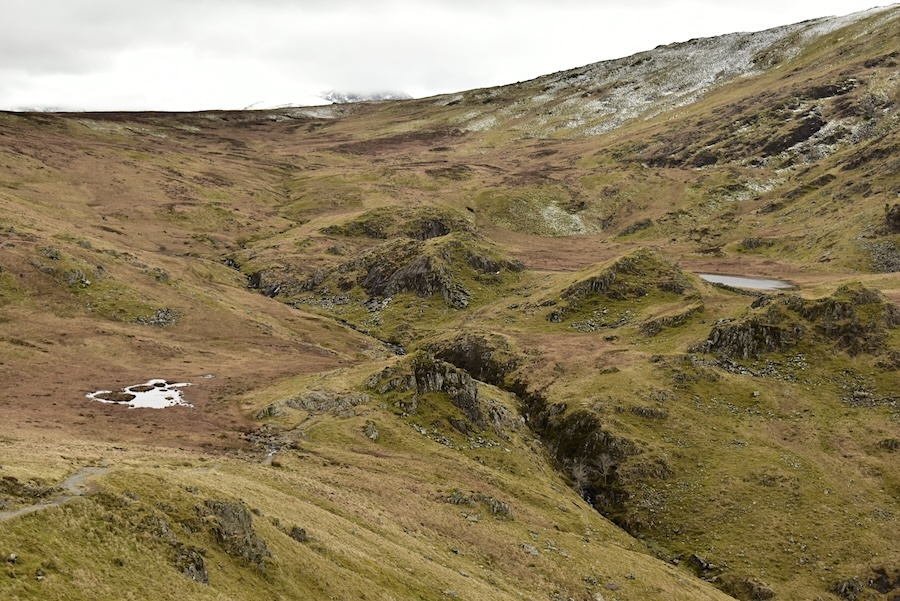
….. Yewthwaite Combe and the former lead mining area. Lead mining ended here in the 1890s after about a hundred years worth of being worked. Even so there are still plenty of spoil heaps. shafts and adits around. The structure in the shot is marked on the OS map as a sheepfold but I’ve always wondered whether it was a former mine building. This area is also said to have been the home of Beatrix Potter’s famous hedgehog character, Mrs Tiggy-Winkle, who was supposed to have lived in a hole somewhere above the mine.
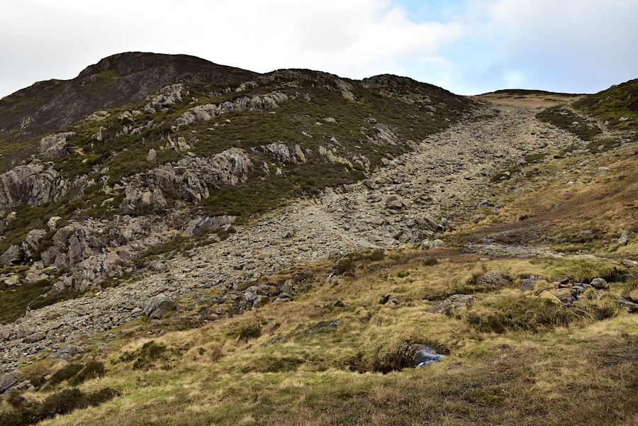
The soft grassy path eventually disappeared under this slew of boulders, rocks and stones which was a nightmare to walk on as can be imagined. Not sure whether it is spoil that the old miners chucked down the hill just to get rid of it or whether its the result of a landslip some time in the past. An ill-timed foot placement on the very loose stones would lead to a most uncomfortable and bruising sit-down so we trod carefully until we were back down on the gravel path below it.
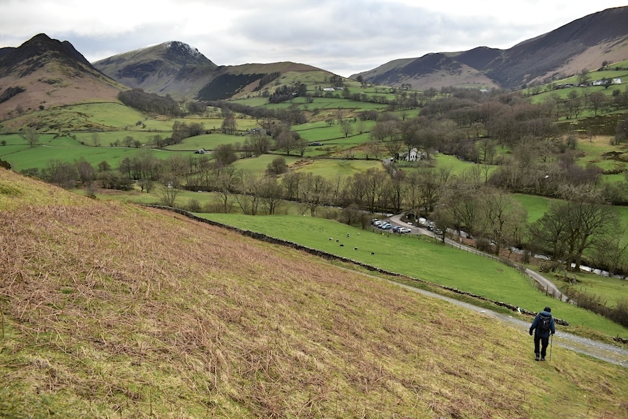
We followed the gravel path to this point where we veered off to the right down the hill and back to the former mine track below which we joined at the beginning of today’s walk. From there it was back to the path across the field and then we were back on the road once more and heading down to the parking area. There are more cars down there than when we arrived this morning so it obviously filled up after we had set out. The couple of cars which were already parked when we arrived have departed as we will be doing in a few more minutes. So we come to the end of today’s walk and although we weren’t lucky enough to have any sunny spells at least it didn’t rain and we weren’t battling gale force winds and being blown sideways. That counts as a decent day in our book. Looking back we’ve managed to be out on a walk, somewhere or other, four times altogether during February. Decent days have been few and far between this winter so let’s hope that March continues in the same vein as February so we can keep walking on a regular basis.