Heron Pike, Great Rigg and Stone Arthur
Walk Date – 25th February 2019
Distance – 6.7 miles
Weather – very warm, no wind, very hazy
The air flow from the south continues to provide dry and settled weather across the country and the absence of even the hint of a breeze tempted us out onto some of the higher fells today. The weather was perfect and provided ideal walking conditions, the only downside being the very thick haze which compromised the long distance views quite a bit. However, the flip side to the haze meant that we gazed at some very atmospheric scenes which were a constant source of fascination.
Route
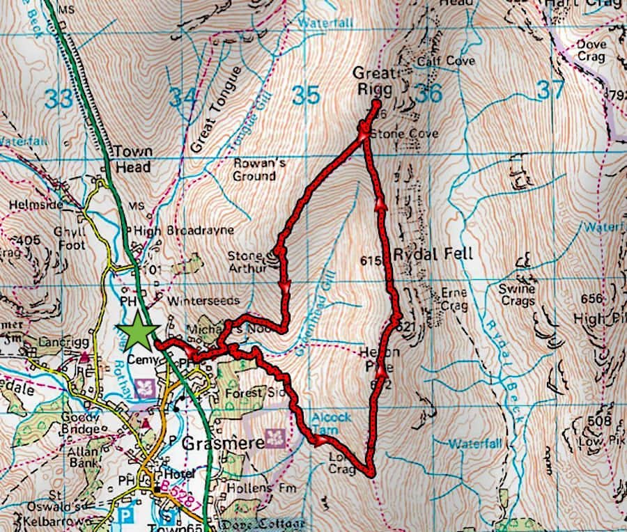
A591 lay-by – Michaels Nook – Forest Side – Alcock Tarn – Nab Scar ridge – Lord Crag – Heron Pike – Erne Crag – Great Rigg – Stone Arthur – Michaels Nook – A591 lay-by
We were a little later arriving at the lay-by than we had anticipated, firstly because we had to drive to Keswick and pick up the A591 from there. We would normally turn off before Keswick and take the B5322 road down to the A591 in St John’s in the Vale but that road is closed at the moment. The next delay began some distance below the lay-by parking for Helvellyn and ended at the Station Coppice parking area opposite Swirls. Only one lane was open and a convoy arrangement was in operation so it was a case of sitting and waiting for the convoy vehicle to return and lead us through. We thought the usual traffic light system would have been a more efficient way of dealing with the roadworks. We wondered why someone thought it was a better idea to have a man drive a van back and forth along the road all day at the head of a line of traffic just to escort it through. We managed to park without any bother when we finally arrived since only a handful of cars were already parked. As we waited to cross the busy road I took the above shot of Seat Sandal where, even at this close distance, the haze is apparent.
A hazy Helm Crag across the fields as we walk up to Michaels Nook.
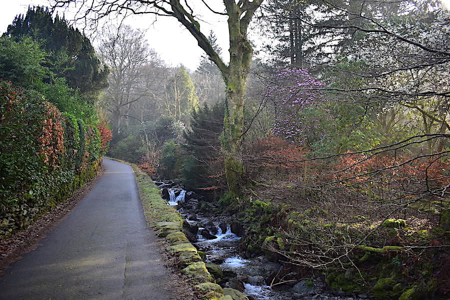
The view along the lane alongside Greenhead Gill as we walk up through Michaels Nook where the rhododendrons are in bloom and the wild cherry trees are sprinkled with delicate white flowers.
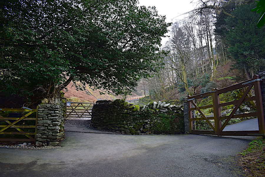
We reach the top of the lane and are met by a variety of gates most of which have ‘Private’ notices attached to them. The one we need is the one directly ahead with the notice attached to its top left corner. Before Storm Desmond washed the footbridge away in 2015 you would go through that gate and immediately turn right to walk across the bridge.

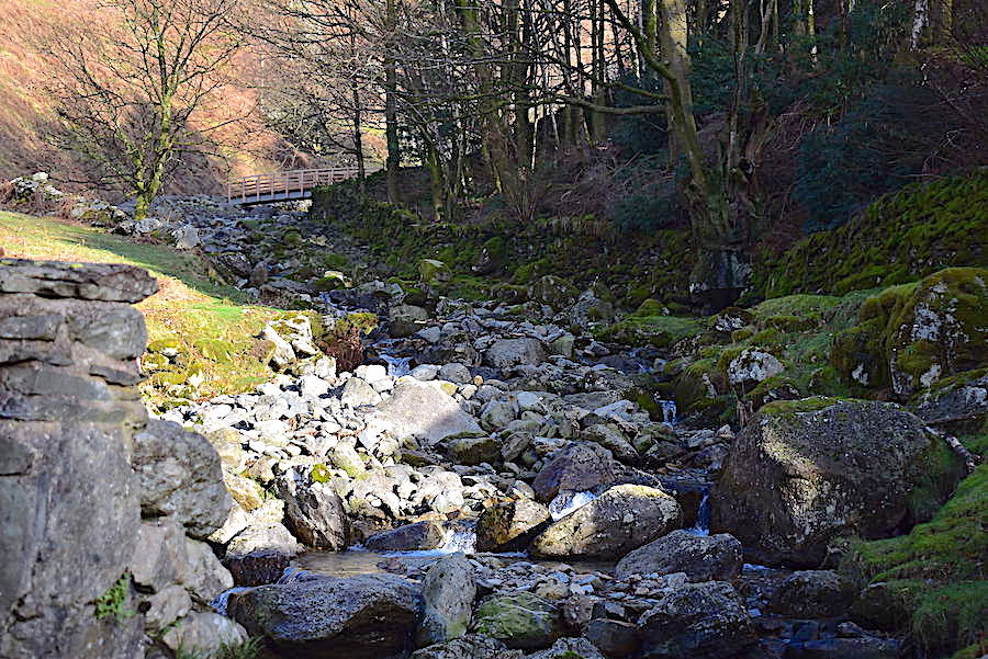
This is where the footbridge was located before the storm and the shot shows where the footpaths once connected with the bridge. I suppose you could still ‘boulder hop’ across at this point but there really isn’t any need to because …..
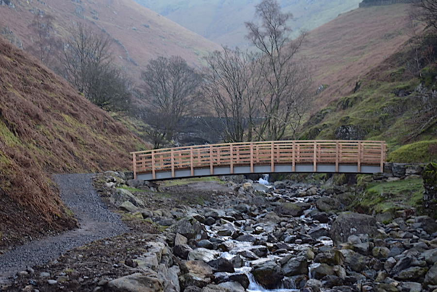
….. about a hundred yards further up the path is the recently installed replacement bridge. The long span stands high above the beck and if that ever gets washed away we would probably be experiencing a flood of monumental proportions.
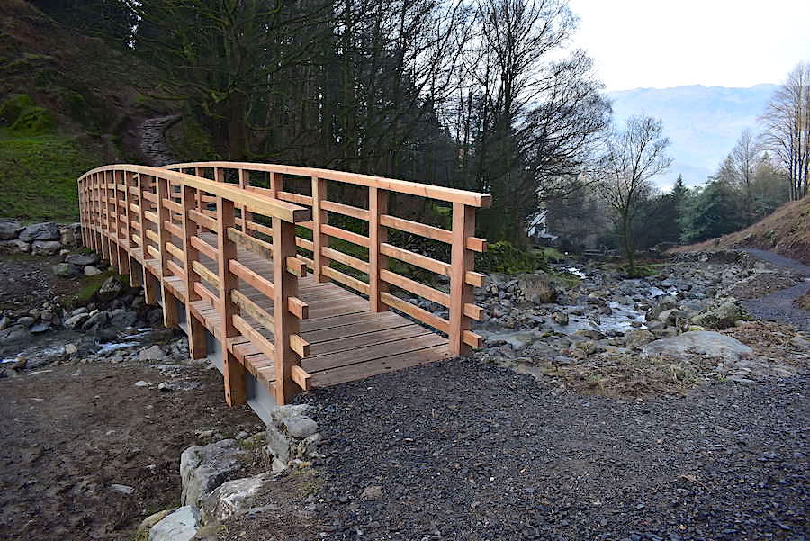
Looking back down the path from the bridge, the old one was located just in front of the white house down there so the new one is quite close to the original position. The path up to Alcock Tarn can be seen rising up the hillside at the end of the bridge. The path behind me continues upwards and after a short distance leads to …..
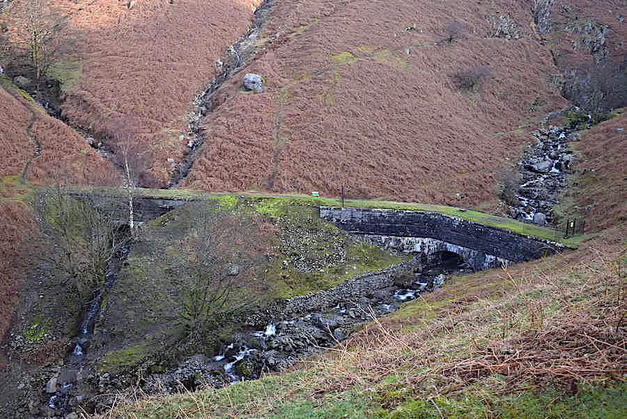
….. the aqueduct carrying water from Thirlmere down to Manchester. We cross the beck and follow the Alcock Tarn path from where there’s this view of the aqueduct.
Directly across from us is Stone Arthur which we will visit later on in our walk. Just peeping up behind it on the right is the summit of Great Rigg which we’ll also be heading up to today.
We just had to stop to take our jackets off when we reached this little shelf a short distance below Butter Crag. We’re only wearing our lightweight ones but even those were too much today and our faces were dripping with perspiration. After a quick mop round and feeling much more comfortable we hoisted packs once again and continued climbing.
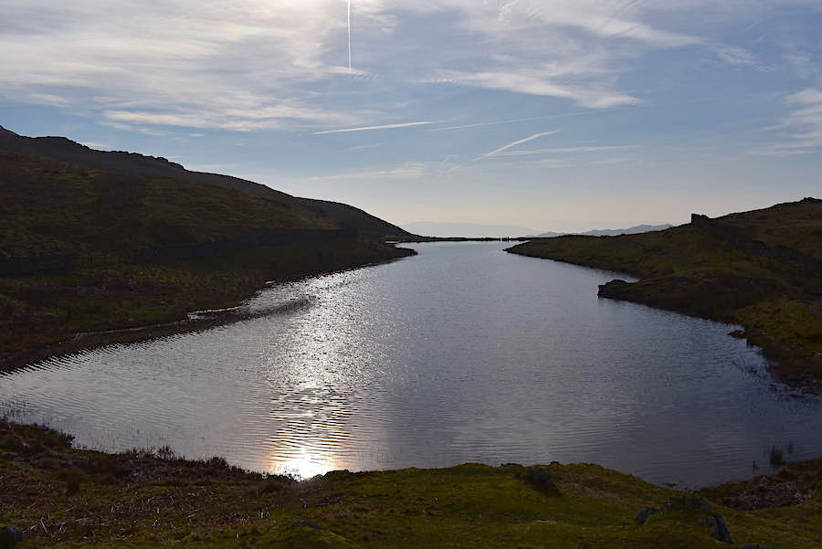
A view of Alcock Tarn, which looked lovely in the misty sunlight, from Butter Crag. It wasn’t as dark as the shot shows but that’s what happens when shooting straight into the sunlight.
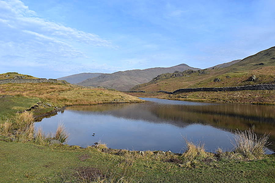
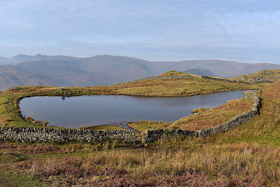
A much better view of the tarn from its southern end. Over on the right, just above the wall, is Butter Crag from where I took the previous shot and immediately behind that is the Stone Arthur to Great Rigg ridge. Every time we’ve been up here there has always been a crowd of ducks on or around the tarn but there wasn’t one to be seen today. It was all very quiet with only two ladies walking, just out of shot, along the path on the left.
The two ladies make their way to the southern end of the tarn while we climb over the metal bars in the wall opening and follow the path up to the ridge line. I expect the tarn will get busier as the day progresses because its a grand little walk up from Grasmere, especially on a day like today.
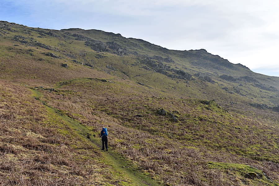
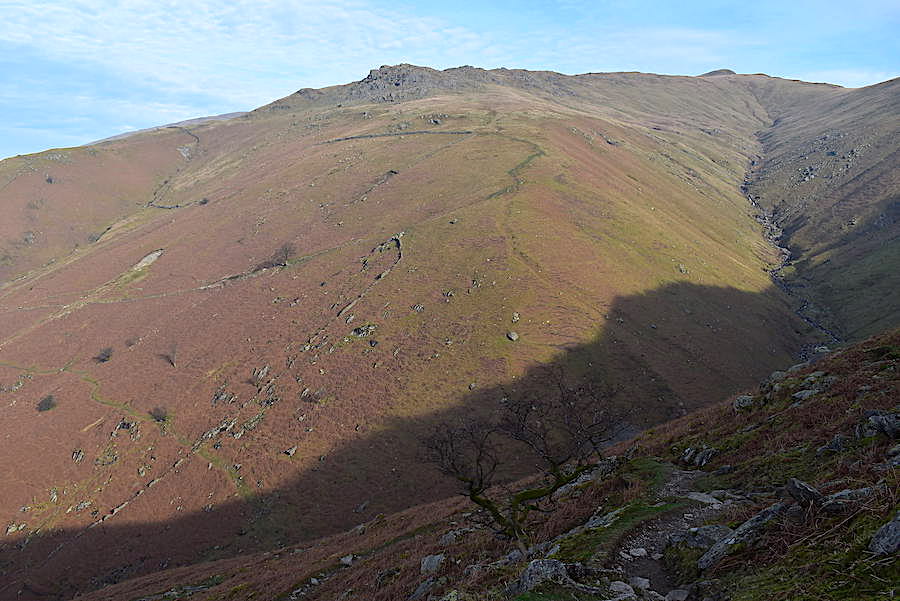
The path across to the ridge line can be a bit of a pain to locate when the bracken is up but, as can be seen, its plain sailing when it isn’t. J strides out purposefully heading for the lower rocky outcrop below the ridge line.
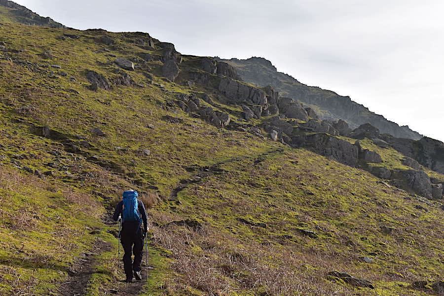
Approaching the outcrop, which involves nothing more than a bit of a clamber over it. There’s nothing awkward about it but it can get very muddy across here sometimes, no problems on that score today though. The bump on the skyline ahead of us is Nab Scar and the path will take us up to the ridge line just to the left of it.
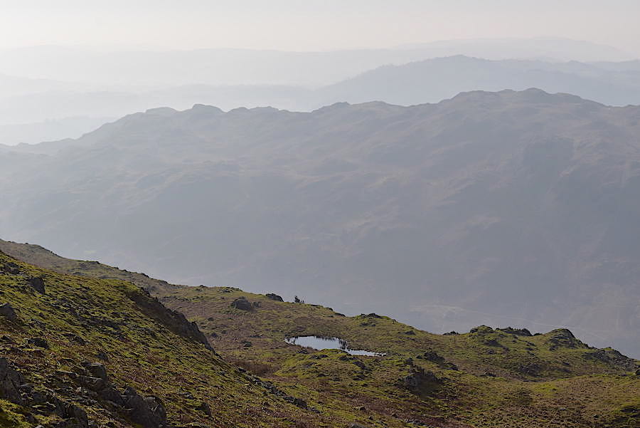
Another first, no ducks at the tarn and now we look down at Dockey Tarn which to our surprise has water in it. Every time we’ve been across here it has always been empty and dried out. The view beyond shows the various humps and bumps across the top of a very hazy Loughrigg Fell.
The ridge line is reached and we look along it towards Nab Scar with nobody on the path at present, although there will be walkers already toiling up there from Rydal.
Another first because, as far as I can recall, this is the first time I have been out walking in short sleeves in February. It feels more like a spring day in late April or early May. We stopped here briefly to take some liquid on board before …..
….. setting off once again to continue across Lord Crag heading for Heron Pike. The ground rises steadily but it is mostly dry and firm so making progress isn’t too difficult.
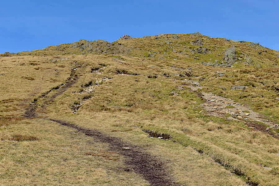
There’s still plenty to do though as I take a look ahead towards Heron Pike.
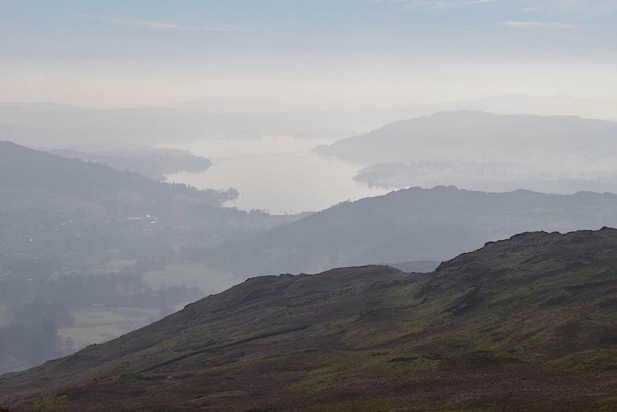
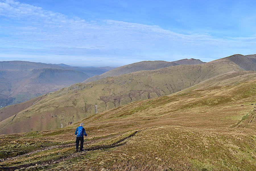
Further along, as we wipe our faces once again, I took a look back towards Windermere. There isn’t much by way of detail but it does have a faintly mysterious quality to it. Again it looked brighter in reality but I was shooting into the sun once more. Just after I’d taken the shot three chaps came by us, with hi’s exchanged as usual. I remarked about the mystical view to the chap bringing up the rear so he stopped, turned round for a look and then said how lovely it all looked in the soft misty light. Out came his smart phone and a couple of shots were taken so I mentioned that he had seen something his companions hadn’t. He told me that they weren’t bothered about the views they were more interested in ‘doing the horseshoe’. That made me feel quite depressed since it seemed as though the walk they were undertaking was nothing more than a tick box activity, Maybe I got the wrong impression and I hope so because there’s so much more to be enjoyed and experienced when walking the fells than simply getting from A to B.
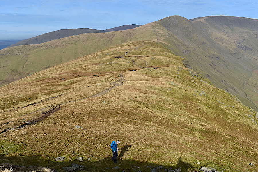
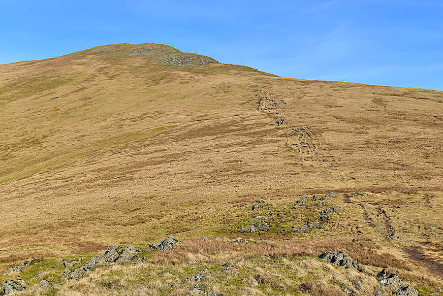
There go the three walkers, the last one carrying the blue pack is the one I’ve just been talking to and who is now trying to catch up with them. The lead walker has also pulled away from the number two in the interim although they were both together when they came by us. So, its time for one more heave up to Heron Pike and, although the gradient isn’t severe it is constantly rising, so by the time Heron Pike is reached the legs and lungs definitely know they’ve been putting in a bit of overtime.
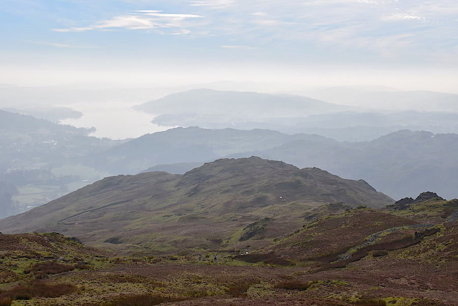
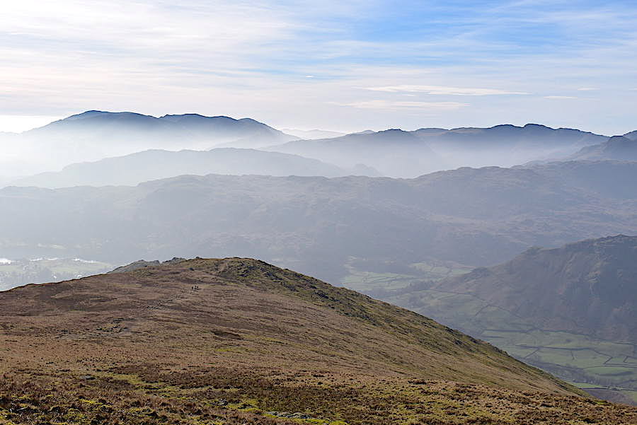
Another hazy view into the distance with the Coniston fells prominent on the skyline. Below them to the right is Lingmoor Fell, and below that is the Dow Bank ridge over to Silver How. Grasmere water is as flat as a mill pond.
A misty view of not very much beyond Nab Scar and Windermere.
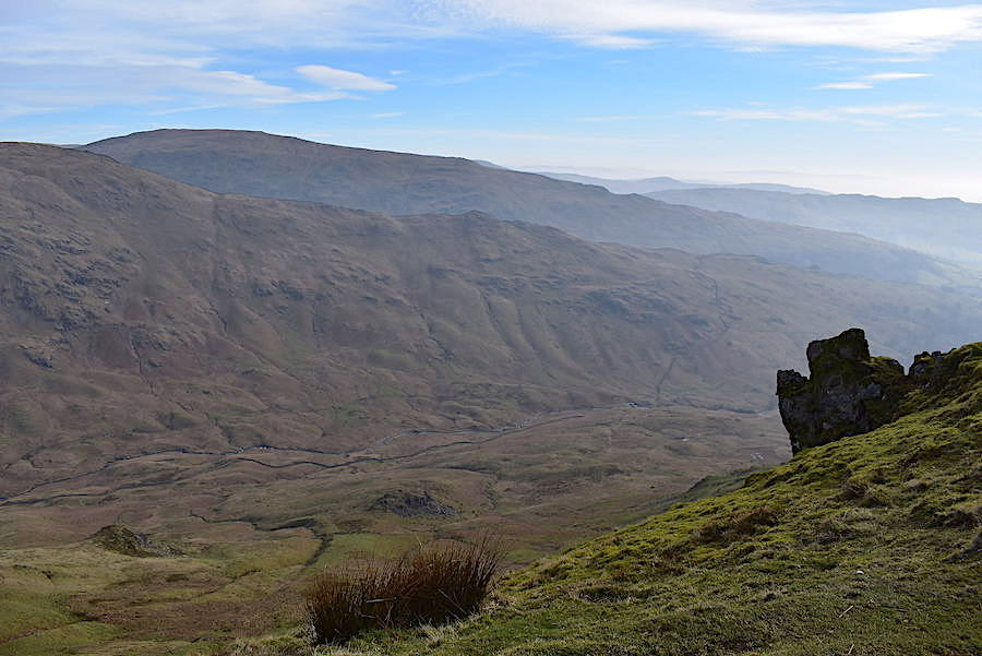
Being just that bit closer the view down to Rydal Beck is a little clearer. On the far side of the beck is Low Pike and on the skyline behind it is Red Screes.
![]()
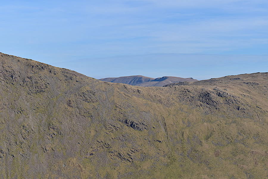
Because of the haze I decided not to bring the long zoom lens with me today and even though there was a slight lifting of it in this shot I don’t think the long zoom would have shown anything in much greater detail. Over on the left skyline are Crinkle Crags, across the Three Tarns gap is Bowfell followed by Scafell, Scafell Pike and Great End. The Langdale Pikes can just be made out below Bowfell and Scafell.
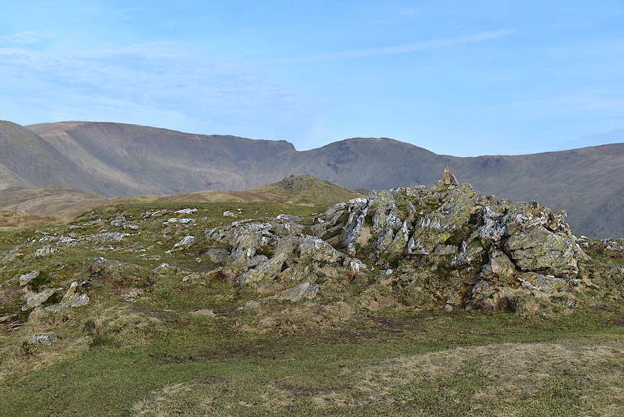
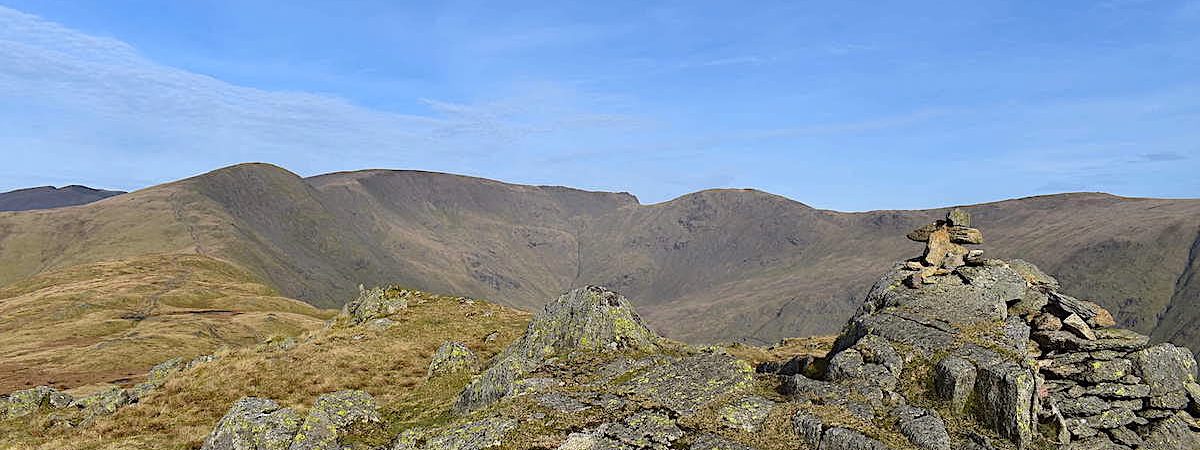
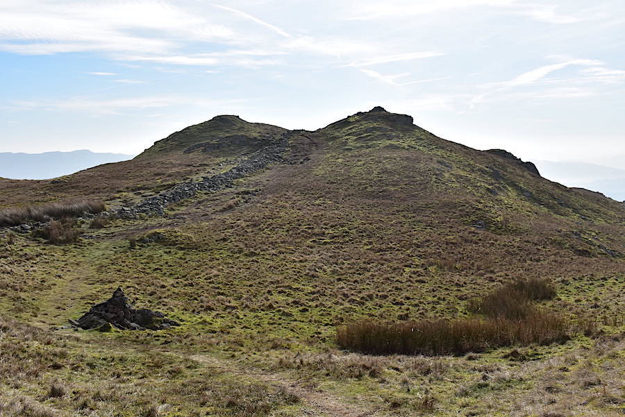
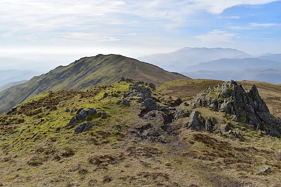
On Heron Pike summit with Fairfield and Hart Crag on the skyline behind. Between Heron Pike and the skyline view is the craggy green hump of Erne Crag, the next high point we will visit.
From Heron Pike we drop down once again and follow the path over to Erne Crag.
A look over towards the Stone Arthur ridge dropping down from Great Rigg. J is already on his way having been slightly irritated by a remark from one of a pair of walkers who arrived at Heron Pike a couple of minutes or so after us. I was busy taking shots so I wasn’t party to the conversation. Whenever we reach a particular spot he likes to get out the gps and see what data its giving him. I had mentioned that Erne Crag was next up so he was looking at its height and distance. Apparently, while he was doing so, the lady of the pair informed him that he was on Heron Pike and, being the down to earth Yorkshireman that he is, he replied “I know where I am love, I’m checking something else’, and departed in an irritated huff. Being busy with the camera I missed all that but I know how he felt when he told me about it. The pair of walkers moved swiftly on and have disappeared below the small grassy mound alongside him.
The view back to Heron Pike from Erne Crag and …..
….. the Rydal Head skyline from the summit. Its just us on here now so there’s nobody around to ruffle any more feathers.
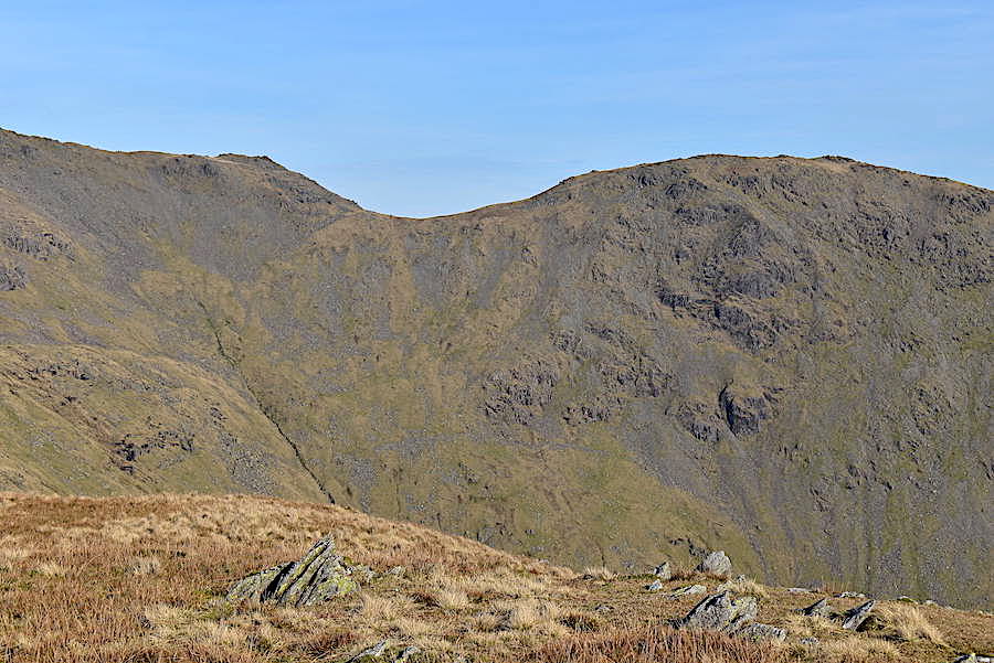
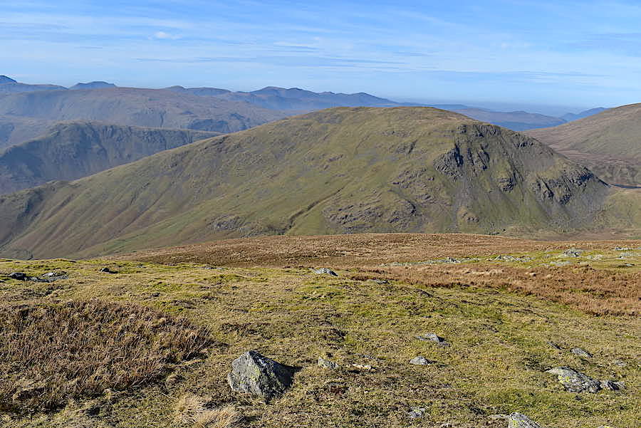
Rydal Head and the upper part of the Fairfield horseshoe from Erne Crag. Great Rigg is on the left, followed by Fairfield, Hart Crag and Dove Crag. An intricate sheepfold can be seen in the bottom right of the shot.
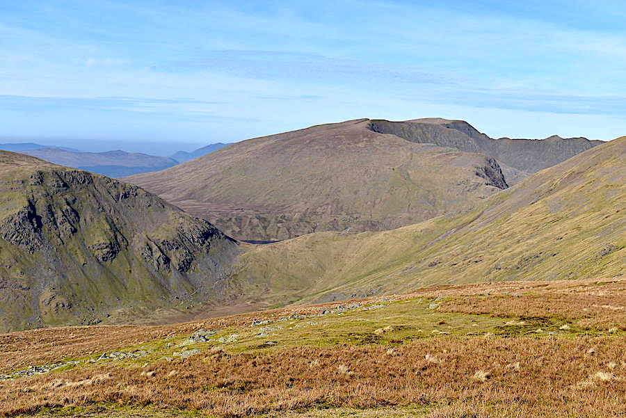
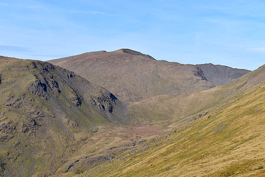
J, still a bit miffed, wanders across to take a look down to Rydal Beck, while I take a look along the route towards Great Rigg. Seat Sandal and the Helvellyn group are just appearing above the Stone Arthur ridge.
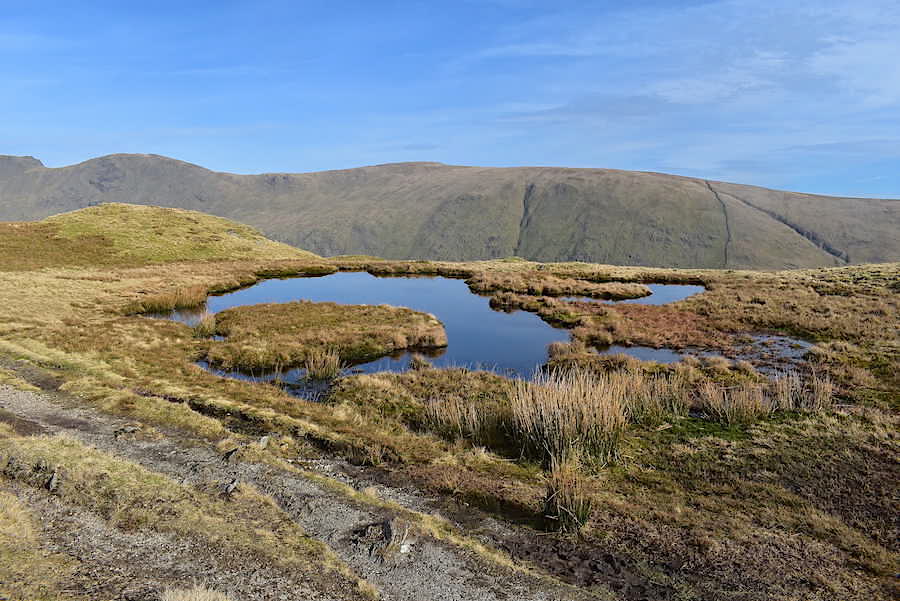
A small un-named tarn beside the path a little further along from Erne Crag.
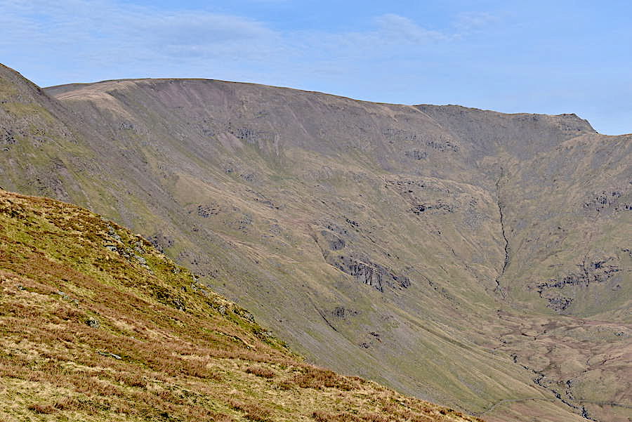
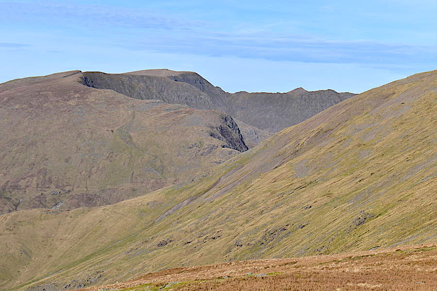
Another look towards Rydal Head where the vast expanse of Fairfield fills the skyline.
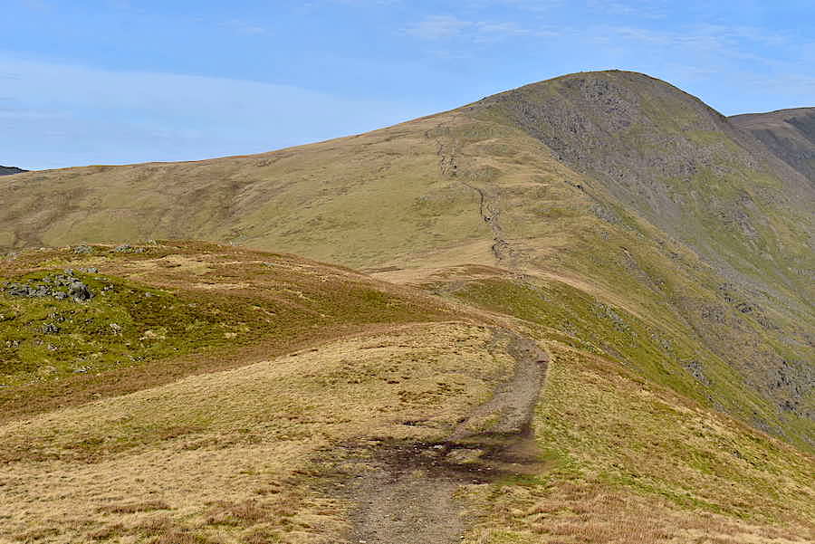
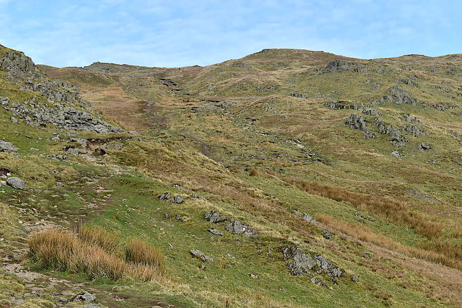
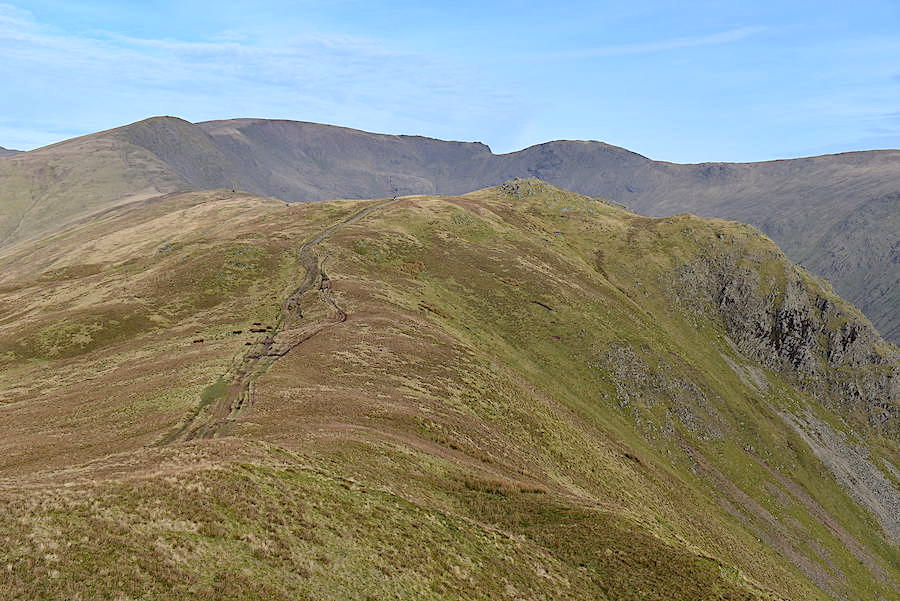
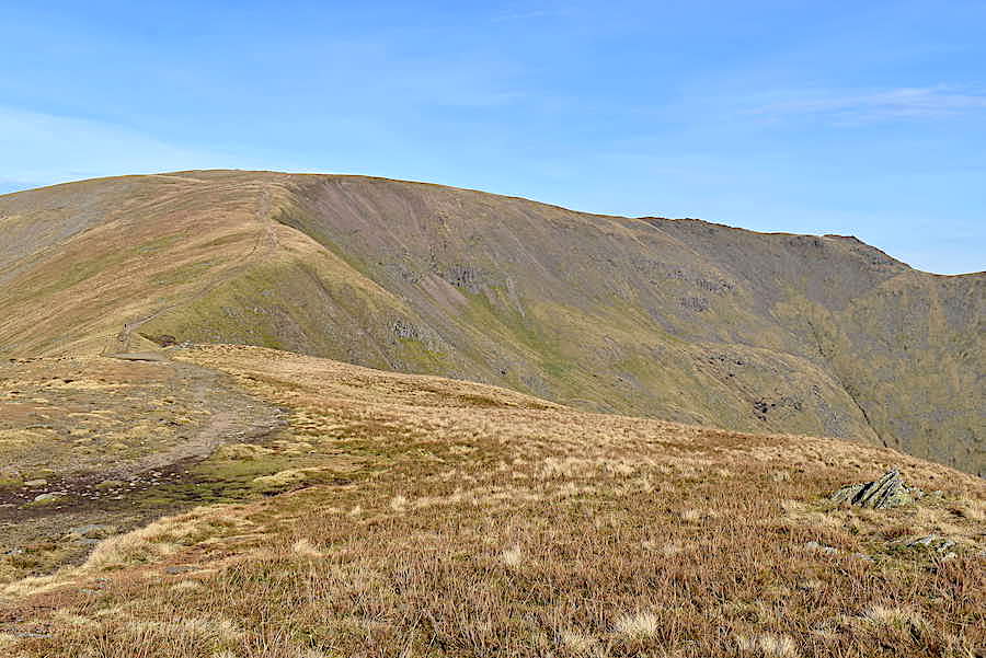
Here beginneth the long march up to Great Rigg. Although they aren’t clear in the shot up ahead we can see the Heron Pike ‘incident’ pair about halfway along, and the three chaps we met earlier just about to reach the beginning of the rockier area below the summit.
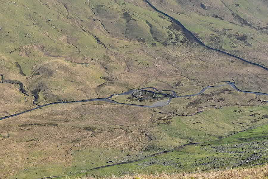
The intricate sheepfold beside Rydal Beck far below us. It always reminds me of an ice-cream cornet.
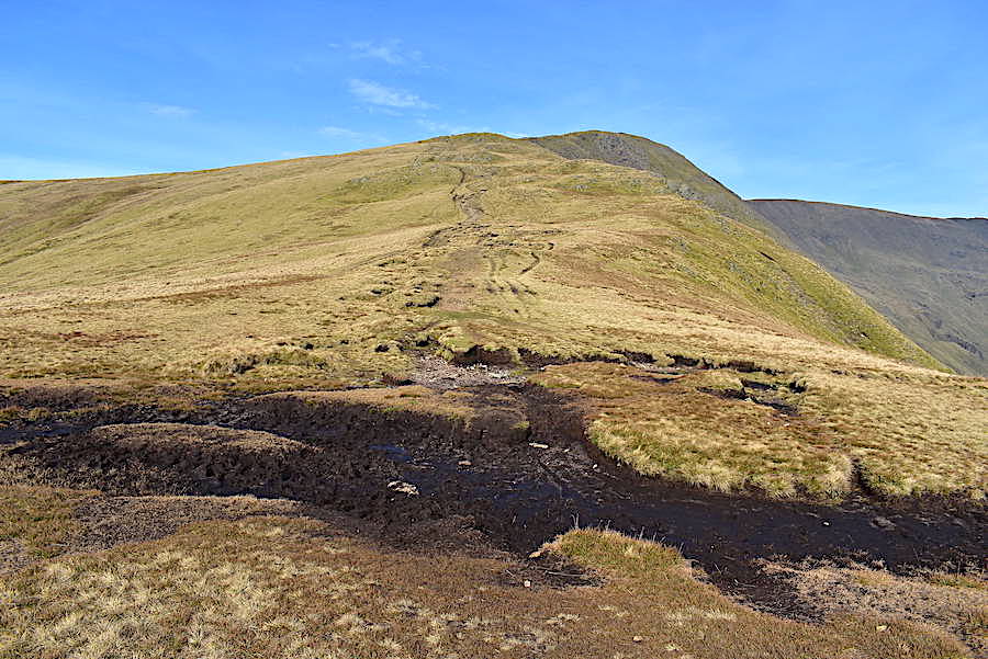
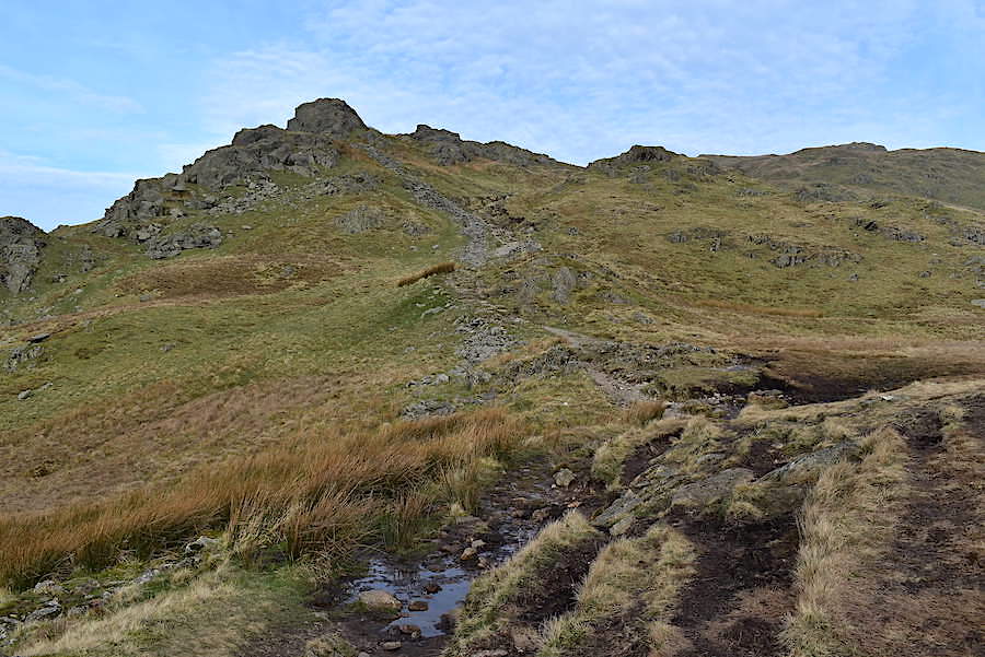
Once we’re across the peat hag the heavier lifting begins. It doesn’t look much but don’t let that benign appearance deceive you.
Across to our left we keep seeing more walkers as they appear between the undulations of the Stone Arthur ridge.
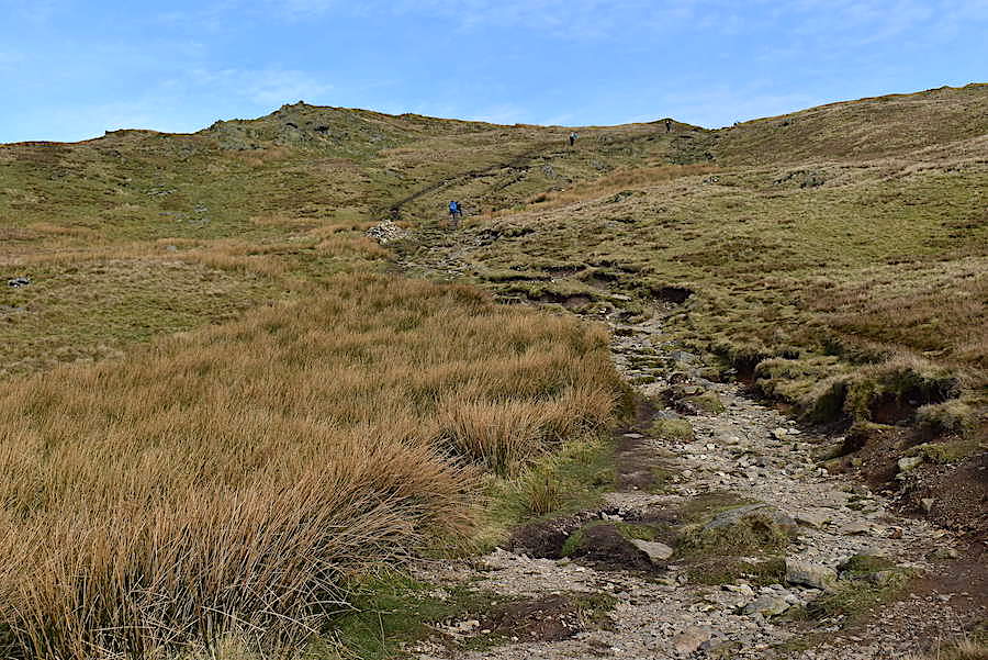
A pause close to the junction with the Stone Arthur path to let a group of four arriving from there join the path to the summit. I took the chance to take a look back along the Erne Crag/Heron Pike route we’ve just walked across.
A cairn appears on the skyline but we’re not quite on the summit yet, its only a marker cairn so there’s still a little more uphill before we get there. There are plenty of walkers around but this last little bit seems to get everyone slowing their pace quite a bit. Understandable because, wherever they started from, everyone has had to do a fair amount of climbing in very warm conditions to get to this point.
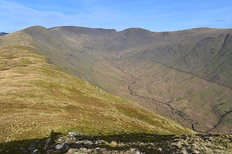
A shot of the view along Rydal Beck as we climb the last few yards …..
….. up on the summit and a look over at the Link Cove col between Fairfield and Hart Crag. A lot of walkers reached the summit at the same time as we did, more or less, and as there was a bit of a crowd I wandered off to take a few more shots.
The next leg of the journey would be over to Fairfield if we were continuing around the horseshoe but we aren’t going over there today so Great Rigg will be our turnaround point.
A zoom in for a closer look at High Raise, Rampsgill Head and Kidsty Pike just visible above the col …..
….. occupying the middle foreground is Seat Sandal to the north west ….
….. with Dollywaggon Pike and the rest of the Helvellyn group beyond Grisedale Hause.
A closer look at Dollywaggon Pike, Nethermost Pike and Helvellyn with Catstycam peeping up above Striding Edge.
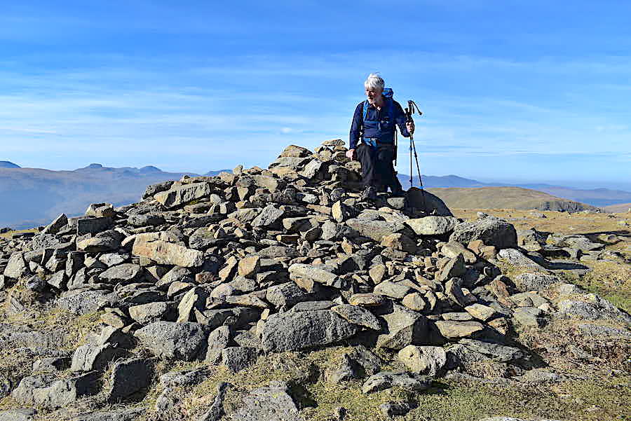
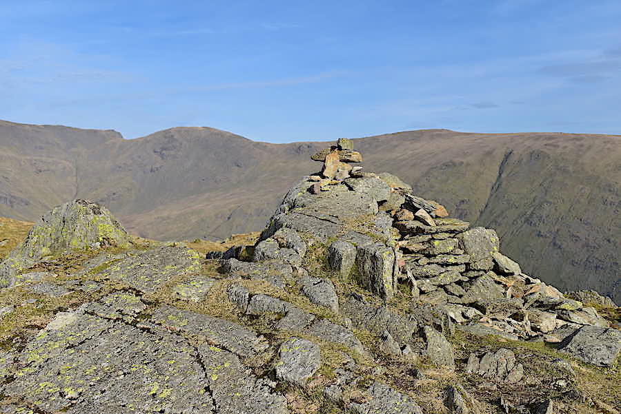
J perches uncomfortably, and a little precariously, on Great Rigg’s cairn while I take a summit shot. He doesn’t take naturally to modelling!

Bowfell, Scafell, Scafell Pike and Great End on this skyline shot …..
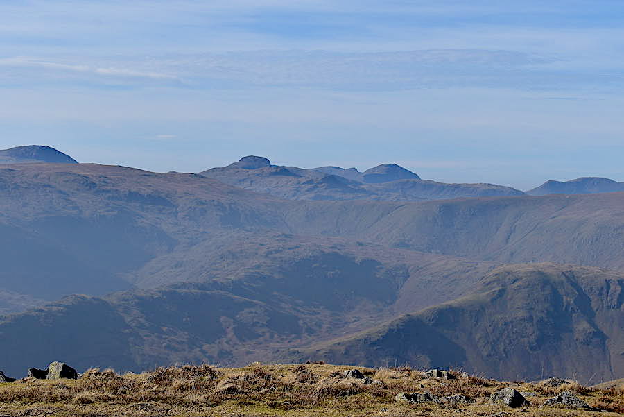
….. Great End, Great Gable, Scoat Fell, Pillar, High Crag and High Stile on the skyline in this one …..

….. and Robinson, Grasmoor, Crag Hill, Scar Crags, Hopegill Head, Grisedale Pike and Lord’s Seat on the skyline in this one.
The summit area is still a little overcrowded with many walkers settling down for a lunch stop. We move down and look for somewhere a little quieter and more comfortable to take our food break. Away from the melee we sit munching the sandwiches and gazing at the fascinating, and slightly surreal, view before us.
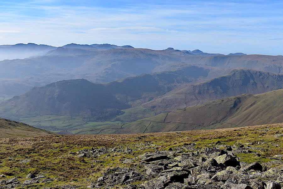
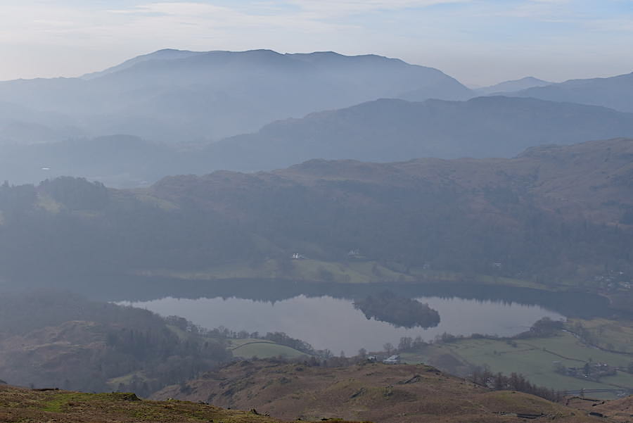
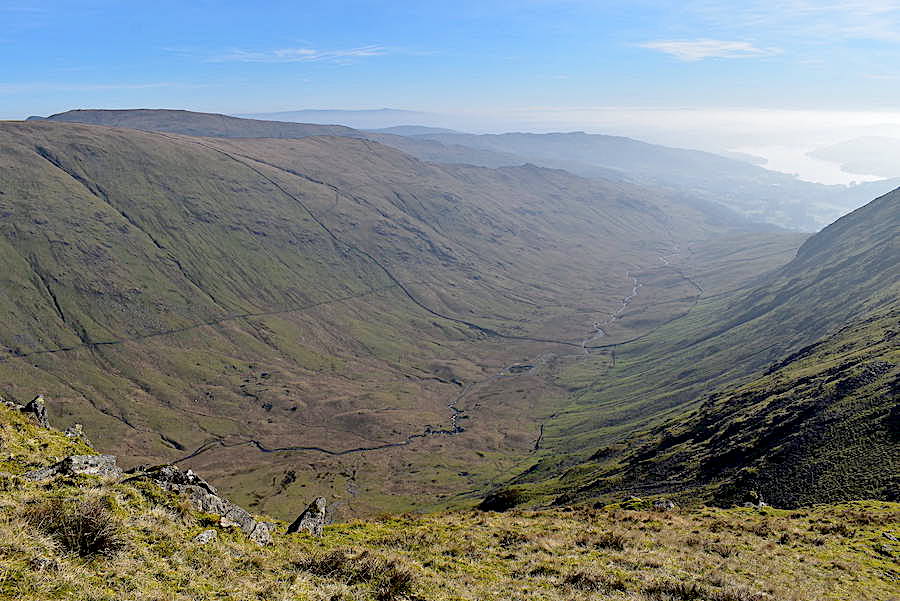
To our right we could see, what could be called the Greenburn horseshoe quite clearly below us. Starting with the shadowy Helm Crag in the left middle foreground it carries on over Gibson Knott, Pike of Carrs and on to Calf Crag. From there the route crosses over to Steel Fell before dropping down its long south east ridge and heading back to Grasmere.
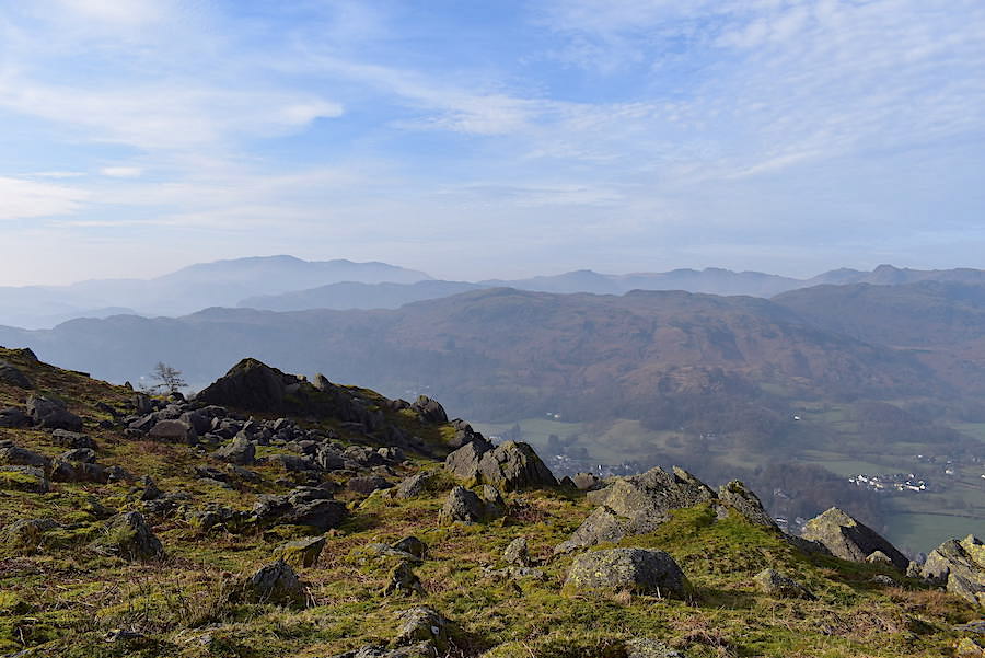
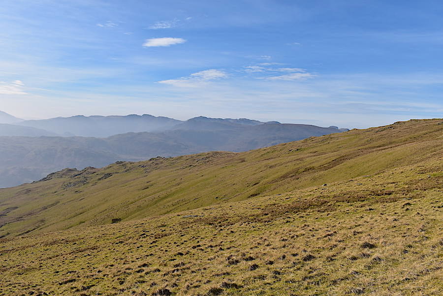
Layer after layer of smoky blue fells, with misty valleys between, to the south west beyond Stone Arthur. A magical sight.
We make our way down to Stone Arthur after our lunch and met several walkers sweating their way up. The path looks much gentler than it really is and I’m pleased we got the heavy lifting done this morning because it is very warm now.
Another look across to the Helvellyn group as we make our way down.
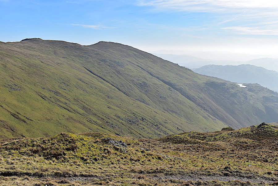
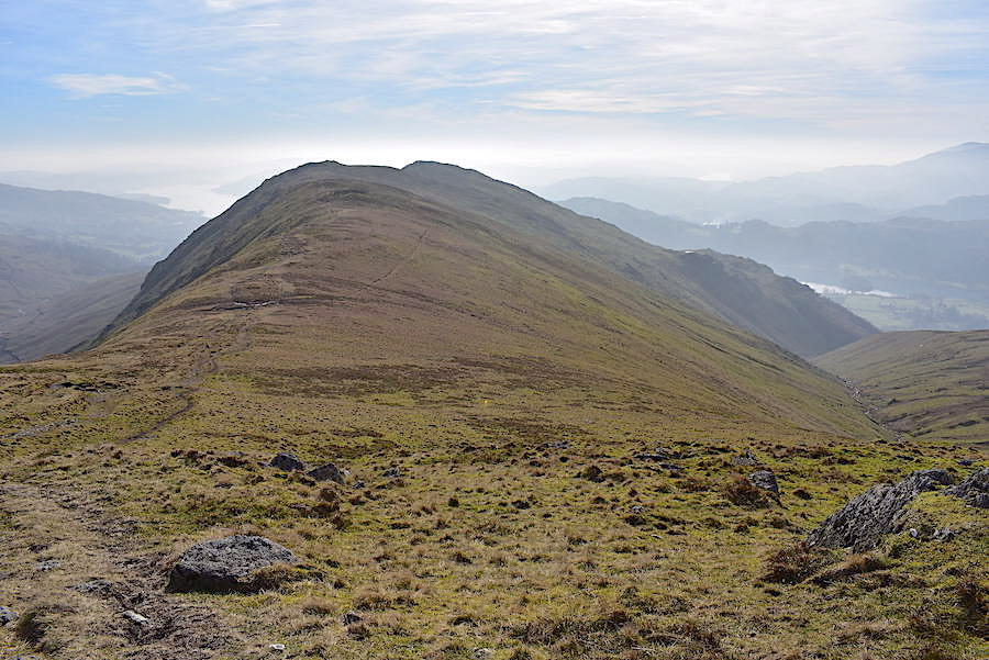
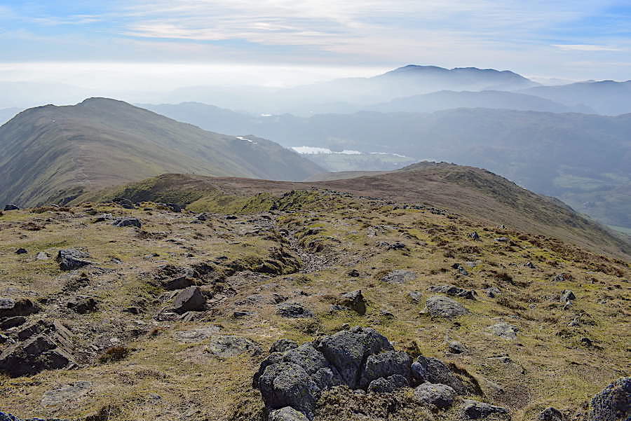
On our left we look over to Erne Crag and Heron Pike with Alcock Tarn sitting on the little shelf to the right of them. The tramp down the Stone Arthur ridge was lovely and very enjoyable, especially so when its a downhill walk all the way to a summit and requires nothing by way of effort.
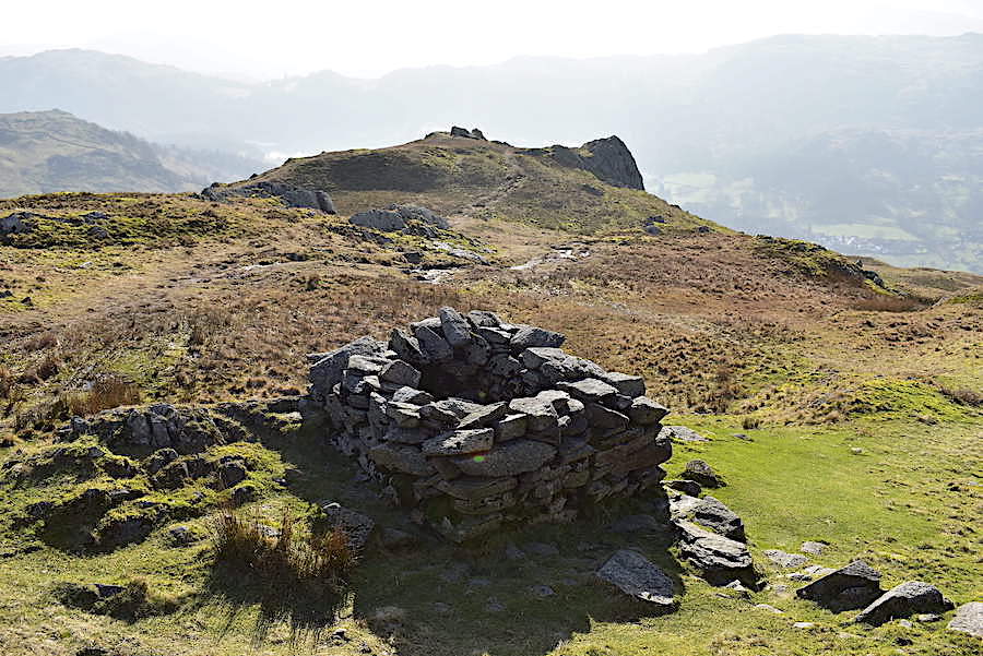
The summit of Stone Arthur from the old bield. It isn’t marked on the OS map and we are still none the wiser about its original purpose. I’m not even sure I should be referring to it as a bield, maybe its an animal trap but it isn’t very deep and if any animal ended up inside it it would be easy enough for it to get out again.
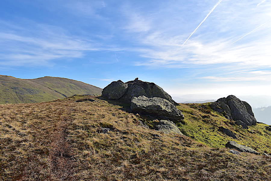
Its not strictly true that it was all downhill to the summit, there was a small rise up to the summit outcrops, so small that it was hardly worth mentioning but I thought it best to mention it in case I’m accused of misrepresentation! Sometimes there’s a few stones forming a rudimentary cairn, other times there’s nothing at all.
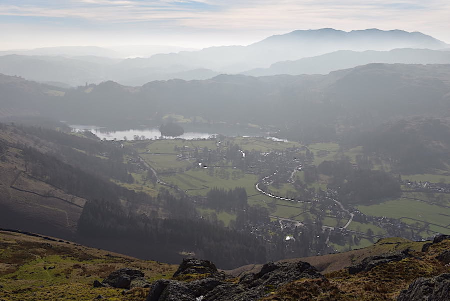
The very hazy view of Grasmere, the village and the water, from Stone Arthur.
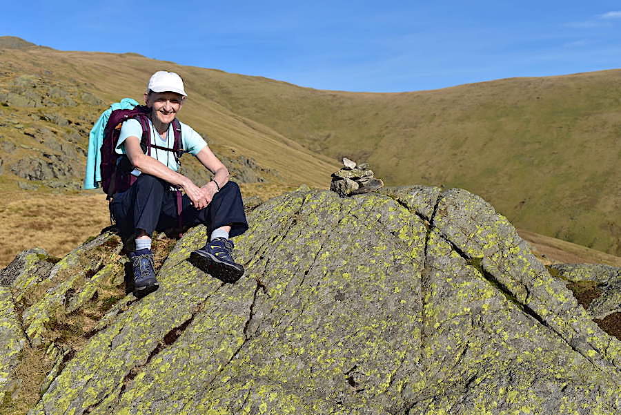
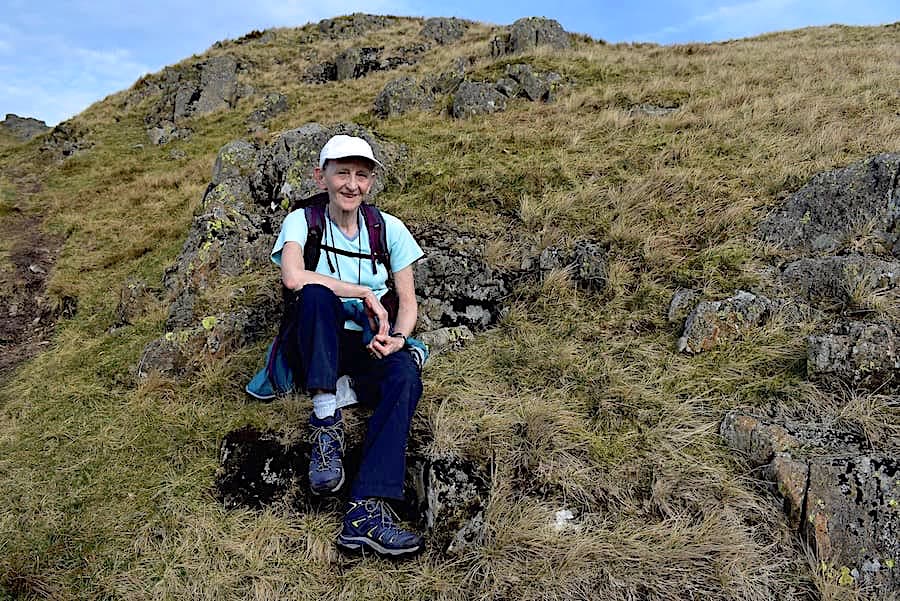
Yours truly having five minutes in the sunshine on Stone Arthur. Short sleeves and sun hat in February, you wouldn’t have put money on it would you?
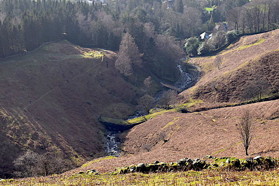
A look down to the aqueduct and the new bridge as we make our way back to Michaels Nook. Our outward route took us, more or less, alongside the wall by the trees on the left, and our return path will be down the grassy path just below the rooftops at the top right.
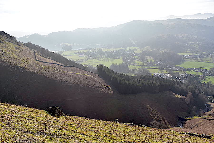
Rising above the trees on Forest Side is another section of our outward route.
Back down at Michaels Nook where I took this look back, from where the old footbridge used to be, up Greenhead Gill to the new bridge. Everything looks very new and unfamiliar up there at present but it will weather in eventually and gradually look a lot less stark.
From the lane leading to Knott House Farm a look across the A591 to Steel Fell and our conversation turns to recalling the climb up its steep north ridge, over there on the right, on a similarly sunny but very cold, blustery day in January. Neither of us even fleetingly considered then that we would be standing here, in short sleeves on a very warm and windless day five weeks later, staring back at it. It might be very unusual weather and it might only be temporary but its very welcome nevertheless. Will there yet be a sting in winter’s tail though?