
Walk date – 30th October 2025
Distance – 4.5 miles
Weather – Some sun and light cloud at start, very cloudy later, no breeze to begin with, but strengthened later as cloud cover arrived, mild
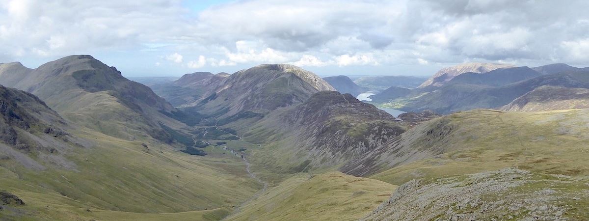
Today’s weather forecast mentioned a weather ‘window’ between 9.00 am and 12 noon where there would be a chance of some sunny spells. It didn’t last for the full three hours though and by 11.00 am we were back to square one and under a grey woolly blanket of cloud yet again. Still, it was nice while it lasted. The forecast also mentioned a foggy start and it was certainly that when we looked out of the window at seven o’clock this morning. We had decided to take advantage of the chance of some sunshine, irrespective of how long it lasted, so we drove over to Bowscale hamlet and had a short morning walk up to Bowscale Tarn . During the drive over to Bowscale we could see that all the valleys around us were full of fog but all the fells around us were largely free of cloud hanging around their tops. Although they were free from cloud all the fell summits ahead of us were nevertheless quite muted and remained so, unless a ray of sunlight managed to land on them. By the time we were driving back home, just turned noon, they had all turned a dull shade of grey. By the way, the ‘smoke signals’ rising up behind the fells in the photo at the top of the page were the remnants of this morning’s inversions in the valleys behind them.
Route
Off road parking at Bowscale – path above Mosedale – Drycomb beck – Bowscale Tarn – Tarn Sike – descent path to bridge across River Caldew – Roundhouse – Swineside – Mosedale – Bowscale off road parking


The little hamlet of Bowscale from the off road parking area where the road was still damp from the overnight rain and, although the cloud looked heavy, bits of blue sky were beginning to appear. The road turns down to the right towards Mosedale hamlet but we carried on straight ahead and followed the track beside which the white van was parked. Carrock Fell is the fell in the background.

A sunlit view of Carrock Fell from the track.

The view along Mosedale ahead of us as we strolled along the track. As can be seen the track is firm underfoot and well graded and we are gaining height steadily and almost imperceptibly.

Below is the Caldew river winding its way through the green fields of Mosedale. The lower slopes of Carrock Fell and the trees around the Roundhouse residence are catching the sun, but we aren’t as we are in the shadow cast by Bowscale Fell on our left.

Approaching Drycomb beck where the track becomes a tad steeper …..

….. and a series of mini cascades where the track crosses the beck.

A look back along the track after crossing Drycomb beck. The beck is situated where a diagonal line of dark green grass can be seen, and …..

….. from the same spot a look back along Mosedale where the Caldew river is quietly making its way down to Caldbeck and then onwards to Carlisle.

Still sunny around Roundhouse where, amongst the cluster of buildings, we could only see one circular building which seems to be a garden conservatory/summerhouse, or something of that nature. The rest of the buildings were hidden by all the surrounding trees. Also in view is the footbridge across the river which our descent path will lead us to. It will need a zoom in to see both of them more clearly.

Bowscale Tarn’s rim of crags, Tarn Crags, come into view so the tarn isn’t far away now. We stopped at this point for J to remove his mid-layer as he was over-heating. Mine was already in my pack as I had removed it when we parked up. There is a solo walker on the path ahead of us who passed us somewhere between here and Drycomb beck.

The sunlight landed on the fells above the mining area around Grainsgill beck enriching their autumn colours. The shot shows the Miton Hill end of Carrock Fell on the right, behind it is Drygill Head rising up to High Pike, and I think that the plateau on the left skyline is Great Lingy Hill.

Another view of Tarn Crags as we approach Bowscale Tarn. At the end of this section the path turns towards the tarn and becomes much narrower as it runs alongside the tarn. As we turned towards the tarn the solo walker who had passed us earlier was perched on a stone overlooking the tarn. We had a brief chat with him and it turned out that he was doing just the same as we were, walking up to the tarn only.

We left him sitting on the stone and walked to the eastern end of the tarn for this shot of it and the various paths around the lower slopes …..

….. then a little to the right for another view across the tarn. The V shape in the centre seems to have spoil heaps around it which may be the result of prospecting when the mine at Grainsgill was in operation. The horizontal pathways going across it don’t seem to lead anywhere in particular. We walked across there during our walk of 19th August 2014 and we managed to get a full view of the tarn from that side. I recall the grassy slopes below the crags across there as being particularly steep.

Another sunny spell came along as we walked back to the tarn’s outflow and where more paths are visible.

Approaching the outflow end now, the solo walker has gone so we have the tarn to ourselves.

Across the outflow is another path, this one leads walkers across the grassy areas below the crags and eventually leads to the path going up the ridge which is on the right skyline. See our walk of 17th September 2020 for details.

The tarn is a big one and is difficult to photograph, especially when the sun is out and the whole area is backlit by it. The sun presented no problems in that respect today as it was now beginning to cloud over and the blue skies and sunshine were drifting away to the east.

The stepping stones at the outflow …..

….. and the path leading from them. We made our way back along the path to the crossing point over Tarn Sike where we crossed over and picked up the path leading back down to the footbridge by the Roundhouse.

The blue skies and sunny spells are being nudged northeastward over Carrock Fell and we are slowly being covered over with a grey cloud blanket. The descent path was grassy all the way with some parts of it being a little steeper than others. There was also a couple of pathways going over to the left, as you look at the shot, which lead over to the Tarn Crags ridge.

Mosedale, the south-eastern end of Carrock Fell and ourselves enjoy just about the last of the sunny spells. Cross Fell and its near neighbours (part of the Northern Pennines) are over on the right skyline and below them is the Eden Valley which looks as though some elements of this morning’s foggy conditions are still hanging around.

Still descending down to Roundhouse, the white house to the right of it is Swineside.

The view back to Tarn Crags and the rest of Bowscale Fell’s ridgeline. We came across no boggy sections at all along the path so no muddy boots when we got home, just boots with bits of grass stuck to them.

The sunshine has gone somewhere else leaving the landscape looking flat and dull now. Here we go again!

Heading down to Roundhouse and the Caldew river.

J’s plated ankle gives no trouble at all down the grassy path, he’s romping down the path way ahead of me.

Oh dear, its the kind of bridge I hoped it wouldn’t be, the kind that give me the heeby-jeebies. The river is quite wide at this point and the bridge, which is supported by two sturdy stone pillars, is high above the water so J took me by the hand and led me across while I kept my eyes closed until we reached the end of it. I’m not good in aeroplanes either!

I hope it wasn’t really leaning like the photo shows and that its just the result of poor photography!

From the safety of the riverbank here’s another view of the footbridge.

The path from the bridge goes alongside the buildings of Roundhouse where there was no-one to be seen although we could hear the engine of something rumbling quite close by. As we made our way up the path and back to the lane along Mosedale we noticed a couple of chaps discussing something in one of the yards and a van which advertised a joinery business so we decided that some repairs/alterations were under way.

A look back along the Roundhouse driveway when we reached the lane. The residents have a good view of Tarn Crags, haven’t they? Notice the gloomy skies.

Walking down the tarmac lane back to Mosedale hamlet, the white house over on the right is Swineside.

Looking back to Tarn Crags and the various pathways below them as we walked along the lane.

The entrance driveway leading to Swineside.

Coming up the lane was a group of Herdwicks who took to ferreting about amongst the gorse bushes lining the lane. This one posed very nicely for me, the rest of them weren’t interested at all.

The view along Mosedale looking back to Roundhouse and its cluster of trees. Coomb Height is the high fell at the end of the valley.

So there we were, just having a natter while ambling along down the lane when we caught sight of this red squirrel taking a bit of a break on the stone wall. We expected it to disappear rapidly, as they usually do before you can get the camera out, but no, this one stayed where it was. It seemed to be as surprised by our presence as we were of its.

It finally decided to make a move, but not before I’d rattled off four shots of it, then it lowered its tail, scampered along the wall for a couple of feet before it dropped down to the ground on the far side of the wall.

We dropped down into Mosedale hamlet where we noticed this building …..

….. the Mosedale Meeting House which holds meetings for the Friends on the 1st and 3rd Sundays of each month at 10.30 am. Notice the date on the lintel above the door which makes this building over 300 years old.

The globalists wouldn’t like this statement at all. They view the rest of humanity as ‘hackable’ animals.

At the end of the lane at this point, the road continues on to Calebreck and Hesket Newmarket but we turn right and make our way back to Bowscale.

Approaching the ‘new’ Mosedale Bridge across the Caldew river …..

….. but we veer off to the left before reaching it to cross the river via the old bridge which is now off limits to cars and motorcycles. The white sign on the stone leaning against the bridge wall says ‘Township of Mosedale”.

After crossing the old bridge leaning against the other side wall was this one, stating that on this side of the bridge is the ‘Township of Bowscale’. Just to the right of this sign was an information board detailing all the old townships in the Parish of Mosedale (now the Parish of Mungrisedale). They were indicated by a red dot on the accompanying map and there were a lot of red dots marked on it. Each township had its own sign and volunteers have been trying to find all the old township stones. They have found only a few so far. The Parish of Mungrisedale seems to consist of the same areas as the former Parish of Mosedale, these being Mungrisedale, Bowscale, Mosedale, Heggle Lane, Haltcliffe Bridge, Hutton Roof, & Murrah and Bernier.

Back in Bowscale now so all that’s left to do is turn left when we reach the house on the left and the off-road parking area will be just a few yards away. Its just a couple of minutes before noon and the cloud cover is total. Oh well, we had some sunny spells along the way but now its gloomy and the wind has increased. We’ve had a pleasant couple of hours walking, it didn’t rain so that was a plus, and best not to mention the footbridge episode, so we’ll get off home and get the kettle on.
———–
We received an update from Friends of the Lake District re the proposed Zip World visitor attraction at the former quarry site at Elterwater. You may remember that a two day hearing was held in April this year which we referred to in our walk of 7th May 2025. Mr Justice Mould has finally made a decision and has ruled that the permission, originally granted by the LDNP authority in May 2024 and which The Friends of the Lake District had appealed against, may now go ahead. The charity is now considering appealing against Mr Justice Mould’s decision. As the Lake District is a World Heritage Site the relevant authority has naturally taken an interest –
UNESCO World Heritage Committee Decision 47 COM 7B.136, The English Lake District, July 2025. That the World Heritage Committee requested the UK government to provide an “updated report on the state of conservation of the property and the implementation of [its recommendations] by 1 December 2026” is itself a signal of the depth of concern that the Committee holds regarding the management of the Elterwater site.
For more details the link to The Friends of the Lake District is here:
https://www.friendsofthelakedistrict.org.uk/News/elterwater-judicial-review-outcome


 The lane eventually flattens out and further along it we noticed another signpost which also indicated this route up to Alcock Tarn.


