A Greenburn Round – Helm Crag, Gibson Knott, Calf Crag and Steel Fell

Walk Date – 9th June 2016

Distance – 7.2 miles

Weather – hot, humid, hazy


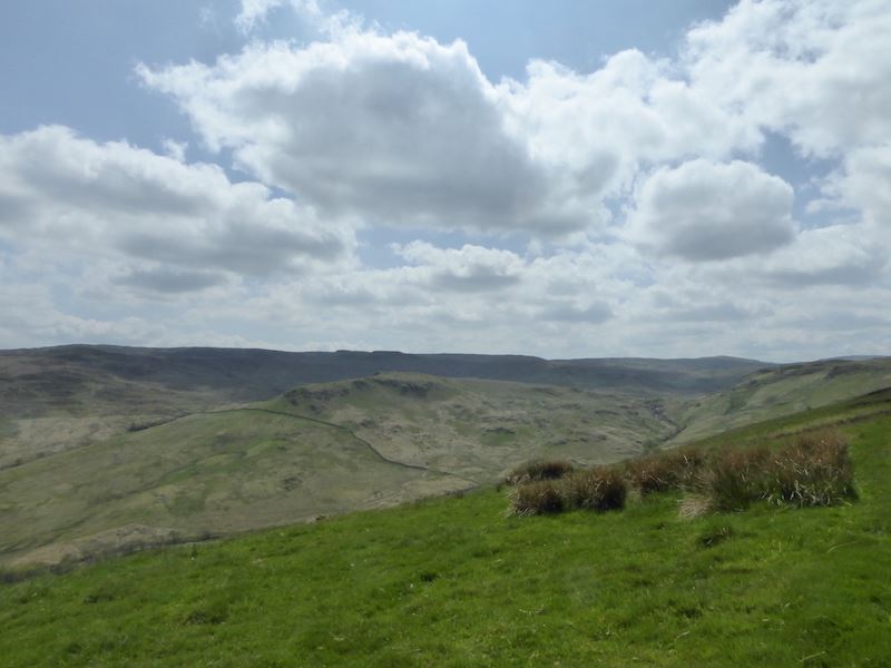
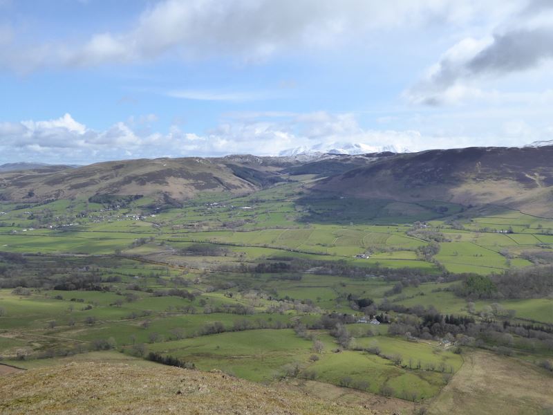
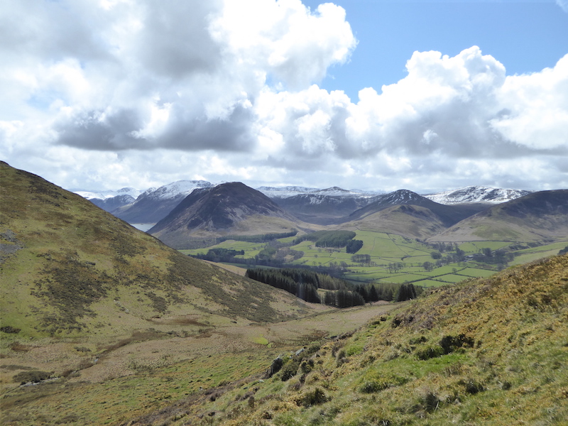
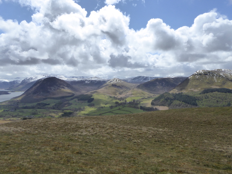
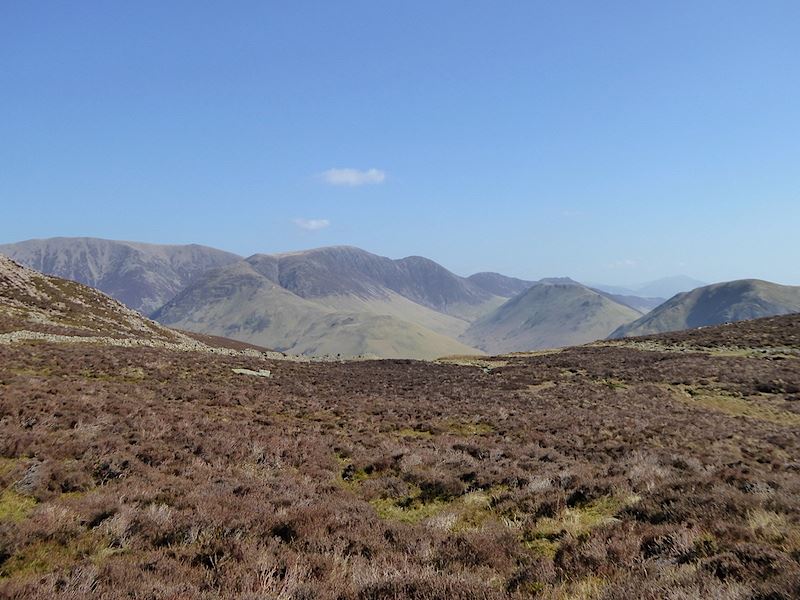
Today’s forecast suggested that there could be some heavy rain by the middle of the afternoon so, not wanting to be caught out on the high fells in a torrential downpour, we set off early for a walk round the fells above the Greenburn valley, just to the north west of Grasmere. In the photo is Steel Fell, with some early morning mist floating around, which will be the last fell on our walk today.


Route

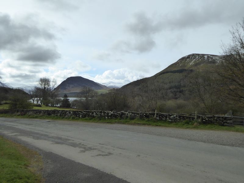
The hot weather continues and its another beautiful morning as we park up in a lay-by on the A591 near Grasmere.  We cross the A591 and walk up to the right for a couple of hundred yards and then turn left onto …..

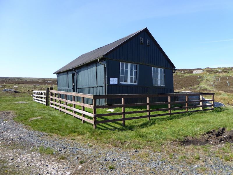
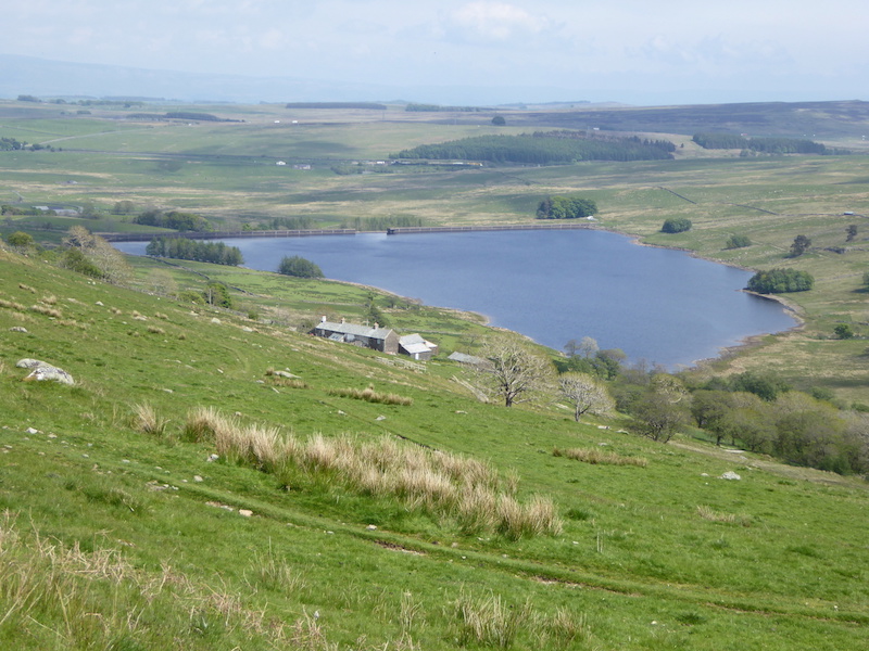
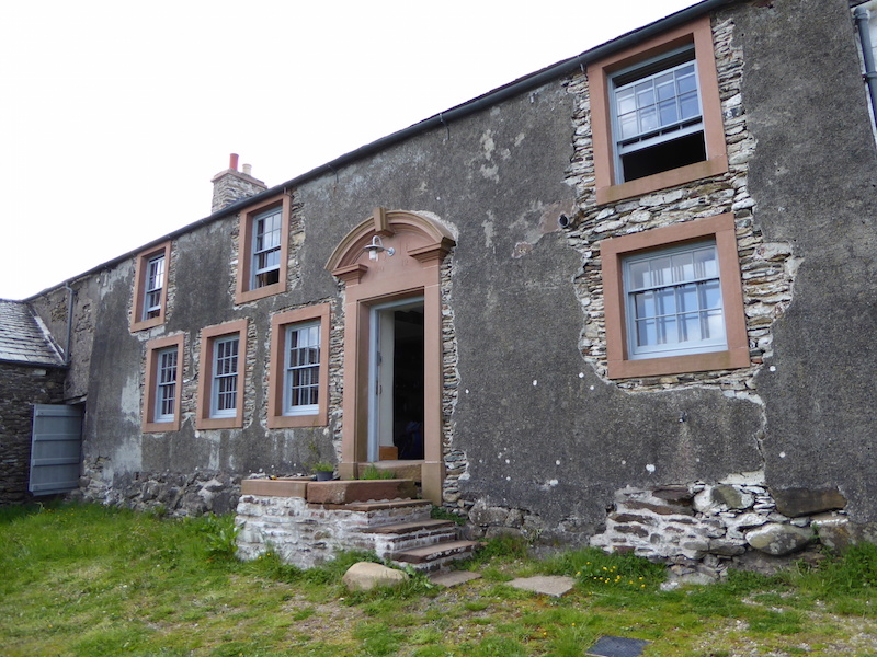
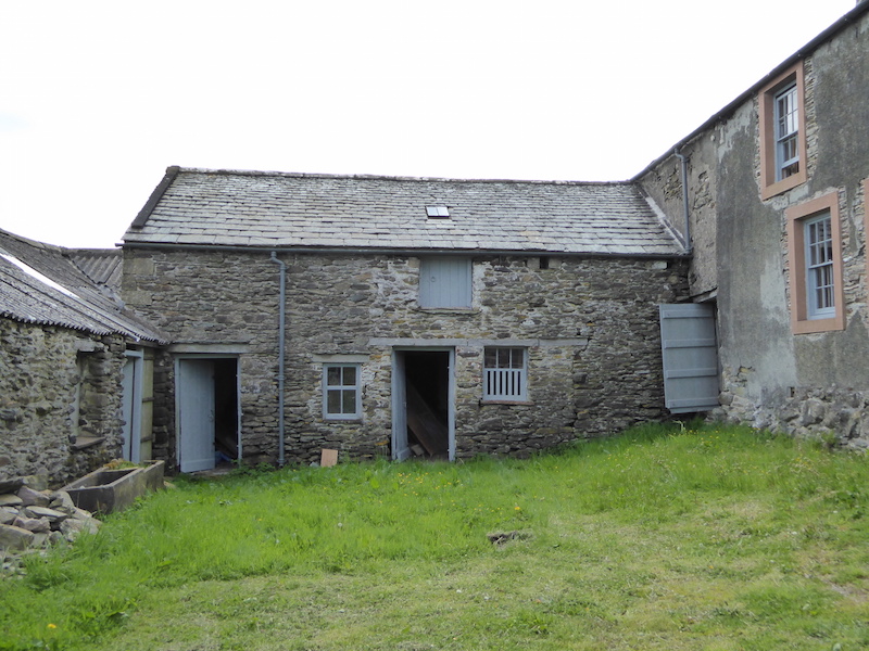
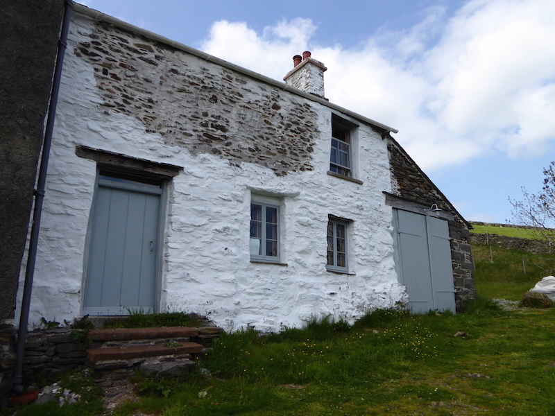
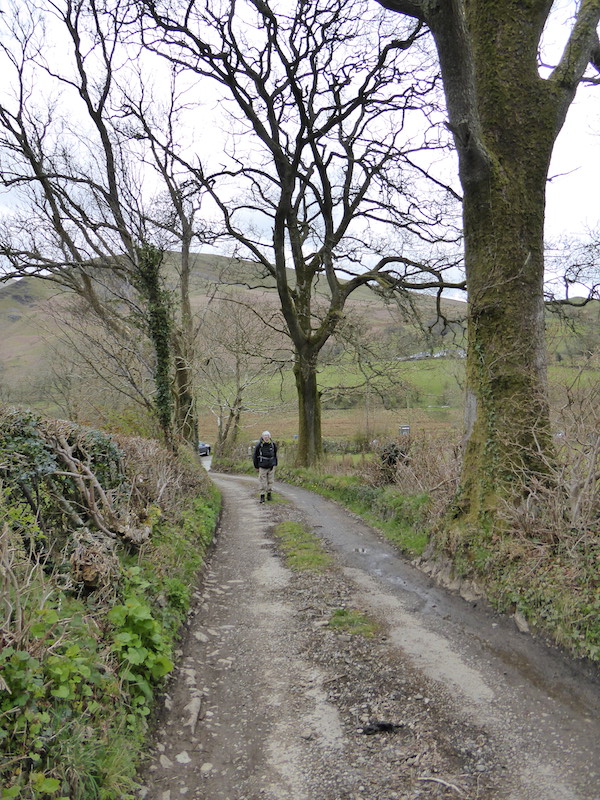
….. this little lane which leads us down to Town Head Farm at the foot of Steel Fell. The lane leads us past the farm and down the hill, at the bottom of which we take a right turn, which takes us up another hill past those white cottages on the left of the shot.

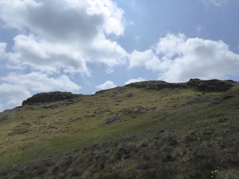
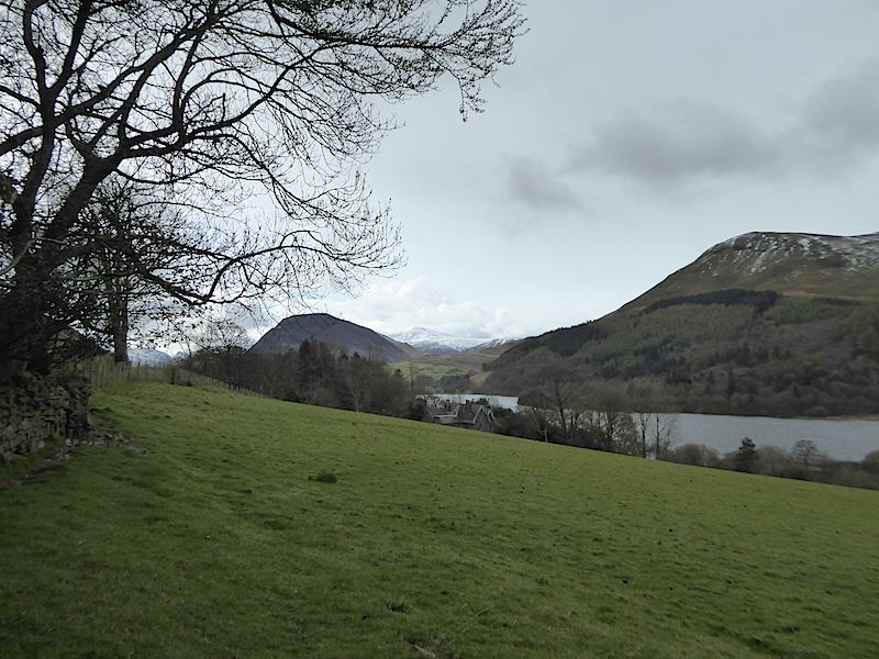
A view of Helm Crag, the first fell on the route, from the lane to Town Head Farm. Standing at just over 1300′ its not one of the big ‘uns but, even so, its testing enough especially on a hot, humid day like today.

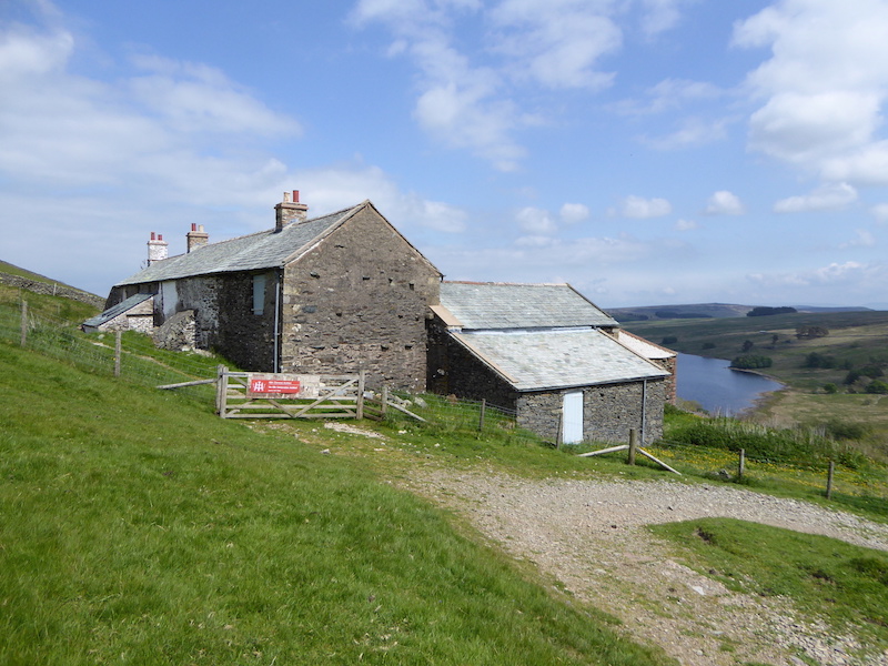
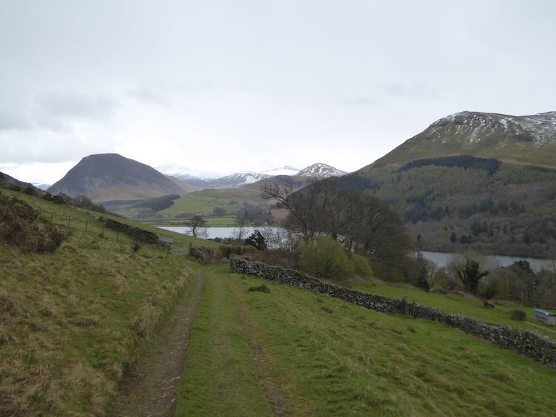
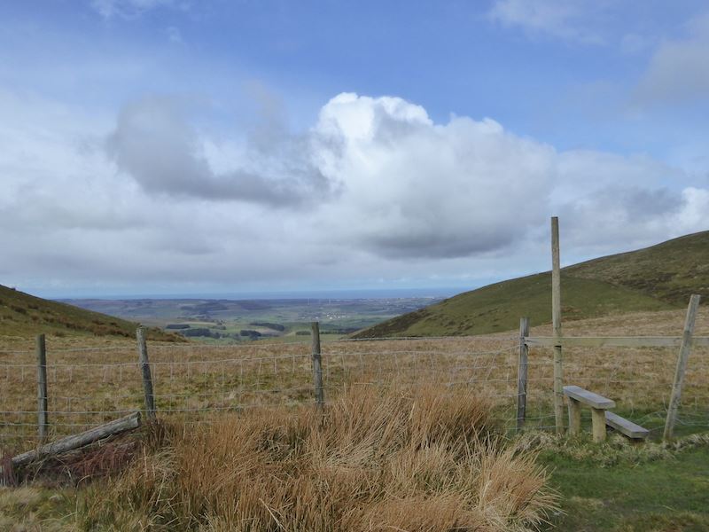
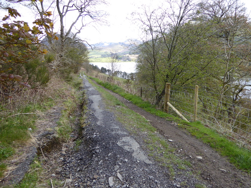
Taking the right hand turn off the little lane we headed up the access road to the white cottages mentioned previously. The access road winds around to the left and leads to a gate. A little further on after going through the gate …..

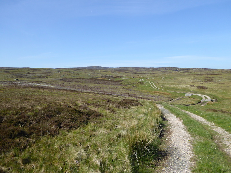
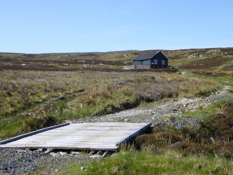
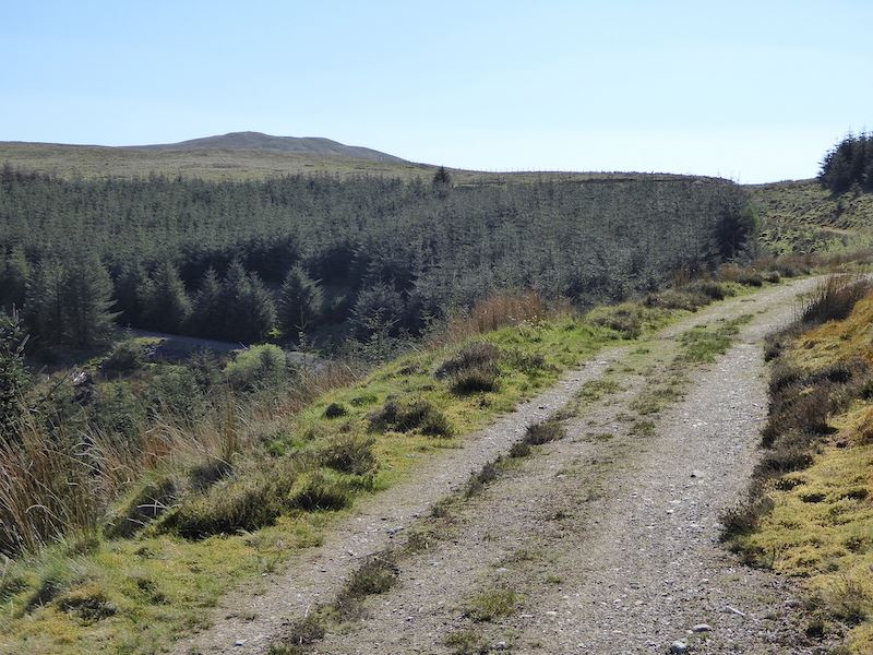
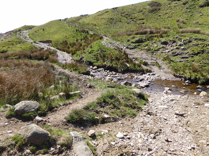
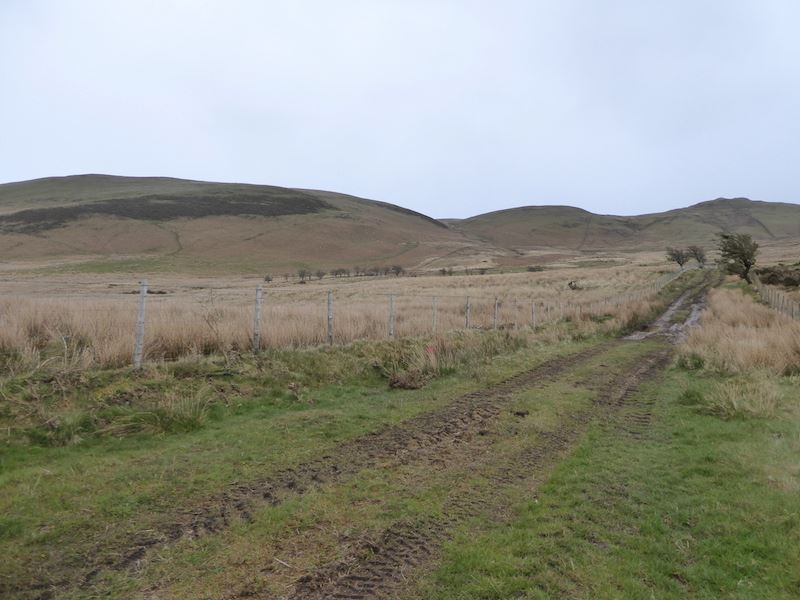
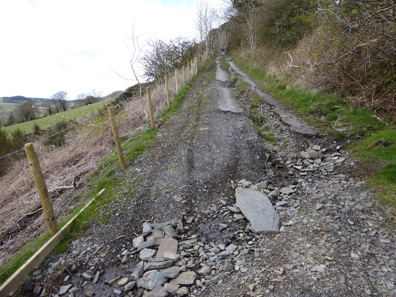
….. the tarmac road ends and the track into Greenburn begins.

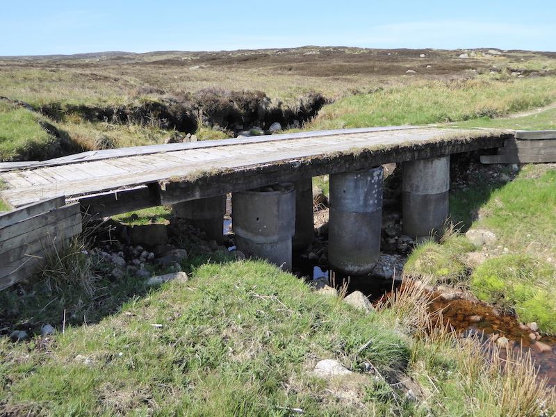
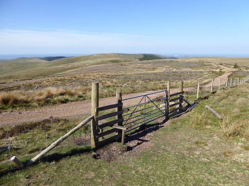
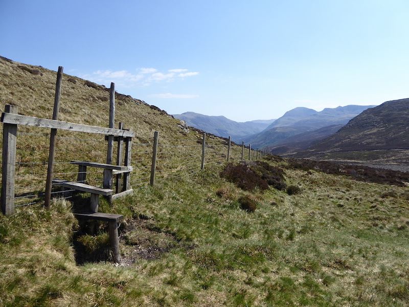
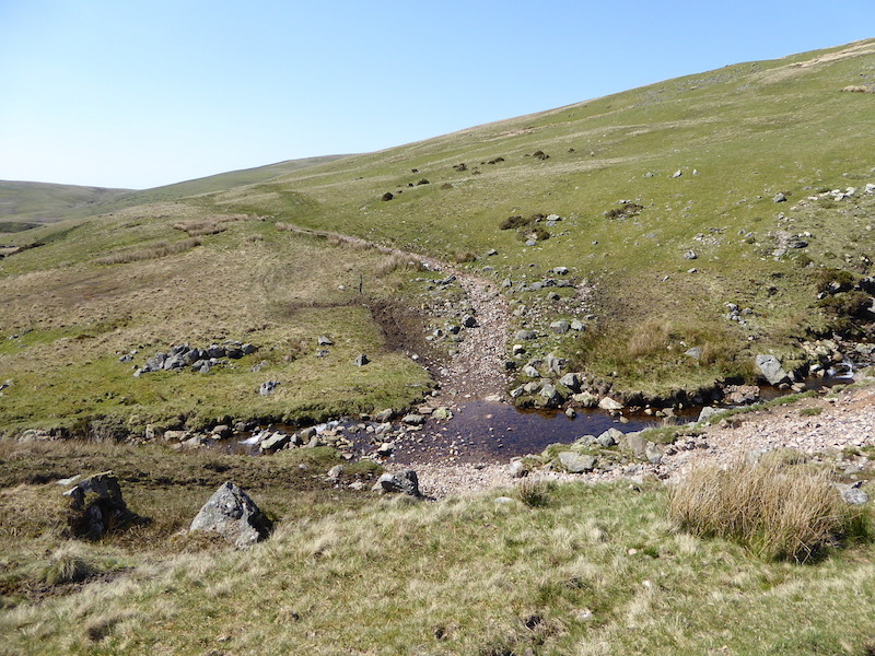
We turned left after walking a short distance along the track and crossed this bridge over the beck. The red and white tape indicating that it must have been damaged during the winter storms, the bridge is quite safe but part of the handrail is still missing.

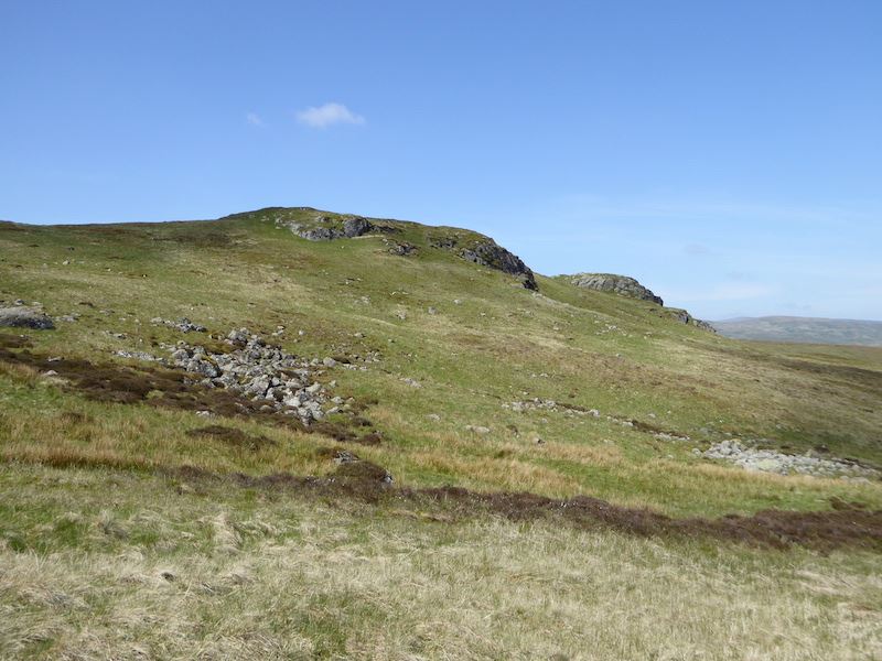
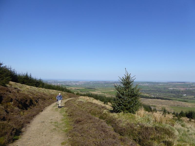
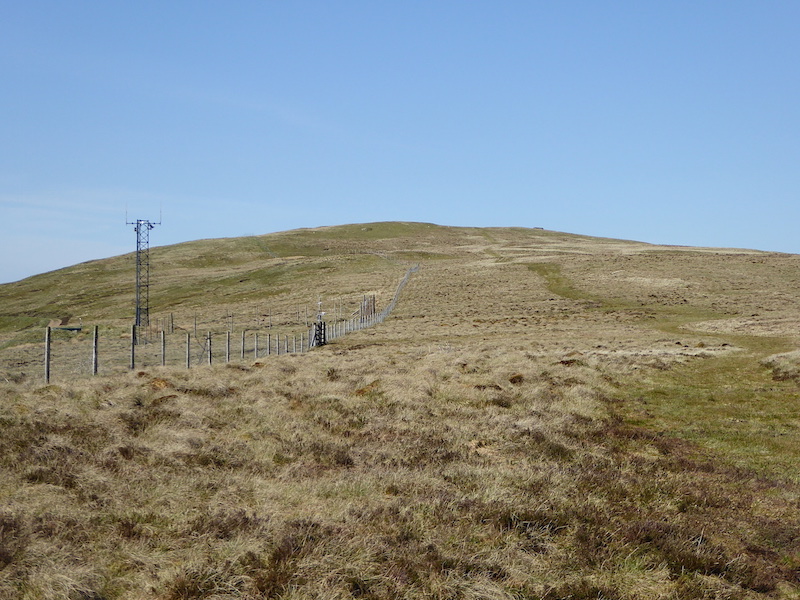
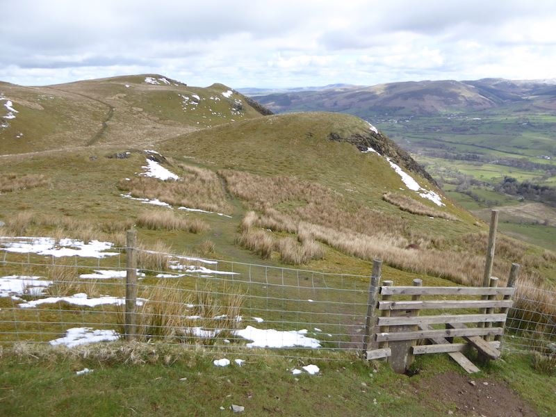
After the beck crossing we pick up the path across the field which leads over to the gates in the two walls running across the photo. Once through those gates we follow another path which rises up the fellside in a series of zig-zags.

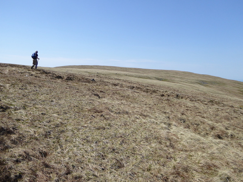
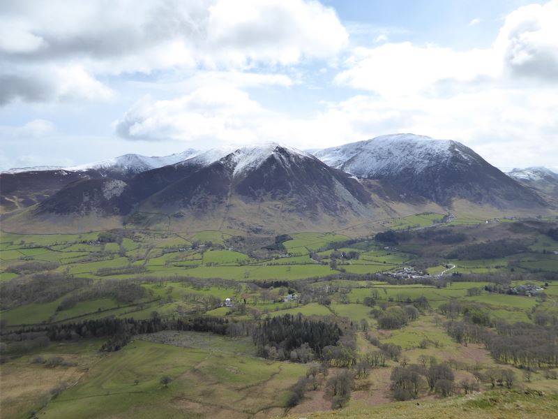
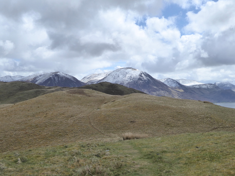
Pausing at the end of one of the zig-zags to have a look at Steel Fell on the other side of the beck. The zig-zag path makes the ascent so much easier but walking up here was very hot work this morning. The sun was on our backs, it was very hot and humid and there wasn’t even the slightest hint of a breeze to help cool us down. Sweat running into our eyes,  dripping down our backs, off the ends of our noses, and onto the insides of my glasses. By the time we got to the hause the brow mopping towel was wet through, our hair was plastered to our heads and we both looked like boiled lobsters.

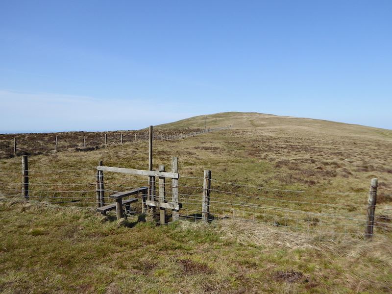
As I reached the hause I could feel a gentle breeze blowing across so I stood facing into it, arms akimbo, and just enjoyed it washing over me, it was absolute bliss. We took a short break here just to towel down our hair and faces and generally get ourselves back together again before continuing on up to Helm Crag. Its not a huge distance up to the summit from here and now we had the light breeze coming across from the right of the picture the climb was a lot less energy sapping.

From the climb up to Helm Crag I took a look back across Bracken Hause. The walkers on the path were three Scottish chaps who had been following a little way behind us up the zig-zags, they too were struggling with the heat and humidity.

The summit of Helm Crag, a large lump of rock called The Howitzer, overlooking the stretch of the A591 known as Dunmail Raise. This is the road which was washed away during Storm Desmond on 5th Dec 2015 and which re-opened to general traffic on 11th May this year.

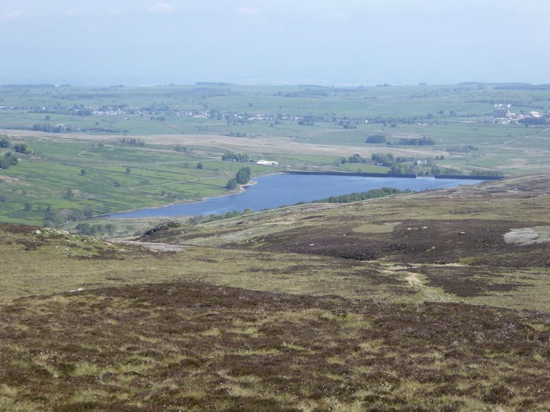
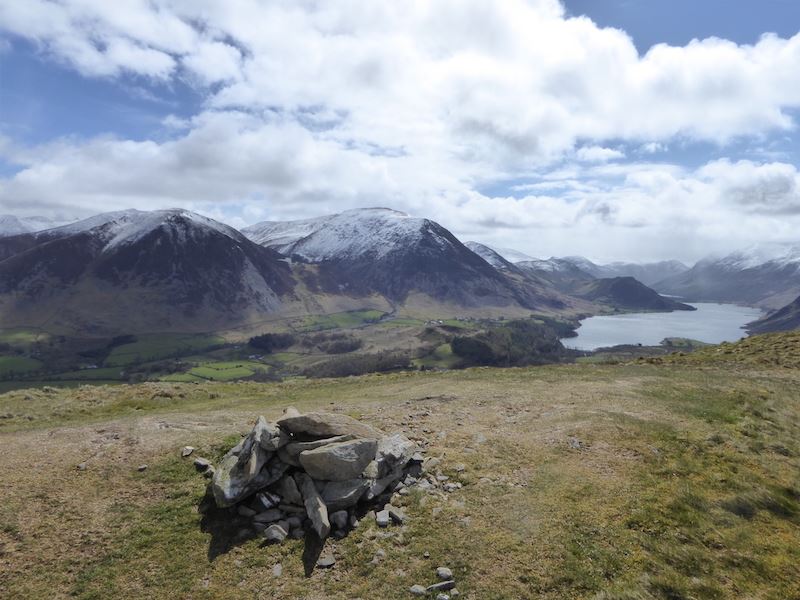
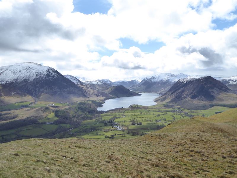
Another rock outcrop, this time with the name ‘The Lion and the Lamb’. Whoever named it must have had a very vivid imagination as similarities to lions and lambs have always escaped me, either on close inspection or from afar. To the right of it is Grasmere, the water, not the village which can’t be seen in the shot, above which is Loughrigg Fell.

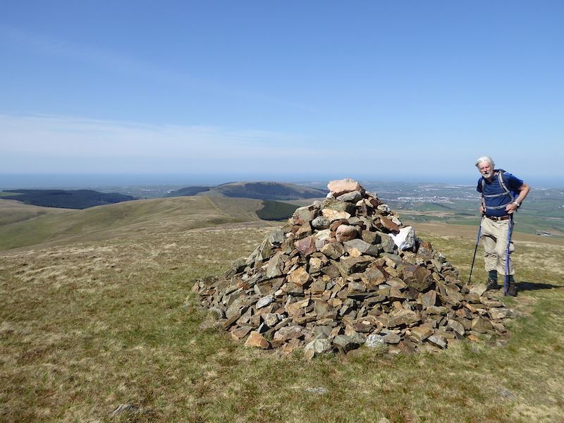
Back to The Howitzer. One of the three Scots was attempting to climb to the very top but gave up about halfway up, the steep drop down the other side putting him off. Getting up is only half the matter, getting down would be even trickier. We had a chat with them, as you do, and learned that they were intending to go on over to High Raise. Well, two of them were, the third had found the heat a bit too much coming up the zig-zags, had decided not to go with them and would meet up with them on their return.

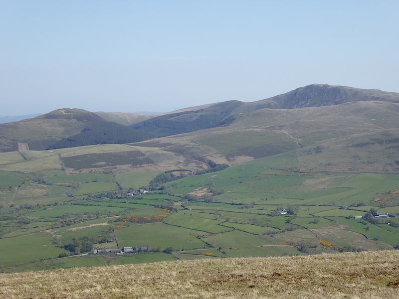
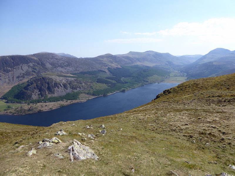
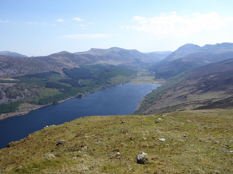
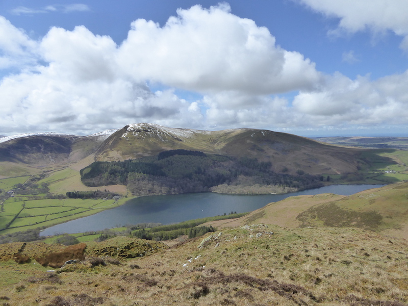
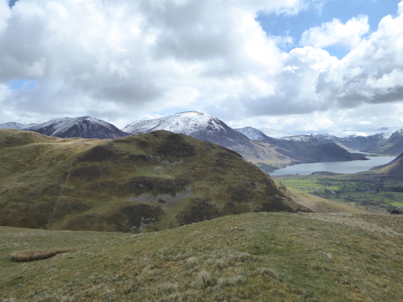
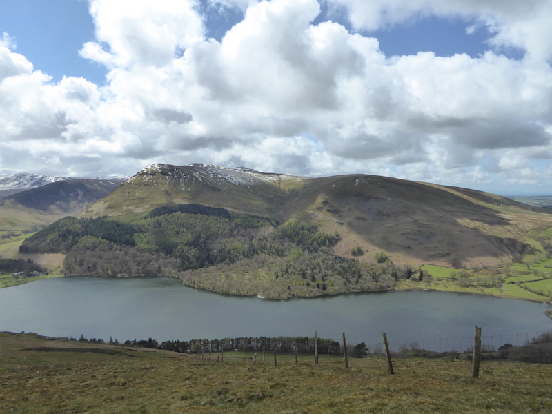
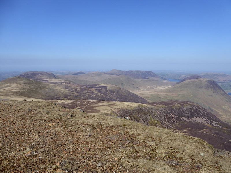
From the descent back to Bracken Hause I took this shot of Tarn Crag over to our left. On the right of it is Far Easedale and on the left is Easedale where you can see the white specks of the waterfalls in Sourmilk Gill. As the photo shows, the conditions were still very hazy and distant views non-existent.

The view back across Bracken Hause to Helm Crag as we continue along the ridge to Gibson Knott. This too was hot work so the breeze, when it came, was more than welcome.

Looking ahead along the path to Gibson Knott. The two walkers ahead had arrived on Helm Crag, from the Grasmere side, while we were there and, after a very brief stop for drinks, left before we did without seeming to take much notice of anything at the summit. We didn’t see them again beyond Gibson Knott so we presumed they had descended into Greenburn from there and returned to Grasmere by that route.

The view down into Easedale as we continue along the ridge. Its lovely to see greenery again although I do wish it wasn’t mostly bracken.

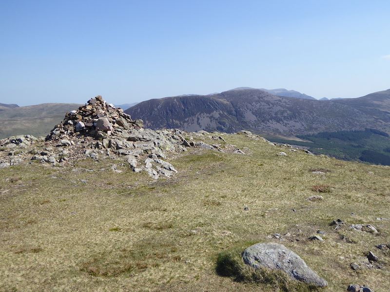
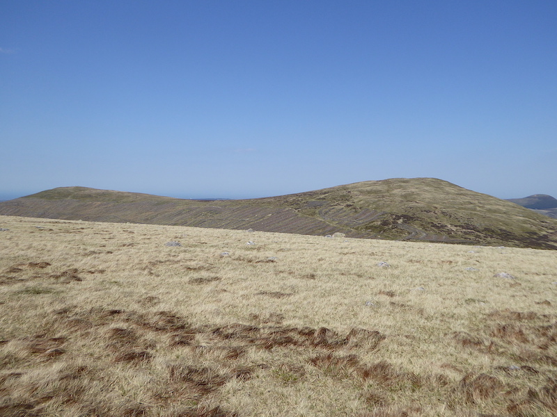
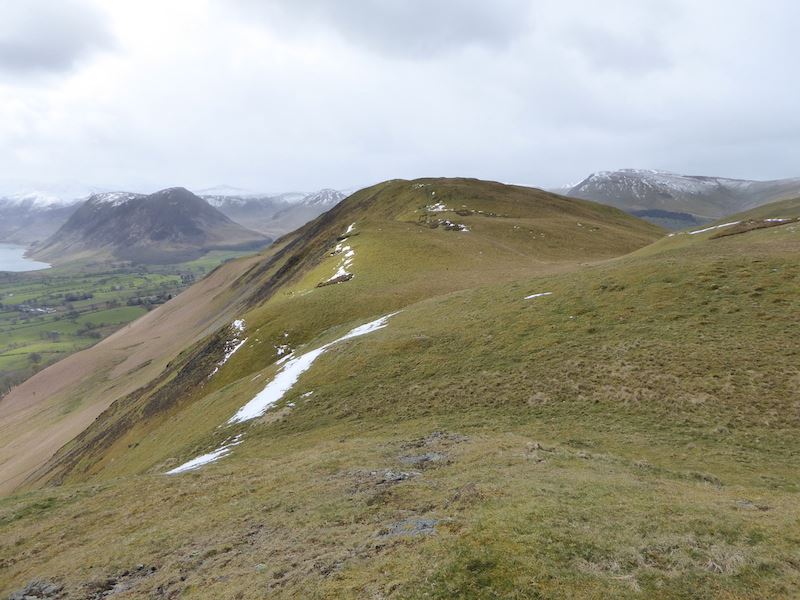
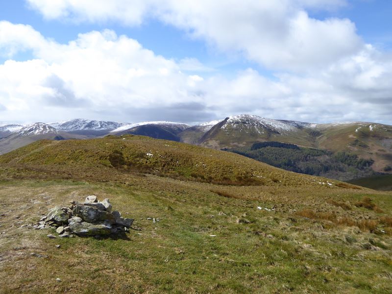
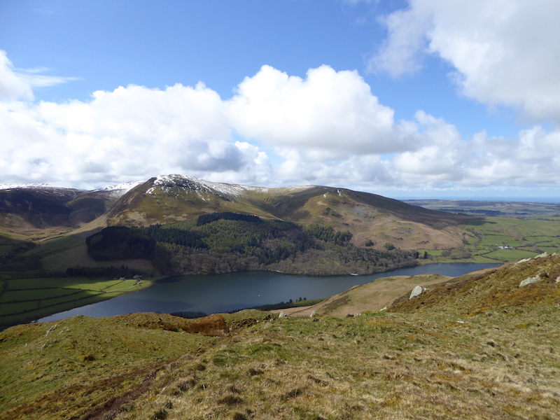
Gibson Knott summit, at 1379′, with Tarn Crag behind it towards the right of the picture. On the skyline to the left is the Blea Rigg ridge.

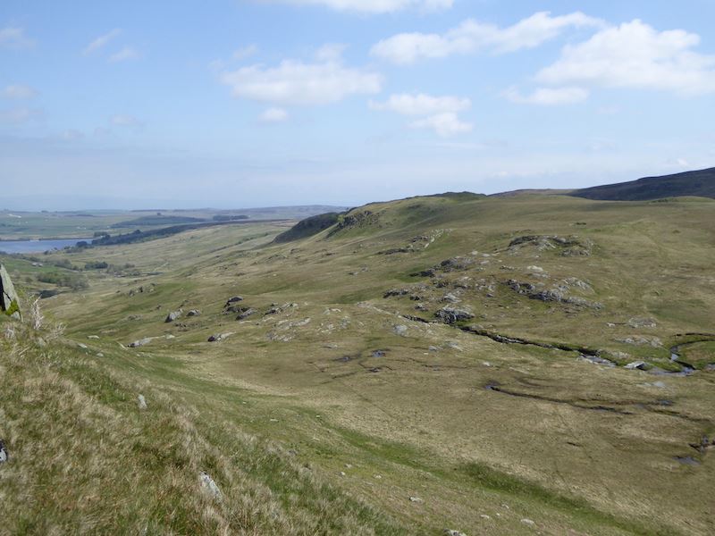
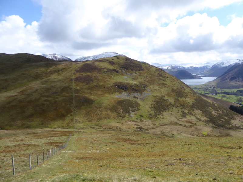
The view behind us is that of Steel Fell across the Greenburn valley.

Still hot and humid although we did have a bit more of a breeze at this point, and our hair was drying out nicely.

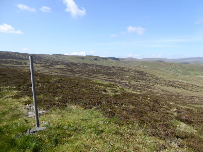
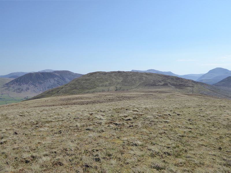
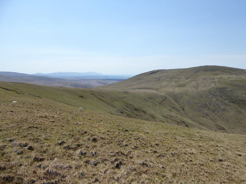
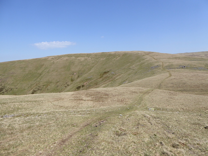
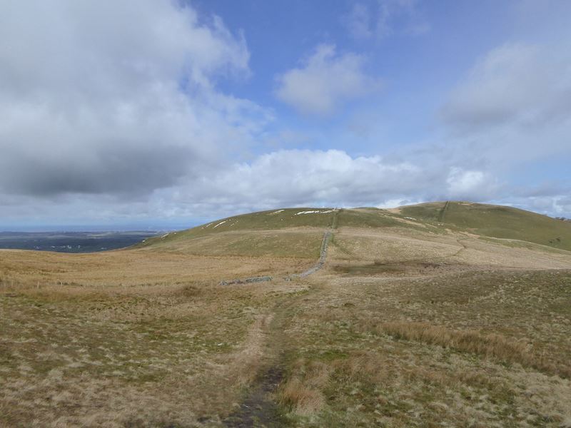
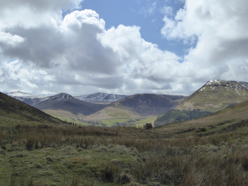
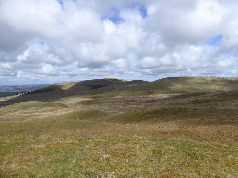
This is typical of the terrain along the ridge, lots of lumps and bumps so you do a lot of ups and downs, its the fell-walking equivalent of a roller-coaster.

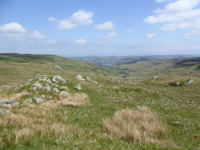
Gibson Knott is well behind us, Helm Crag is a distant memory, and Grasmere is disappearing. We’re a good way along the ridge now so I took another look back.

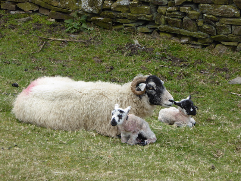
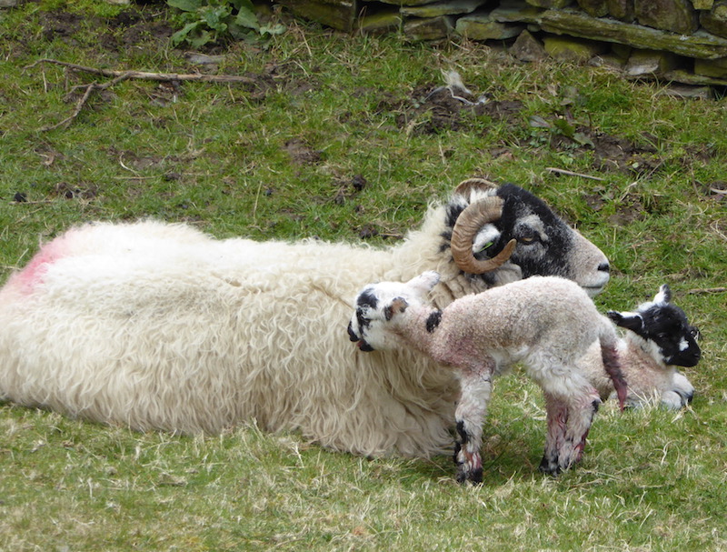
To our left is Tarn Crag and below it is Far Easedale. Raspberry pink seems to be the ‘in’ colour for sheep marking this year as they all seem to be wearing it wherever we go.

Ahead of us is Pike of Carrs, which stands towards the head of Far Easedale, and that means that we are getting closer to Calf Crag where we plan to stop and have something to eat.

A close up of Tarn Crag.

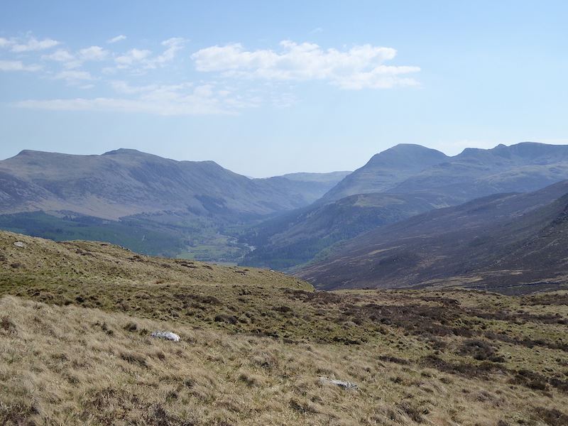
From Pike of Carrs a look back along the ridge we have just walked and down into Far Easedale before we lose the view.

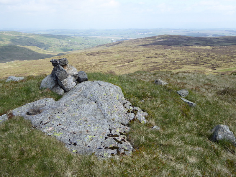
Across the peat hags is Calf Crag, the summit of which is over to the left. This is usually a bit of a boggy area, which is why there are those stepping stones across it but, even with the odd thunderstorm we’ve had lately, it was bone dry today.

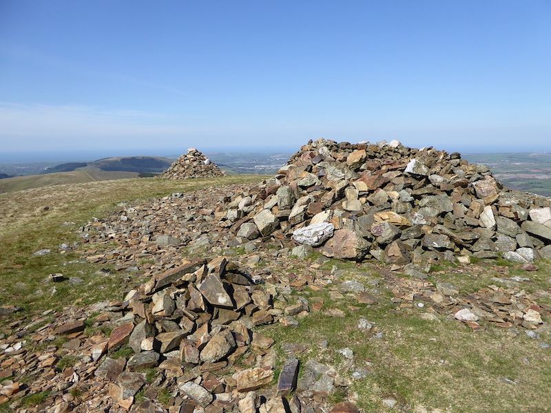
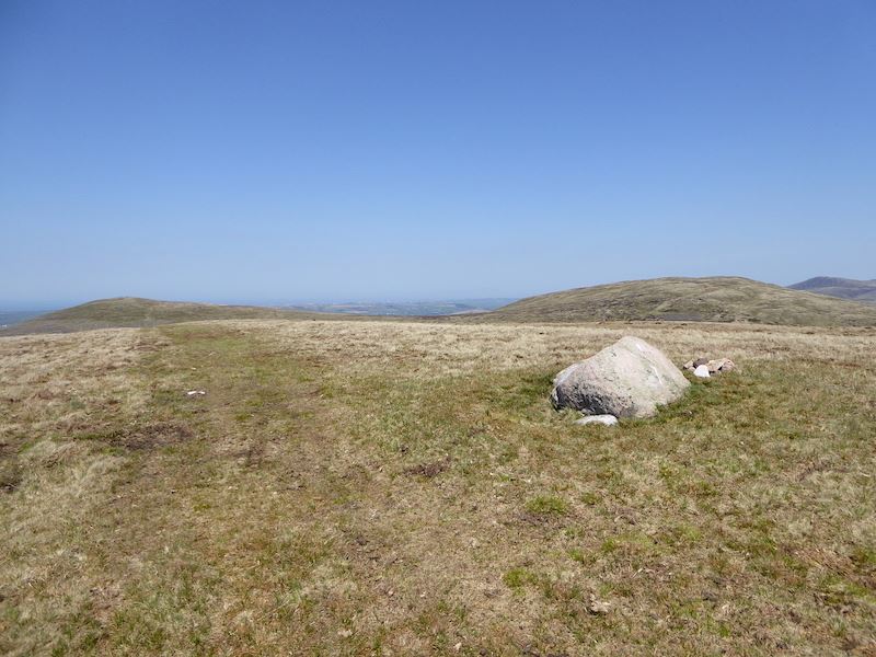
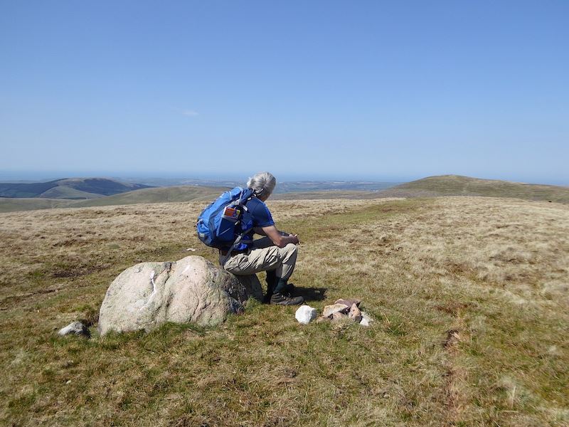
Calf Crag summit, at 1762′, with an un-named tarn in the distance. The clear blue skies are giving way to clouds.

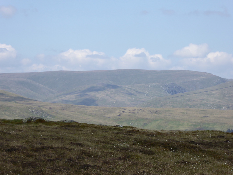
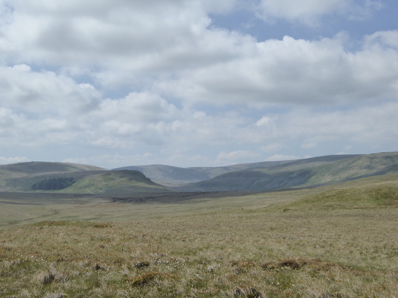
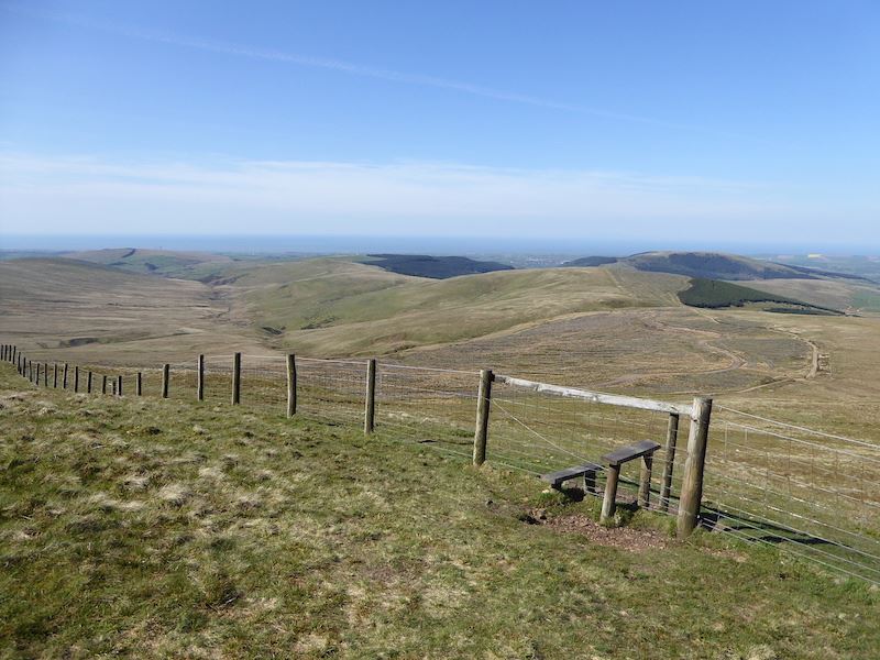
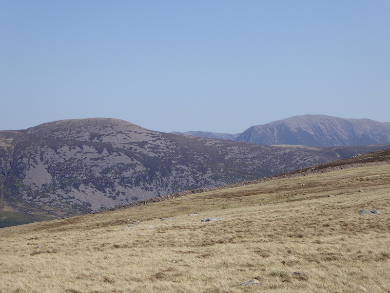
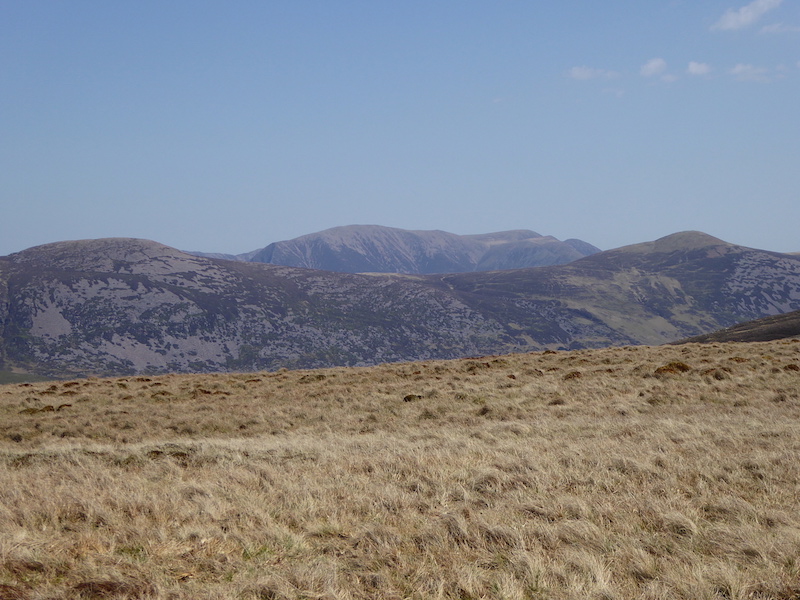
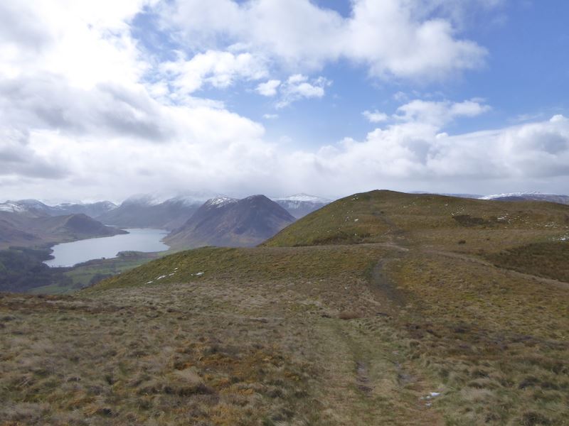
The high point on the left skyline is High Raise, where the two Scots chaps had gone to, and to the right is Greenup Edge. We’re only getting patches of sunshine now but it is still close and muggy.

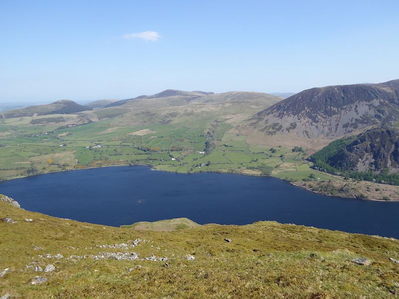
Looking south in the direction of Grasmere from the summit of Calf Crag with the ridge we have just walked across on the left.

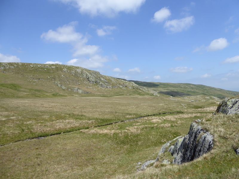
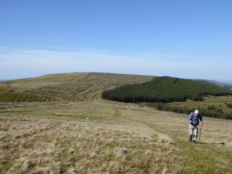
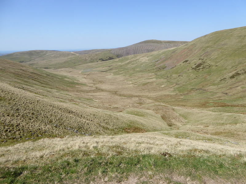
After we’d had something to eat we headed off to the north east on the path which would eventually take us round the head of the Greenburn valley. This view is of Ullscarf, on the right, with Greenup Edge over to the left.

A look across the peat hags to our right at some of the lumps and bumps around Pike of Carrs and Calf Crag.

The path has swung around and we are now heading eastwards towards the head of Greenburn and Steel Fell. On the left skyline are the fells of the Helvellyn range and across the U-shaped gap on the right is Fairfield.

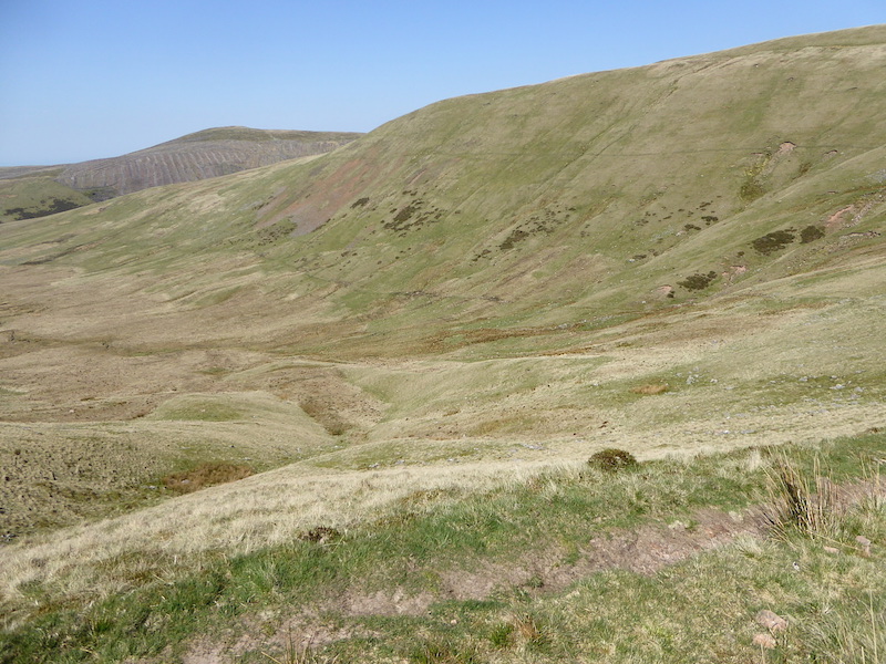
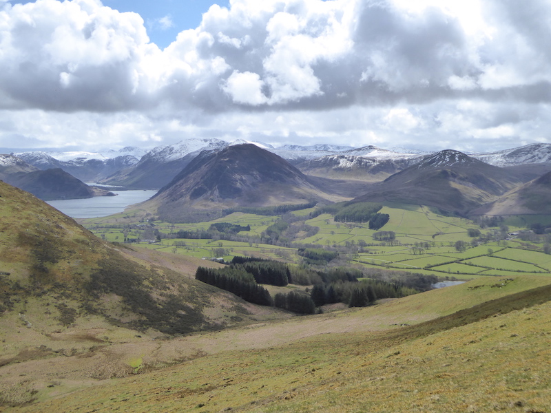
Crossing the head of Greenburn valley and we can see most of the Helm Crag ridge we walked earler.

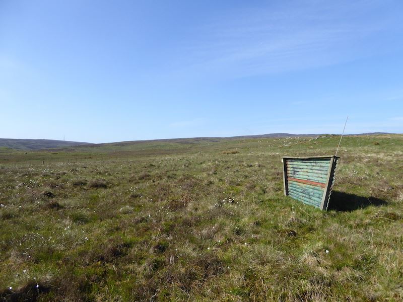
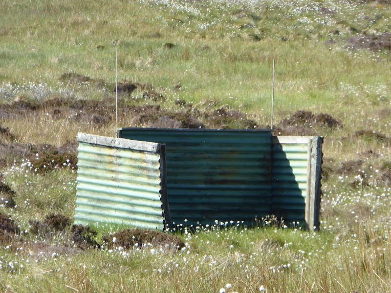
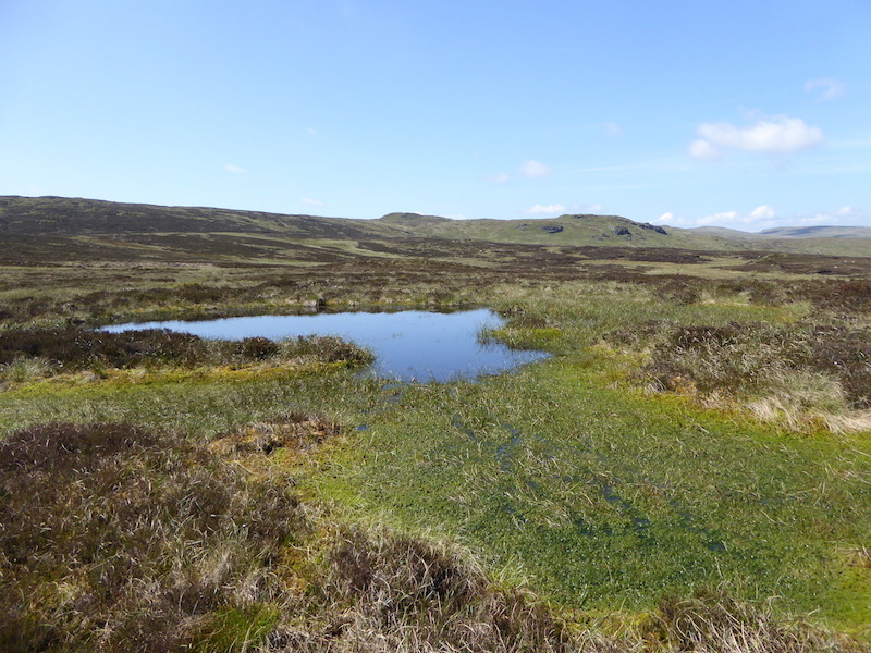
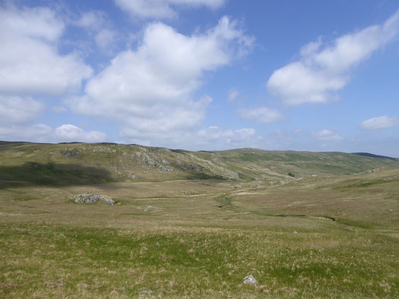
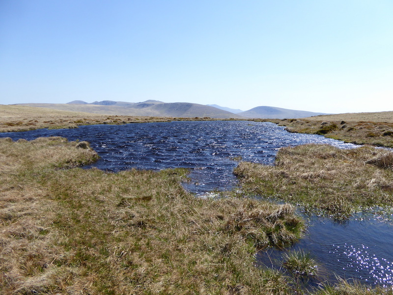
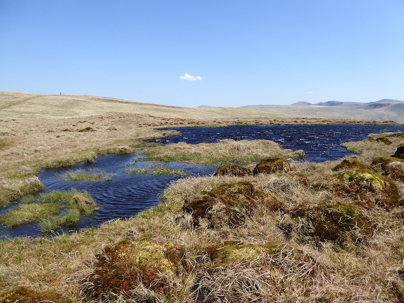
Passing alongside an un-named tarn on the way to Steel Fell.

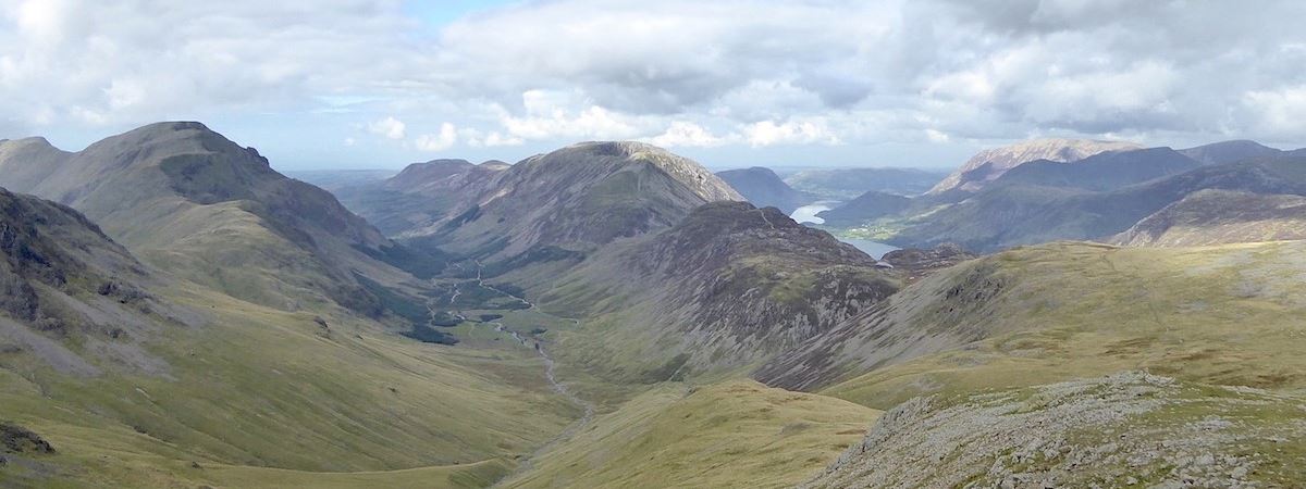
A view of Steel Fell from the head of the Greenburn valley …..

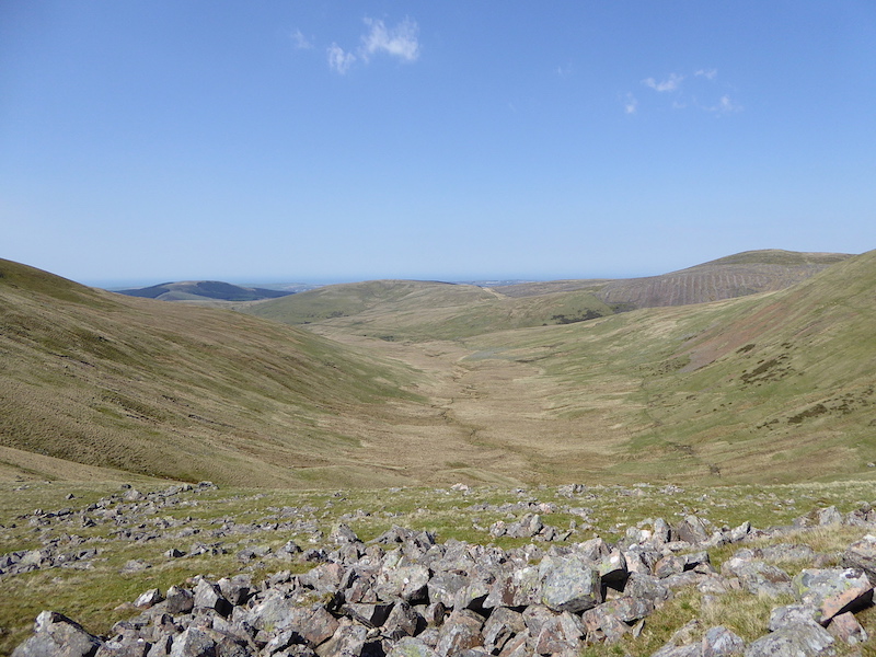
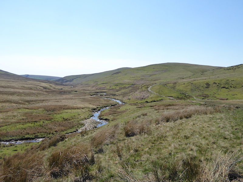
…. and a view down into Greenburn valley with the slopes of Steel Fell and Helm Crag forming  a V shape at the end of it. There are paths along both side of the beck so its possible to have a low level walk up and down the valley, although the beck would need to be crossed before reaching the marshy area of Greenburn Bottom right at the end of it.

Passing another un-named tarn along the way. This flat area holds a lot of water so there are quite a few tarns, pools and puddles around.

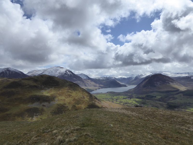
The Helm Crag ridge across the Greenburn valley.

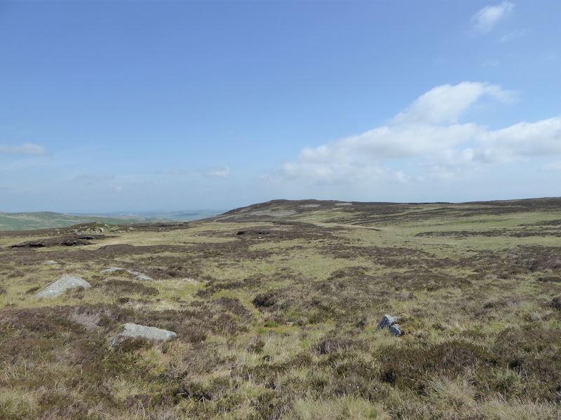
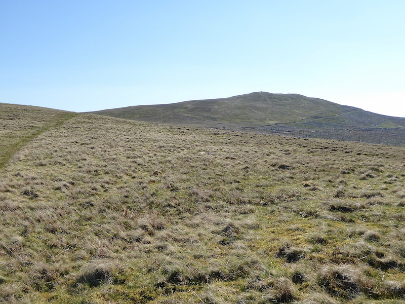
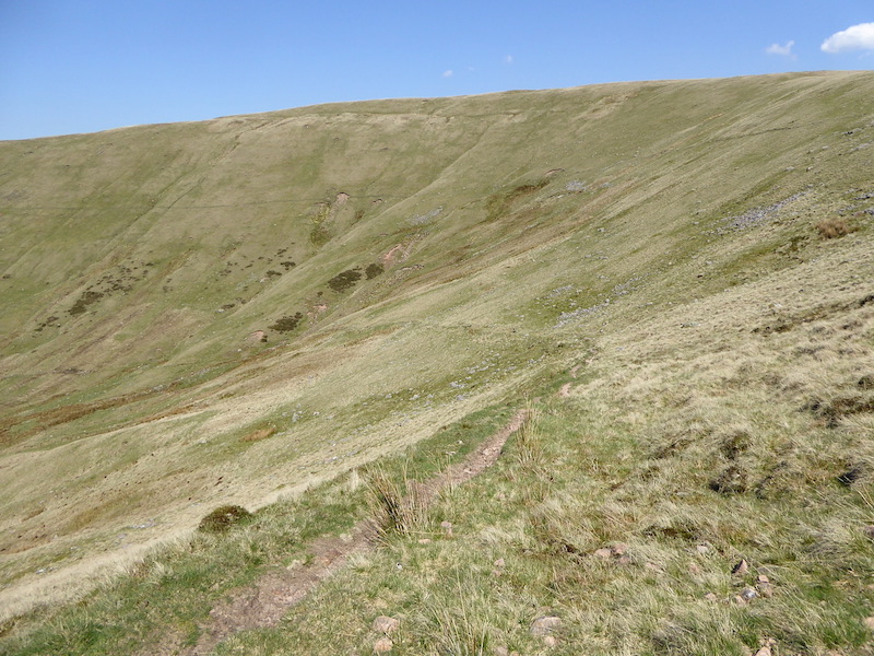
Continuing  along over more lumps and bumps on the way to Steel Fell, but that’s not the summit just yet.

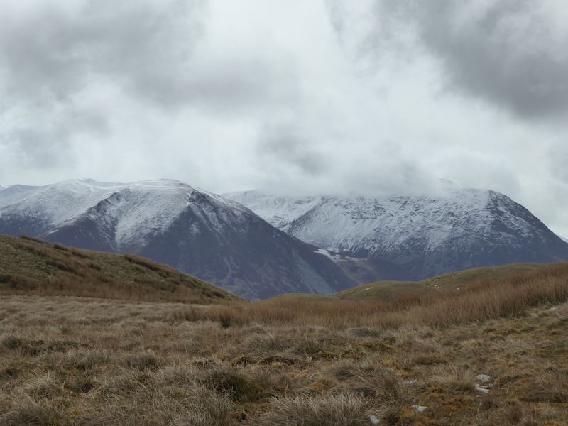
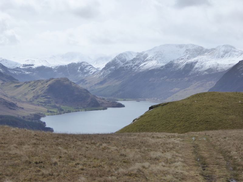
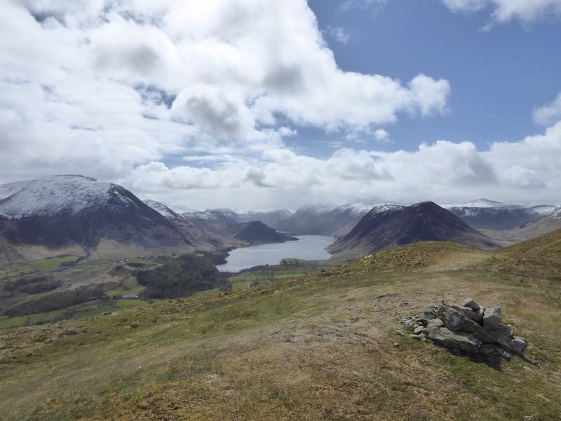
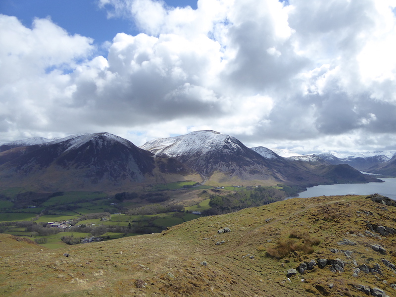
Sombre skies over Thirlmere as we reach the summit of Steel Fell.

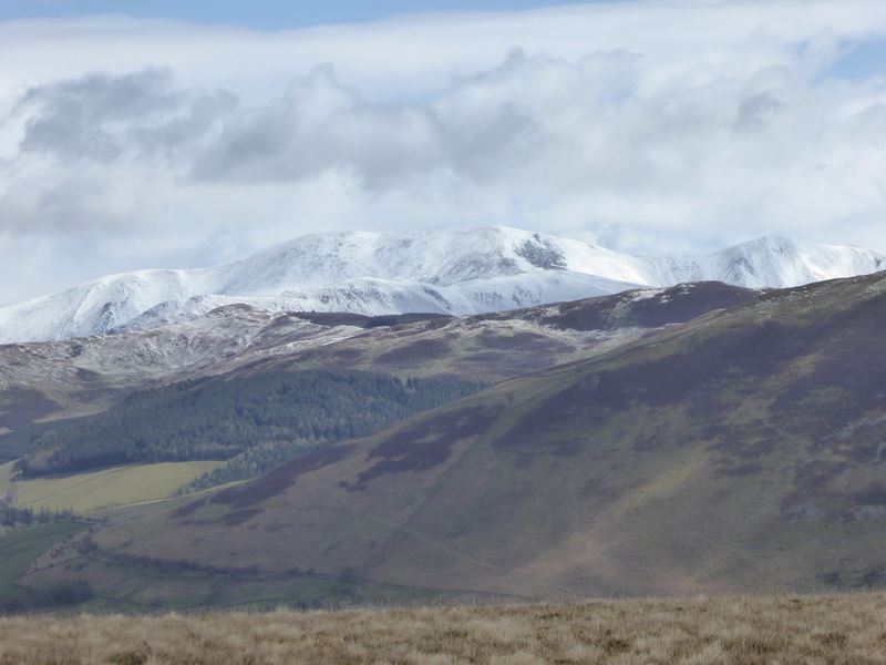
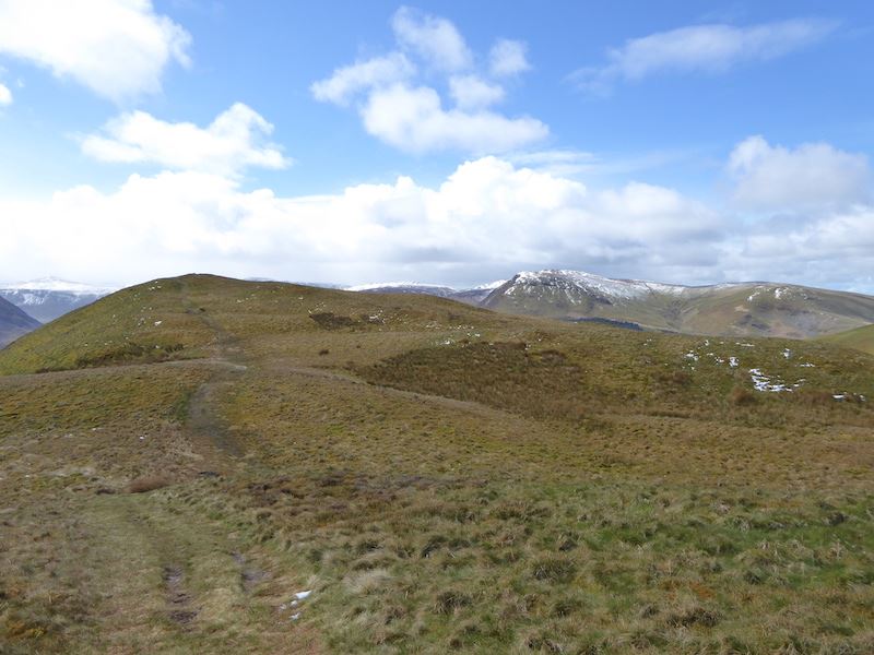
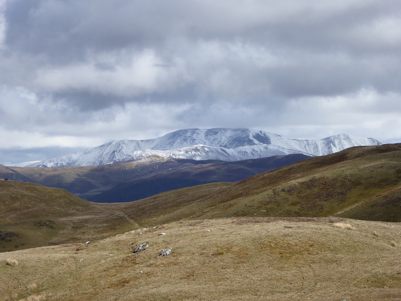
It seems to be a little clearer towards the Helvellyn range, Helvellyn is over on the left, then comes Nethermost Pike and then Dollywaggon Pike over on the right.

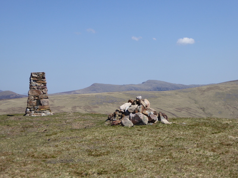
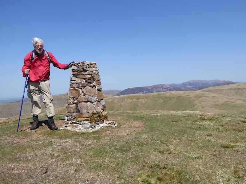
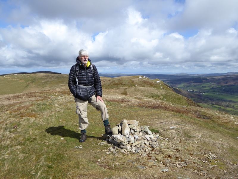
The summit of Steel Fell at 1811′. I couldn’t take shots from the other side as the third Scotsman was sitting there waiting for his mates to join him on their return from High Raise. On Helm Crag he had seemed to indicate that he was going back down and would meet up with them at The Traveller’s Rest down on the A591. As we hadn’t seen him at all along the way to here I asked him what route he had taken from Helm Crag but I didn’t really get a clear understanding of the reply, no doubt because I was struggling to understand the very strong accent.

We begin making our way down Steel Fell taking this shot of Dollywaggon Pike on the left and Seat Sandal on the right from the descent path.

The view down as we descend, with the A591 snaking down to Grasmere on the left and Helm Crag over on the right.

Looking back up at Steel Fell from the descent path.

Helm Crag from the descent path, as you can see it is rather steep sided which is why the zig-zag path makes things easier. You might be able to pick out the route of it but just in case you can’t …..

….. I took another shot lower down and added the arrows to show the route of the path. The Howitzer and The Lion and the Lamb show up a bit better on this shot too.

Looking back up the Greenburn valley as we reach the bottom of the Steel Fell descent path. We joined up with the two walkers on the path below, who had been to Helm Crag and Gibson Knott then descended into Greenburn from Gibson Knott. They were on holiday and were keen to know more about the route we had taken so they could do it themselves in  future.

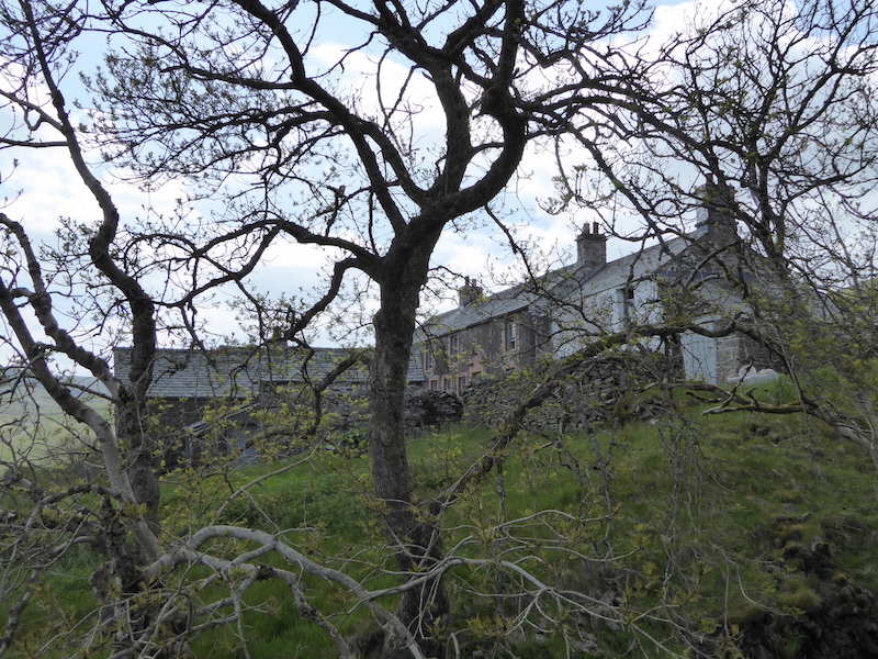
We’re now back at the white cottages and looking over to Town Head Farm. All we have to do now is go down the hill and follow the lane to the farm. The little lane, in the centre, leading away from the farm buildings joins the A591 where we will turn right and walk the hundred yards or so back to the lay-by which is hidden by the trees over on the right. The sun has gone, the sky has clouded over and its still very muggy, so I think we’ve had the best of the day even though it is still only early afternoon. An enjoyable walk with just enough changes of height and terrain to keep things interesting. The forecast for the weekend and the beginning of next week looks a bit unsettled so when and where our next walk will be is rather uncertain at the moment.


Rossett Pike, Esk Pike and Bowfell

Walk Date – 5th June 2016

Distance – 10.75 miles

Weather – hot, humid, hazy


After a lovely sunny start it turned into a disappointing day as far as long distance views were concerned. The haze which has been around for a while now is still with us and by late morning the grey and thundery looking clouds were building, a combination which, by lunchtime, had resulted in some very dark and dismal views indeed. On a better day the views from these fells would have been spectacular and worthy of photographs but, as it was, much of the time we were presented with views of smoky grey and largely featureless fells. There were a few sunnier spells during the afternoon but they were few and far between and the air was heavy with humidity. No amount of photo editing can deal effectively with haze and poor light and many of the photos are not as good as they should have been, but they show the varying conditions during the walk so I’ve included them all, good, bad and indifferent.


Route

We had an early start from home this morning for the ninety minute drive over to Great Langdale where we had no choice but to park in the pay and display by the Old Dungeon Ghyll Hotel. All the free parking spaces around Rossett Bridge had been taken by the time we arrived at 8.30 am. The walk we are doing begins on the path through this gate which is located behind the hotel. Its a beautiful morning and spirits are high as we take to the path heading for Mickleden.

Heading towards Mickleden with Pike O’Blisco on the left, Crinkle Crags on the centre skyline, and The Band on the right. The Band is the eastern ridge of Bowfell with Oxendale to the left of it and Mickleden to the right.

The Band, in the centre, leading up to Bowfell on the right with Crinkle Crags to the left. The fells and valleys have shed their brown winter coats and are showing their fresh summer greenery.

We eventually turn into Mickleden and pass below the soaring crags of the Langdale Pikes, with Pike O’Stickle, on the left, and Gimmer Crag to the right. Apparently you can still find Neolithic axe heads up in that long scree run just in front of it as there seems to have been some sort of a ‘factory’  in a cave up there. They were fashioned from a narrow vein of greenstone volcanic tuff found there, and axe heads from here have been found by archaeologists in many parts of the country, fifteen of them have even been found in the River Thames.

Still pondering on the why’s and wherefore’s of the axe factory we continue along Mickleden with Rossett Pike straight ahead of us and Bowfell over on the left. There’s no-one else here but us at the moment and the peace and quiet is marvellous.

Its not exactly easy to get to is it? So how come some ancient human thought, “I’ll have a walk up there and see if I can find something to make an axe head with, I might even get a little business going. You never know, it could be a nice little earner.” On the other hand perhaps it was just serendipity, we’ll never know, or will we?

Time to stop wittering on about axe factories and concentrate on the matter in hand as we are now well into Mickleden and a whole lot closer to Rossett Pike.

The crags below Rossett Pike which we will be walking along in a little while.

The sheepfold and the Stakes Gill crossing are good indicators that the path is about to split into two routes because just across the bridge is …..

…. this cairn with its very helpful navigational aid which is self-explanatory so I needn’t elaborate further, except to say that from here, the only way is up.

A look down from part way up the Stake Pass path. Its a good pitched path with relatively short lengths of hairpin bends so its not too ‘in your face’. What made it hard work was the humidity and the blazing sun on our backs.

Pike O’Stickle and the view down into Mickleden from higher up the path, at this point we were glad of that bit of cloud cover.

At the top of the path, where it enters Langdale Combe and crosses over the beck to Martcrag Moor, we kept to this side of the gill and began to seek out the path which would take us across below Black Crags. There isn’t a very well established path as this route isn’t often climbed,  but there was enough of one for us to get started, even if it did disappear from time to time. It didn’t really matter anyway Rossett Pike was always directly ahead of us so we only had to keep walking towards it .     

From one of the many grassy shelves along the way a look across Martcrag Moor towards High Raise on the far left, and the little pimple on the centre skyline which is Sergeant Man. Its a bit more than a pimple when you get to it though.

Passing by a small tarn below Buck Pike on yet another grassy shelf as we make our way across the crags.

A jaw dropping view of the Langdale Pikes from the route below Rossett Crags.

The view along Mickleden with Lingmoor Fell across the valley from the Pikes,  taken from the east cairn on Rossett Pike. There was a group of people already having lunch on the actual summit so not wanting to barge in on them we had our lunch on a little knoll just a few yards behind me.   

We finally get a look in at the summit cairn on Rossett Pike after the group had departed. Apparently it was someone’s final Wainwright summit so I suppose they stayed longer to mark the occasion. By now the cloud cover had increased and apart from the rather sombre Glaramara ridge behind everything was pretty much greyed out and it was pointless to try for any distance views, so I didn’t.

Leaving Rossett Pike and the path over to the centre right is the Rossett Gill route which had dozens of walkers trudging their way up from Mickleden. We never saw a soul on the grassy Black Crags route we took, so we were in no-one’s way and no-one was in ours, blissful for me because I don’t enjoy being in a crowd.

As we leave Rossett Pike, below us is Angle Tarn with Esk Pike towering above it and Great End just appearing above Esk Hause.

Turning the camera slightly to the right shows the next part of our route, down to  the tarn outlfow and then up, down and up again to Esk Hause.

Climbing up from the tarn and looking back across it to Hanging Knotts at the northern end of Bowfell. Someone’s doing a spot of wild camping down there beside the tarn. Its not something I’ve ever tried because I’m not very good at camping, wild or tame, as some in my family would laughingly testify.

A look back at Rossett Pike as we negotiate the next bit of up. It was really close and muggy now and this bit was proving to be taking quite a bit of effort and will power.

Pausing for brow mopping and a drinks stop now that we’ve reached a flatter section, so I take another look back at Rossett Pike.

Close by was this little tarn over which is a clearer view of Sergeant Man on the centre skyline.

Looking ahead at the next bit of down and up which will take us onto Esk Hause with Allen Crags on the right.

Along the way I take a look back, the Langdale Pikes now greyed out, Rossett Pike in the middle, and more of Bowfell now showing over to the right.

You could say that this is the walking equivalent of Piccadilly Circus as its a major crossing point with paths converging and diverging in all directions. The path across there is leading up to Allen Crags.

Great End has a path below it which eventually leads over to Scafell Pike. I didn’t see anyone taking the opportunity to take the right turn off the path and take the one which offers the chance to walk over to Great End. I suppose Scafell Pike is just too much of a temptation, which is a shame because there are some staggering views down the deep gullies on Great End.

From the Hause and nicely lined up for their photo are Esk Pike and Bowfell, the next summits we will be climbing.

Looking back down at our route from Rossett Pike in the centre, Behind it is Lingmoor Fell with the Pikes on the left and Bowfell on the right. From about this point we began to get a few occasional bursts of sunshine.

Great Gable and Green Gable to the right of Great End as we make our way from the Hause up to Esk Pike.

Turning round the other way and there, waiting patiently, is Esk Pike. Last time we were up there it was chucking it down and the way we are feeling now a quick rain shower would be very welcome, its too darned hot at the moment.

Over to the right of us is Ill Crag which is part of the Scafell group.

As we get higher up Esk Pike we can now see the summit of Allen Crags.

The view back to Great End from the path to Esk Pike. The path sweeping over to the left below Great End is the one leading on to Scafell Pike which I mentioned earlier.

We’re much higher now so the summit of Glaramara comes into view behind Allen Crags.

In front of us there is still more climbing to be dealt with, its a rocky route to Esk Pike.

Sprinkling Tarn with Seathwaite Fell behind from just below the summit of Esk Pike.

Not much further to go before we reach the summit and the path leads us to …..

….. the bottom of this last little scramble which is quite short and quite easy, which is quite a relief.

Bowfell and the route across to it from Esk Pike summit.

Looking due south in the direction of Pike de Bield at the non-existent view over Eskdale.

Looking along Upper Eskdale and Great Moss and trying not to be disappointed by the haze and lack of views.

The River Esk at the bottom left with Scafell Pike at the top right of the skyline.

Esk Pike summit with the Scafells behind.

I’ll stop moaning about the lack of views and just enjoy a sit down for a few minutes.

The jumble of stones, rocks and boulders on the summit area.

From Esk Pike we make our way down to Ore Gap to make the crossing over to Bowfell. The redness of the path is due to the presence of haematite, an iron oxide, in the soil.

We’ve climbed up from Ore Gap and are making our way over to Bowfell. The route across the fellside could be very confusing but there is a continuous line of cairns to follow which makes the journey a whole lot simpler. Here I took a look back to Esk Pike.

Looking ahead to the summit of Bowfell and I think it becomes clearer  why it could be confusing without the cairns to guide you.

We’re making good progress thanks to the cairns and a good path. This is another look back to Esk Pike with Allen Crags to the right of it.

I am determined not to grumble as I look over the south ridge of Esk Pike to the Scafells. The clarity may not be all that good but at least they are visible and not covered in cloud as they often are. Scafell is to the left, then the gap known as Mickledore followed by Scafell Pike, the highest fell of them all.

On the way to Bowfell summit I spotted this fantastic view of the Langdale Pikes above Mickleden. On the extreme left of the shot you can see a little group of climbers who had just arrived on that top, which I think is probably the Bowfell Buttress, but can’t be sure. They were chatting away whilst busily divesting themselves of ropes, carabiners and other bits of kit as though they had just had a walk through a park. I would have been a quivering jelly, unable even to stand up never mind hold a conversation and put the gear away, that sort of exposure is not something I can deal with.

There are lots of interesting geological features on Bowfell, this slab of striated rock must have been horizontal once upon a time and I thought about the how, when, and why, and what this place looked like when this upheaval took place.

A very welcome sight as we approach the summit of Bowfell. No smooth grassy summit here, its a case of picking your way carefully, and watching where you’re putting your feet.

From the summit of Bowfell the view southwards across Crinkle Crags and the hazy fells beyond.

The view of the Scafells from Bowfell summit.

On Bowfell summit, from here its downhill all the way, no wonder I’m smiling.

The col below is generally known as The Three Tarns although two of them are hidden at the moment. Above the tarn is the beginning of Crinkle Crags which extends quite a distance along  the right of the shot. There are five Crinkles in all. On the distant skyline are the Coniston fells, and left of centre below the skyline is Red Tarn. To the left of Red Tarn is Pike O’Blisco and to its right is Cold Pike.

There’s nothing much to be seen beyond the Langdale Pikes though. Below us is The Great Slab.

Turning round and in the other direction is the north top of Bowfell, the darkish area to the right. The three fells behind are, from left to right, Esk Pike, Allen Crags and Glaramara.

Leaving the summit now and making our way down to The Great Slab.

A look back up at the summit area as we descend.

These splintered rocks lie just below the summit.

Another look back to the summit, you know you have to go down but its always a bit of a wrench to leave, I don’t know why.

Another look at the splintered rocks. They reminded me of a pod of Orcas bobbing up out of the sea looking to see if there are any seals lazing around on an ice floe.

I’ll stop wittering on about Orcas and get on with walking towards the slab.

The Great Slab, and what else could it be called? Its a huge, tilted slab of rock a little way below Bowfell summit.

This huge lump isn’t so much tilted as completely upended. With a variety of colours and striations its a geological history book, you can’t help but think about what was happening at the time each layer was added.

More huge lumps of tilted striated rock, hardly anyone gave them a second glance because …..

….. they were so intent on getting up there.

We’re on the way down to the Three Tarns  now and I was surprised to see that they all contained water given the lack of rain recently. The path down here is a bit of nightmare, steep and very loose underfoot, so we took our time across this section. On a couple of sections I was tempted to utilise my fifth point of contact but I managed to resist.

Safely down with a view of the Scafells beyond the tarn below the Bowfell Links.

From the tarns there’s a good path leading down to The Band and back to Mickleden. The sky is looking very thundery now and we kept feeling the odd spot of rain now and again.

The view doesn’t change much on the way down but eventually this view appears. Pike O’Blisco, on the left, with Cold Pike opposite it across the col. The deep ravine is Browney Gill and the rocky area to the right of it is Great Knott.

Journey’s end comes into sight along Great Langdale as we continue down The Band to Stool End Farm. The distance from the tarns back to where we are parked is probably not much more than a couple or so miles, but on weary legs it felt  like a marathon.

We’re back on firm, flat ground and walking along the lane from Stool End Farm, behind me, to the road at the end of Great Langdale. The Old Dungeon Ghyll Hotel and the car park are behind that line of trees just above the wall so our walk is almost over. Its been a long walk in very hot and humid conditions and, of course, the lack of views was disappointing, but it has been a good day’s walking across three fine fells, and at £6.50 for the day’s parking, its a cheap day out too. On the way home we drove through the mother of all thunderstorms all the way along the length of Thirlmere. The wipers were on maximum speed and still couldn’t deal with it, we were reduced to crawling along, huge sighs of relief when we came out of it at the other end.


Clough Head

Walk Date – 4th June 2016

Distance – 5 miles

Weather – warm, overcast, hazy


Route

The good weather continues so once the morning jobs were done we decided to have an afternoon walk up to Clough Head via the Old Coach Road. The road begins where I am standing and we have parked just at the beginning of it where it joins the A5322, which is the tarmac road in the foreground. The view is of Skiddaw on the left with Lonscale Fell over to the right. Long distance views were difficult today, it was very hazy so nothing showed up particularly well.

From the same spot I turned round for this view of Clough Head  beyond the trees in someone’s garden. The  Old Coach Road is veering off to the left and is a rough stony track which leads over to High Row, near Dockray.

Further up the road and more of Clough Head appears on the skyline.

We’ve passed through the small area of forest now and we’re out onto the open fell side with Lonscale Fell on the left and Blencathra to the right. Judging by the style of the seat it has been here quite a good number of years.

Standing on the road just below the seat I take a look back at High Rigg, on the left, with Low Rigg on the right.

Continuing on up the road towards the spoil heaps and old quarries. This lower area is called Threlkeld Knotts, which in the past was quarried for the granite it contained.

Further along the road and a look back to Latrigg, the small fell on the left, with the Skiddaw fells over to the right.

The long and winding Old Coach Road stretching ahead of us with more evidence of past quarrying on the fellsides.

A look back to Blencathra with the village of Threlkeld nestling below it. I took to walking on the grass as the rough stony track was beginning be a nuisance. The stones and pebbles have a habit of sliding away just as you push off against them, at best it slows you down and at worst you end up with grazed knees.

The winter storms haven’t helped either and in many places the road has been badly damaged by all the water which flowed down it. This particular groove was easily 2′ deep and on the gate up ahead …..

….. was this notice. There was a similar one on all of the gates we went through as it is not traffic restricted and  vehicles can still be driven along here.  Driving along this road in a modern vehicle would be uncomfortable enough, even without all the damage, what it was like sitting in a horse drawn coach you can only imagine and wince.

From the gate a look back at the badly damaged road and the sheepfold just beside it.

A close up of the sheepfold, named on the OS map as Clough Fold, which is so well maintained that it must still be in use.

I had just taken the previous shot of the sheepfold and was about to put the camera back in the bag when I saw this convoy of 4×4’s coming along towards the gate so I took a close up shot of it. The drivers have ignored the notice on the first gate, which was just a little way up from where we had parked, and decided to risk it. Astounded is a nicer word, but gobsmacked better conveys how I felt when I saw them. They had to stop when they were almost at the sheepfold and the drivers began getting out to have a look and discuss the situation. We left them to their deliberations and carried on with our walk.

We’re now almost at the top of the climb out of  St John’s in the Vale and the Mell fells appear on the horizon.

The road carries on to High Row, but we leave it here and begin the steepish climb up to White Pike. Just below the fence to the right is the roof of …..

….. an old railway goods wagon which seems to have been used for storage or shelter in the past. Its now quietly falling into decay.

Its time to get the legs into bottom gear and make the climb up to White Pike which is over there on the left. Its a well trodden and firm path, not excessively steep, but it definitely gives the legs and lungs a good workout.

Pausing for a breather and a look back down at our route, and the goods wagon, from the road.

I’m just about to put the camera away when I get gobsmacked again. Thirty two minutes have elapsed between this shot and the previous one of the convoy so it has taken them quite a while to negotiate the rough track up to this point, and they still haven’t reached the gate where we turned off.

We watched their painfully slow and bumpy progress wondering all the while, why? Why would you drive over such a horrendously damaged track, risking damage to  your expensive vehicle and possibly yourself, whilst grinding along at a snail’s pace in bottom gear and using heaps of fuel? Perhaps its a ‘bloke thing’.

We’ve seen enough so back to the matter in hand and we are soon approaching White Pike, up there on the left.

From the slopes of White Pike a look across to Great Dodd on the right and the long sweep down which ends at Wolf Crags on the left.

Still on the little col between White Pike and Clough Head. The path over to the right is the one we will take up to Clough Head summit.

A look back at White Pike from the climb up to Clough Head. I expected to see the convoy on the road below over to the right but they still hadn’t made it that far, so they were still somewhere below White Pike. I couldn’t be bothered to wait so I didn’t see them again as we carried on to the summit.

A view down to Threlkeld Knotts and St John’s in the Vale as we approach Clough Head summit.

The trig column and shelter come into view on the pleasant stroll across the top.

On a better day the views would be lovely from Clough Head summit.

Behind the trig column and shelter is Blencathra.

The blue-grey view eastwards from the summit.

At least we can see Latrigg, the little fell over on the right.

One last shot at the summit and then we’ll go, the sun is out but the haze isn’t shifting at all.

We start the descent and on our left is Great Dodd again, this side of it slopes down to that little rocky bit which is called Calfhow Pike. Beyond the slope is Helvellyn which you can just about make out in the murk.

Calfhow Pike is now on the left and from it the land drops down and ends abruptly above some very steep crags.

A close up and hazy view to the north-western fells across Derwentwater from the descent.

A longer view of our descent route, we won’t drop off the edge though as the path veers off to the right and leads us across some scree slopes and then down to Threlkeld Knotts again.

This cairn marks the point where the path veers to the right across the slopes known as Red Screes.

These steep slopes mark the end, or the beginning, of the Clough Head to Dollywaggon Pike line of fells, usually referred  to as the Helvellyn range, since Helvellyn, which is the highest of them, is situated  towards the southern end of the range.

Sections of the path were very dry, dusty, loose and slippery as we haven’t had any serious rain for quite while now.

 A look back at one of the trickier sections of the path, quite a steep slope with lots of loose stones beneath your feet but we  managed to avoid any undignified slithers to the ground.

The view across St John’s in the Vale from the scree slope path.

High Rigg across the Vale with the Bleaberry Fell ridge behind it.

A look back at the descent route which started at about the middle of the grassy area of the centre skyline and continued down on the diagonal towards the left. It then curved around the grassy slopes to the point where I am now standing.

A look across to Wanthwaite Crags from the descent.

The gradient has become easier on the knees and becomes a pleasant stroll back down to the valley bottom.

Through the gate …..

….. over the stile …..

….. through the woods and along the forest track …..

….. and here we are back at the seat.

From the seat its a short walk back to the car which is parked just beyond those trees to the right of the shot. The ridges and folds of High Rigg seem more pronounced than they were to begin. A good little walk on a sunny Saturday afternoon, with a little convoy interest thrown in for good measure, you never know what you will come across when you go out for a walk.


A Wet Sleddale Round

Walk Date – 29th May 2016

Distance – 8.25 miles

Weather – dry, warm and sunny


Its Sunday on a warm and dry Bank Holiday weekend. There’s nothing wrong with that is there? No, but it will probably mean that car parks and parking spaces will be overflowing and the popular fells will be crowded. With all that in mind we decided to stick close to home and take a walk somewhere we know its not likely to be very busy.


Route

So here we are, five miles from home at Wet Sleddale reservoir where our car is the only one in the parking area, which is just out of shot on the right of the photo, and starting out for a walk across some of the remote Shap Fells. There is absolutely no-one around, not even a duck or a goose on the water, and all you can hear are the curlews, its wonderful.

A bit of re-cycling here as old concrete drainage pipes have been used to create a crossing over one of the many becks.

Never saw one all day, should we look out for subtracters too?

Didn’t see any of these either, so wild life was obviously keeping a low profile while we were around. Why does the notice have the Yorkshire Dales logo on it?

As you can see this isn’t a place where you’ll find the big ‘in your face’ fells. Its uninhabited, wild, open moorland so you are probably wondering why there seems to be a road of sorts stretching across it. That line of structures starting over on the left of the photo should give you a clue …..

….. as they are grouse butts, which varied in style and appearance. This is the basic model, three bits of wood and some corrugated sheeting, does the job but a bit on the utilitarian side, you could think of it as tourist class if you like.

A little better than tourist class, as it will accommodate two very comfortably and you do have some protection from the winds on either side of you, but its not quite the de luxe model …..

….. which this type definitely is. Solidly constructed of thick wood, plenty of wind protection, roomy and not in danger of imminent collapse. How these various butts are allocated on a grouse shoot I have no idea, numbers out of a hat, greasing a palm, pistols at dawn? Whatever the method you can bet your boots that the shooter who gets the basic model will probably do some under the breath muttering about it.

Now this is a bit sneaky, providing a bridge crossing for any animal who doesn’t like getting wet looks like a kind gesture until …..

….. until you examine the bit in the middle which is the business end of the crossing, although it doesn’t look as if the trap has been set. There was another one of these somewhere else just lying on the grass and completely rusty so perhaps they aren’t in use any more. I think they were intended to trap stoats and weasels.

No traps for the unwary at this beck crossing. More re-cycling of concrete drainage pipes, this time on the vertical to support the wooden footbridge.

This is the reason for the road, providing access to a big shed with a fence round it, named rather grandly on the OS map as ‘lunch house’. The grouse shooting parties will arrive in their 4×4’s, park up, shoot some grouse, have lunch in the shed, shoot some more grouse and then go home, no doubt having paid through the nose for it all.

We couldn’t have our lunch in the lunch house as it was all locked up, and it was a bit too early for lunch anyway. Given what you have to pay for a day’s shooting I suppose the shooting party’s lunch would consist of something a little more up-market than the humble chicken sandwiches and sun softened Mars Bars that we have in our packs.

From the lunch house we carry on up to Gray Bull. A huge lump of pink granite with its base in a deep and dark green pool of water, where who knows what was lurking amongst the slimy looking plant life, all topped off with a sporty light green hair style. Given that there is nothing much else to see in the photo you can understand why it forms a useful landmark when navigating across here.

From Gray Bull we made our way over to Sleddale Pike which is not very high and not very steep, but what this area lacks in height and steepness is more than offset by the nature of the ground. We weren’t off-path here because there is no path, that ended at the lunch house. So huge clumps of tussocky grass, heather and sphagnum moss have to be negotiated. A misplaced foot on tussocky grass will throw you off balance, trying to step between the tussocks will have you knee deep in the stuff, the heather does its best to snag on your socks, tie itself to your bootlaces or create a lattice work of scratches on your legs, and as for sphagnum moss, which can soak up more than eight times its own weight in water, you  can imagine what that’s like to walk across. All in all it takes a heavy toll on the legs, I think its as difficult as walking in deep snow.   

The leg muscles were given a breather on Sleddale Pike while I took some photos, this is the view, looking eastwards, of Wet Sleddale reservoir from Sleddale Pike.

Now looking south west towards our next objective, Great Saddle Crags on the centre skyline. The ground in between is that same mixture of tussocky grass, heather and sphagnum moss. Come on legs, let’s get going.

We came across plenty of pools walking across here, this one was particularly sneaky since what looks like a nice green lawn in front of it wasn’t that at all, it was just tangled vegetation floating on the surface inviting the unwary to step on it and end up who knows how deep in water.

Its a bit like doing one of those dot to dot drawings walking across here, as you look for the next dot of dry and/or level ground to step on but we’re making slow and steady progress. I took a look back at Sleddale Pike just to convince myself that I had actually covered some distance as it certainly didn’t feel like I was getting anywhere at all.

Approaching Great Saddle Crags and the sight of rising ground gives us hope that the ground will be drier and firmer underfoot than it has been since we left the lunch house track. My calf muscles are now complaining about the work load and the low crags ahead are beginning to assume the proportions of Everest.

The top of Great Saddle Crags. No big tussocks of grass, no heather, no sphagnum moss, just ordinary grass on solid ground. Hallelujah, I think I’ve just reached heaven. When the novelty of standing on firm ground had worn off I took a shot looking back at Sleddale Pike and the bit we have just walked and stumbled over.

It was very hazy today so long distance views were poor, but this close up didn’t turn out too badly. On the skyline is Harter Fell, and over on the right, with the wall running down it, is Branstree.

This is the longer view of the previous photo to include the cairn on Great Saddle Crags.

With the legs rested for five minutes we begin to drop down off Great Saddle Crags to make our way down to Sleddale Beck. The terrain is just the same as before but at least its down hill which makes life easier.

Crossing Widepot Sike. A sike is just a small stream, usually flowing through marshy ground. How true in this case.

This herd of red deer came thundering across the fellside below us, seemingly out of nowhere as we hadn’t had sight of them until now. Sorry about the blur but they were running like blazes and the camera is on maximum zoom.

They had obviously spotted us from wherever they had been hidden, made a dash for it, and finally disappeared behind the slope of the fell side.

Heading down to Sleddale Beck with Tongue Rigg on the left and Sleddale Pike over on the right. The ground conditions on this higher ground have improved so it was easier to get a move on.

On the left skyline is Seat Robert with Tongue Rigg over on the right. We saw lots of these protective plastic tubes and this was quite a large planting area, but as usual it had mostly been a useless exercise. I always look to see how the young trees are doing, and it was the same old story here, not very well. We found two small hawthorns, about a foot high, a very sickly looking holly with two yellowing leaves just poking out of the ground, and something with a few leaves, which looked like beech, which had just managed to cling on to life. That’s not a good success rate when you consider the dozens and dozens of stakes and tubes which were here.

Tod Crags on the left across the valley bottom but we’re heading for the large rock below it for a lunch break. To the right is Widepot Sike which is flowing down to join forces with Sleddale Beck coming in from the left.

On maximum zoom again to show the deer were still keeping an eye on us as we were having lunch.

From our lunch rock, Tod Crags on the left and Seat Robert on the right, with Sleddale Beck between us and them.

From the climb up Tod Crags a look down at the very wet area around Sleddale Beck.

The view down to Wet Sleddale reservoir from Tod Crags.

From Tod Crags a view into Mosedale with some of the far eastern fells beyond.  A wild, remote and unfrequented landscape where, so far, we have encountered no-one else.

From Tod Crags its just a short distance to reach the bliss of the firm, dry path which is coming in from Mosedale behind us. Its just great not to have to watch where you’re putting your feet all the time. We began to meet others as we walked along this path, two men on quad bikes going up to the Mosedale bothy,  a couple who were walking, and four young men on mountain bikes who came whizzing past us, so it wasn’t exactly crowded along here.

As I was taking this view of the fells around Wet Sleddale another walker came along the path towards us. This was a lady, in her 80’s, from Eamont Bridge who stopped for a chat with us. She asked us what route we had taken so far and she grimaced when we told her. She said she had only walked that route once and vowed she would never do it again, too much tussocky grass.  After a long chat with her about all manner of things we continued along the track back towards …..

….. Wet Sleddale reservoir and Sleddale Hall. Here we turn off the main path and take the downhill track you can see running across the foreground. You can see our car from here parked by the right hand side of the dam wall in front of that clump of trees.

Sleddale Hall. If you are familiar with the cult film ‘Withnail and I’ you may recognise it as Uncle Monty’s Crow Crag. If you aren’t familiar with the film just type Withnail into the search box and you’ll be overwhelmed by information.

The once derelict house was bought a few years ago and the owner is renovating it so I climbed up the footpath to see how things were progressing. The owner was there and he came out into the courtyard and invited me over to take a look.

This is the main house with new door and window surrounds, and new windows. The old render will be replaced with a lime render.

The courtyard and some of the outbuildings …..

This outbuilding is attached to the main house and looks as though it has had its coating of lime render already.

The new owner lives in Kent, which, as you all know, is where we used to live so we had  a bit of a chat about that. Its a long drive from there to here and it can’t be easy to find the time to come up and work on the house. Here’s a link if you’d like to know a bit more – https://www.telegraph.co.uk/culture/film/film-news/6086994/Withnail-and-I-farmhouse-sold-to-fan-of-film.html

At the bottom of the hill below the house is the old stone pack horse bridge …..

….. with this attractive little set of falls below it.

A close up of Sleddale Hall as we continue on from the bridge.

Back at ground level and walking along the reservoir path to the car which is parked beyond the trees by the end of the dam wall.

Finally, and almost back at the car, a sighting of one of the local residents. The cormorant was far too busy keeping an eye on a noisy group of Canada geese to be bothered by us.


Armboth Fell and High Tove

Walk Date – 22nd May 2016

Distance – 4.2 miles

Weather – dry, warm and sunny


Walks have had to be curtailed over the past two weeks as its planting time and the garden needed bringing up to scratch after the winter. So we took advantage of the good weather to get it done, of course once the gardening was dealt with the weather changed and we were confined to barracks again under grey overcast skies and cold winds. Today however, after an unsettled morning there seemed to the chance of a warm and sunny afternoon so off we went to Thirlmere for a short walk up Armboth Fell and then over to HIgh Tove.


 Route

The route starts on the road on the west side of Thirlmere, close to the United Utilities car park at Armboth, and starts off as this very rough track alongside Fisher Gill.

Just a short distance up the rough track this forest trail comes into view across Fisher Gill, which is over to the left on the photo. There was no problem in crossing the gill as there were plenty of stones to step on as is obvious in the previous photo, and once on the forest trail I took this shot looking back down it. Now its time to turn round and start walking uphill again.

Over on our left, almost hidden by the trees, we glimpse the old Armboth Hall summerhouse, and you’ve got to go and take a look around, haven’t you?

Armboth Hall was demolished in the 1880’s when the water level of Thirlmere was raised to create the reservoir, and the old summerhouse is the only building belonging to the Hall which still remains.

I don’t know if the bothy is used very much but the basics seem to be available …..

….. and although it is rather spartan in appearance …..

….. it would no doubt be a welcome refuge in very bad weather.

From the bothy the forest track continues to climb steeply but eventually the gradient eases and levels out for a short distance.

The forest track ends at this stile which we climb over and continue on across the grassy area alongside the wall.

We’re still walking alongside the wall, but the trees have been left behind and now we are out on the open fellside with this view of High Seat over to the right of us.

We leave the path we were on through a gate in the fence on our left and make a short detour up to Fisher Crag. This is the view from the summit looking southwards along Thirlmere with the Helvellyn range on the opposite shore.

Also from the summit is this lovely view northwards along Thirlmere with Blencathra at the far end.

Looking towards Armboth Fell from Fisher Crag. That’s where we are heading next but we can’t go directly across as the  large flattish area in the centre is very boggy. So we keep to the higher ground to the right of the tall tree and do battle with the heather and rocks instead.

The bright sunshine highlighting the ridges and valleys on Blencathra.

Looking north along Thirlmere once again, to the right of Blencathra is Clough Head and below that the tree covered slopes of Great How.

Grappling with the heather as we make our way over to Armboth Fell summit, making sure we keep well away from the flatter, and wetter, areas. The Helvellyn range on the skyline behind.

From the same spot and now looking across to the Dodds on the skyline.

The rocky outcrop which forms the summit of Armboth Fell and over on the right skyline is High Tove where we are heading for next. If you look closely you might be able to pick out the path we will take to get across there.

On the centre skyline is Ullscarf with the two rocky tops of High Saddle and Low Saddle running down along its northern shoulder.

Looking across to High Seat from the summit of Armboth Fell.

Blencathra and the Dodds from Armboth Fell.

There were some superb cloud formations over the Dodds …..

….. and the Helvellyn range today.

On the way across to High Tove so I take a look back at the rocky summit of Armboth Fell …..

….. and another look back from further along.

I couldn’t resist taking a shot of these fabulous clouds hovering above the Dodds.

Another view of Ullscarf to our left as we approach High Tove.

Looking back from the crossing to High Tove and on the skyline from left to right are Helvellyn, Nethermost Pike, Dollywaggon Pike, Fairfield, Seat Sandal and Heron Pike. On the extreme right of the photo, just above the heather covered pointed bit, is Steel Fell.

On High Tove summit now and looking north towards High Seat with Blencathra behind it. The area between where I’m standing and High Seat, known as The Pewits, is one of the wettest in the Lake District. Its an extensive morass and walking across it is very unpleasant unless the ground is frozen solid or there has been a prolonged period of dry weather

Even here the ground is still holding the water and we haven’t had any serious rainfall for a while. Going through the gate would lead you down into Watendlath, and on the right of the skyline is Dale Head , just to the left of it is the arching curve of Pillar, and over on the extreme left is Great Gable.

At least this bit is dry so we had a short break to enjoy the views and the sunshine. The fell dominating the skyline is Ullscarf.

Views of High Seat and Blencathra from High Tove summit.

High Seat and Blencathra again, but now including Clough Head over on the right.

A close up view of the fells on the skyline which are, from left to right, Crinkle Crags, Bowfell and Esk Pike.

Another close up, this time of the fells to the east of us. From left to right is Helvellyn, with its summit in the shade, then comes Nethermost Pike, which is enjoying some sunshine, and lastly, the shaded top of Dollywaggon Pike.

Making our way down from High Tove with Fisher Gill burbling away to the right of us.

Below us is the wall which we followed earlier on the way to Fisher Crag, and on the skyline are White Side and Brown Cove Crags.

Thirlmere comes into view again as we descend alongside Fisher Gill.

Huge boulders are strewn all around this section of the path, I’m no geologist so I can’t say if they are glacial erratics or not.

AW deemed this one worthy of a mention in his guide book to the central fells, describing it as a ‘perched boulder’. It is balanced somewhat precariously but its been like this for donkey’s years.

Adding a sense of scale to the perched boulder.

Not far to go now, there’s the road just showing through the trees at the bottom.

We just have to cross the footbridge, turn right onto the road and the car park is just out of shot on the right. A great little walk on a warm and sunny Sunday afternoon and the only people we saw were the two who returned to their car just as we were about to drive back home.


Grike, Crag Fell, Whoap and Lank Rigg

Walk Date – 9th May 2016

Distance – 9 miles

Weather – dry, warm and sunny, very strong easterly winds at all levels


Route

The dry weather continues and for today’s walk we are over in the west once more. There’s no-one around except a man on a quad bike rounding up his fell ponies, who gives us a cheery wave as he drives back onto the road from the fellside. The car is parked down there on the Cold Fell road, its the only one there so its looking a bit lonely. As soon as we got out of the car we felt the full force of the wind sweeping down the road.

We’re on the path which winds its way around the lower slopes of Blakeley Raise and on the skyline is Knock Murton, in the centre, and on the right Blake Fell. We had hoped that the slopes of Blakeley would offer some shelter from the wind but they didn’t.

The path continues beyond the gate through the tree plantation.

Further up the path and a look back and out to sea across the coastal plain.

A little further on and Grike, the first fell on our walk, comes into view.

Blakeley Raise, and the other fells around, have had quite a number of their trees felled in recent years, so what’s on the ground doesn’t now equate with what’s on the OS maps. Below the trees over on the right is the path we have just walked up from the road. We noticed this path going across Heckbarley so we decided to see if it continued on to Grike.

We were battling the strong winds, which were blowing from right to left as you look at the photo, as we walked and wobbled our way up here. When we reached the top of the rise over there on the left we could see that the path was veering away from the direction we wanted to go in so we cut across and re-joined the forest path which you can see rising diagonally across the lower slopes of Grike. I still call it a forest path but it isn’t now that the trees below it have been felled.

Eventually the track passes alongside this gate and stile where we cross and take the path across the fellside which leads up to the summit of Grike. As you will see this was the first of several stile crossings we made today.

We reach the fence crossing the top of Grike and have to cross stile number two. The forest track is clearly visible below us and the car is parked way back there on the road below and behind the trees on Blakeley Raise.

We’ve reached Grike summit and have a closer view of Knock Murton, on the left, and Blake Fell over on the right.

The summit cairn and shelter on Grike. We had a short break in the shelter although it didn’t offer any protection from the wind as the sides weren’t high enough. The wind was behind me at this point and doing its best to push me headlong into the shelter.

Hair and trousers demonstrating the force of the wind on Grike summit. The walking poles were put to good use as stabilisers throughout the walk today.

From Grike we start to head across to Crag Fell which is normally a very wet, boggy and squelchy affair, but after a week’s worth of high winds and no rain it was drying out very nicely and the ground was fairly firm beneath our feet.

Straight ahead, to the left of centre, is Pillar standing tall above Ennerdale although that isn’t on view just yet. The aerial mast isn’t a thing of great beauty but its a handy marker in poor weather.

Across from us is Lank Rigg which will be the last fell on our walk today.

We’re down off Grike now so this is a look back at it together with aerial mast and fence …..

…. and where you have a fence you often get a stile, so this is stile crossing number three. There was another one just off to the left so you could get across that fence if you needed to.

From the stile crossing its just a short walk up to the summit of Crag Fell where the strength of the wind increased even more. The heather covered fells behind are Herdus, left, and Great Borne to the right of it.

A view along Ennerdale Water from Crag Fell. At this point I was having to be stabilised to avoid being blown over backwards such was the ferocity of the wind as it came straight down the valley. Had it been blowing the other way I wouldn’t have been standing here. Notice the surface of the water as the wind blows over it. The tiny fell on the opposite shore is Bowness Knott, above it is Great Borne, then Starling Dodd, and beyond that are Red Pike, High Stile and High Crag where we walked on 20th April.On the right of the shot is the huge bulk of Pillar.

Looking back to Grike from Crag Fell summit, where the swept back look is the latest hair style. We had a variety of hair styles during the walk depending on the direction in which we walked.

Another view along towards the head of Ennerdale Water …..

….. and a view of the outflow end of Ennerdale Water before we escape from the battering we’re taking.

Looking along Ennerdale as we descend Crag Fell. In front of Pillar is the ridge rising up to the summit of Steeple with Scoat Fell and Haycock behind it.

We’re almost at the bottom of Crag Fell and on the way to cross Black Pots with a view of Boathow Cags on the left. The wind is coming straight at us from across that ridge over there and that’s the next part of our route. We’ll go  to the wall corner and then cut across to the right for the walk across to Whoap, that’ll be another change of hair style then. Oh look,  there’s another stile as well.

Another look along Ennerdale from stile crossing number four.

More fun was waiting for us in the form of this improvised crossing of one of the deep dark pools, where who knows what might be lurking beneath the surface. The bridge comprised of nothing more than a few wooden poles slung across and using the walking poles for balance wasn’t an option as there was nothing solid to plant them into. You just had to get on and hope for the best and I had the honour of going first.

What you might call a leap into the unknown as the ground on this side was none too solid either, but wet feet were somehow avoided.

A few yards further on from the watery obstacle we negotiate stile crossing number five and begin to climb alongside the wall, which you can see in the picture four photos back, so we can make our way to the ridge crossing to Whoap.

At the wall corner there was another stile, but right beside it was a gate so I used that instead, consequently no picture of a sixth stile. Here’s a look at the featureless open moorland we crossed on the way to Whoap, not somewhere you’d want to be on a bad weather day as there isn’t a ha’porth of shelter. I wonder how many viewers will know what a ha’porth is/was.

On the way across to Whoap on our right we have this view of Grike and Crag Fell, and we’re being blown even more sideways. We must have looked like two drunks as we tottered across here.

There’s the wall we turned away from and behind it are Great Borne to the left, with Grasmoor on the right.

Grike and Crag Fell from the summit of Whoap. This summit isn’t on AW’s 214 list and, with the best will in the world, there isn’t a lot to it or that you can say about it, other than its a large, grassy mound with a big rock on top of it. However, it is handy for …..

….. getting across to Lank Rigg, which is on AW’s 214 list, as it provides this handy connecting ridge. You can imagine what the strength of the wind was across there.

From Whoap summit a look across at the Grasmoor fells behind Great Borne and Starling Dodd.

Well, the big summit rock came in handy for something, a brief sit down with our backs to the wind while it gave us both yet another hair style. We’re in t-shirts which tells you that it wasn’t a cold wind at all. The temperature was 24C or 75F so we should have been constantly brow mopping, but we weren’t, so I suppose the wind was blowing the sweat from our faces before we could get too hot and bothered by it.

A look down the valley as we cross from Whoap to Lank Rigg. The treeless slopes of Grike resembling a pudding basin haircut.

We’re a little way up the lower slope of Lank Rigg so this is a look back at Whoap and the route we took off it. It would have been a pleasant ramble but for the wind …..

….. where we experienced its strongest level on the summit of Lank Rigg, as the surface of the tarn illustrates. The spray from the water was blowing onto us as we walked by.

There was nothing by way of shelter back there by the trig column so we had walked over here where we knew there was a wind shelter where we could stop for something to eat. Unfortunately the entrance to the shelter was right in the face of the wind so that idea was a non-starter. Behind me was a small rise with a cairn on it so we found a slightly more sheltered spot behind and below the slight rise where we’d get a little less battered while we ate.

After lunch we walked back to the cairn and trig column where I took a couple of quick photos. I had to kneel down to take this one as it was just impossible to stand long enough to take it without being blown over. The skyline shows Red Pike on the left and High Stile to the right of it.

The hair style now takes the form of a ‘comb-over’ with deep side parting. Why is the hair going in one direction and the trousers in another? The windproof isn’t on because its cold it just hasn’t been removed since we finished eating lunch.   

We descend Lank Rigg as quickly as possible to seek some shelter on the lower path which passes below the connecting ridge and Whoap summit. This is the first time today we’ve been able to stand without worrying about being blown over, it was absolute bliss just to stand in the hot sunshine in the lee of those steep slopes. The path veers left below the summit of Whoap …..

….. continues along the flanks of Whoap …..

….. and carries on all the way to the end of the valley.

Three curious calves giving us the once-over as we continue down the valley. I don’t suppose they get much company around here, its not exactly remote but it doesn’t feature prominently on the tourist map either. We’ve only seen four other people all day and that was miles back on Crag Fell.

Fording the first of the two becks running down the slopes of Whoap.

The infant River Calder winding its way down the valley. It will eventually run right through the middle of Sellafield nuclear power station and enter the Irish Sea just to the south west of Sellafield.

Making the crossing of the second beck.

We are almost at the end of the valley so I take a look back at Whoap on the left and Lank Rigg on the right. Looking at Lank Rigg you might wonder why we didn’t just descend from the summit straight down the front. The problem with that is the preponderance of wetness on the lower slopes and around the bottom and we couldn’t be sure how wet it might still be. After some humming and hahing we opted for the route we took which we knew would definitely be the dryer option.

Here the path meets the Cold Fell road so today’s walk is virtually at an end. All we have to do now is walk along the road back to the car which is parked just about at the bottom right end of that little grassy hill to the right of the shot. We look like Wurzel Gummidge on a bad day and our heads are still drumming from the pounding they have been subjected to, but apart from the wind the weather was great and the hot sunshine was most  welcome. I checked up on the winds once I was back home and the Met. Office figures for the wind speeds were Easterly 35 to 45 mph (force 7-8) sudden gusts 55mph (force 9). I told you it was windy!


Four Stones Hill

Walk Date – 8th May 2016

Distance – 4.8 miles

Weather – dry, very warm and sunny, brisk southerly wind


Route

Its a warm and sunny afternoon so we decide to take a short walk not too far from home which begins in the little village of Burnbanks. This view shows, more or less, half of the village …..

….. and this is, more or less, the other half. It was originally built in the 1930’s by Manchester Corporation to house the workers who were constructing the Haweswater Dam and reservoir, although at that time it was a much larger village. There’s more about it on the web if you’d like more information.

We took the right hand lane at the telephone box which leads to a gate, beyond which is the path showing in the photo. We left that path, which will be our return route, to bear off up to the right over the open fellside.

That’s the path we have just walked and down below are the houses of the village.

As you can see there is nothing excessively steep to deal with and its a pleasant stroll up to the rocky tops of Burn Banks.

One of the rocky tops of Burn Banks, this whole area is one of those places where you can just wander in and out of the craggy bits, walk to the top of them, have a bit of a gentle scramble over them, or simply find somewhere with a view you like and spend an hour or so simply doing nothing.

There are paths here, there and everywhere so you can choose whichever one takes your fancy, they’re all interconnected so you’d probably end up back where you started if you didn’t have a particular destination in mind.

Our destination is Four Stones Hill which is over yonder, the dark hump to the left, so we follow the grassy green path. The only fly in the ointment today was the strength of the wind and that’s been a feature of the weather for over a week now.  Thankfully it was a warm one.

Looking along Haweswater towards Measand End from one of the little hill tops along the way.

Turning a little to the right of the previous shot for a look ahead to Four Stones Hill, on the near left, and High Kop, the high point on the centre skyline.

A view down to Haweswater Dam with the water levels now back to normal. During the winter floods the water was pouring over the highest parts of the wall.

From the same viewpoint a look along Haweswater towards Mardale Head.

An ancient round cairn sited just below Four Stones Hill, the purpose of which seems to be unknown.

Four Stones Hill beyond the ancient cairn circle.

Just a very short distance from the cairn circle is Four Stones Tarn, minus the water as we’ve had a bit of a dry and windy spell just lately. This also sits just below the summit of Four Stones Hill.

I’m standing where water should be, although if there was any water it would hardly reach my ankles as the ground is so flat.

Presumably at one time there were four standing stones, given the name of the hill, but only two are still standing here now.

From left to right the fells on the skyline are Selside Pike, Branstree and Harter Fell. We met the only other walkers we saw today at this point. Just two older blokes making their way steadily up towards us and then downing packs in the cairn circle and having a bit of a tea break.

It would be interesting to know where the other two stones were placed, and the significance of siting four stones just here.

Gateway to The Lakes.

From the top of Four Stones Hill a look down at the dried up tarn, that’s the bright green bit with the line of stones beside it.

Looking the other way the view of Haweswater and the dam wall. Below and just right of centre you might be able to pick out a cairn perched on the rock outcrop …..

…. but just in case you can’t there it is in close up. Its an unusual shape being more pyramidal than circular.

Looking back to Four Stones Hill from the two standing stones

Branstree and Harter Fell at the Mardale Head end of Haweswater.

Looking over to Measand End as we walk down Four Stones Hill.

Over on our right is Fordingdale Bottom with Measand Beck running through it.

This is our halfway point where we cross Measand Beck to start the return leg back to Burnbanks.

The beck has some attractive waterfalls but it is rather difficult to get close to them as they drop down through a deep and rocky ravine.

We’re on the path which runs along the top of the ravine and at this point the beck is quite some way below us, so the only water we can see at the moment is Haweswater.

A look back at Four Stones Hill from the path above the ravine. The rocky area in the foreground is the other side of the ravine.

There are a few places along the path where it is possible to scramble down to the beckside for a better view of the falls. The sides of the ravine have lots of bushes and trees so the best views are to be had when the trees aren’t in leaf. In a couple of weeks this view will be obscured by all the foliage.

Another lovely set of falls, a view achieved by taking a bit of a scramble over wet, slippery rocks.

The spring leaves are already obscuring the view of the upper set of falls at this point.

This is almost the last set of falls before …..

….. the beck flows under this bridge and then into Haweswater just a few yards further downstream.

From the bridge the path runs alongside, but slightly above, the Haweswater shoreline.

High fences and gates to prevent deer and other grazing animals from eating newly planted woodland. Once the trees are established the fencing and gates will be removed.

Haweswater Information Board courtesy of United Utilities.

Gorse bushes in full bloom all along the path.

A view of Haweswater, with the wind still ruffling the surface, from the path. We’re almost back in Burnbanks village so our walk is almost at an end …..

….. but I thought you might like to see a photo of the busy road junction at the entrance to the village. The road I’m standing on goes into the village behind me and no further. The road to the right goes along the opposite shore of Haweswater and comes to a dead end at Mardale Head. The one on the left takes you back through some pretty hamlets and villages and then onwards towards Penrith. We’re parked just out of shot on the right so that’s the end of today’s outing. We haven’t walked any great distance, there were no strenuous climbs, the weather was lovely and there were no crowds, just the thing for a pleasant Sunday afternoon ramble.


Little Hart Crag and High Hartsop Dodd

Walk Date – 7th May 2016

Distance – 6 miles

Weather – dry, hazy, overcast, keen easterly wind on summits


Route

This is Goldrill Beck running between the two areas of car parking just off the A592 near Hartsop. Across the beck there is one car already parked, and on this side, where we are, there is also one car already parked. Its 8.20 am and we are ready to start our walk up to Little Hart Crag. Its not exactly sunny as there is a thin veil of cloud but its not at all cold.

Walking along the shore of Brothers Water and noticing a slight breeze rippling the surface.

There wasn’t anyone around as we walked along so perhaps everyone was still tucking into breakfast. Here I took a look back along the water with a view of Brock Crags opposite us.

Despite the hazy sunshine it was a very pleasant walk along here. The fells ahead of us are Caudale Moor, on the left, and Middle Dodd, in the centre, with Red Screes just showing behind it. On the right is High Hartsop Dodd with the two rocky tops of Little Hart Crag behind it.

We’ve reached Hartsop Hall and are about to go through that gate in the wall and cross the field beyond. The little notice indicates that its through the gate for the Kirkstone Pass and Scandale Pass. The fell just behind the wall is High Hartsop Dodd which we will be descending on the return leg. Alongside it is Middle Dodd with Red Screes just behind it.

A look into Dovedale as we walk across the field, with Dove Crag still showing a few snow patches.

We’re now walking across the lower slopes of High Hartsop Dodd with Middle Dodd straight across from us. Between the two is Caiston Beck and the path we are on will turn right there and carry on up the side of the beck.

We’ve turned on to the Caiston Beck path and begin making our way up Caiston Glen. Looking back there is a view of the two tops of Angletarn Pikes.

We’re making steady progress up Caiston Glen with some attractive waterfalls to look at on the way up …..

By the time we reached this point I was just about ready to leap into that water and give my calf muscles a little hydrotherapy treatment.

At last the end is in sight as we get nearer to Scandale Pass. It hasn’t got steeper since we came up here a couple of years ago but it certainly felt as though it had, and of course, the legs have a lot more mileage on the clock since the last time we were here.

On level ground at last as we reach the top of Scandale Pass with the cairn on High Bakestones over at the top right. The stile is somewhat redundant as the wall has collapsed in several places along its length.

From the other side of the stile a view up to Little Hart Crag which is our next port of call. We are now being blown about by the cold easterly wind which we hadn’t been aware of as we climbed through Caiston Glen.

Up ahead is High Bakestones and Dove Crag, not for us today though as we will shortly turn over to the right for the last bit of climb up to Little Hart Crag.

Scandale Tarn with High Pike and Low Pike beyond them, and a smidge of Windermere over on the left. You can see how bad the haze was today so we had very little by way of longer views.

Back there is where we turned off the path for the remainder of the climb up Little Hart Crag. The view across is of Middle Dodd on the left and Red Screes on the right.

High Bakestones and Dove Crag across a silted up and un-named tarn.

Turning a little to the right we get a hazy view of Saint Sunday Crag above Hartsop above How.

A hazy view down into Scandale where you can make out part of Windermere but very little else.

Scandale again but this time with Scandale Tarn perched on its grassy shelf. Nice for a sunny day picnic but too windy and chilly to linger by today.

Almost on the top of Little Hart Crag now so I take a look over to Dove Crag, with the snow patches on the left, and to the right of that is the long ridge of Hartsop above How with Saint Sunday Crag behind.

Little Hart Crag summit and we get a brief glimpse of the sun.

There are two rocky tops to Little Hart Crag, this is top number two from top number one, or perhaps that’s top number one and we are on top number two.  Anyway, there’s not much difference in height between the two of them so I don’t suppose it matters.

Crossing from one to t’other gives us a view of High Hartsop Dodd, below us to the right, and Brothers Water just beyond it. It seems ages since we were walking alongside the water.

On the other side of us, as we cross over, are Middle Dodd and Red Screes. No reflections on the tarn as the wind continues to ruffle across it.

There isn’t a huge distance between the two tops so its only a matter of minutes before we are over on the next one.

A view of both tops of Little Hart Crag, with High Bakestones thrown in for good measure.

Head on into the wind as we set off down to High Hartsop Dodd with the haze getting even hazier.

Hartsop above How across the valley as we leave Little Hart Crag.

A look back at the two rocky tops of Little Hart Crag …..

….. and a look across towards Dove Crag and Hart Crag.

Looking across to the other side there is now a very grey sky above Middle Dodd and Red Screes.

A peek down into Dovedale, a walk through that valley is on the ‘to do’ list.

Looking down at the lower end of Dovedale below Hartsop above How.

I hope those two walkers in shorts have brought some warmer clothing with them as they might feel a bit chilly when they reach the top of Little Hart Crag.

Another look across Dovedale at the rugged scenery, which is topped off by Dove Crag, Hart Crag and Fairfield.

The underwhelming summit cairn on High Hartsop Dodd.

Looking through the murk to Brothers Water.

The view from the descent of High Hartsop Dodd, its steep but at least we are going down it. The field to the bottom right is still full of the tons of stones which were washed down during the winter storms. Just a few people camping in the campsite just above.

From the same place, a look over to our right to see the Kirkstone Pass road below Caudale Moor.

The steep descent wasn’t the only thing to have to deal with, the upper step of the stile was very wobbly. It wouldn’t be a good place to take a tumble, you’d probably do a roly-poly all the way to Brothers Water.

Looking up at the steep slope of High Hartsop Dodd.

Back at valley level, and walking through what is shown on the OS map as a ‘settlement’.  Nothing remains of anything which looks like that, but I’m no archaeologist so the evidence could be staring me in the face and I wouldn’t know it.

An old barn below High Hartsop Dodd. I took two shots of this, both of them absolutely level, but the barn still seems to be leaning slightly, perhaps it really is since it must be quite an old one.

Back to the path alongside Brothers Water with a view across to Angletarn Pikes and Brock Crags.

On maximum zoom to get a shot of this cormorant standing on a buoy in the middle of Brothers Water.

The wind is not as strong down at this level but its still rippling the surface of the water. On the other side the view is of Brock Crags on the left, The Knott in the middle, and Gray Crag to the right of it.

Finally, we’re back at the now very crowded car park, the areas on either side of the beck are completely full. The only people around though were the ones on the bridge, we met no-one on the lakeside path so all the other car occupants are walking somewhere else.


Fellbarrow, Low Fell and Darling Fell

Walk Date – 30th April 2016

Distance – 6 miles

Weather – rain at first, cloudy with sunny spells later, windy


Its the last day of April, its a Bank Holiday weekend and the weather man said this would be the best day of the week. Well, it wouldn’t have to do much to improve on this week’s weather would it? The country has been in the grip of a bitterly cold flow of air from the Arctic all week with very strong winds, and rain, sleet, hail and snow falling in a variety of mixtures and densities. All the fells from east to west were covered in fresh falls of snow as we drove over to Loweswater this morning, and as we hadn’t packed the spikes I was hoping that the much lower Loweswater Fells would have escaped most of the blizzards.


Route

We’re parked across the road in that lay-by over there, just at the head of Loweswater, and Carling Knott on the right only has a slight dusting of snow, while Mellbreak over on the left doesn’t seem to have any at all. Looks like we won’t need the spikes after all, but we do need the jackets because its raining.

Almost opposite where we parked is a small lane from where I took this shot looking over to Loweswater, with Mellbreak on the left and Carling Knott on the right. The lane, which is also a bridleway, leads up to Askill Farm and then turns on to the Mosser Fell road.

Higher up the bridleway and passing through the fields above Askill Farm. The distant higher fells have a lot more snow.

In the second field, a little higher up the bridleway, is this old piece of farm machinery, a Bamford Mower apparently. Its quietly rusting away and its been there so long that the wheels and cutters have sunk into the ground and the grass has grown over them. I think it adds a bit of character to what would otherwise be just an uninteresting field. At the top of this field the bridleway joins the Mosser Fell road. (The splodge over on the left is a spot of rain.)

A little further along the Mosser road this lane branches off to the right. We could have used it to go over to Fellbarrow, which is over there on the left, but it was waterlogged so we didn’t bother with it.

Just a short distance further on from the waterlogged lane is a better option, where a rough track going off to the right leads down towards Mosser Beck. The track crosses the beck, just out of shot, and continues over to Fellbarrow. It can be seen just appearing to the right of the photo. An old sheepfold sits on the opposite side of the beck.

A look back to Carling Knott and Burnbank Fell as we continue across. The snow covered fell between them is Blake Fell.

We’re almost on the ridge now, and just about on the very edge of the Lake District. Nothing much but flat land between us and the Solway Firth where some of Scotland’s mountains can be seen.

From left to right on the skyline are Great Borne, Carling Knott, Gavel Fell and Blake Fell.

Turning slightly to the left, the view now is of a snowy skyline. From left to right the fells are Red Pike, Starling Dodd and Great Borne. Hen Comb is the one with the snowy stripes, just peeping above the grassy area to the right of centre.

The dark mass behind Low Fell is Mellbreak with the snow covered peaks of Red Pike, High Stile and High Crag in the background.

Heavy grey clouds above Whiteside and Grasmoor, it has stopped raining but it is very windy up here.

The trig column and cairn on  Fellbarrow summit.

It looks a bit bleak but it wasn’t all that cold, just very windy.

Looking west to the coast from Fellbarrow summit and noticing that it looks like some brighter weather is on its way.

About to descend from Fellbarrow to head across the ups and downs of the ridge to Low Fell.

The stile is needed, but the gate is redundant as the fence leading to it is long gone. Fellbarrow and the fence we walked down beside is over to the right.

Looking to the coast from the stile, and the better weather is almost with us, hooray!

A look back at the route from Fellbarrow. The stile and redundant gate are hidden by the humps and bumps of the ridge. Walking this kind of terrain is great as you can really get tramping along quite nicely.

Crummock Water and its surrounding fells. Rannerdale Knotts is the little one jutting out into the water on the left. Behind that is Haystacks, and across the gap from Haystacks are High Crag, High Stile and Red Pike.

Heading over towards Watching Crag and being watched by two Swaledales, who seemed intent on maintaining possession but who were the first to blink.

The sheep hot-footed it elsewhere and I got a view of Lorton Vale with the Skiddaw fells in the distance.

Turning slightly to the right from the same spot the view is of Whiteside and Grasmoor. Behind Whiteside is Hopegill Head and the slope down to Ladyside Pike.

Turning a little further to the right and the view is a longer look along Crummock Water.

Straight ahead of us is the grassy route to the summit of Low Fell with Mellbreak to the left of it.

A close up of the snow covered Skiddaw fells. By ‘eck, it fair teks yer breath away. (That’s Yorkshire speak when viewing a magnificent sight.)

A look back across the stile to Watching Crag.

Over the stile, up a slight rise and now a look ahead to Low Fell and some blue sky at last.

It wasn’t half windy across here, blowing us sideways from right to left.

Low Fell summit and the view along Crummock Water.

Looking to the south west from Low Fell. On view from left to right are Hen Comb, Great Borne, Gavel Fell, Carling Knott and Burnbank Fell.

The big clouds are now playing havoc with the light, one minute bright sun and the next shadows everywhere. From this angle that cairn looks like some alien creature which has curled up and died.

A sunny spell on Low Fell summit, and a look back to Watching Crag on the right and Fellbarrow in shadow on the left.

The long view of Crummock Water from Low Fell.

Heading across to the lower end of Low Fell to find a sheltered spot for a short break and a little light refreshment. There he goes, one mention of food and he’s off like a rocket.

We found a nice little sun trap for our break with a view across to Low Fell and all the way back along the ridge to Fellbarrow. We’ve seen only two people up to this point and they were making their way towards us from Low Fell.

After the break we climbed just a very short distance for another view along Crummock Water.

A slight turn to the right and one end of Loweswater comes into view, and across the fields, from left to right, are Mellbreak, Hen Comb, Gavel Fell and Carling Knott.

Further to the right again and across Loweswater are Carling Knott and Burnbank Fell.

From this viewpoint a little more of Whiteless Pike appears, just to the right of Grasmoor there in the centre.

A longer view of Loweswater, and just to the left of Carling Knott we can now see the snow covered top of Gavel Fell.

We’ve dropped down from Low Fell to the crossing at Crabtree Beck. Now we have to regain the height we’ve lost to get up to Darling Fell, which is out of shot to the right.

Onwards and upwards to Darling Fell summit, with Crabtree Beck down below on the left.

Almost at the top now, so a look back at the route off Low Fell and up to Darling Fell. On the way down Low Fell we met another group of four walkers coming up who were having a bit of a struggle with the loose stony path. That’s six walkers in total we’ve met so far today, not a lot for a Bank Holiday, I thought it would be a lot busier than that.

Just beyond Crummock Water we get a glimpse of Buttermere.

The fells around Crummock Water from Darling Fell.

Another view from Darling Fell, this time turning slightly to the right from the previous shot.

A look back to Low Fell from Darling Fell.

Looking back to Fellbarrow, centre left in the shade, from Darling Fell.

A close up of the Skiddaw fells from Darling Fell.

Looking back at the route across Darling Fell, and still being blown sideways.

The view down to Loweswater from the Darling Fell ridge.

From the same place, a look back along Loweswater …..

….. and looking along Loweswater with Burnbank Fell opposite. The car is parked at the side of the road running through the fields over to the centre right, so we’re almost at the end of today’s walk.

The path off the fellside eventually joins up with the Mosser Road. This used to be a secondary traffic road but its now signposted as unfit for cars as it quite badly eroded, its fine for walkers though.

Looking up the road and the situation is even worse. When it did serve as a traffic road it must have been tricky for two vehicles to pass each other.

Twin lambs, newly born and still carrying traces of their recent birth, with their mother. So new that they don’t even have their numbers sprayed on yet. The one nearest the camera was just trying to get to its feet …..

….. and it had a wobbly time getting up and staying up. It was also looking for a feed but its mother looked a bit too weary to stand up so its feeble bleats were disregarded.

This is the little lane that we started out on this morning and there’s the road at the bottom of it. The car is parked on the right of the grey telephone box to the right of the second tree down. When we started out ours was the only car in the lay-by, now there are only a couple of spaces left, and the occupants are probably out on the fells enjoying the fresh air, sunshine and the scenery, just as we did. Now for the unexciting bit, the hour and a quarter’s worth of driving before we get back home again. ho hum.


Red Pike, High Stile and High Crag

Walk Date – 20th April 2016

Distance – 8.7 miles

Weather – warm and sunny, but hazy, south westerly breeze on summits


Route

Its 8.40 am on a beautiful morning in Buttermere and we’re off to walk across the Red Pike to High Crag ridge, part of which is on the skyline opposite. The first fell of the walk, Red Pike, can’t be seen at the moment as its behind Dodd, the fell to the right of the shot. The gash in the fell side is Sour Milk Gill and our route will go up diagonally from the bottom left of that, through the trees and out onto the open fellside over to the left. The path will then turn back on itself and head up to the right to the top of the gill and on to Bleaberry Tarn. From the tarn the path leads up to Red Pike. Off we go then, down the hill from the parking area on our way into Buttermere and not a cloud in the sky, its going to be a good day.

St James’s Church, Buttermere where we parked out of shot just by the wall.

The start of the path through Burtness Wood. A good path but it seemed to go on forever, or perhaps I was just being a little impatient to get out of the woods and to able to see something other than trees.

At last we reach the open fellside and a chance to look across Buttermere village to the Grasmoor group of fells. Grasmoor is the big fell on the centre skyline. The triangular fell in the centre below it is Whiteless Pike, and below that is the long ridge of Rannerdale Knotts.   

Turning slightly to the right and opposite is High Snockrigg which rises up to Robinson.

As the path turns towards Sour Milk Gill it levels out a little, from where there is this great view of Crummock Water with the Loweswater fells reflected in it at the far end.

A look back for a view of the path we’re on. Across Buttermere is Robinson, then Hindscarth and Dale Head with part of Fleetwith Pike over on the right.

The path turns up and runs parallel, more or less, with Sour Milk Gill, so another look back before we start climbing again.

Eventually we get our first glimpse of Red Pike, just peeping out over there on the left. Above Sour Milk Gill are the scree slopes of Dodd.

Looking up at Chapel Crags and Red Pike as we approach Bleaberry Tarn.

Bleaberry Tarn and the path leading up to The Saddle between Red Pike and Dodd.

Looking towards some of the north western fells from the tarn area.

The dramatic Chapel Crags above Bleaberry Tarn. There were plenty of midges over the water so the fish were very busy catching them for breakfast. Other than the occasional faint splash there wasn’t a sound up here. We had a short break here just enjoying the peace and quiet and watching the ripples made by the fish. It was tempting to stay a while longer but …..

….. the climb up to Red Pike was waiting, so it was on with the packs and off up the path to The Saddle.

A look back down the pitched path to Bleaberry Tarn, and a view of the path we followed up to the tarn.

Looking across The Saddle to Dodd. The pitched path swings away from The Saddle so we still have a firm footing at the moment.

A quick look over to Crummock Water and Grasmoor before continuing.

Turning round to have a look at what comes next. Yes, its steep but we still have a firm footing for the time being. Even so it’ll be hot work because the morning is warming up rapidly.

The pitched path comes to an end and we have to scrabble across the very loose scree and soil to reach the bottom of the gully. Well, the GPS gadget may have given us a total walk mileage of over 8 miles but just getting up here felt that far. OK, so I exaggerate but it felt like 8 miles worth of effort. This section will also have a pitched path very soon according to the notices which we kept seeing. As far as I’m concerned it can’t come soon enough.

A few minutes more scrabbling over the loose ground and we are on the summit of Red Pike, our efforts are rewarded with this fabulous view of Crummock Water and the Grasmoor fells.

The views from Red Pike summit are excellent, although the haze does rather spoil the definition on the fells. This is the view to the north east over Dodd.

There’s no-one else around and we take a short break in the summit shelter. It wasn’t too windy but there was a sneaky little breeze which the shelter kept at bay.

All the cursing, grumbling and sweating on the way up are forgotten the minute you hit the top and take in the fabulous views. Here I’m looking to the west from the summit. Over on the right of the shot are the two tops of Mellbreak with Loweswater just to the left of it. On the left the large, heather clad fell is Great Borne, with the lighter green and brown slopes of Starling Dodd just in front of it.

A closer look at Great Borne and Starling Dodd, with Ennerdale Water to the left of them.

The little white object in the centre is another one of the notices announcing the impending provision of the last section of pitched path up to the summit of Red Pike. On the skyline to the right of centre is Haycock leading down to the rocky lump of Little Gowder Crag and then on to Caw Fell.

Summit meeting. We had Red Pike to ourselves for about ten minutes before four other walkers arrived. Not a group, just a young couple, one lone male walker and one male runner, with the green head-band, who eventually set off towards High Stile like a scalded cat.

Summit cairn on Red Pike. Look at the trousers, told you it was windy.

The view ahead to High Stile, the hard climbing is done with but there are still a few ups and downs along the ridge.

The bald top of Bowness Knott sandwiched between Great Borne, on the right, and Ennerdale Water and Crag Fell on the left. You would have a view of the coast too but for the haze.

Leaving Red Pike and heading over to High Stile. The runner is long gone, the young couple are well on their way and the lone male walker is still back at the summit, the usual ebb and flow of fell walkers.

The view down to the tarn as we walk the path over Chapel Crags. The path up to the tarn on the right hand side of it, and the path leading over to Red Pike on the left.

Looking back to Red Pike from Chapel Crags.

On we go, climbing steadily up to High Stile.

A view of the tarn from one of the gullies on Chapel Crags. Its enough to turn the legs to a quivering jelly!

A slightly different view of the tarn from another deep and narrow gully further along the path.

Peering over the crags for a view of Red Pike, Mellbreak, Dodd and Bleaberry Tarn.

Crag Fell on the far side of Ennerdale Water, with Angler’s Crag, below it, jutting out into the water.

A glimpse of Robinson behind the crags on High Stile. The highest point of High Stile is just over there on that northern spur and is about three feet higher than …..

….. this high point cairn along the High Stile ridge.

Not being a pernickety stickler for standing on the absolute topmost inch of any fell, I can make do with a five minute sit down at this cairn. This cairn has a bit more about it than the one marking the higher point, which looks as though someone with a dumper truck has come along and just haphazardly off-loaded a heap of stones, with no thought of structure or appearance, so I didn’t bother taking a photo of it.

Just a few feet away from the cairn is this high point which gives a retrospective view of Red Pike and a good view of the scenery to the west.

From the cairn at 2644′ we walk around to the northern spur to the higher point at 2647′, taking in this view of Pillar across Ennerdale along the way.

A couple of shots as we walk across the spur …..

….. with dramatic views of Chapel Crags.

Unfortunately, when we reached it the best view point was occupied by walkers having their lunch, and short of trampling through their sandwiches and packets of crisps, there wasn’t much I could do about it. In any case, it didn’t matter very much as the views would have been more or less the same as the ones I’ve already taken.

On the eastern side of the spur, from left to right, are Dale Head, Fleetwith Pike and High Crag, nearest the camera.

Slightly to the left of the previous shot are Robinson, Hindscarth and Dale Head, with the long ridge of Fleetwith Pike over on the right.

Heading over towards the final fell of the walk, High Crag over towards the left of the shot.

Before dropping down to the High Crag ridge a shot of Haycock, on the centre skyline, with Little Gowder Crag, then Caw Fell to the right of it. To the left of Haycock are the ridges of Great Scoat Fell and Steeple.

A glimpse of the head of Buttermere as we cross over from High Stile to High Crag.

The crumbling faces of Grey Crags across Burtness Comb, the arrow indicating the position of two rock climbers.

A close up of the two climbers. I’m no rock climber, but even if I was I would be thinking twice about tackling such shattered and weather beaten rocks.

A look back at the route from High Stile across Comb Crags.

The head of Buttermere as we approach the crags of High Crag.

Not a great shot of Pillar but its the best that could be managed today. Pillar Rock is more or less visible between the two slivers of snow on either side of it. Over on the right skyline the pointed top of Steeple is now visible.

Comb Beck flowing down Burtness Comb and on into Buttermere.

Looking down into the very long valley of Ennerdale as we walk over to High Crag.

High Stile across Burtness Comb. I wondered how the two rock climbers were getting on on Grey Crags over there. They’ve already had to walk all the way up from Buttermere, with all their gear, just to get to the crags. Then comes the really hard work of doing the climbing, its enough to turn the legs to jelly just thinking about it.

High Stile across Comb Crags.

Looking down Gamlin End on High Crag to Seat, immediately below with the path along it. Haystacks is behind and to the left of Seat,  with Green Gable and Great Gable on the right skyline guarding the head of Ennerdale.

Turning slightly left for a view of Fleetwith Pike across Warnscale Bottom.

A little more to the left and across Fleetwith Pike from left to right are, Robinson, HIndscarth and Dale Head.

A look at what’s before us before we step into thin air, or so it appears. On the right across Ennerdale are the lower slopes of Pillar behind which is Kirk Fell, with Great Gable to the left of it. Behind Kirk Fell, and just above the dip in the middle of it, is Scafell Pike, with Scafell to the right of that. The River Liza snaking its way along Ennerdale far below.

Looking back towards High Stile from High Crag summit cairn.

We have the summit all to ourselves, which makes me wonder where everyone else has got to. Perhaps they are all still on HIgh Stile eating their sandwiches and discussing whether they can face the steep descent off this summit.

We’re not really stepping into thin air, but its a very steep descent, as you can see, and the path, if I can call it one, is horribly loose underfoot. Part of it is visible on the left of the shot and, from there, it winds down and across to the right.

A bit more of the rough path at the bottom right of the shot, so carefully down we go. We were a little way further down, negotiating a tricky bit, when a young man came along behind us and asked us if we had lost a basket further back. We were a little nonplussed as neither of us had noticed a basket anywhere. We must have looked a bit bewildered as he then took out of his pocket one of those cup-shaped rubber things which can be attached to walking poles and are intended to stop the pole sinking into soft ground. Ah, that’s what you mean, I’d had visions of shopping baskets in my mind! Anyway we hadn’t lost one so off he went. He didn’t seem at all bothered by the state of the path, and by the time we reached the pitched section …..

….. he was way down there, on his way to the level section by the tarn. Ah, the carefree confidence of youth, and where does it go when you get older? This path is firmer under foot but its steep and twisty and if you don’t keep the brakes on you can find yourself being propelled downwards by what feels like an invisible force. I think its called gravity. Anyway, if you aren’t careful you end up feeling like a runaway train and descending a whole lot faster than you might have intended.

We needed to get back to Buttermere village so we left the main path, which carries on over Seat, and cut across to join the path coming down from Scarth Gap. Here’s a look back up at HIgh Crag while we waited for the leg muscles to recover.

We eventually join the Scarth Gap path, the legs return to something like normality and we can enjoy the pleasant wander back down to the shore-line path along Buttermere.

Looking across Warnscale Bottom where Fleetwith Pike dominates the view …..

….. and ahead to Buttermere, where we are just about to join the shore-line path and where, at last, we can take the brakes off the legs and let the muscles really relax.

Its now a lovely afternoon, just the thing for the pleasant return stroll along the lake shore.

The gurgling and splashing sounds coming from Comb Beck were getting nearer and after taking this shot we stopped at the beck and had a short break, where we indulged in some blissful foot spa treatment, the first paddle of the year, in the very, very cold water. A treat for feet.

The breeze still ruffling the waters of Buttermere.

We reach the end of our walk as we cross the fields between Buttermere and Crummock Water, so I take a final look along the water to Fleetwith Pike. We decided that we owed it to ourselves to have an ice-cream from Wilkinsyke Farm, its made on the premises and, in our opinion, is the best ice-cream in Lakeland. What better way to end a grand day out?