Eagle Crag, Sergeant’s Crag and Langstrath

Walk Date – 10th April 2016

Distance – 9.1 miles

Weather – warm and sunny, cool easterly wind on the tops


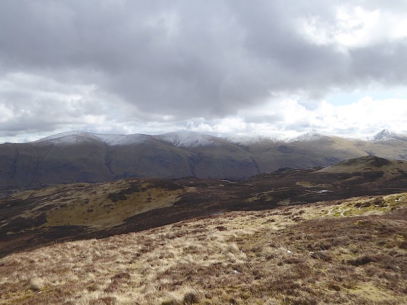
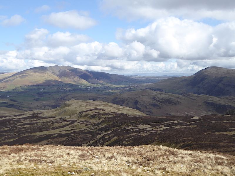
When we left home this morning everywhere, as far as the eye could see, was enveloped in a large temperature inversion, so we saw nothing but fog until we were well along the A66 heading towards Keswick. Once we were out of the fog we were very surprised to see that fresh snow had fallen. There was no snow anywhere yesterday, just the odd patch in places on the higher fells and I thought we had seen the last of it until winter comes around again. There was quite a lot on the eastern fells in particular so I took a few photos as we travelled along, some from lay-bys, others through the car window so apologies for the blurry shots …..

Little Mell Fell.

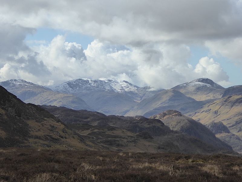
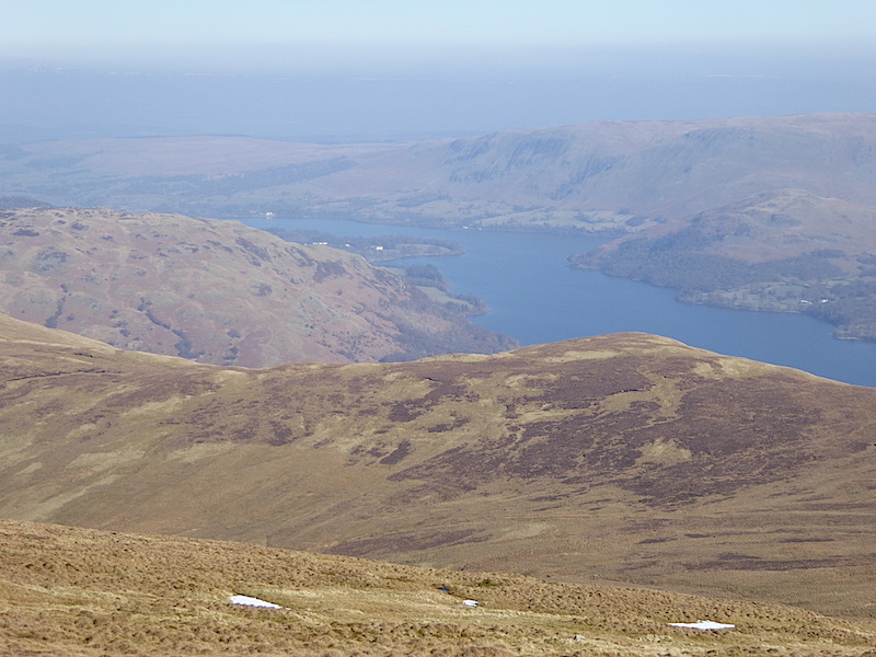
The Helvellyn range on the right skyline.
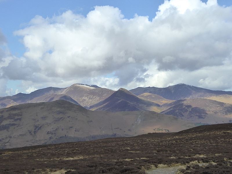
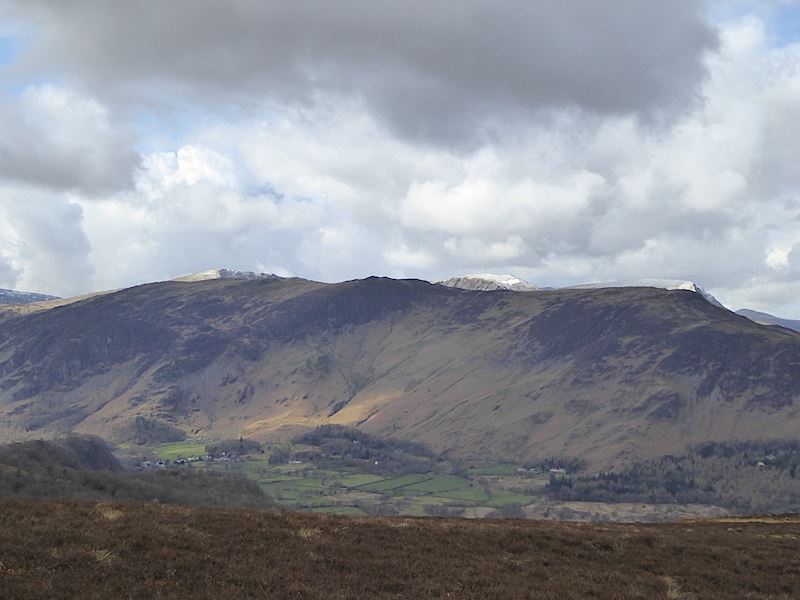
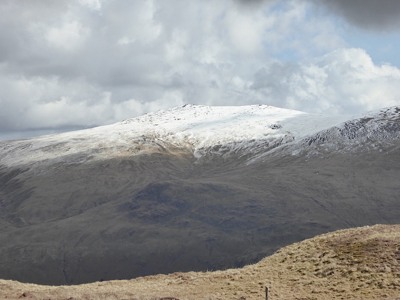
Blencathra.

Great Dodd and Clough Head.

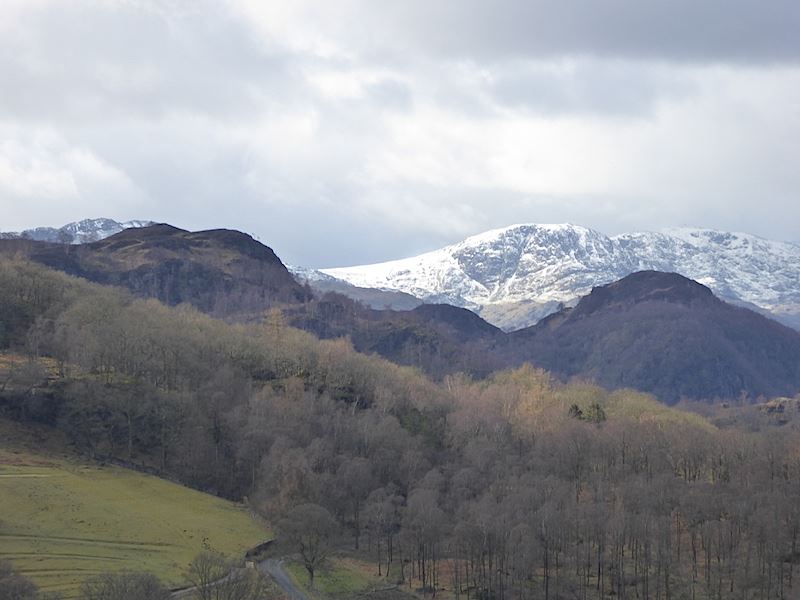
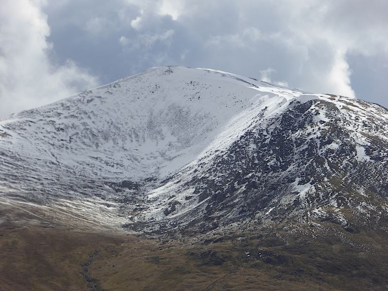
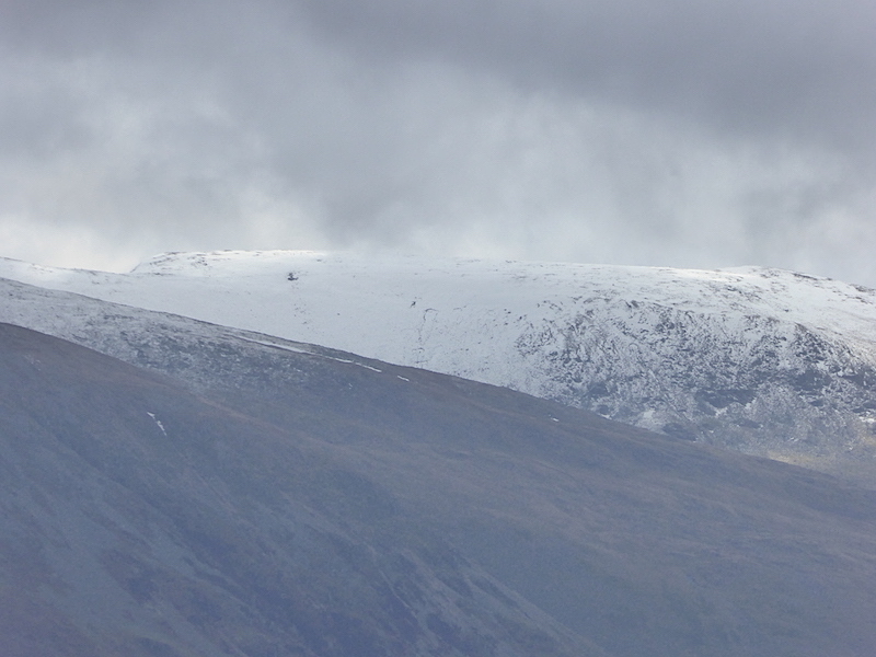
Blencathra again from the A66.

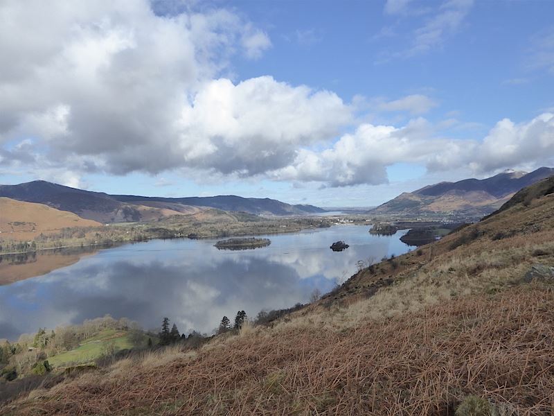
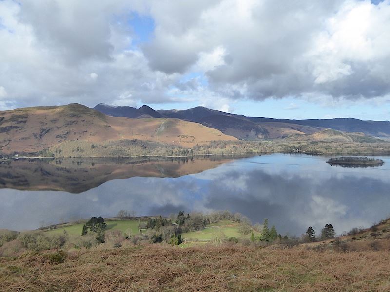
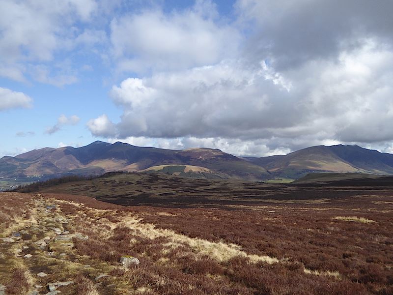
Some of the north western fells from the A66.


Now on with the walk …..
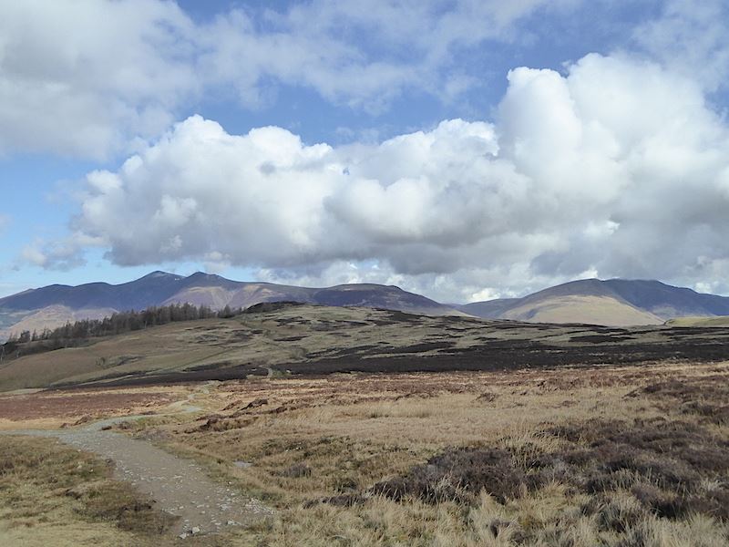
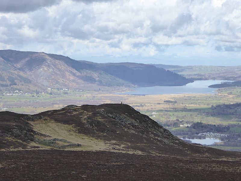
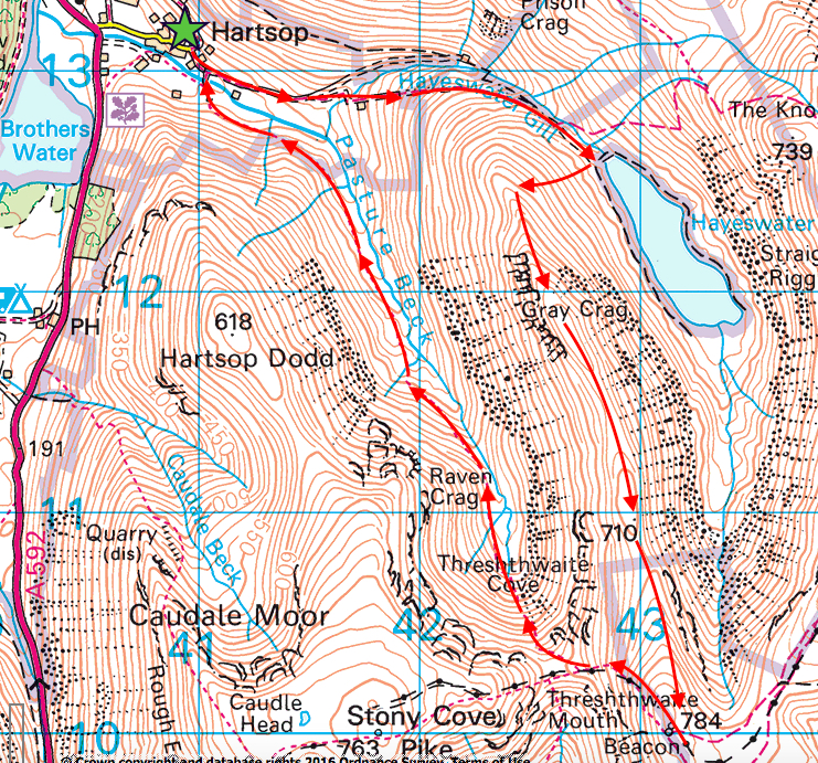
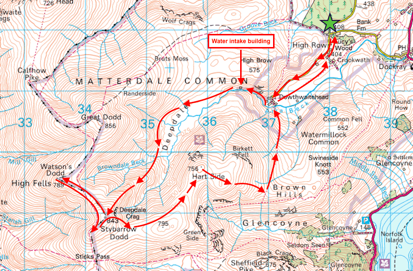
Route

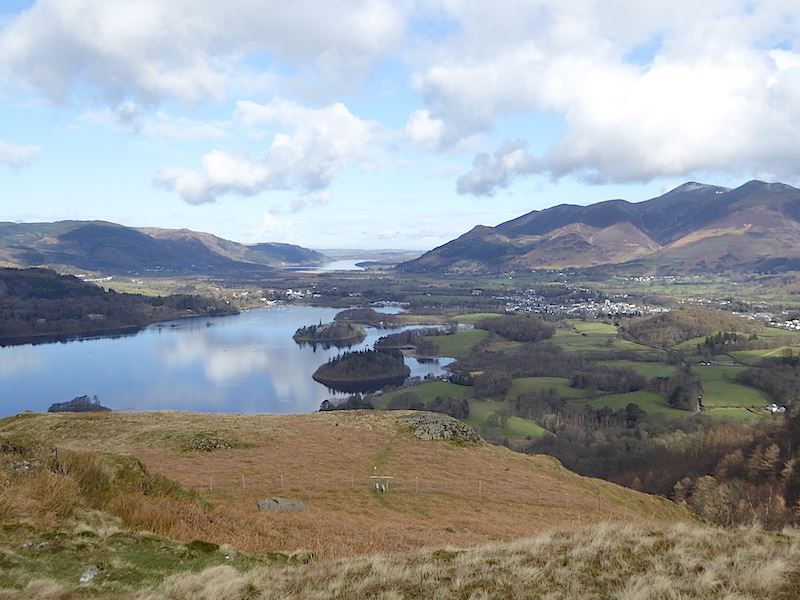
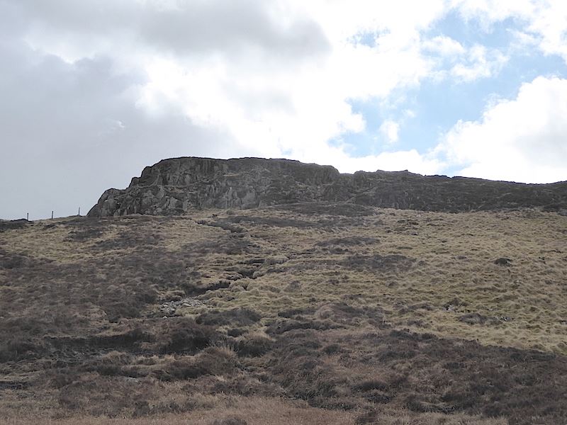
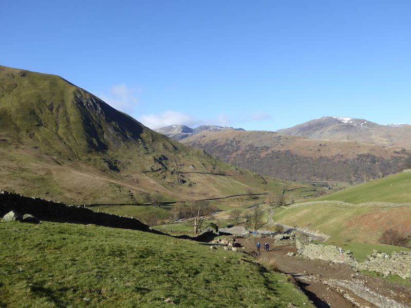
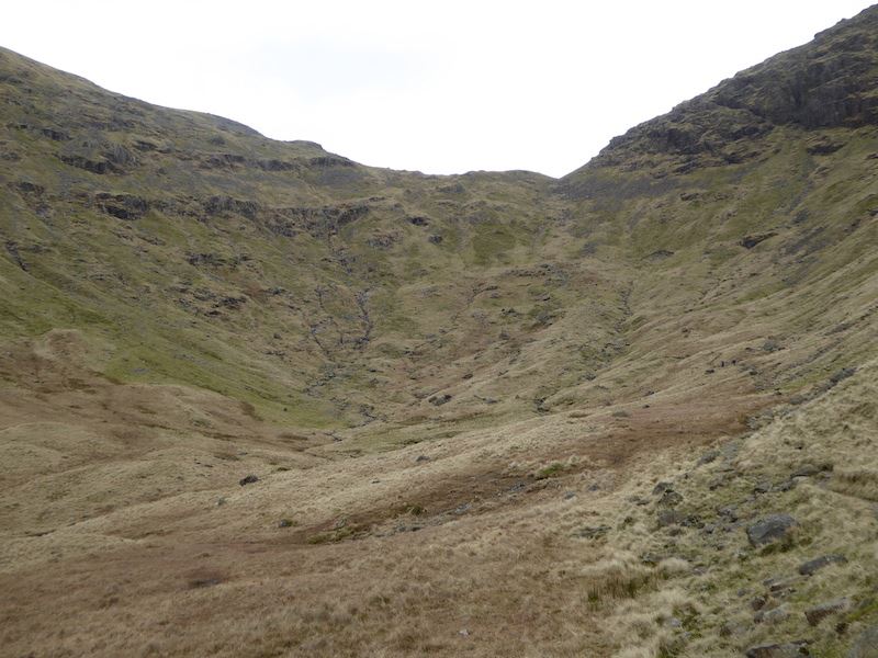
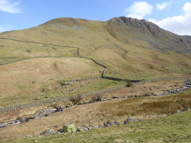
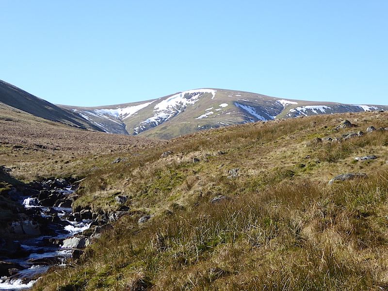
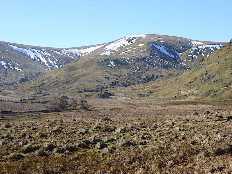
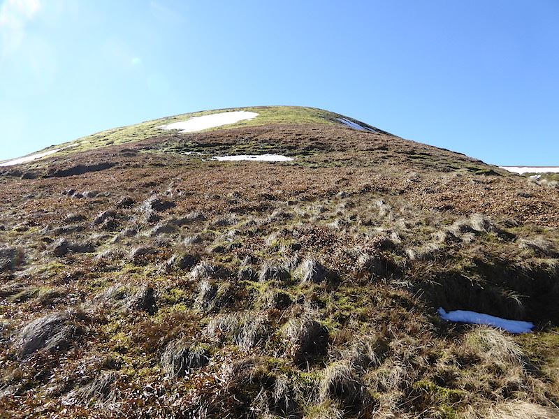
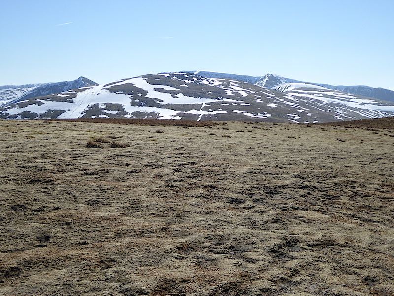
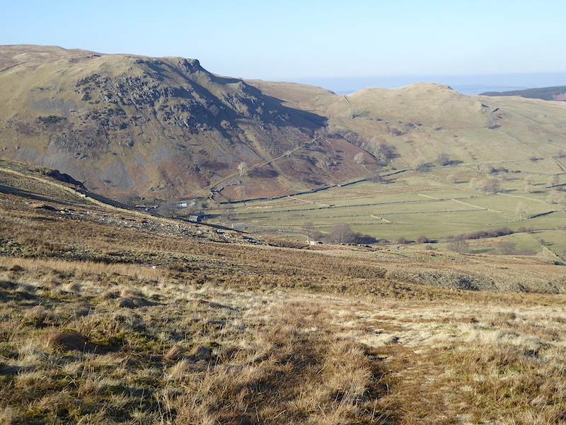
The first fell we’ll walk up today will be to Eagle Crag is in the centre of the shot. It has a sprinkling of snow but Greenup Edge over on the left has quite a bit more. Its a beautiful morning with just enough coolness about it to keep the jacket on for a little longer.

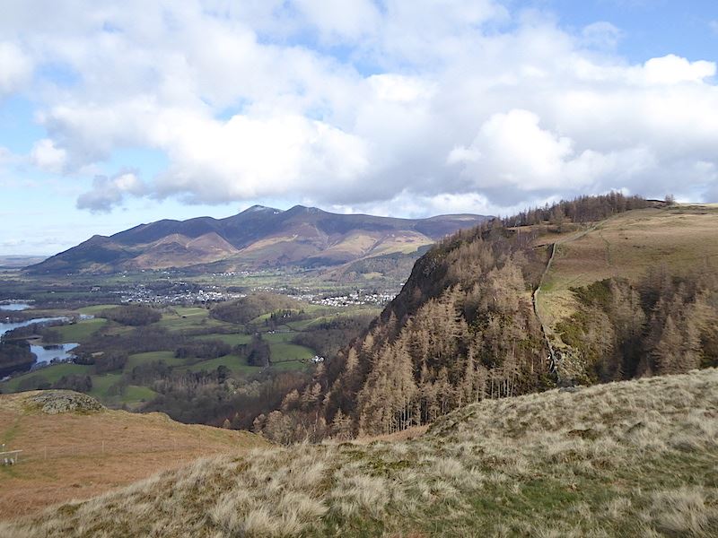
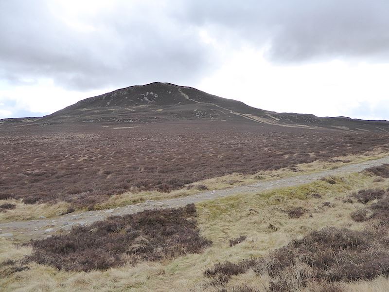
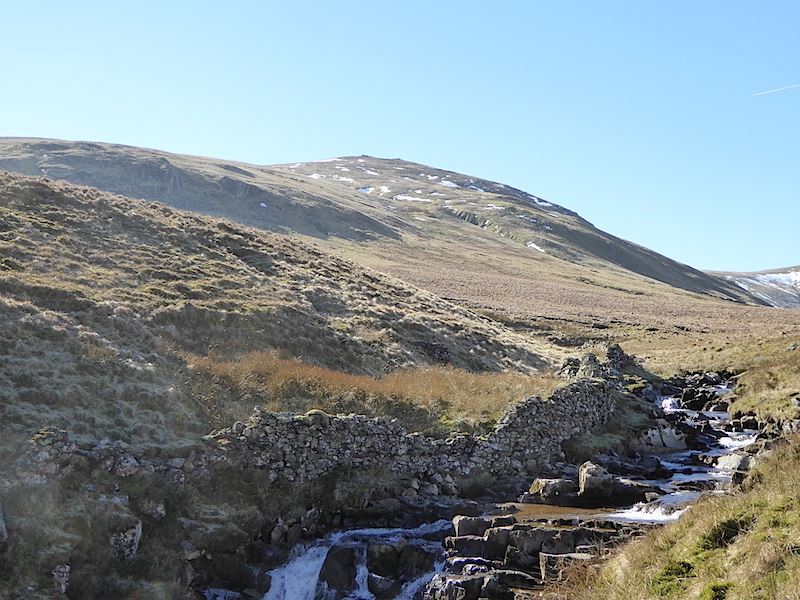
Not much snow on Grange Fell though, and it looks like somebody had a fun time trying to drive out of the muddy grass

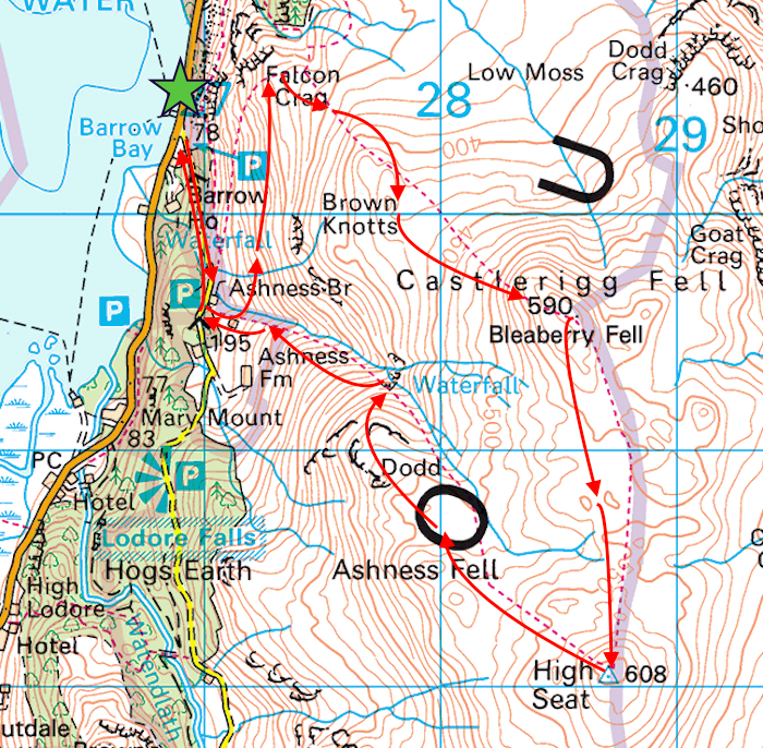
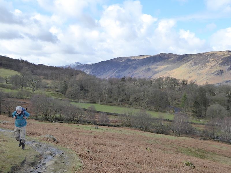
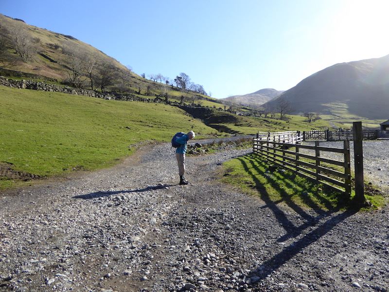
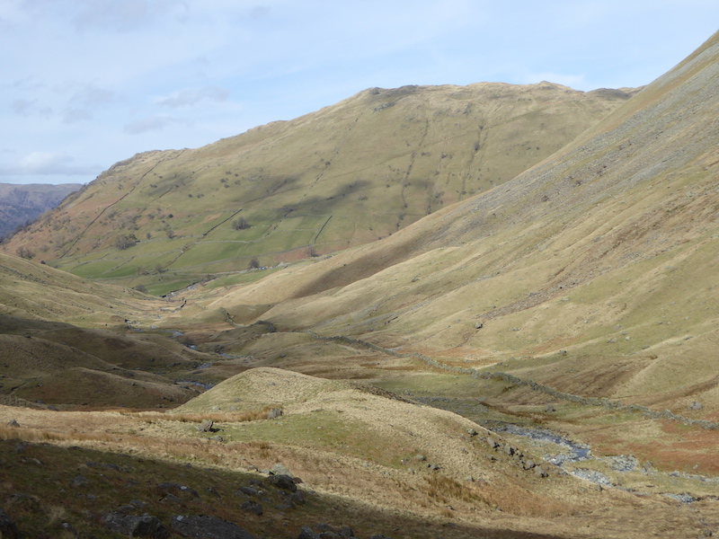
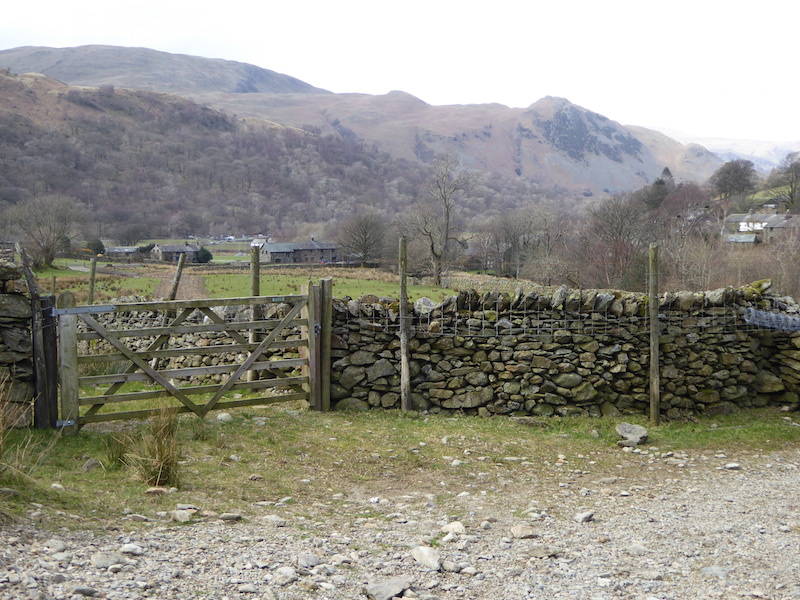
A look back along the lane as we walk along to Stonethwaite village.

“Don’t look now, but have you seen what her behind us is wearing?”

You wouldn’t really do anything else on that track, would you?

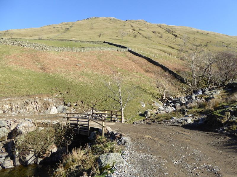
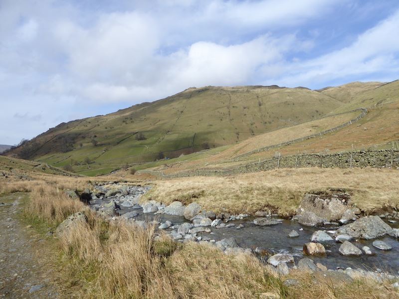
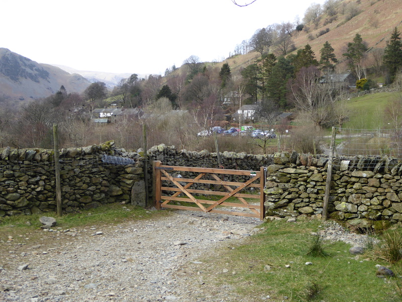
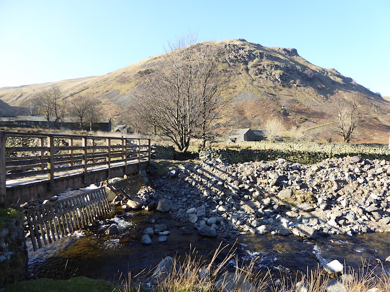
This is where we leave the village and cross over Stonethwaite Beck to pick up the path on the other side.

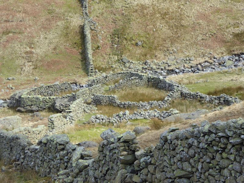
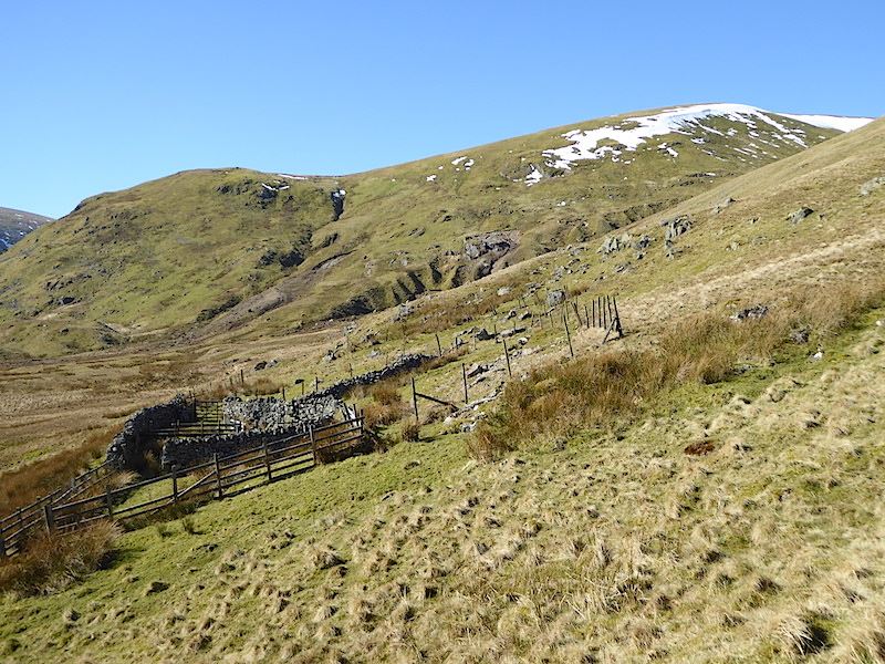
Not too far from the bridge is this sheepfold, the shot turned out to look better than I thought it would. The sun was more or less directly in front of us so taking  pictures looking ahead was difficult.

Eagle Crag across Stonethwaite Beck.

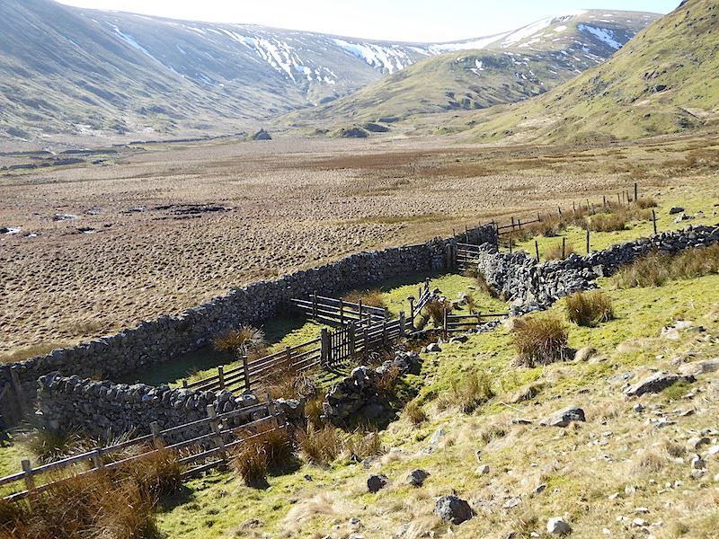
Another sheepfold alongside the beck. The jackets came off at this point as the day was warming up nicely.

A look back down as we make steady progress up Greenup Gill.

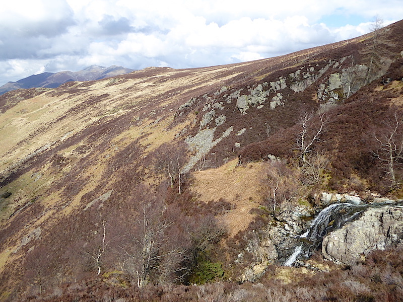
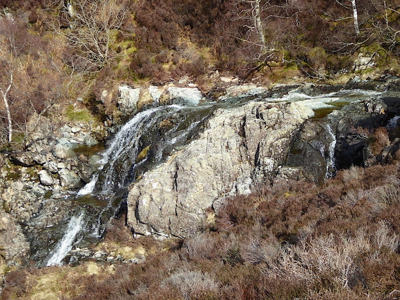
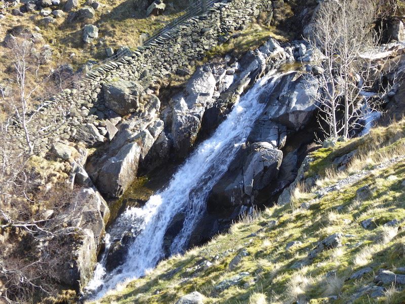
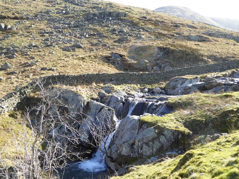
One of the many pretty little waterfalls in Greenup Gill.

Just above this waterfall is what looks like a bit of old wall. Its actually a sheepfold standing on a little island in the beck. We plan to turn off to the right somewhere here if we can find a handy place to cross.

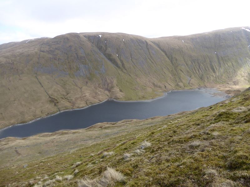
A better view of the sheepfold, and Greenup Edge, now that we’ve crossed the beck and gained a bit more height. We’ve also gained a lot more water underfoot as the ground on this side is very, very wet. Its difficult to keep a foothold on the wet grass and we’re slipping and sliding with every step.

Higher up still and an even better view of the sheepfold and the little island.

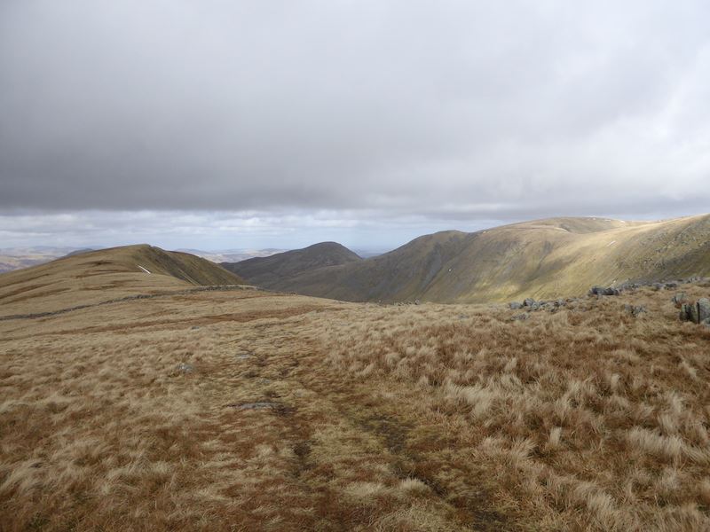
Over on the left the top of Eagle Crag comes into view.

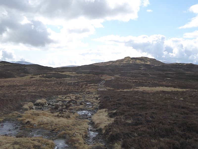
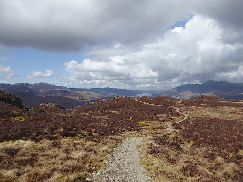
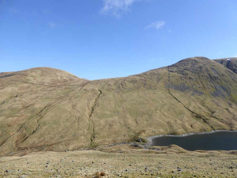
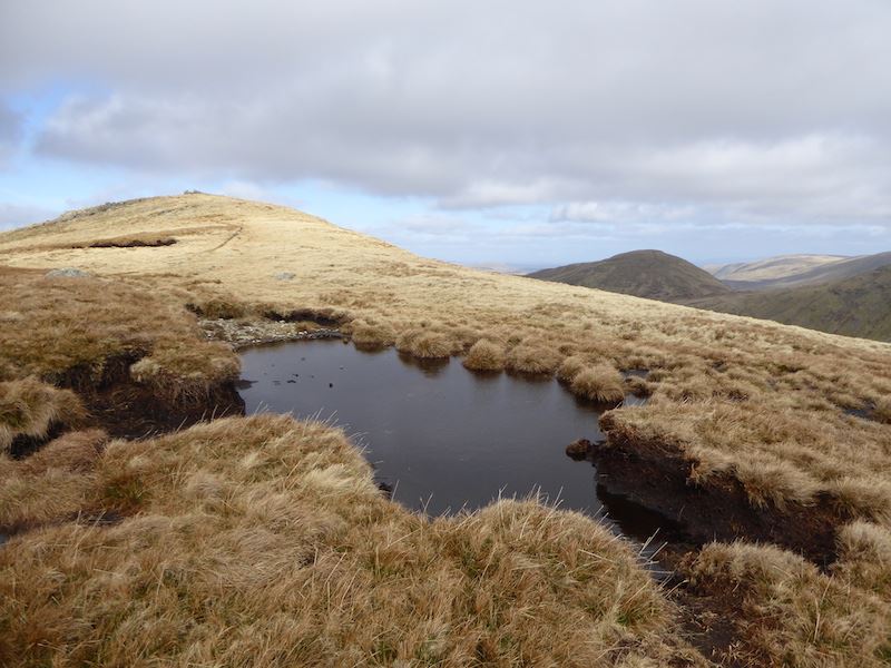
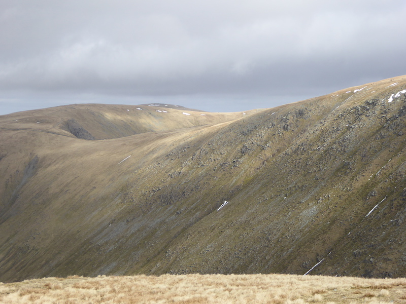
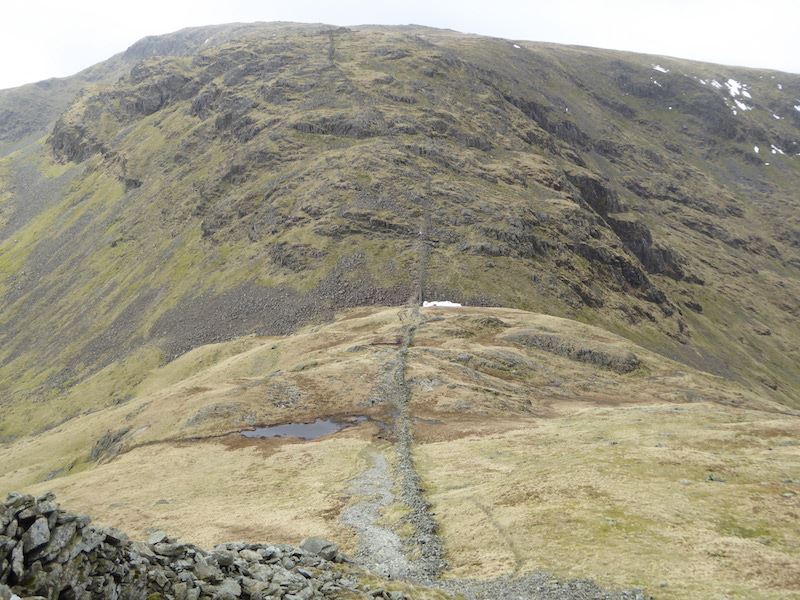
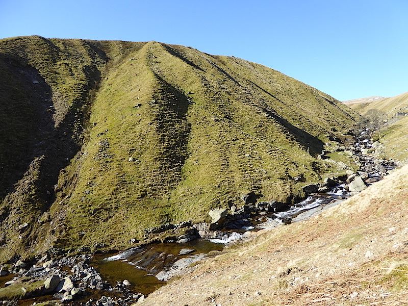
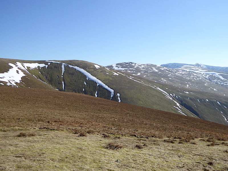
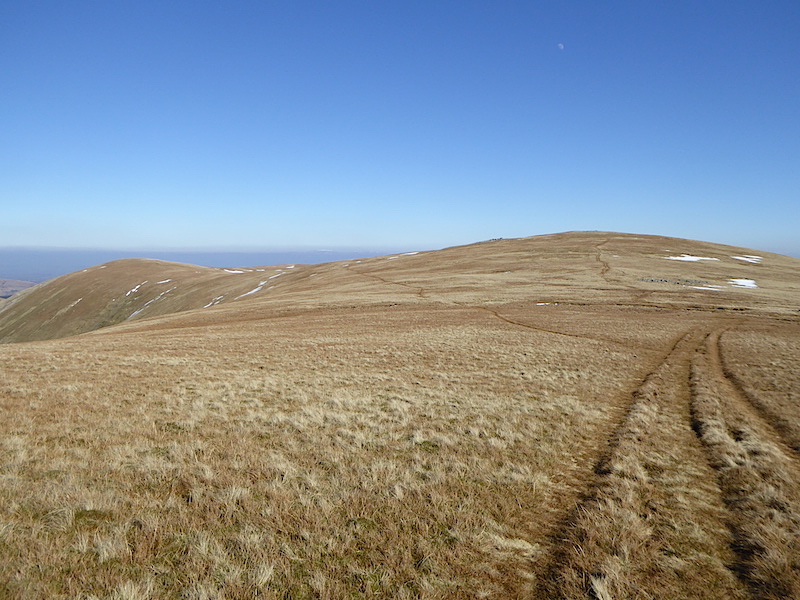
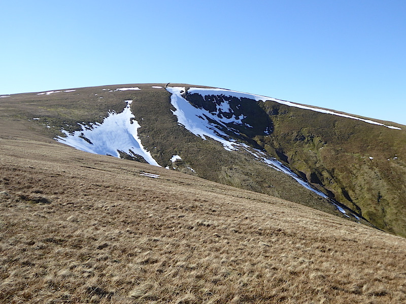
The ground is no drier up here and water is running everywhere through the flattened grass, progress slowed over here as it was hard to get any sort of firm grip under the boots, if we’d had the ice spikes with us they would have come in very handy for a while. Those white upturned basin shapes are snow covered drumlins. Above the ones to the left is Lining Crag with the path, which we turned off earlier, going up to the left of it and leading on up to Greenup Edge.

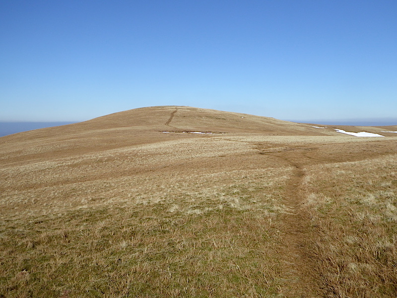
Eventually we reach ground which was marginally drier as we get nearer to the wall below Eagle Crag.

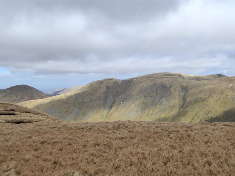
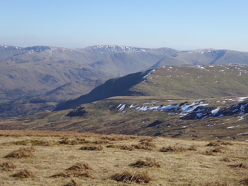
At the wall I take a look behind us to High Raise, over on the left, and Sergeant’s Crag on the right.

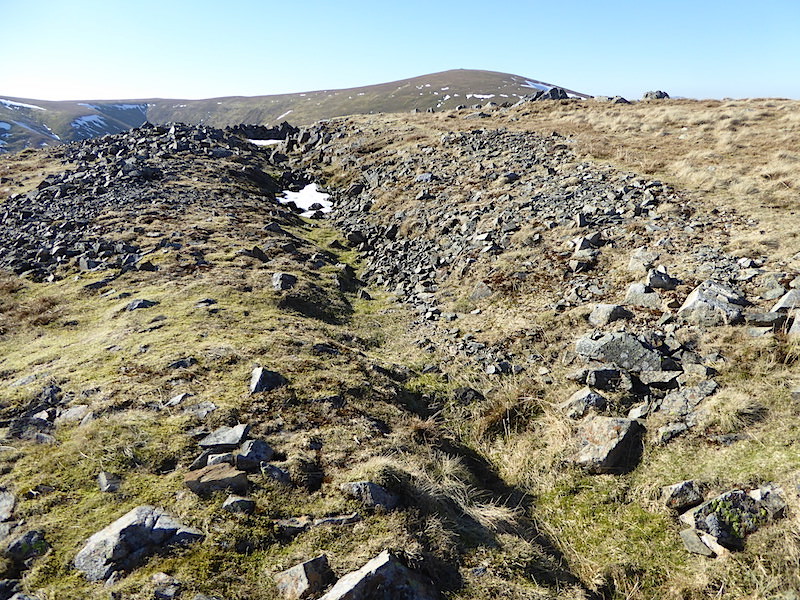
Since the wall has a fence above it there is a stile to do the cross over, once you’ve ploughed your way through the mud that is. The stile is a bit longer on the other side, a situation not helped by the fact that one of the lower rungs was  missing, involving a big step down for anyone who is in the ‘a bit short in the leg’ category. The stile is a useful ‘warm up’  exercise for the next bit of excitement.

Your trials and tribulations do not end at the stile, having got over the wall you now have to climb back up it again to get onto the right side of Eagle Crag. The stile wall continues right up to the side of Eagle Crag and then turns along it towards where I am standing with the camera. This returning wall also has fence on top of it, so you can’t climb directly over from the other side. We call it ‘The Awkward Corner’, its especially awkward if you aren’t as bendy as you once were.

” I’m OK, you just stand there taking photos and giggling, I can manage.”

Made it!

The Awkward Corner …..

….. and the stile which is just a few yards away from it. Now the fun and games a over and we are on the correct side of the fence we can get on with climbing the last few yards up to the summit of Eagle Crag …..

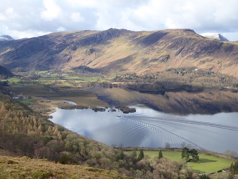
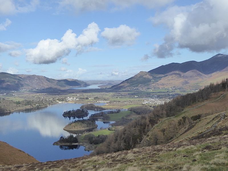
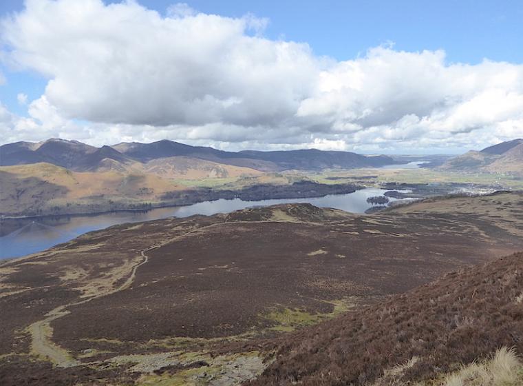
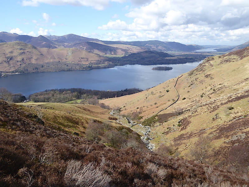
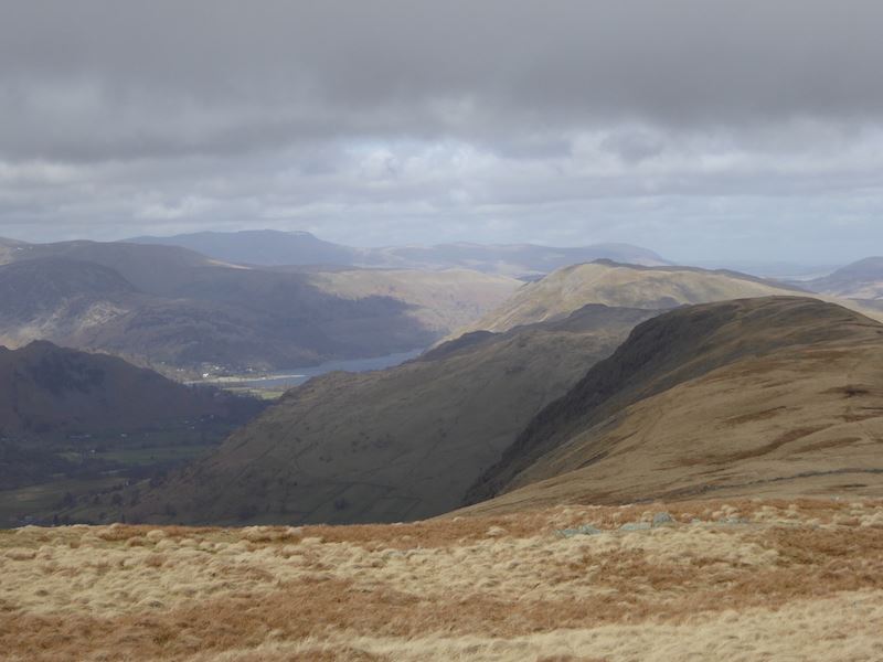
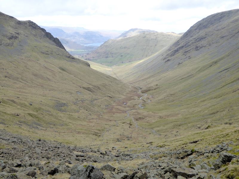
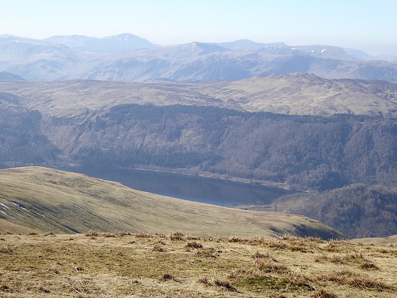
….. from where there is a fine view down into Borrowdale. The village of Stonethwaite in the green fields below.

The view across to the Skiddaw fells isn’t too bad either
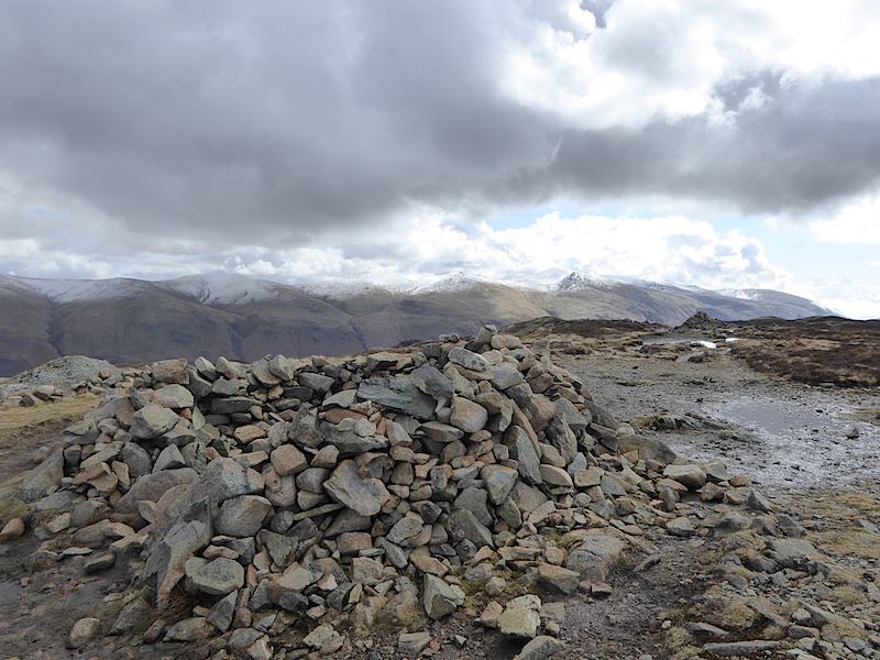
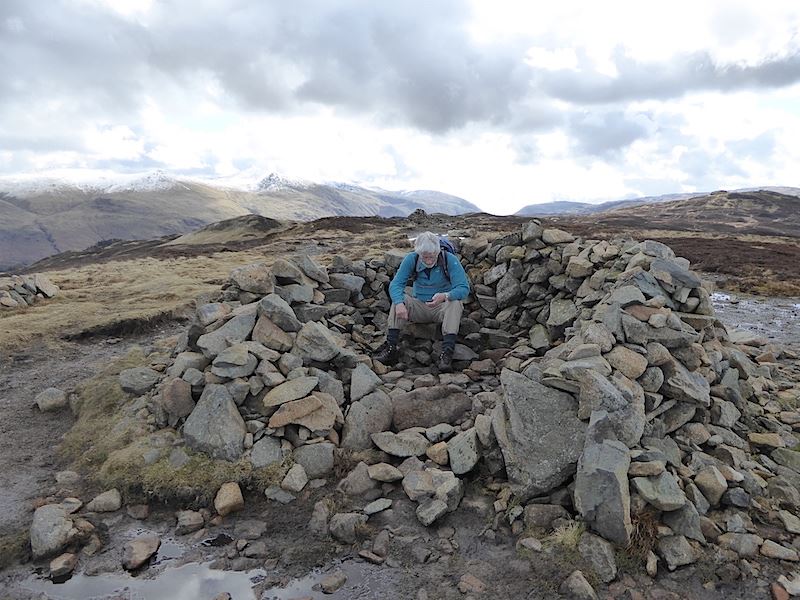
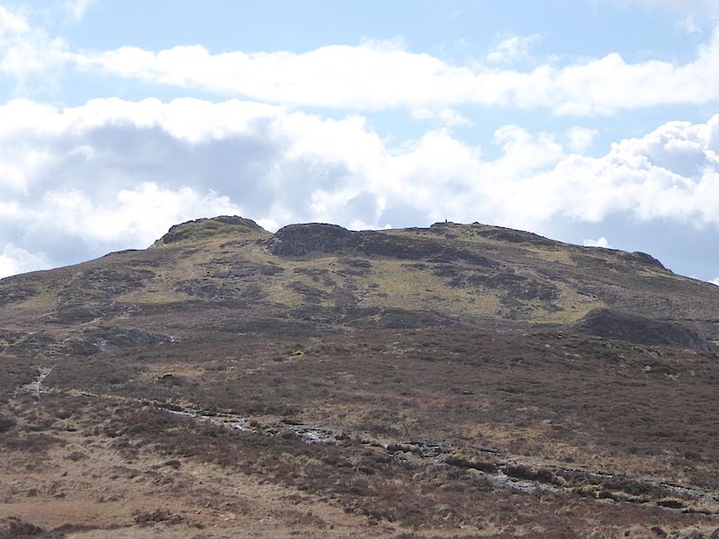
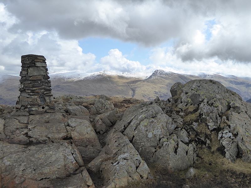
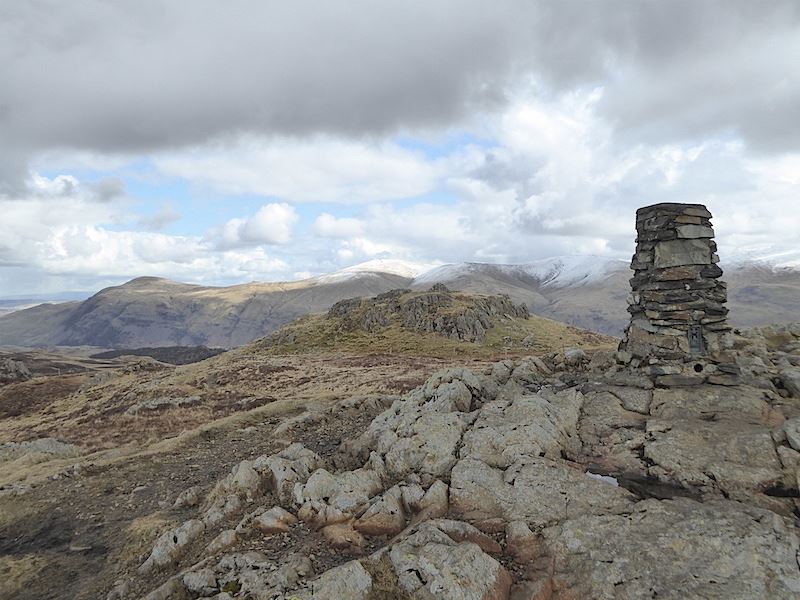
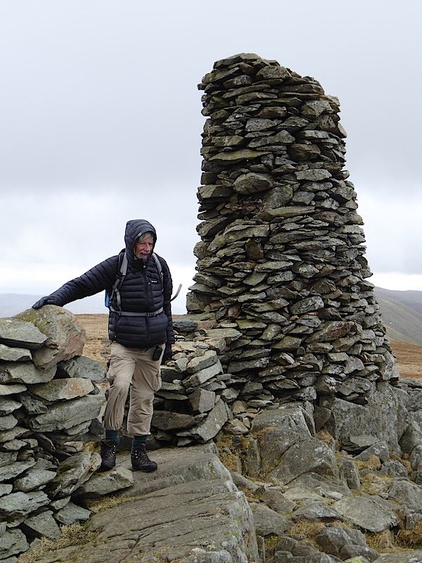
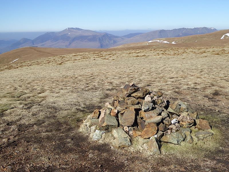
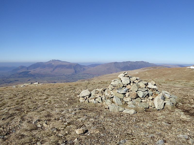
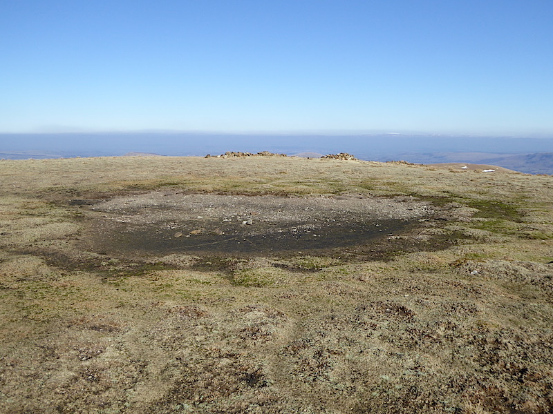
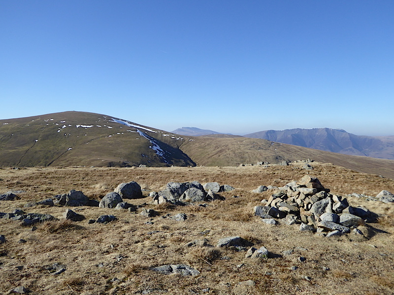
Eagle Crag summit.

We put another layer on as there was a nippy little breeze up here today.

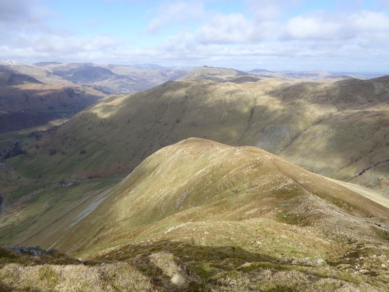
From Eagle Crag summit looking south to Sergeant’s Crag, straight ahead, and High Raise over to the left.

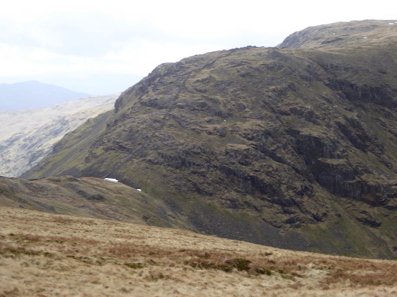
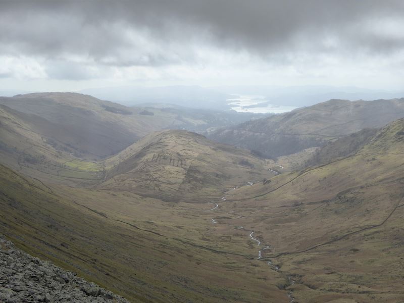
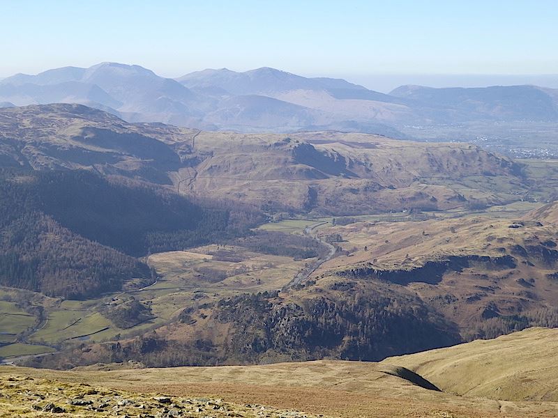
A closer look at Glaramara across the valley. By ‘eck, its a long way down.

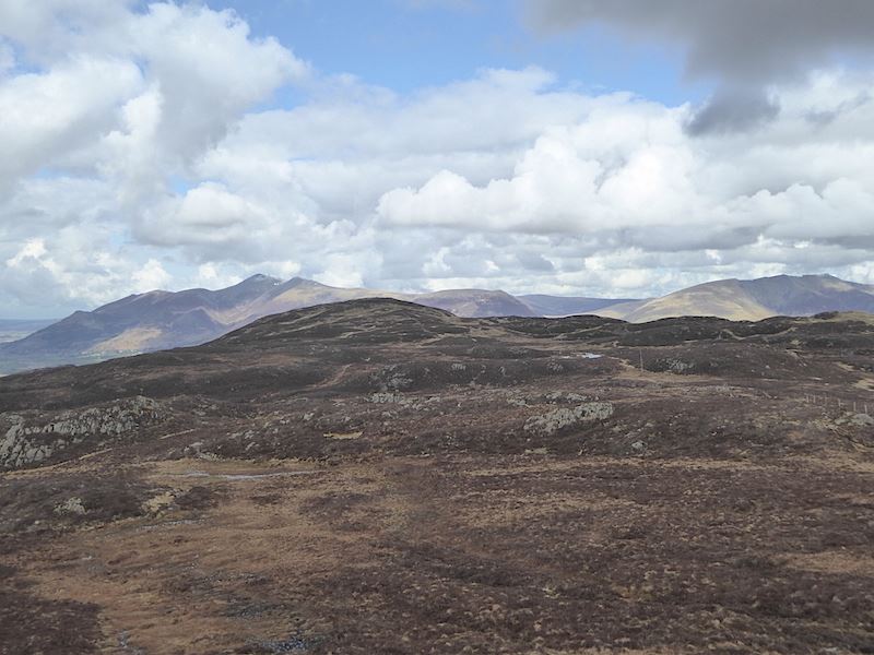
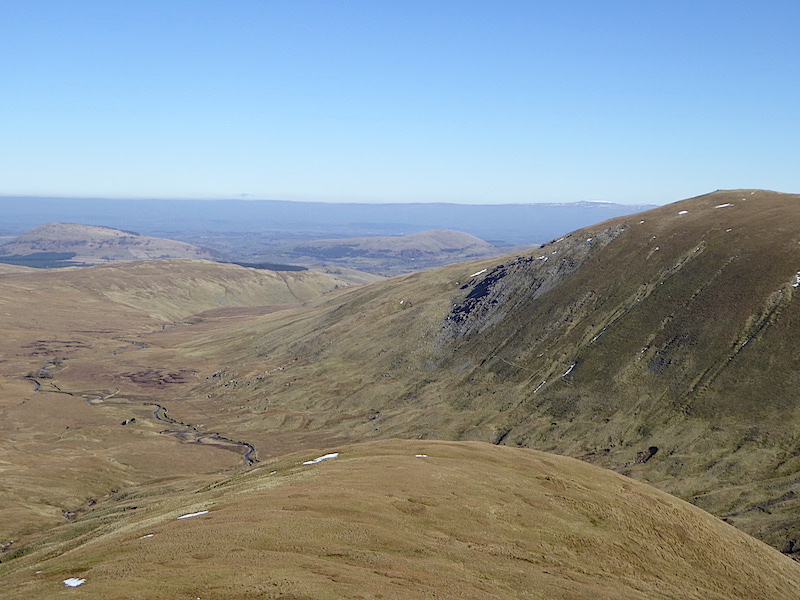
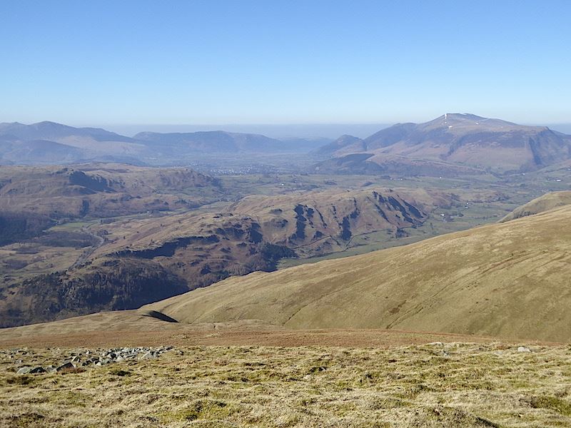
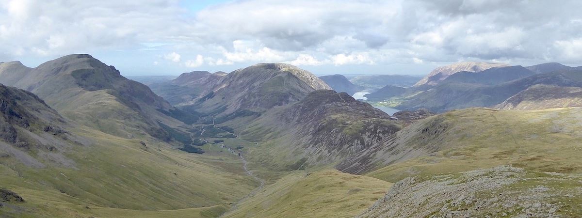
Looking west from Eagle Crag with Pillar and Fleetwith Pike over on the left and Dale Head to the right of them.

Turning slightly to my left and now Great Gable appears on the far left.

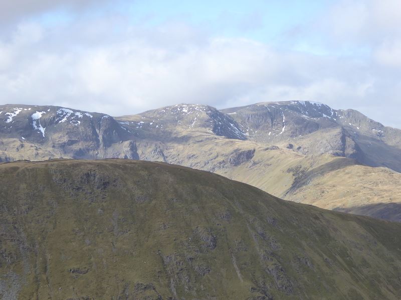
Bowfell on the centre skyline, with Esk Pike to the right of it and Crinkle Crags to the left.

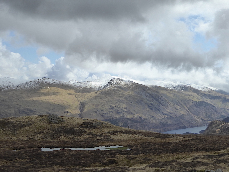
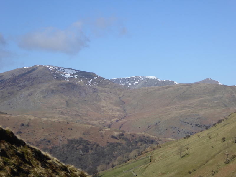
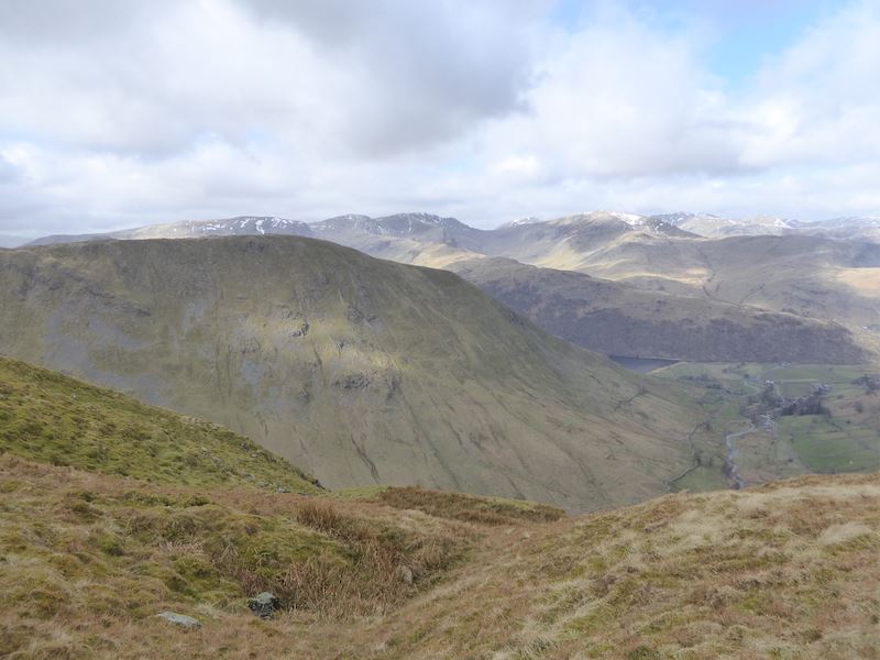
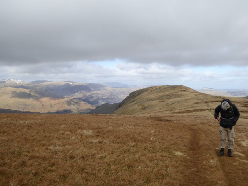
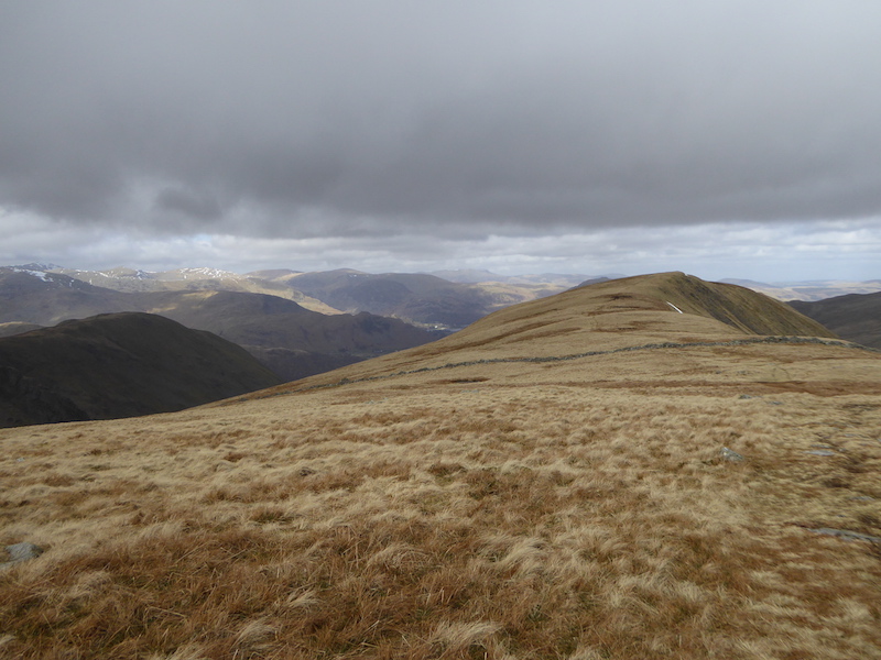
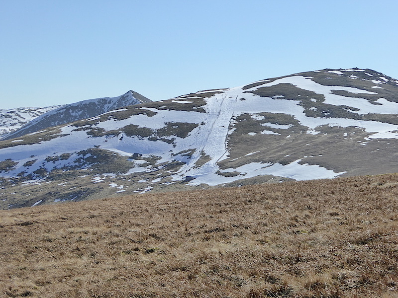
A look back to Eagle Crag as we make our way over to Sergeant’s Crag, a pair of wellies would have been better than boots over here today. Blencathra, the dark shape on the right skyline, looks to have lost most of the snow it had this morning.

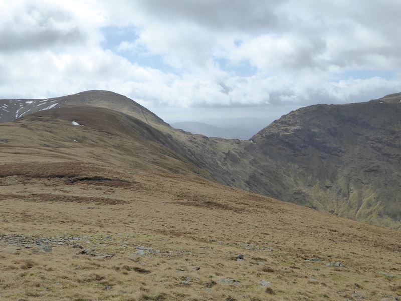
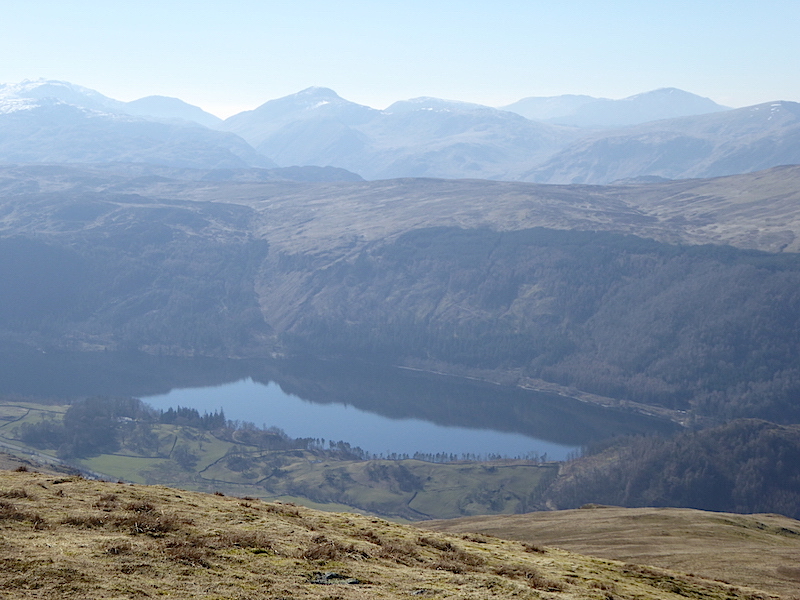
Looking over towards Ullscarf, over to the left of it is the peak of High Saddle.

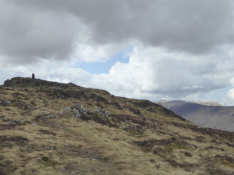
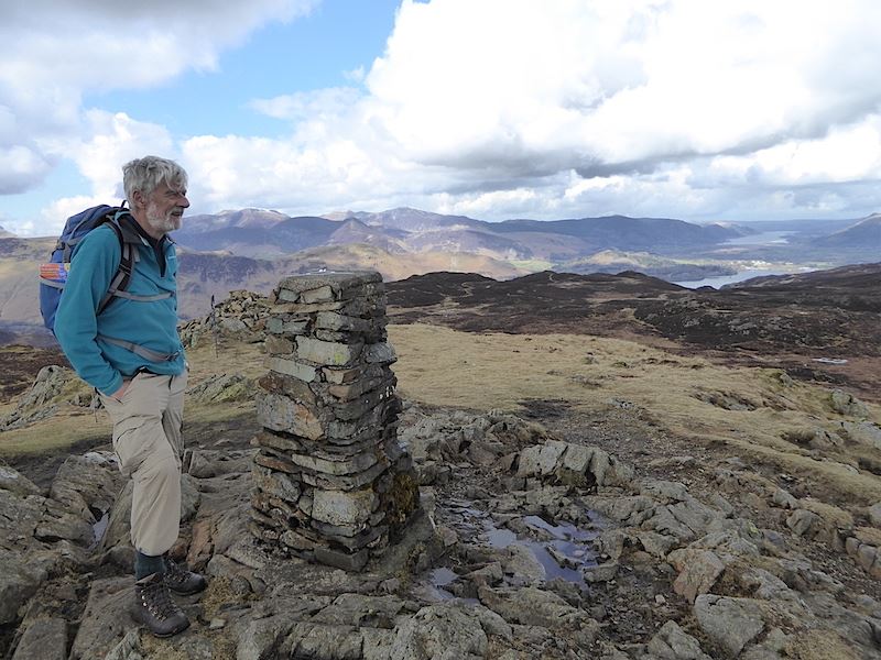
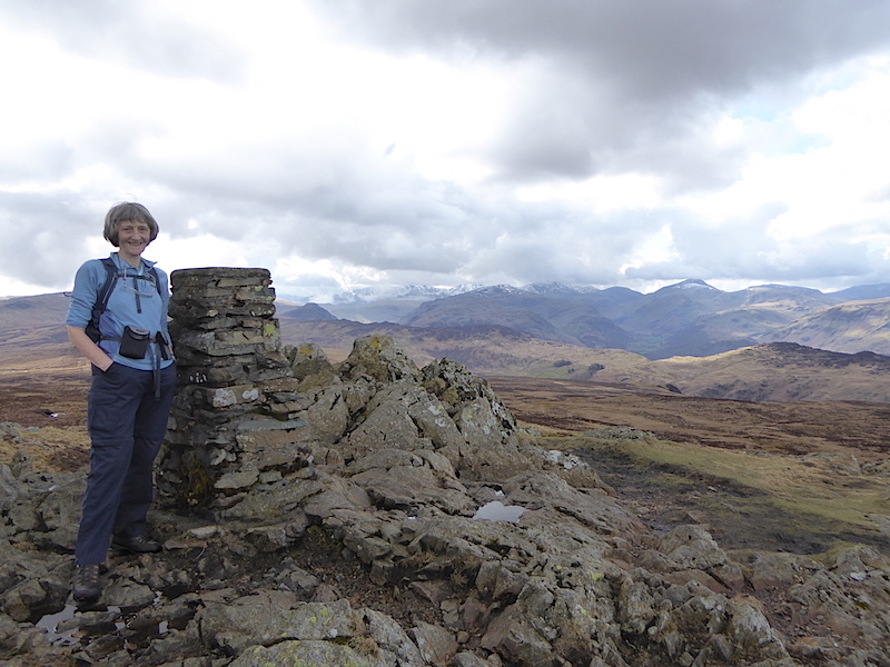
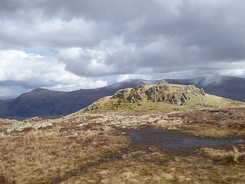
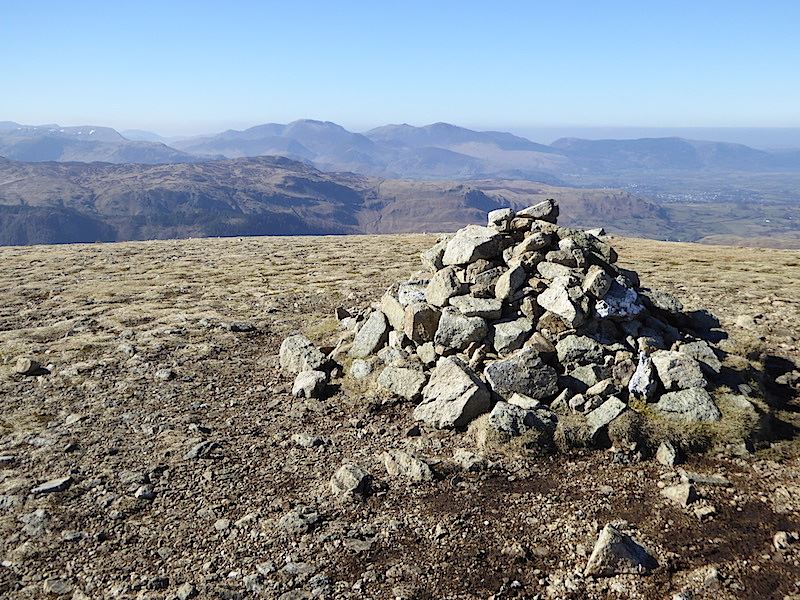
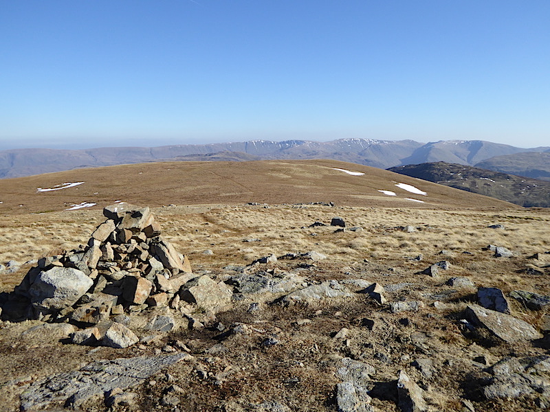
Sergeant’s Crag summit.

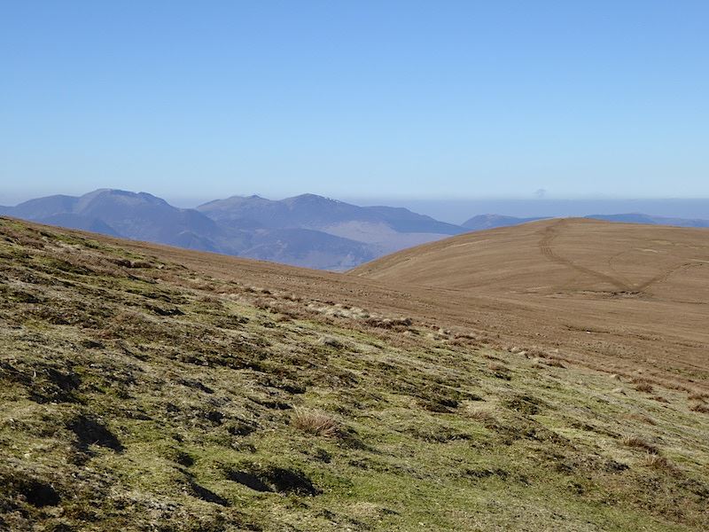
The Skiddaw fells are losing their snow too. Did I mention it was windy up here?

Looking south west from Sergeant’s Crag

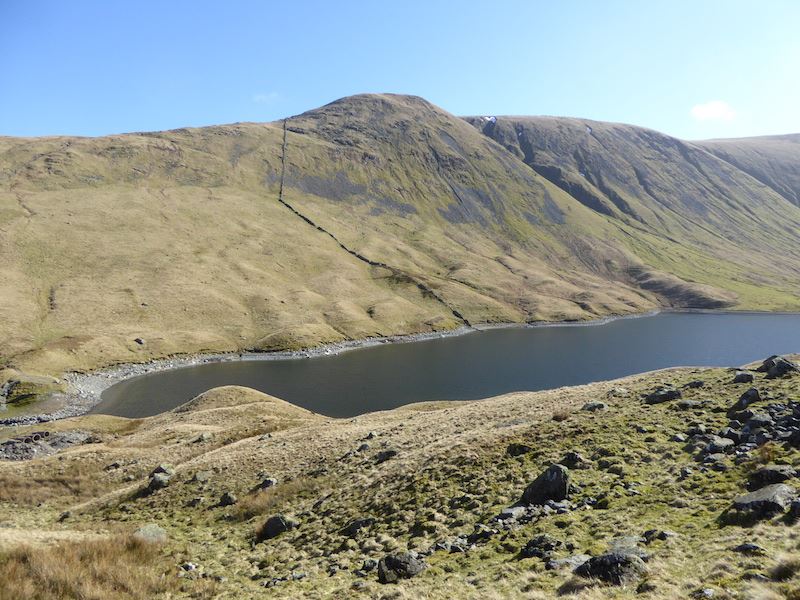
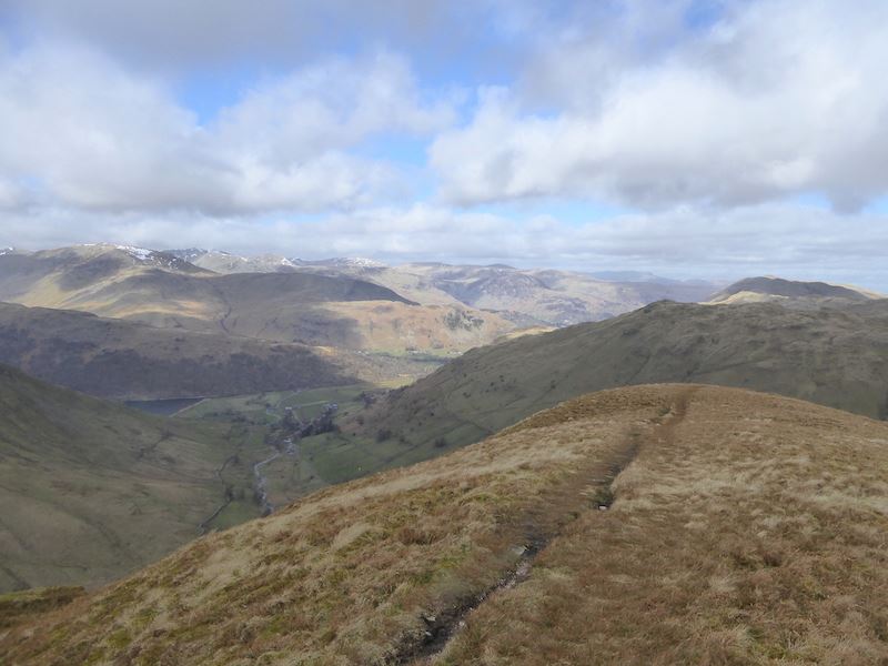
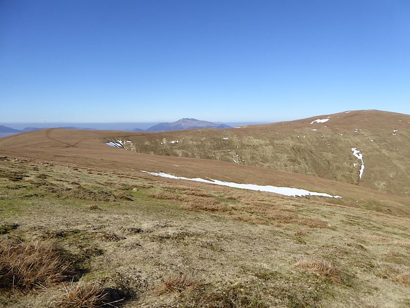
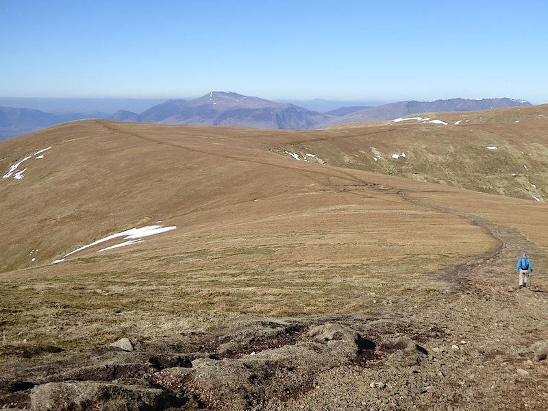
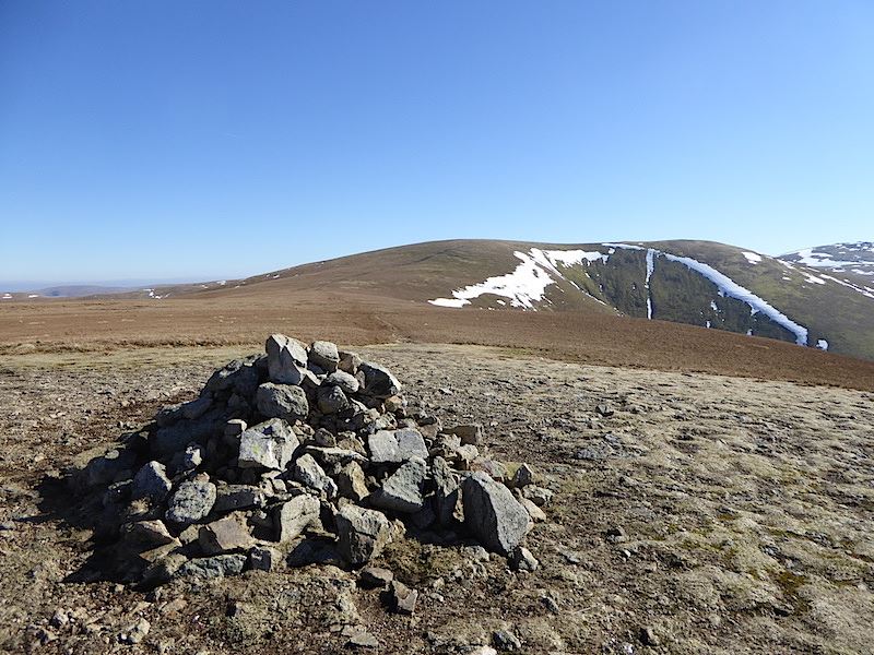
If we continued along the path we would eventually get to High Raise over there on the left, but we aren’t going that way today. We will be walking over to the right heading for Brown Crag from where we will descend into Langstrath. The little bump sticking up over there is Pike O’Stickle.

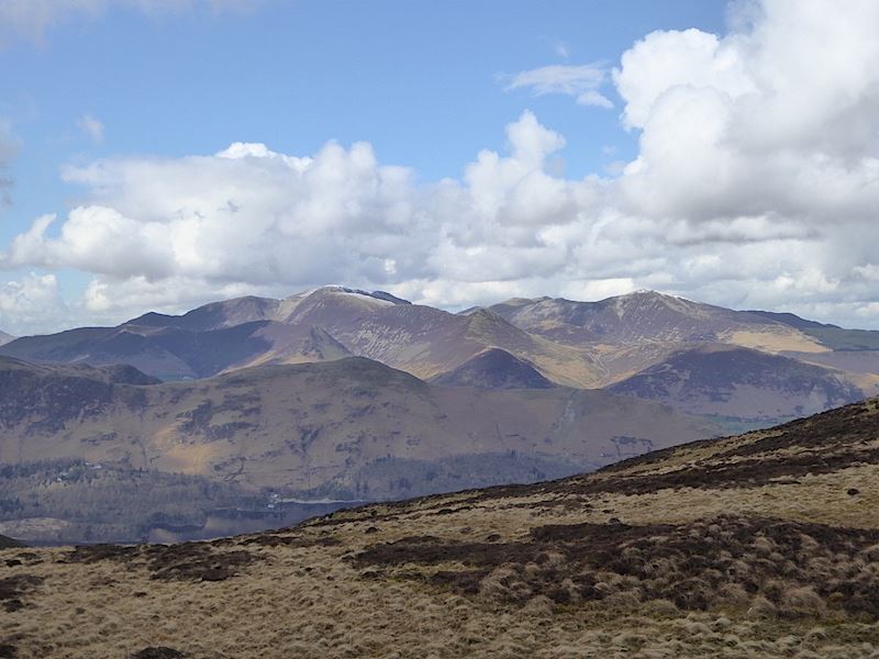
Looking towards Skiddaw from Sergeant’s Crag.

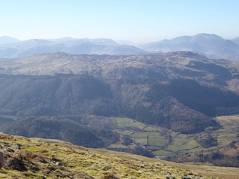
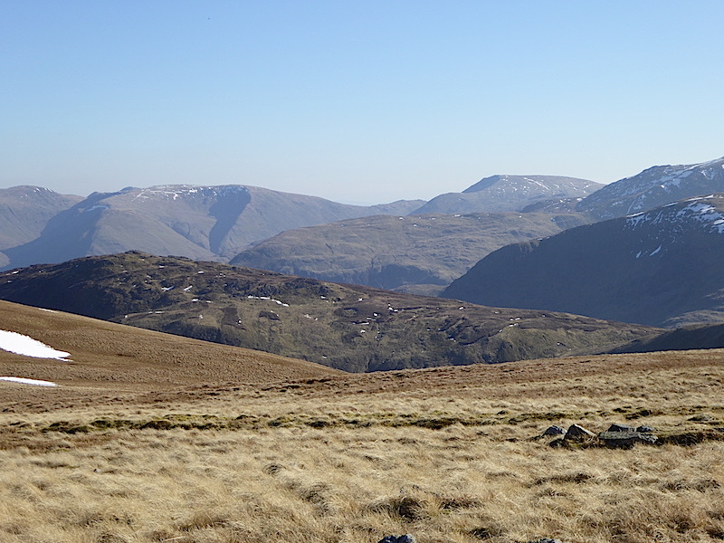
Looking straight across Langstrath at Glaramara.

Another stile to cross as we leave Sergeant’s Crag, its quite short on this side …..

….. but longer on the other.

A look back at Sergeant’s Crag as we make our way across another very wet area.

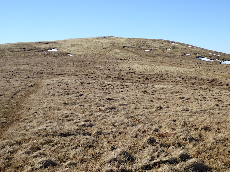
Heading for Brown Crag with a view of some of the southern fells ahead of us. Brown Crag is at the end of this wet grassy plateau.

From Brown Crag a view of Stake Beck, on the left, joining Langstrath Beck.

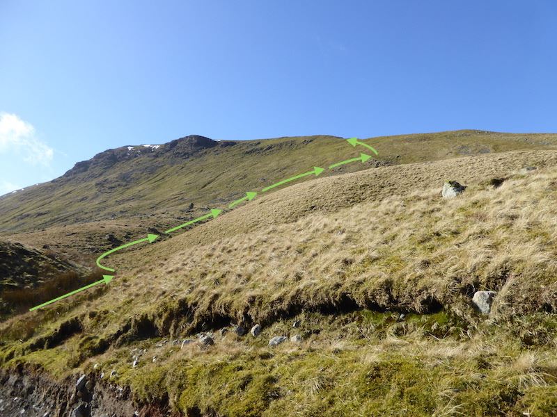
Looking down into Langstrath from Brown Crag. Now we have to get from up here to down there, so we double back from the high point to a lower point, and then descend in a series of zig-zags down a steep, wet, grassy slope. Despite plenty of slithering and cursing neither of us ended up on our backsides.

Safely down into Langstrath and now for the long walk down the valley back to Stonethwaite. What looks like a beck on the bottom right is really the path so there was a good bit of side-stepping and puddle jumping on the way.

Despite all the wetness its a great valley to wander down on a sunny afternoon, with the added bonus that we are now sheltered from that nippy east wind by the surrounding fells.

Langstrath Beck bubbling gently down over the stones, which, together with the occasional bleats from sheep were the only sounds in the valley, it was just fabulous. If you want to get away from it all take a walk up Langstrath.

There are paths on both sides of the beck, so even if you can’t manage hills, you can still have a really good flat walk, up one side of the valley and back down the other …..

….. and if you should come here on a really hot day, bring your swimming stuff and take a dip in Black Moss Pot, a very popular swimming spot in summer. There are plenty of other places for a dip though in a beck as long as this one.

The beck tumbles through the narrow cleft between the rocks and into the deep pot. The flat topped rocks on the left serve as a jumping off point. Lower rocks on the opposite side provide an alternative means of entry if you don’t fancy leaping into the unknown. I’m still waiting for a really hot day although there is no way I’ll be starting on the left hand side.

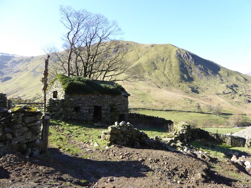
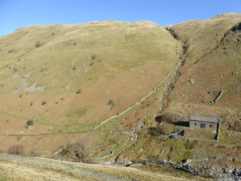
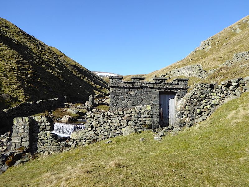
The derelict building across the beck, known as Johnny House, at the Stonethwaite end of Langstrath.

The crystal clear water of Langstrath beck looking very inviting, but it was very, very cold.

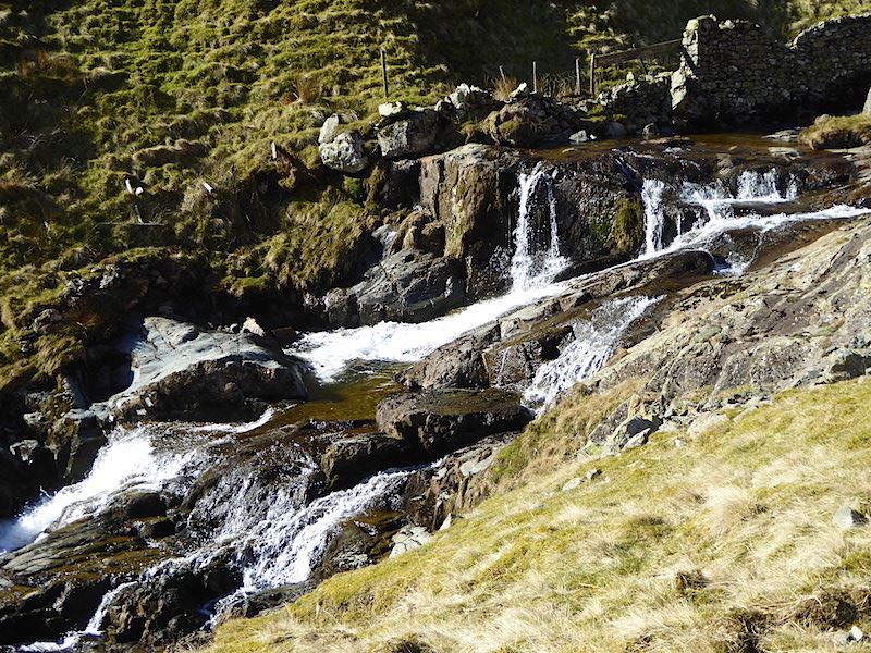
Further down the beck has to drop down from the flatness of Langstrath to the flatness of Stonethwaite. The drop starts here at Galleny Force.

Looking upstream at Galleny Force …..

….. and looking downstream.

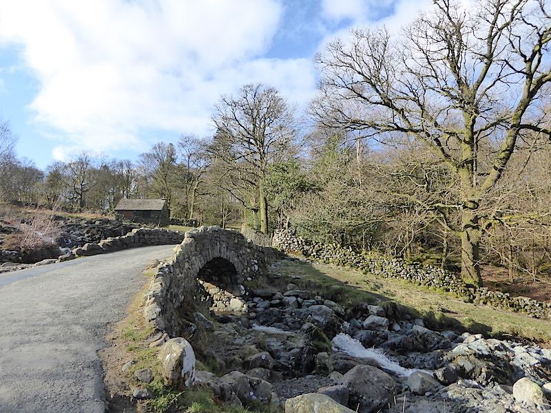
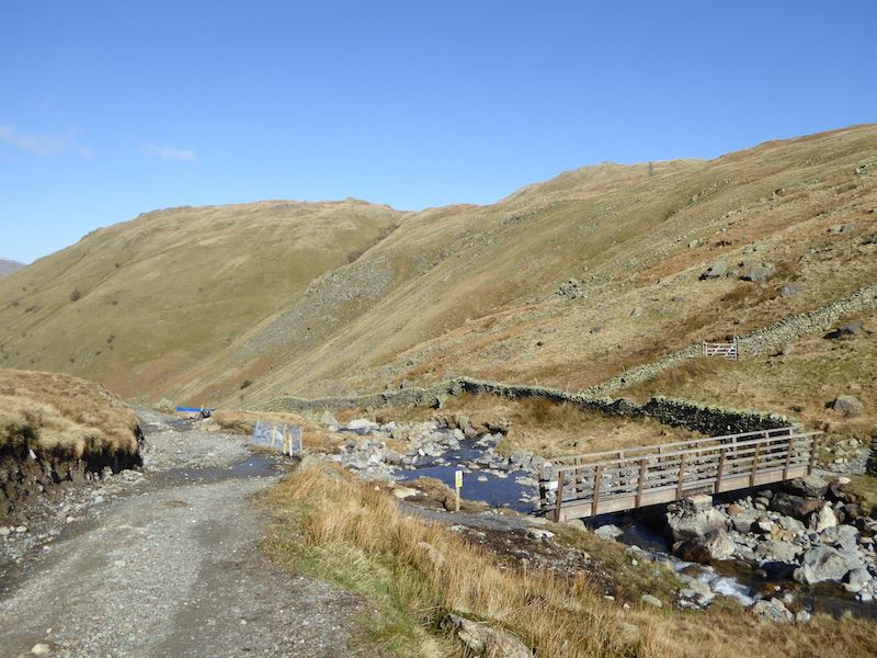
Crossing the bridge takes us out of Langstrath and over on to the Greenup Gill path, from here we return to Stonethwaite using the path we started out on this morning.

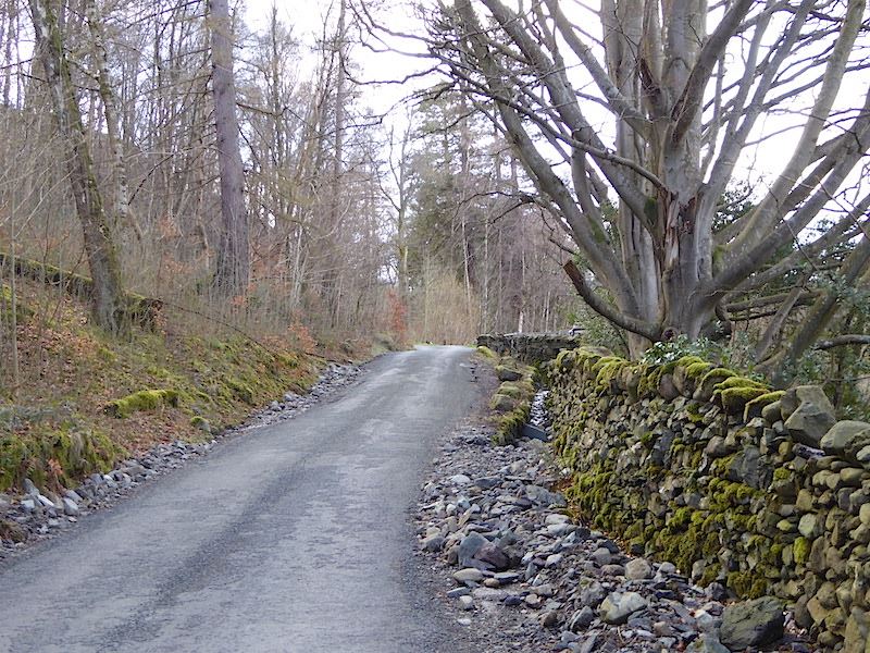
Memorial plaque on the bridge.

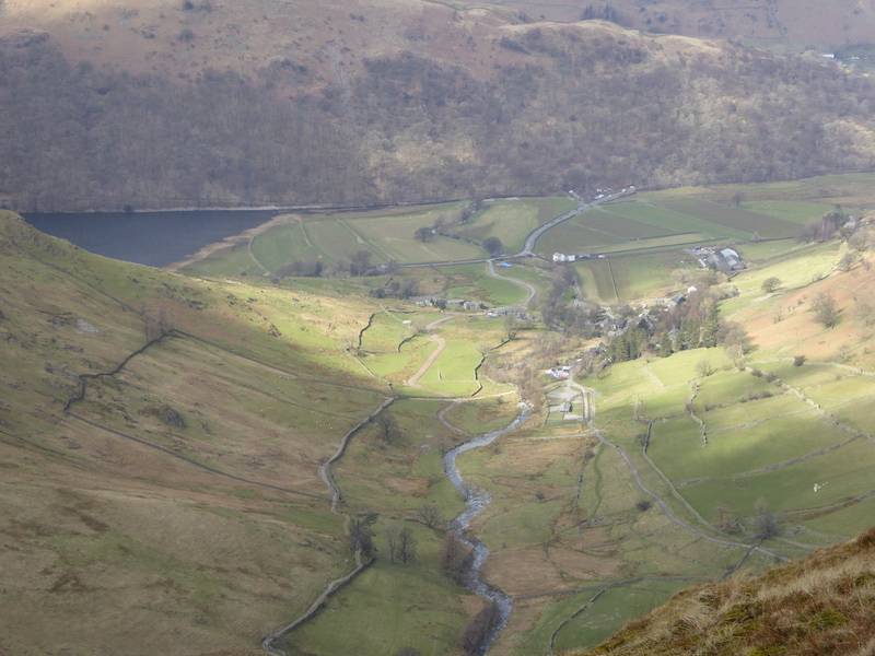
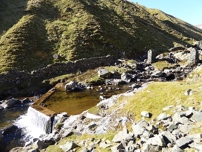
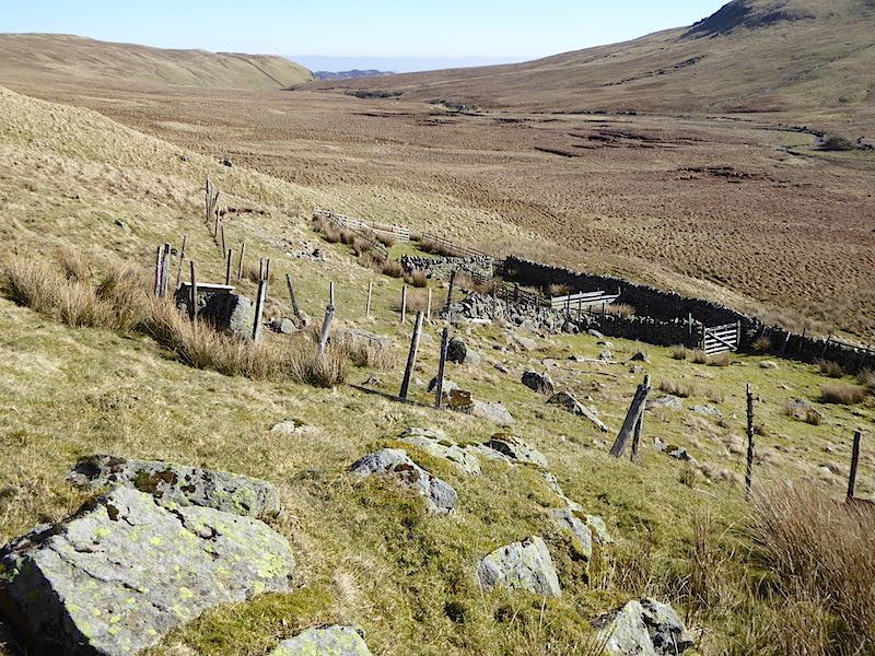
From the bridge you can see where the two becks meet, Langstrath Beck on the left, Greenup Gill on the right. Once joined it becomes Stonethwaite Beck. The second sheepfold we passed this morning is over on the right hand side.

Eagle Crag and Sergeant’s Crag across Stonethwaite Beck …..

….. and ahead of us is Stonethwaite and our journey’s end. The sun shone all day so this morning’s snow has melted away, the grass is beginning to grow again, and the trees and hedges are in bud, waiting for a little bit more warm weather before bursting open and bringing some fresh greenery to the landscape, and to eyes which are just getting a little weary of seeing winter brown.


Bleaberry Fell and High Seat

Walk Date – 31st March 2016

Distance – 6.2 miles

Weather – mostly sunny with fine weather cloud, dry


Today looks like being the best one of the week, although there was a hint that there might be some showers moving in during the afternoon. With that in mind we opted for something not too high and not too long in length just in case. We parked in the usual spot at the bottom of the Watendlath road.


Route

We start by walking up the road from the car park up to Ashness Bridge.

This small structure catches my attention each time I walk past it so today I decided to have a closer look at it, the inscription reads – ‘In memory of Robert Graham 1889 – 1966 of Keswick, who on the 13 -14 June 1932 traversed 42 Lakeland peaks within 24 hours. A record which stood for 28 years.’ This has become known as the Bob Graham Round, it starts and finishes at the Moot Hall in Keswick and it covers about 62 miles and with a total ascent of over 26,000 feet. I won’t ever be running it.

Its a lovely sunny morning as we approach a deserted Ashness Bridge, when we returned it was packed with visitors and a painting group who had set up their easels on every possible vantage point. I’m glad we got here early.

Looking beyond Ashness Bridge over to the Skiddaw group of fells.

We walked just a short way along the path alongside Ashness Beck and then took a left turn across the bridge, this route would take us across the lower slopes of Brown Knotts.

There’s not a breath of wind this morning so there’s a mirror finish on Derwentwater.

A look back as we make our way along the slopes of Brown Knotts. Over to the right in the trees is the road coming from Ashness Bridge and going on up to Watendlath. The tarmac road ends at Watendlath but quite a few paths start from there so there’s a variety of walks you can undertake from Watendlath.

Looking along Derwentwater with Bass Lake beyond it as we continue across Brown Knotts.

Directly across the water is Catbells catching some of the sunshine while the north western fells behind are under cloud.

Looking south towards the snow covered Great End and the Scafell group through the humps and bumps of Grange Fell.

Of course, somebody had to come along and spoil it all didn’t they? That’s the 10 o’clock launch from Keswick heading on its clockwise route over to the Lodore landing stage. The 9.45 am launch from Keswick will be somewhere back down the water making its way round anti-clockwise.There are 4 landing stages on the far side and 3 on this. Beyond the water is the Maiden Moor to High Spy ridge.

The view along Derwentwater, with Bass Lake beyond it,  from Falcon Crag.

Moving slightly to my right the view on the skyline is of the Skiddaw group with Keswick below them, and over on the right is Walla Crag.

We’ve now rounded the corner from Falcon Crag where the path we were on meets up with the one coming over from Walla Crag.  Fantastic cloud formations above the Skiddaw fells and Blencathra.

The view behind us as we follow the path to Bleaberry Fell.

Ahead of us is the path snaking around Low Moss up to Bleaberry Fell. This bit is gentle enough but there is a quite a steep section just below the summit, thankfully it doesn’t last long.

The path has rounded towards Bleaberry Fell which gives us this grand view of the snow covered Scafells, in the centre, with Glaramara over on the left and Great Gable over on the right.

Behind us is a fistful of north western fells, in the centre the two pointy ones are Rowling End with Causey Pike, its parent fell, just above it. On the skyline to the right of those two is the Grisedale Pike to Hopegill Head route. Going off to the left, just behind Causey Pike is the ridge going from it across Scar Crags. Behind that is Sail above which a little bit of Crag Hill is just visible.

Three snowy peaks are just visible above the Maiden Moor ridge, from left to right they are Dale Head, Hindscarth and Robinson.

A lone walker takes in the view from the top of Brown Knotts. There’s a large sheepfold to the left below which came in handy for a short refreshment stop.

Now we’re on the final steep bit with a look back at the path we have followed. We thought the lone walker might make his way up too but there was no sign of anyone else coming along the path so perhaps he had a refreshment stop in the sheepfold too.

A few minutes later and we are on the top of Bleaberry with a view over to the Dodds and the Helvellyn range. Despite appearances it wasn’t especially cold up here, but the clouds were playing havoc with the lighting conditions, brilliant sunlight one minute and deep gloom the next.

We had some rain a couple of days ago which resulted in new snow covering the fells on the eastern side, prior to that it had almost disappeared, winter hasn’t quite loosened its grip just yet it seems.

In contrast Blencathra, which is only just across the road so to speak, has had hardly any fresh snow and Clough Head, which forms the end of the Dodds/Hellvelyn range hasn’t got any at all.

The snow filled basin of Brown Cove below Helvellyn Lower Man was standing out quite well so I thought you might like to see it in close up.

In the shelter and taking a reading. No matter which route over to High Seat you decide on it will not be dry underfoot, this is probably the wettest ridge walk in the Lake District.

From the shelter, a view to the south and Great Gable making its presence felt over to the right.

The north western fells again from Bleaberry Fell.

Here we go then, ahead of us over there is High Seat, a simple walk you might think and so it would be if the area between here and there would only dry out. The journey across would take half the time it does if you didn’t have to keep taking large detours around the worst of the wetness. AW had an amusing take on it – ‘This is a walk to wish on your worst enemy’.

Don’t be fooled by that path, the water has taken it over so now its become a temporary stream. However, despite the all the wet we have managed, so far, to avoid it spilling over the boot tops so we still have dry feet as we get nearer to High Seat.

Rising ground and drier underfoot, we’re just below the summit of High Seat now.

From the same spot I turn and take a look back at the crossing from Bleaberry Fell.

Dry ground at last as we make our way up to the trig point on High Seat.

Looking east to the Helvellyn group from High Seat. Its a bit difficult to pick out the fells with all that cloud activity going on.

Still looking eastwards, but looking over to Clough Head on the left and the snow capped Dodds to the right of it.

Looking north west with a glimpse of Derwentwater and Bass Lake.

Looking south from High Seat but the build up of cloud is covering most of the tops, you can still make out Great Gable though over towards the right.

Below the Helvellyn group you can just see a small section of Thirlmere. Lots of cloud activity across there too.

The cloud suddenly drifted away from Raise so I grabbed a close up while I had the chance.

Another ‘grab it while you can’ shot, this time a close up of Helvellyn, plenty of snow up there too.

Even the summit area of High Seat isn’t completely squelch free. While we were here David Powell-Thompson turned up, instantly recognisable by his long and flowing curly hair, with someone who was taking a guided walk with him. If you watched Julia Bradbury’s walk across Striding Edge, in her Wainwright Walks TV series, you will have seen David guiding her safely across Striding Edge.  I did not ask for photos or autographs, I prefer to let people get on with what they are doing, but we had a few minutes worth of chat about the conditions along this ridge, and he did ask us to confirm that the next fell he was heading for was Bleaberry Fell. I think he lives in the west of Cumbria so he will know that area much better than this I expect.

A look back at High Seat as we begin the descent with the luxury of a dry and surfaced path with only an occasional patch of wetness to begin with.

There it is, a dry and firm path with sunshine on it, a sight to make the spirits rise and a chance to get a move on again.

Much further down now and the path runs high above Ashness Beck.

A close up of the waterfall in the beck.

Ashness Beck below us flowing towards Derwentwater.

On the home straight and heading for the finishing line. Care needed down here as the grass was short and slippy and two members of the group ahead each fell over twice in quick succession.

We were completely ignored by this local resident …..

….. until we offered a handful of grass from the patch it had just been tucking into. Well, that was the only way to get its head up. From here its just a short walk down to Ashness Bridge and the afore-mentioned crowds so this was the last shot of the day. We still had dry feet too, in case you were worrying.


Gray Crag and Thornthwaite Crag

Walk Date – 25th March 2016

Distance – 6.7 miles

Weather – sunny morning, very cloudy and windy afternoon


Poor weather was forecast for the Easter weekend, with today, Good Friday, being the best day of the holiday weekend. With that in mind we went over to Hartsop for a walk up to Gray Crag and on to Thornthwaite Crag.


Route

Its a brilliantly sunny morning and for the first time this year we set off in shirt sleeves as it is already quite a warm morning. This is the start of the path just a few yards from the car park at the top of the village.

Just a short way from the village we have to cross Hayeswater Gill, the area around the bridge is looking a bit messy at the moment.

This is the reason for all the upheaval, the Hayeswater Hydropower Scheme.

Despite the site traffic and general mess the old barn remains unaffected. Hartsop Dodd in full sun in the background.

Looking back down the path, or should that be highway, now that it is much wider so the site traffic can move around. Below the wall on the left is the old barn with its greenery roof. The wall to the right looks as though it may have had some contact with one of the construction vehicles. On the left of the shot is Hartsop Dodd and on the right skyline is Saint Sunday Crag.

On the opposite side of the beck from us is the old filter house, with Brock Crags over to the left.

The beck drops quite dramatically is several places on its way down and creates a variety of water slides, cascades and waterfalls. Its quite steep sided so its difficult to get close enough to get a really good shot.

A look back from the path across to Saint Sunday Crag on the left, Helvellyn in the centre and Catstycam over to the right.

Cascades in Hayeswater Gill, with The Knott, above the fell side, just visible in the sun’s glare.

The footbridge provides the beck crossing now that the old dam across Hayeswater has been removed, and the path continues on up the slopes of The Knott. That’s not on our route today so we continue on the old path up towards Hayeswater.

Looking up at the eastern side of Gray Crag from the Hayeswater outflow. The green arrows indicate, very roughly, the route we are planning to take up to the Gray Crag ridge. You can make the ascent directly up the front, or nose, of the fell but it is very, very steep so we opted for the shorter, and a little less steep, route along its flanks. There is no established path so its a case of picking the route you fancy and going for it.

A pause for breath gives me a chance to look back down to the outflow of Hayeswater, from where we started our ascent.

Ten minutes later and another ‘get your breath back’ stop. As you can see it is quite steep so progress isn’t rapid, but we have got quite a bit further up. On the left skyline is Rest Dodd and on the right is The Knott. Coming in at the bottom left of the shot is the path we would have been on if we had crossed the footbridge earlier.

Twenty minutes later and we reach the lower section of Gray Crag ridge and a short stretch of level ground before the next part of the climb. This is the view to the north west, and just beyond the end of the ridge, Brock Crags and behind that Place Fell. Way down in the valley to the lower left is Hartsop where we started from.

Looking west across Hartsop Dodd from Gray Crag ridge.

A close up view down to Hartsop from the ridge.

The view down to Hayeswater from the lower section of the ridge.

We’re just about at the top of the last uphill section so I take this shot before it disappears from our view. We’re looking back along the lower section of the ridge at the Hartsop end of Gray Crag. You can probably work out just how steep the front, or nose, end of Gray Crag really is from this shot.

The view over Hartsop Dodd with, from left to right, Dove Crag, Hart Crag and Fairfield on the skyline.

The view ahead along Gray Crag with Thornthwaite Crag behind it. The weather, coming in from the south west, is taking a turn for the worse and the wind was extremely strong and cold all the way along the ridge.

A look back along Gray Crag, with Rest Dodd just peeping up behind it. I didn’t take any summit photos, it was hard enough to stand upright never mind pose for a photo. I only took this one as we had a little bit of shelter at this point.

Across from us are Kidsty Pike and HIgh Raise, above the wall on the extreme right, The Knott, with a patch of sunshine on its lower slopes, to the left of the wall, and Rest Dodd, in shadow, over on the extreme left.

Dark cloud cover and very strong winds across Gray Crag. The strength of the wind demonstrated by the trousers.

Threshthwaite Mouth (with the snow patch) and Threshthwaite Crag.

Looking to the north east back along Gray Crag as we begin the climb up to Thornthwaite Crag.

Looking north west from the same place. The cloud has really thickened up above us now, its very chilly and the good weather has been pushed into the distance.

A look back towards Glenridding and Ullswater from the climb to Thornthwaite Crag. This isn’t an excessively steep climb but with the wind blowing very strongly and directly at you it was hard going.

HIgh Raise just peeping up above Rampsgill Head in the centre of the shot.

Thornthwaite Beacon comes into view at last as we approach the summit.

The view over to High Street from the beacon. The pre-planned route from this point was to walk over to High Street and return to Hartsop via The Knott and Brock Crags, but all that was to change.

Even the beacon failed to provide much in the way of shelter and it is now very windy and even chillier up here. The trousers are still doing a good job of demonstrating the wind strength.

It may be a cold and windy summit at the moment but there’s no denying that the beacon is a very imposing structure, its visible for miles around. Photos taken we then huddled behind the wall, along with everyone else who arrived, and had some lunch while we considered our options from this point. As we were having lunch a bank of very low cloud came across and High Street disappeared from view. Looking in the direction from which it came we could see that there was no break anywhere in the cloud, so that more or less decided us that we would return to Hartsop by an alternative route.

After lunch we leave the beacon and begin making our way down to Threshthwaite Mouth. From there we will take the path down into Threshthwaite Cove and down the valley route back into Hartsop.

Looking down to Threshthwaite Mouth. There is a path on either side of the wall, we chose this side as it is marginally less loose than the one on the other side. Its a steep route down and we are aiming for that patch of snow where we will take the path down to the right. The path to the left goes down into Troutbeck. On the crags opposite you can follow a path alongside the wall and that will lead you up to Stony Cove Pike, the summit of Caudale Moor. Its not as fearsome as it might look.

Grey and gloomy skies over Troutbeck and Windermere to our left as we make our way down to Threshthwaite Mouth. The wind was still blowing strongly and no way of sheltering from it on the way down. Just when you are wanting to descend quickly to get out of the battering wind, you can’t because the path is loose and slippy, and with the wind trying to blow you back down to Hartsop in one fell swoop you have to be even more careful.

After what seemed like forever we made it down safely to Threshthwaite Mouth, from where I took this shot looking down into Threshthwaite Cove. The path from here runs all the way back to Hartsop and, mercifully, after walking down just a few paces the fell side behind us provided the cover we needed and the wind battering stopped. This was quite a busy route today, although with more walkers going down than coming up. We mentioned the strength of the wind to all those we met although I’m sure we didn’t need to, one look at our hair would have told them all they needed to know.

A look back up to Threshthwaite Cove now that we’re finished with the steepest part of the descent and I can stand up straight again.

A close up of a more intricate than usual sheepfold alongside Pasture Beck. As its by the beck I wondered if it was also used as a washfold.

A view down Pasture Bottom (yes it really is called that) with Brock Crags on the skyline.

Walking down Pasture Bottom alongside Pasture Beck. The grey and gloomy clouds haven’t quite reached here yet.

Pasture Bottom below the western slopes of Gray Crag. When we climbed up from the other side earlier on we reached the lower ridge at a point just about where it starts rising again over the large, craggy area on the right.

Back down in Hartsop with a view of Arnison Crag over on the right skyline.

Just slightly to the right of the previous photo is another gate with Hartsop village car park just beyond it.

Finally, from the car park gate a view, over the sheep pens, of Gray Crag, which is looking a little sombre now that the cloud has reached all the way down the valley. You would hardly think it was the same day, given the lovely weather we had at the start, but that’s how things turn out sometimes and as long as you’re prepared it needn’t spoil things too much.


Stybarrow Dodd, Watson’s Dodd and Hart Side

Walk Date – 17th March 2016

Distance – 9.9 miles

Weather – very warm with blue sky and sunshine all day


Route

The fine dry weather continues and we have a free day, so here we are parked up at High Row near Dockray on a really lovely morning. There isn’t a cloud to be seen and the sunlight is so bright it is casting very strong shadows everywhere. Within seconds of putting them on my sunglasses had turned as dark as it was possible for them to go and I could see barely a thing through them, so I gave up and made do with lots of eye squinting for the rest of the day. This is as near to the start of the footpath as we can get so we have one mile of road walking along to Dowthwaite Head before we can really get going properly.

The January born triplets checking out the latest arrivals as they are brought into the fields for the first time.

Heads down and tucking in now that the farmer’s Dutch helper has filled the troughs with sheep treats. The farmer stayed on board his quad bike and shouted instructions to the helper down in the field, in between chatting to us and telling us all about the different types of sheep he had, when the lambs were born, and that we’d see lots of others as we walked along to the farm at the head of the lane. Apparently his Dutch helper used to come over and help out when he was in his teens but has a wife and family now so he hadn’t been able to visit for a few years. He seemed to be enjoying it though despite all the shouted instructions from the farmer .

There they go, off to the next field. We caught up with them again checking on a lamb, only just born a few minutes earlier, and its mother. The ewe seemed to be concentrating on producing another lamb so the helper had to run down and check on the first born lamb. Its head was up and it was breathing so all was well.

When we reached the farm the farmer asked us where we were heading for and when we told him Deepdale he screwed up his face and said it was an awful wet place and what did we want to go there for. He probably thought we were mad for wanting to go there but he was helpful enough to point out where the footpath started. It would have been difficult to locate it without his help as it required threading a way through the farmyard, through a gate and then following a faint path out onto the open fell alongside Rush Gill. He waved us off and said he was off for his breakfast. So here we are looking down at some of the waterslides in Rush Gill from an old footpath just above it. This is somewhere we haven’t walked before and the gill was a pleasant and very pretty surprise.

More waterfalls in Rush Gill and there were many others, all slightly different in appearance, all the way along. On such a lovely morning it was really nice to be walking along here.

A little further along and we came across this, which I think is an old water intake building. I don’t know if it still in use though, the door was padlocked but the window at the back had no glass in it so it is open to the elements.

I scrambled over the rocks to the rear of the building and took this shot of the weir in the gill. I wanted to have a look in through the glassless window but the steepness of the slope and the looseness of the rocks underneath it made it too difficult to get a firm foothold so I have no idea what is inside the building.

The path eventually comes out at Dowthwaite Head Moss, ‘the awful, wet place’ as described to us earlier by the farmer. Here we get our first view of Stybarrow Dodd, in the centre, still clinging on to a few patches of snow.

Over on the left we have a view of Hart Side which will be the last fell we will visit on our walk today.

We’ve climbed out of the gill and we’re looking into the head of Deepdale. The farmer may not be too keen on this place but on a day like today you can appreciate its wild beauty. Yes, of course its wet, its very flat so all the water running off the fells collects in it and some of it will eventually drain into the gill. There isn’t a clear footpath but sheep trods can be followed from time to time, and keeping to the lower edges of the surrounding slopes helps to avoid the worst of the wetness. Given the amount of rain we had over the winter months I was surprised that the whole place wasn’t actually under water.

On the left is Hart Side and to the right is Stybarrow Dodd, where we will be walking straight up the grassy area known as Middle Tongue.

Skirting round Dowthwaite Head Moss, there’s no-one around and we don’t expect to see anyone either until we are on Stybarrow Dodd summit. This will never be a well trodden route because of its wetness.

Dry ground under our feet as we approach Randerside Fold. The fell with snow behind it is Great Dodd with Lurge Crag down at the end of it.

The view down to the sheepfold as we pass above it.

As there was some good seating available we decided that this would be a good place for a short refreshment stop. We have a view of the sheepfold, practically the whole of Deepdale Moss, and even Gowbarrow, the dark lumpy fell just visible above the v shape on the skyline. Not a breath of wind and a lovely little sun trap for a ten minute break.

After our break we continued on, crossed Browndale Beck and commenced the steep climb up Middle Tongue. Slow progress up here, hot sun, wet tussocky grass and not much of a view in front of us.

Frequent stops were required on the way up here, to get your breath back, to give the calf muscles a chance to rest, have a drink, take a photo or admire the view. The two isolated humps are Great Mell Fell, to the left, and Little Mell Fell in the centre. Hart Side is over on the right and just behind it is the snow capped Cross Fell over on the northern Pennines.

Over to the right the path to Watson’s Dodd appears with some of the north western fells to the left of it. We are still going uphill though as we haven’t reached the top of Stybarrow Dodd just yet.

The ground eventually flattens out onto the summit area, the legs give a sigh of relief and we have a view over towards Watson’s Dodd to the left with Great Dodd to the right. In between the two is Skiddaw.

The bliss of flat ground once more and a view of Catstycam, on the left, Raise in the middle, with the plateau of Helvellyn just behind it.

Stybarrow Dodd summit with Skiddaw on the left and Blencathra on the right. From here we took the path over on the left to Watson’s Dodd and a stop for something to eat.

A section of Thirlmere below us as we begin to walk over to Watson’s Dodd.

Making our way over to Watson’s Dodd. Very little chance of losing the path here, its so well trodden as you can see.

Thirteen minutes later and we arrive at Watson’s Dodd summit with Skiddaw and Blencathra dominating the northern fells. The Watson whose name this fell commemorates seems to be unknown.

Looking towards the north western fells across Bleaberry Fell.

From Watson’s Dodd a look back at Stybarrow Dodd.

Great Dodd from Watson’s Dodd. The summer weight trousers have come out of their winter hibernation and it was warm enough to have unzipped the bottoms and worn them as shorts but I just couldn’t be bothered with the faff of doing it so I rolled them up instead.

We found a sunny little hollow on the west side of Watson’s Dodd and got the lunch boxes out. The view is looking over High Rigg, the rather crumpled fell going across the middle, with the Skiddaw group over to the right.

There was a lot of haze around today so there’s not much detail on the long distance views. Down below is the A591 snaking over to Keswick, its now partially open for a bus service to operate between Keswick and Grasmere, and also for walkers and cyclists to use. It is still closed to all other traffic as the road still isn’t fully repaired after it was washed away during Storm Desmond on 5/6 December 2015.

In the middle foreground are High Seat, on the left, and Bleaberry Fell on the right.

A view of Thirlmere and the fells to the west from our lunch spot.

After spending a very pleasant half hour having lunch, and generally doing nothing but taking in the views, we began making our way back to Stybarrow Dodd.

Back on Stybarrow Dodd and looking over to the eastern fells with the flat top of High Street in the centre.

I wasn’t expecting to see a dried out Stybarrow Dodd tarn after all the rain we had over the winter.

A close up of the ski run on the north side of Raise, we saw about half a dozen skiers using it today but if this weather keeps up the skis will have to go back into storage before much longer.

Tramping down from Stybarrow Dodd across open grassland, straight ahead is the summit of Green Side, while over to the left, and where we are heading, is the summit of Hart Side.

A look back at the eastern face of Stybarrow Dodd …..

….. and a look ahead to the western side of Hart Side. Lovely easy walking and a treat for the calf muscles.

On Hart Side is this strange groove or ditch which may possibly be an old prospecting trench. The old Greenside lead mine isn’t far away so perhaps the two things are connected in some way.

The rock strewn top of Hart Side looking towards Great Dodd, on the left, Skiddaw in the centre, and Blencathra on the right.

The view east from Hart Side and the path ahead which will take us back down to Dowthwaite Head.

Sheffield Pike, the dark brownish fell, across the middle foreground with some of the eastern fells beyond it.

A look back at Hart Side, the path going to the right of the shot leads across to Birkett Fell.

A view of Ullswater as we make our way down.

Looking down to the farm at Dowthwaite Head. Our return route will take us through the fields back to the car park.

Dowthwaite Crag with the farm buildings below it.

The return route through the fields to High Row with plenty of opportunities for cute lamb photos …..

“Oh come on, stop being so sheepish, they’re only taking a photo.”

Just arrived, 100% pure wool jumpers – available in black or white.


Lord’s Seat, Broom Fell and Graystones

Walk Date – 14th March 2016

Distance – 6.5 miles

Weather – dry, warm and sunny


After a weekend of unremitting grey cloud cover and general low light gloom it was a treat to hear yesterday that the weather up here will be dry, settled and a good bit warmer for the next week or so. Its something to do with the jet stream apparently having shifted position and stopping all the cold, nasty, wet stuff getting at us. Anyway, I missed the detailed meteorological reasons because my thoughts immediately went off in another direction – its going to be a good day tomorrow, where shall we go? So this beautiful sunny Monday morning sees us parked near Darling How Farm on the track leading off the B5292 Whinlatter Pass road. One other car here already when we arrived and another one just coming up the track as we got out of our car.


Route

Here’s a view of Ladyside Pike over on the left as we get ready to start, the other car I mentioned is just turning up the track towards us.

Off we go then, along the main forest track into the Aiken Beck valley, to walk the 2.6 miles and ascend 1100 ft or so up to the top of Lord’s Seat. The track, wide enough to allow access for forestry vehicles, is like this for the majority of the way as it steadily climbs towards Lord’s Seat. Dry, firm ground under our feet for the first time in months and just look at that sky, its a fantastic morning to be out and about.

Looking back towards Graystones from the forest track, that will be the last fell on our walk today.

Over on the left is Broom Fell, which will be the second fell we visit today, and on the right is Lord’s Seat at the head of the valley.

We pass through a large area of cleared forest as the road begins to climb towards the head of the valley, you can just see the bare slopes of Lord’s Seat in the centre above the tree line.

Eventually a way-marker post beside the forest track indicates the start of the path through the forest. This is looking back down the track, it did get quite muddy and squelchy along this bit.

From the same place on the path a look ahead at where the track is leading, the shade was very welcome through here as the temperature was rising steadily and a couple of layers of clothing had already been removed.

After a short distance the path through the forest leads us out onto a heather clad ridge between Lord’s Seat and Ullister Hill. It was rather muddy up here too but there is a good path crossing it which is what I’m standing on to take this shot of Skiddaw and its neighbouring fells. Very little snow is left anywhere now and I think that will probably be the end of it until winter comes back round again.

Further along the ridge path through the heather and a view of Grisedale Pike on the left, Hopegill Head in the centre, and Whiteside over on the right. The brown and green coloured fell sandwiched in between is Whinlatter Fell.

The summit of Lord’s Seat comes into view. The laid path ends at the stile in the fence from where its just a short distance, up the well worn grassy path, to the summit. The lone walker up ahead was the driver of the car which was just coming up to the parking area in the first photo. We kept ‘leap-frogging’ one another all the way, we stopped to remove jackets, he passed us. He stopped further along to remove his jacket, we passed him, and so it went on all the way to the top. He passed us again at this point as I stopped to take some photos.

Over the stile and a view of Broom Fell, on the right, and the treeless summit of Graystones over on the left.

From Lord’s Seat summit the view looking towards the Skiddaw group of fells, with Barf, the heather clad fell, directly below us.

Bass Lake, looking very blue, with Binsey behind it.

Beyond Ullister Hill a view of Clough Head, and still with patches of snow, the Dodds and the Helvellyn range.

Lord’s Seat summit, no big fancy cairn here, just an old iron fence post and a meagre scattering of stones,

Taking in the views from Lord’s Seat summit.

There’s even a view across the Solway Firth of some of the mountains over in Dumfries and Galloway.

Time to head off to Broom Fell using the path over on the right. Its not a huge distance and, depending on how fast you walk, twenty to thirty minutes should see you on the summit.

A look over at the Skiddaw group over on our right as we start the descent off Lord’s Seat.

Almost at the bottom so I take a look back at the descent path from Lord’s Seat. The path was a bit slurpy here and there but stepping over on to the grass kept our footholds slither free.

Approaching Broom Fell summit.

Broom Fell has more summit ‘furniture’ than Lord’s Seat – a rather grand column cairn, a wind shelter, not forgetting the stile and the fence, of course.

Its quite a tall cairn too, as you can see, I didn’t measure it but it looks to be more than six feet high. Did I mention that it was windy up here? Notice the absence of fleecy top, jacket, hat and gloves, and I was wishing that I wasn’t wearing lined, winter weight trousers too. Its very warm for mid March.

Broom Fell summit.

From Broom Fell summit looking over to Graystones, the path over on the right is the one we’ll use to get there.

Making our way across the moorland path towards Graystones. It was a bit squelchy in places but nothing too unpleasant or difficult to deal with. You can really get a good stride and pace going along this sort of terrain.

A look back at Broom Fell from one of the squelchy sections across the path to Graystones.

We’re approaching Widow Hause, the path runs to the right of the tree line so we’ll be walking in shade for a while. Its no great hardship though as the sun is quite hot now, so we can cool down a little before the climb from the Hause up to Graystones summit.

There’s a short but quite steep climb from the Hause up to Graystones and we’d lost the tree shade, so we had a ‘brow mopping’ stop at this point. Above the trees in the centre is Broom Fell, with the snow topped Skiddaw just peeping over the top of it, and Lord’s Seat is now way over in the distance to the right.

A view down to Ling Fell, and out to sea, from the climb to Graystones.

Binsey on the skyline with Sale Fell below and in front of it.

That’s the climbing over and done with so now we’ll look for a little sun trap somewhere here and have our lunch.

We find a convenient and flattish area of rock for our lunch stop, which gave us this view looking south westwards. Out on its own over on the left is Mellbreak, over on the right is the rounded grassy hump of Fellbarrow, and on the centre skyline are Gavel Fell and Blake Fell.

Lunch break over and as we leave I take a look back at our lunch spot up there on that lowest group of rocks.

Its just a very short distance from where we had lunch over to the summit of Graystones, where we have this view of Broom Fell and Lord’s Seat with Skiddaw providing a majestic, late winter backdrop

Looking south from Graystones summit a close up view of, from left to right, Grisedale Pike, Hobcarton End and Hopegill Head.

Graystones summit.

Making our way along to the steep descent from Graystones.

Below us is Darling How Farm and the forest track we started out on earlier. Behind it, the tree covered slopes of Whinlatter Fell.

This is a very, very steep descent, thankfully dry and largely non-slip today. If you zoom in you might just be able to make out a walker down at the bottom. That’s the chap who kept leap-frogging us at the beginning of the walk, he even had his lunch only about 100 yards away from us back up on Graystones. I was glad to see him so far in front of us down there as his constant presence was beginning to irritate. I’m sure he wasn’t stalking us but it felt like it at times.

It was such a lovely day, and still only 1.30 pm so instead of descending right to the bottom we decided to extend our walk by crossing over the stile to walk along one of the forest tracks.

From the stile a look ahead along the forest track.

The track eventually brought us down alongside Aiken Beck …..

….. and then on to Spout Force, best viewed when the trees have lost their leaves and after lengthy periods of rain. Looks like we timed it right then.

Footbridge across Aiken Beck, but we continued along without crossing, making our way instead to the road at the end of the path at Scawgill Bridge.

Walking back up the road from the bridge to the car park I took this shot of Graystones. The descent path runs down alongside the wall and the forest.

Back where we started at Darling How Farm. Its still only early afternoon and it seems a shame to have to go home. As I’m changing out of my boots and stowing my stuff into the car boot I realise that this is the first time since 2nd November 2015 I’ve been out on a walk and not had to put my gloves on at any point, let’s hope I can put them away permanently before too much longer.


Gowbarrow Fell

Walk Date – 11th March 2016

Distance – 4.6 miles

Weather – dry but overcast and cool


The day started with a lovely sunny morning so we decided that, after the morning jobs were done, we’d go and take an afternoon walk up Gowbarrow Fell. Unfortunately, by the time we were ready to go, the weather had decided it didn’t want to play any more and so we ended up with a sky looking as though it had been given a coat of light grey emulsion which diffused what sunlight remained.


Route

Here I’m looking southwards from the start of the path which is just off the lay-by on the A5091, a short distance below Dockray.

The path eventually leads down to the High Cascades bridge which crosses Aira Force beck.

Looking upstream at the bridge at High Cascades.

From the bridge a look upstream for a view of some of the falls.

Another view from the bridge, this time looking downstream with the hazy sunlight casting a silver sheen on the water as it flows over the rocks and boulders.

A look back along the path which leads from the bridge out on to the open fell side. Not much to see thanks to the low light but Place Fell, the dark mass in the centre, can be identified easily enough.

We left the muddy, grassy path behind us at the gate, now we’re climbing up the muddy rocky one.

Thanks to the poor light the views were very indistinct, you couldn’t even see much detail on the fell closest to us which is Place Fell over to the left. To the right of it you can just about make out Glenridding Dodd rising up towards Sheffield Pike.

I suppose you could say this is what the ‘fag end’ of winter looks like. The sky is murky, the higher fells have snow but its thinning out gradually, the fields have the brownish green winter look of sheep having over-grazed it, and there is no sign yet of fresh green buds appearing on trees, shrubs and hedgerows. It feels as though everything is holding its breath before finally letting go and allowing spring to come bursting through. The snowdrops are out but I haven’t seen many daffodils yet, however, the first lambs are out in the fields though, so that’s a start.

Approaching Gowbarrow top where a group of young walkers are just about to depart.

The view north eastwards along Ullswater from Gowbarrow top.

The trig point on Gowbarrow with Great Mell Fell behind.

This time with Little Mell Fell behind the trig point.

Gowbarrow Fell summit.

A closer look at the snow and sky blending into each other over on the Dodds.

Without the close up this is what the view really looked like across there. Just to let you know what you’re looking at though, over there are the snowy tops of Stybarrow Dodd, Great Dodd and Clough Head.

“Can you be quick please, I’m getting blown away.”

A look back at the summit of Gowbarrow as we begin our descent and get out of the wind.

Looking across Ullswater towards Arthur’s Pike and Bonscale Pike.

The remains of the former shooting lodge. You can’t see this much of it in summer as the bracken grows high enough to cover it.

Another view of the shooting lodge from lower down the path.

To the right, on the shore line of Ullswater just below the snow capped fells, is Hallin Fell.

The terrace path along Gowbarrow. A lovely walk in summer but today I just got a little tired of looking at brown. The flip side of the brown will be the appearance of green in the form of fresh bracken and I don’t like that stuff either. You just can’t please some folk, can you?

Looking north eastwards along Ullswater.

The path passes above the Yew Crag viewpoint, but a very short detour down to the gate takes you on to it and some grand views up and down the length of Ullswater. Place Fell, in brood mood, behind it.

Looking towards the Glenridding end of Ullswater from Yew Crag.

This is the view looking the other way from Yew Crag.

On the centre skyline is the prominent peak of Heron Pike, to its right the ground rises up to Sheffield Pike, and to its left it drops down to Glenridding Dodd.

A look back at the Yew Crag viewpoint, on the right, with the memorial seat on the left.

A brown and brooding landscape. The only sound came from the road which you can see in centre at the bottom of the picture. Part of the road is closed at the moment while things are put to rights again after the storms so you could hear the machinery clanking away, getting things back to normal again in time for Easter, we hope.

Lyulph’s Tower with its mock castle facade. although all you can see from here is the back of it.

Aira Force in good flow.

A close up of the upper section of Aira Force.

The lower bridge just below Aira Force.

Aira Force and the pool its drops into from the viewing platform about halfway up the steps. A small section of the lower bridge is in the shot at the bottom right.

You don’t have to stay on one side or the other of the beck as there are plenty of crossing points. We kept to the path going off to the left today.

High Force.

Finally, we’re back where we started at High Cascades bridge. From here there’s just a very short walk now along the path behind me back to the car park. Gowbarrow is a handy little fell when you only have a morning or an afternoon to spare, its just a shame that the morning sunshine didn’t last.


Mardale Ill Bell via the east ridge

Walk Date – 28th February 2016

Distance – 5 miles

Weather – dry with sunny spells, cold under cloud cover


We hadn’t really planned any walk today as the forecast last night seemed a bit neither one thing or the other, apart from the fact that it wouldn’t be hot. Thanks to that we didn’t have a very early start or we could have done a longer walk. Seeing that the morning was a bright, clear and crisp one we decided to drive over to Mardale and see if the Storm Desmond landslip had been cleared, and based on that make a decision on what we’d do next.


Route

The view from the drive along the side of Haweswater was impossible to ignore so we pulled up at the road side from where I took the above photo and the following two. This one is looking over at Kidsty Pike, the pointy one, across Haweswater on an absolutely beautiful morning.    

The wooded promontory, named The Rigg, in front of the ridge path leading up to Rough Crag, with High Street, to the right, beyond it. Mardale Ill Bell is over on the left.

Looking along the road towards Mardale Head with Harter Fell on the left, and a snow capped Mardale Ill Bell to the right of it. Slivers of surface ice showing on Haweswater.

All you need to know about Haweswater on the information board in the car park at Mardale Head. The fact that we are in the car park means that the landslip has been cleared so now another part of the Lakes is available to walkers.

Today’s objective, Mardale Ill Bell.

Harter Fell casting a shadow across our route as we make our way up to Small Water. This is a grand little section of the walk, it leads up to Small Water tarn and starts quite gently as can be seen in the photo. It continues to rise very steadily so there are no very steep sections, and for a good part of the way the path runs alongside Smallwater Beck with its attractive waterfalls. The views back towards Haweswater get better and better as you climb and if all you can manage is a couple of miles or just have an hour or so to spare then this is the walk for you.

Looking back at Haweswater with thin films of surface ice here and there.

Looking over to the Rough Crag – Long Stile approach to High Street.

Very icy paths today but it wasn’t worth putting the spikes on as the ice was easily side-stepped by using the solid grassy ground on either side.

One of the waterfalls in Smallwater Beck.

Icicles clinging to the rock in Small Water Beck.

Mardale Ill Bell across a frozen Small Water. The path across the tarn continues around it and on up to the Nan Bield Pass, but when we are over that little grassy rise we will turn right off the main path and continue on to the summit via the east ridge, which is indicated by those two knobbly lumps on the right skyline. We won’t be walking over the top of them though as the route passes below them.

Nan Bield Pass, the low point on the skyline, across the outflow at Small Water.

We’ve turned off the main path now and we’re climbing more steeply. Time for a breather and a look at the ice patterns on Small Water.

Selside Pike in the sun and Branstree in the shade across Haweswater.

A glimpse of Haweswater and an un-named tarn.

The summit plateau of Harter Fell, with a sliver of Small Water below it

A better view of Small Water from higher up and further along the route.

A look back to Haweswater as we climb higher.

Kidsty Pike, on the centre skyline, across Caspel Gate, which is the brownish patch just below it. We put the spikes on around this point as we were about to climb across a large area of thick and frozen snow.

Safely up the snow patch at the top of which is this old quarry building. Those old quarry men chose a good site for their hut, it would be a great place to sit and get the ‘snap tin’ out after working hard in the quarry all morning.

Another view of the old quarry building, this time looking south to the Nan Bield Pass.

The low point on the skyline is the top of Nan Bield pass, the ridge to the left of it leads up to Harter Fell.

Harter Fell and Small Water from the quarry building.

Looking towards High Street. We don’t need to cross that patch of snow as our route now goes off over a level section to the left of the shot.

The view across to our right of the north ridge of Mardale Ill Bell.

We’re just below the summit at this point and its a good spot to see the size and shape of Haweswater.

We’re almost at the summit now and the ground has lost much of its steepness. The summit plateau of Harter Fell is opposite.

A couple of minutes later and we’re at the summit of Mardale Ill Bell, complete with ice block installation.

Harter Fell from Mardale Ill Bell summit.

The view eastwards from Mardale Ill Bell summit.

Yoke, Ill Bell and Froswick from Mardale Ill Bell summit.

A close up of Thornthwaite Beacon from Mardale Ill Bell summit.

Looking across to High Street from Mardale Ill Bell.

Looking between Yoke and Ill Bell for a close up of the sunlight glistening on Morecambe Bay, a long way down to the south.  We could have done with some of that, its all gone a bit grey over here.

The view to the south west from Mardale Ill Bell.

We walked to the west for a short distance to get some shots of Blea Water. This glimpse of Blea Water was the best I could manage as I wasn’t too keen on walking into that snow so close to the edge to get a better one.

Looking across Long Stile to Kidsty Pike, that’s the little rocky bump on the skyline just above the cloud shadow.

Returning to Mardale Ill Bell summit cairn, still sporting its block of ice.

Descending Mardale Ill Bell with a view of Kentmere reservoir below Yoke and Ill Bell.

The view down to Small Water and Haweswater as we leave Mardale Ill Bell.

On the way down to Nan Bield Pass.

The shelter at Nan Bield Pass, busy at the crossroads today. The path to the right leads up to Harter Fell summit, the walker in yellow has just walked up from Small Water, and the path going down to the right leads down to Kentmere.

The path from the shelter leading up to Harter Fell summit.

Kentmere reservoir from the Nan Bield shelter.

The Nan Bield shelter from the eastern side.

More icy sections on the Nan Bield Pass as we make our way down.

Small Water and Haweswater as we descend the Nan Bield Pass.

Safely down at Small Water.

The stone shelters alongside Small Water.

Not far to go now to the car park at the end of the road. I haven’t worked out why but there’s always seems to be a bit of an optical illusion going on when taking a photo of Haweswater from this area. It looks as though the water is sloping to the right, which it obviously isn’t since it would be spilling over onto the road and the car park. I always check the horizontal level on the camera to get things perfectly level and take several shots, just in case, but they still come out looking weird.


Ard Crags and Knott Rigg

Walk Date – 25th February 2016

Distance – 6.8 miles

Weather – sunny start, cloud cover later, not too cold


Route

Its a beautiful morning and we’re parked at the old quarry area by Rigg Beck for a walk up to Ard Crags and Knott Rigg. Its been quite a while since we had a walk up here, almost seven years in fact, so a return visit is long overdue. This is looking up Rigg Beck with Causey Pike just peeping out over on the left.

Just a few paces along the path and the three distinctive crests on Ard Crags, on the left, come into view.

Further along the path with Ard Crags to the left, Sail in the centre, and Scar Crags to the right. The three crests on Ard Crags are clearer to see from this angle.

A look back at the crossing point over Rigg Beck. Although crossing over the stones looks fairly straightforward, the water level today was such that it was covering most of them so we had to cross at a point off to the left of the shot where the banks were quite close together, and where only a long stride was needed to get us across quite easily.

From the beck, down at the bottom left, the path rises across the fell side and leads on to the ridge path.

On the left is the path we’ve been following which reaches the ridge and joins with another coming from the far end of the ridge. A view of Catbells in the centre of the shot as we take a look back at the view.

Turning round we view the very steep climb up to the first crest, this is Aikin Knott. That’ll mean a few pit stops on the way up there then.

The view eastwards from the top of Aikin Knott. Aikin Knott? Aching yes!

Causey Pike on the left and a view of Blencathra on the centre skyline from the top of Aikin Knott.

From left to right on the skyline are High Spy, Dale Head, Hindscarth and Robinson as we continue along Aikin Knott.

A brief spell of level walking before the second crest, the east summit, on Ard Crags has to be tackled. The legs are very grateful for this brief respite.

A look down into Keskadale before we start the second climb up to the east summit.

On the other side of us is Causey Pike.

On the west side of us, as we reach the east summit, is Rowling End in sunshine and shadow, with a view northwards beyond it. The path up here is quite straightforward but it is only wide enough for one foot at a time so its a bit like tightrope walking. The heather on either side was growing across it as well which was a bit of a nuisance. Heather is the sort of plant whose stems seems bent on wrapping themselves around your boots, as if deliberately trying to slow you down, or even trip you up. Sneaky stuff is heather.

Looking the other way, to the east,  the skyline shows some of the snow capped Dodds to the left, and to the right, part of the Helvellyn range. Adding drama to the view was the constantly changing cloudscape above them all.

A look back at the path leading from the east summit across to the west one.

Another view of Causey Pike with Blencathra beyond. The patch of woodland down there looks to have found itself a nicely sheltered little sun trap, no wonder its thriving. That might be worth exploring one of these days.

Still climbing and taking a look back at the east summit with Aikin Knott just below that. Rigg Beck is now a long way below us over to the left.

At last the path levels out and now we’re making our way along to the highest point on Ard Crags, the west summit.

The long ridges of Hindscarth and Robinson, and Keskadale Beck, stretching down towards the Newlands Valley.

Ahead of us, on the left, is the summit of Ard Crags.

Looking back at the east summit with Aikin Knott just below it. To the bottom right of the photo is the road we will walk back on.

Looking south west to the snow capped  High Crag – High Stile – Red Pike range. The fast moving cloud is playing havoc with the lighting and plunging us into deep shadow every few minutes.

The view south west from the  insignificant heap of stones marking Ard Crags summit.

Causey Pike and Blencathra from a very windy Ard Crags summit.

Looking ahead to Knott Rigg summit, the little sunlit patch in the centre.

Hindscarth and Robinson getting some sun on their backs.

The view west from the summit. From left to right are Whiteless Pike, Wandope, Crag Hill and Sail.

Looking back along the Ard Crags ridge with Causey Pike and Blencathra to the left, and Clough Head and Great Dodd on the right skyline.

The bowl shape over on the left, between Wandope and Crag Hill, is Addacomb Hole.

View down into Keskadale as we leave Ard Crags summit.

Wandope, Crag Hill and Sail from further along the ridge.

A few more ups and downs still to go before we reach Knott Rigg summit.

The view east from the short col between Ard Crags and Knott Rigg. The first fells at the end of the fields are Catbells and Maiden Moor, behind them the darkish mass is the long ridge between Bleaberry Fell and High Seat, and on the skyline Clough Head, the Dodds and the Helvellyn range.

A look back at Ard Crags summit from the col.

Climbing out of the col on the way to Knott Rigg.

A look back along the route from Ard Crags …..

….. and a look forward at the route to Knott Rigg. So far we have met only one other walker all the way along this ridge.

On the skyline from the left are Red Pike, Starling Dodd and Great Borne. Over on the right is Whiteless Pike.

On the left, Sail, Scar Crags and Causey Pike, with a long look back along the ridge route we’ve followed.

On the left the long ridge between Scar Crags and Causey Pike.

The summit of Knott Rigg, no trig point, no cairn, no shelter, just this scrape of rocks. However, we did meet three more walkers, from Lancashire, who had puffed and panted their way up here from Newlands Hause. One of them, a short, stout chap and very red in the face gaspingly asked me if this was the top. When I said that it was he said ‘Thank god for that, he’s been saying we’re on the top now for ages, but every time I looked in front of me there was another bloody hill to get up!” The he to whom he was referring was another  member of the group who had brought his brand new gps along for its very first outing and was just getting to grips with how things worked. The red faced man didn’t need a gps to tell him he wasn’t at the top, all he’d needed to do was to look ahead and groan. Of course, we now have four blokes and a gadget so man talk about these gadgets ensued. I went off to take more photos …..

The view south west from Knott Rigg.

Robinson from Knott Rigg. The sunny morning has disappeared, the clouds have joined together and ganged up on us to block out the sun.

Looking over High Snockrigg to High Stile, in the centre, and its neighbouring fells.

Whiteless Pike from Knott Rigg.

The conversation about satnavs comes to an end and we can get under way again. A close up view of Newlands Hause as we descend from Knott Rigg.

Robinson from the descent of Knott Rigg.

One of the knottier sections of Knott Rigg.

The view down to Newlands Hause and Moss Force as we descend.

The road from Newlands Hause down to Buttermere.

Nearly down at Newlands Hause.

A look back up from the start of the climb up to Knott Rigg. No doubt the red faced chap and his mates thought that was the summit when they started out, and I wonder how many other people walk up there thinking the same, only to find that it isn’t when they get there?

Moss Force tumbling down the slopes of Robinson.

A long stretch of road walking lies before us, although there’s plenty of grass to walk on if  there is a lot of traffic. The road is supposed to be closed but there was some occasional traffic passing us. More about the road closure later.

A look back up the valley, not a soul around.

There are views of Blencathra and Catbells ahead of us for most of the return leg.

Catbells and Maiden Moor across the valley.

The reason for the road closure, a culvert on the verge of collapse just below Keskadale Farm. Another victim of Storm Desmond.

A view of the culvert from the other side. Looks as though the fencing has been blown down in the subsequent storms.

Further along the road was this large landslip which had started way up above us …..

….. and this is the other side of the landslip. The roadway has been cleared but a lot of debris is still lying around in the fields.

On the left is Catbells and over the right is Maiden Moor, and no, I haven’t lost my sense of balance, the fence really is at that acute angle. Perhaps the person who installed it had good reason to place it like that.

Hindscarth and Robinson, the Newlands valley heavyweights.

Milk churns and and an old plough on display at Birkrigg.

The ‘new’ house which is just across the road from the quarry car park, about a dozen paces to the left of the shot. It was completed in 2011 so I suppose we shouldn’t call it ‘new’ any more.

This is what used to be here and was known by everyone as ‘The Purple House”. Apparently it started life in 1881 as The Newlands Hotel and ended it as a guest house before becoming virtually derelict. It was sold at auction in 2007 for £470,000, then demolished and eventually replaced by the house in the previous photo.


A Watendlath Wander

Walk Date – 22nd February 2016

Distance – 5.8 miles

Weather – dry, cloudy and cool, with an occasional glimpse of sunshine


Route

This wasn’t anything like the weather we were supposed to be having today. A frosty but bright and sunny day was the forecast which tempted us out, but all we got was a blanket of cloud and cool, damp air. It was hardly designed to lift the spirits after yet another rain soaked Saturday and Sunday.  But here we are, walking up the Watendlath road from the car park near the bottom of it. No fells are being climbed today as most of them have their tops shrouded in cloud and there wouldn’t be any good views, so its a just walk up to Watendlath and then the walk back down again.

Its not a huge distance from the car park up to Ashness Bridge so in no time at all we’re almost at the bridge. Taking advantage of the fact that there was no-one else around for once, I took a few shots of the bridge as I knew when we got back here the place would be very busy as usual. The following are the shots of the bridge …..

Continuing along the tarmac road from the bridge and passing Ashness Farm.

Derwentwater in sombre mood beneath sullen grey skies. The view from Surprise View. (The viewpoint is marked on the route map with a blue symbol shaped like half a daisy flower if you want to know where I’m standing.)   

Water, water, everywhere. The southern end of Derwentwater is under water once again. It had been drying out but much of the snow has melted, so the melt water and the weekend rain have covered the area again.

A lone photographer had set up his camera and tripod just below those rocks and was waiting patiently for some better light. He mentioned that he had been at Buttermere at 5.30 am, then had come here in the hope of brighter conditions, only to be disappointed once more.

A short distance from Surprise View a path diverges from the tarmac road and leads down to Watendlath Beck. There was a notice saying that the bridge was out of use as it was damaged during Storm Desmond so we went down to have a look.

The ‘out of use’ bridge, and beyond is the path we had just walked down to get to it. The damage is at the far end of the bridge and if you look closely you can see that there is a gap between the end of the bridge and the stone pier by the bank. So if its out of use how did we get over to this side of the beck? Perhaps its best just to gloss over that.

Watendlath Beck flowing down to flood Derwentwater a bit more.

Reecastle Crag across the beck.

Reflections in a puddle on the path.

No problems crossing here, everything was intact but we had a look just in case.

A look back down the valley from the beck side path.

The crags and boulders of Grange Fell.  Perhaps its better not to think about where all these rocks and boulders have come from and just keep walking.

Goat Crags on the opposite side of the valley.

A handy set of steps taking the path over a higher section, although the collapsed deer fencing was a bit of hazard at times.

Plenty of ups and downs along this section of the path.

Looking back down Watendlath Beck valley, Ether Knott on the left and Reecastle Crags on the right.

We turn a corner and Watendlath comes into view.

Plenty of water rushing down Watendlath Beck today.

Watendlath bridge, also damaged during Storm Desmond and closed for the time being. Judging from the debris on the scaffolding the water levels have been very high again since it was installed.

This temporary crossing was quickly installed after the storm. It was definitely in place just a couple of weeks after the storm. Notice the construction, no piers as such, just huge tree trunks resting on either bank and held in place by a couple more placed crossways to them, which in turn are prevented from moving by the wooden stakes driven into the ground, simple and quick. Why couldn’t that be done at the ‘out of use’ bridge, its not as if we’re short of fallen trees.

The little hamlet of Watendlath. Pronounced with the emphasis on ‘end’ so its WatENDlath and even though I know that I still mispronounce it.

The view from the other side of the bridge.

Over on the other side is the path leading up to Grange Fell. Here I’m standing at the outflow end of Watendlath Tarn. Over to the left there’s a net strung across to stop the fish in the tarn making a bid for freedom and escaping to Derwentwater.

Great Crag, on the right, across Watendlath Tarn.

Not many people about at the tarn today, but it will be a different scene altogether when spring and summer arrive.

The waterside path heading off towards Great Crag.

The only action around here was the drakes chasing the ducks, its getting to be that time of year I suppose.

Old domestic and farming items serving as planters in a Watendlath garden. Those galvanised dolly tubs were all the rage before the electric washing machine came along, together with wash (or rubbing) boards, wash dollies (in our house called a ‘posser’) the obligatory bag of Reckitt and Colman’s Dolly Blue, and outside in the yard, a big mangle with wooden rollers. Ee, by ‘eck, them wer’t days! Childhood memories come rushing back.

An old hay turner in the cafe garden.

Fold Head Farm, the gold coloured ornament on the wall being the only bit of sun we saw today.

The side view of Fold Head Farm with the tarn just beyond.

The cafe garden, a cup of tea and a piece of cake would have very welcome but it wasn’t open today.

The entrance to the cafe garden.

After our wander around Watendlath we begin making our way back down the tarmac road, Ether Knott ahead of us. That’s the name printed on the map but I can’t help wondering if its really meant to be called Heather Knott.

From the road a look across at the some of the crags of Grange Fell.

Passing below Reecastle Crags and plenty of water running off the fell sides all the way back down.

Ghostly silver birches clinging to the crags.

Fresh hay, the ovine equivalent of fillet steak.

Who Dares, Wins.

‘Don’t you know its rude to watch while people are eating?”

It must be some form of solid feed cake, but whatever it was they were certainly enjoying it.

Looking back in the direction of Watendlath.

‘ROAD SUMMIT’ it says on the stone, so here we are on the highest point on the Watendlath road. The moss covered stones in the woods are typical of this area of woodland.

Back at Surprise View and the weather hasn’t improved. The lone photographer has packed up and gone, and so has everybody else.

Derwentwater through the trees as we make our way back to the car park. Well it wasn’t the brightest of days but we’ve had a good leg stretch, plenty of fresh air and it didn’t rain, hallelujah.


Latrigg

Walk Date – 18th February 2016

Distance – 5.2 miles

Weather – dry, sunny spells, not cold, slight breeze on the top


The spell of cold, dry weather has come to an end for the time being. It rained all day yesterday so the drying out process  has been stopped in its tracks. However, there’s a good forecast for today, before the rain returns tomorrow, so I opted for a solo walk up Latrigg.


Route

Here I am on Spooney Green Lane starting out for Latrigg which is up ahead of me.

The Skiddaw fells, with their tops camouflaged by cloud and snow, from Spooney Green Lane.

My outward route took me over the busy A66, the return leg will also involve crossing this road but that will be by a similar bridge further up the road there.

Some of the things you might see in Latrigg woods.

Looking across Keswick and Derwentwater to the north western fells. I had to remove one layer at this point, even in the shade it was quite warm work.

Two old gateposts at the first bend in the path. I had to wait a minute or two here as I could hear voices below, it turned out to be two runners charging their way up the path. I wish I could  run and talk at the same time, well come to think of it, I just wish I could run!

What you might see in Gale Ghyll Woods.

The Skiddaw group of fells, still with their heads in the clouds.

At this point the path becomes a series of hairpin bends each providing a gently rising section of path.

The north western fells from the signpost. You can see how the path rises gently across the fell side, and how steep the ascent would be if it wasn’t there.

Another hairpin bend from the remains of a very old gatepost.

Another hairpin bend, but I am almost at the top. The deep grooves in the path the result of torrents of water running down during all the storms we’ve had and simply washing it away.

At the end of the hairpins is a seat with a view. Keswick is down below, at the northern end of Derwentwater, with the north western fells beyond it.

From this angle you can just see a little of Bass Lake over on the right. The little fell along its shore, with a splash of sun on it, is Barf.

Unfortunately there was quite a bit of cloud around this morning so the snow capped tops of the fells are not very distinct.

The view behind the seat. As you can see I’m not at the summit yet and that hump on the skyline isn’t it either.

Nobody but me up here at the moment.

I was just about to leave when Grisedale Pike suddenly got a splash of sunlight on it.

A rather misty shot of High Rigg, down there in St John’s in the Vale.

Walking across the broad top of Latrigg with a view of Clough Head, on the right, and the two Mell Fells over on the left.

There isn’t anything which marks the highest point on Latrigg but this scrape of rock is the generally accepted summit.

Over to my left are the cloud covered fells which are clustered below Skiddaw.

Snow capped Clough Head, and to the right of it you can just make out the slopes of Great Dodd. I had to put the hood up along here as it suddenly became very breezy.

The snow capped fell in front is Blease Fell, which is really the western shoulder of Blencathra.

I chanced a shot to the south while there was some cloud cover. In the centre is Bleaberry Fell, and the flat-topped, dark shape below it to the right is Walla Crag.

A look back as I begin to make my way down Latrigg.

A flat and broad expanse of grass makes for pleasant walking down off Latrigg.

Farm vehicles have made the grooves which were already there even deeper in the very wet ground, and although it wasn’t icy you were only a wrong step away from an unwelcome sit down, as it was very soft and slippery underfoot along here.

Another look back before the view disappears.

The grassy track eventually gives way to this gravel one, it passes through a group of gorse bushes and you have a view of Clough Head all the way along.

At the end of the gravel track is the junction with Brundhome Road. I turned right at the junction for the road walk back into Keswick. If you look carefully you’ll find a view of Robinson between the twigs on the lowest branch on the right hand side.

It was quite warm walking along here with the sun over on my left and sheltered from the breeze by the slopes of Latrigg on my right. There’s a clearer view of Robinson over there on the skyline too.

More storm damage. Down on my left the River Greta is flowing through the valley. During Storm Desmond the swollen river washed away large sections of the fell side and caused several landslips. The landslips have ripped the tarmac apart.

The damaged road from the other side. I kept coming across sections like this all the way along the road. A little further along from here the road had a barricade across it with a ‘ROAD CLOSED’ sign attached to it.

I’ve yet to walk along a forest road without coming across stacks of felled tree trunks somewhere along the route. I thought they had a lovely orange glow to them in the sunlight.

This is the second bridge crossing over the A66. Its not very pleasing to look at, but at least I have a view of Catbells as I cross over the noisy road.

Approaching the Calvert Trust Riding Centre, with quite a good view of Robinson in the centre behind it.

An even better view of Robinson through the trees a little further along the road.

A close up of the snow capped Robinson above the green slopes of High Snab Bank.

Sunny Robinson opposite a dark and brooding Causey Pike.

I’m about 100 yards away from the car as I reach the end of my walk and take this shot of Latrigg.

Finally, a view of Dodd, the little sunlit fell on the left, with Carl Side to the right. Two horses in their winter rugs are grazing in the field below, and two more walkers, by the gate on Spooney Green Lane, are just starting their walk up Latrigg. When I arrived there was only one car parked on Brundholme Road. When I returned two hours and twenty minutes later it was as full as a millipede’s sock drawer, I’m glad I came early.