Steel Knotts

Walk Date – 13th February 2016

Distance – 2 miles

Weather – thick cloud, cold east wind, some sleet


Yesterday’s walk around Hallin Fell reminded us that we last walked up Steel Knotts in 2014 so, as today’s forecast was a bit on the gloomy side, we decided to spend a couple of hours walking up there this morning. Its near home and of modest elevation so we were unlikely to be up in the cloud, although there wouldn’t be much we could do about any of the forecasted sleety showers which might come our way.


Route

On the drive to Howtown I caught sight of one of the Ullswater steamers, ‘The Lady Wakefield’, beached during Storm Desmond. The crew themselves then had to be rescued. The vessel is damaged and likely to be out of action until April this year.

A close up of the vessel through a gap in the hedge.

We drove on up the Howtown hairpins to St Peter’s Church car park from where you get this view of Beda Fell.

Right behind us is St Peter’s Church, Martindale where we were yesterday.

Towards the left is the path to Steel Knotts via Birkie Knott, we’ll be using that as our descent route later on.

Our route to the summit takes us past Lanty Tarn with Beda Fell behind.

Across from us is Hallin Fell and a little bit of blue sky. Blimey, where did that come from?

We made a slight diversion from the path to this viewpoint along Martindale.

Back on our route again and down below is the bridge over Howegrain Beck which we crossed yesterday.

Winter Crag Farm down in the valley with Winter Crag behind it. Just behind the very dark yew tree is the old church of St Martin.

Winter Crag Farm again, and now we’ve moved further along more of the old church comes into view.

Its all looking a bit grey and gloomy over The Nab, on the left, and Beda Fell, on the right.

More blue sky over Beda Fell.

The Nab,  in the centre,  with the fields below it still partially flooded after all the recent storms.

Continuing along the higher path which traverses the slopes of Steel Knotts.

Above and behind us is the summit of Steel Knotts. You could climb straight up but its very steep and the route we are taking is easier on the legs.

Another look down into a rather soggy Martindale.

The traverse path we used came out, from the right, at the flattish area just below us. At that point we turned left to bring us up to here. Turning to the right at that point would eventually lead you up to the High Street range of fells, the slopes of which you can just about make out through the low cloud. Its not a good enough day to be up there in all that cloud with the cold east wind cutting through you.

From the same point as the previous shot but turning round to see the summit of Steel Knotts directly ahead of us. It really isn’t as hard as it looks.

A look back from further along the path, with limited views of the fells beyond Gowk Hill and The Nab.

Pikeawassa, the summit of Steel Knotts.

Taking shelter behind the summit rocks, no climbing up them today, its a bit too windy for that.

There was a biting east wind up here today. Its coming in directly behind me which is why I’m huddled in front of the summit rocks.

look back at the summit as we start the descent from Steel Knotts. It was far too cold to hang around and the views were limited.

The Pooley Bridge – Howtown section of Ullswater from the descent path. The Pooley Bridge pier is at the far end close to that small conical hill, and the Howtown pier is tucked away in that crescent shaped bay just above the brownish slope below us.

Quick, get a shot of that sun on Hallin Fell before it disappears.

Descending Birkie Knott with Hallin Fell directly ahead of us. The Howtown hairpins over on the right of the shot.

A little bit of Ullswater showing below Gowbarrow Fell with Lanty Tarn and St Peter’s church directly below us. One of those sleety showers came over as we were making our way down, but it didn’t bother us too much.

A look back at our route down Birkie Knott. The camera threw a wobbly after I’d taken this shot and refused to focus properly so there are no more photos today. It did the same thing just before the guarantee expired so there was no charge for the repair. The warranty on the repair has now expired, ho hum.


Around Hallin Fell

Walk Date – 12th February 2016

Distance – 3.7 miles

Weather – dry with sunny spells but a cool east wind


The morning has been taken up with routine chores, but we still have a decent afternoon of weather so we decide to do one of those walks that you’re always going to do, but never quite get around to it. We’ve walked up Hallin Fell many a time but never all the way around it. After parking at Howtown we cross the road and take the path which will take us all the way around the fell.


Route

From the path this is the view across Ullswater towards Dunmallard Hill at the end of the lake.

Over on our right is Bonscale Pike with Arthur’s Pike just peeping out behind it.

The terraced path on the lower slopes of Hallin Fell.

Below Bonscale Pike is Mellguards, the white building in the centre, with the Howtown ferry pier just below it.

Steps going down to the path which leads to the ferry pier.

The view really opens up once you are clear of the small wooded area.

Arthur’s Pike, in the centre, catching some sunshine.

The view along Ullswater from the terrace path below Hallin Fell.

Another look across to Arthur’s Pike and Bonscale Pike.

Half of Ullswater, the other half bends around the left of the shot, ending at Glenridding. Its a very long lake, roughly 20 miles all the way around it.

A view of Swinburn’s Park as we approach Geordie’s Crag.

Geordie’s Crag in the foreground, with Gowbarrow Fell over on the left.

Arthur’s Pike and Bonscale Pike from Geordie’s Crag.

The view along Ullswater from Geordie’s Crag.

Continuing along the rocky path from Geordie’s Crag. Don’t slip here or you’ll be in for an early bath.

Gowbarrow Fell, which stands along the southern section of Ullswater which ends at Glenridding.

The view through the trees near Kailpot Crag.

Kailpot Crag.

Roots and rocks at Kailpot Crag.

Approaching Hallinhag Wood.

Blue skies over Gowbarrow Fell.

The path though Hallinhag Wood.

Its good to see the Ullswater ‘steamer’ back in service after the floods. I didn’t see it until it was almost past so it was a bit of a scramble to get the camera out in time before the boat disappeared behind the tree branches.

The path with views of Ullswater ends here at Sandwick Bay, from here its mostly a walk along the narrow tarmac lanes.

A look back at the path, lots of water still around …..

….. and plenty of it still running across the fields.

Looking towards the southern end of Ullswater.

Very slowly the water is draining away, but the debris left behind shows by how much Ullswater overflowed onto the land around it.

The remains of an old building above the path. The path runs alongside the wall but it was much too muddy to use.

Flood debris in front of Beckside Farm.

Gowbarrow Fell behind the ruined farm buildings.

Sandwick Beck,  flowing on its way down to Ullswater,  from the bridge across it.

The gate at the end of the bridge, we didn’t visit the tea room today.

One of the cottages in the hamlet of Sandwick, which I understand is pronounced Sanick.

Part of Beda Fell with the snow covered fells of the High Street range behind.

Hallin Fell.

The western side of Beda Fell.

The beck and the lane part company at this point.

Beda Fell was nicely lit so I thought it would make a good picture, but by the time I’d got the camera out …..!

We’ve just come from Sandwick so its on to Howtown next.

Hallin Fell from the lane to Howtown.

The fire is going well in Hallin Bank farmhouse, its only mid-afternoon but you can feel the temperature dropping already, the chilliness is added to by the keen east wind.

Steel Knotts ahead of us as we continue down the lane.

The bridge over Howegrain Beck with Steel Knotts in the background.

The eastern side of Beda Fell.

Still doing the job for which it was intended, Queen Victoria would be proud.

The ‘new’ church of St Peter, Martindale, consecrated in 1882. The ‘old’ church of St Martin is down the valley about half a mile away. The date that church was established is unknown but there is a mention of it in a charter of 1220.

A look down at the Howtown hairpins, our car is parked on the patch of green over on the right, opposite the start of the path around Hallin Fell.

Well, that’s today’s walk almost at an end and there’s no need to risk life and limb walking down the road as there are numerous paths across the grass. We could have walked down the road quite safely today though as there was very little traffic.


In the snow above Honister

Walk Date – 10th February 2016

Distance – 5 miles

Weather – sunny start, cloudy later, dry with a cold north westerly wind


A few more days of poor weather, including Storm Imogen which turned out to be nothing more than a strong wind here, have come and gone and we are in for a settled spell say the forecasters. Putting our faith in their reading of the meteorological tea leaves we set off for Honister. It didn’t start well. A detour was still required as two bridges we could use are closed, and then two long delays thanks to roadworks, so it took much, much longer to get to Honister than it normally would.


Route

With neither of us in the best of moods, since we were only too aware of the time slipping by thanks to the long delays, finally we get to Honister, where I wandered across to look down the Honister Pass road from the slate mine.

Sapphire skies, sparkling snow and a very cold north westerly wind. Its a beautiful day though, even Honister Crag doesn’t look quite as dark and forbidding as it usually does.

A look across the mine road at the old mining levels on the slopes of Dale Head.

A bend in the path gives a view of the slate mine buildings and the fells beyond.

Immediately behind us at the bend is the rock cutting.

The view to our right as we make our way up the old tramway path. The mine road going up on the left hand side is used to take visitors by bus up to the mine entrance, where you can take various types of mine tours, have a go at the three Via Ferrata routes or test your nerve walking The Infinity Bridge. Having been on none of them I can’t tell you what these experiences are like, but they have a web site which tells you all about them, if you’re interested in that sort of thing.

A covering of snow on Dale Head and the higher fells, all we’ve had at ground level though is rain.

On the path from the old winding house and on our right we have Haystacks, the dark mass in the middle, forever dwarfed by its big neighbours. Pillar on the left with High Crag and High Stile to the right.

Behind us is Fleetwith Pike.

A view across Warnscale Bottom, which gets its name from the beck meandering along down there.

Buttermere and Crummock Water reflecting the sapphire sky, and a little more of Warnscale Beck showing to the bottom right.The view cheers me up a little but nevertheless my irritation over the long delays still persists.

Pillar over on the right as we make our way along the snow filled path. There was a hard frost last night and the snow crunched and crackled beneath our feet as we walked along, it sounded rather like walking over spilled sugar or a bag of crisps.

Grey Knotts, not looking quite so grey today. We didn’t go up to any summits today, it was windy enough down here.

Looking towards Beck Head, the U shaped gap, with Great Gable on the left and Kirk Fell on the right.

Pillar showing off its sparkling winter coat, with Haystacks, just below it, looking a bit dowdy in comparison.

Straight in front of us is Kirk Fell.

High Crag on the left skyline with Mellbreak lower down on the right. The tarn in the shot is Blackbeck Tarn.

Water everywhere in this view, Ennerdale Water on the left, Buttermere and Crummock Water over on the right, with Blackbeck Tarn just in front of them. Its not called The Lake District for nothing. The two valleys are separated by the High Crag – High Stile – Red Pike range which is in the centre of the photo.

Green Gable on the left and Great Gable on the right. There wasn’t a lot of choice in taking this, the sun is right behind the two of them so, either I wait until a cloud comes across and get a view of them in the shade, or wait for the cloud to move and get a view of them as black silhouettes. It looks like it would have been an interesting experience walking down Windy Gap today, there seems to be quite a lot of snow in it.

Great Gable and Beck Head.

A closer look at Great Gable and its crags.

Kirk Fell and Pillar getting some sunshine.

Looking straight down Ennerdale with Pillar on the left, and the High Crag, High Stile and Red Pike group on the right.

Frozen tarns at Gillercomb Head with Brandreth behind them.

Borrowdale and the snow covered eastern fells from Gillercomb Head.

Looking eastwards from the lower slopes of Green Gable, the sun might be shining over there but over here in the shade it was very chilly indeed.

Brandreth across the frozen tarns at Gillercomb Head.

Green Gable in the sunlight at last.

Returning to Honister along the Moses Trod path, we have this view of the Ennerdale and Buttermere valleys to our left.

Water, snow, no snow, clouds, blue sky, sunshine. Now, if only I could show the bitterly cold wind, that would sum it all up very nicely.

Squelching our way back along the Moses Trod path with Fleetwith Pike and Dale Head ahead of us.

The view from the old tramway as we make our way back down to the slate mine. The path looks as though it just ends with a steep drop but of course it doesn’t, and it descends quite steadily down to the mine buildings. No summits today but we’ve had a good walk in the snow and seen some familiar fells from new and different aspects.


Troutbeck Tongue

Walk Date – 3rd February 2016

Distance – 7.5 miles

Weather – dry, sunny, slight breeze on the summit


Storm Henry finally blew itself out and disappeared, followed by another day of rain and wind, but today was going to be the best day of the week since another bout of bad weather will hit us on Thursday and for the next few days. Seizing the chance we went over to Troutbeck for a walk up the Troutbeck Valley and back over the Tongue. It was forecast to be rather on the windy side at 500m and above so that’s why we opted for this walk, the Tongue isn’t very high and we’d have shelter from any winds as we walked through the valley.


Route

We walked up past the church and cut through the holiday park to pick up the path along the valley.

Looking north as we make our way along the Troutbeck Valley path. It was a lovely mild day, blue sky, big white clouds and, best of all, it wasn’t raining. There had been some overnight snow flurries which had settled on the tops but hardly any at all on the ground.

Above us on the right is the western section of the Kentmere Horseshoe. We’re still waiting for the sun to reach us.

Further along the valley with Troutbeck Tongue to the left of centre. The puddles on the path were typical of the conditions along here today. It was extremely muddy all along the path, flood debris everywhere, water running off the fell sides, huge puddles covering the path for yards and yards. We were constantly side-stepping up the fell side to find a non-slip, quagmire free foothold so it was really difficult to get a move on.

Looking over a sodden field at a sunny Wansfell Pike up on the skyline.

Crossing one of the many becks, some flowing beneath the path, others flowing straight over it.

Sheep rushing across as they heard the roar of the farmer’s quad bike which had just passed us on the path. He was courteous enough to slow down so that he didn’t shower us in muddy water. The sheep were hoping for a food delivery but were disappointed.

Its straight on for us, following the track round to the left would only take us past Long Head Green Farm and down to Ings Lane.

Debris left by the recent floods and water pouring off the fells, there were similar situations all along the path.

This barn came in handy for the cow leaning against the end wall, it was having a really good scratch. The others were just hanging around right in the middle of the path, over which the water from the beck was flowing. They obligingly moved as we came across, and the only problem they posed was the state of the path. It was churned up beyond recognition by their hooves, and the rest of it I’ll leave to your imagination. Let’s just say I was more than pleased to get beyond it all.

Baystones, the highest point of Wansfell.

Troutbeck Tongue. We’re not going up the front today, instead we’ll cross the beck and pick up the path on the other side. Its just visible, to the right, above the wall on the fellside opposite.

Making our way down to the bridge over Hagg Gill.

Crossing Hagg Gill.

A look back at the Hagg Gill crossing.

Landslips on the slopes of Yoke, more evidence of recent storm damage.

Overnight snowfalls have left a covering on the higher fells and transformed the views.

A close up of Threshthwaite Mouth, the U-shaped gap on the skyline.

A look back down the Troutbeck Valley, straight into the sun so its not the best of shots. However, it was a nice place to sit and have a break, listen to the water rushing down, and generally enjoy the peace and quiet.

After our break we leave the main path and cross over to the northern end of Troutbeck Tongue. I took a look back at the huge clouds billowing over Thornthwaite Crag and Froswick.

More clouds came rolling in over Stony Cove Pike over on the left. Watching the cloud shadows changing the patterns on the landscape is always fascinating.

Red Screes, over on the left of the skyline, behind Stony Cove Pike.

Starting from the wall corner, over on the right and highlighted by the snow, is the Scot Rake route up to Froswick. We’ve walked down it and its a good route, we must walk up it one of these days.

Looking over towards Yoke as we begin walking up the northern end of Troutbeck Tongue.

A look back towards Red Screes and Stony Cove Pike. Only a sprinkling of snow on the Tongue.

Looking back from the climb up Troutbeck Tongue.

A closer look at Red Screes on the skyline.

A close up beyond the lower slopes of Red Screes for a glimpse of the distant fells to the south west of us.

A look back as we reach the flatter area at the top of Troutbeck Tongue. As you can see, the sun is immediately behind me so photos in that direction were difficult.

Having said that I risked this shot, of Windermere shimmering in the sunlight, and just hoped for the best.

A look over at Yoke as we continue across the Tongue.

To the left of Yoke, the next fell along is Ill Bell.

From Ill Bell the next fell to the north is Froswick, and on the extreme left is the path leading on to Thornthwaite Crag.

The view to the north from Troutbeck Tongue summit.

It was just a little breezy on the summit but not at all cold. By the way,  that shine on my boots is testament to all the wetness we have walked through today.

Looking along the Troutbeck Valley towards Windermere.

Three Herdies wondering what on earth I’m up to. The Herdwicks are a hardy breed and can tough it out on the fells through the winter. They also have very cute faces and they stare very intently at you. They didn’t have much company today, there was only us and five other walkers up here all day.

A look back at the summit of Troutbeck Tongue and our route from it.

Trout Beck winding its way like a silver ribbon through the valley. The way down was extremely wet, muddy and slippery and both of us experienced an undignified slither, followed by an unwanted sit down on wet ground, on the way down. The only damage was the discomfort of soaking wet seats of trousers. I wouldn’t have minded so much but when I had my unplanned sit down I was only a couple of yards from the level path at the bottom, so I very nearly got away unscathed.

Looking back at Troutbeck Tongue as we make our way towards Ings Lane.

Troutbeck Park Farm, bought by Beatrix Potter in 1923 for £8000. When she died in 1943, Beatrix Potter left fourteen farms and 4000 acres of land to the National Trust, together with her flocks of Herdwick sheep.

Crossing Hagg Bridge, lots of storm debris lying around on the banks.

Troutbeck Park Farm nestling below Troutbeck Tongue.

Ing Bridge, now repaired and the yellow bags of ballast, which were providing some stability, have been removed. (See 15th Aug 2015 walk to compare the two photos)

Sunshine and shadows in the Troutbeck Valley.

How gates used to look before someone had the idea of using hinges.

Spring can’t be far away if the catkins are out.

A look back to view, from right to left, Yoke, Ill Bell, Froswick and Thornthwaite Crag.

Finally, looking across towards Sour Howes as we cross the last field before we reach the road and make the short walk back to the car.


A circuit of Crummock Water

Walk Date – 23rd January 2016

Distance – 8.9 miles

Weather – rain, strong and gusty winds but very mild


The weather gods seem to have decided that we’ve had enough fun in the snow so they’ve moved the cold spell somewhere else and brought back the moist southerly air again. It rained all day yesterday, so the snow has all but disappeared, and today’s forecast seemed a very uncertain with a mixed bag of rain showers, low cloud, wind and the occasional sunny spell. We got everything except the last bit. A walk round Crummock Water would get us out and provide a lengthy enough walk without venturing onto the fells.


Route

So here we are, walking from the parking area, just above the church, down into Buttermere. Its raining, its windy but at least it isn’t cold.

The High Crag, High Stile and Red Pike fells on the western side of Buttermere. Red Pike is out of shot to the right but the top was in cloud anyway so I didn’t bother too much.

Crossing the outflow flowing from Buttermere into Crummock Water.

A look across to Fleetwith Pike as we reach the other side. Everything’s looking very grey and brown today, so different from our walk just two days ago.

The bridge over Sourmilk Gill, yesterday’s rain and the snow melt adding to the volume of water coming down.

Scale Bridge. The path along Crummock Water shore can be accessed using a field path from Buttermere village which leads to this bridge.

A little further on from Scale Bridge and we’re still walking alongside the outflow, with Rannerdale Knotts over to the left, and Whiteless Pike, more or less in the middle. The cloud covered grey shapes behind them are the fells of Grasmoor and Whiteside.

A look back over the shoulder towards HIgh Snockrigg and Robinson.

Looking ahead with Mellbreak on the left, Rannerdale Knotts on the right, and the Loweswater fells appearing in the centre. Everything was sodden through along here.

High Snockrigg and Robinson on the left and a rapidly disappearing Fleetwith Pike over to the right. The path all along this side of Crummock was very trying, deep pools of water everywhere, wet and slippery stones, and ankle deep mud patches. It didn’t make for quick walking but if there’s ever a competition for best puddle jumper/bog hopper/slippery stone skipper we’re in with a chance, we certainly had the training for it today.

Looking ahead through the rain over Crummock Water. We’ve reached a grassy section of path so that should be a bit easier we thought. No, it wasn’t, water was just running down over the top of it so we got a bit of grass ski-ing practice in as well.

Its raining again and very windy along here as we head towards Ling Crags. If it hadn’t been raining we would have been able to walk in shirt sleeves as it was so mild, as it was we were enduring sauna like conditions inside the wet weather gear we were wearing.

A look back at what’s happening behind us, nothing, apart from rain, cloud and wind.

Looking across Low Ling Crag to Grasmoor and its neighbours.

The little promontory of Low Ling Crag jutting out towards Rannerdale Knotts, with Whiteless Pike to the left and High Snockrigg and Robinson to the right.

No sign now of Fleetwith Pike which, on a better day, woud be visible right at the far end of the shot. If you’re wondering what that white area is to the bottom right let’s just say that it was once a sheep.

On the left is Whiteside and on the right is Grasmoor, white tops to the waves are beginning to appear on the water.

We’re nearing the end of Crummock Water so we’re almost halfway around. The Loweswater fells to the left of the shot. We aren’t the only daft beggars out today you know, along here we came across a female runner and a bloke walking three dogs.

The wind is really whipping up the water now and its still raining hard.

We were nearly blown over as we walked along the little beach just here at the head of the water.

A little further on, around the corner from the previous photo (after having to walk on the lakeside wall as the path was flooded) we reached the pumping station (built by Workington Corporation in 1903) which provided some much needed shelter from the wind so we decided to have some lunch there. Out came the soup and rolls and very welcome they were too. This is a shot of Carling Knott and Burnbank Fell from the pumping station area.

The Loweswater fells from the same spot. Darling Fell is over on the far left with Low Fell in front of it.

Moving on after lunch and the rain has stopped, the cloud has lifted and we have a clearer view of Grasmoor over on the left. As you can see from the water its still windy.

Another storm casualty. A little further back from where this was taken we had to take to the wall again, the path was under about a foot of water back there as was the land to the side of it.

Crummock Water’s outflow running into the River Cocker and on to Cockermouth. The picture is a bit off the horizontal but it was difficult enough to stay upright in the wind, never mind getting the composition perfect.

Returning via the terraced path above the lake, which shows more evidence of the damage done by recent storms.

The path continues through the trees which provided welcome shelter from the wind. The camera is playing tricks here as it was nowhere near as bright as this in reality.

Mellbreak on the opposite shore.

Grasmoor from the lakeside path just below the road.

Rannerdale Knotts on the left, and the first clear view today of Red Pike, the rounded hump over to the right.

Grasmoor from the section of road walking we had to do. The lake shore path stops at a section of private land and then turns back up to the road. Not a problem today as there wasn’t much traffic.

A look back, across some of the land we weren’t allowed to set foot on, with Mellbreak on the left and the Loweswater fells to the right.

Debris alongside Cinderdale Beck brought down during the storms.

A look back at the Loweswater fells.

Heading along the road towards Rannerdale Knotts. Where is everybody? I know its a rubbishy day but even so, its Saturday and you generally get folks just out for an afternoon drive along here, but everywhere is so quiet.

Looking back at Grasmoor from the road into Buttermere.

Whiteless Pike on the left and Rannerdale Knotts on the right. The wind has dropped and the clouds are higher now.

Canada geese making their usual loud and irritating noise as they invade one of the fields, slap an ASBO on them!

Grasmoor still hanging on to some stretches of snow right at  the very top, although its a bit hard to see against the lighter sky.

Approaching Hause Point. The road contours around the rocky point and, as you can see, there is no lake shore path available just here.

Looking back along Crummock Water.

No cloud now on the Red Pike – High Crag ridge.

There’s also a clearer view of Fleetwith Pike on the left and Haystacks over on the right. Along the ridge between the two are Grey Knotts, Brandreth and Green Gable.

Red Pike, the high point on the right, and High Stile over on the left. The little hump between the two is called Dodd and between Dodd and Red Pike is a heather clad corrie containing Bleaberry Tarn. I don’t know why I mentioned that because you can’t see it and I didn’t go up to take a photo either.

Back on the lakeshore path at the Buttermere end, and a look back at Mellbreak to the left of centre. Its just a short walk from here back into Buttermere village.

Finally we walk up the hill past St James’s church to the car park which is just behind it. We did have a short break between here and the previous photo. We had to pass the Syke Farm cafe so we treated ourselves to an ice cream. Yes, I know its January but it was so mild and we were thirsty. Yes, I know we had some drinks in our packs but that’s not the same thing at all, and its the best ice cream I’ve tasted in the Lakes, possibly even anywhere, so it would just be plain silly to walk past and ignore it, wouldn’t it?


Sheffield Pike and Glenridding Dodd

Walk Date – 20th January 2016

Distance – 5.7 miles

 Weather- dry, sunny, mild, no wind


The snow has gone at low levels but there is still plenty of it up on the fells and with today being forecast as the best day of the week off we went to get some more ‘falling over in the snow’ practice on Sheffield Pike and Glenridding Dodd.


Route

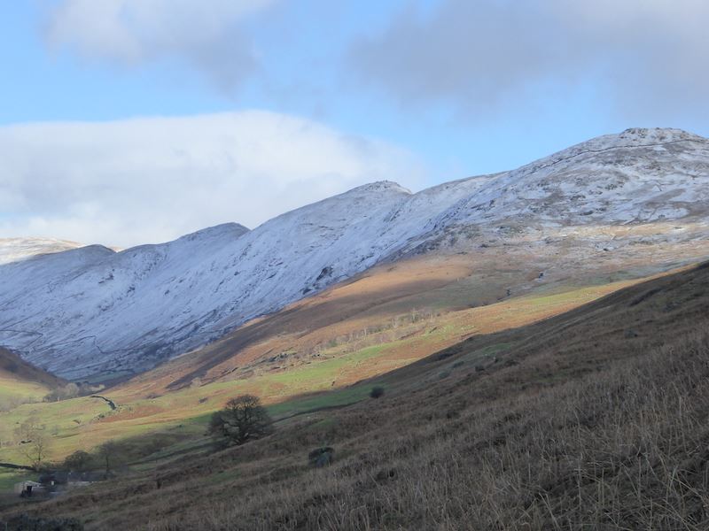
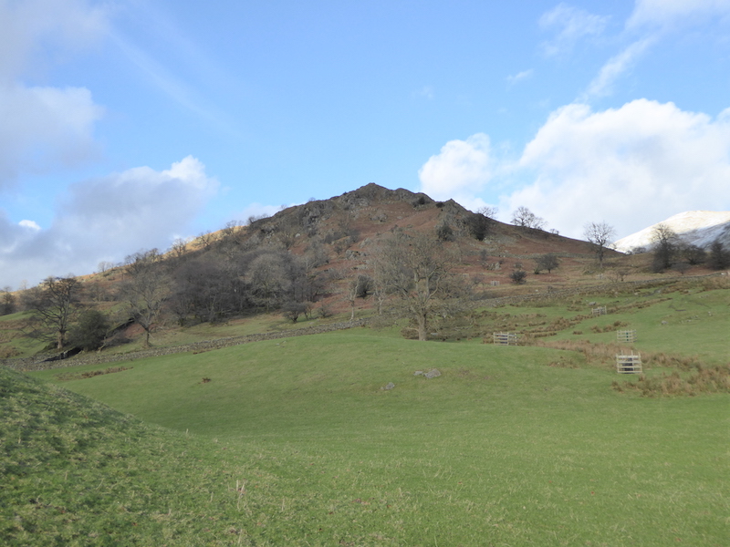
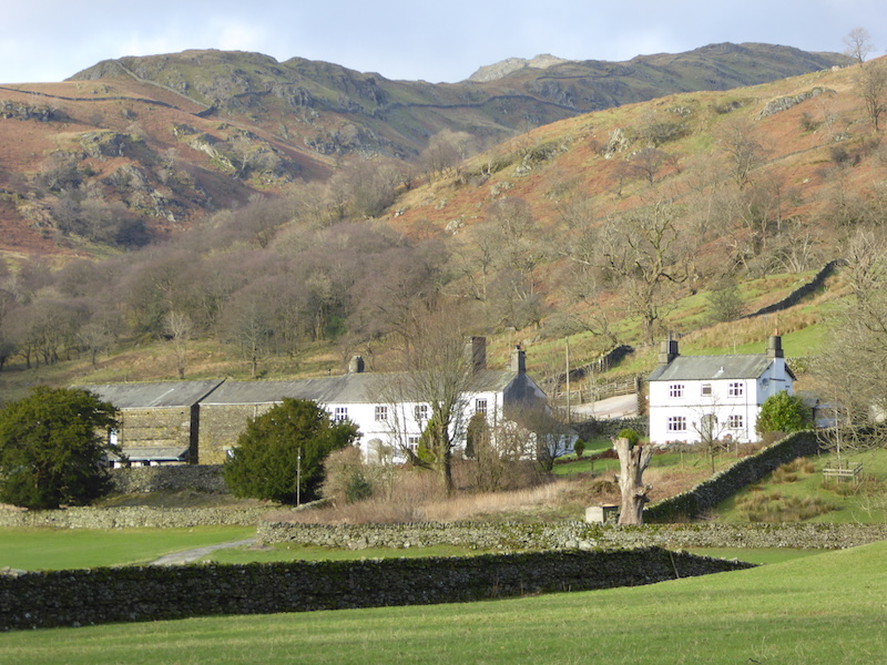
We start by walking up the hill out of Glenridding, with Glenridding Dodd and Heron Pike behind The Traveller’s Rest. Its a bit too early for there to be any travellers resting, but there’ll be plenty later on this afternoon.

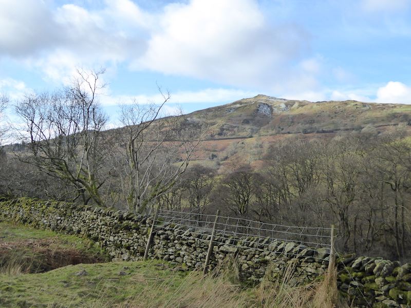
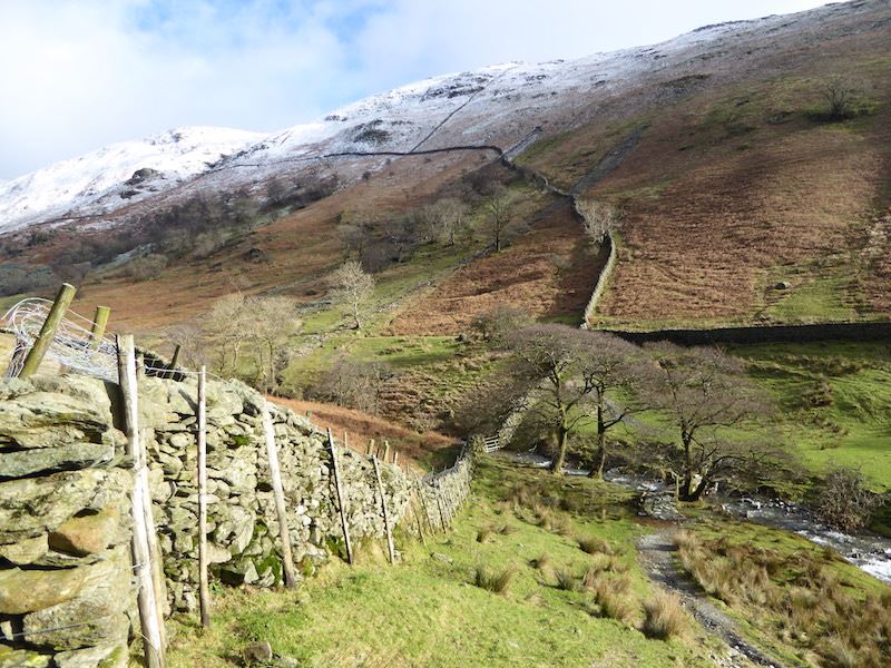
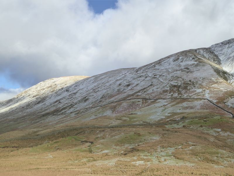
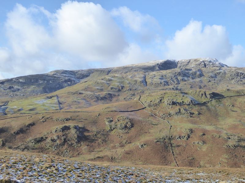
Birkhouse Moor as we turn right onto the Greenside Road.

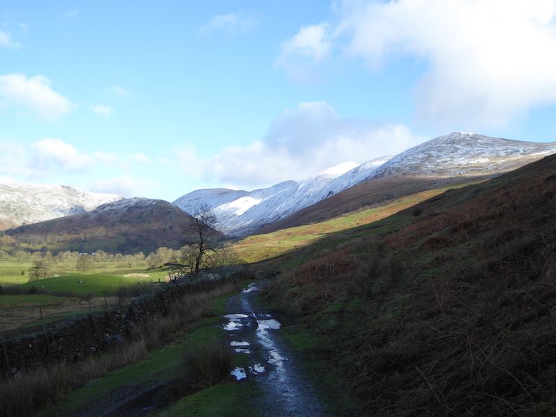
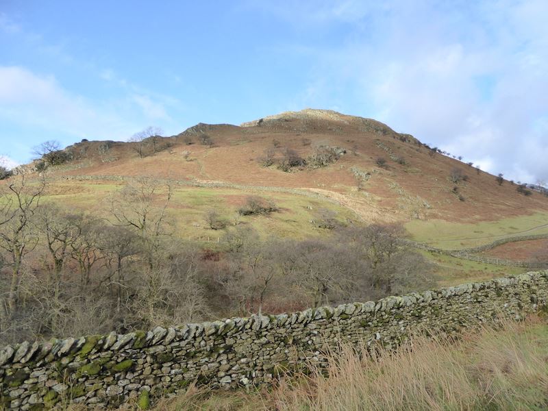
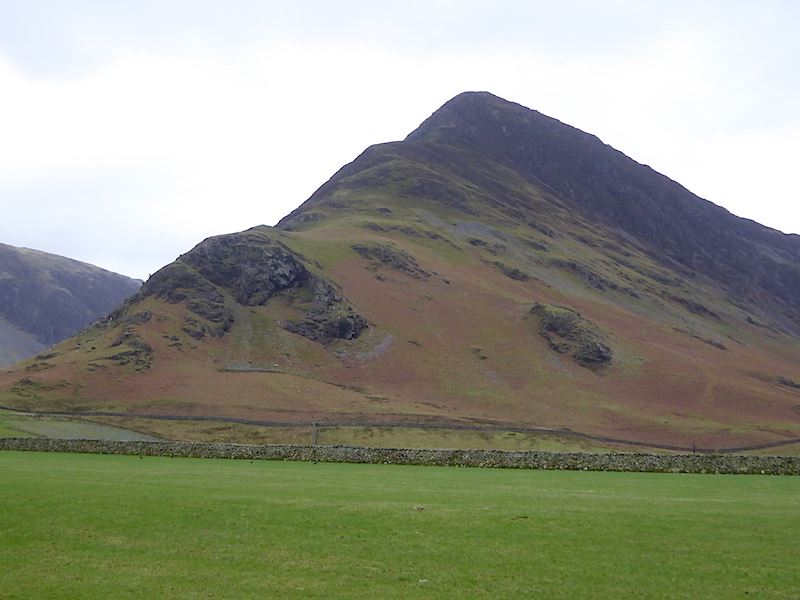
Place Fell beyond Glenridding.

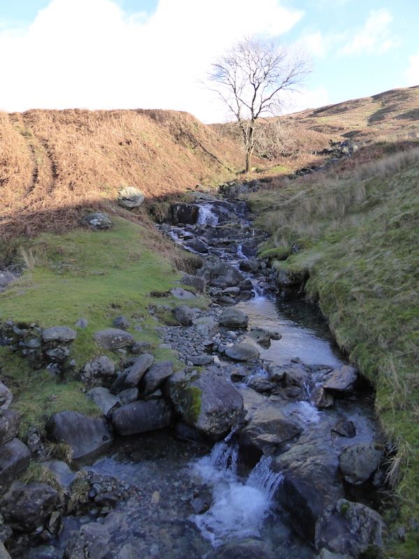
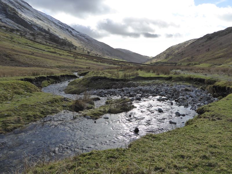
A look into the beck, as we walk up the Greenside road, at the debris brought down during Storm Desmond. Machines are at work digging it all out.

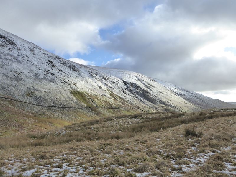
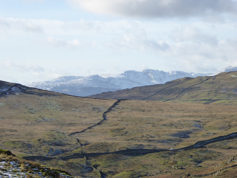
Looking ahead as we walk up the Greenside Road to the old mine. It was like walking along a busy main road up here this morning, as car after car drove up. There is some parking for the Lake District Ski Club up ahead and no doubt that is where they were all heading. About an hour’s walk from the old mine, maybe more in today’s deep snow, there is a ski tow on the north facing slopes of Raise. We also saw some snow-boarders walking up.

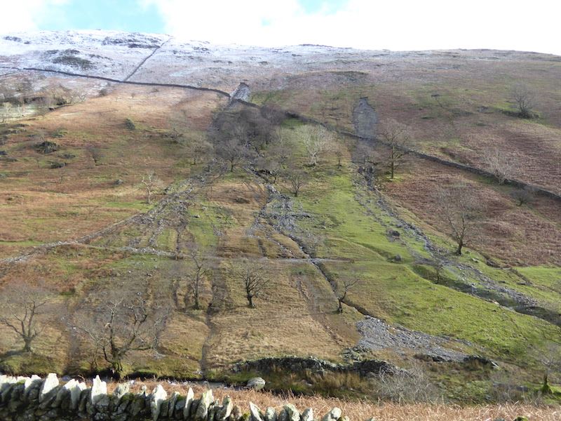
Alongside the road is this building built into the side of the hill. Its generally thought to be where the gunpowder, for use at the mine, was stored.

The other side of the old gunpowder store.

We’re above the mine area now and looking back down the beck with a little bit of Ullswater visible below Place Fell.

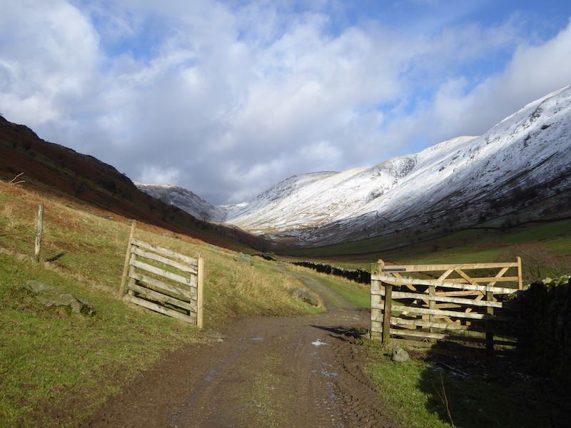
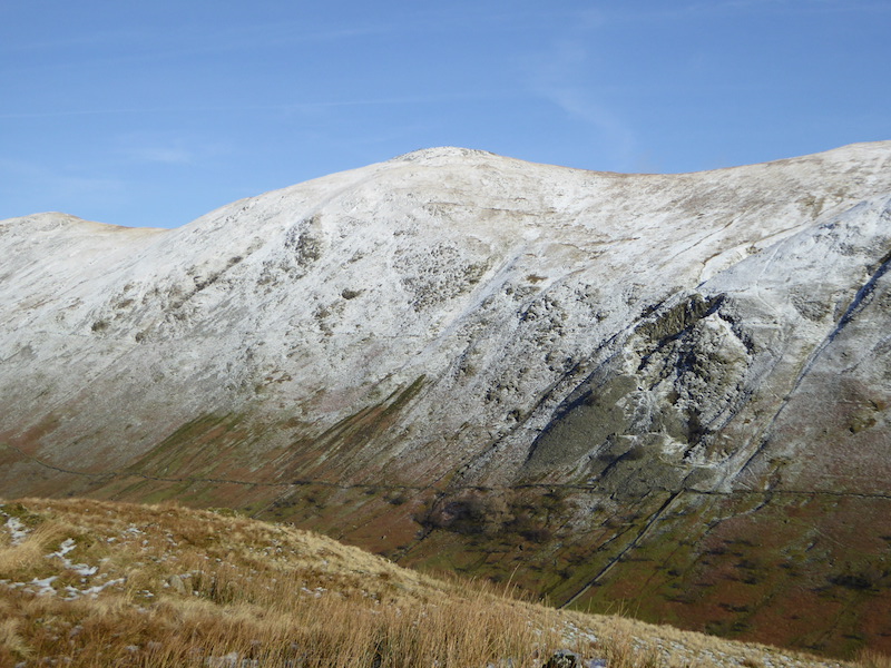
Ahead of us is Catsycam, taken from the path we took up to Stang End.

Here comes the sun ….. If you know the rest of the song you can sing along if you like.

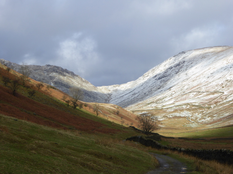
Looking towards the eastern fells from the path around Stang End above the old Greenside mine. This was now very warm work with the sun on our backs and icy stretches on the path, so the fleeces came off and the micro-spikes went on. Progress was better after that. As we were doing all that a walker came up behind us making for the ski slope on Raise. He was also  working up a sweat and mentioned that he was glad he had his skis and boots stored in the ski hut and wasn’t having to carry them up.

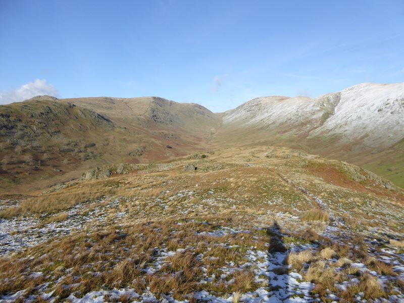
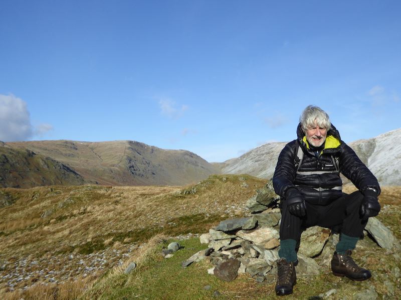
We parted company with the skier on the path to ‘The Chimney”, he was going straight on to Raise but we were going over to Sheffield Pike. Here we are at the spoil heap area just below Greenside. We had a short stop here and thought about the possibility of going over to Stybarrow Dodd which is just out of shot to the left of the photo. We decided to go over to Nick Head, the flat area on the skyline, and see what the conditions were like.

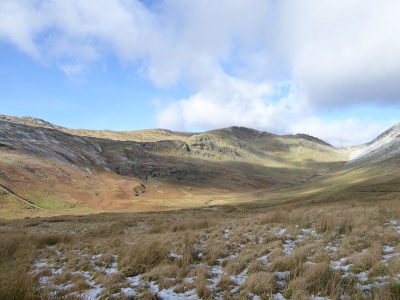
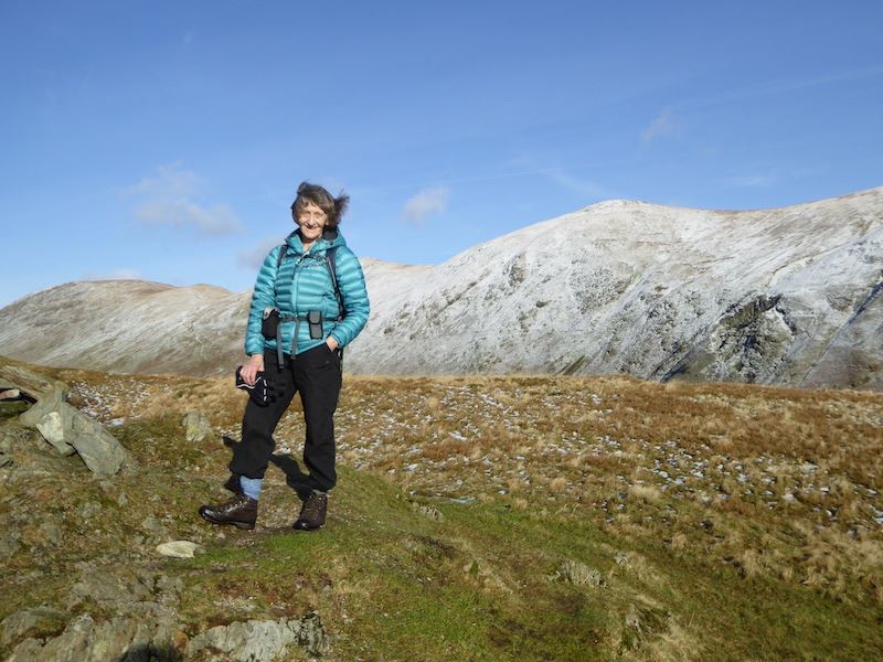
Looking over towards Sheffield Pike while we had the Mars Bar stop.

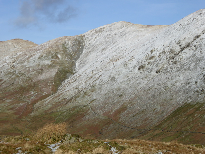
We’ve crossed over the bridge and are slowly making our way up. Slowly because the snow was above knee height and untrodden, apart from animal and ski tracks. We ‘rock-hopped’ wherever possible but at some point the hollows in between the rocks have to be negotiated. Across from us is Catstycam, with the pointed top, on the left and Raise over on the right. The flat area in the middle contains the old spoil heaps, well camouflaged by the snow today.

Straight ahead is the col between Raise, on the left, and Stybarrow Dodd on the right. Between the two is Sticks Pass which leads up to the col.

Sheffield Pike from the area around Nick Head. Here we searched in vain for any sign of previous walkers but not a footprint going over to Greenside could be found, and if we want to go to Stybarrow Dodd we have to walk up Greenside first. Hmmm, its not a great distance but do we really want to blaze an uphill trail through very deep drifts and what can sometimes be a bit of a soggy area? We gave it a go but progress was very slow and arduous, so we abandoned the idea and headed back, using our own footprints, towards Sheffield Pike, which is now there in front of us.

We’re back over on the slopes of Sheffield Pike and looking across to Raise where a number of people were ski-ing and using the ski tow. Its all happening on the shady side so its a bit difficult to see them. We watched the skiers with the binoculars for a while and had a moment of concern when I saw a lone walker suddenly completely disappear beneath the snow in the area where the arrow is. I was just thinking about calling the MRT when he popped up again and managed to get himself out of whatever hole he had fallen into.

Looking across Nick Head to Greenside, ski tracks running across, but no people tracks. Ah well, we gave it a go, but it all looks pretty deep and pristine over there. The track up to  the top is clearly visible, its getting to it that’s the problem.

Ski tracks zooming off to the right and Hart Side under a cloak of cloud.

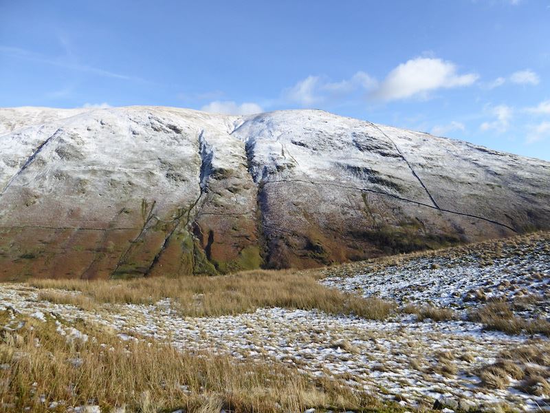
Greenside and Hart Side. When we saw that the cloud making for Greenside we were glad that we hadn’t continued trying to get up there. The metal post is a boundary marker and had the initial M, for Marshall of Patterdale Hall, and the date 1912 engraved on it. I didn’t look to see what the other side had as I was busy having my lunch at the time. A bit of research later revealed that I would have seen an H for Howard of Greystoke Castle.

The cloud is really building up over on Hart Side and, just out of shot on the left, Greenside. Now I’m really glad we didn’t bother trying to get up Greenside.

Greenside again from our lunch spot and a lone walker coming up Sheffield Pike. He suddenly appeared so perhaps he came up via the Glencoyne side.

Lunch over and we head up to Sheffield Pike. Ski tracks and footprints coming from here too. The footprints puzzled me since they petered out just a bit lower down, almost as if their owners had been airlifted off at that point, very strange.

A view of the two Mell Fells from the climb up Sheffield Pike.

Drifts of varying depths everywhere. My walking pole is about three feet long, excluding the handles, so this one is about 18″ deep.

A view along Ullswater from Sheffield Pike summit.

The two Mells fells on the skyline and Gowbarrow Fell, with partial snow cover, over to the right.

Sheffield Pike summit cairn, although its hard to distinguish it, in the snow, from the rocks it stands on.

From the summit looking towards Helvellyn, although its somewhere under all that cloud at the moment.

Descendng through more drifts from Sheffield Pike summit.

We make our way across the top of Sheffield Pike towards Heron Pike. We’ll need to watch where we step as it can be very wet and boggy across here at times.

The drifts were quite deep in many places along here. My walking poles almost disappeared in this one and they still hadn’t touched solid ground.

Heading eastward towards Heron Pike over there at the far end of the plateau, although I shouldn’t call it a plateau as it definitely isn’t an area of fairly level ground.

A view of Ullswater as we walk along.

A panorama of eastern fells on the way to Heron Pike.

Negotiating the many lumps and bumps.

We didn’t have any disasters across here today, even the little tarns were frozen.

Saint Sunday Crag, the high fell on the right, across the frozen tarn.

The cloud has moved and Catstycam can be clearly seen, Helvellyn, which is higher, although it doesn’t look it in this shot, is behind it.

A view of some of the eastern fells, the distinctive flat top, and a proper plateau, of High Street is in the centre of the skyline.

Looking back at the summit of Sheffield Pike. We kept coming across all sorts of patterns in the snow, here’s a shot of one of them …..

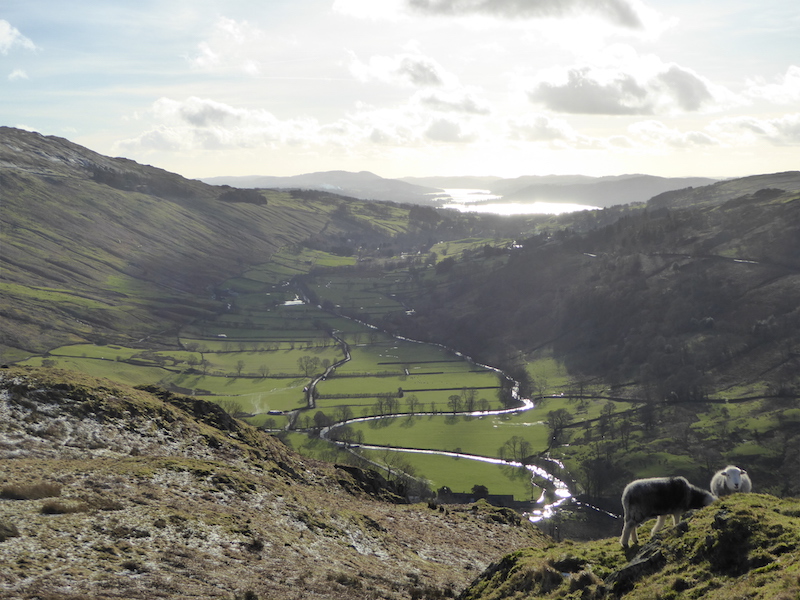
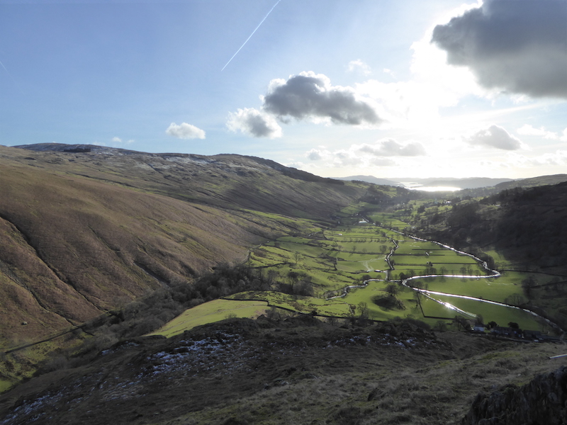
What a fabulous view from Heron Pike, below is Glenridding Dodd, part of Ullswater, and layers of eastern fells.

A breathtaking view along Ullswater from Heron Pike.

Looking back at Heron Pike, the path which we’ve just walked down roughly follows the line of the ridge.

From the last part of the descent a look ahead to Glenridding Dodd with Place Fell behind it.

Once down from Sheffield Pike we then made the very short climb up to the summit of Glenridding Dodd. The view along Ullswater from the summit, the light is lovely right now.

Rising above the wall are Heron Pike, on the left, and Sheffield Pike, the summit is set far back and just visible above the flattish area. Behind them to the left is Raise where the skiers are no doubt beginning to think about making the walk back down to their cars.

The summit cairn on Glenridding Dodd.

Place Fell and its neighbouring fells from the summit.

Descending Glenridding Dodd via The Rake, plenty of storm damage evident on the path. The sun has now dropped below the high fells behind us so things look a bit gloomy down below.

The reflections in Ullswater in the centre caught my eye as we descended so I took a very slight detour to get a shot of it.

The sun is setting on Place Fell and the moon is rising above it as we return to Glenridding after a glorious day on the fells.


A snowy walk on Brock Crags

Walk Date – 16th January 2016

Distance – 7 miles

Weather – cold, sunny start, cloud late morning, snow from 2 pm onwards


Route

– 5C when we left to drive over to Hartsop. We were just able to squeeze ourselves into the last parking space when we arrived. It was a lovely sunny morning, but we knew it wasn’t going to last as we could see the cloud coming over even before we left home.

Gray Crag from the point where we turned up the path to the old filter house.

Hartsop Dodd from the filter house path.

A new hydro-electric scheme is being installed somewhere along the beck, judging by the fresh mound of soil beside the path it looks like they’ve only recently started work on it though.

A look back from the tarmac path which only has a thin layer of snow at this point. On the skyline are Saint Sunday Crag on the right and Fairfield and Hart Crag over on the left.

The old filter house is on the left with The Knott behind it.

From the filter house the path turns back on itself and continues on a fairly level traverse towards an old wall. I don’t think it was intended to be a path as I read somewhere that it is the course of the covered over Hayeswater viaduct which crosses the fell side above the walled enclosure.

Looking back to the filter house and The Knott from the viaduct path.

The path turns back on itself once again and now we are heading for the wall which you can see ahead of us. We could have left the viaduct path at the wall and just climbed alongside it to meet the path but there was some drifting alongside it so we gave that idea a miss. The tracks you can see in the path are animal not human, so the native fell dwellers have been using it too. One set was quite large so probably made by a big deer.

Around this point the fleeces had to come off as we were in full sun and it was very warm. Those are our footprints on the track, so no-one has been along this route since the snow fell two days ago. The course of the path runs in the hollow there but it looked to be full of stones so we kept to the higher ground alongside it. As we have left the old viaduct path behind us I don’t know the original reason for this path, but it definitely is one, so it was used for some purpose or other in the past.

The gap in the broken wall, the path continues on ahead or you could climb steeply up alongside the wall. We kept to the path as the snow up by the wall looked to be quite deep in places.

From the same spot a view over to Gray Crag on the right, and The Knott on the left.

An atmospheric phenomenon known as a ‘sun dog’ or, to give it its scientific name, a ‘parhelion’. Sun dogs are commonly caused by the refraction of light from plate-shaped hexagonal ice crystals either in high and cold cirrus or cirrostratus clouds. The crystals act as prisms, bending the light rays passing through them with a minimum deflection of 22 degrees. As the crystals gently float downwards with their large hexagonal faces almost horizontal, sunlight is refracted horizontally, and sun dogs are seen to the left and right of the Sun. In case you are amazed at the extent of my scientific knowledge I will own up to having looked all that up, to save you the trouble. There was a corresponding one over on the right but it was partially obscured by some thin cloud and it didn’t show up very well on the photo I took of it.

Between The Knott on the left and Gray Crag on the right is Hayeswater Gill. You can just make out Hayeswater at the top of the gill with High Street behind it.

We’ve reached the flattish area just below Brock Crags summit and are heading towards the wall you can see at the top of the shot. Lots of snow here so I decided to see how deep it was! I’m now leaning on the poles to try and lever my left foot out, so of course the pressure on the poles and my right foot caused them to sink down even further. Some hilarity occured at this point. Things get even trickier when you lose your balance and fall into it. The fall doesn’t hurt but getting upright again is difficult when the ground around you just keeps giving way, even more hilarity when that happens.  By the way, that’s not a skirt I’m wearing, its the fleece I took off earlier and couldn’t be bothered to stow it in my pack. I would also like to reassure viewers that I do have a head, although it looks as though the brain inside it has gone on a tea break at the moment.

Hmm, I think we’ll avoid that smooth patch of snow in the middle, it looks like another area of deep snow.

Approaching the wall where we will cross through it, turn to the left and continue over to Brock Crags.

Deep and crisp and somewhat uneven. Wind patterns in the snow drifts and the ice crystals twinkling in the sunlight.

More patterns in the snow drifts alongside the wall. We stopped for a short break at the wall to give the legs a bit of a rest and to enjoy the sunshine while it lasted.

From the wall a view across to The Knott and High Street.

Angle Tarn and Angletarn Pikes from the path over to Brock Crags. That sky is looking a bit ominous.

Place Fell, on the centre skyline, looks as though it has quite a deep covering of snow on it.

A close up of Hayeswater and High Street from the path to Brock Crags

We are slowly losing the blue sky and the cloud is getting thicker and darker.

The path to Brock Crags summit with the cairn at the end of it. Even though the ground was frozen we didn’t risk walking straight through the middle as it is generally a very wet area and you just never know.

More patterns in the snow as we look towards Gray Crag. I wasn’t tempted to see how deep it was.

A view of Rest Dodd across one of the frozen pools just below Brock Crags summit.

Looking eastwards, with the snow covered Pennines on the horizon, across the other frozen pool below Brock Crags.

A very chilly looking Angle Tarn.

Brock Crags summit cairn. Fairfield is immediately behind the cairn with Hart Crag to the left of it.

From the summit a view down to Brothers Water.

Hartsop Dodd in the centre, and a big black cloud coming in from the right so that’s the end of the sunshine I think.

You can have any colour you like as long as its white, brown or black.

The view eastwards from Brock Crags summit.

A different view of Angle Tarn as we start to descend.

Sombeody decided that we’d take an off path route down to Angle Tarn,  that’ll be more deep snow to negotiate then.

Making our way around a frozen Angle Tarn.

All we need now is a big flat rock and then we can have some lunch.

We’ve found a rock, its not that one though, and scraped the snow off it, all we have to do now is to get out the flask of hot soup and the sandwiches.

Its getting harder to see the difference between the land and the sky, and its beginning to snow. A look back to Angle Tarn as we continue on our way.

If the weather hadn’t deteriorated we would have gone up the Pikes, but the sky was getting darker, the snow was getting thicker and we had a thirty mile drive home, so we didn’t.

Below us the fields, which were green this morning, are now turning white.

A look back at the north top of Angletarn Pikes as we make our way down to Boredale Hause.

Making our way down to Hartsop from Boredale Hause and the snow is really starting to settle now.

Brock Crags from the path to Hartsop.

Another victim of the recent storms, an easy enough crossing though using those stones in the beck. The white specks on the beck are the snowflakes coming down.

It doesn’t look like it but it was still snowing as we walked along the lane to Hartsop. Hartsop Dodd is just about visible in the background.

One of the old cottages in Hartsop, complete with spinning gallery above. The road, which this morning was dry tarmac, is now snow covered and the snow is falling thickly. The parking area is just around the corner there, so our walk comes to an end here. It was more of a stumble through the snow than a walk at times but it was very enjoyable nevertheless.


A circuit of Buttermere

Walk Date – 10th January 2016

Distance – 4.2 miles

Weather – rain to start with, very windy and overcast


Route

Its blowing like billy-o and raining as we set off from Syke Farm for a clockwise circuit of Buttermere. The weather is no better but desperation has set in and we need to get out for a couple of hours, rain or no rain, or we’ll go ‘stir crazy’.

A look back towards Dodd and Red Pike from the lakeshore path and raindrops on the camera lens.

A little caution was required along some sections of the path, everything underfoot was wet and slippery and we didn’t relish the thought of an impromptu slither down into Buttermere.

Haystacks and High Crag across Buttermere.

A dusting of snow on High Crag but hardly any on Haystacks.

A view of Mellbreak at the far end of Buttermere.

A closer view of High Crag.

Approaching the entrance to the tunnel.

Haystacks, looking a bit dour under some very gloomy skies.

A look back at the tunnel exit, or the entrance if you’re going anti-clockwise.

Fleetwith Pike and Haystacks at this end of Buttermere.

I intended to take a shot of the Buttermere Pines further back along the path but forgot, so I’ll have to make do with this for the time being.

Fleetwith Pike above the car park at Gatesgarth. 9 cars @ £4 each = £36 so far, and there’s still plenty of time for more visitors this afternoon. I wish I had a bit of spare land somewhere in the Lake District.

Haystacks as we cross the field from Gatesgarth Farm.

I know it doesn’t look it but the wind was ferocious along here. Being small and lighweight I held on to the fence just in case.

Fleetwith Pike, doesn’t look too bad from here …..

…..  a view of the side of it reveals its true nature, its a steep one alright.

Looking towards Warnscale Bottom and seeing plenty of water flowing down Warnscale Beck and Black Beck.

Plenty of water flowing under Peggy’s Bridge too, although the wind was doing its best to blow it back up on to the hills.

“You’re fed up with the rain? How do you think I feel, stuck out in it all day and night? What with the rain and that Belted Galloway behind you with its incessant bellowing, I’m just about at the end of my tether,”

I’m standing in a howling wind, slowly sinking into saturated, muddy ground and looking back at Fleetwith Pike.

Looking across Buttermere to a snowy Grasmoor behind Whiteless Pike.

A longer view down Buttermere.

There was a terrific amount of damage all the way along here, trees recently uprooted and fallen over, so I’m assuming its storm damage rather than regular thinning out.

A look to my right from the lakeshore path …..

….. and a look to my left from the same spot.

Rannerdale Knotts over to the left and Buttermere village nestling amongst the trees.

Almost at the end of Buttermere and looking towards High Snockrigg and Robinson. Lots of storm debris lying around everywhere.

Sourmilk Gill in spate and making a terrific noise about it too.

Approaching the footbridge on the path back into Buttermere village.

Looking over at High Stile and Sourmilk Gill. The sound of the water rushing down the gill could be heard at the parking area just above the church in the village.

From left to right – High Crag, High Stile and a bit of Dodd. Its a long time since we went up there, perhaps we’ll get round to it this summer.

The Fish Inn in Buttermere, there weren’t many people around the village today.

Syke Farm and the path through it which we used when we started our walk.

The ornamental gate at St. James’s Church in Buttermere …..

….. and to end with, a quick peek inside the church.


Dodd Fell

Walk Date – 1st January 2016

Distance – 4.3 miles

Weather – cold, damp and overcast, very windy on the top


Route

The Old Sawmill Tea Rooms, closed for the winter.

Information board for Mirehouse, also closed for the winter.

Well then, seeing as there’s no chance of a cuppa or a look round a house, we’ve no choice but to go for a walk. Only joking though, we did know the that tea rooms and Mirehouse would be closed and we had already decided to have a walk up Dodd today. Staying up to see in the New Year had its down side in the form of a late start, so its only a short outing today. This is the bridge over Skill Beck where we start the walk.

Crossing the bridge and we can see that there is still plenty of water pouring down Skill Beck.

Storm damage alongside the beck.

Looking down the beck flowing behind the tea rooms.

Logs salvaged from the fallen trees.

There on the left are the roots of the tree which fell across the beck during the recent storm.

The path we’re taking up alongside Skill Beck, its quite a steep pull up here.

Water pouring off the fell alongside the path. There was a pile of stones and gravel alongside the hole so it looked as though that had been dug out to allow the water to drain away under the path and down into Skill Beck.

Another casualty of the storms. That explains why we saw a ‘Trail Closed’ sign a little lower down the path.

A look back down from the path junction as we approach Long Doors.

Looking over to Derwentwater, the sun trying to make a breakthrough and failing.

A close up of Helvellyn, the highest peak on the right, with what looks to be a decent covering of snow.

Derwentwater and its surroundings fells, although its a bit difficult to see them clearly today.

We’re still making our way up Dodd, across the middle is the path we’ll use to return to the tea rooms car park.

A long distance view of the snow covered Dodds and Helvellyn.

The flood plain, between Bass Lake and Derwentwater, doing what its meant to do.

By heck, it was blowing a hooley up here. We’re on Dodd summit now and looking across to Derwentwater,

One end of Bass Lake, looking very brown and sludgy at the moment as all the recent wet weather will have deposited lots of silt into it.

Looking across to Ullock Pike from Dodd summit. Now let’s get down before we’re blown over, it wasn’t supposed to be this windy today.

From our descent via the forest track I took this shot of some of the snow topped north western fells.

Looking across the flooded fields over to Derwentwater.

At least the level has dropped enough to give access across High Stock Bridge.

It all looks a bit surreal down there.

Looking across the flood plain to the north western fells.

Another view across the flood plain.

No, its not an optical illusion, or a flying saucer, its just an alien force called ‘The Sun’ and I took a photo of it just in case we don’t see it again until June.

Making our way down beside Skill Beck, although we’re now on the opposite side to the one we walked up on.

Quite a force of water coming down Skill Beck today.

Almost back at the tea rooms and a chance to look at the damage on this side of the beck.

The culprit’s roots are over on the opposite bank, together with a heap of gravel which got dumped there too.

Before we leave a final look at the ‘woodyard’, I suppose the silver lining is that those logs will get put to good use in one way or another.  If the Old Sawmill hadn’t been turned into a tea room it would have come in handy at this time.


Walla Crag

Walk Date – 27th December 2015

Distance – 3.4 miles

Weather – at last, no rain, mild, with sunshine and clear blue skies


There was to be a fine, dry start to the day according to the forecast although it would cloud over during the afternoon. This was unexpected, so we seized our chance, and not having had anything planned in advance thanks to the constant rain, we decided to drive over Keswick way and have a short walk up Walla Crag.  Exercise, fresh air and sunshine – the perfect antidote to the enforced ‘house arrest’ brought about by the atrocious stormy weather over the past couple of months. Storm Desmond at the beginning of the month was followed by Storm Eva on Christmas Day and Storm Frank is due to turn up in the next day or two, waterlogged doesn’t even begin to describe the conditions in the Lake District just now.


Route – out and back

A clear view of Skiddaw from the lay-by on the A591 as we get ready to start our walk.

Cloud capped Blencathra.

A view of some of the north western fells as we squelch across a very, very soggy field, with every step we sank up to the ankles in the saturated ground.

A look across to Bass Lake which looks as though it has retreated almost back to where it should be.

Well, the bridge is still there although it has taken a bit of a battering during the storms and isn’t as straight as it should be. You can see the amount of debris which has been brought down with the water.

We’ve gained more height so now we have a view over Keswick to the Skiddaw range.

Blencathra still cloud capped over there. The water down there isn’t a named tarn, even so, its a very large pool in a farmer’s field, the same field we squelched over at the beginning of our walk. There are fields full of pools everywhere at the moment.

A look back along the path and over to Clough Head and The Dodds on the skyline.

Almost at the top of Walla Crag with a view of the northern end of Derwentwater with Bass Lake beyond. During Storm Desmond Bass Lake flowed over into the green strip of land between the two so you can imagine the mess it caused.

The summit cairn on Walla Crag, looking eastwards to Clough Head and Great Dodd.

Looking north westwards over Bass Lake from Walla Crag summit.

Walla Crag summit in very strong sunshine, we haven’t seen this much sun in weeks!

Looking somewhat windblown on Walla Crag.

A lovely clear view from Walla Crag summit.

A large build of cloud on Blencathra, there will be some disappointed people up there at the moment. All the effort of getting up there only to have no view, I know how that feels.

However, it looks to be thinning out over Skiddaw.

Looking across a very full Derwentwater to some of the north western fells.

Part of the southern end of Derwentwater, I couldn’t go any further to the left because of the sun. The fell to the right is Catbells, and across to its left is Maiden Moor.

Catbells summit to the left foreground. This is usually a very popular walk but there weren’t many people on there today.

From Walla Crag a look across to Bleaberry Fell. I wouldn’t even think of going over there just yet as it can be a very wet area at the best of times, and this isn’t the best of times.

I took a bit of a chance with this one as you can see from the position of the sun. Not a great shot but in the centre you can still make out some of the fells around Borrowdale.

The rocky top of Walla Crag, Grisedale Pike standing out on the left skyline.

Another view of the north western fells from Walla Crag summit.

A view eastwards to Clough Head and The Dodds from the stile just below Walla Crag summit.

Oh dear, Blencathra’s cloud cap is increasing and descending.

The path runs alongside the wall to the left so navigation isn’t difficult along here. Walking along was something else, wet, wet, wet!

A look back at Walla Crag and the path we’ve been using.

From the same spot but this time looking forward, Clough Head is just peeping above over on the right.

A look down into the beck at the storm damage.

Back at the bridge and another view of the debris which has been washed down.

I know it doesn’t look it but I think this field was the wettest one I’ve ever walked across. We were ankle deep in spongy, saturated ground with every step. This is the one with the big pool of standing water that appears in an earlier photo.

A look back at Walla Crag on the left as we continue on our squelchy, muddy way.

Well, Skiddaw had been clear but suddenly a bit of cloud activity started happening out of nowhere.

We’re almost at the end of the walk now so I take another look back. The tree seems to have lost a few branches here and there but looks in good shape otherwise, and it would take a lot more than Storm Desmond to dislodge Grisedale Pike over there.

As we walked across the field I noticed a bit more cloud activity, this time over on Helvellyn. I still marvel at how all this just appears quite suddenly, seemingly from nowhere. I know its all the result of moisture + heat = evaporation and condensation, but that doesn’t diminish the wonder of this fascinating process.

A shot of Blencathra taken from the car as we drove back home, I didn’t expect that one to work out quite so well. Over on the extreme right of the skyline is the summit, clear at last for any walkers up there.

This will be our last walk in 2015 as tomorrow is forecast to be very windy and showery, then Storm Frank is due to descend upon us through Tuesday night and Wednesday, and New Year’s Eve on Thursday is also set to bring more rain.